
Search for another town


Free U.S. delivery 7 to 10 days after you order
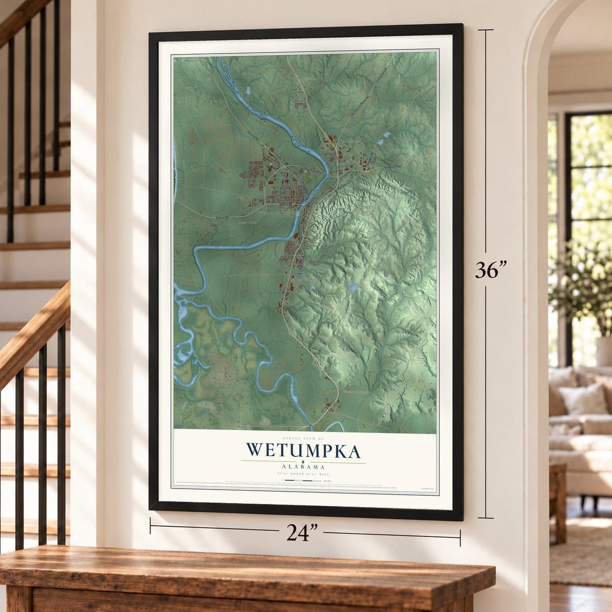
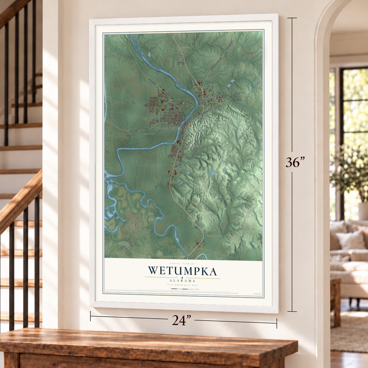
Wetumpka, Alabama Map Art
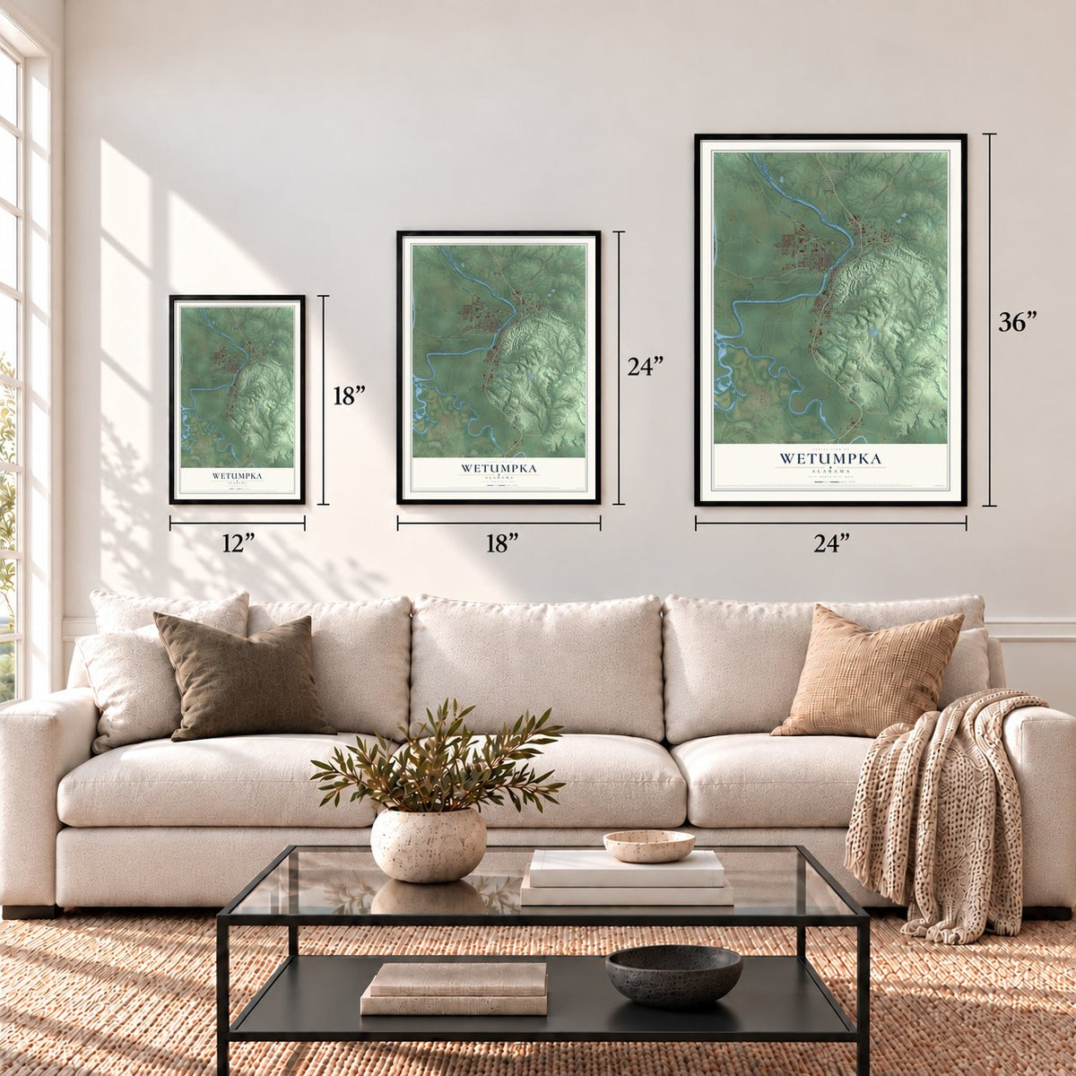
A new map of Wetumpka, Alabama, made in 2026 and printed to order on thick archival matte paper.
12" x 18" Archival Matte Print
A Map of Home. A Work of Art.
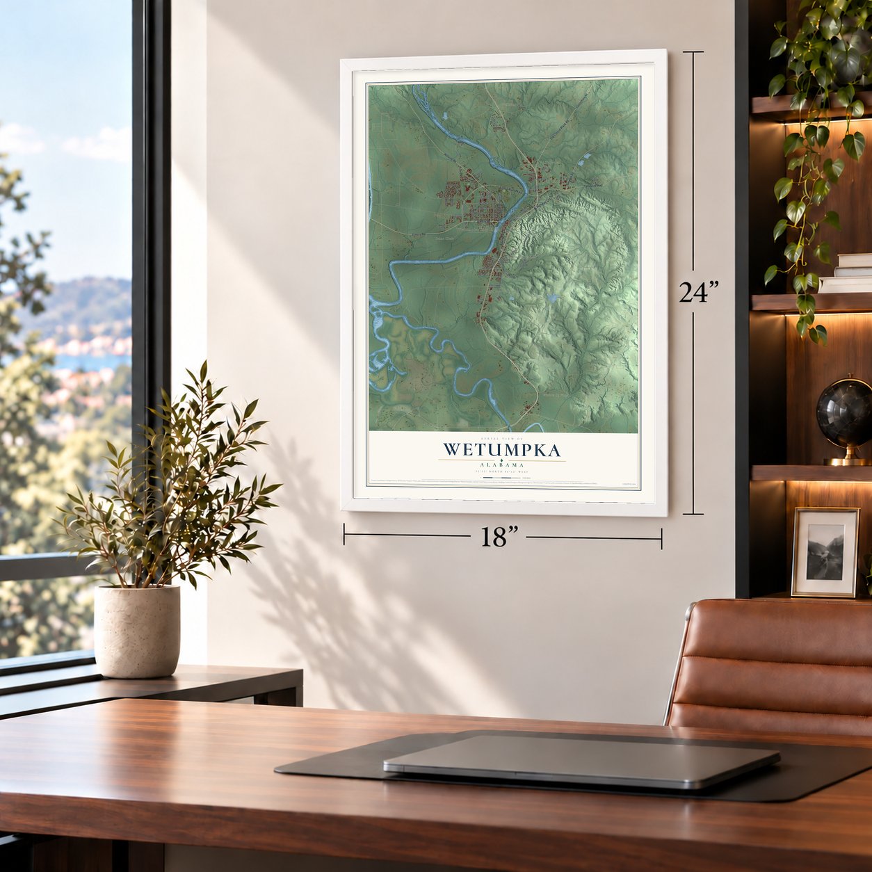
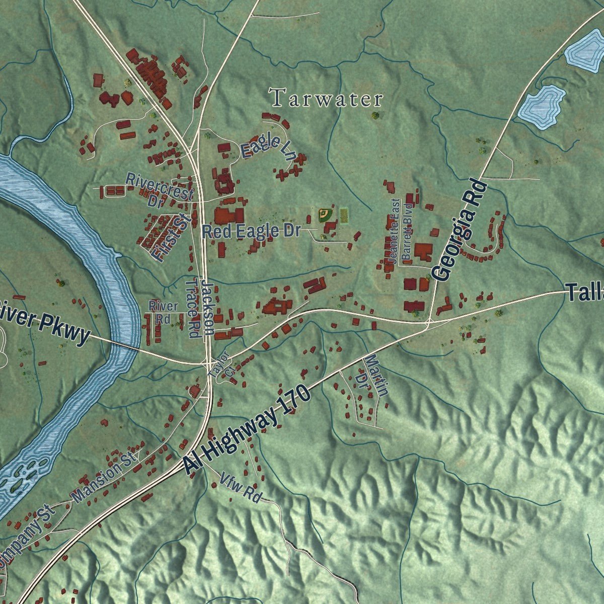
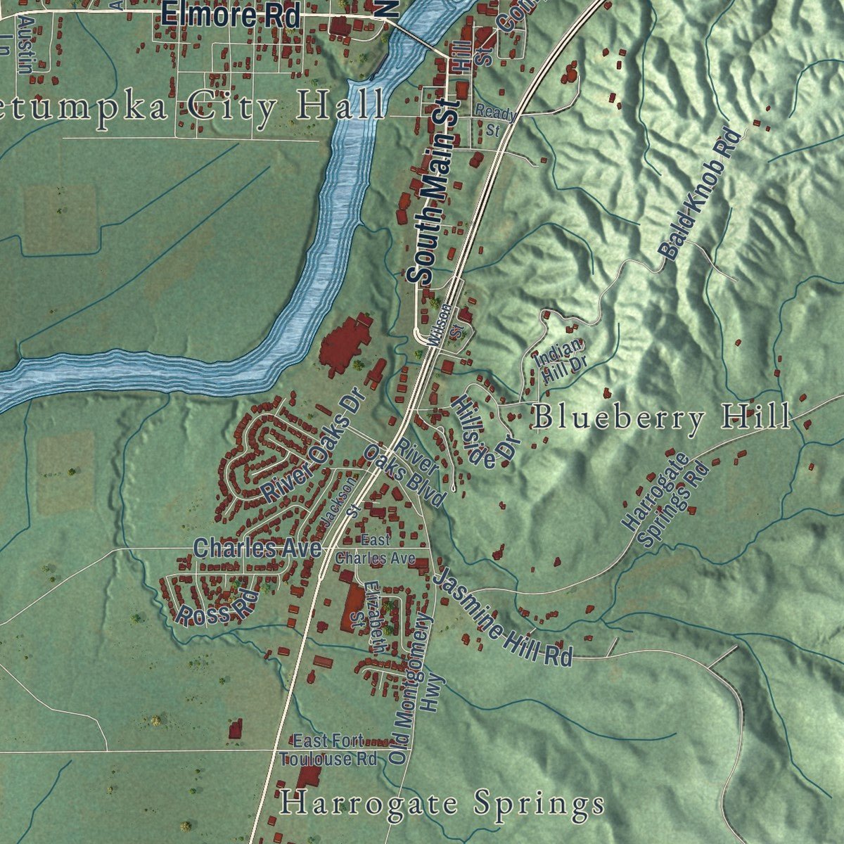
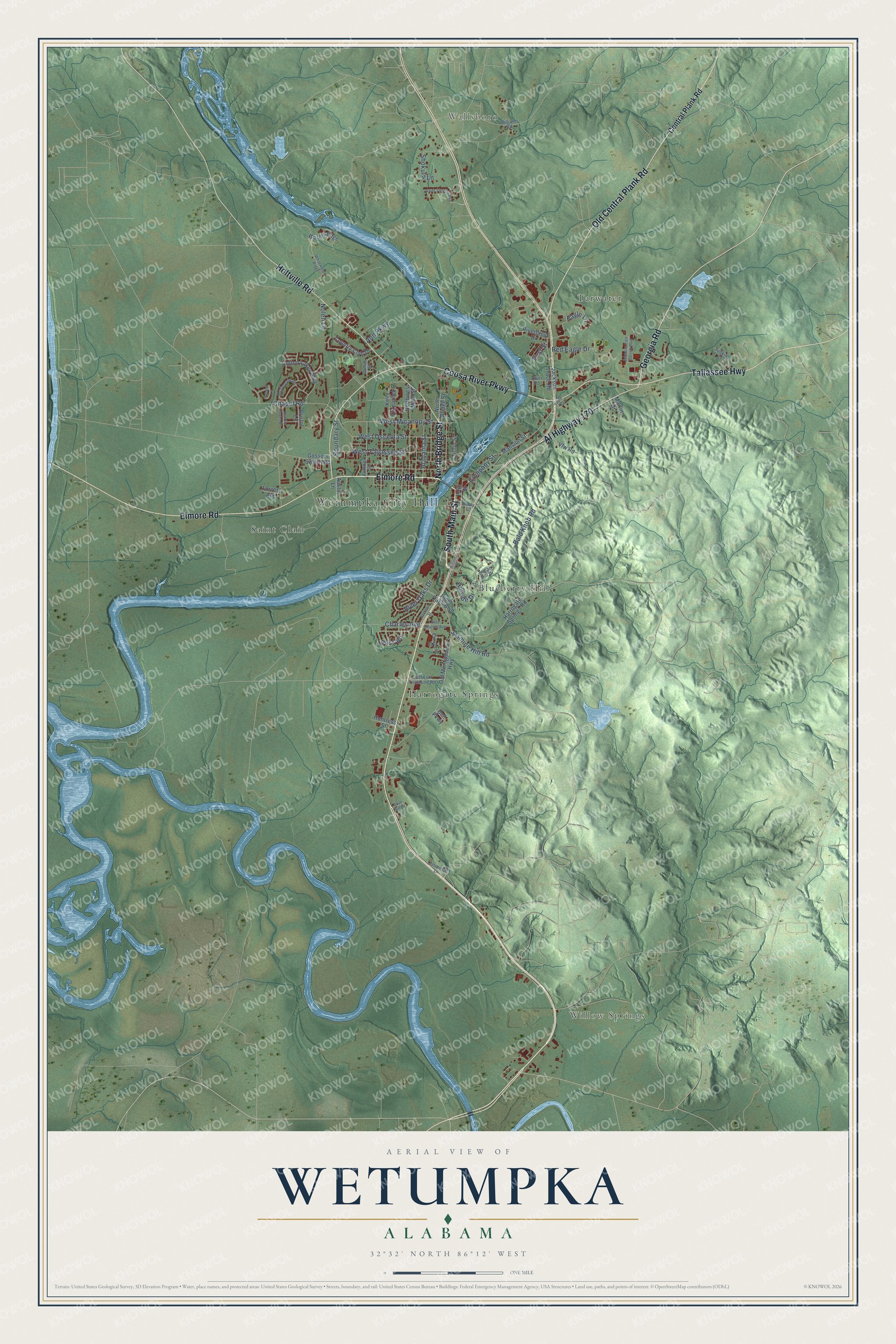
Explore Wetumpka, Alabama from a whole new perspective. Created using aerial imagery and detailed geographic data, this map captures Wetumpka building by building, with labeled streets, familiar landmarks, and shaded topographical relief that highlights the natural contours of the landscape.
Combining modern data with the timeless character of a vintage atlas, this map is just as interesting up close as it is beautiful on the wall. Whether you grew up in Wetumpka, spent memorable years there, or call it home today, this unique map is a great way to celebrate a place that means something to you. Zoom in on the preview to look for your street, and then order a print to put your memories on the wall.
Three ways to hang it
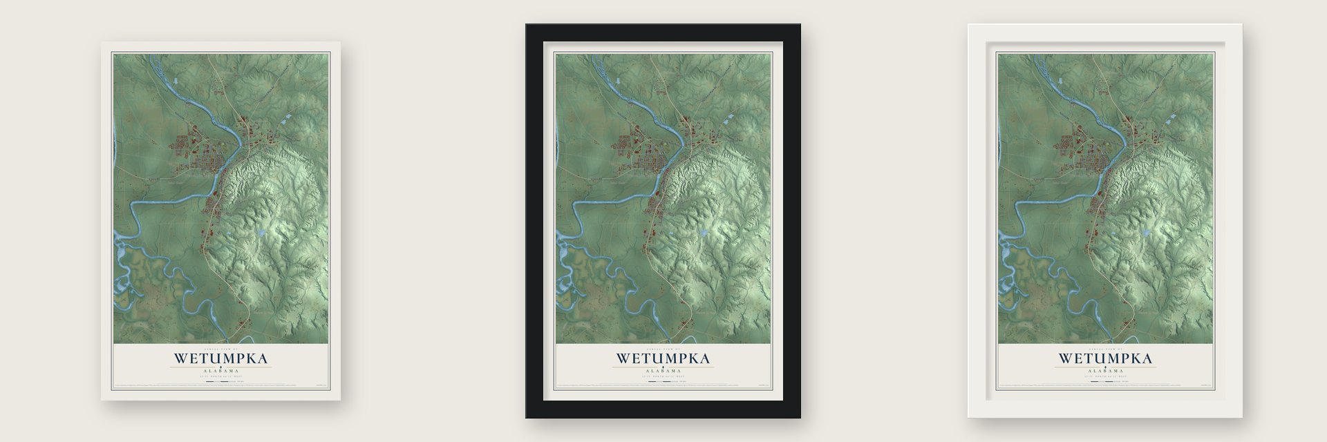
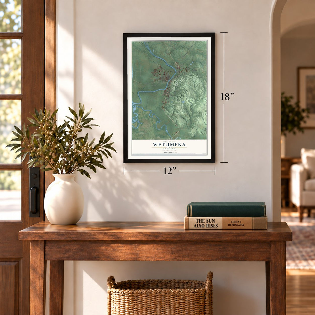
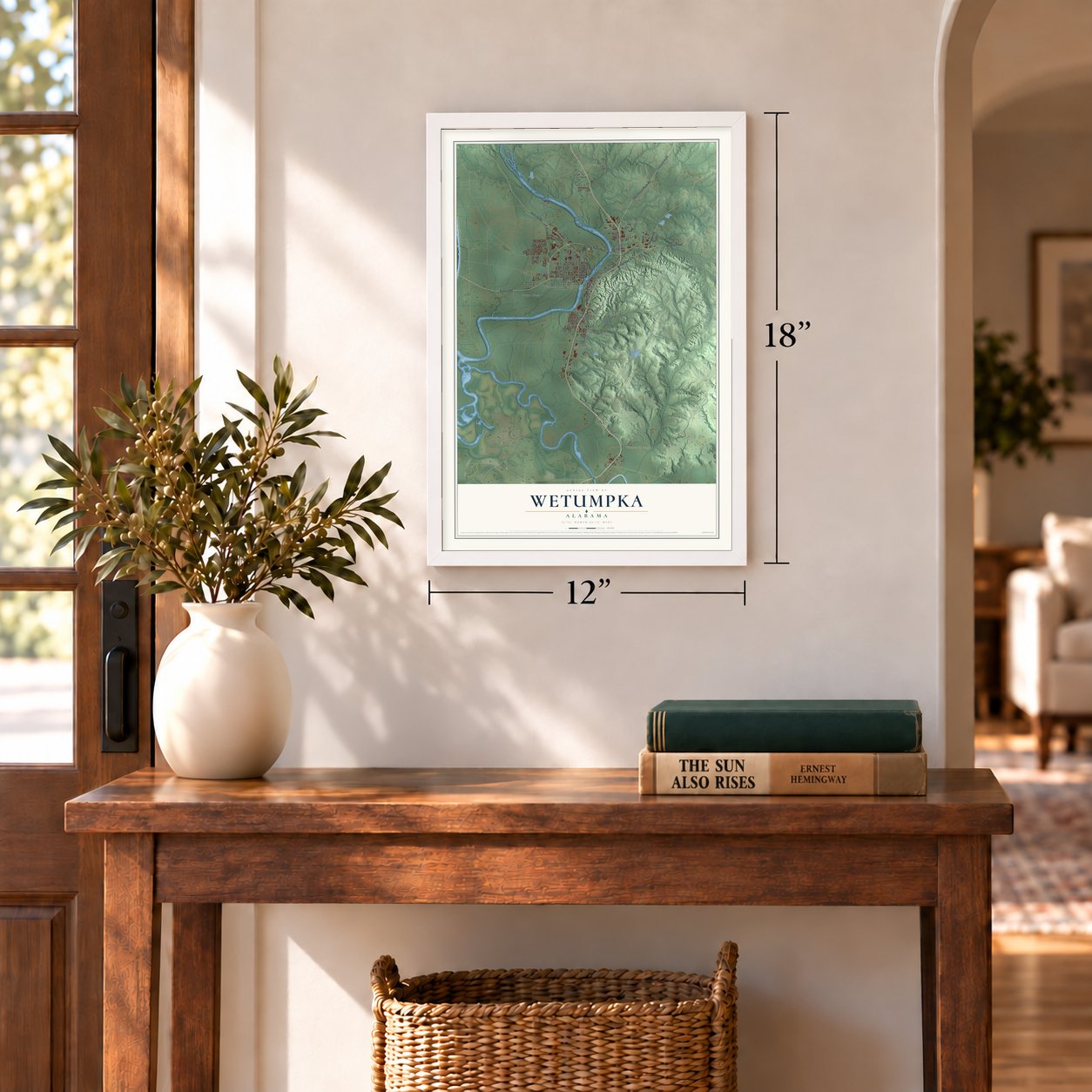
Unframed archival matte, a black wood frame or a white wood frame.
Up close
Geography Worth Displaying
This map was created using accurate cartographic data and authoritative geographic sources, including the U.S. Geological Survey and the Census Bureau. The map brings together terrain, waterways, roads, and building detail. The majority of the streets are labeled, houses are accurately depicted, and the topography is derived from government sources. Combining local data with carefully composed color and shading leads to this beautifully detailed Wetumpka artwork for your wall.
Rather than simply showing street outlines, we’ve included as many of the street names as we could reasonably fit on the map while keeping their names legible. Zoom in on the high resolution preview to see exactly what’s on the map. We truly set out to create a statement piece for anyone who loves Wetumpka. So whether it’s for you, or a gift for someone you love, we hope this map of Wetumpka brings back fond memories.
Read the story behind this map of Wetumpka, Alabama from 2026.

About Wetumpka, Alabama
Wetumpka is a city of 7,220 people and the county seat of Elmore County, built on both banks of the Coosa River. Its name comes from Muscogee Creek words meaning "rumbling waters," thought to describe the roar of the rapids at the Devil's Staircase. The Creek village of Taskigi stood nearby when the French built Fort Toulouse in 1714, and the French held the post until 1763. After Andrew Jackson beat the Creeks at Horseshoe Bend, he repaired the old fort, and it became Fort Jackson.
Wetumpka was incorporated in 1834 as two halves: a commercial east side in Coosa County and a residential west side in Autauga County. Steamboats carried cotton from its port down to Mobile, the town had 1,200 people by 1836, and an East Coast paper ranked it with Chicago among the West's most promising cities. In 1845 it lost the race for the state capital to Montgomery, and that same year a fire burned its warehouses, whose charred bricks went downriver to build the new capital. Elmore County made it the county seat in 1866, but the population, 3,824 in 1850, had fallen to 562 by 1900.
“Three lighted lanterns hanging from the rafters were the last things seen of the bridge as it washed away in the flood of March 1886.”
- Horace King's covered bridgeThe Coosa's first bridge at this spot went up in 1834, built by the Wetumpka Toll Bridge Co., and a flood carried it away in 1844. That year John Godwin had a covered toll bridge built, designed and directed by his slave, Horace King. Freed in 1846, King built bridges across the South, and after the Civil War Russell County voters twice elected him to the state legislature. Walkers paid 5¢ to cross; churchgoers crossed free.
- The Bibb Graves Bridge, 1931After the covered bridge was lost in 1886, a ferry ran until the Southern Bridge Co. of Birmingham finished an iron bridge in 1887. When that one wore out, the state and county split a $177,440 project, and the fourth bridge opened in 1931. Edward Houk, born in Denmark, designed it, and it was named for Governor Bibb Graves. Its rainbow arches make it one of only two Alabama bridges hung from reinforced concrete.
- A crater from spaceSome 85 million years ago, while a shallow sea covered this ground, an asteroid estimated at 1,000 feet across hit and left a ring six miles wide. Its ridges of metamorphic rock still rise east of the city, topped by Bald Knob, the rim's tallest summit. The ring was known for over a century before geologists recognized it in the 1970s as an impact crater, and drilling at its center found rock altered as only an impact can.
- Churches from the 1850sThe Presbyterians organized in 1836 and dedicated their church in 1857, Gothic on the outside and Greek Revival within. In 1861 the Wetumpka Light Guard set out from it to join the Confederate Army, and it joined the National Register in 1976. The Methodists, organized in 1837, finished their third building in 1854; its original nave seated 500, and it served both Black and white congregations.
- Big Fish in 2003Several scenes of Big Fish, the 2003 movie based on Daniel Wallace's 1998 novel, were filmed in Wetumpka.
Find your street
Names on the Wetumpka map
Every name below is printed on this map. Look for your street, your school, the park where you played, or the pond down the road.
Places and landmarks7
- Wetumpka City Hall
- Wallsboro
- Willow Springs
- Blueberry Hill
- Harrogate Springs
- Saint Clair
- Tarwater
Streets and roads71
- Elmore Road
- South Main Street
- North Bridge Street
- Old Central Plank Road
- Tallassee Highway
- Holtville Road
- Coosa River Parkway
- Al Highway 170
- Georgia Road
- West Micanopy Street
- Alabama Street
- West Osceola Street
- First Street
- Chapel Road
- Company Street
- Bald Knob Road
- West Tallassee Street
- River Oaks Drive
- Jasmine Hill Road
- Shokula Lane
- Hillside Drive
- Red Eagle Drive
- Boundary Street
- Charles Avenue
- Ross Road
- Ann Parkway
- Eagle Lane
- Nolen Lane
- Central Plank Road
- Mansion Street
Show all 71 streets
- Old Montgomery Highway
- Harrogate Springs Road
- Cotton Lakes Boulevard
- Northwest Main Street
- Jackson Trace Road
- Waters Edge
- Rivercrest Drive
- Country Club Drive
- Kelly Fitzpatrick Drive
- Forrest Avenue
- River Oaks Boulevard
- Gossom Switch Road
- Bell Parkway
- Vfw Road
- Hill Street
- Martin Drive
- Cotton Street
- Bristol Lane
- Huntress Street
- Austin Lane
- McDonald Drive
- Autauga Street
- Elizabeth Street
- Williams Road
- East Fort Toulouse Road
- Indian Hill Drive
- James Street
- River Road
- Judkins Court
- Wilson Street
- Whitewater Ridge
- Jeanette East Barrett Boulevard
- Ready Street
- Saint Thomas Avenue
- East Charles Avenue
- Hearth Haven Drive
- Jackson Street
- Taylor Court
- Periwinkle Lane
- Fanoni Lane
- Dove Hill Drive
Names are listed as they appear on the printed map. Zoom into the product photos to find them.
The art of mapping a place
How This Map Was Made
Real places. Remarkable detail. Discover the layers that turn geographic data into a map of home.

The view from above
Aerial imagery reveals the character of the land: woodland, open fields, and the patterns of a place.

The shape of the land
Elevation data brings hills, valleys, and subtle changes in the landscape into view.

The details of home
Roads, waterways, and building footprints come together to make the map feel unmistakably local.

Geography becomes art
Considered color, shading, and typography bring the layers together in a map made for your wall.


Process illustrated with Mendon, Massachusetts. Aerial imagery: USDA NAIP. Terrain: USGS 3D Elevation Program. Map details and finished artwork: KNOWOL.
The Details
About This Print
Choose an archival matte print, or a black or white Ayous wood frame. The archival matte print is unframed.
Select your size and finish above to see the matching product image and price.
Materials & Craftsmanship
A contemporary map with the character of a classic atlas, printed on archival matte paper. Optional frames are made from Ayous wood.
Your printed map does not include the watermark shown in the full-map preview.
Shipping & Delivery
Free shipping within the United States. Every print is made to order in the USA.
Buying a gift? Add a note in your cart and we'll include it. We never put prices in the package.
Prints ship within 2 to 3 business days. Allow 7 to 10 days total from ordering for delivery. Timing may vary during holidays or periods of high order volume.
Read our shipping policy.
Returns and damaged prints
Each print is made to order. Change-of-mind refunds are not available after production.
If your print arrives damaged, misprinted or incorrect, contact support@knowol.com within 30 days of receiving it. Include your order number, photos and a description of the issue.
Read our full refund and replacement policy. For questions about your order, email support@knowol.com.
Find your town
Looking for another city?
Find a map of home in our Alabama collection, or any town in the country.
Nearby
Maps of towns near Wetumpka
Know someone from one of these towns? Their map makes a great gift.
 Blue Ridge
, Alabama
From $39.99See the map
 Redland
, Alabama
From $39.99See the map
 Coosada
, Alabama
From $39.99See the map
More maps nearby: Elmore, Emerald Mountain, Holtville, Millbrook and Deatsville.