
Search for another town


Free U.S. delivery 7 to 10 days after you order
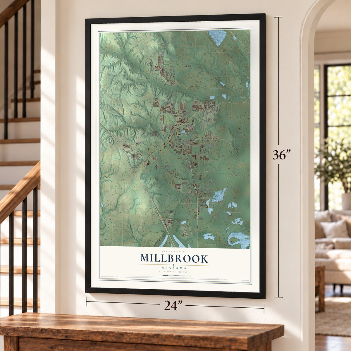
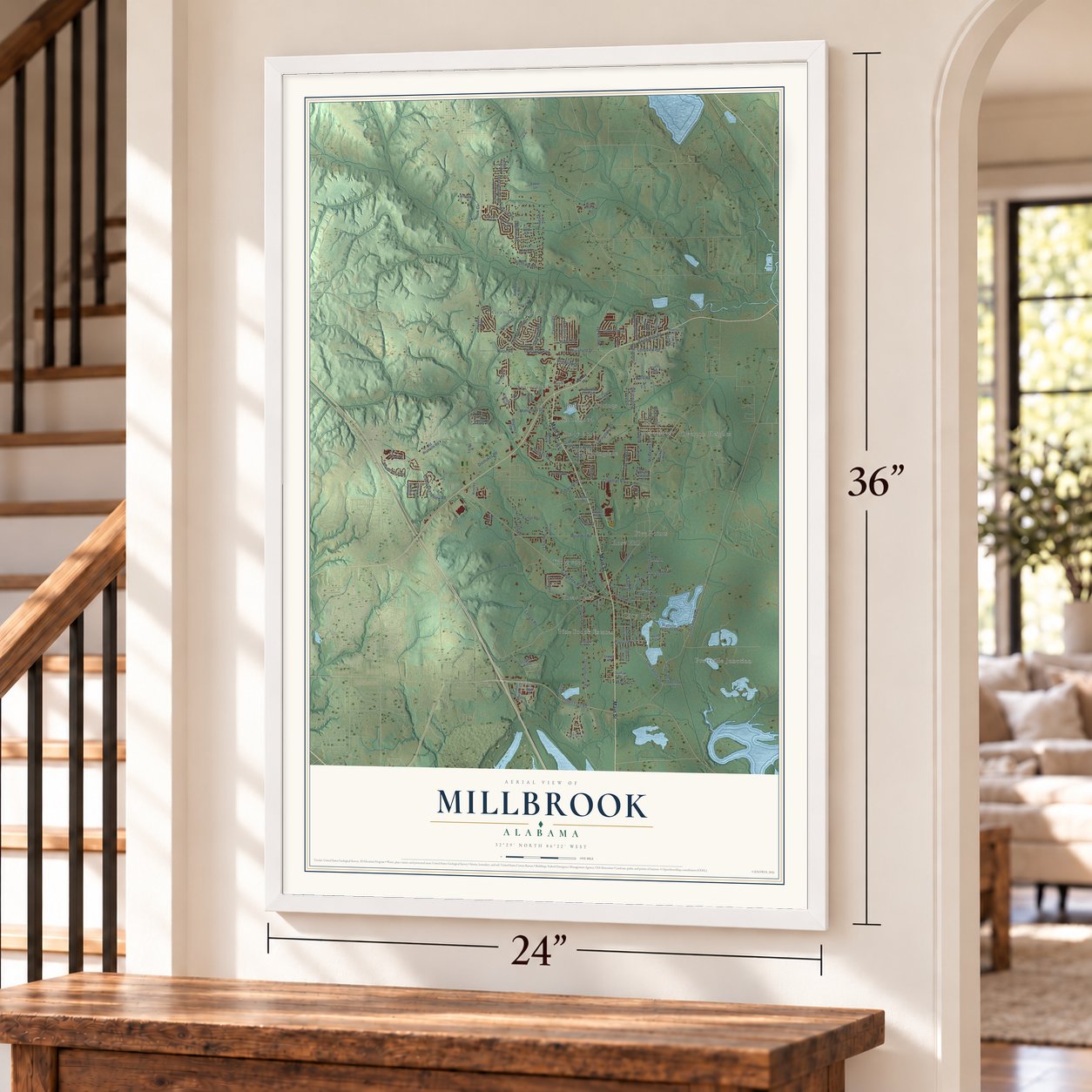
Millbrook, Alabama Map Art
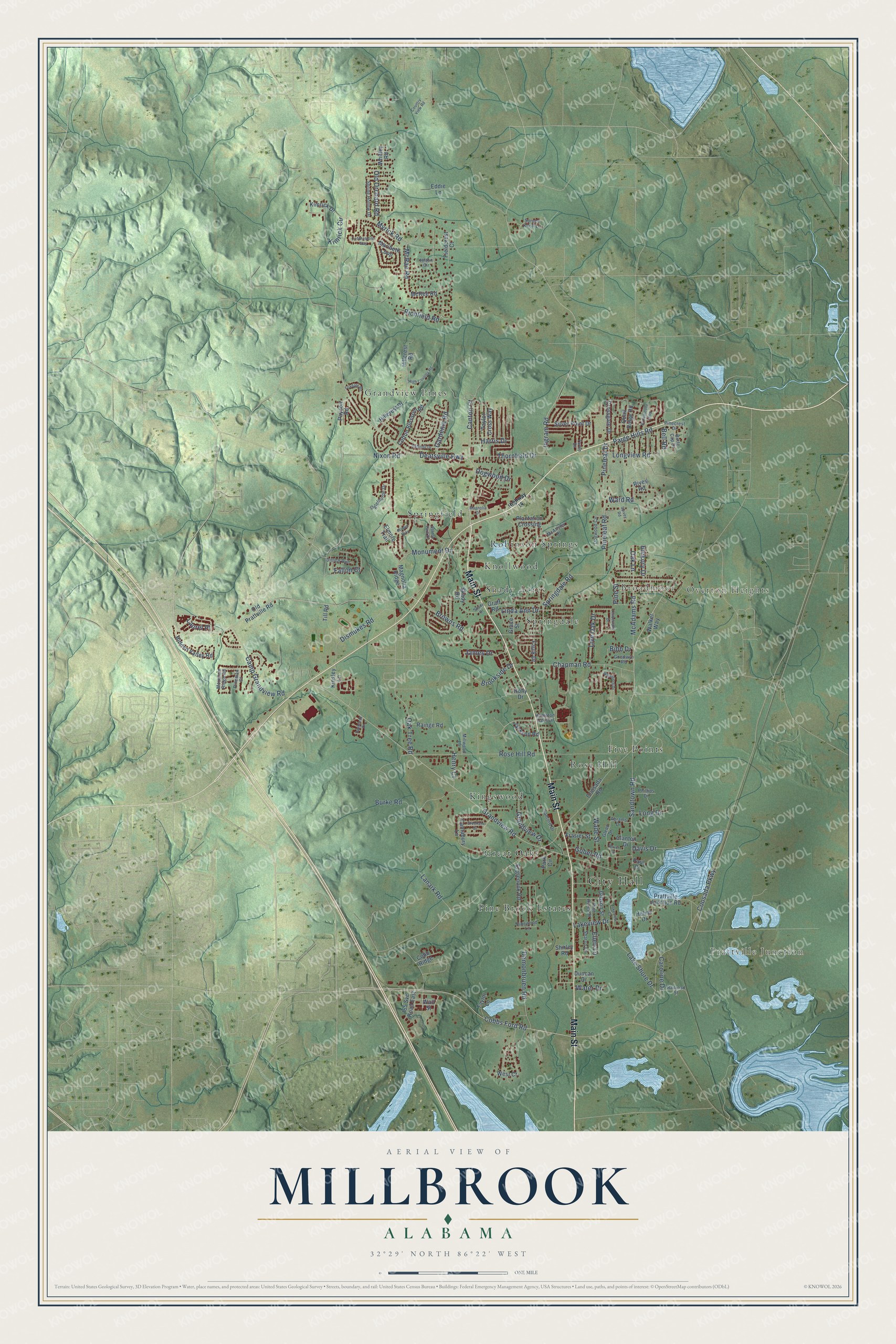
A new map of Millbrook, Alabama, made in 2026 and printed to order on thick archival matte paper.
12" x 18" Archival Matte Print
A Map of Home. A Work of Art.
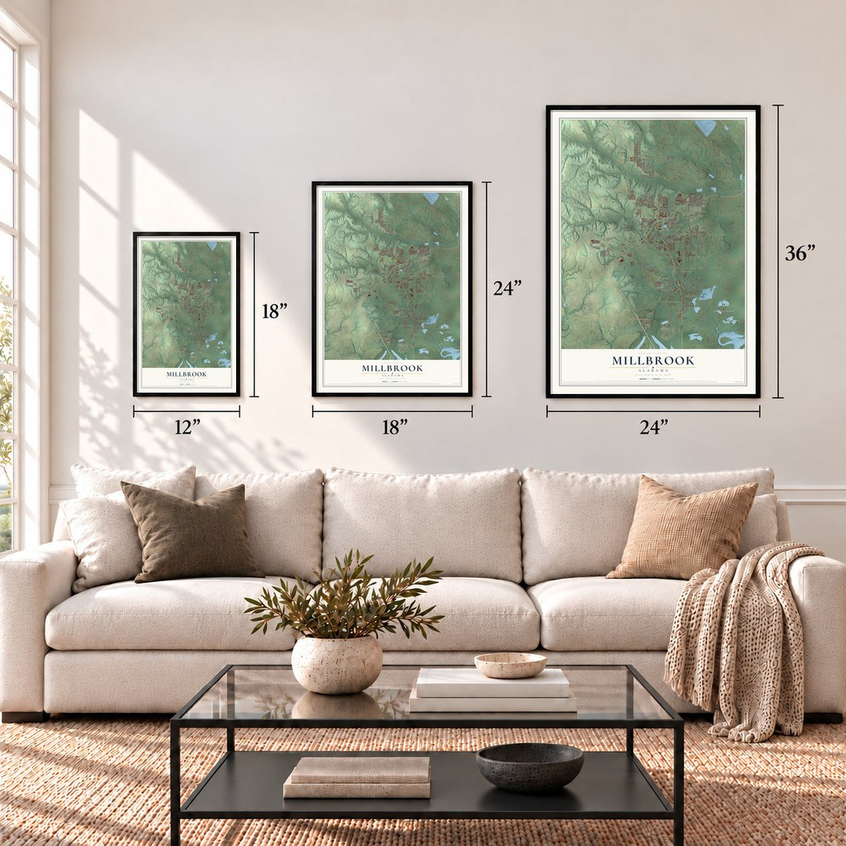
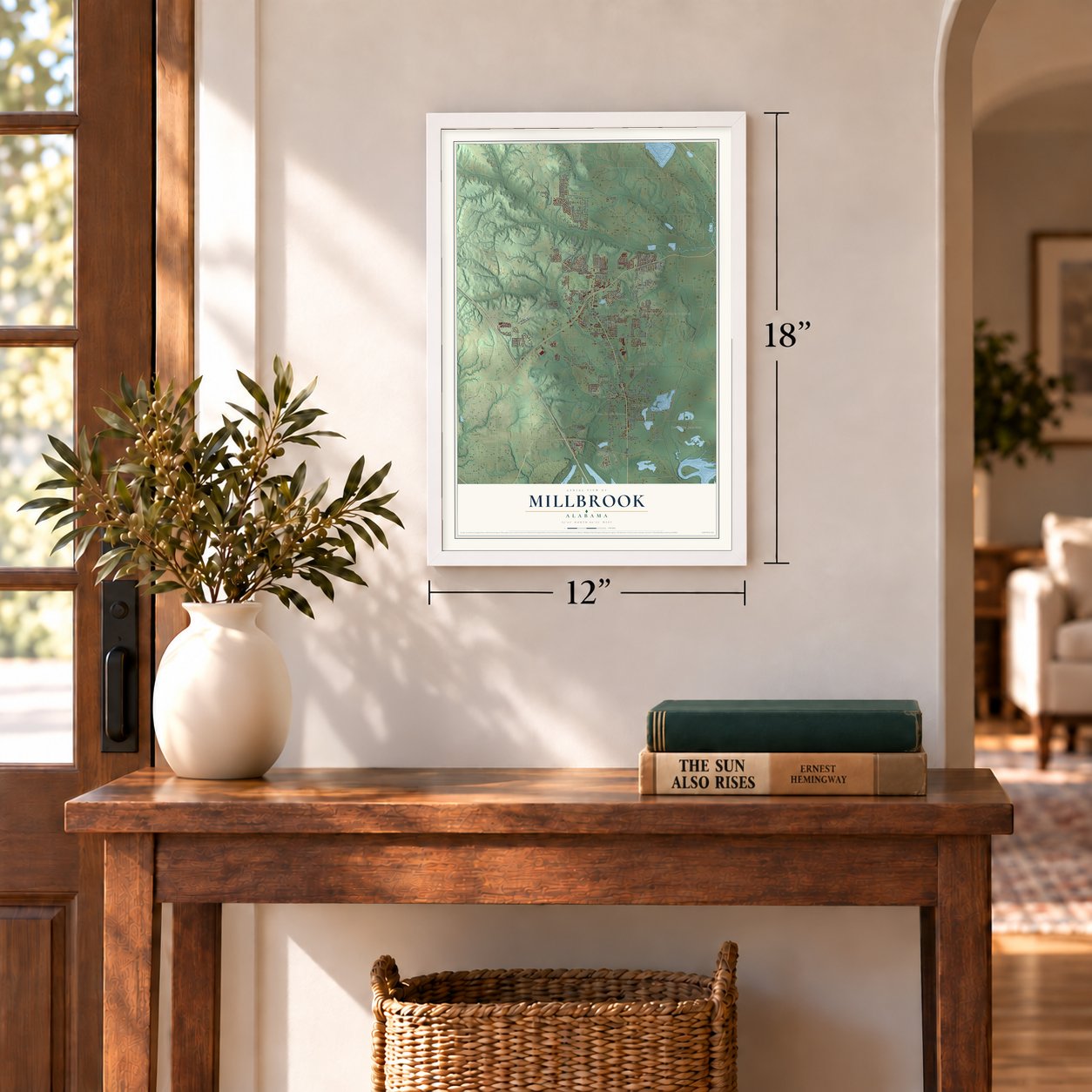
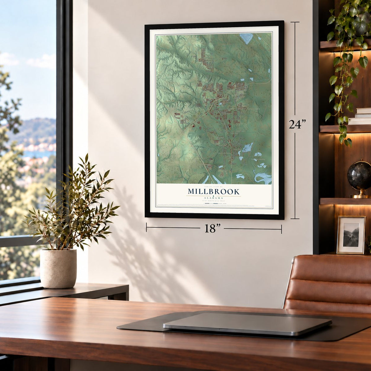
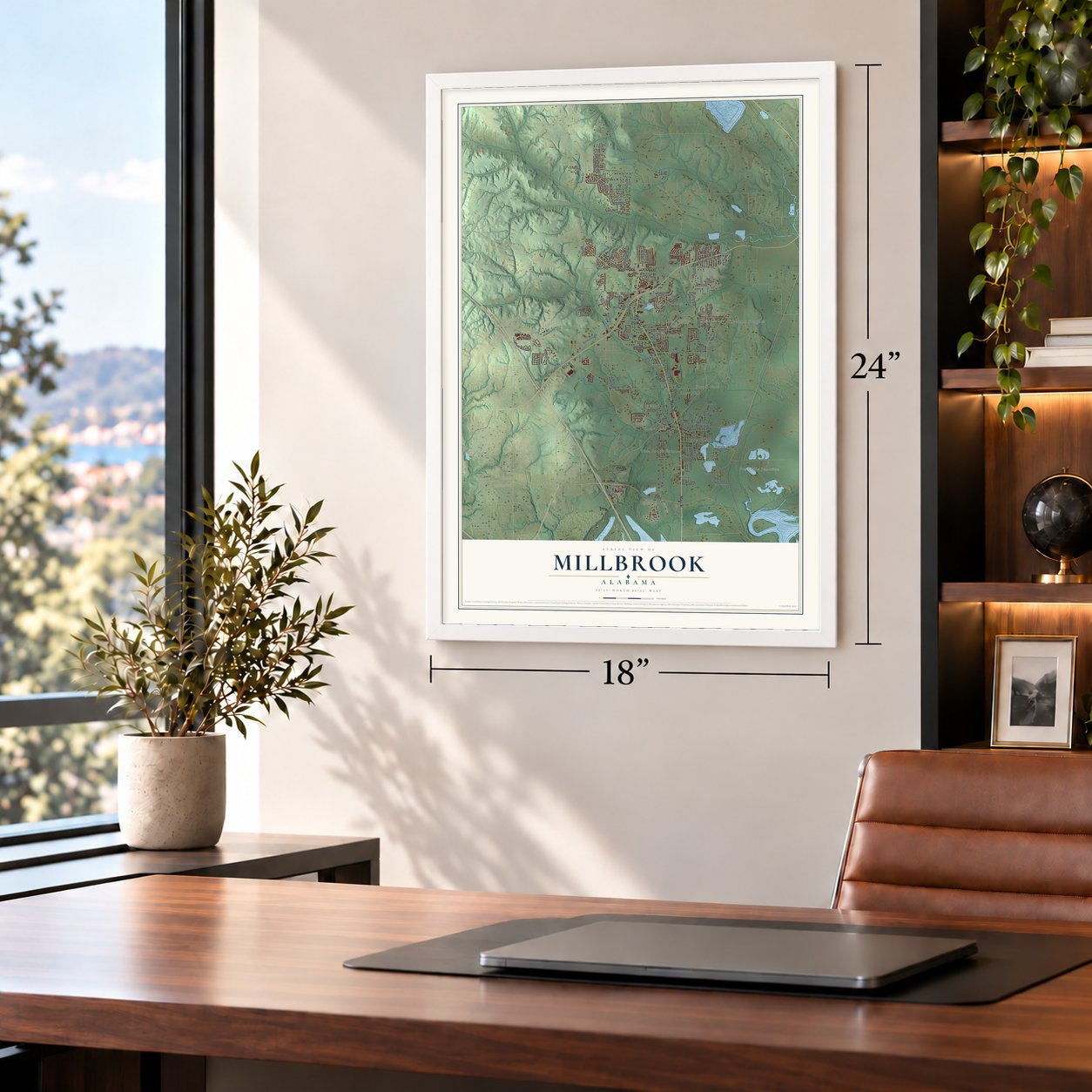
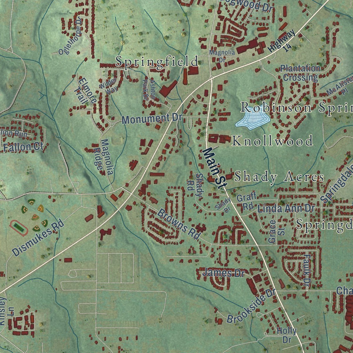
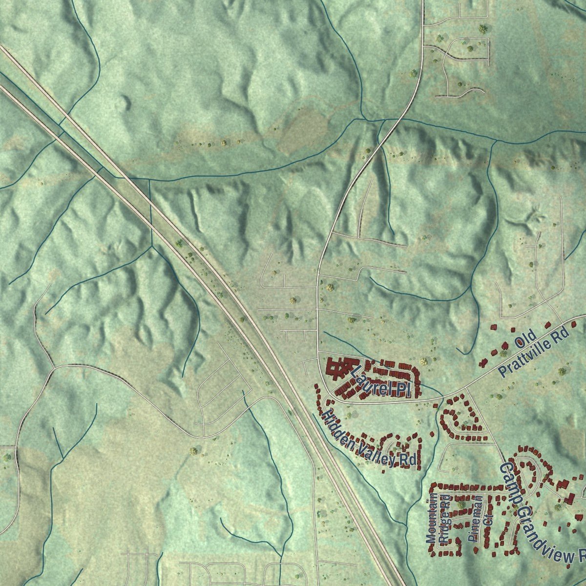
Explore Millbrook, Alabama from a whole new perspective. Created using aerial imagery and detailed geographic data, this map captures Millbrook building by building, with labeled streets, familiar landmarks, and shaded topographical relief that highlights the natural contours of the landscape.
Combining modern data with the timeless character of a vintage atlas, this map is just as interesting up close as it is beautiful on the wall. Whether you grew up in Millbrook, spent memorable years there, or call it home today, this unique map is a great way to celebrate a place that means something to you. Zoom in on the preview to look for your street, and then order a print to put your memories on the wall.
Three ways to hang it
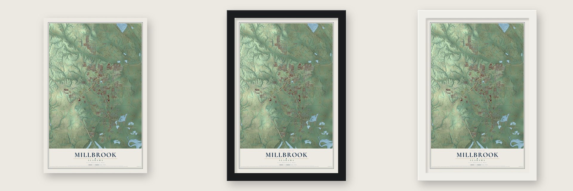
Unframed archival matte, a black wood frame or a white wood frame.
Up close
Geography Worth Displaying
This map was created using accurate cartographic data and authoritative geographic sources, including the U.S. Geological Survey and the Census Bureau. The map brings together terrain, waterways, roads, and building detail. The majority of the streets are labeled, houses are accurately depicted, and the topography is derived from government sources. Combining local data with carefully composed color and shading leads to this beautifully detailed Millbrook artwork for your wall.
Rather than simply showing street outlines, we’ve included as many of the street names as we could reasonably fit on the map while keeping their names legible. Zoom in on the high resolution preview to see exactly what’s on the map. We truly set out to create a statement piece for anyone who loves Millbrook. So whether it’s for you, or a gift for someone you love, we hope this map of Millbrook brings back fond memories.
Read the story behind this map of Millbrook, Alabama from 2026.

About Millbrook, Alabama
Millbrook is a city of 16,564 people in Elmore and Autauga counties, about 10 miles north of Montgomery. The land was once part of the Creek town of Coosawda, where European traders began doing business with the Creeks in 1763. Settlers from Georgia and the Carolinas built the first non-Indian homes in 1775, and Bolling Hall, a Georgia congressman who had fought in the Revolution, finished the area's first permanent house, Ellerslie, in 1818.
Soon after settlement, Robinson Springs, now inside the city, became a summer resort for wealthy Montgomery families. When the Louisville & Nashville railroad finished a spur line through Millbrook in 1878, the trip to Montgomery got easier, and many summer renters bought houses and stayed all year. The town grew quickly between the two world wars, and after Interstate 65 opened in the mid-1970s, Millbrook incorporated as a city in 1977.
“As to water, it cannot be excelled any where for coolness, clearness, and pleasantness, and the abundance of it.”
- Thornfield, finished in 1820A year after Bolling Hall built Ellerslie, the pioneer Archibald McKeithen began the area's second permanent home, Thornfield, and he finished it in 1820. Both houses still stand today, and both are private homes.
- A church built in 1848The Robinson Springs United Methodist Church was organized in 1828 and first met in a log building, which the congregation soon outgrew. Its permanent church was finished in 1848. Because the church had no steady minister, it sold its parsonage to the Alabama historian Albert J. Pickett, and that house still stands two doors down.
- Alabama's first state fairIn 1852 Robinson Springs, then known as a summer retreat with cool, clear spring water, hosted the first state fair ever held in Alabama.
- A company raised under a treeIn June 1862 Private Bolling Hall III, home on leave from the fighting in Virginia, gathered a company of men under a tree where the Confederate Monument now stands. The men elected him captain and joined Hilliards Legion, and what was left of the company later became the 59th Alabama Infantry, with Hall as its colonel. The monument, at Highway 143 and Monument Drive, names 186 men from Millbrook and the area around it.
Find your street
Names on the Millbrook map
Every name below is printed on this map. Look for your street, your school, the park where you played, or the pond down the road.
Places and landmarks15
- City Hall
- Prattville Junction
- Overton Heights
- Broadmoor
- Five Points
- Grandview Pines
- Great Oaks
- Kingswood
- Knollwood
- Pine Brook Estates
- Robinson Springs
- Rose Hill
Show all 15 places
- Shady Acres
- Springdale
- Springfield
Streets and roads145
- Main Street
- Deatsville Highway
- Cobbs Ford Road
- Oak Lane
- Richfield Road
- McAdams Road
- Kimrick Circle
- Grandview Road
- Rose Hill Road
- Sandtown Road
- Myrick Road
- Ingram Road
- Pineleaf Road
- Pineleaf Drive
- Oak Tree Road
- Browns Road
- Caroline Drive
- Springdale Road
- Chapman Road
- Burke Road
- Coosada Parkway
- Davis Drive
- Lake Shore Drive
- Thornfield Drive
- McRae Road
- Demonbruen Road
- Dismukes Road
- Grandview Drive
- Camp Grandview Road
- Dogwood Drive
Show all 145 streets
- Lanark Road
- Gober Road
- Longview Road
- Linda Ann Drive
- Gardenia Road
- Canton Court
- Paige Hills Road
- Monument Drive
- Ward Road
- Live Oak Drive
- Old Orchard Road
- Fallon Court
- Lakeview Drive
- Brookside Drive
- Wade Street
- Nixon Road
- James Drive
- Bibb Drive
- Harris Drive
- Henry Court
- Long Drive
- Hickory Drive
- Ellen Lane
- Water Drive
- Bell Road
- Laurel Place
- Pine Street
- Old Prattville Road
- Hillcrest Drive
- Hillcrest Road
- Payson Road
- Coosada Road
- Cantabury Lane
- Magnolia Ridge
- McRee Road
- Maribeth Loop
- Plantation Crossing
- Prattville Junction Road
- Englenook Road
- Kimrick Drive
- Cotton Blossom Road
- Hidden Valley Road
- Silver Point Drive
- Crossgate Drive
- Gibson Street
- Clanton Drive
- Shady Road
- Taylor Cross Way
- Rainge Road
- Frasier Street
- Fieldcrest Court
- I65 Svc Road East
- Jackson Road
- Graff Road
- Faulk Drive
- Cobb Ridge
- Kinsley Lane
- Rives Road
- West Court
- Holly Drive
- Taylor Lane
- Quail Ridge Road
- Eddie Lane
- Whitley Road
- Grace Street
- Park Circle
- Elmore Trail
- Walker Way
- Helms Drive
- Duncan Drive
- Wall Street
- Shirley Road
- Till Road
- Paul Court
- Hampton Oaks Drive
- Spring Hollow Drive
- Mountain Ridge Road
- Dogwood Circle
- Oglethorpe Drive
- McAlister Place
- Pinecrest Drive
- Sharon Lane
- Pinewood Lane
- Butte Cap Drive
- Dillion Run
- Spruce Knoll Lane
- Pine Acres Street
- Phillips Drive
- Sanford Drive
- Goodwyn Road
- Millwood Lane
- Abrams Drive
- Railroad Street
- Glenn Drive
- Pineman Court
- Hilton Circle
- Turtle Drive
- Highway 14
- Timberland Drive
- Brownstone Loop
- Foxdale Road
- Daffodil Drive
- Ashton Park Drive
- Cobblestone Way
- Lakeview Court
- Country View Road
- High Country Road
- Woodford Drive
- Gresham Drive
- Wilder Way
- Oliver Drive
- Daybreak Drive
- Spivey Road
- Magnolia Drive
- Shady Drive
Names are listed as they appear on the printed map. Zoom into the product photos to find them.
The art of mapping a place
How This Map Was Made
Real places. Remarkable detail. Discover the layers that turn geographic data into a map of home.

The view from above
Aerial imagery reveals the character of the land: woodland, open fields, and the patterns of a place.

The shape of the land
Elevation data brings hills, valleys, and subtle changes in the landscape into view.

The details of home
Roads, waterways, and building footprints come together to make the map feel unmistakably local.

Geography becomes art
Considered color, shading, and typography bring the layers together in a map made for your wall.


Process illustrated with Mendon, Massachusetts. Aerial imagery: USDA NAIP. Terrain: USGS 3D Elevation Program. Map details and finished artwork: KNOWOL.
The Details
About This Print
Choose an archival matte print, or a black or white Ayous wood frame. The archival matte print is unframed.
Select your size and finish above to see the matching product image and price.
Materials & Craftsmanship
A contemporary map with the character of a classic atlas, printed on archival matte paper. Optional frames are made from Ayous wood.
Your printed map does not include the watermark shown in the full-map preview.
Shipping & Delivery
Free shipping within the United States. Every print is made to order in the USA.
Buying a gift? Add a note in your cart and we'll include it. We never put prices in the package.
Prints ship within 2 to 3 business days. Allow 7 to 10 days total from ordering for delivery. Timing may vary during holidays or periods of high order volume.
Read our shipping policy.
Returns and damaged prints
Each print is made to order. Change-of-mind refunds are not available after production.
If your print arrives damaged, misprinted or incorrect, contact support@knowol.com within 30 days of receiving it. Include your order number, photos and a description of the issue.
Read our full refund and replacement policy. For questions about your order, email support@knowol.com.
Find your town
Looking for another city?
Find a map of home in our Alabama collection, or any town in the country.
Nearby
Maps of towns near Millbrook
Know someone from one of these towns? Their map makes a great gift.
 Coosada
, Alabama
From $39.99See the map
 Elmore
, Alabama
From $39.99See the map
 Prattville
, Alabama
From $39.99See the map
More maps nearby: Deatsville, Pine Level, Holtville, Wetumpka and Blue Ridge.