
Search for another town




Free U.S. delivery 7 to 10 days after you order
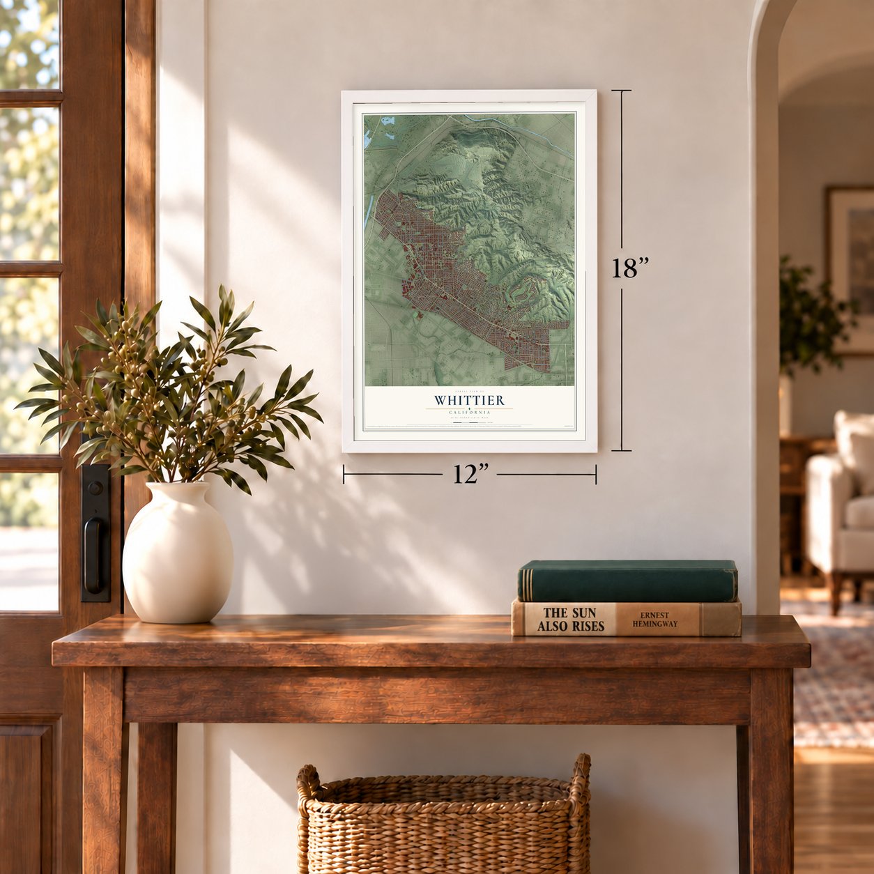
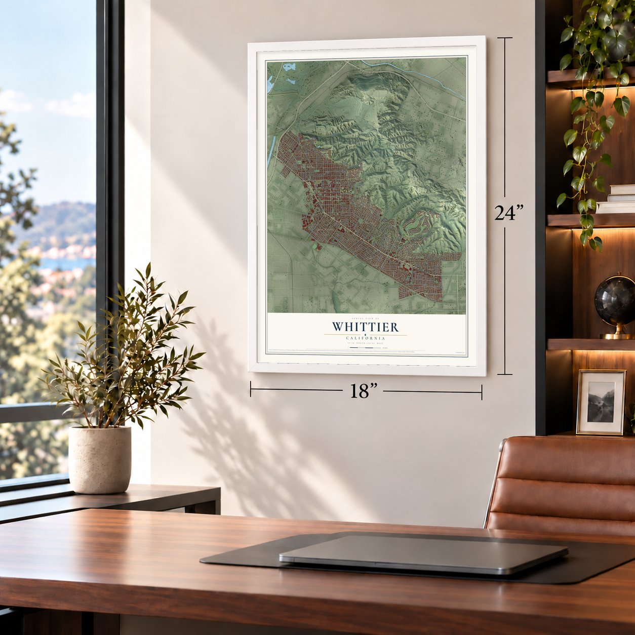
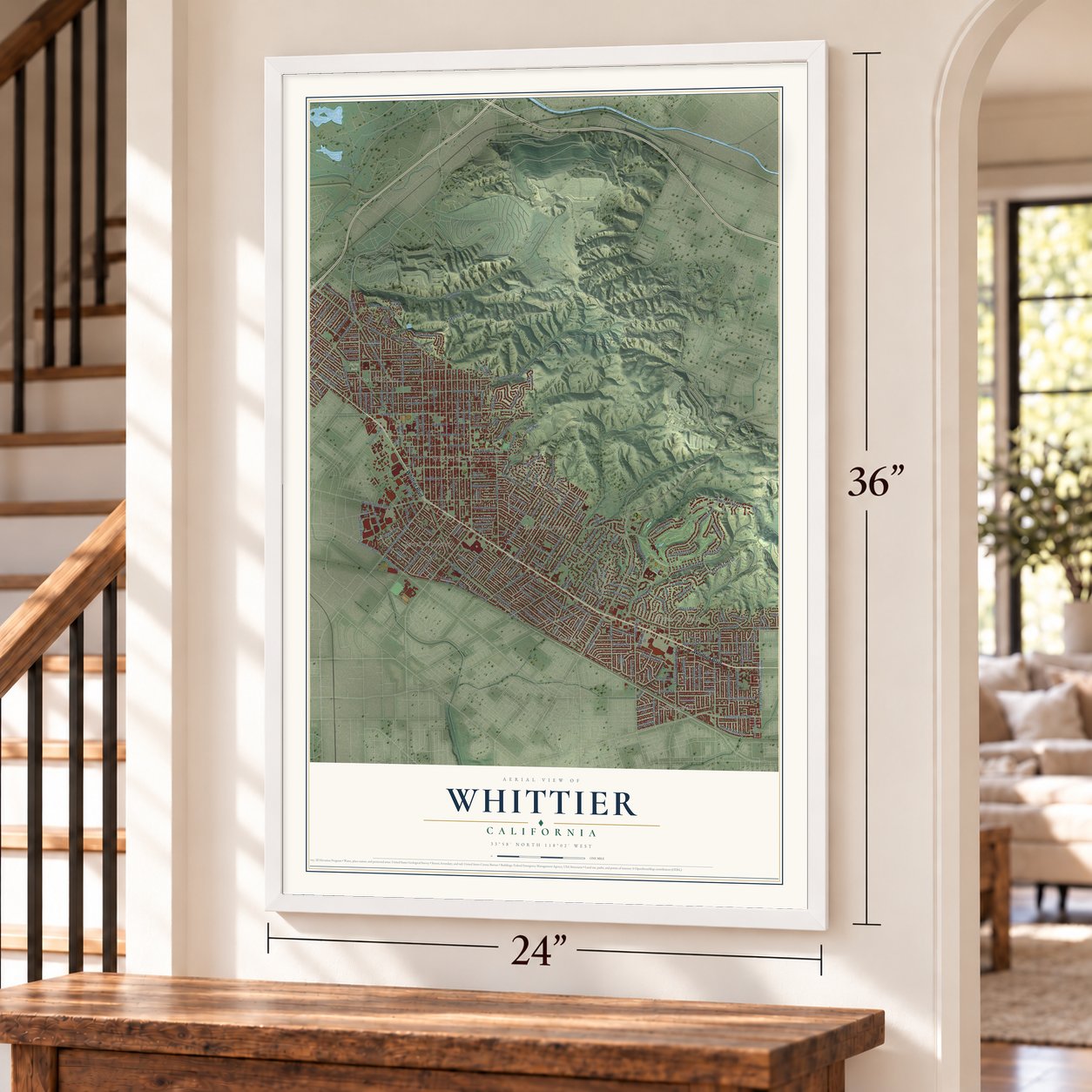
Whittier, California Map Art
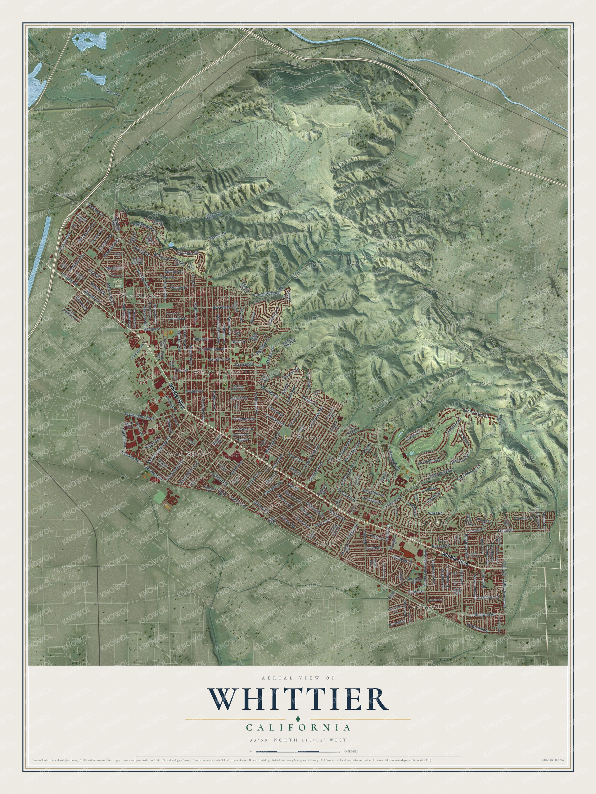
A new map of Whittier, California, made in 2026 and printed to order on thick archival matte paper.
12" x 18" Archival Matte Print
A Map of Home. A Work of Art.
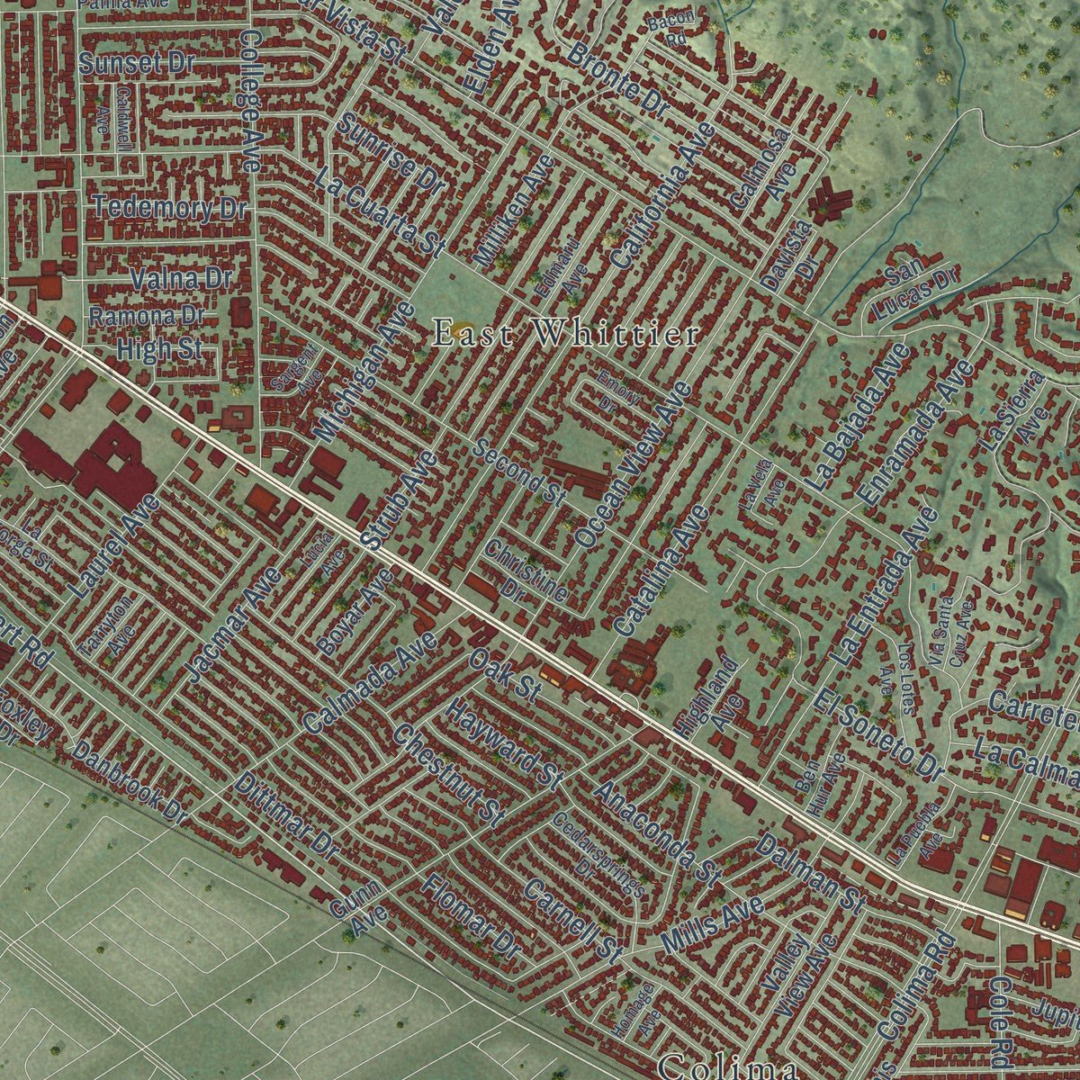
Explore Whittier, California from a whole new perspective. Created using aerial imagery and detailed geographic data, this map captures Whittier building by building, with labeled streets, familiar landmarks, and shaded topographical relief that highlights the natural contours of the landscape.
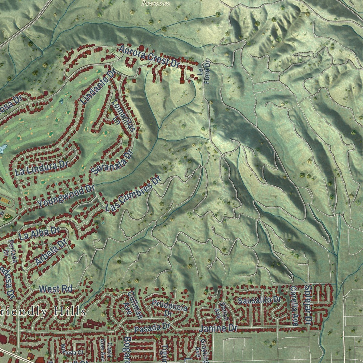
Combining modern data with the timeless character of a vintage atlas, this map is just as interesting up close as it is beautiful on the wall. Whether you grew up in Whittier, spent memorable years there, or call it home today, this unique map is a great way to celebrate a place that means something to you. Zoom in on the preview to look for your street, and then order a print to put your memories on the wall.
Three ways to hang it
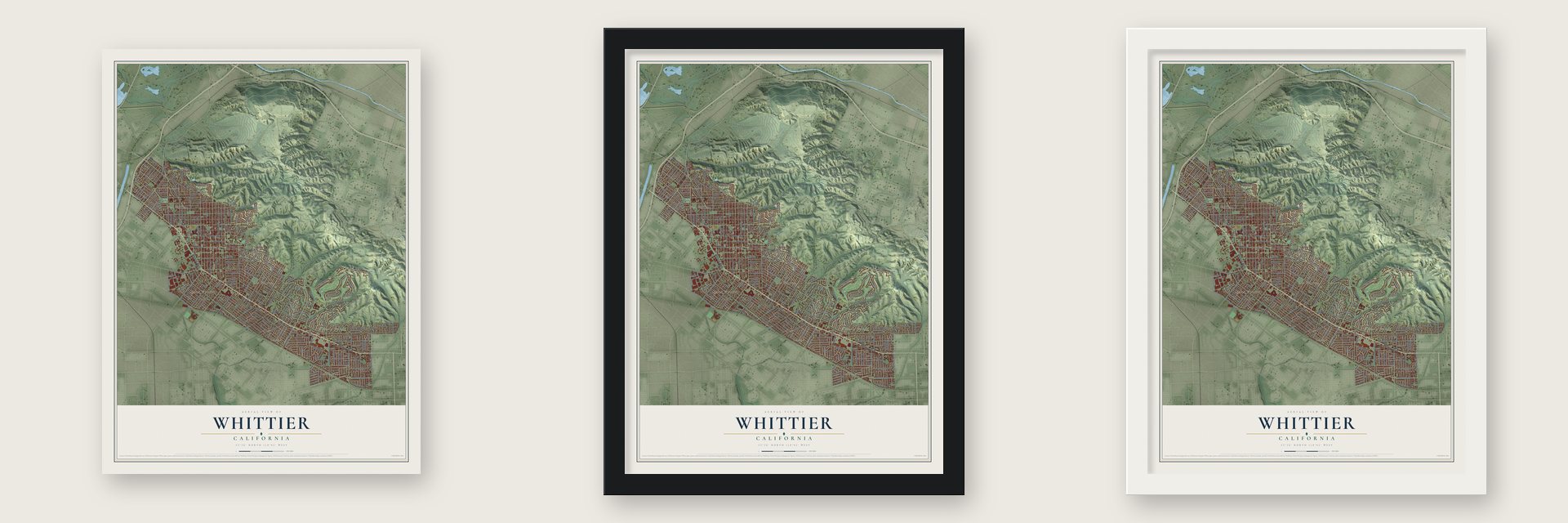
Unframed archival matte, a black wood frame or a white wood frame.
Up close
Geography Worth Displaying
This map was created using accurate cartographic data and authoritative geographic sources, including the U.S. Geological Survey and the Census Bureau. The map brings together terrain, waterways, roads, and building detail. The majority of the streets are labeled, houses are accurately depicted, and the topography is derived from government sources. Combining local data with carefully composed color and shading leads to this beautifully detailed Whittier artwork for your wall.
Rather than simply showing street outlines, we’ve included as many of the street names as we could reasonably fit on the map while keeping their names legible. Zoom in on the high resolution preview to see exactly what’s on the map. We truly set out to create a statement piece for anyone who loves Whittier. So whether it’s for you, or a gift for someone you love, we hope this map of Whittier brings back fond memories.
Read the story behind this map of Whittier, California from 2026.

About Whittier, California
Whittier is a city of 87,306 people in Los Angeles County. After the Mexican War, German immigrant Jacob F. Gerkens paid the government $234 for 160 acres under the Homestead Act and built a cabin there. He later became the first police chief of Los Angeles. A group of Quakers eventually bought the land, enlarged it to 1,259 acres and set out to build a Quaker town. They named it for the Quaker poet John Greenleaf Whittier and deeded him a lot. He never came, but the city was the subject of his poem "My Name I Give to Thee." Whittier incorporated in February 1898.
At first the only way to Los Angeles was on foot or by wagon over rough dirt roads, which made it hard to ship crops. In 1887 local businessmen paid $43,000 for the Southern Pacific to build a six-mile spur and a depot. Orange and lemon groves sold "Quaker Brand" fruit across the country, and by 1906 the town shipped 650 carloads of oranges and 250 of lemons each year. Walnut planting also began in 1887, and in time Whittier grew more walnuts than any other place in the nation.
- Meetings on a front porchJonathan and Rebecca Bailey, among the first residents, held Quaker meetings on the porch of their house. In 1887 the Quakers built a 100-seat meeting house at Comstock Avenue and Wardman Street. They soon outgrew it and moved to Philadelphia Street and Washington Avenue in 1902. Membership reached 1,200 by 1912, and a brick meeting house for 1,700, with mahogany pews, opened in 1917. The present building, dedicated in 1975, reuses its stained glass and mahogany.
- Whittier College since 1896The Pickering Land and Water Company set aside 20 acres for a college in 1887, but the land boom collapsed and building stalled. Whittier Academy, open since 1891, took the name Whittier College on July 30, 1896, with 100 students. A depression in the 1890s meant 17 years went by before it gave out its first bachelor's degrees. Its mascot is The Poet.
- Richard Nixon's hometownRichard Nixon grew up in East Whittier and played football at Whittier High School from 1928 to 1930 and at Whittier College from 1930 to 1934. During the 1930s his law office was in Uptown, inside the National Bank of Whittier Building. After he came home from World War II, his former landlord there, businessman Herman Perry, led a Committee of 100 Republicans in the drive to elect Nixon to Congress in 1946.
- The 1987 earthquakeOn the morning of October 1, 1987, the ground shook at 7:42 a.m. The 5.9 quake was centered six miles north-northwest of Whittier. It killed eight people and damaged many of Uptown's historic buildings. A 5.2 aftershock on October 4 did more harm. Residents formed the Whittier Conservancy that year to stop the demolition of old buildings, and the city set up a Historic Resources Commission to name landmarks and historic districts.
Find your street
Names on the Whittier map
Every name below is printed on this map. Look for your street, your school, the park where you played, or the pond down the road.
Places and landmarks10
- Whittier City Hall
- Palm Park
- Puente Hills Preserve
- Bartolo
- Colima
- East Whittier
- Friendly Hills
- Leffingwell
- South Whittier
- West Whittier
Streets and roads243
- Whittier Boulevard
- Lambert Road
- Leffingwell Road
- Whitley Street
- Gretna Avenue
- Janine Drive
- Hadley Street
- Colima Road
- Mar Vista Street
- Painter Avenue
- Greenleaf Avenue
- Beverly Boulevard
- La Cuarta Street
- Bright Avenue
- Santa Fe Springs Road
- Carnell Street
- Cullen Street
- Washington Avenue
- Dittmar Drive
- Orange Drive
- Milton Avenue
- Philadelphia Street
- Newlin Avenue
- Comstock Avenue
- Broadway
- Flomar Drive
- Pickering Avenue
- Friends Avenue
- Starbuck Street
- Penn Street
Show all 243 streets
- Ocean View Avenue
- Putnam Street
- Russell Street
- Camilla Street
- Floral Drive
- Bailey Street
- Scott Avenue
- Santa Gertrudes Avenue
- Calmada Avenue
- Walnut Street
- Catalina Avenue
- Skyline Drive
- Norwalk Boulevard
- College Avenue
- Mulberry Drive
- Palm Avenue
- Valley Home Avenue
- California Avenue
- Lashburn Street
- Strub Avenue
- Lindante Drive
- Hoover Avenue
- Youngwood Drive
- La Serna Drive
- Newcomb Avenue
- Michigan Avenue
- El Rancho Drive
- El Soneto Drive
- Bogardus Avenue
- Rose Drive
- Enramada Avenue
- La Alba Drive
- Chestnut Street
- Grovedale Drive
- Citrus Avenue
- Pioneer Boulevard
- Howard Street
- Anaconda Street
- Larrylyn Drive
- Beverly Drive
- Oak Street
- First Avenue
- Pounds Avenue
- Heathfield Drive
- Aurora Crest Drive
- Hayward Street
- Mills Avenue
- Washington Boulevard
- Villaverde Drive
- Wardman Street
- Tedemory Drive
- Whittier Avenue
- Seranata Drive
- Dorland Street
- Laurel Avenue
- Sunset Drive
- Cole Road
- Ben Alder Avenue
- La Entrada Avenue
- Arbela Drive
- Elden Avenue
- Alta Avenue
- Bronte Drive
- Jordan Road
- Hornell Street
- Vale Drive
- Hill Avenue
- Lodosa Drive
- Dalman Street
- Sunrise Drive
- Maple Street
- Homeland Avenue
- Rockne Avenue
- Deveron Drive
- Valna Drive
- Las Cumbres Drive
- Dorland Drive
- High Street
- Carley Avenue
- Worsham Drive
- Summit Drive
- North Circle Drive
- Virginia Avenue
- Jacmar Avenue
- La Calma Drive
- Norino Drive
- Turnbull Canyon Road
- Carretera Drive
- Redman Avenue
- Carinthia Drive
- Shoemaker Avenue
- Condesa Drive
- La Lindura Drive
- Nogal Avenue
- Slauson Avenue
- Bowen Drive
- Chetle Avenue
- Solejar Drive
- Yermo Street
- Canyon Drive
- La Bajada Avenue
- Earlham Drive
- West Road
- Rincon Drive
- Adler Drive
- Olive Drive
- Canobie Avenue
- Danbrook Drive
- Magnolia Avenue
- Second Street
- Calmosa Avenue
- Citrustree Road
- Davista Drive
- Foxley Drive
- Cullman Avenue
- Gunn Avenue
- Gregory Avenue
- Canyon Crest Road
- Jupiter Street
- La Cima Drive
- Dunton Drive
- Valley View Avenue
- Ramona Drive
- Kibbee Avenue
- Christine Drive
- Monte Vista Drive
- Southwind Drive
- Cadbury Road
- La Sierra Avenue
- Tigrina Avenue
- McGee Drive
- Santa Fe Street
- Rideout Way
- Milliken Avenue
- Sausalito Drive
- Honolulu Terrace
- Acacia Avenue
- Memphis Avenue
- Workman Mill Road
- Pasada Drive
- Fernview Street
- El Braso Drive
- Hester Avenue
- Beverly Hills Drive
- Loch Lomond Drive
- Sorensen Avenue
- Rivera Road
- Forest Avenue
- Park Street
- Prudencia Drive
- Whittwood Drive
- San Lucas Drive
- Boyar Avenue
- Corella Avenue
- Sycamore Canyon Road
- Madison Avenue
- Lomacitas Lane
- Sherrill Street
- Siphon Road
- Altmark Avenue
- Highland Avenue
- Byron Road
- Ridge Road
- Elmer Avenue
- La Forge Street
- Grande Vista Drive
- Cedarsprings Drive
- North Valley Home Avenue
- Portada Drive
- Rushford Street
- Adele Avenue
- Edmaru Avenue
- Haviland Avenue
- Lisco Street
- Lorene Street
- Verdosa Drive
- Helmer Drive
- Orchard Avenue
- Ben Hur Avenue
- Via del Palma Avenue
- Panorama Drive
- Tarryton Avenue
- Illinois Street
- Persing Drive
- Shiloh Avenue
- Grayling Avenue
- Jenkins Drive
- Le Flore Drive
- Union Avenue
- Lyle Avenue
- El Arco Drive
- Emory Drive
- Pierce Avenue
- Bacon Road
- Shady Valley Lane
- La Puebla Avenue
- Sargent Avenue
- Maybrook Avenue
- Omelia Road
- Costa Glen Avenue
- Los Lotes Avenue
- El Venado Drive
- Oval Drive
- Morningside Drive
- See Drive
- La Vela Avenue
- Lucia Avenue
- Pasadena Street
- Via Santa Cruz Avenue
- Homage Avenue
- Caldwell Avenue
- Mikinda Court
- Leffco Road
Names are listed as they appear on the printed map. Zoom into the product photos to find them.
The art of mapping a place
How This Map Was Made
Real places. Remarkable detail. Discover the layers that turn geographic data into a map of home.

The view from above
Aerial imagery reveals the character of the land: woodland, open fields, and the patterns of a place.

The shape of the land
Elevation data brings hills, valleys, and subtle changes in the landscape into view.

The details of home
Roads, waterways, and building footprints come together to make the map feel unmistakably local.

Geography becomes art
Considered color, shading, and typography bring the layers together in a map made for your wall.


Process illustrated with Mendon, Massachusetts. Aerial imagery: USDA NAIP. Terrain: USGS 3D Elevation Program. Map details and finished artwork: KNOWOL.
The Details
About This Print
Choose an archival matte print, or a black or white Ayous wood frame. The archival matte print is unframed.
Select your size and finish above to see the matching product image and price.
Materials & Craftsmanship
A contemporary map with the character of a classic atlas, printed on archival matte paper. Optional frames are made from Ayous wood.
Your printed map does not include the watermark shown in the full-map preview.
Shipping & Delivery
Free shipping within the United States. Every print is made to order in the USA.
Buying a gift? Add a note in your cart and we'll include it. We never put prices in the package.
Prints ship within 2 to 3 business days. Allow 7 to 10 days total from ordering for delivery. Timing may vary during holidays or periods of high order volume.
Read our shipping policy.
Returns and damaged prints
Each print is made to order. Change-of-mind refunds are not available after production.
If your print arrives damaged, misprinted or incorrect, contact support@knowol.com within 30 days of receiving it. Include your order number, photos and a description of the issue.
Read our full refund and replacement policy. For questions about your order, email support@knowol.com.
Find your town
Looking for another city?
Find a map of home in our California collection, or any town in the country.
Nearby
Maps of towns near Whittier
Know someone from one of these towns? Their map makes a great gift.
 South Whittier
, California
From $39.99See the map
 West Whittier-Los Nietos
, California
From $39.99See the map
 Rose Hills
, California
From $39.99See the map
More maps nearby: Santa Fe Springs, Hacienda Heights, East Whittier, East La Mirada and La Habra Heights.