


Search for another town





Free U.S. delivery 7 to 10 days after you order
Winchester, Kentucky Map Art
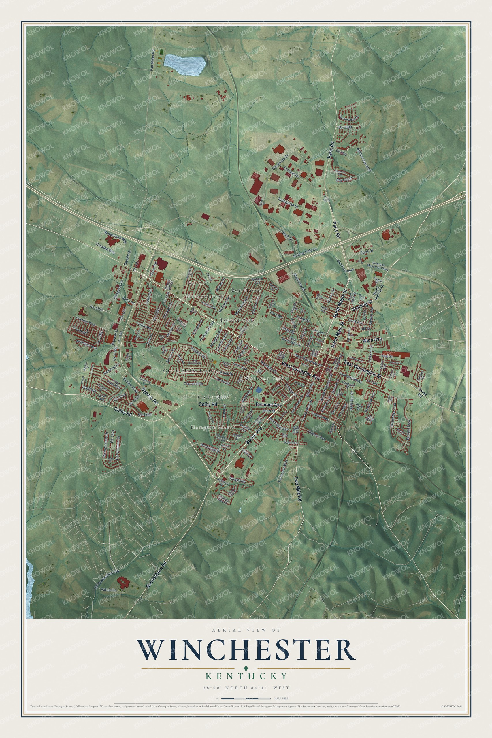
Building by building, with labeled streets and shaded relief.
12" x 18" Archival Matte Print
A Map of Home. A Work of Art.
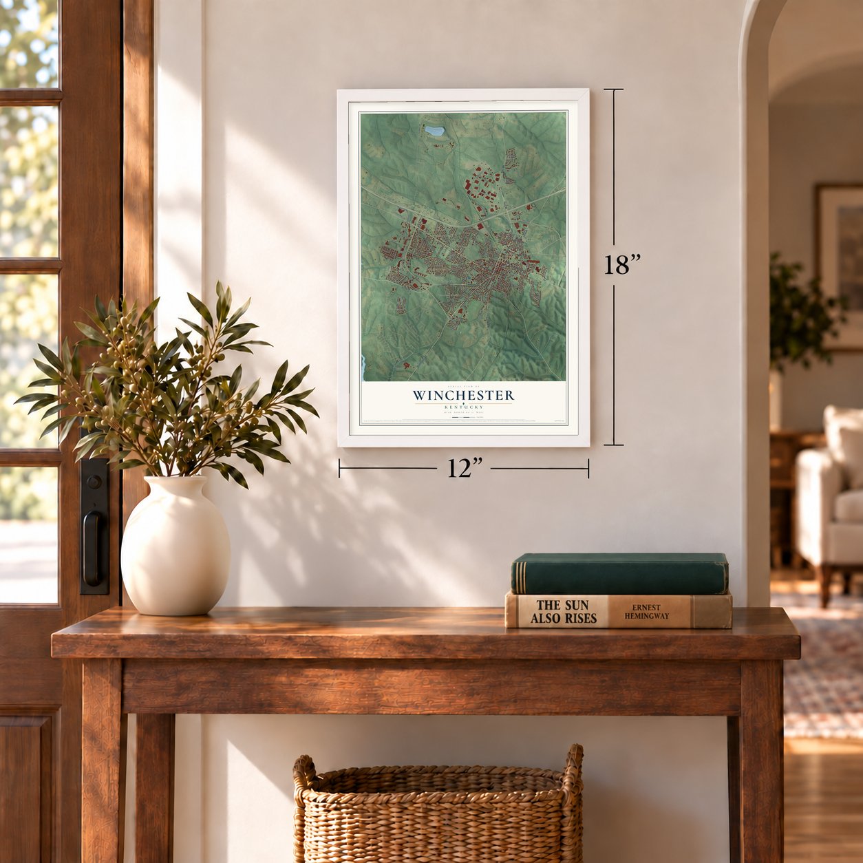
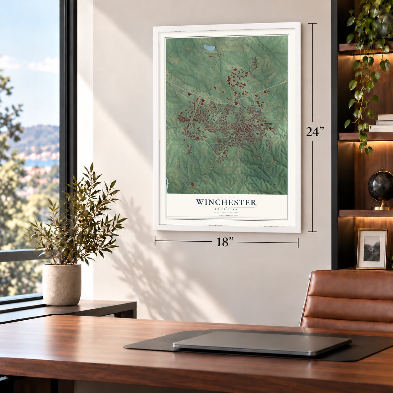
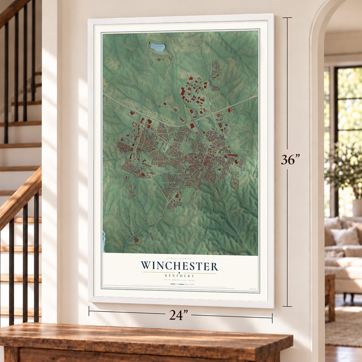
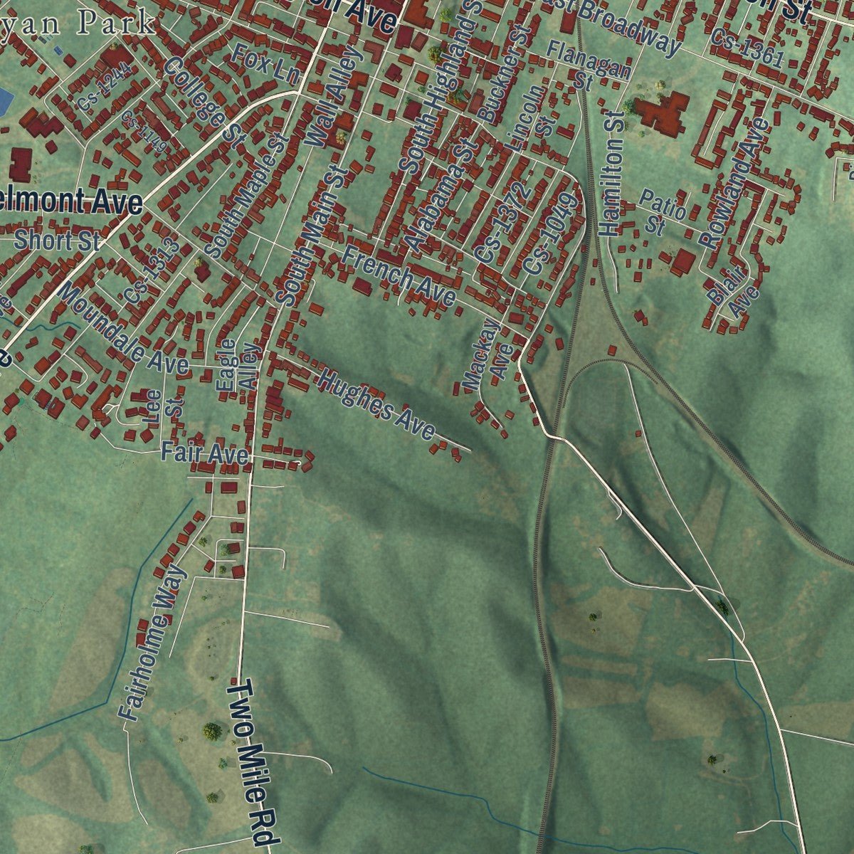
Explore Winchester, Kentucky from a whole new perspective. Created using aerial imagery and detailed geographic data, this map captures Winchester building by building, with labeled streets, familiar landmarks, and shaded topographical relief that highlights the natural contours of the landscape.
Combining modern data with the timeless character of a vintage atlas, this map is just as interesting up close as it is beautiful on the wall. Whether you grew up in Winchester, spent memorable years there, or call it home today, this unique map is a great way to celebrate a place that means something to you. Zoom in on the preview to look for your street, and then order a print to put your memories on the wall.
Three ways to hang it
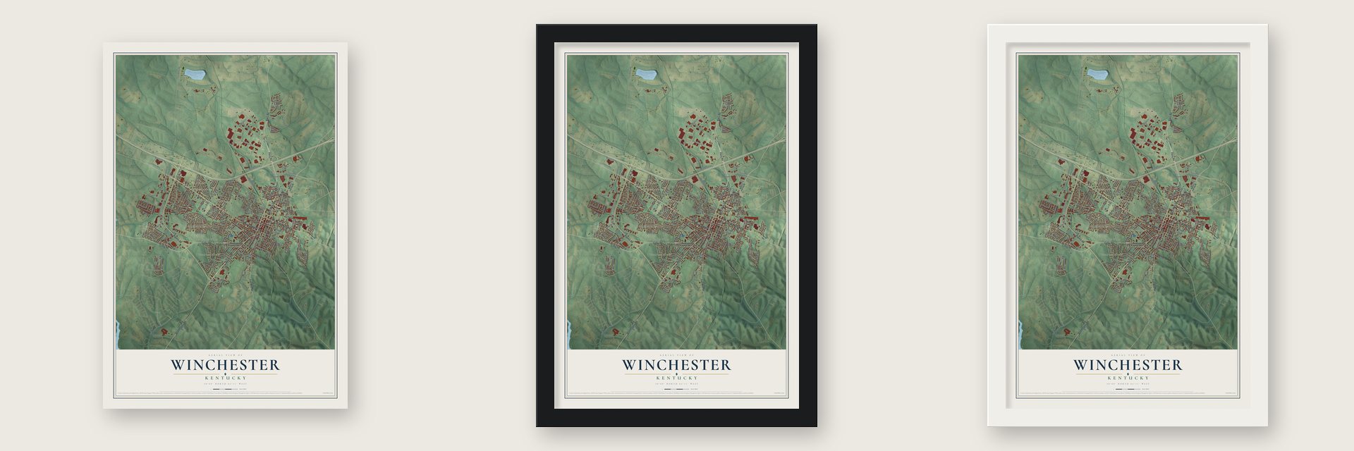
Unframed archival matte, a black wood frame or a white wood frame.
Up close
Geography Worth Displaying
This map was created using accurate cartographic data and authoritative geographic sources, including the U.S. Geological Survey and the Census Bureau. The map brings together terrain, waterways, roads, and building detail. The majority of the streets are labeled, houses are accurately depicted, and the topography is derived from government sources. Combining local data with carefully composed color and shading leads to this beautifully detailed Winchester artwork for your wall.
Rather than simply showing street outlines, we’ve included as many of the street names as we could reasonably fit on the map while keeping their names legible. Zoom in on the high resolution preview to see exactly what’s on the map. We truly set out to create a statement piece for anyone who loves Winchester. So whether it’s for you, or a gift for someone you love, we hope this map of Winchester brings back fond memories.
Read the story behind this map of Winchester, Kentucky from 2026.

Find your street
Names on the Winchester map
Every name below is printed on this map. Look for your street, your school, the park where you played, or the pond down the road.
Places and landmarks8
- Meadowbrook
- Bel Air
- Hampton Manor
- Bon Haven
- Colby Hills
- Forrest Park
- Green Fields Estates
- Wesleyan Park
Streets and roads201
- West Lexington Avenue
- North Main Street
- Sterling Street
- North Maple Street
- Boone Avenue
- Colby Road
- Paris Road
- Bypass Road
- East Washington Street
- Boonesboro Road
- Winn Avenue
- Two Mile Road
- Belmont Avenue
- South Main Street
- Shoppers Drive
- Mutual Avenue
- Elm Street
- West Broadway Street
- Evans Street
- First Street
- Market Street
- Rolling Hills Lane
- Corporate Drive
- Fulton Road
- East Broadway
- Holiday Road
- Magnolia Street
- College Street
- Wall Alley
- Estes Drive
Show all 201 streets
- Early Drive
- Brownland Way
- Enterprise Drive
- Redwing Drive
- Buffalo Trce
- Fairholme Way
- Maryland Avenue
- Nunnelly Court
- Cs-1352
- Frontier Way
- Stamper Drive
- Van Meter Road
- Runnymeade Drive
- Oxford Drive
- Cherry Street
- Fortune Drive
- Windridge Drive
- Fitch Avenue
- South Highland Street
- Hill Street
- Cs-1207
- Pioneer Drive
- Jackson Street
- Dale Drive
- Old Boonesboro Road
- Pearl Street
- Ashton Oak Way
- Hamilton Street
- Finley Road
- Hiawatha Trail
- Churchill Drive
- Cs-1108
- Bullion Boulevard
- Cook Avenue
- Cs-1202
- French Avenue
- McCann Drive
- Hughes Avenue
- Tech Drive
- Moundale Avenue
- Short Street
- Earlymeade Drive
- Vaught Road
- Cs-1341
- Kittison Drive
- Rowland Avenue
- Milwood Drive
- Old Paris Pike
- Croxton Way
- Tremont Lane
- Sheffield
- Cs-1372
- Alabama Street
- New Street
- Willow Drive
- Patton Lane
- Cs-1386
- Bay Hill Drive
- Arlington Road
- Lindberg Road
- Cs-1353
- Caudill Drive
- Third Street
- Locust Drive
- Cs-1383
- Lana Lane
- Fair Avenue
- Cs-1389
- Cs-1348
- Long Avenue
- Skylark Drive
- Carol Road
- Cs-1049
- Fox Lane
- Cs-1393
- Lisle Lane
- Irvine Road
- Blair Avenue
- West Washington Street
- Veterans Memorial Parkway
- North Highland Street
- Seventh Street
- South Maple Street
- Colby Ridge Boulevard
- Hampton Avenue
- Candlewood Drive
- Harkins Drive
- Pendleton Street
- Carolina Avenue
- Professional Avenue
- Bells Alley
- Franklin Avenue
- Hood Avenue
- Manor Drive
- Country Club Court
- Holly Avenue
- Spruce Court
- Hanover Drive
- Wellington Way
- Buckner Street
- Cs-1320
- Cs-1385
- Hubbard Road
- Southern Court
- Breeze Hill Drive
- Andover Drive
- Victory Avenue
- Flanagan Street
- Apple Street
- Cs-1313
- Mackay Avenue
- Patio Street
- Wabash Avenue
- Eagle Alley
- Lincoln Street
- Clay Street
- Al Fan Court
- Keffer Road
- Lee Street
- Cs-1148
- Almond Street
- Cs-1317
- Taylor Avenue
- Camden Drive
- Cs-1361
- Ragan Drive
- Cedar Drive
- Ascot Avenue
- Jett Drive
- Ada Lane
- Oak Street
- Mount Sterling Road
- Silverton Way
- Westside Drive
- Sunset Heights
- Graves Drive
- Jefferson Street
- Hays Street
- Kiwi Drive
- Edgewood Drive
- Old Bottom Road
- Apache Trail
- Country Club Drive
- Rose Drive
- Dorset Lane
- Gay Street
- Rosemary Drive
- Dixon Way
- Cs-1244
- Cs-1344
- Mayfair Court
- Canary Lane
- Walle Drive
- Pear Court
- Mockingbird Valley Road
- Madison Avenue
- Church Alley
- Westwood Drive
- Fifth Street
- Sylvania Avenue
- Barnes Drive
- Cs-1149
- North Bloomfield Road
- Stratford Glen Drive
- Edgemont Avenue
- Harrod Drive
- Frito Lane
- Chelsea Way
- Crawford Avenue
- Byrd Avenue
- Ritz Court
Names are listed as they appear on the printed map. Zoom into the product photos to find them.
About Winchester, Kentucky
Winchester is a city of 19,134 people and the county seat of Clark County, about halfway between Lexington and Mt. Sterling. John Baker founded the settlement and named it for his former home, Winchester, Virginia. The town was incorporated in 1793.
Kentucky Wesleyan College moved to Winchester in 1890 and stayed until 1954. When the college left, the local Churches of Christ opened Southeastern Christian College on the same grounds. That school closed in 1979, and the old campus was saved and turned into a public park.
- Ale-8-One and beer cheeseAle-8-One, Kentucky's own brand of soft drink, has come off Winchester bottling lines since 1926. Beer cheese was first made in Clark County, near Winchester, in the 1940s, and the city now holds a Beer Cheese Festival every June.
- Oliver School, 1892 to 1969Oliver School taught Winchester's Black students for decades, first as a high school and later as an elementary school. After integration in 1956, its high school students rode buses to Winchester High School, which had admitted only white students until then. The Oliver School campus joined the National Register in 2004.
- The last L&N passenger trainThe Louisville and Nashville Railroad once ran its trains through Winchester both east and west and north and south. The final passenger service was an unnamed run between Cincinnati and Atlanta, all that remained of the old Flamingo that had once gone on to Jacksonville. It ended on March 7, 1968.
Keep exploring Kentucky
Winchester is one of 659 Kentucky towns we've mapped. Every dot on the map is a print of its own.
The search covers every state, Kentucky first.
Near Winchester
Order 2 or more town maps and save 10%. Shown in the size and finish you picked above, so they hang as a set.
- Boonesborough 12" x 18" / Archival Matte Print $39.99
- North Middletown 12" x 18" / Archival Matte Print $39.99
- Mount Sterling 12" x 18" / Archival Matte Print $39.99


More maps nearby: Paris, Lexington-Fayette, Kenwick, Camargo and Waco.
The art of mapping a place
How This Map Was Made
Real places. Remarkable detail. Discover the layers that turn geographic data into a map of home.

The view from above
Aerial imagery reveals the character of the land: woodland, open fields, and the patterns of a place.

The shape of the land
Elevation data brings hills, valleys, and subtle changes in the landscape into view.

The details of home
Roads, waterways, and building footprints come together to make the map feel unmistakably local.

Geography becomes art
Considered color, shading, and typography bring the layers together in a map made for your wall.


Process illustrated with Mendon, Massachusetts. Aerial imagery: USDA NAIP. Terrain: USGS 3D Elevation Program. Map details and finished artwork: KNOWOL.
The Details
About This Print
Choose an archival matte print, or a black or white Ayous wood frame. The archival matte print is unframed.
Select your size and finish above to see the matching product image and price.
Materials & Craftsmanship
A contemporary map with the character of a classic atlas, printed on archival matte paper. Optional frames are made from Ayous wood.
Your printed map does not include the watermark shown in the full-map preview.
Shipping & Delivery
Free shipping within the United States. Every print is made to order in the USA.
Buying a gift? Add a note in your cart and we'll include it. We never put prices in the package.
Prints ship within 2 to 3 business days. Allow 7 to 10 days total from ordering for delivery. Timing may vary during holidays or periods of high order volume.
Read our shipping policy.
Returns and damaged prints
Each print is made to order. Change-of-mind refunds are not available after production.
If your print arrives damaged, misprinted or incorrect, contact support@knowol.com within 30 days of receiving it. Include your order number, photos and a description of the issue.
Read our full refund and replacement policy. For questions about your order, email support@knowol.com.