
Search for another town





Free U.S. delivery 7 to 10 days after you order
Woodcrest, California Map Art
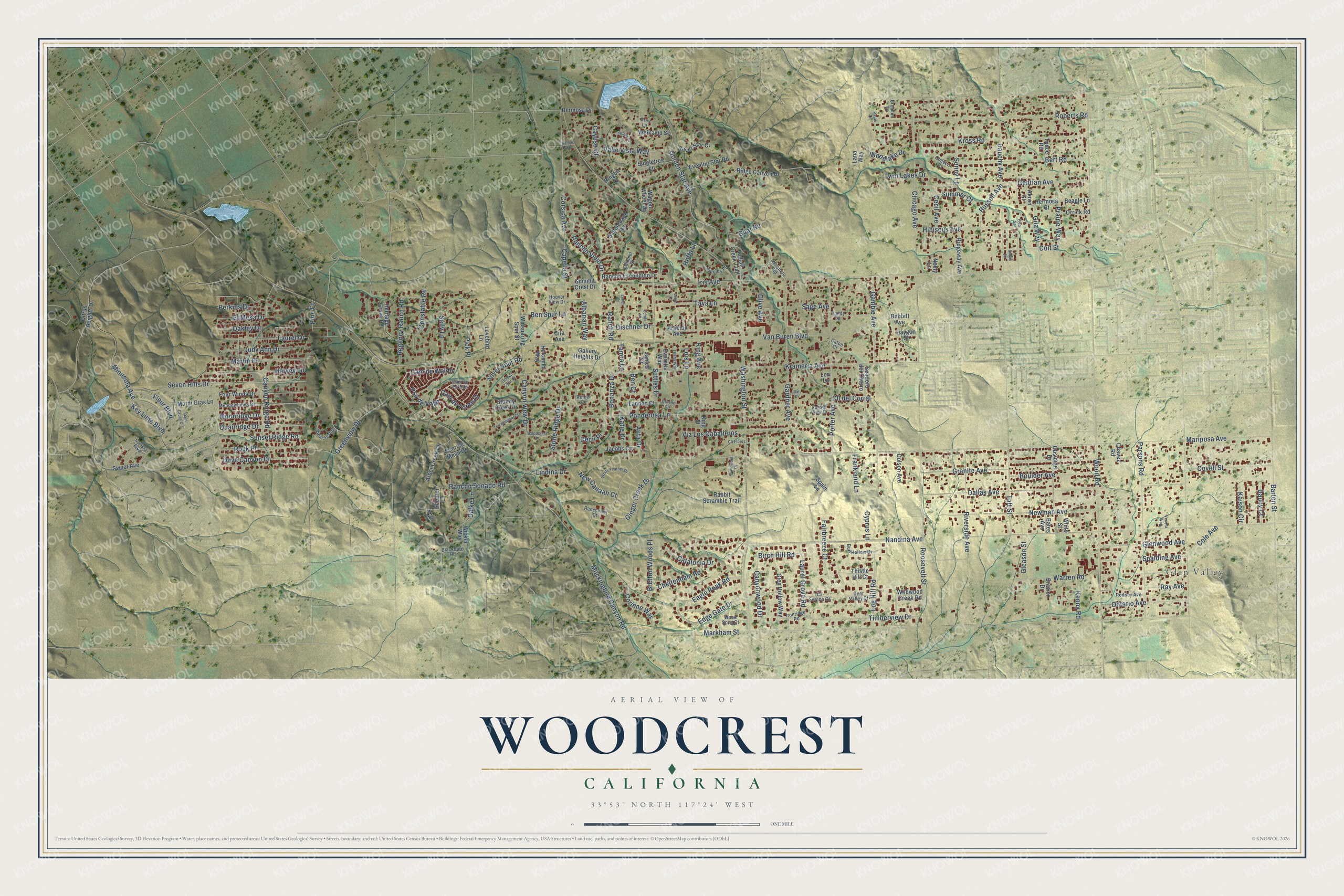
A new map of Woodcrest, California, made in 2026 and printed to order on thick archival matte paper.
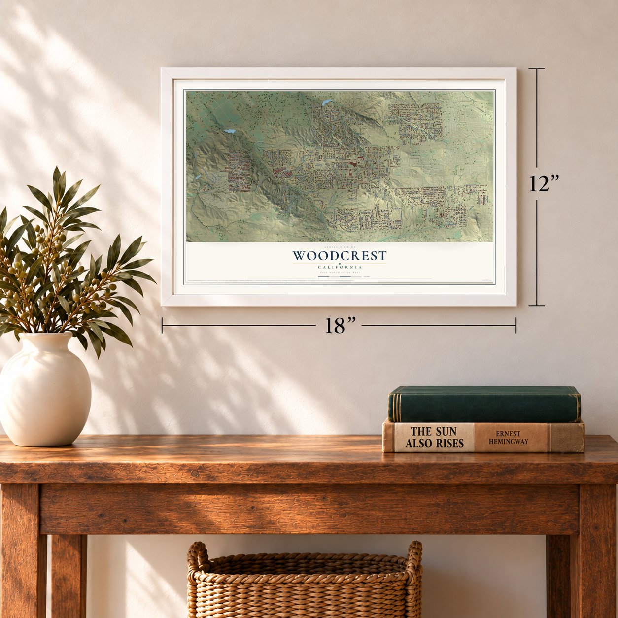
12" x 18" Archival Matte Print
A Map of Home. A Work of Art.
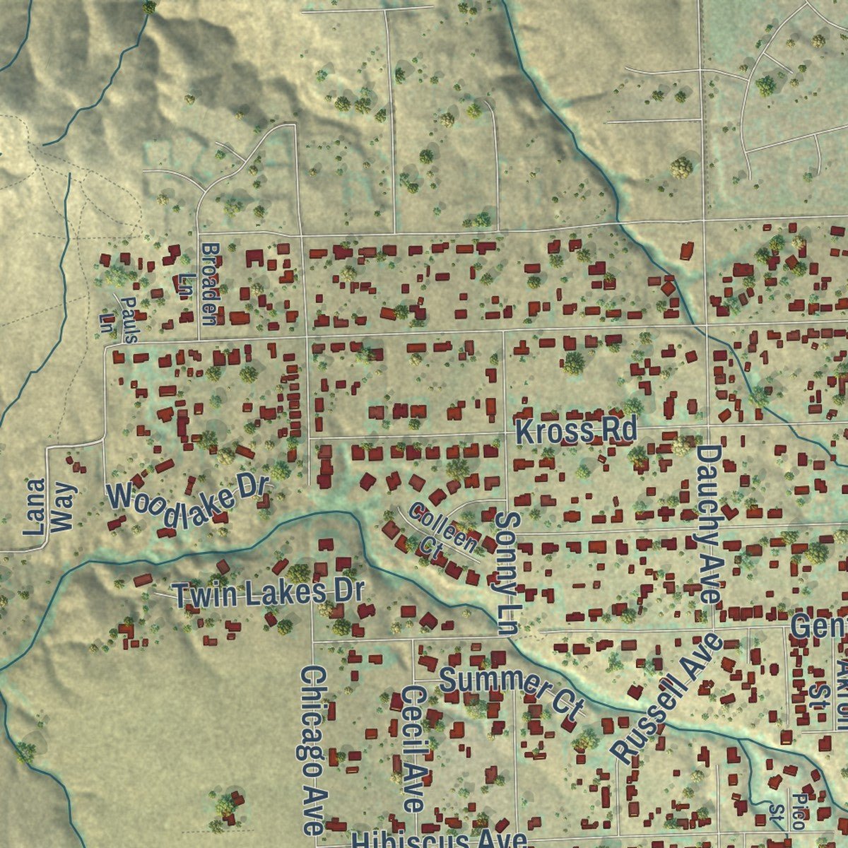
Explore Woodcrest, California from a whole new perspective. Created using aerial imagery and detailed geographic data, this map captures Woodcrest building by building, with labeled streets, familiar landmarks, and shaded topographical relief that highlights the natural contours of the landscape.
Combining modern data with the timeless character of a vintage atlas, this map is just as interesting up close as it is beautiful on the wall. Whether you grew up in Woodcrest, spent memorable years there, or call it home today, this unique map is a great way to celebrate a place that means something to you. Zoom in on the preview to look for your street, and then order a print to put your memories on the wall.
Three ways to hang it
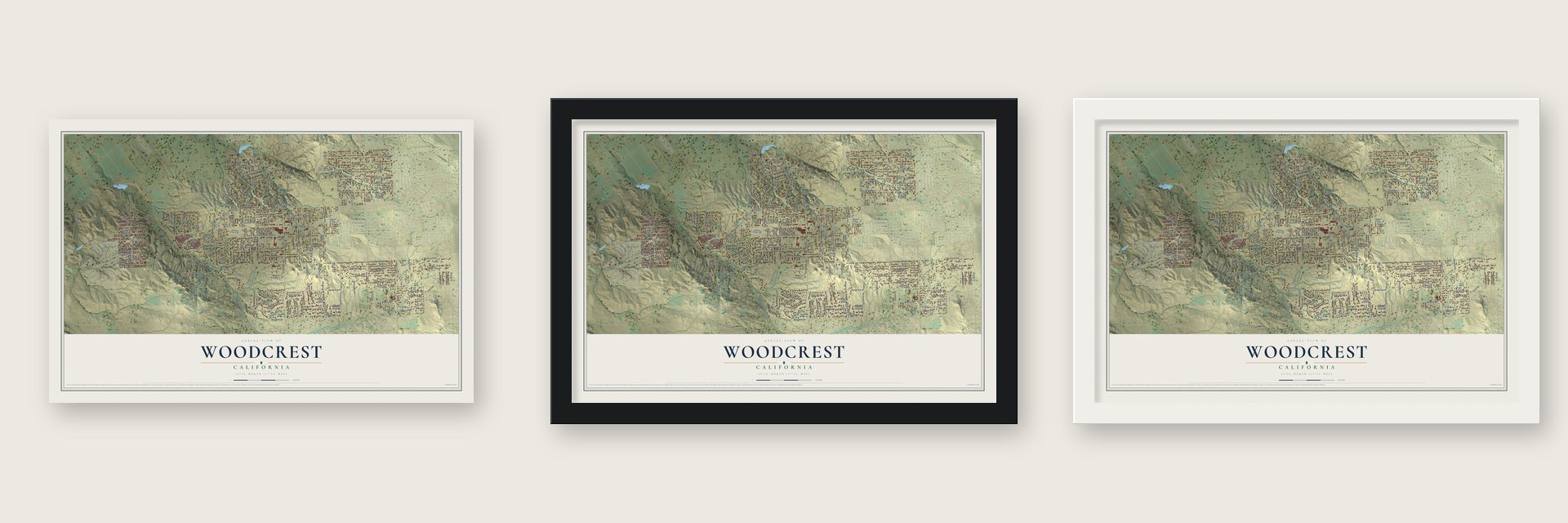
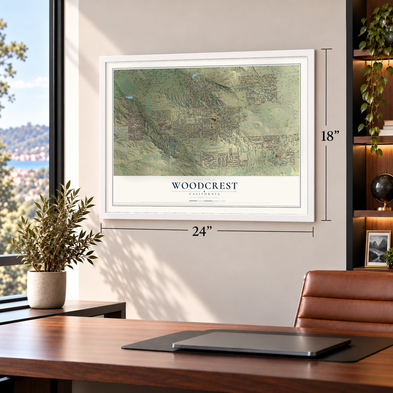
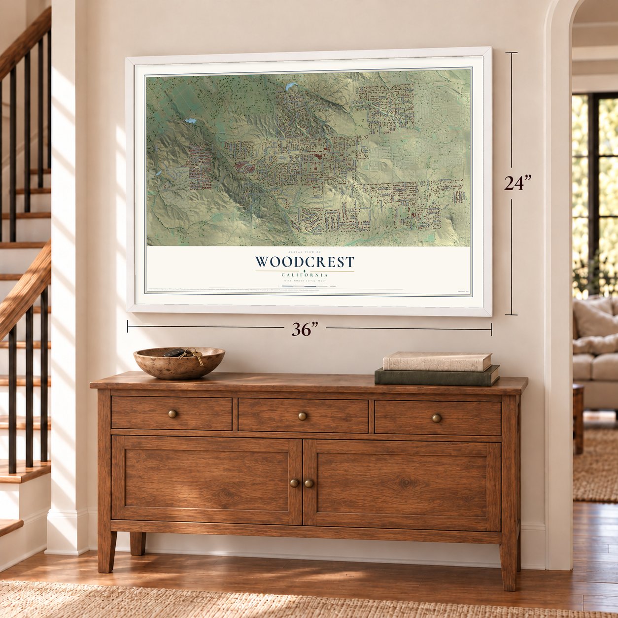
Unframed archival matte, a black wood frame or a white wood frame.
Up close
Geography Worth Displaying
This map was created using accurate cartographic data and authoritative geographic sources, including the U.S. Geological Survey and the Census Bureau. The map brings together terrain, waterways, roads, and building detail. The majority of the streets are labeled, houses are accurately depicted, and the topography is derived from government sources. Combining local data with carefully composed color and shading leads to this beautifully detailed Woodcrest artwork for your wall.
Rather than simply showing street outlines, we’ve included as many of the street names as we could reasonably fit on the map while keeping their names legible. Zoom in on the high resolution preview to see exactly what’s on the map. We truly set out to create a statement piece for anyone who loves Woodcrest. So whether it’s for you, or a gift for someone you love, we hope this map of Woodcrest brings back fond memories.
Read the story behind this map of Woodcrest, California from 2026.

About Woodcrest, California
Woodcrest began as a community of dry-land grain farmers in the hills outside Riverside. Its first subdivision, Oak Glen Tract, appeared in 1905, while the Woodcrest Acres name arrived with a subdivision and post office in 1926. Citrus groves later spread here as orchards within Riverside declined.
- Grain-farming beginningsDry-land grain farmers first populated the Woodcrest area in the late 19th century.
- A school in 1894Riverside County authorized the Oak Glen School District as the population grew.
- Named in 1926Woodcrest Acres gave its name to the post office and the wider community.
- Horse countryWoodcrest remains an equestrian community with ranches and horses at many residences.
- 15,378 peopleThe 2020 census counted 15,378 residents.
Find your street
Names on the Woodcrest map
Every name below is printed on this map. Look for your street, your school, the park where you played, or the pond down the road.
Places and landmarks1
- Glen Valley
Streets and roads222
- Iris Avenue
- Kross Road
- Edge Gate Drive
- Log Hill Road
- Van Buren Boulevard
- Mariposa Avenue
- Washington Street
- Markham Street
- Nandina Avenue
- Mockingbird Canyon Road
- Krameria Avenue
- Wood Road
- Porter Avenue
- Roberts Road
- Dallas Avenue
- Chicago Avenue
- Cole Avenue
- Suttles Drive
- Granite Avenue
- Roosevelt Street
- Parsons Road
- Golden Star Avenue
- Warren Road
- Gentian Avenue
- Gamble Avenue
- Gardner Avenue
- Ponderosa Lane
- Minneola Avenue
- Newman Avenue
- Dauchy Avenue
Show all 222 streets
- Seven Hills Drive
- Bert Road
- Corsica Avenue
- Tava Lane
- Ginger Creek Drive
- Canyon View Drive
- Via Los Caballeros
- Timberview Drive
- Hibiscus Avenue
- Riverside Avenue
- Taft Street
- Corinne Way
- Dove Canyon Drive
- Laurel Drive
- Rancho Viejo Drive
- Capella Street
- Canyon Ridge Road
- Stone Ridge Drive
- Oakley Drive
- Greenview Drive
- Martin Place
- Valle Vista Way
- Covell Street
- Boulder Avenue
- Barton Street
- Ontario Avenue
- Harvey Lane
- Constable Road
- Quailridge Drive
- Cam de Lorenzo
- Rock Place
- Sage Avenue
- Bretton Woods Place
- Glenwood Avenue
- Spalding Avenue
- Pick Place
- King Avenue
- Prairie Way
- Goat Road
- Judy Ann Drive
- Rancho Sonado Road
- Pso de Vega
- Laurel Grove Road
- El Mesa Drive
- Eagle Peak Road
- Moonridge Drive
- Regency Ranch Road
- Fleur Boulevard
- Sonny Lane
- Canyonwood Drive
- Albarian Way
- Cheltenham Road
- Sally Lane
- Fairbreeze Court
- Cayuse Court
- Colt Street
- Cam de Waldo
- Russell Avenue
- Ray Avenue
- Sunset Ridge Road
- Woodlake Drive
- Catalonia Drive
- Perkins Drive
- Key Lime Boulevard
- Silver Spur Road
- Alita Drive
- New Canaan Court
- Ben Spur Lane
- Gleason Street
- Twin Lakes Drive
- Ranch Road
- Cecil Avenue
- Frankland Lane
- Dischner Drive
- Bonanza Drive
- Kenny Road
- Lindina Drive
- Birch Hill Road
- Cll del Corral
- Dalke Lane
- Cecil Place
- Summer Court
- Gila Way
- Dauby Court
- Kaison Circle
- Katie Drive
- Tamra Lane
- Hoffa Lane
- Cyprus Lane
- Olive Avenue
- Pine Court
- Lois Lane
- Ben Court
- Hermosa Street
- Lana Way
- Ridge Canyon Drive
- Four Winds Drive
- Ridgeway Avenue
- Indian Creek Trail
- Rancho Escondido Drive
- Evening Star Road
- Obsidian Drive
- Stoney Creek Drive
- Arbor Creek Circle
- Mardi Gras Lane
- Saddleback Road
- Singletree Lane
- Sendero del Charro
- Wagon Wheel Drive
- Whispering Spur Street
- Gallery Heights Drive
- Glen Hollow Way
- Heritage Grove Road
- Rabbit Scramble Trail
- Shearer Lane
- Silver Star Court
- Sunrise Mesa Drive
- Sweet Avenue
- Summit Crest Drive
- Citrus Heights Drive
- Jacobs Circle
- Weikamp Street
- King Street
- Orrick Road
- Beagle Lane
- Hermosa Drive
- Golson Avenue
- Arabian Avenue
- Wicker Way
- Landon Court
- Wildwood Creek Road
- Thistle Hill Court
- Lovebird Lane
- Bobbitt Avenue
- Holcomb Way
- Haygen Street
- Akron Street
- White Street
- Teace Road
- Everetts Way
- James Court
- Bates Avenue
- Ringbit Court
- Chavez Road
- Brazier Drive
- Spain Lane
- Neely Lane
- Cita Avenue
- Lori Lane
- Ranchero Road
- Carista Boulevard
- Meadowlands Drive
- Cam de Estrilla
- Sandy Terrace
- Burl Hollow Drive
- Viewcrest Drive
- Rodney Avenue
- Ranchview Court
- Deer Valley Court
- La Serena Court
- Ironridge Road
- Calumet Court
- Wood Song Court
- Dooley Place
- Sunset View Drive
- Grey Lane
- Blackburn Road
- Colleen Court
- Broaden Lane
- Hoover View Drive
- Reiner Circle
- Caton Court
- White Feather Drive
- Shorb Street
- Terraceview Court
- Armintrout Drive
- Woodcrest Drive
- Londa Lane
- Kellen Court
- Greene Circle
- Golden Spur Court
- Rain Cross Circle
- Trisha Way
- Cll Flores
- Venora Way
- Bellino Way
- Bali Drive
- Nolen Lane
- Pauls Lane
- Lenel Court
- Lenet Court
- Pico Street
Names are listed as they appear on the printed map. Zoom into the product photos to find them.
The art of mapping a place
How This Map Was Made
Real places. Remarkable detail. Discover the layers that turn geographic data into a map of home.

The view from above
Aerial imagery reveals the character of the land: woodland, open fields, and the patterns of a place.

The shape of the land
Elevation data brings hills, valleys, and subtle changes in the landscape into view.

The details of home
Roads, waterways, and building footprints come together to make the map feel unmistakably local.

Geography becomes art
Considered color, shading, and typography bring the layers together in a map made for your wall.


Process illustrated with Mendon, Massachusetts. Aerial imagery: USDA NAIP. Terrain: USGS 3D Elevation Program. Map details and finished artwork: KNOWOL.
The Details
About This Print
Choose an archival matte print, or a black or white Ayous wood frame. The archival matte print is unframed.
Select your size and finish above to see the matching product image and price.
Materials & Craftsmanship
A contemporary map with the character of a classic atlas, printed on archival matte paper. Optional frames are made from Ayous wood.
Your printed map does not include the watermark shown in the full-map preview.
Shipping & Delivery
Free shipping within the United States. Every print is made to order in the USA.
Buying a gift? Add a note in your cart and we'll include it. We never put prices in the package.
Prints ship within 2 to 3 business days. Allow 7 to 10 days total from ordering for delivery. Timing may vary during holidays or periods of high order volume.
Read our shipping policy.
Returns and damaged prints
Each print is made to order. Change-of-mind refunds are not available after production.
If your print arrives damaged, misprinted or incorrect, contact support@knowol.com within 30 days of receiving it. Include your order number, photos and a description of the issue.
Read our full refund and replacement policy. For questions about your order, email support@knowol.com.
Find your town
Looking for another city?
Find a map of home in our California collection, or any town in the country.
Nearby
Maps of towns near Woodcrest
Know someone from one of these towns? Their map makes a great gift.
 Lake Mathews
, California
From $39.99See the map
 Casa Blanca
, California
From $39.99See the map
 Riverside
, California
From $39.99See the map
More maps nearby: March ARB, El Sobrante, Mead Valley, Home Gardens and Good Hope.