
Search for another town





Free U.S. delivery 7 to 10 days after you order
Worthington, Ohio Map Art
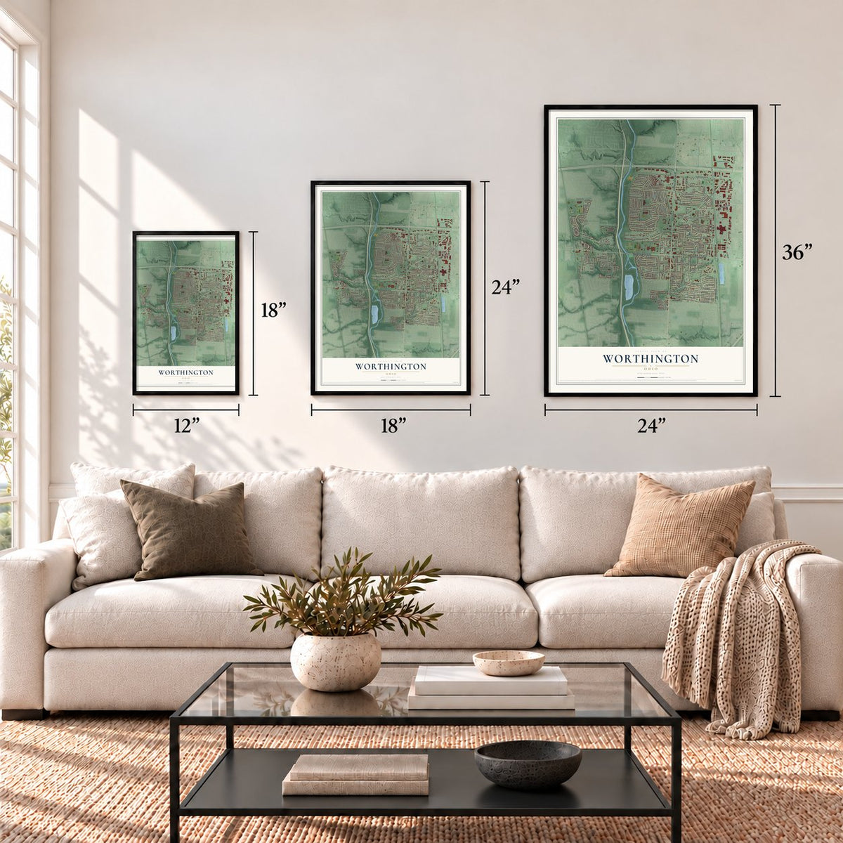
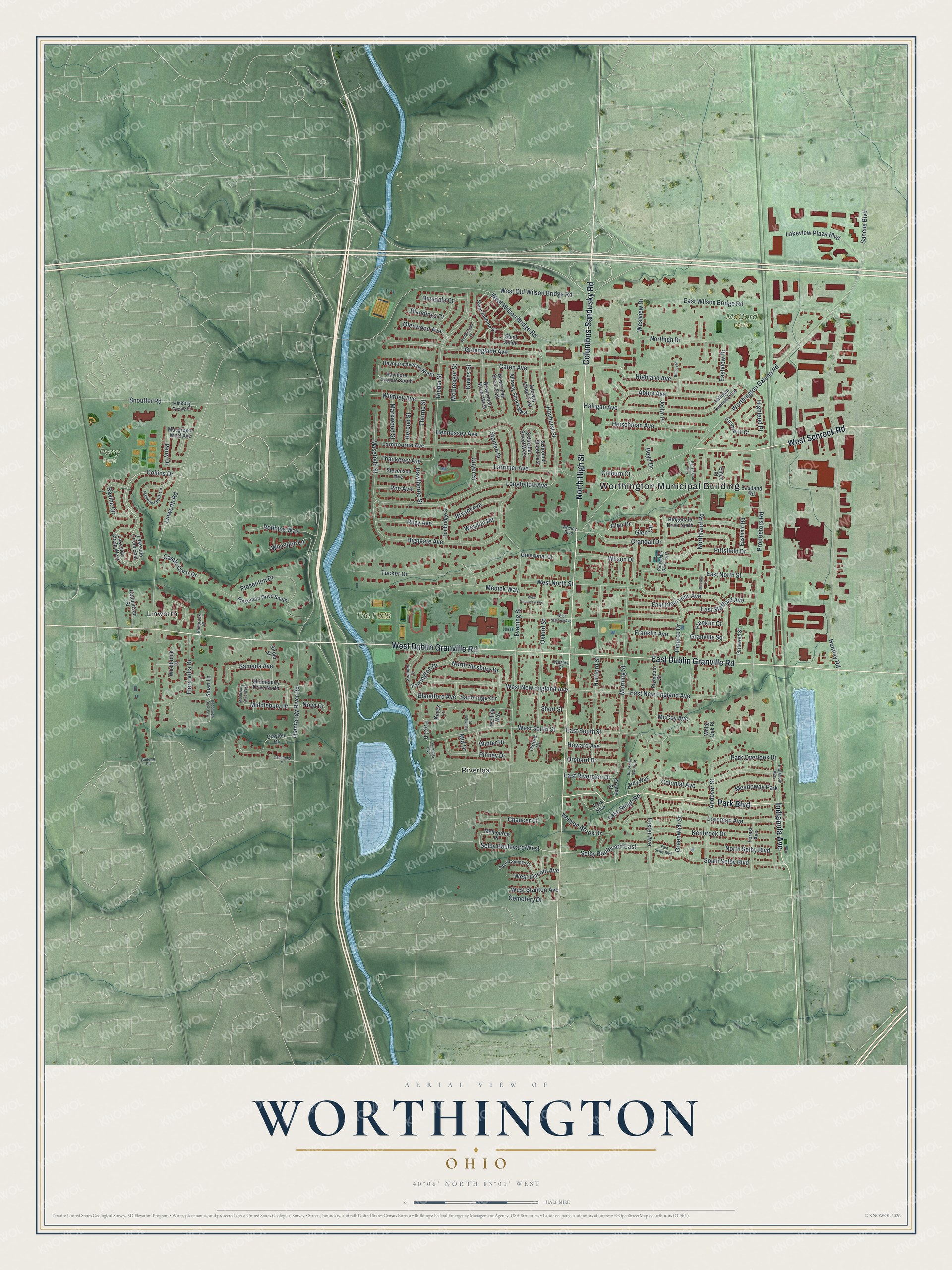
A new map of Worthington, Ohio, made in 2026 and printed to order on thick archival matte paper.
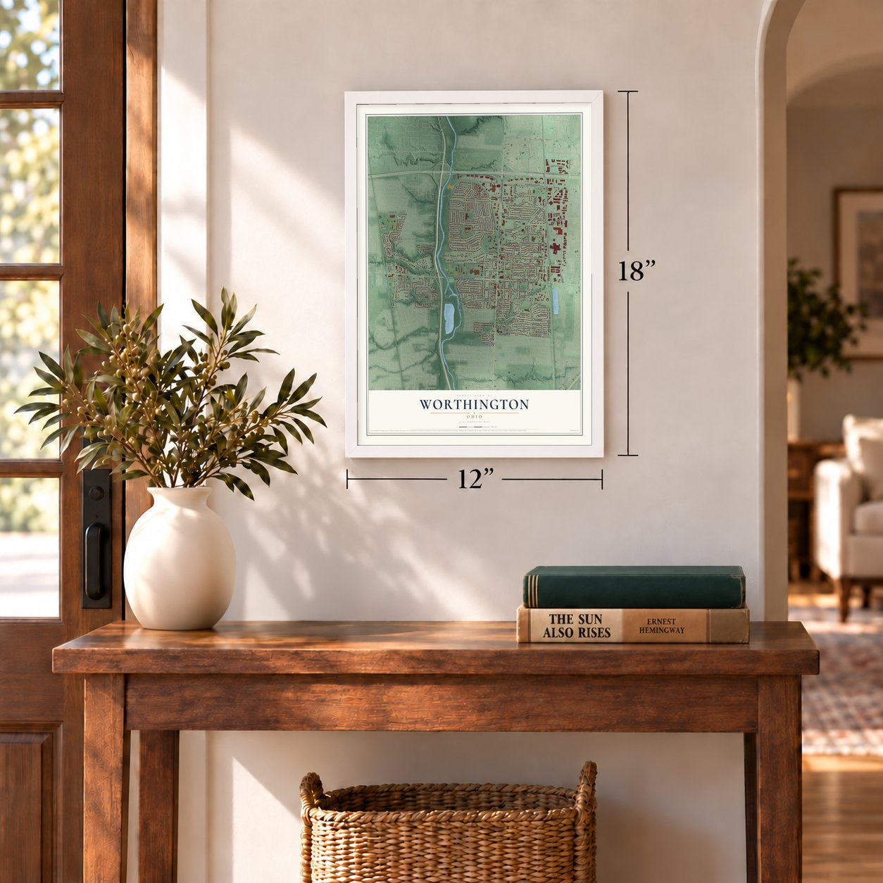
12" x 18" Archival Matte Print
A Map of Home. A Work of Art.
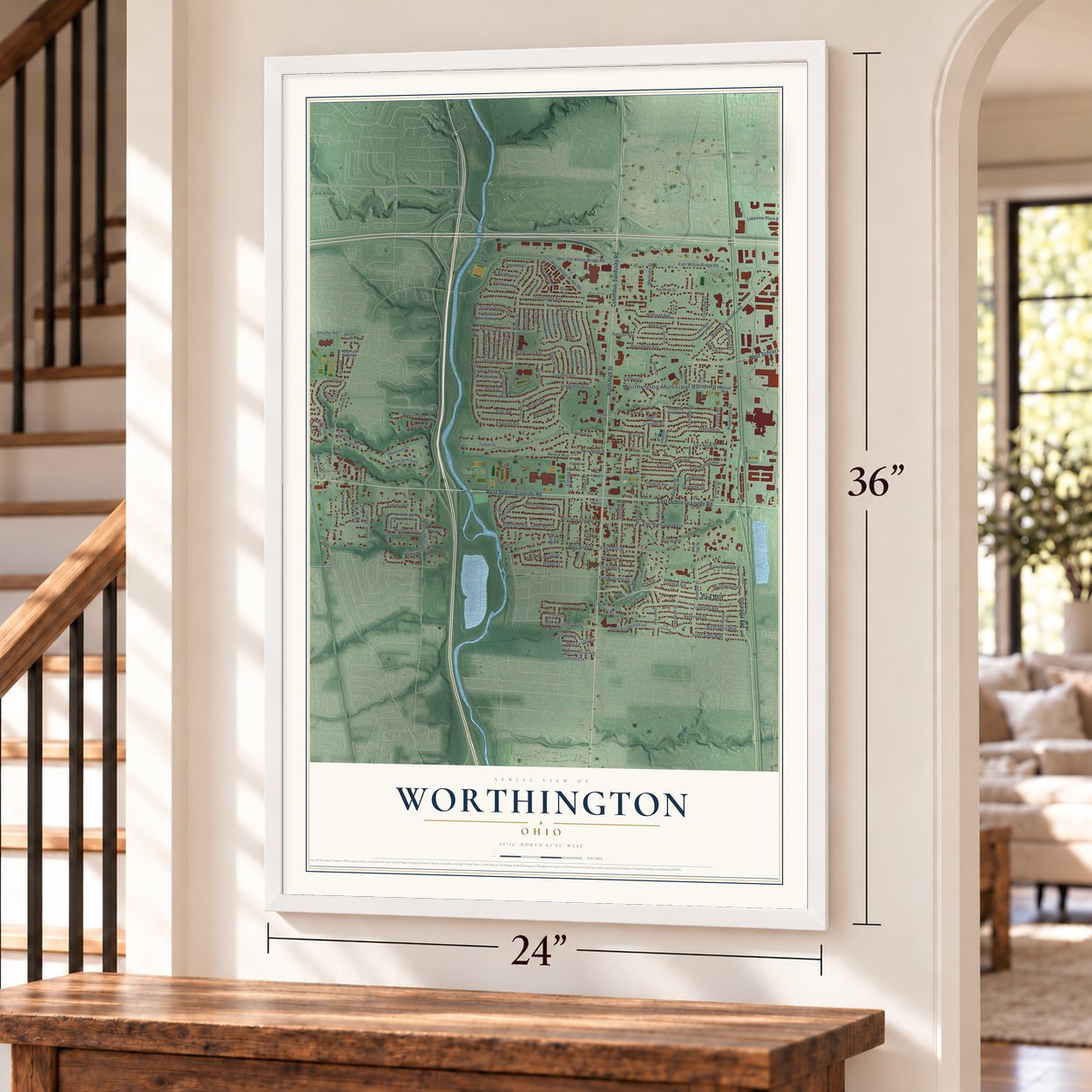
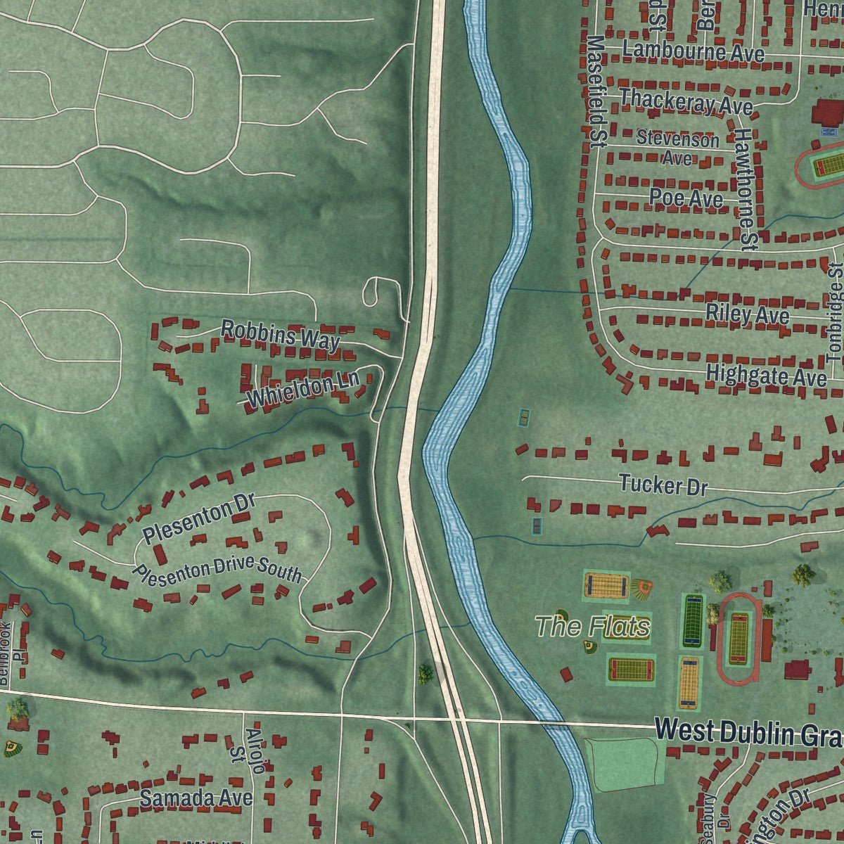
If you grew up in Worthington, live in Linworth or Riverlea, or have family off North High Street, this map has plenty for you to find. It's a modern aerial view of Worthington in Franklin County, Ohio, built from modern data with a vintage feel. Zoom in on the preview and look for your block.
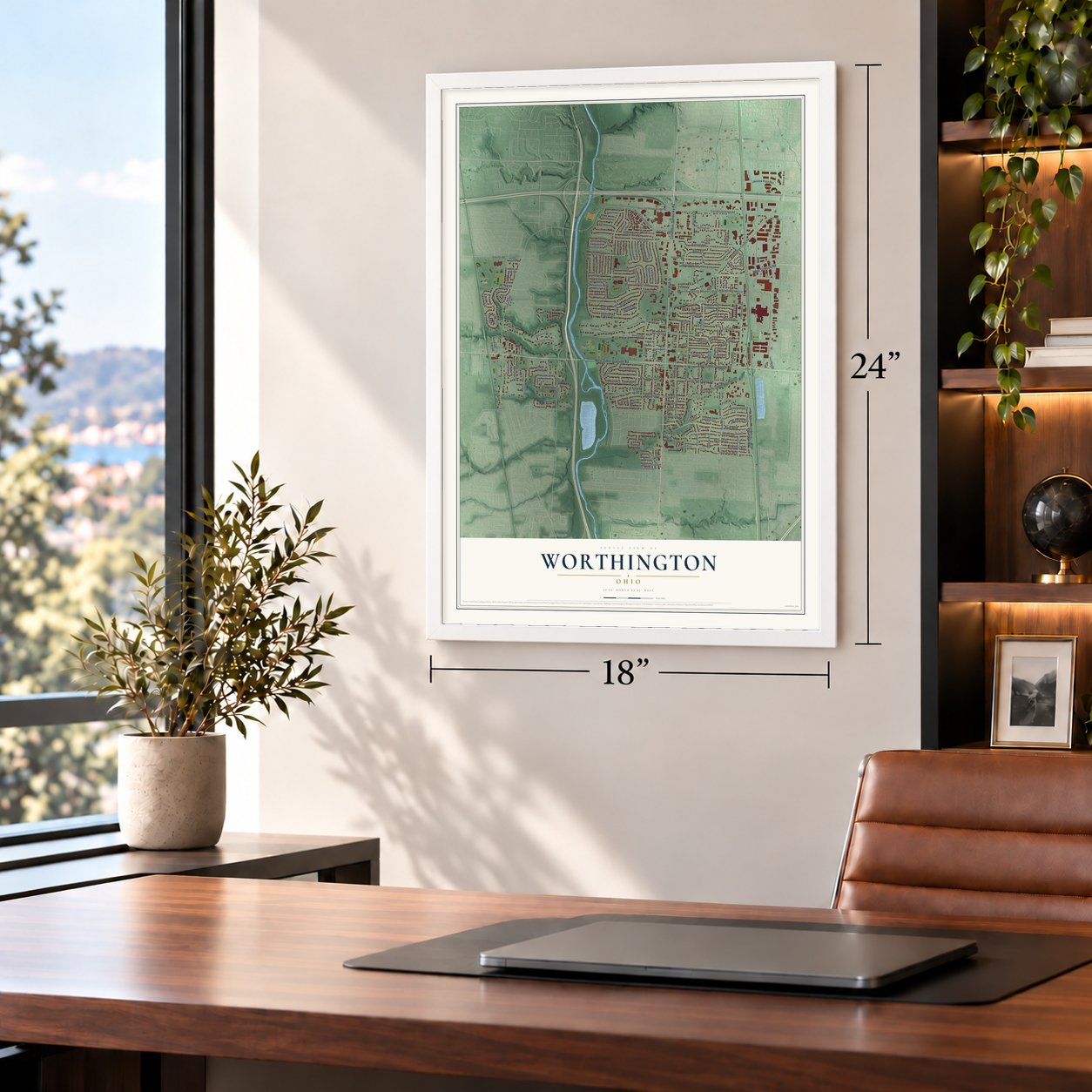
Three ways to hang it
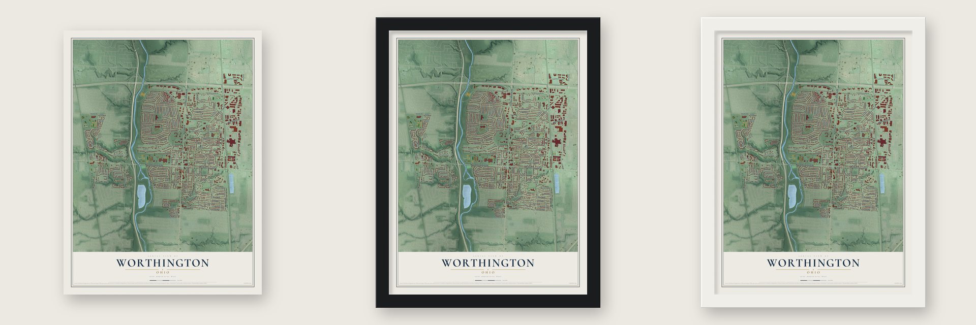
Unframed archival matte, a black wood frame or a white wood frame.
Up close
Real geography. Art worth displaying.
This map was created using accurate cartographic data and authoritative geographic sources, including the U.S. Geological Survey and the Census Bureau. The map brings together terrain, waterways, roads, and building detail. The majority of the streets are labeled, houses are accurately depicted, and the topography is derived from government sources. Combining local data with carefully composed color and shading leads to this beautifully detailed Worthington artwork for your wall.
Rather than simply showing street outlines, we’ve included as many of the street names as we could reasonably fit on the map while keeping their names legible. Zoom in on the high resolution preview to see exactly what’s on the map. We truly set out to create a statement piece for anyone who loves Worthington. So whether it’s for you, or a gift for someone you love, we hope this map of Worthington brings back fond memories.
Read the story behind this map of Worthington, Ohio from 2026.
About Worthington, Ohio
Worthington is a Franklin County city with 14,786 residents recorded in the 2020 census. Founded by the Scioto Company in 1803, its early plan arranged 160 lots around a public green. High Street and Dublin Granville Road still meet at the old town center.
- New England OriginsIn 1802, 38 men from Connecticut and Massachusetts organized the Scioto Company, which purchased 16,000 acres along the Olentangy River.
- Named for WorthingtonThe founders honored Thomas Worthington, who helped James Kilbourn select the site and later served as Ohio's governor.
- Capital FinalistIn 1812, Worthington was among the finalists considered for Ohio's capital.
- St. John's BeginningsSt. John's, organized February 6, 1804, was the Northwest Territory's first Episcopal church, with James Kilbourn as its first deacon.
- Black Community ChurchPeter Banks and four other men began an A.M.E. congregation in 1896, and its church received the name St. John A.M.E. in 1914.
Find your street
Names on the Worthington map
Every name below is printed on this map. Look for your street, your school, the park where you played, or the pond down the road.
Places and landmarks7
- Worthington Municipal Building
- McCord Park
- Perry Park
- The Flats
- Linworth
- Riverlea
- Meadoway Park
Streets and roads182
- North High Street
- Columbus-Sandusky Road
- West Dublin Granville Road
- East Dublin Granville Road
- Park Boulevard
- West Schrock Road
- Indianola Avenue
- Collins Drive
- Selby Boulevard East
- Selby Boulevard West
- Hayhurst Street
- Middlebury Drive
- Worthington Galena Road
- Huntley Road
- Linworth Road
- Evening Street
- West Wilson Bridge Road
- East Wilson Bridge Road
- Proprietors Road
- Olentangy River Road
- Hartford Street
- Morning Street
- East North Street
- East Stafford Avenue
- Rieber Street
- Longfellow Avenue
- Highland Avenue
- Tucker Drive
- Crandall Drive
- Loveman Avenue
Show all 182 streets
- Greenglade Avenue
- Colonial Avenue
- East South Street
- East New England Avenue
- Caren Avenue
- Oxford Street
- West New England Avenue
- Kenbrook Drive
- Greenwich Street
- West South Street
- Andover Street
- East Clearview Avenue
- Snouffer Road
- Masefield Street
- Lambourne Avenue
- Plesenton Drive
- Highgate Avenue
- Medick Way
- Halligan Avenue
- Heischman Avenue
- South Selby Boulevard
- Pingree Drive
- Larrimer Avenue
- North Selby Boulevard
- Northland Road
- Abbot Avenue
- Pittsfield Drive
- Whitney Avenue
- Lakeview Plaza Boulevard
- West Old Wilson Bridge Road
- Foster Avenue
- Northigh Drive
- Hennessey Avenue
- Pinney Drive
- Riley Avenue
- Robbins Way
- Park Overlook Drive
- Ravine Circle
- Whieldon Lane
- Farrington Drive
- Bryant Avenue
- Flora Villa Drive
- Wilson Drive
- Thackeray Avenue
- Kenyon Brook Drive
- Perry Drive
- Samada Avenue
- Chaucer Court
- West North Street
- Castle Crest Drive
- West Lincoln Avenue
- Howard Avenue
- Orchard Drive
- Glen Circle
- Sancus Boulevard
- Franklin Avenue
- Blandford Avenue
- Weydon Road
- North Sinsbury Drive
- West Stanton Avenue
- Cemetery Drive
- East Riverglen Drive
- Markwood Street
- Olenwood Avenue
- Berend Street
- Thorne Street
- Short Street
- Poe Avenue
- Highland Place
- Lake Ridge Road
- Glen Drive
- Guyer Street
- Hawthorne Street
- Franklin Court
- Sanbridge Circle
- Boyd Drive
- Westview Drive
- Eastview Drive
- McGreegor Street
- Downs Street
- Stenten Street
- Blandings Court
- Colburn Court
- Granville Square
- McCoy Avenue
- Winter Drive
- Hinsdale Court
- Nova Court
- Fox Lane
- Mid Drive
- Lakeside Circle West
- Lakeside Circle East
- Melbourne Place
- Middlebury Drive North
- Ridgedale Drive North
- Saint Antoine Street
- Bowerman Street West
- Clayton Drive
- Haymore Avenue North
- Saint Julien
- Plymouth Street
- Plesenton Drive South
- Alloway Street West
- Bowerman Street East
- Schreiner Street East
- Alloway Street East
- Halligan Avenue East
- Haymore Avenue South
- Forest Avenue
- Joslyn Place
- Schreiner Street West
- Stevenson Avenue
- Eastworth Court
- Alrojo Street
- Granby Street
- Tonbridge Street
- Greenbriar Court
- Griswold Street
- Eastfield Road
- Hardy Way
- Hickory Grove Court
- Keyes Lane
- Macgregor West Avenue
- Hutchinson Street
- Westbrook Place
- Oxford Court
- Eastland Road
- Stuart Lane
- Welling Way
- White Oak Place
- Emco Place
- Meadowbrook Circle
- Ridgedale Drive East
- Sharon Springs Drive
- Seabury Drive
- Bellbrook Place
- Wesley Boulevard
- Wesley Court
- East Selby Boulevard
- Middlebury Drive West
- Beechview Drive East
- West Stafford Avenue
- Wethersfield Place
- Kensington Way
- West Clearview Avenue
- Brookside Oval East
- Cambridge Court
- Olentangy Boulevard
- Betsey Place
- Hallmark Place
- Mar-Min Court
- Godown Road
Names are listed as they appear on the printed map. Zoom into the product photos to find them.
The art of mapping a place
How This Map Was Made
Real places. Remarkable detail. Discover the layers that turn geographic data into a map of home.

The view from above
Aerial imagery reveals the character of the land: woodland, open fields, and the patterns of a place.

The shape of the land
Elevation data brings hills, valleys, and subtle changes in the landscape into view.

The details of home
Roads, waterways, and building footprints come together to make the map feel unmistakably local.

Geography becomes art
Considered color, shading, and typography bring the layers together in a map made for your wall.


Process illustrated with Mendon, Massachusetts. Aerial imagery: USDA NAIP. Terrain: USGS 3D Elevation Program. Map details and finished artwork: KNOWOL.
The Details
About This Print
Choose an archival matte print, or a black or white Ayous wood frame. The archival matte print is unframed.
Select your size and finish above to see the matching product image and price.
Materials & Craftsmanship
A contemporary map with the character of a classic atlas, printed on archival matte paper. Optional frames are made from Ayous wood.
Your printed map does not include the watermark shown in the full-map preview.
Shipping & Delivery
Free shipping within the United States. Every print is made to order in the USA.
Buying a gift? Add a note in your cart and we'll include it. We never put prices in the package.
Prints ship within 2 to 3 business days. Allow 7 to 10 days total from ordering for delivery. Timing may vary during holidays or periods of high order volume.
Read our shipping policy.
Returns and damaged prints
Each print is made to order. Change-of-mind refunds are not available after production.
If your print arrives damaged, misprinted or incorrect, contact support@knowol.com within 30 days of receiving it. Include your order number, photos and a description of the issue.
Read our full refund and replacement policy. For questions about your order, email support@knowol.com.
Find your town
Looking for another city?
Find a map of home in our Ohio collection.
Nearby
Maps of towns near Worthington
Know someone from one of these towns? Their map makes a great gift.


