
Search for another town





Free U.S. delivery 7 to 10 days after you order
Yorktown, New York Map Art
Building by building, with labeled streets and shaded relief.
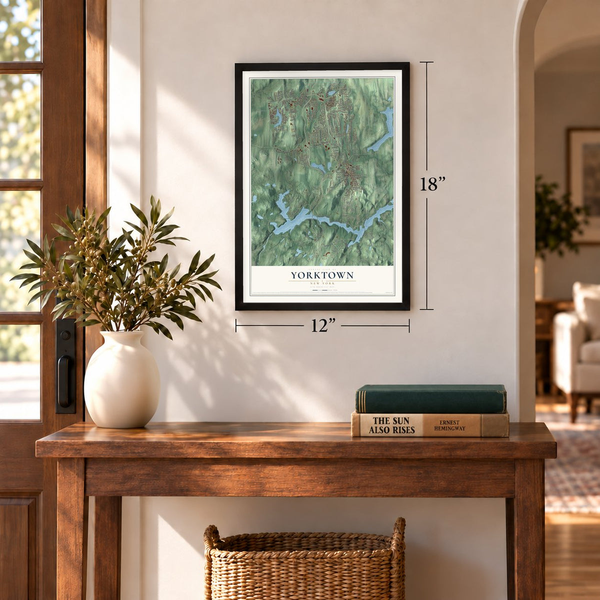
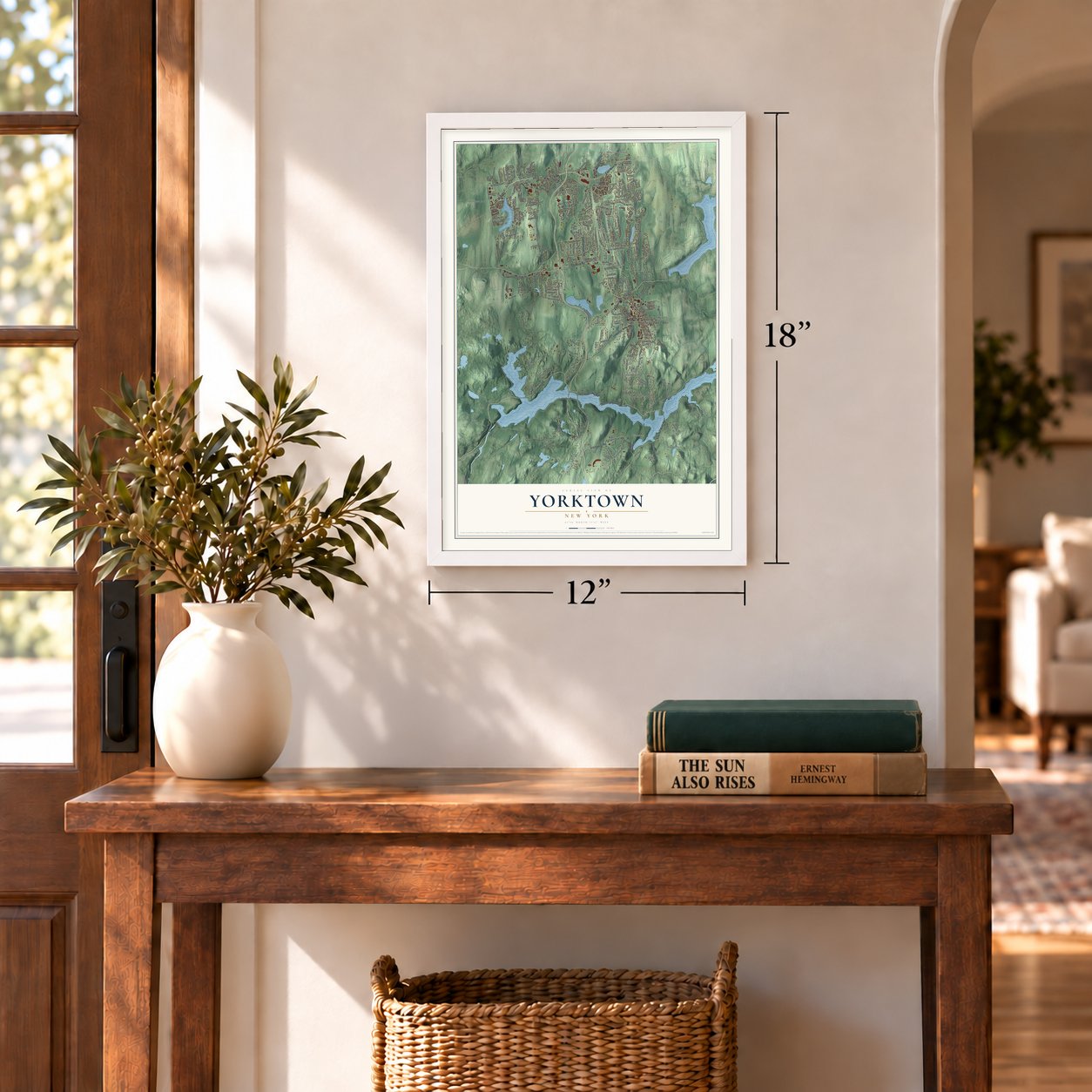
12" x 18" Archival Matte Print
A Map of Home. A Work of Art.
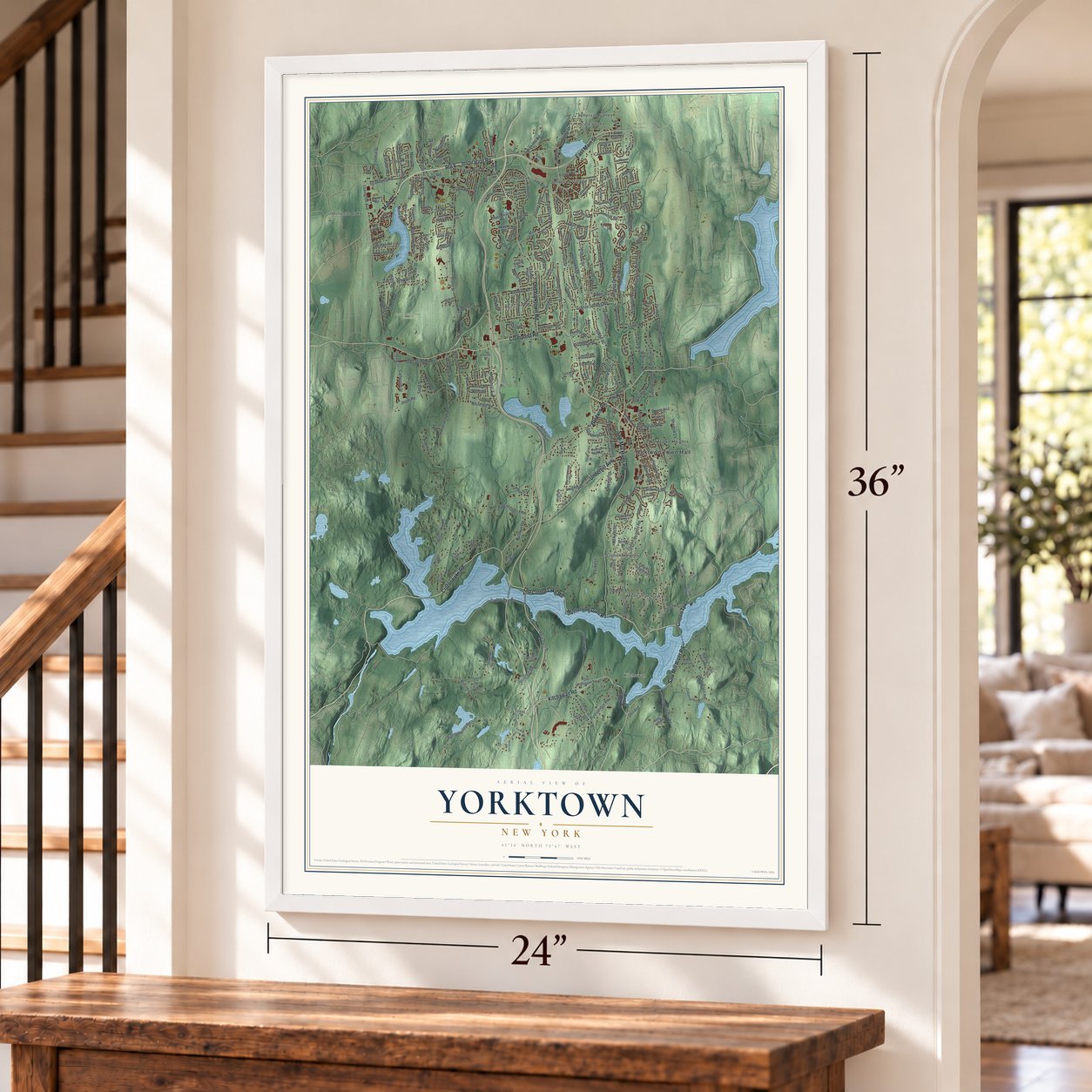
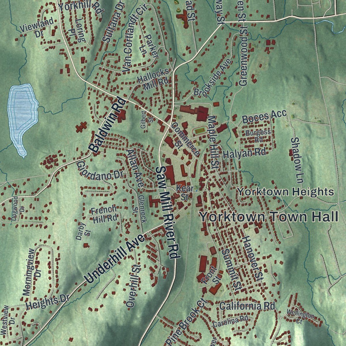
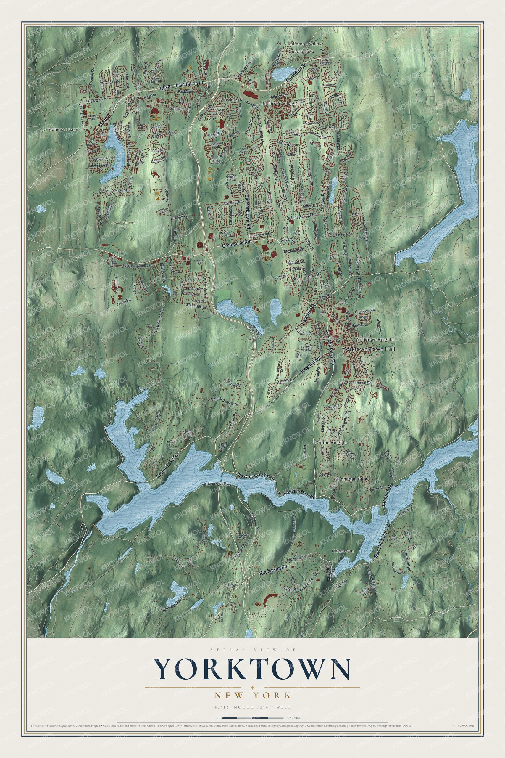
Explore Yorktown, New York from a whole new perspective. Created using aerial imagery and detailed geographic data, this map captures Yorktown building by building, with labeled streets, familiar landmarks, and shaded topographical relief that highlights the natural contours of the landscape.
Combining modern data with the timeless character of a vintage atlas, this map is just as interesting up close as it is beautiful on the wall. Whether you grew up in Yorktown, spent memorable years there, or call it home today, this unique map is a great way to celebrate a place that means something to you. Zoom in on the preview to look for your street, and then order a print to put your memories on the wall.
Three ways to hang it
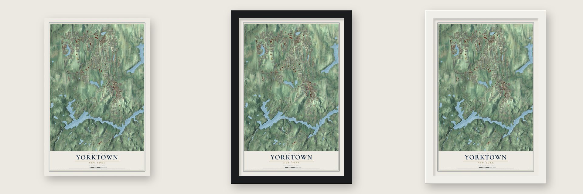
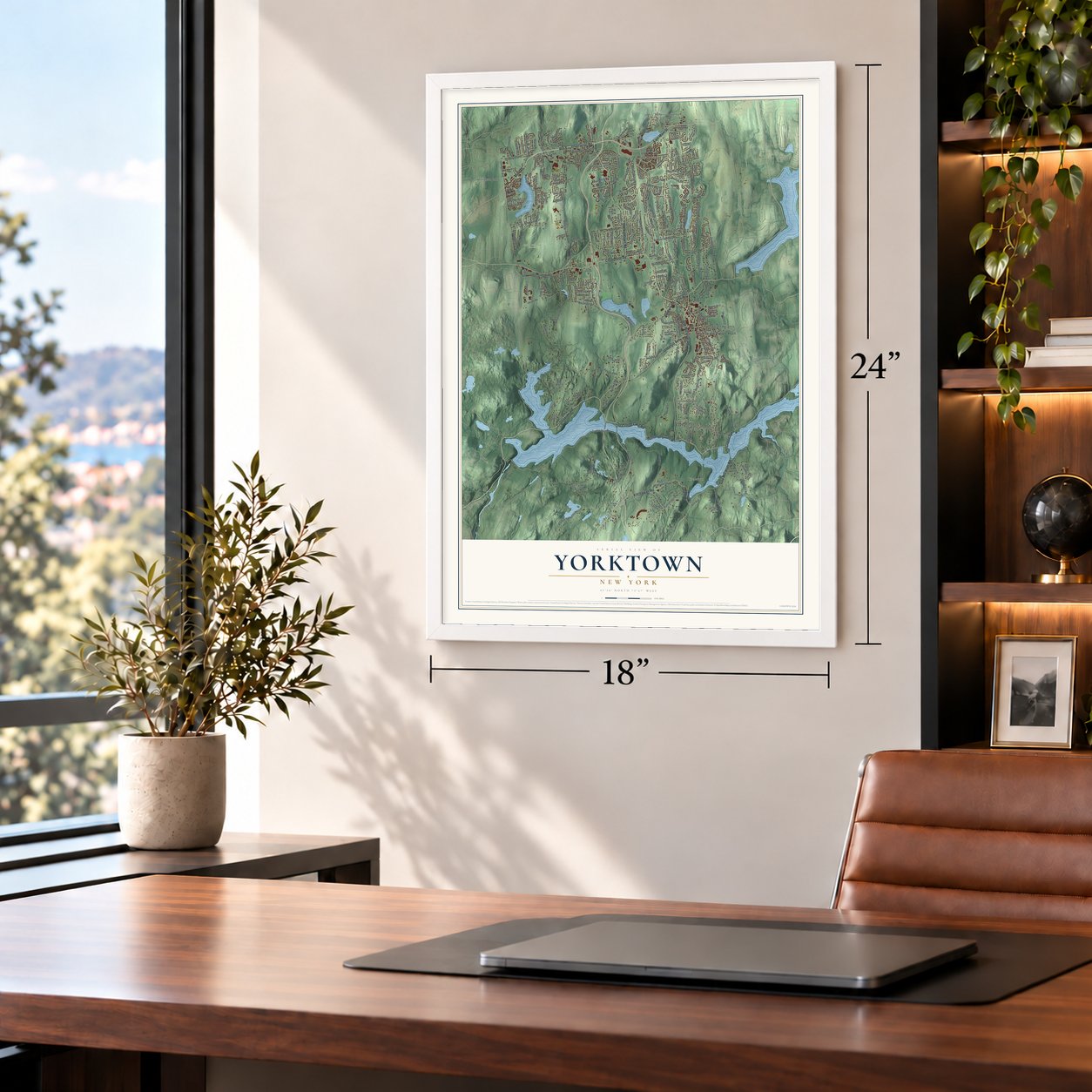
Unframed archival matte, a black wood frame or a white wood frame.
Up close
Geography Worth Displaying
This map was created using accurate cartographic data and authoritative geographic sources, including the U.S. Geological Survey (USGS) and FEMA. The map brings together terrain, waterways, roads, and building detail. The majority of the streets are labeled, houses are accurately depicted, and the topography is derived from government sources. Combining local data with carefully composed color and shading leads to this beautifully detailed Yorktown artwork for your wall.
Rather than simply showing street outlines, we’ve included as many of the street names as we could reasonably fit on the map while keeping their names legible. Zoom in on the high resolution preview to see exactly what’s on the map. We truly set out to create a statement piece for anyone who loves Yorktown. So whether it’s for you, or a gift for someone you love, we hope this map of Yorktown brings back fond memories.
Explore the full map of Yorktown, New York and read about the local places it shows.

Find your street
Names on the Yorktown map
Every name below is printed on this map. Look for your street, your school, the park where you played, or the pond down the road.
Places and landmarks12
- Yorktown Town Hall
- Jefferson Valley
- Oceola Lake
- Mohegan Lake
- Kitchawan
- Shrub Oak
- Sylvan Glen Park Preserve
- Croton Heights
- Jefferson Village
- Manhattan Park
- Yorktown Heights
- Goose Lake
Streets and roads277
- Saw Mill River Road
- Inspiration Road
- East Main Street
- Croton Lake Road
- Crompond Road
- Old Croton Lake Road
- Kitchawan Road
- Route 6
- Old Yorktown Road
- Underhill Avenue
- Hunterville Dam Road
- Baldwin Road
- Croton Turnpike
- Main Street
- Croton Dam Road
- Aqueduct Street
- Curry Street
- Crow Hill Road
- Mohegan Avenue
- Hill Boulevard
- Mark Road
- Barger Street
- Lake Road
- Hunterbrook Road
- Hanover Street
- Gomer Street
- Stony Street
- Baptist Church Road
- London Road
- Granite Springs Road
Show all 277 streets
- Strang Boulevard
- Lexington Avenue
- Lee Boulevard
- Spring Valley Road
- Old Crompond Road
- Quinlan Street
- Ridge Street
- Evergreen Street
- Quaker Church Road
- Locke Lane
- Illington Road
- Broad Street
- Blinn Road
- Pinesbridge Road
- Croton Heights Road
- Mohansic Avenue
- White Hill Road
- Arcady Road
- Springhurst Street
- Jacob Road
- Hickory Street
- Strawberry Road
- Wenonah Trail
- Ivy Road
- Maple Hill Street
- Van Cortlandt Circle
- Farm Walk Road
- Village Road
- Marcy Street
- Barberry Road
- Summit Street
- Hemlock Street
- Poplar Street
- Greenwood Street
- Amazon Road
- Hyatt Street
- North Deerfield Avenue
- Allan Avenue
- Indian Hill Road
- New Road
- Catherine Street
- Sagamore Avenue
- Seven Bridges Road
- Eleanor Drive
- Dunning Drive
- Heights Drive
- Grant Avenue
- Mill Street
- Cross Road
- Mead Street
- Foothill Street
- Flanders Drive
- Cordial Road
- Deer Street
- Dell Avenue
- Pine Brook Court
- Loder Road
- Waverly Road
- Williams Drive
- Windmill Drive
- James Street
- Field Street
- Ferncrest Drive
- Wharton Drive
- Elizabeth Road
- Wood Street
- Overhill Street
- Horton Road
- Gregory Street
- Sunrise Street
- Pine Grove Court
- McKeel Street
- Cecile Drive
- Manor Street
- Nutly Circle
- Winding Court
- Sultana Drive
- Overlook Avenue
- Jordan Drive
- Hedwig Drive
- Alden Drive
- Dale Street
- Larkspur Street
- Edcris Road
- Shadow Lane
- Gambelli Drive
- Mill Pond Road
- Halyan Road
- California Road
- Judy Road
- Giordano Drive
- Yorkhill Road
- Amelia Drive
- Willoway Street
- Lawrence Drive
- Fox Hall Street
- Boces Acc
- Locksley Road
- Glen Road
- Beaver Drive
- Ettman Street
- Lester Road
- Walker Drive
- Cooper Street
- Hilltop Road
- Syska Road
- High Street
- Pines Bridge Road
- Sunset Street
- Commerce Street
- Baker Highway
- Kear Street
- Journeys End Road
- Mohansic Avenue East
- Birdsall Drive
- Colonial Hill Drive
- Wildwood Street
- Old Kitchawan Road
- Somerston Road
- Morningview Drive
- Hayes Drive
- Gay Ridge Road
- Brookside Avenue
- Front Street
- Hog Hill Road
- Oakside Road
- Colonel Greene Road
- Douglas Drive
- North Ridge Road
- Briarhill Road
- French Hill Road
- Westminster Road
- Sunny Ridge Road
- Echo Hill Path
- Chestnut Court
- Buckhorn Street
- Saddle Ridge Drive
- Hallocks Mill Road
- Radcliffe Drive
- Estates Drive
- Boone Road
- Colonial Street
- Old Farm Lane
- Spring Drive
- Spring Pond Road
- Route 100 North
- Court Street
- Fairview Avenue
- Parker Lane
- Park Lane
- Ogden Drive
- Katrina Drive
- Beekman Court
- Denby Drive
- Walter Road
- Wilson Road
- Lookout Street
- Trelawn Street
- Holyoke Road
- Loring Place
- Juniper Drive
- Viewland Drive
- Kipling Drive
- Sycamore Lane
- Smith Road
- Lorelei Drive
- Dane Street
- Chase Road
- Heyward Street
- Quarry Drive
- Garden Lane
- Barry Court
- Grants Lane
- Oslo Drive
- Chen Court
- Bank Road
- Maiden Lane
- Clover Road
- Arch Drive
- Wren Place
- Elk Court
- Glenrock Street
- Woodlands Drive
- Chadeayne Road
- Briarhill Street
- Westview Drive
- Kamhi Drive
- Heathercrest Drive
- Cranberry Lane
- Leland Drive
- Campbell Road
- Spring Street
- Carolina Road
- Journeys End Lane
- High Ridge Road
- Hillside Drive
- Spring Hill Lane
- Weatherby Street
- Rachel Drive
- Lewis Avenue
- Sunflower Drive
- Jefferson Court
- Casey Court
- Oak Street
- Burgess Road
- Navajo Street
- Rela Lane
- Darby Street
- Audra Court
- Claire Court
- Carr Court
- Lily Court
- Rustic Ridge Court
- Old Logging Road
- Ravencrest Road
- Hitching Post Lane
- South Deerfield Avenue
- Dogwood Drive
- Winchester Court
- Bridge Point Lane
- New Chalet Drive
- Revere Drive
- Tulip Drive
- Isle de France
- Wellington Court
- Brender Lane
- Farsund Drive
- Sharon Lynn Boulevard
- Oriole Court
- Uncas Road
- Maple Brook Court
- Delano Road
- Fox Tail Lane
- Sutton Street
- Fairhills Drive
- Jaclyn Lane
- Adela Court
- McDonald Road
- Carpenter Road
- Union Road
- Cedar Road
- Crow Hill Path
- Barkley Lane
- Gilbert Street
- William Court
- Jill Court
- Sara Court
Names are listed as they appear on the printed map. Zoom into the product photos to find them.
About Yorktown, New York
Yorktown stands at the northern edge of Westchester County, about 38 miles from midtown Manhattan. Once called Hanover, the township adopted its present name when it incorporated in 1788. The name commemorates the Franco-American victory at Yorktown during the Revolutionary War.
- 36,569 residentsYorktown's population was counted in the 2020 U.S. Census.
- Battle of Pine's BridgeMembers of the 1st Rhode Island Regiment died defending the Croton River crossing on May 14, 1781.
- The first Croton DamBuilt in Yorktown for New York City's water supply, the dam failed in 1842 with deadly consequences.
- Major Andre's last breakfastThe British officer ate at the Underhill House shortly before his capture and later execution as a spy.
- Five business hamletsMohegan Lake, Shrub Oak, Jefferson Valley, Crompond, and Yorktown Heights make up the town's business hamlets.
Keep exploring New York
Yorktown is one of 2,154 New York towns we've mapped. Every dot on the map is a print of its own.
The search covers every state, New York first.
Near Yorktown
Order 2 or more town maps and save 10%. Shown in the size and finish you picked above, so they hang as a set.
- Crompond 12" x 18" / Archival Matte Print $39.99
- Yorktown Heights 12" x 18" / Archival Matte Print $39.99
- Jefferson Valley-Yorktown 12" x 18" / Archival Matte Print $39.99


More maps nearby: Furnace Woods, Lake Mohegan, Shrub Oak, Cortlandt and Millwood.
The art of mapping a place
How This Map Was Made
Real places. Remarkable detail. Discover the layers that turn geographic data into a map of home.

The view from above
Aerial imagery reveals the character of the land: woodland, open fields, and the patterns of a place.

The shape of the land
Elevation data brings hills, valleys, and subtle changes in the landscape into view.

The details of home
Roads, waterways, and building footprints come together to make the map feel unmistakably local.

Geography becomes art
Considered color, shading, and typography bring the layers together in a map made for your wall.


Process illustrated with Mendon, Massachusetts. Aerial imagery: USDA NAIP. Terrain: USGS 3D Elevation Program. Map details and finished artwork: KNOWOL.
The Details
About This Print
Choose an archival matte print, or a black or white Ayous wood frame. The archival matte print is unframed.
Select your size and finish above to see the matching product image and price.
Materials & Craftsmanship
A contemporary map with the character of a classic atlas, printed on archival matte paper. Optional frames are made from Ayous wood.
Your printed map does not include the watermark shown in the full-map preview.
Shipping & Delivery
Free shipping within the United States. Every print is made to order in the USA.
Buying a gift? Add a note in your cart and we'll include it. We never put prices in the package.
Prints ship within 2 to 3 business days. Allow 7 to 10 days total from ordering for delivery. Timing may vary during holidays or periods of high order volume.
Read our shipping policy.
Returns and damaged prints
Each print is made to order. Change-of-mind refunds are not available after production.
If your print arrives damaged, misprinted or incorrect, contact support@knowol.com within 30 days of receiving it. Include your order number, photos and a description of the issue.
Read our full refund and replacement policy. For questions about your order, email support@knowol.com.