



Free U.S. delivery 7 to 10 days after you order
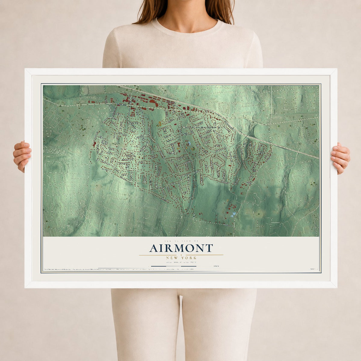
Airmont, New York Map Art
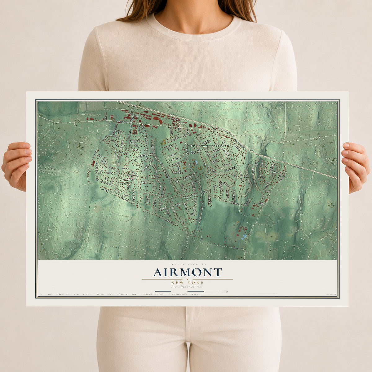
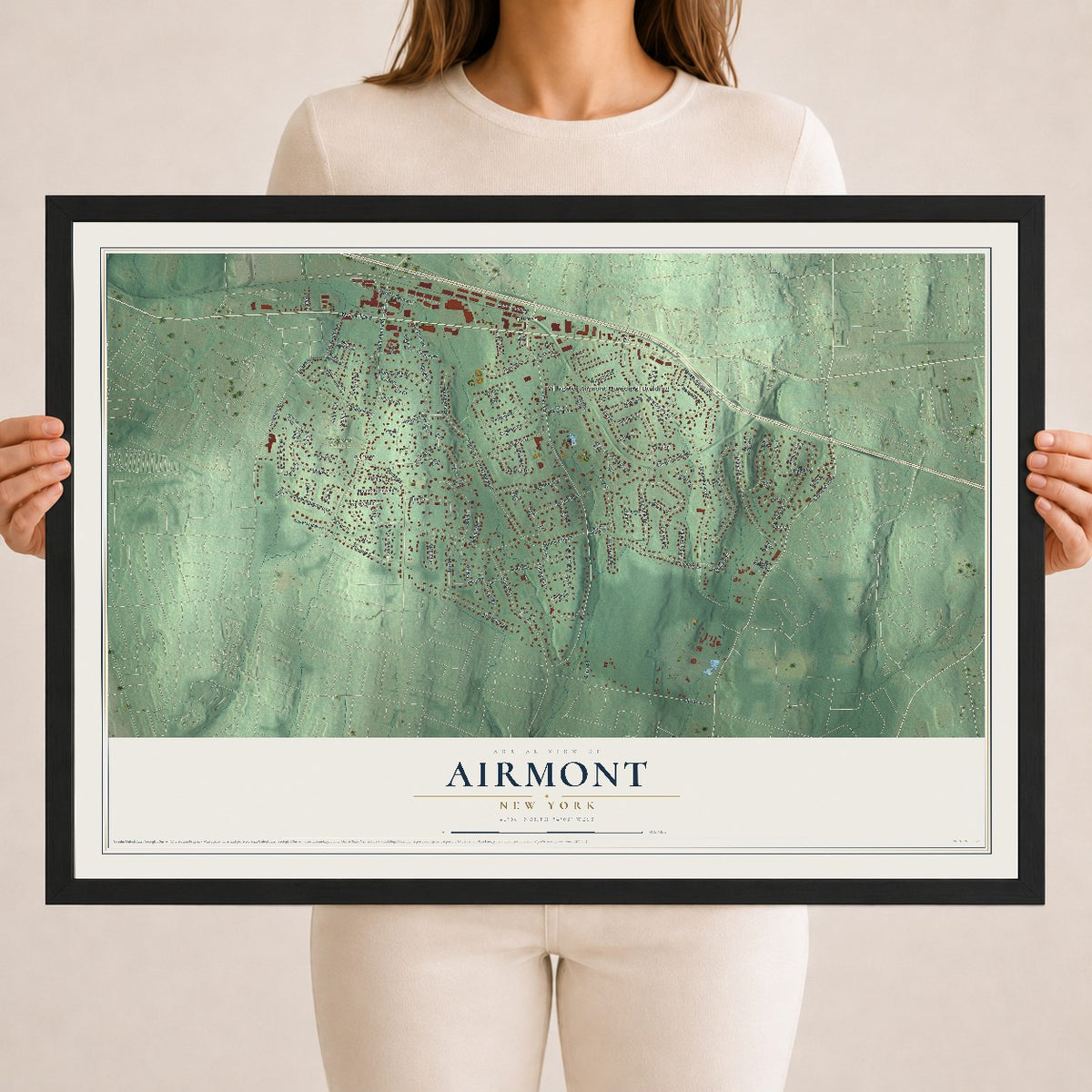
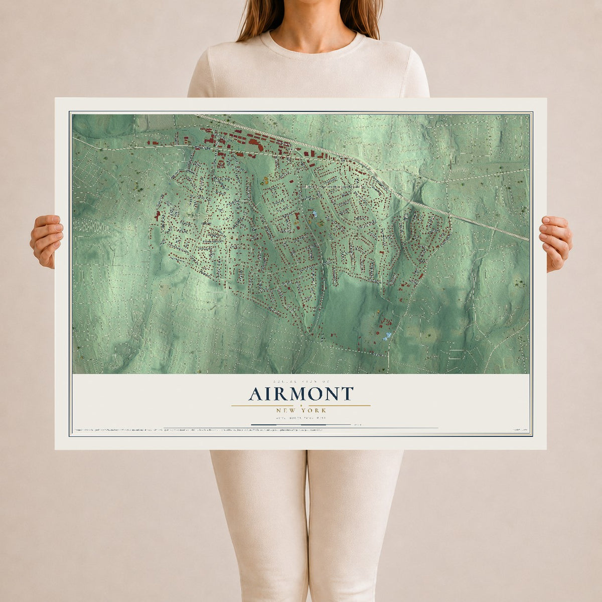
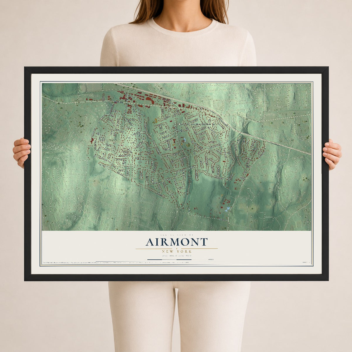
A new map of Airmont, New York, made in 2026 and printed to order on thick archival matte paper.
12" x 18" Archival Matte Print
A Map of Home. A Work of Art.
Bring a piece of Airmont home. Whether it’s where you grew up, your current home, or simply a moment in your life, this Airmont, New York map print brings those memories to your wall. Antique-inspired styling and modern geographic detail combine to create artwork that’s beautiful from across the room, with plenty to study and explore when you get up close.

Real geography. Art worth displaying.
This map was created using accurate cartographic data and authoritative geographic sources, including the U.S. Geological Survey (USGS) and FEMA. The map brings together terrain, waterways, roads, and building detail. The majority of the streets are labeled, houses are accurately depicted, and the topography is derived from government sources. Combining local data with carefully composed color and shading leads to this beautifully detailed Airmont artwork for your wall.
Rather than simply showing street outlines, we’ve included as many of the street names as we could reasonably fit on the map while keeping their names legible. Zoom in on the high resolution preview to see exactly what’s on the map. We truly set out to create a statement piece for anyone who loves Airmont. So whether it’s for you, or a gift for someone you love, we hope this map of Airmont brings back fond memories.
Explore the full map of Airmont, New York and read about the local places it shows.

About Airmont, New York
Airmont is a community in New York. Its documented story includes this detail: The village of Airmont, incorporated in 1991, is a consolidation of the hamlets of Tallman, Airmont and South Monsey. The record also notes that in October 2023, the Department of Justice settled its discrimination lawsuit with the village, over zoning of places of worship. Together, these points give a concise view of the community.
- Beginnings in 1991The village of Airmont, incorporated in 1991, is a consolidation of the hamlets of Tallman, Airmont and South Monsey.
- Beginnings in 2023In October 2023, the Department of Justice settled its discrimination lawsuit with the village, over zoning of places of worship.
- Beginnings in 1715Christ Evangelical Lutheran Church, Church and Airmont roads Dogwoods, 24 DeBaun Avenue Christ Evangelical Lutheran Church was founded in 1715, by Palatine Germans in Mahwah, New Jersey.
- Beginnings in 1850The church was incorporated in Rockland County in 1850, and the current edifice built in 1855.
- Part of local historyAirmont is located at 41°5′57″N 74°6′0″W (41.099163, -74.100011).
Find your street
Names on the Airmont Village map
Every name below is printed on this map. Look for your street, your school, the park where you played, or the pond down the road.
Places and landmarks4
- Village of Airmont Municipal Building
- Airmont Cemetery
- Airmont
- Tallman
Streets and roads148
- Nyack Turnpike
- Saddle River Road
- Cragmere Road
- Haskell Avenue
- Hillside Avenue
- Spook Rock Road
- Cherry Lane
- Lorna Lane North
- New County Road
- Smith Hill Road
- Regina Road
- South Airmont Road
- South Monsey Road
- Laura Drive
- Lorna Lane
- Church Road
- North De Baun Avenue
- Park Avenue
- Dawn Lane
- Shuart Road
- Christmas Hill Road
- Monsey Heights Road
- Fawn Hill Drive
- Montclair Avenue
- North Lorna Lane
- Ackerman Avenue
- Twin Lakes Drive
- Campbell Avenue
- Edgebrook Lane
- Echo Ridge Road
Show all 148 streets
- Marjorie Drive
- Hampton Road
- Madison Hill Road
- Thomsen Drive
- South Amundsen Lane
- Overbrook Drive
- Dorchester Drive
- Besen Parkway
- Rustic Drive
- Augur Road
- South Lorna Lane
- Post Lane South
- Algonquin Circle
- Provost Drive
- Eros Drive
- Darby Road
- Heather Drive
- Biret Drive
- Victoria Drive
- Blossom Road
- Annette Lane
- Hidden Glen Lane
- Dale Road
- Mary Beth Drive
- Brookside Avenue
- Woodland Place
- Utopian Place
- Murray Drive
- Mountain View Avenue
- Van Gogh Lane
- Potter Lane
- Twinkle Road
- Iroquois Trail
- Stillo Drive
- Patriot Drive
- De Baun Avenue
- Kent Road
- Amanda Court
- Kristoffersen Court
- Autumn Court
- Adams Lane
- Bell Court
- Sumter Road
- Alpha Lane
- Quincy Court
- Birch Street
- Bolger Lane
- Sabin Drive
- Orchard Place
- Kelly Court
- Larch Court
- Kile Court
- Feller Court
- Stage Street
- Dunn Road
- Haven Court
- Kings Court
- Fairview Terrace
- North Augur Drive
- Appleblossom Court
- Potter Place
- Post Lane North
- Van Orden Avenue
- East Blossom Road
- North Amundsen Lane
- Stone Meadow Lane
- Margo Court
- Country Club Lane
- Eagle View Court
- Glasgow Lane
- Litchult Court
- Hemion Way
- Young Court
- Fosse Court
- Highview Avenue
- Beaver Hollow Lane
- Long Meadow Drive
- Beatrix Lane
- Farmer Lane
- Daisy Court
- Vermeer Court
- Sonia Court
- Lamplight Lane
- Eton Place
- Oratam Road
- Lee Drive
- Cardinal Court
- Abbey Road
- Krashes Court
- Devon Court
- Leaf Court
- Jeanine Street
- Ayr Court
- Smith Court
- Regina Court
- Burris Court
- Stub Road
- East Haskell Avenue
- North Airmont Road
- Carpenter Court
- Larissa Court
- Frontier Lane
- Donald Court
- Glode Court
- Duryea Court
- Elber Court
- South Van Dyke Avenue
- Eleanor Place
- Glenmere Court
- Pondview Drive
- Cobblestone Lane
- Harlow Lane
- Phillips Drive
- Newport Court
- Shulman Court
- College Road
- Rayson Lane
- White Road
Names are listed as they appear on the printed map. Zoom into the product photos to find them.
The art of mapping a place
How This Map Was Made
Real places. Remarkable detail. Discover the layers that turn geographic data into a map of home.

The view from above
Aerial imagery reveals the character of the land: woodland, open fields, and the patterns of a place.

The shape of the land
Elevation data brings hills, valleys, and subtle changes in the landscape into view.

The details of home
Roads, waterways, and building footprints come together to make the map feel unmistakably local.

Geography becomes art
Considered color, shading, and typography bring the layers together in a map made for your wall.


Process illustrated with Mendon, Massachusetts. Aerial imagery: USDA NAIP. Terrain: USGS 3D Elevation Program. Map details and finished artwork: KNOWOL.
The Details
About This Print
Choose an archival matte print, or a black or white Ayous wood frame. The archival matte print is unframed.
Select your size and finish above to see the matching product image and price.
Materials & Craftsmanship
A contemporary map with the character of a classic atlas, printed on archival matte paper. Optional frames are made from Ayous wood.
Your printed map does not include the watermark shown in the full-map preview.
Shipping & Delivery
Free shipping within the United States. Every print is made to order in the USA.
Buying a gift? Add a note in your cart and we'll include it. We never put prices in the package.
Prints ship within 2 to 3 business days. Allow 7 to 10 days total from ordering for delivery. Timing may vary during holidays or periods of high order volume.
Read our shipping policy.
Returns and damaged prints
Each print is made to order. Change-of-mind refunds are not available after production.
If your print arrives damaged, misprinted or incorrect, contact support@knowol.com within 30 days of receiving it. Include your order number, photos and a description of the issue.
Read our full refund and replacement policy. For questions about your order, email support@knowol.com.
Find your town
Looking for another city?
Find a map of home in our New York collection.
Nearby
Maps of towns near Airmont
Know someone from one of these towns? Their map makes a great gift.
 Monsey
, New York
From $39.99See the map
 Viola
Viola, New York
From $39.99See the map
 Kaser
Kaser, New York
From $39.99See the map
More maps nearby: Montebello, Suffern, Spring Valley, Chestnut Ridge and Ramapo.