


Search for another town





Free U.S. delivery 7 to 10 days after you order
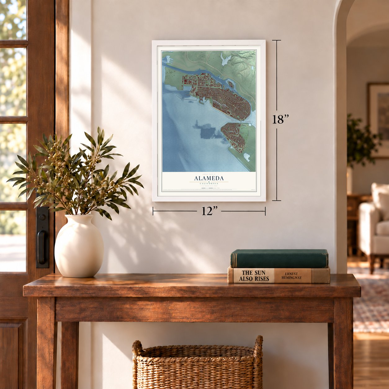
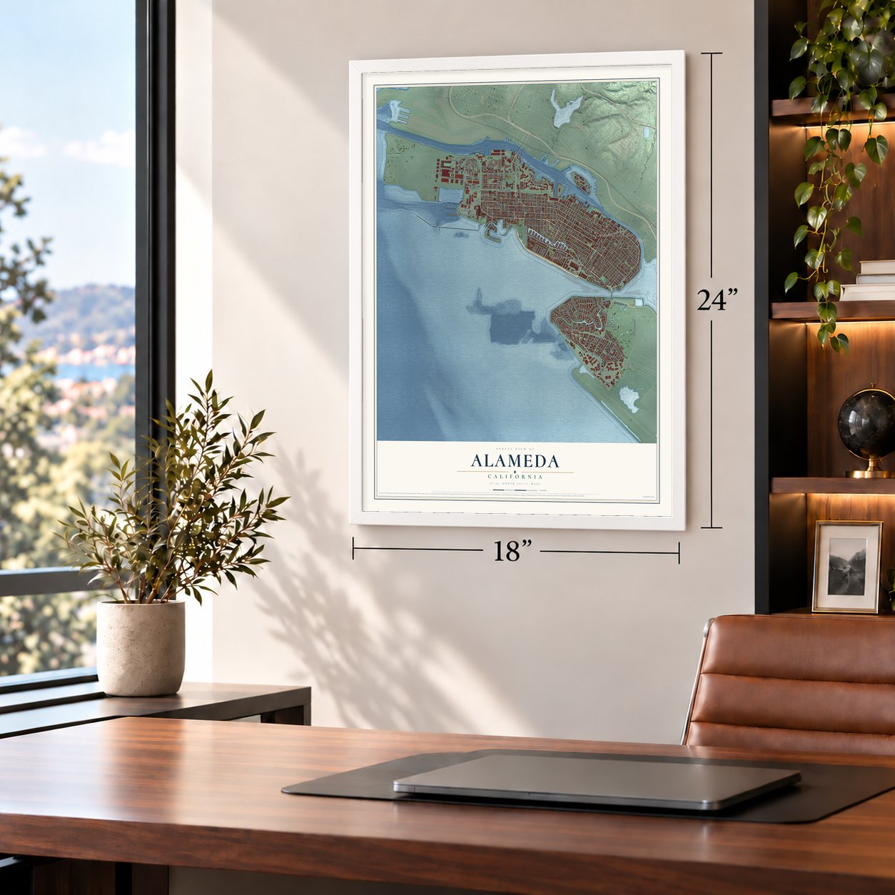
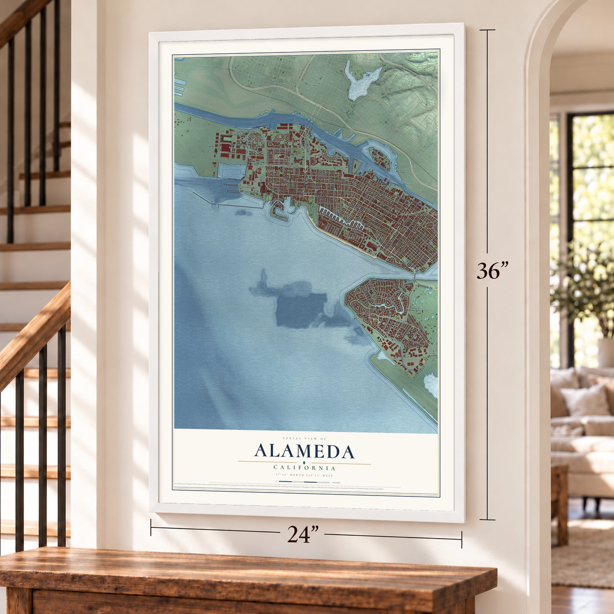
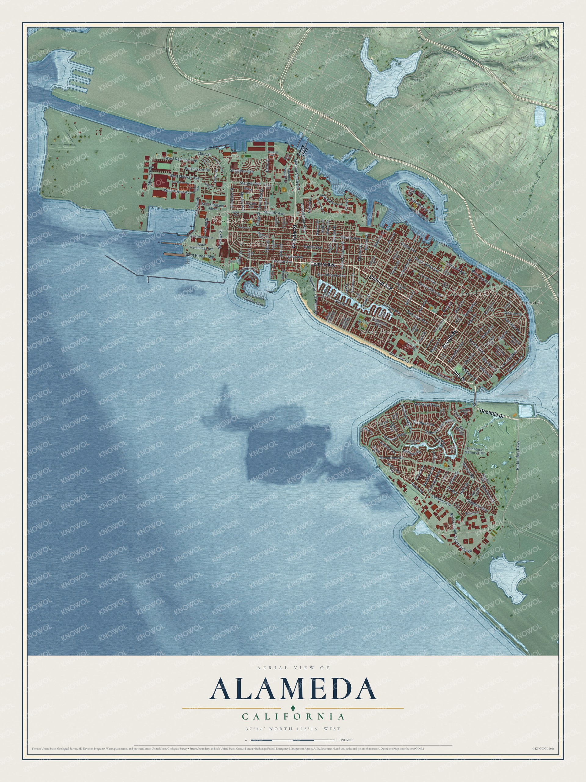
Alameda, California Map Art
Building by building, with labeled streets and shaded relief.
12" x 18" Archival Matte Print
A Map of Home. A Work of Art.
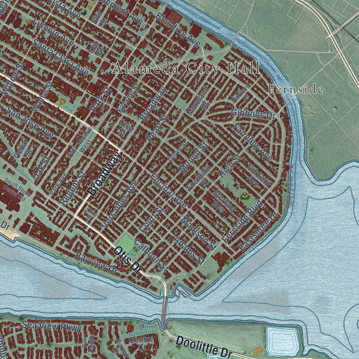
Explore Alameda, California from a whole new perspective. Created using aerial imagery and detailed geographic data, this map captures Alameda building by building, with labeled streets, familiar landmarks, and shaded topographical relief that highlights the natural contours of the landscape.
Combining modern data with the timeless character of a vintage atlas, this map is just as interesting up close as it is beautiful on the wall. Whether you grew up in Alameda, spent memorable years there, or call it home today, this unique map is a great way to celebrate a place that means something to you. Zoom in on the preview to look for your street, and then order a print to put your memories on the wall.
Three ways to hang it
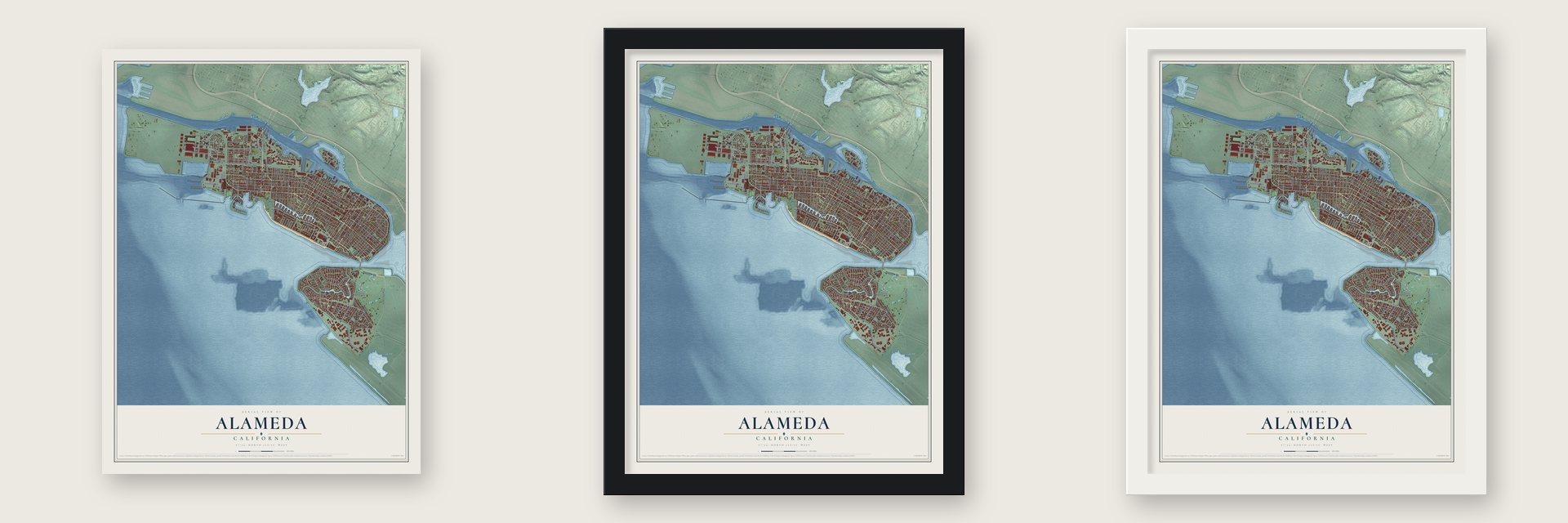
Unframed archival matte, a black wood frame or a white wood frame.
Up close
Geography Worth Displaying
This map was created using accurate cartographic data and authoritative geographic sources, including the U.S. Geological Survey and the Census Bureau. The map brings together terrain, waterways, roads, and building detail. The majority of the streets are labeled, houses are accurately depicted, and the topography is derived from government sources. Combining local data with carefully composed color and shading leads to this beautifully detailed Alameda artwork for your wall.
Rather than simply showing street outlines, we’ve included as many of the street names as we could reasonably fit on the map while keeping their names legible. Zoom in on the high resolution preview to see exactly what’s on the map. We truly set out to create a statement piece for anyone who loves Alameda. So whether it’s for you, or a gift for someone you love, we hope this map of Alameda brings back fond memories.
Read the story behind this map of Alameda, California from 2026.

Find your street
Names on the Alameda map
Every name below is printed on this map. Look for your street, your school, the park where you played, or the pond down the road.
Places and landmarks5
- Alameda City Hall
- Fernside
- Woodstock
- West End
- South Shore
Streets and roads182
- Otis Drive
- Doolittle Drive
- Broadway
- Encinal Avenue
- Central Avenue
- Webster Street
- Harbor Bay Parkway
- Shoreline Drive
- Fernside Boulevard
- Constitution Way
- Eighth Street
- Westline Drive
- Blanding Avenue
- Buena Vista Avenue
- Aughinbaugh Way
- Fifth Street
- Pearl Street
- Atlantic Avenue
- Park Street
- Main Street
- Sherman Street
- Ballena Boulevard
- Stargell Avenue
- Catalina Avenue
- Skyhawk Street
- Poggi Street
- Pacific Avenue
- Clement Avenue
- Campbell Boulevard
- South Loop Road
Show all 182 streets
- Santa Clara Avenue
- Lincoln Avenue
- Grand Street
- Mecartney Road
- Island Drive
- San Jose Avenue
- Willow Street
- Eagle Avenue
- San Antonio Avenue
- Versailles Avenue
- High Street
- Taylor Avenue
- Haight Avenue
- Mosley Avenue
- Oak Street
- Clinton Avenue
- West Midway Avenue
- Paru Street
- West Tower Avenue
- Sea View Parkway
- Maitland Drive
- Bay Street
- Union Street
- Saint Charles Street
- Orion Street
- Lafayette Street
- Court Street
- Robert Davey Junior
- Ferry Point
- Mound Street
- Ninth Street
- Sheffield Road
- Calhoun Street
- Regent Street
- West Essex Drive
- West Red Line Avenue
- Third Street
- Gibbons Drive
- Morton Street
- West Hornet Avenue
- Viking Street
- Mariner Square Drive
- Monarch Street
- Kofman Parkway
- Singleton Avenue
- Benton Street
- Bayview Drive
- Eastshore Drive
- Adams Street
- Madison Street
- Stanton Street
- Baywalk Road
- Holly Street
- Ratto Road
- Oleander Avenue
- Fairview Avenue
- Coral Sea Street
- Bette Street
- Sixth Street
- Fir Avenue
- Cam del Valle
- Silva Lane
- Glenview Street
- Wood Street
- Verdemar Drive
- Tideway Drive
- Chapin Street
- Garden Road
- Nason Street
- Posey Tube
- Mariner Square Lp
- Fontana Drive
- Walnut Street
- North Loop Road
- Fountain Street
- Creedon Circle
- Everett Street
- West Ticonderoga Avenue
- Eagle Road
- Beach Road
- Oyster Pond Road
- West Seaplane Lagoon
- Independence Drive
- Fourth Street
- Sweet Road
- Sandcreek Way
- Bryant Avenue
- Moreland Drive
- McDonnel Road
- Anderson Road
- Sea Bridge
- Dublin Way
- Clubhouse Memorial Road
- Sterling Avenue
- Garfield Avenue
- McKay Avenue
- Crown Drive
- Bartlett Drive
- Tarryton Isle
- Shell Gate Road
- Coral Reef Road
- Tralee Lane
- Centre Court
- Linden Street
- Elm Street
- Cedar Street
- Percy Lane
- Kara Road
- Crist Street
- Lea Court
- Spencer Road
- Alameda Avenue
- Park Avenue
- West Oriskany Avenue
- Pan Am Way
- Channing Way
- Marshall Way
- Minturn Street
- Melrose Avenue
- Purcell Drive
- Challenger Drive
- Ironwood Road
- Grove Street
- Park Avenue West
- North Star Road
- Harvard Drive
- Cola Ballena
- Tucker Avenue
- Triumph Drive
- Chipman Street
- Tahiti Lane
- Mitchell Avenue
- Verdi Street
- Mozart Street
- Cottage Street
- Pond Isle
- Diller Street
- Barbers Point Road
- West Ranger Avenue
- Hibbard Street
- Clay Street
- Cypress Street
- Dayton Avenue
- Stardust Place
- South Shore Center Road
- Oak Park Drive
- San Pedro Road
- Maple Way
- Tonga Lane
- Bruzzone Drive
- Gresham Drive
- Sand Harbor
Names are listed as they appear on the printed map. Zoom into the product photos to find them.
About Alameda, California
Alameda is a city of 78,280 people in Alameda County, built on islands in San Francisco Bay. For more than 3,000 years a band of the Ohlone lived on what was then a marshy peninsula joined to Oakland, and they left oyster shell mounds as tall as 14 feet. Spanish colonists called the oak-covered land Encinal, and it became part of Don Luis María Peralta's huge Rancho San Antonio.
After California passed to the United States, Alameda was founded on June 6, 1853, and voters chose its Spanish name, meaning a tree-lined avenue. It began as three settlements: a village at Encinal and High streets, Hibbardsville by the North Shore ferry, and Woodstock to the west. In 1872 the city grew to cover the whole island and took in Woodstock. Crews began cutting a tidal canal through the marsh in 1874, and when they finished in 1902, Alameda became an island.
- First train to the Bay, 1869On September 6, 1869, the first train on the transcontinental railroad to reach San Francisco Bay pulled into the Alameda Terminal. It was the first rail line in North America to run from coast to coast. The Central Pacific's ferry pier here later became the Alameda Mole.
- The popsicle's debut in 1923Neptune Beach opened in 1917 at what is now Crab Cove, and people called it the "Coney Island of the West." The popsicle went on sale to the public there for the first time in 1923. The park drew big crowds through the 1920s and 1930s and closed in 1939.
- Champions at Croll'sFrom 1883 to 1914, Croll's Gardens and Hotel, at Webster Street and Central Avenue, served as a training camp for some of boxing's best known fighters. Jack Johnson and other champions stayed and trained there. The Croll Building joined the National Register in 1982.
Keep exploring California
Alameda is one of 1,990 California towns we've mapped. Every dot on the map is a print of its own.
The search covers every state, California first.
Near Alameda
Order 2 or more town maps and save 10%. Shown in the size and finish you picked above, so they hang as a set.
- Oakland 12" x 18" / Archival Matte Print $39.99
- Clinton 12" x 18" / Archival Matte Print $39.99
- Brookfield Village 12" x 18" / Archival Matte Print $39.99


More maps nearby: Maxwell Park, Dimond District, Glenview, Trestle Glen and Adams Point.
The art of mapping a place
How This Map Was Made
Real places. Remarkable detail. Discover the layers that turn geographic data into a map of home.

The view from above
Aerial imagery reveals the character of the land: woodland, open fields, and the patterns of a place.

The shape of the land
Elevation data brings hills, valleys, and subtle changes in the landscape into view.

The details of home
Roads, waterways, and building footprints come together to make the map feel unmistakably local.

Geography becomes art
Considered color, shading, and typography bring the layers together in a map made for your wall.


Process illustrated with Mendon, Massachusetts. Aerial imagery: USDA NAIP. Terrain: USGS 3D Elevation Program. Map details and finished artwork: KNOWOL.
The Details
About This Print
Choose an archival matte print, or a black or white Ayous wood frame. The archival matte print is unframed.
Select your size and finish above to see the matching product image and price.
Materials & Craftsmanship
A contemporary map with the character of a classic atlas, printed on archival matte paper. Optional frames are made from Ayous wood.
Your printed map does not include the watermark shown in the full-map preview.
Shipping & Delivery
Free shipping within the United States. Every print is made to order in the USA.
Buying a gift? Add a note in your cart and we'll include it. We never put prices in the package.
Prints ship within 2 to 3 business days. Allow 7 to 10 days total from ordering for delivery. Timing may vary during holidays or periods of high order volume.
Read our shipping policy.
Returns and damaged prints
Each print is made to order. Change-of-mind refunds are not available after production.
If your print arrives damaged, misprinted or incorrect, contact support@knowol.com within 30 days of receiving it. Include your order number, photos and a description of the issue.
Read our full refund and replacement policy. For questions about your order, email support@knowol.com.