


Search for another town






Free U.S. delivery 7 to 10 days after you order
Alton, Ohio Map Art
Building by building, with labeled streets and shaded relief.
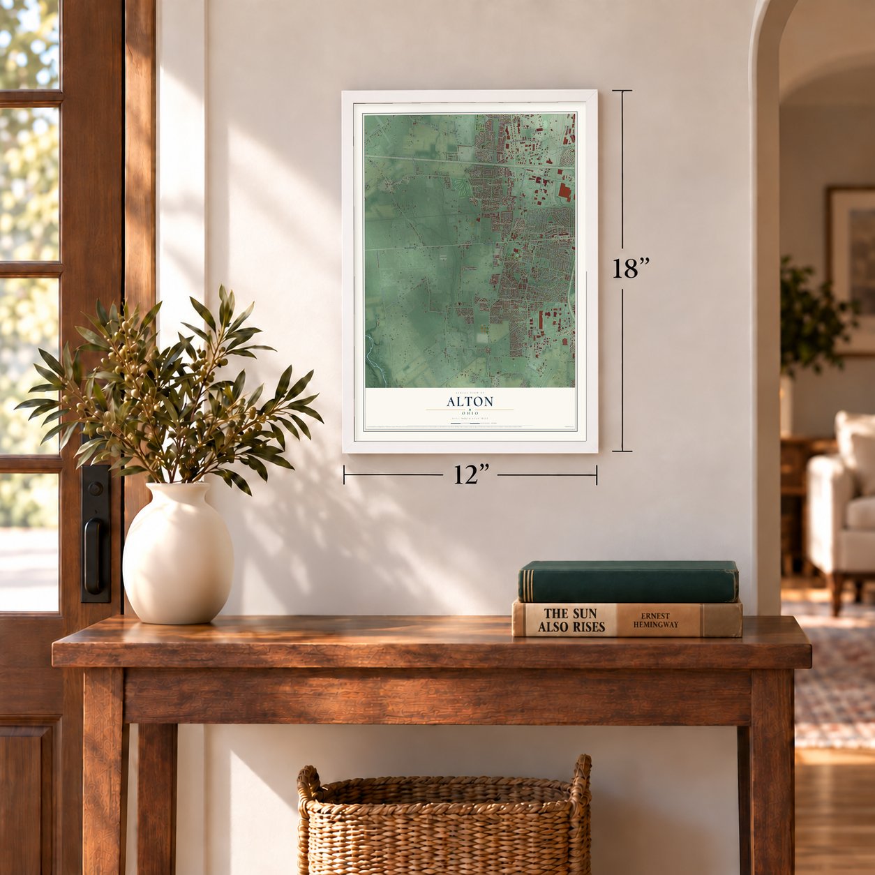
12" x 18" Archival Matte Print
A Map of Home. A Work of Art.
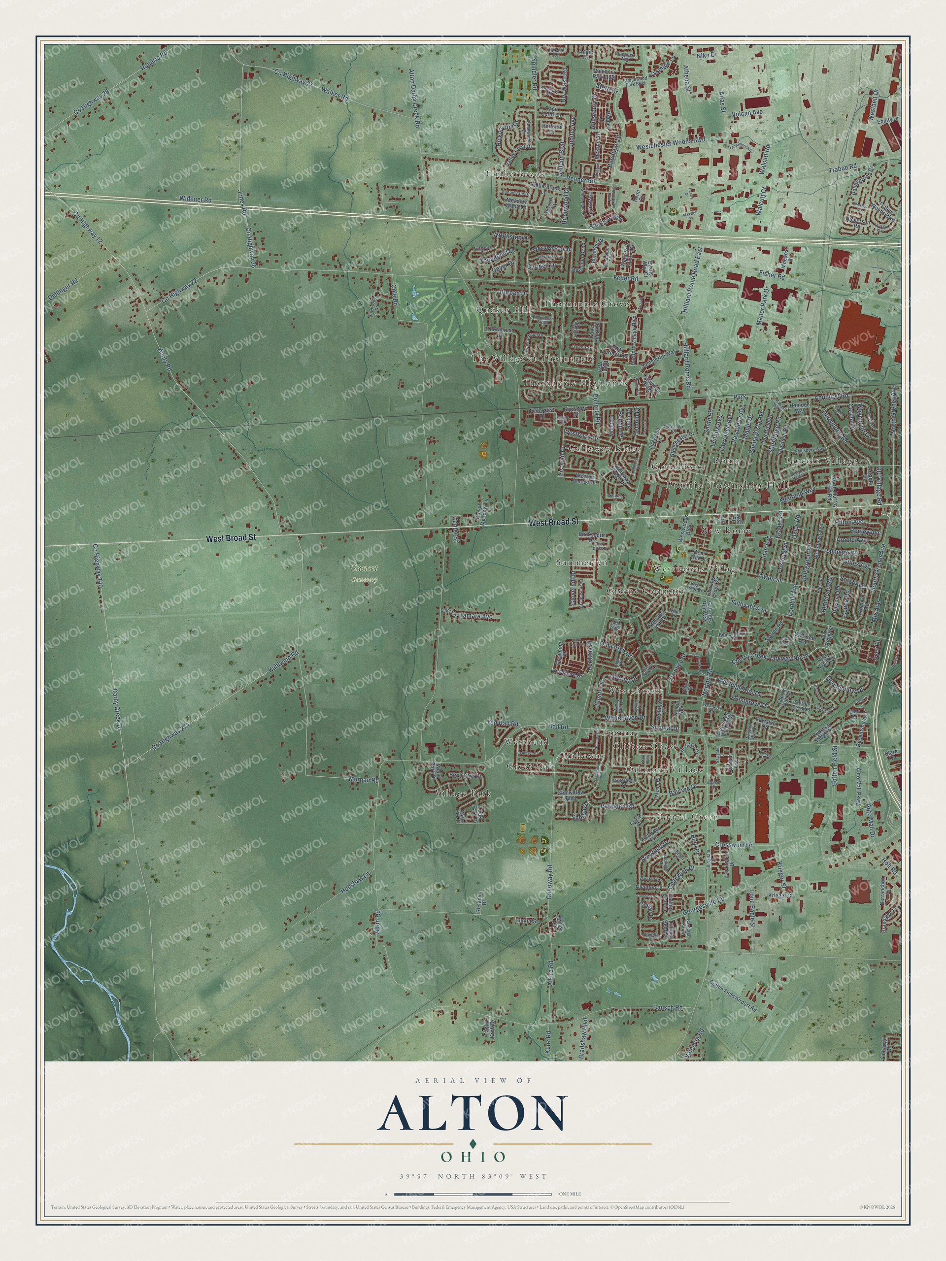
Explore Alton, Ohio from a whole new perspective. Created using aerial imagery and detailed geographic data, this map captures Alton building by building, with labeled streets, familiar landmarks, and shaded topographical relief that highlights the natural contours of the landscape.
Combining modern data with the timeless character of a vintage atlas, this map is just as interesting up close as it is beautiful on the wall. Whether you grew up in Alton, spent memorable years there, or call it home today, this unique map is a great way to celebrate a place that means something to you. Zoom in on the preview to look for your street, and then order a print to put your memories on the wall.
Three ways to hang it
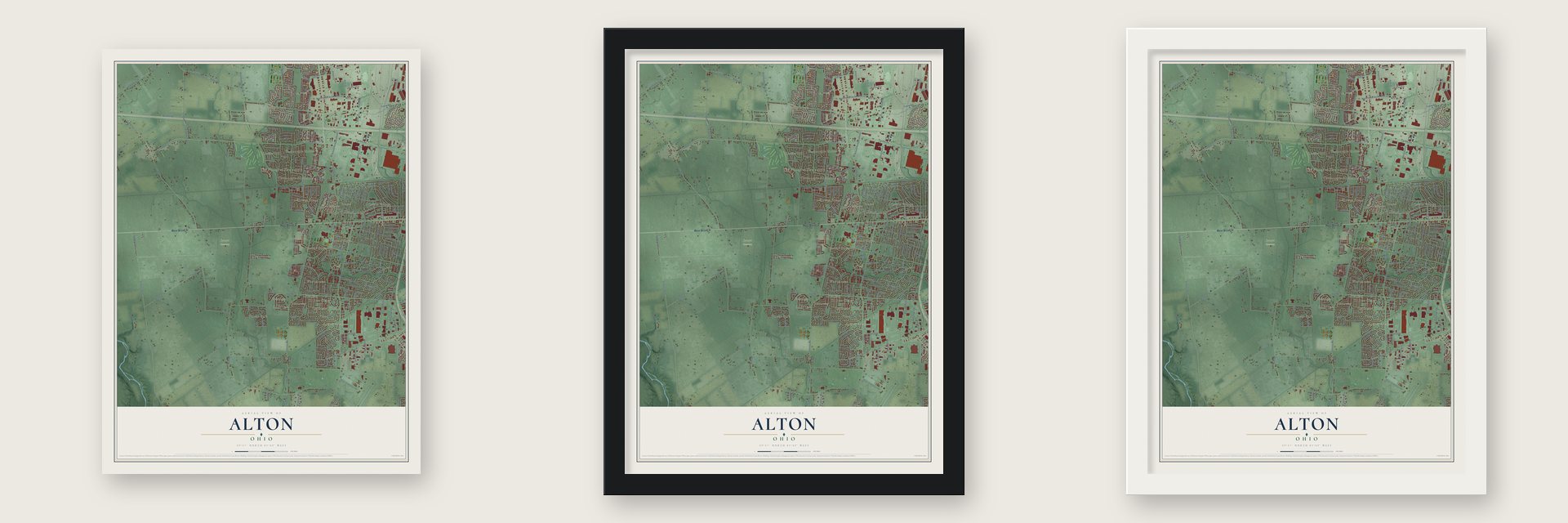
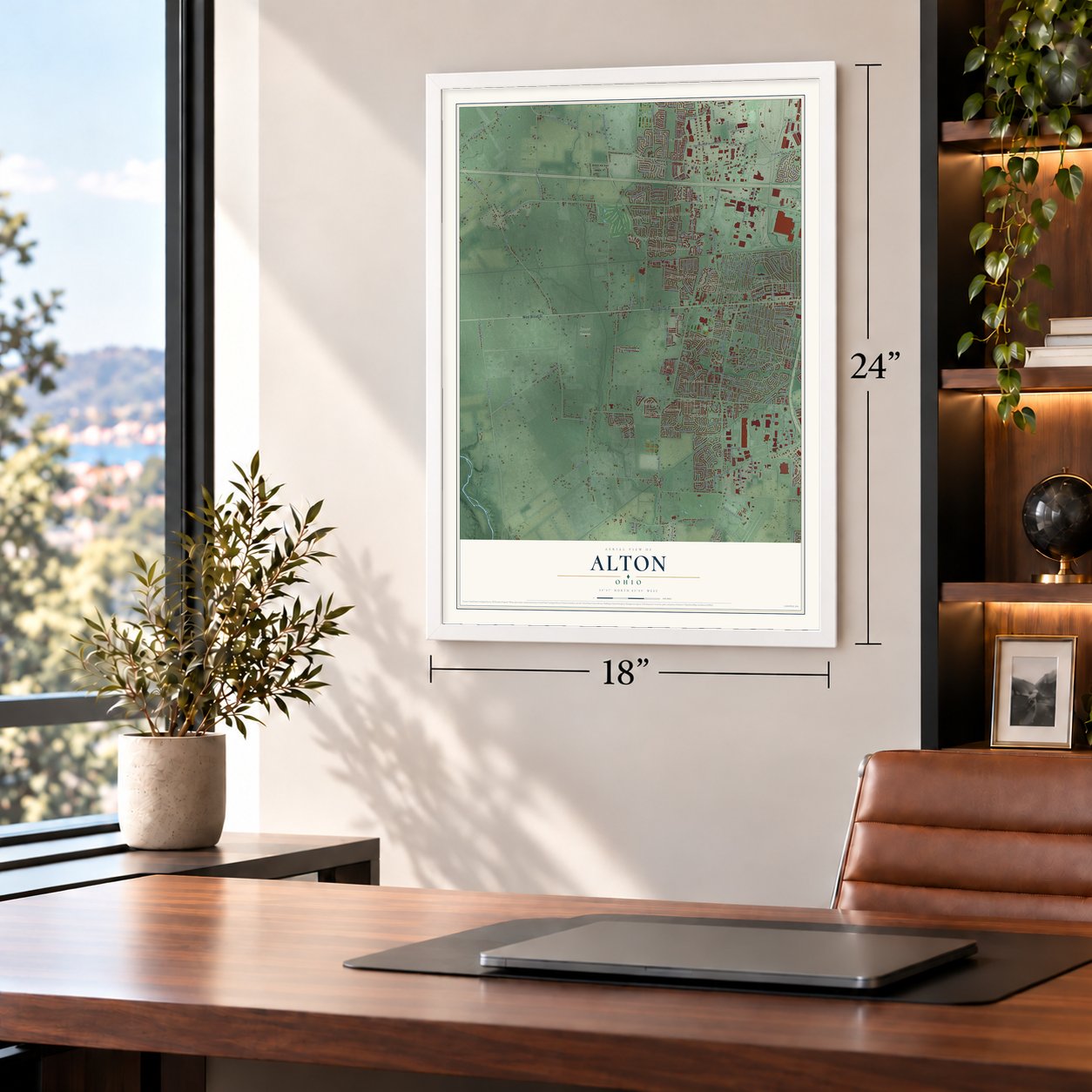
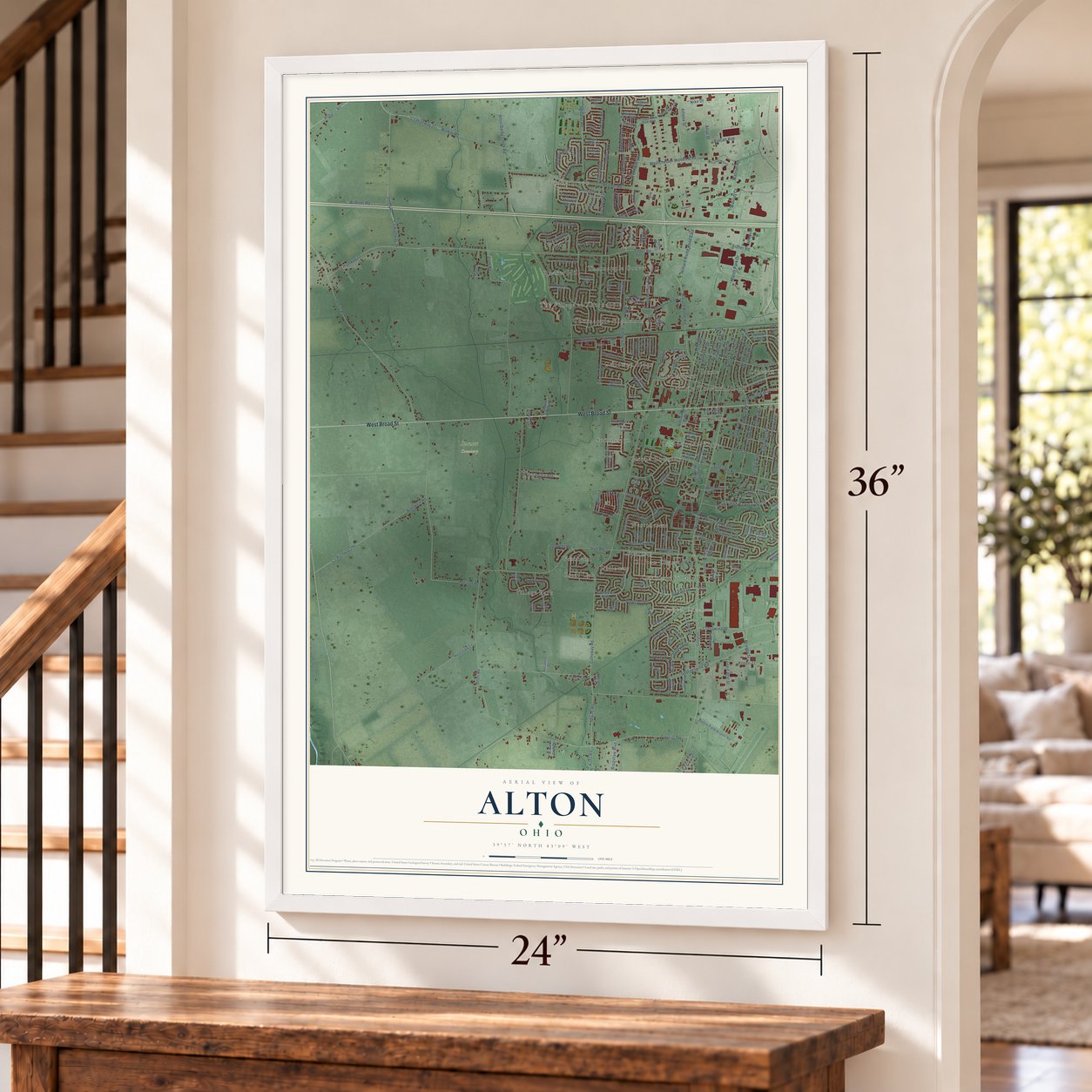
Unframed archival matte, a black wood frame or a white wood frame.
Up close
Geography Worth Displaying
This map was created using accurate cartographic data and authoritative geographic sources, including the U.S. Geological Survey and the Census Bureau. The map brings together terrain, waterways, roads, and building detail. The majority of the streets are labeled, houses are accurately depicted, and the topography is derived from government sources. Combining local data with carefully composed color and shading leads to this beautifully detailed Alton artwork for your wall.
Rather than simply showing street outlines, we’ve included as many of the street names as we could reasonably fit on the map while keeping their names legible. Zoom in on the high resolution preview to see exactly what’s on the map. We truly set out to create a statement piece for anyone who loves Alton. So whether it’s for you, or a gift for someone you love, we hope this map of Alton brings back fond memories.
Read the story behind this map: Detailed Map of Alton, Ohio.

Find your street
Names on the Alton map
Every name below is printed on this map. Look for your street, your school, the park where you played, or the pond down the road.
Places and landmarks25
- Prairie Township Hall
- Timberbrook
- Laurel Green
- Sunset Cemetery
- Summerlyn
- Village Park
- Quaker Hill
- Westchester
- Lincoln Village
- Westwoods Village
- Great Oak
- Galloway Ridge
Show all 25 places
- Thornapple Highlands
- Clifton Chase
- Rome
- Halloway
- Greene Countrie
- Glenchester
- Thornapple Grove
- The Village at Thornapple
- Westbend
- Epernay
- Oakmont Village
- New Rome
- Park
Streets and roads291
- West Broad Street
- South Grener Avenue
- Cherry Creek Parkway North
- Old Village Road
- North Grener Avenue
- Annhurst Road
- Doherty Road
- Olde Irish Drive
- Buena Vista Avenue
- Westchester Woods Boulevard
- Hilton Avenue
- Westgrove Drive
- County Highway 12
- Alkire Road
- Norton Road
- Feder Road
- Alton Road
- County Highway 140
- Darby Creek Drive
- Hall Road
- Galloway Road
- Hilliard Rome Road
- Alton Darby Creek Road
- Amity Road
- Cole Road
- Renner Road
- Murnan Road
- Sullivant Avenue
- Georgesville Road
- Trabue Road
Show all 291 streets
- Fisher Road
- County Highway 22
- Walker Road
- County Highway 274
- Kuhlwein Road
- County Highway 36
- Jones Road
- Spindler Road
- Manor Park Drive
- County Highway 28
- Roberts Road
- County Highway 27
- Evergreen Terrace
- Bausch Road
- Walcutt Road
- Inah Avenue
- Atlas Street
- Palmetto Street
- Westbelt Drive
- Pasadena Avenue
- Lawrence Avenue
- Lennox Avenue
- Maple Drive
- Hilliard Rome Road East
- Bolton Field Street
- Crosswind Drive
- Redmond Road
- Auto Mall Drive
- Fernhill Avenue
- Sturbridge Road
- Henshaw Lane
- Nike Drive
- Baytree Drive
- Mix Avenue
- Bennigan Drive
- Darbyhurst Road
- Owen Street
- Postle Boulevard
- Hickory Hill Drive
- Galleon Boulevard
- Dellinger Road
- Old Hall Road
- Parkglen Road
- Ridgebury Drive
- Youngland Drive
- Oxley Road
- Dyer Lane
- Ringfield Drive
- Athena Street
- Widener Road
- Wesleigh Run Drive
- Gladys Road
- Carilla Lane
- Lone Eagle Street
- Steffi Drive
- Frost Avenue
- Jupiter Avenue
- Westbank Drive
- Walcutt Court
- Medfield Way
- Deephollow Drive
- Krieger Street
- Smith Road
- Chanwick Drive
- Iris Trail Drive
- Carmell Drive
- Vulcan Avenue
- Wrothston Drive
- Whitehaven Drive
- Stiles Avenue
- Birchwood Drive
- Bradshaw Boulevard
- Tamara Avenue
- Weymouth Lane
- Durban Drive
- Holt Road
- Pamlico Street
- Henley Avenue
- Arnold Avenue
- Cloverhill Drive
- Celina Road
- Sumter Street
- Jasmine Lane
- Alliance Way
- Kunz Road
- Geyer Drive
- Dry Wash Road
- Hemhill Drive
- Sundial Drive
- O'Reily Drive
- Belfair Drive
- Valencia Road
- Perilous Place
- Bierl Drive
- Shelba Drive
- Center Street
- Ithaca Drive
- Valencia Park Boulevard
- Firewood Lane
- Cedar Springs Road
- North Murray Hill Road
- Woodlawn Avenue
- Hartford Village Boulevard
- Deerfield Road
- Cherry Bud Drive
- Westwoods Boulevard
- Trabue Woods Boulevard
- Timberbrook Lane
- Glenchester Drive
- Summerlin Way
- Topsfield Road
- Galloway Ridge Drive
- Oak Park Drive
- Bolton Field Airport Road
- Lombard Road
- Daytona Road
- Auto Mall Parkway
- Wallinger Drive
- Messner Drive
- Burnham Drive
- Regentshire Drive
- Branding Iron Drive
- Waterford Pointe Circle
- Brandigen Lane
- Buechler Bend
- Carpenter Ridge
- Nickerson Road
- Valley Crest Drive
- Weston Woods Drive
- Cape Henry Drive
- Wexford Park Drive
- Meadow Wood Lane
- Bolingbrook Drive
- Sundrops Avenue
- Aviator Avenue
- Burlake Drive
- Bucksburn Drive
- Charing Cross Street
- Keim Circle
- Red Glare Drive
- Cypress Ridge Place
- Milepost Drive
- Glennon Drive
- Station Road
- Signature Drive
- Hobbes Drive
- Convair Drive
- Wood Park Drive
- Gleaming Drive
- Lancia Lane
- Millett Drive
- Gabriels Run Way
- Glenwillow Boulevard
- Ruffin Drive
- Thorncrest Drive
- Birch Park Drive
- Muirwood Village Drive
- Elam Way
- Equity Drive
- Cape Coral Lane
- Berrancher Drive
- Falene Place
- Grants Lane
- Golden Fern Lane
- Faversham Drive
- Clover Meadow Lane
- Old Tree Avenue
- Hunter Street
- Hamden Way
- Federalist Drive
- Sawatch Drive
- Krieger Court
- Curry Drive
- Linbaugh Road
- Deer Hill Drive
- Rosanna Drive
- Fox Ridge Street
- Cabin Croft Drive
- Portside Drive
- River Trail Court
- Trillium Bend Drive
- Falling Leaf Lane
- Evans Way Court
- Lion Drive
- Angie Drive
- Clare Drive
- Dlyn Street
- Miller Street
- East Street
- Pub Street
- Tanglewood Park Boulevard
- Amesbury Way
- Windy Hill Lane
- Bellow Falls Place
- Hiler Road
- Deerlick Drive
- Wimbeldon Boulevard
- Bluegrass Way
- Hardwood Drive
- Claytonbend Drive
- Stemwood Drive
- Dunsmere Drive
- Sunny Vale Drive
- Silver Spurs Lane
- Brandenberry Drive
- Ravensdale Place
- Spivey Lane
- Cove Point Drive
- Winterberry Drive
- Annmary Road
- Cardinal Trail Drive
- Tillingham Drive
- Acree Lane
- Elnora Drive
- High Arbor Drive
- Westbury Drive
- Luccis Court
- Western Run Drive
- Redsand Road
- Dove Tree Drive
- Gazelle Drive
- Morton Court
- Maple Park Drive
- Tricia Drive
- Clairbrook Avenue
- Early Light Avenue
- Marsala Avenue
- Bear Drive
- Beacon Hill Road
- Crossbrook Boulevard
- Transamerica Drive
- Riverstone Drive
- Tenagra Way
- Bucksglen Drive
- Navigator Drive
- Yarmouth Lane
- Sanderson Drive
- Woodsboro Drive
- Bloomington Boulevard
- Yehlshire Drive
- Galli Court
- Starcrest Drive
- Schauer Drive
- Bellinger Drive
- Plumway Drive
- Mogul Drive
- Powder Mill Lane
- Debate Way
- Upwoods Drive
- Tampico Drive
- Appleby Drive
- Sherwill Road
- Tully Cross Drive
- Holland Drive
- Brush Ridge Court
- Sharets Drive
- Maxwell Place
- Revere Court
- Oslo Pass
- Rentra Drive
- West Street
Names are listed as they appear on the printed map. Zoom into the product photos to find them.
About Alton, Ohio
Thomas Graham laid out Alton in 1836, the year the National Road was built across Prairie Township. A post office opened there soon after. James Bryden and Adam Brotherlin then laid out a rival town nearby called Rome. The two competed for a few years, but Alton lasted and Rome faded away.
Keep exploring Ohio
Alton is one of 1,389 Ohio towns we've mapped. Every dot on the map is a print of its own.
The search covers every state, Ohio first.
Near Alton
Order 2 or more town maps and save 10%. Shown in the size and finish you picked above, so they hang as a set.
- Lincoln Village 12" x 18" / Archival Matte Print $39.99
- Lake Darby 12" x 18" / Archival Matte Print $39.99
- Galloway 12" x 18" / Archival Matte Print $39.99
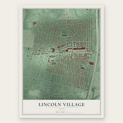


More maps nearby: Westgate, Hilltop, Valleyview, Urbancrest and Hilliard.
The art of mapping a place
How This Map Was Made
Real places. Remarkable detail. Discover the layers that turn geographic data into a map of home.

The view from above
Aerial imagery reveals the character of the land: woodland, open fields, and the patterns of a place.

The shape of the land
Elevation data brings hills, valleys, and subtle changes in the landscape into view.

The details of home
Roads, waterways, and building footprints come together to make the map feel unmistakably local.

Geography becomes art
Considered color, shading, and typography bring the layers together in a map made for your wall.


Process illustrated with Mendon, Massachusetts. Aerial imagery: USDA NAIP. Terrain: USGS 3D Elevation Program. Map details and finished artwork: KNOWOL.
The Details
About This Print
Choose an archival matte print, or a black or white Ayous wood frame. The archival matte print is unframed.
Select your size and finish above to see the matching product image and price.
Materials & Craftsmanship
A contemporary map with the character of a classic atlas, printed on archival matte paper. Optional frames are made from Ayous wood.
Your printed map does not include the watermark shown in the full-map preview.
Shipping & Delivery
Free shipping within the United States. Every print is made to order in the USA.
Buying a gift? Add a note in your cart and we'll include it. We never put prices in the package.
Prints ship within 2 to 3 business days. Allow 7 to 10 days total from ordering for delivery. Timing may vary during holidays or periods of high order volume.
Read our shipping policy.
Returns and damaged prints
Each print is made to order. Change-of-mind refunds are not available after production.
If your print arrives damaged, misprinted or incorrect, contact support@knowol.com within 30 days of receiving it. Include your order number, photos and a description of the issue.
Read our full refund and replacement policy. For questions about your order, email support@knowol.com.