


Search for another town


Free U.S. delivery 7 to 10 days after you order
Hilltop, Columbus, Ohio Map Art
Building by building, with labeled streets and shaded relief.
12" x 18" Archival Matte Print
A Map of Home. A Work of Art.
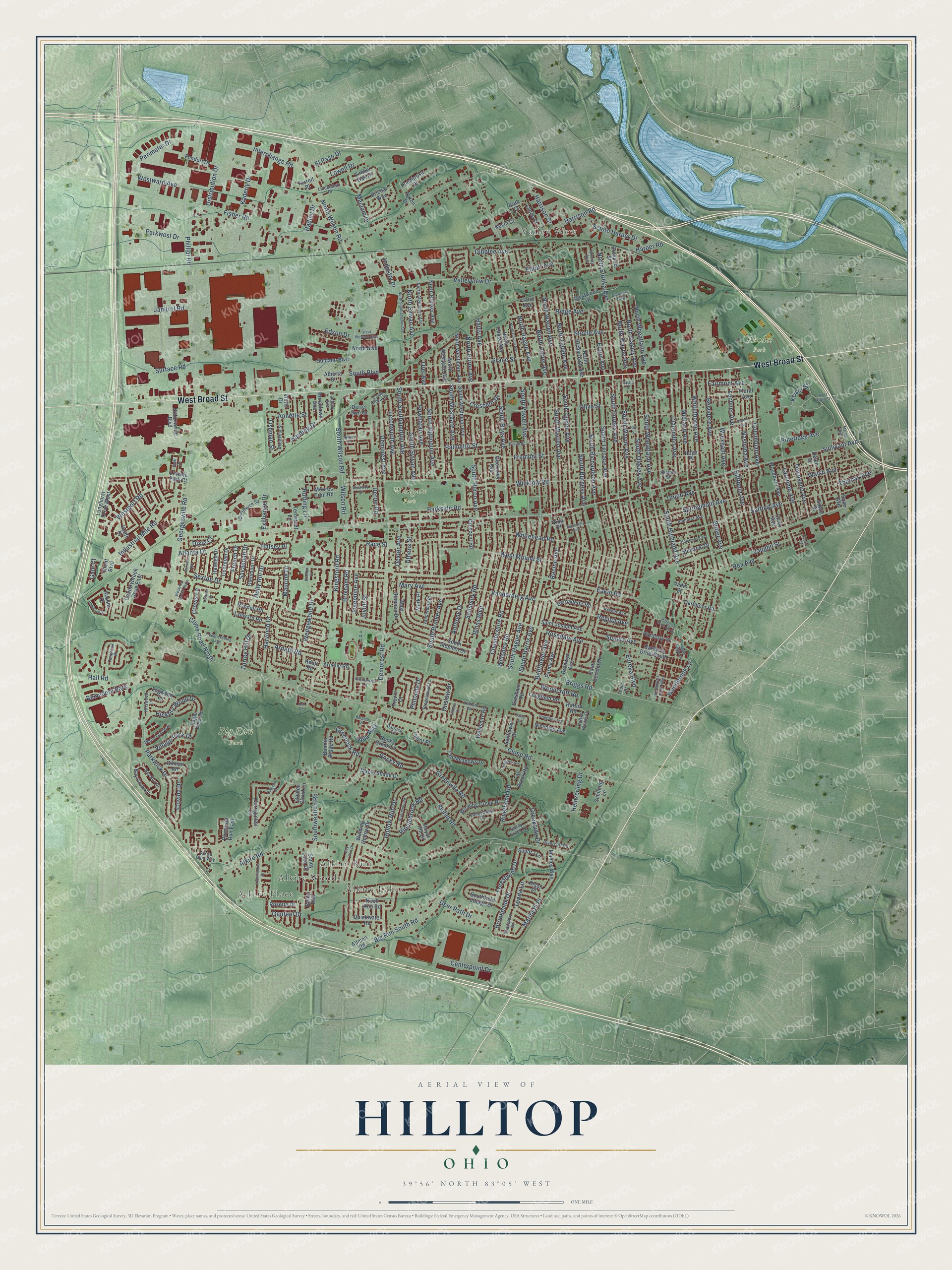
Explore Hilltop, Ohio from a whole new perspective. Created using aerial imagery and detailed geographic data, this map captures Hilltop building by building, with labeled streets, familiar landmarks, and shaded topographical relief that highlights the natural contours of the landscape.
Combining modern data with the timeless character of a vintage atlas, this map is just as interesting up close as it is beautiful on the wall. Whether you grew up in Hilltop, spent memorable years there, or call it home today, this unique map is a great way to celebrate a place that means something to you. Zoom in on the preview to look for your street, and then order a print to put your memories on the wall.
Three ways to hang it

Unframed archival matte, a black wood frame or a white wood frame.
Up close
Geography Worth Displaying
This map was created using accurate cartographic data and authoritative geographic sources, including the U.S. Geological Survey and the Census Bureau. The map brings together terrain, waterways, roads, and building detail. The majority of the streets are labeled, houses are accurately depicted, and the topography is derived from government sources. Combining local data with carefully composed color and shading leads to this beautifully detailed Hilltop artwork for your wall.
Rather than simply showing street outlines, we’ve included as many of the street names as we could reasonably fit on the map while keeping their names legible. Zoom in on the high resolution preview to see exactly what’s on the map. We truly set out to create a statement piece for anyone who loves Hilltop. So whether it’s for you, or a gift for someone you love, we hope this map of Hilltop brings back fond memories.
Read the story behind this map: Detailed Map of Hilltop, Columbus, Ohio.

Find your street
Names on the Hilltop map
Every name below is printed on this map. Look for your street, your school, the park where you played, or the pond down the road.
Places and landmarks9
- Alkire Place
- Valley View
- Big Run Park
- Rhodes Park
- Westgate Park
- Alkire Lakes
- Alkire Woods
- Alkire Run
- Belvedere Park
Streets and roads333
- West Broad Street
- Maribeth Place
- Townsend Avenue
- Vanderberg Avenue
- Keiser Street
- Tonda Lane
- West Mound Street
- Phillipi Road
- Tishman Street
- Sullivant Avenue
- Demorest Road
- Eakin Road
- Clime Road
- Briggs Road
- Alkire Road
- Fisher Road
- Georgesville Road
- South Hague Avenue
- Whitehead Road
- South Harris Avenue
- Palmetto Street
- Binns Boulevard
- Wicklow Road
- Whitethorne Avenue
- South Eureka Avenue
- Valleyview Drive
- North Wilson Road
- Clarendon Avenue
- Safford Avenue
- Olive Street
Show all 333 streets
- South Richardson Avenue
- South Roys Avenue
- South Brinker Avenue
- North Hague Avenue
- South Wayne Avenue
- South Warren Avenue
- Grace Street
- South Terrace Avenue
- South Ogden Avenue
- South Burgess Avenue
- Wedgewood Drive
- Steele Avenue
- Fremont Street
- South Highland Avenue
- Derrer Road
- South Wheatland Avenue
- Wiltshire Road
- Big Run South Road
- Springmont Avenue
- Belvidere Avenue
- South Oakley Avenue
- Midland Avenue
- South Westgate Avenue
- Columbian Avenue
- Holly Hill Drive
- Union Avenue
- Wrexham Avenue
- Chestershire Road
- Josephine Avenue
- South Sylvan Avenue
- Parkwick Drive
- Nashoba Avenue
- South Powell Avenue
- Parkside Road
- Rosedale Avenue
- Eldon Avenue
- North Eureka Avenue
- Salisbury Road
- Racine Avenue
- Powhatan Avenue
- Pineridge Avenue
- North Warren Avenue
- Dibblee Avenue
- South Huron Avenue
- Bellflower Avenue
- South Southampton Avenue
- Ridge Avenue
- North Harris Avenue
- Lechner Avenue
- Race Street
- Savannah Drive
- Harrison Road
- North Sylvan Avenue
- South Algonquin Avenue
- Kingsford Road
- Industrial Mile Road
- South Wilson Road
- Demorest Avenue
- Edson Drive
- Westport Road
- Walsh Avenue
- Butler Avenue
- Sexton Drive
- Brixham Road
- Letchworth Avenue
- Riverbend Road
- North Ogden Avenue
- Harwood Drive
- Woodbrook Lane
- Regina Avenue
- Rea Avenue
- North Oakley Avenue
- North Wheatland Avenue
- Clime Road North
- Mary Avenue
- North Wayne Avenue
- Maurine Drive
- Interchange Road
- Thomas Avenue
- Perimeter Drive
- Southwestern Road
- Elliott Avenue
- Hilltonia Avenue
- Lowell Drive
- Westward Avenue
- Hall Road
- Kaderly Drive
- Maclam Drive
- Janitrol Road
- Distribution Drive
- Bluhm Road
- Forestwind Drive
- Centerpoint Drive
- Joyful Street
- Larcomb Avenue
- Hickory Wood Drive
- Haldy Avenue
- Hollow Run Drive
- Greenville Road
- Surface Road
- Halsey Place
- Brookbank Drive
- Rocky Road
- Pinnacle Drive
- Scioto Harper Drive
- Ardath Road
- Vaughn Street
- Atlanta Drive
- Crescent Drive
- Creekside Drive
- Torrey Hill Drive
- Ripplebrook Road
- Fairmont Avenue
- Anthony Drive
- Harrison Drive
- Heinzerling Drive
- Eureka Boulevard
- Village Park Drive
- Greenock Road
- Exchange Drive
- North Huron Avenue
- Woodcroft Road
- Onslow Drive
- Harding Drive
- Deer Path Drive
- Spaatz Avenue
- Athens Street
- Covina Drive
- Dexter Avenue
- El Paso Drive
- Parkwest Drive
- Wilson Road
- Ruffing Lane
- French Drive
- Crevis Lane
- Annette Street
- Galli Court
- Harper Road
- Industry Drive
- South Boulevard
- Genteel Drive
- Hadley Drive
- Orel Avenue
- Vida Way
- Dixie Court
- Reilly Run
- Olson Place
- Sandy Lake Drive
- Hardesty Drive South
- Derrer Run Drive
- North Richardson Avenue
- Winding Hollow Drive
- Bronwyn Avenue
- Woodbury Avenue
- Lynward Road
- North Westmoor Avenue
- North Brinker Avenue
- South Stephen Drive
- Guernsey Avenue
- South Westmoor Avenue
- Ryan Avenue
- Nationwide Boulevard
- Floral Avenue
- Winding Creek Drive
- Tall Meadows Drive
- Georgian Drive
- North Chase Avenue
- Bay Club Circle
- Westwood Drive
- West Stephen Drive
- Saint Joseph Avenue
- Saint Cecelia Drive
- Manley Way
- Countrybrook Drive East
- Fondorf Drive
- Southfield Village Drive
- Parma Avenue
- Glenmoor Drive
- Helen Street
- Ternstedt Lane
- Maple Shade Court
- Alberta Street
- Fall Brook Road
- Clark Avenue
- Eagle View Drive
- Rosette Drive
- Bernadette Road
- Brichar Way
- North Westgate Avenue
- Gilman Road
- Suncrest Drive
- Longfield Road
- Rocky Creek Lane
- Randell Road
- Sunflower Drive
- Dartmoor Road
- Carrigallen Lane
- Westshire Road
- Soldano Boulevard
- Raleigh Drive
- Hyatt Drive
- Lincoln Park Court
- Talbot Place
- Nicholas Avenue
- Pheasant Run East
- Sondra Lane
- Quickwater Road
- Royal Hill Drive
- Ponderosa Drive
- Logwood Lane
- Allmon Road
- Hardesty Court
- Crescent Road
- Broadlawn Avenue
- Moores Trail Road
- Bonnie Ridge Road
- Golden Cloud Lane
- Lance Court
- Longhurst Drive West
- Arnelle Road
- Mark Place
- North Boulevard
- Gresham Road
- Adell Road
- Prospect Street
- Schilling Lane
- Timber Oak Drive
- Kevin Court
- Hope Place
- Avonia Drive
- Viotis Drive
- Knoll Run Road
- Ferrell Place
- Edwin Street
- Nixon Drive
- Ruth Court
- Vadis Street
- Brent Boulevard
- Carol Avenue
- Trevor Court
- Hafton Road
- Vida Place
- Valleywood Drive
- North Algonquin Avenue
- Commerce Square
- Rivercliff Road
- Alkire Glen Way
- Bay Run Drive
- Valley Creek Drive
- Amherst Avenue
- Riegelwood Lane
- Alice Rita Street
- Tedco Drive
- White Leaf Way
- Kreber Avenue
- Vanderberg Place
- Chadsterz Drive
- Farmhurst Lane
- Kriswood Lane
- Lindendale Drive
- Telham Drive
- Hafton Woods Drive
- Tenbrook Place
- Murray Avenue
- Volney Avenue
- Darracq Circle
- Camp Chase Drive
- Shelton Street
- North Powell Avenue
- Prominence Drive
- North Southampton Avenue
- Woodbrook Circle West
- Doren Avenue
- Westview Center Plaza
- Rivermont Road
- Bay Port Drive
- Glenview Boulevard
- Fredericksburg Avenue
- Homewood Avenue
- Martha Avenue
- Hambrick Street
- Hillgrove Avenue
- Briggston Avenue
- Hardesty Drive North
- Great Western Boulevard
- Daisy Lane
- Westway Drive
- Postle Road
- Burroughs Avenue
- Apple Ridge Lane
- Scriven Avenue
- Baroma Drive
- Scott Drive
- Delgany Street
- Doulton Court
- West Town Street
- Telham Court
- Cottrell Drive
- Wilkes Court
- Yvette Court
- Apple Street
- Ray Street
- Yew Drive
Names are listed as they appear on the printed map. Zoom into the product photos to find them.
Keep exploring Ohio
Hilltop is one of 1,389 Ohio towns we've mapped. Every dot on the map is a print of its own.
The search covers every state, Ohio first.
Near Hilltop
Order 2 or more town maps and save 10%. Shown in the size and finish you picked above, so they hang as a set.
- Westgate 12" x 18" / Archival Matte Print $39.99
- Valleyview 12" x 18" / Archival Matte Print $39.99
- Urbancrest 12" x 18" / Archival Matte Print $39.99
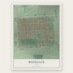
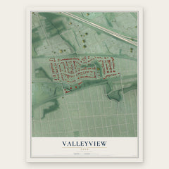
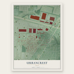
More maps nearby: Lincoln Village, Franklinton, Marble Cliff, Grandview Heights and Fifth by Northwest.
The art of mapping a place
How This Map Was Made
Real places. Remarkable detail. Discover the layers that turn geographic data into a map of home.

The view from above
Aerial imagery reveals the character of the land: woodland, open fields, and the patterns of a place.

The shape of the land
Elevation data brings hills, valleys, and subtle changes in the landscape into view.

The details of home
Roads, waterways, and building footprints come together to make the map feel unmistakably local.

Geography becomes art
Considered color, shading, and typography bring the layers together in a map made for your wall.


Process illustrated with Mendon, Massachusetts. Aerial imagery: USDA NAIP. Terrain: USGS 3D Elevation Program. Map details and finished artwork: KNOWOL.
The Details
About This Print
Choose an archival matte print, or a black or white Ayous wood frame. The archival matte print is unframed.
Select your size and finish above to see the matching product image and price.
Materials & Craftsmanship
A contemporary map with the character of a classic atlas, printed on archival matte paper. Optional frames are made from Ayous wood.
Your printed map does not include the watermark shown in the full-map preview.
Shipping & Delivery
Free shipping within the United States. Every print is made to order in the USA.
Buying a gift? Add a note in your cart and we'll include it. We never put prices in the package.
Prints ship within 2 to 3 business days. Allow 7 to 10 days total from ordering for delivery. Timing may vary during holidays or periods of high order volume.
Read our shipping policy.
Returns and damaged prints
Each print is made to order. Change-of-mind refunds are not available after production.
If your print arrives damaged, misprinted or incorrect, contact support@knowol.com within 30 days of receiving it. Include your order number, photos and a description of the issue.
Read our full refund and replacement policy. For questions about your order, email support@knowol.com.