
Search for another town


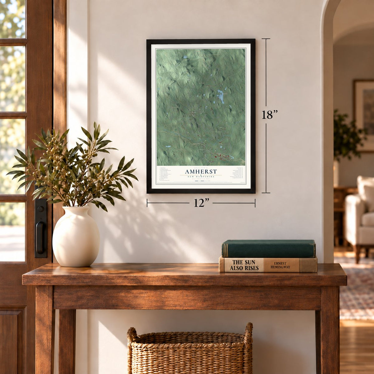
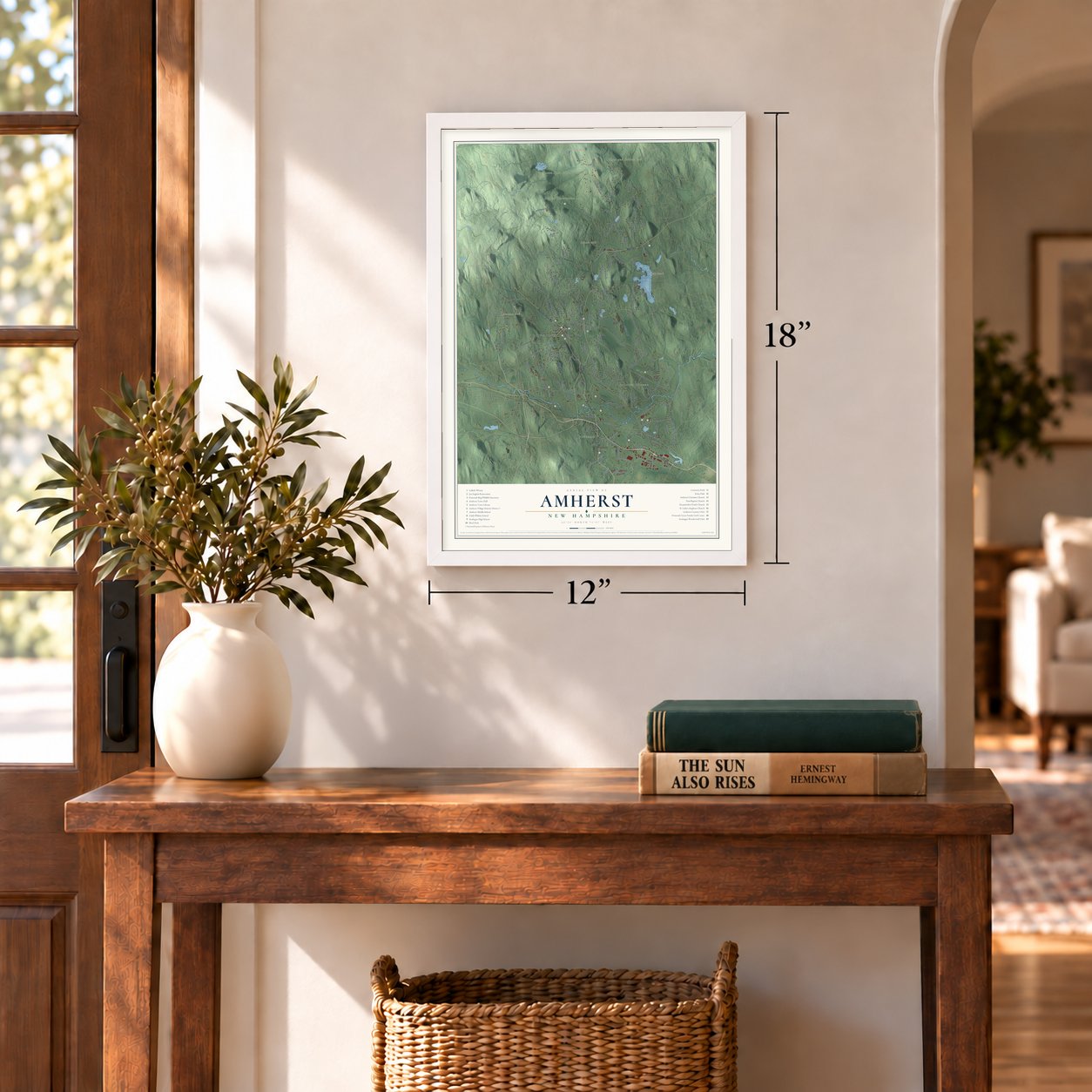

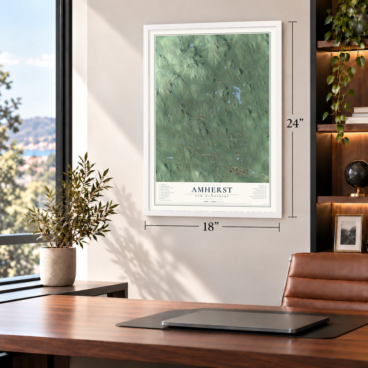
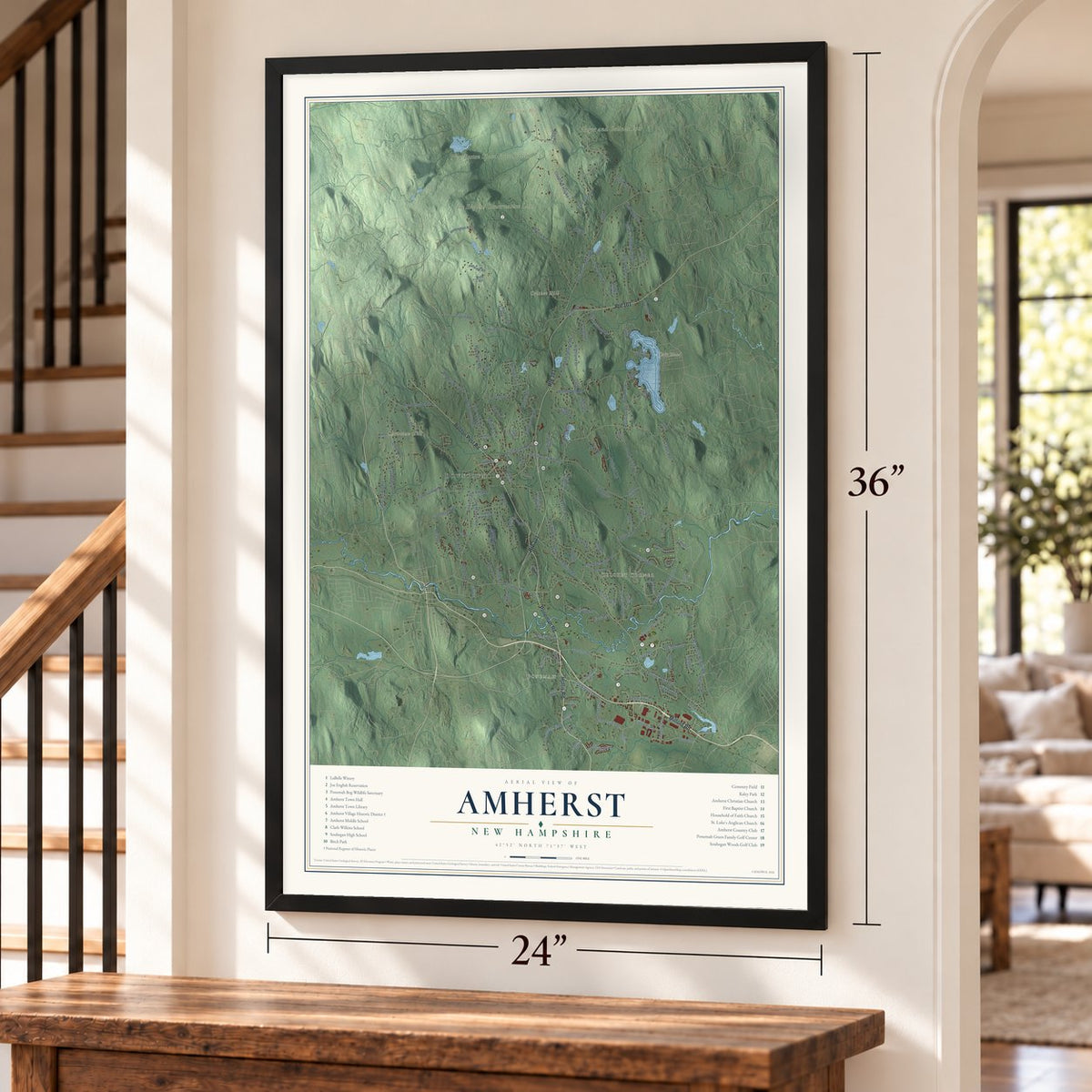

Free U.S. delivery 7 to 10 days after you order
Amherst, New Hampshire Map Art
Building by building, with labeled streets and shaded relief.
12" x 18" Archival Matte Print
A Map of Home. A Work of Art.
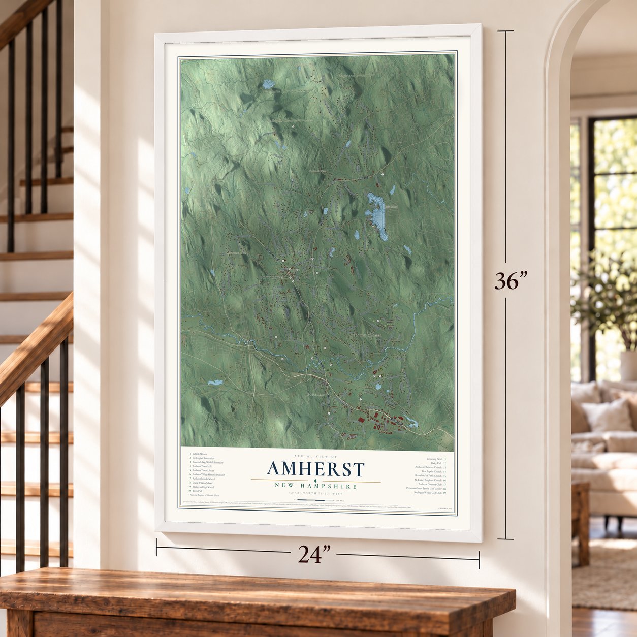
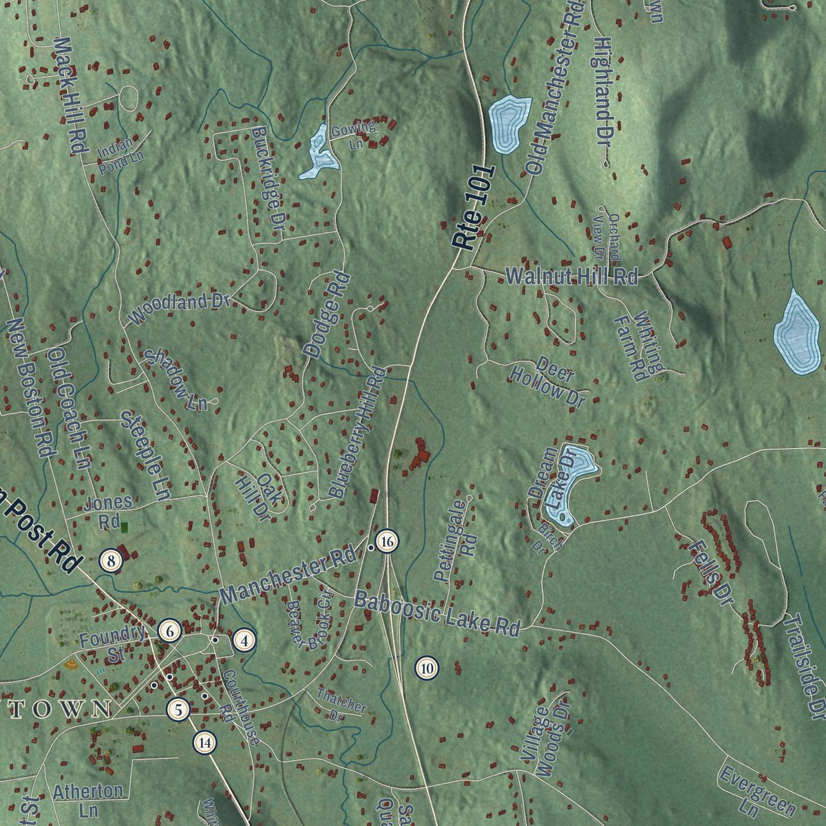
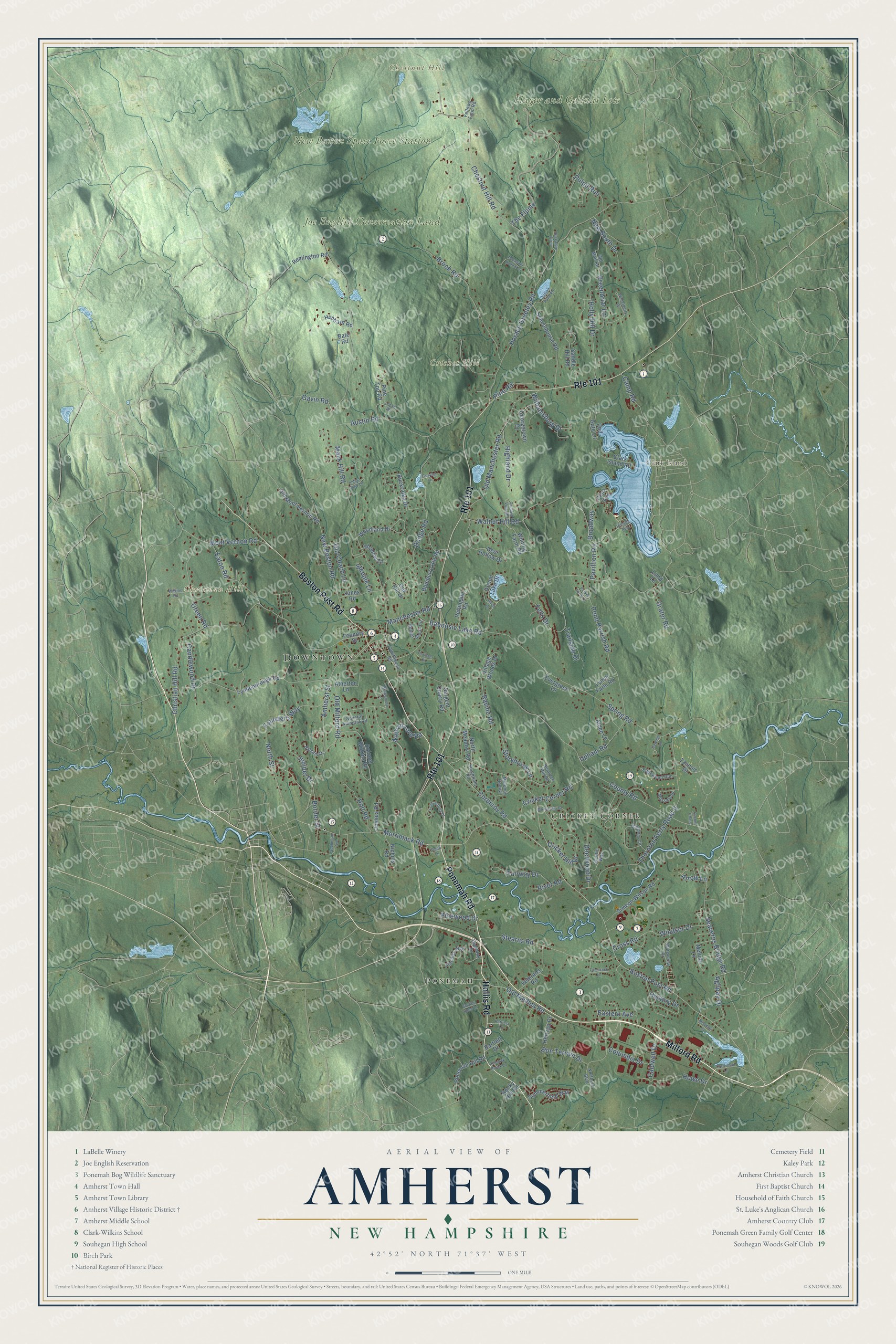
Explore Amherst, New Hampshire from a whole new perspective. Created using aerial imagery and detailed geographic data, this map captures Amherst building by building, with labeled streets, familiar landmarks, and shaded topographical relief that highlights the natural contours of the landscape.
Combining modern data with the timeless character of a vintage atlas, this map is just as interesting up close as it is beautiful on the wall. Whether you grew up in Amherst, spent memorable years there, or call it home today, this unique map is a great way to celebrate a place that means something to you. Zoom in on the preview to look for your street, and then order a print to put your memories on the wall.
Three ways to hang it
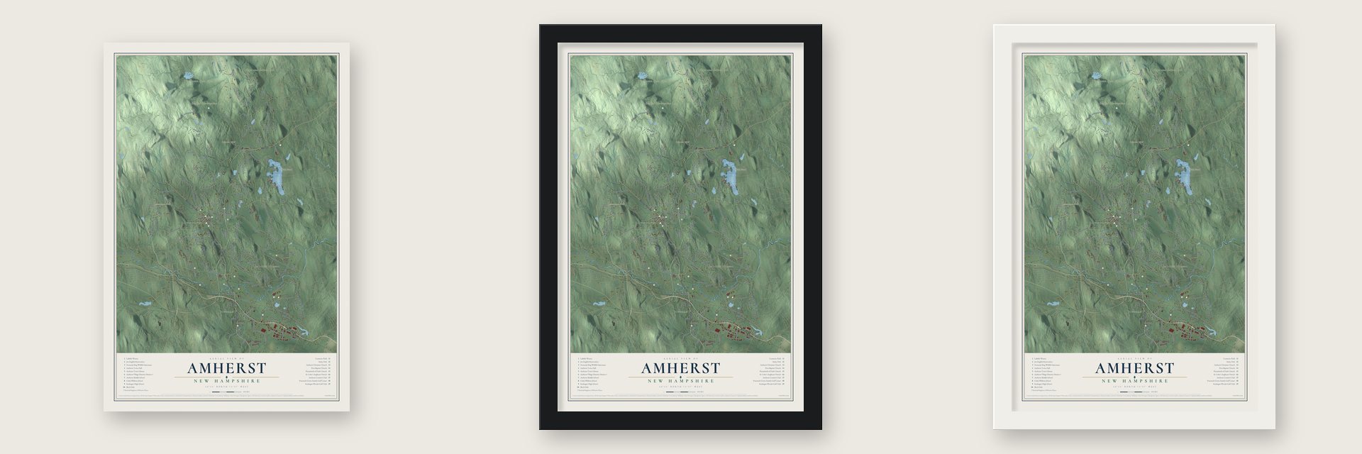
Unframed archival matte, a black wood frame or a white wood frame.
Up close
Geography Worth Displaying
This map was created using accurate cartographic data and authoritative geographic sources, including the U.S. Geological Survey (USGS) and FEMA. The map brings together terrain, waterways, roads, and building detail. The majority of the streets are labeled, houses are accurately depicted, and the topography is derived from government sources. Combining local data with carefully composed color and shading leads to this beautifully detailed Amherst artwork for your wall.
Rather than simply showing street outlines, we’ve included as many of the street names as we could reasonably fit on the map while keeping their names legible. Zoom in on the high resolution preview to see exactly what’s on the map. We truly set out to create a statement piece for anyone who loves Amherst. So whether it’s for you, or a gift for someone you love, we hope this map of Amherst brings back fond memories.
Explore the full map of Amherst, New Hampshire and read about the local places it shows.

Find your street
Names on the Amherst map
Every name below is printed on this map. Look for your street, your school, the park where you played, or the pond down the road.
Places and landmarks10
- Downtown
- Ponemah
- Cricket Corner
- Chestnut Hill
- Christian Hill
- Clark Island
- Cricket Hill
- New Boston Space Force Station
- Joe English Conservation Land
- Hager and Gelinas Lots
Streets and roads160
- Ponemah Road
- Milford Road
- Hollis Road
- Route 101
- Boston Post Road
- Old Nashua Road
- Manchester Road
- Baboosic Lake Road
- Merrimack Road
- County Road
- Mack Hill Road
- The Flume
- Christian Hill Road
- Horace Greeley Road
- Amherst Street
- Spring Road
- Chestnut Hill Road
- Thornton Ferry Road II
- Dodge Road
- Austin Road
- Old Manchester Road
- Walnut Hill Road
- Brook Road
- Pond Parrish Road
- Stearns Road
- Corduroy Road
- New Boston Road
- Fells Drive
- Seaverns Bridge Road
- Broadway
Show all 160 streets
- Mont Vernon Road
- Holly Hill Drive
- Cricket Corner Road
- Green Road
- Nathan Lord Road
- Old Milford Road
- Eaton Road
- Fairway Drive
- Greenbriar Lane
- Juniper Drive
- Cross Road
- Ravine Road
- Cricket Hill Drive
- Founders Way
- Hickory Drive
- Aglipay Drive
- Upham Road
- New South Drive
- Highland Drive
- Pine Road
- Holt Road
- Williamsburg Drive
- Windsor Drive
- Storybrook Lane
- Pinewood Drive
- Border Street
- Deerwood Drive
- Howe Drive
- Pulpit Run
- Candlewood Drive
- Trailside Drive
- Old Coach Lane
- North Street
- Caldwell Drive
- Bon Terrain Drive
- Columbia Drive
- Eastern Avenue
- Steeple Lane
- Grater Road
- Camp Road
- Gavin Road
- Pavillion Road
- River Road
- Arrow Lane
- Rocky Hill Road
- Lyndeborough Road
- Buckridge Drive
- Schoolhouse Road
- Blueberry Hill Road
- Dream Lake Drive
- Woodland Drive
- Colonel Wilkins Road
- Saddle Hill Road
- Deer Hollow Drive
- Ponemah Hill Road
- Simeon Wilson Road
- Nichols Road
- Veterans Road
- Old Mont Vernon Road
- Oak Hill Drive
- Atherton Lane
- Whiting Farm Road
- Summerfield Way
- Pine Top Road
- Jones Road
- North Meadow Road
- Pettingale Road
- Joshua Road
- Hubbard Road
- Lynch Farm Road
- Georgetown Drive
- Shadow Lane
- Remington Road
- Clark Island Road
- Evergreen Lane
- Hertzga Drive
- Melody Lane
- Sargent Quarry Road
- Village Woods Drive
- Foundry Street
- Red Gate Lane
- Alden Lane
- Taconic Drive
- Bartlett Drive
- Clark Avenue
- Bate Road
- Lund Lane
- Northern Boulevard
- Danbury Circle
- Courthouse Road
- Standish Way
- Waterview Drive
- Hemlock Hill Road
- Beaver Brook Circle
- Edgewood Run
- Mosswood
- General Amherst Road
- Old Mail Road
- Scottie Way
- Balsam Drive
- Southfield Road
- Fellows Farm Road
- Overlook Drive
- Melendy Hollow
- Craftsman Lane
- Winterberry Drive
- Lord Jeffrey Drive
- Whittemore Lane
- Locke Road
- Pheasant Hollow Lane
- Monticello Drive
- Meadow Lane
- Damon Pond Road
- Smith Lane
- Indian Pond Lane
- Souhegan Avenue
- Golden Pond Lane
- Patricia Lane
- Birch Drive
- Wilkins Road
- Thatcher Drive
- Orchard View Drive
- Huckabee Farm
- Tamarack Lane
- Peacock Brook Lane
- Parker Farm Lane
- Gowing Lane
- Sawmill Lane
- Timber Chase
- Hillside Avenue
Names are listed as they appear on the printed map. Zoom into the product photos to find them.
About Amherst, New Hampshire
Amherst is a town of 11,753 people in Hillsborough County, on the Souhegan River. Veterans of King Philip's War received its land in a 1728 grant, and in 1733 settlers began a village known first as Narragansett Number 3 and later as Souhegan Number 3. They organized a Congregational church in 1741. Governor Benning Wentworth granted the town its charter on January 18, 1760, and named it for General Jeffery Amherst, who had commanded British forces on this continent in the French and Indian War.
The town stood on the main road crossing the county from east to west, which helped make it the seat of Hillsborough County in 1770, and it prospered through the Revolution. Then it began to shrink. Milford split off from its southwest corner in 1790, and Mont Vernon took the northwest in 1803. Milford's water-powered mills drew business away, and in 1866 the county seat moved there. Amherst grew little until after World War II, when it drew newcomers as part of the Greater Boston region.
- A common laid out about 1755The village grew up around a common laid out about 1755. The first meeting house was raised in 1749 on high ground northeast of the green and was hauled down to the common once the town had its charter. A few houses from 1750 still stand, one of which began as a tavern. Work on the Congregational Church started about 1771, and the brick Farmer's Bank followed in 1806.
- A courthouse from 1825Amherst Town Hall was built in 1825 as Hillsborough County's third courthouse, back when county business still came to Amherst. Nearby stands the Amherst Brick School, a brick schoolhouse in the Greek Revival style.
- A future president's weddingFranklin Pierce, later the 14th president, trained under Judge Edmund Parker in Amherst. His wedding to Jane Means Appleton, whose father had once led Bowdoin College, took place at a house facing the village green.
- Horace Greeley, born 1811Horace Greeley was born into a poor Amherst family in 1811. He learned the printing trade as an apprentice in Vermont, reached New York in 1831 and founded the New-York Tribune a decade later. He spread the advice "Go West, young man," and in 1872 he challenged Ulysses S. Grant for the presidency.
Keep exploring New Hampshire
Amherst is one of 264 New Hampshire towns we've mapped. Every dot on the map is a print of its own.
The search covers every state, New Hampshire first.
Near Amherst
Order 2 or more town maps and save 10%. Shown in the size and finish you picked above, so they hang as a set.
- Merrimack 12" x 18" / Archival Matte Print $39.99
- Bedford 12" x 18" / Archival Matte Print $39.99
- Mont Vernon 12" x 18" / Archival Matte Print $39.99
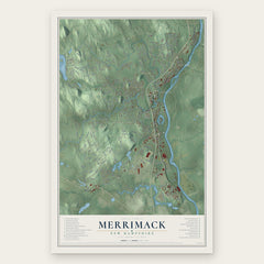


More maps nearby: Milford, East Merrimack, Klondike Corner, Litchfield and New Boston.
The art of mapping a place
How This Map Was Made
Real places. Remarkable detail. Discover the layers that turn geographic data into a map of home.

The view from above
Aerial imagery reveals the character of the land: woodland, open fields, and the patterns of a place.

The shape of the land
Elevation data brings hills, valleys, and subtle changes in the landscape into view.

The details of home
Roads, waterways, and building footprints come together to make the map feel unmistakably local.

Geography becomes art
Considered color, shading, and typography bring the layers together in a map made for your wall.


Process illustrated with Mendon, Massachusetts. Aerial imagery: USDA NAIP. Terrain: USGS 3D Elevation Program. Map details and finished artwork: KNOWOL.
The Details
About This Print
Choose an archival matte print, or a black or white Ayous wood frame. The archival matte print is unframed.
Select your size and finish above to see the matching product image and price.
Materials & Craftsmanship
A contemporary map with the character of a classic atlas, printed on archival matte paper. Optional frames are made from Ayous wood.
Your printed map does not include the watermark shown in the full-map preview.
Shipping & Delivery
Free shipping within the United States. Every print is made to order in the USA.
Buying a gift? Add a note in your cart and we'll include it. We never put prices in the package.
Prints ship within 2 to 3 business days. Allow 7 to 10 days total from ordering for delivery. Timing may vary during holidays or periods of high order volume.
Read our shipping policy.
Returns and damaged prints
Each print is made to order. Change-of-mind refunds are not available after production.
If your print arrives damaged, misprinted or incorrect, contact support@knowol.com within 30 days of receiving it. Include your order number, photos and a description of the issue.
Read our full refund and replacement policy. For questions about your order, email support@knowol.com.