
Search for another town




Free U.S. delivery 7 to 10 days after you order
Merrimack, New Hampshire Map Art
Building by building, with labeled streets and shaded relief.
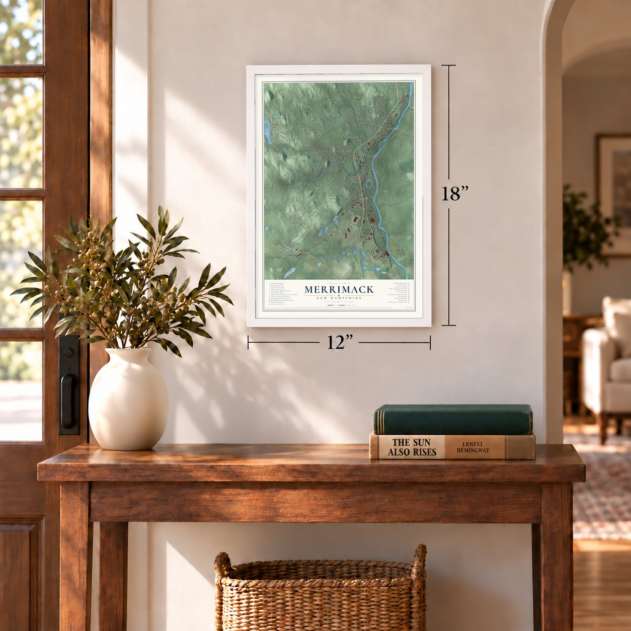
12" x 18" Archival Matte Print
A Map of Home. A Work of Art.
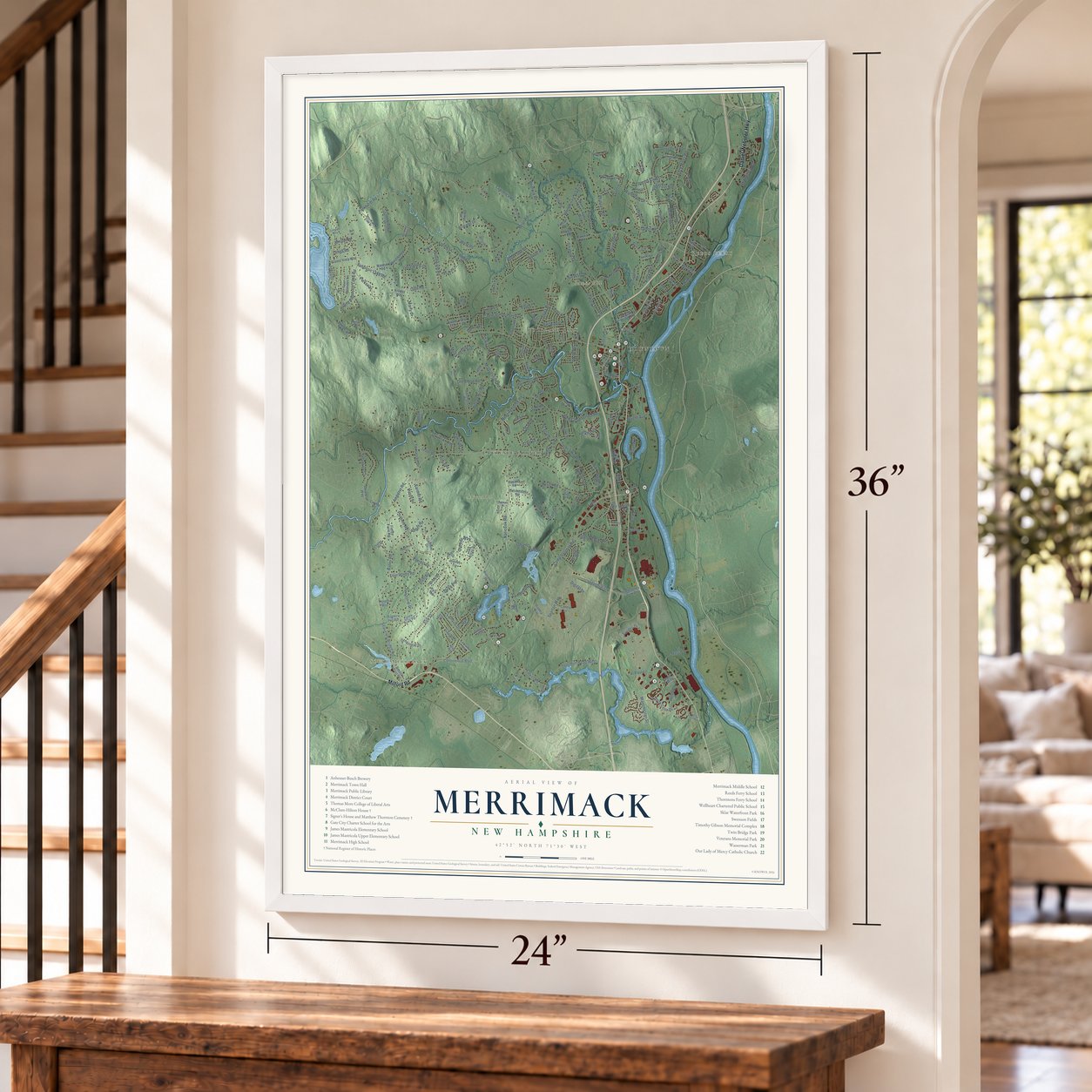
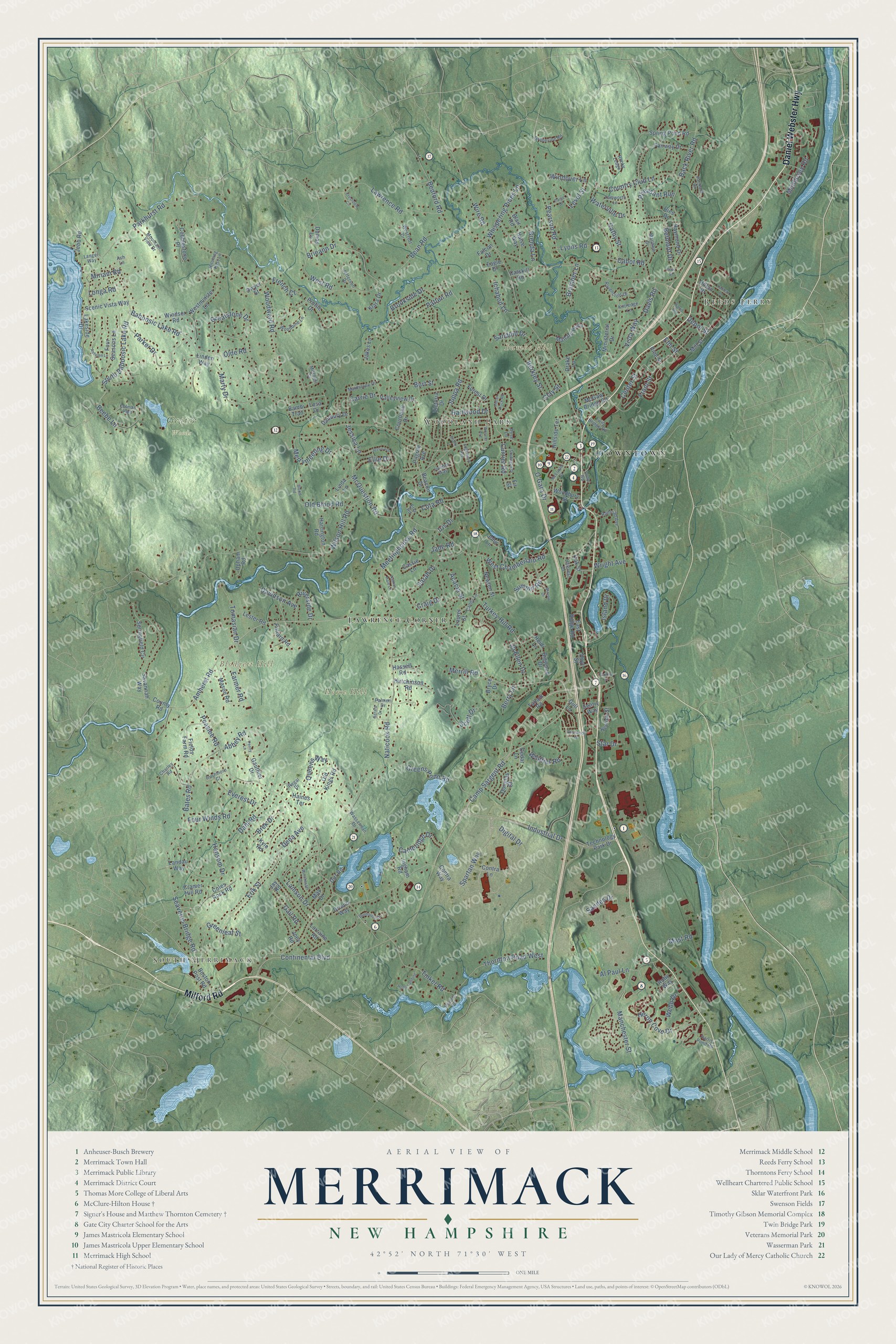
Explore Merrimack, New Hampshire from a whole new perspective. Created using aerial imagery and detailed geographic data, this map captures Merrimack building by building, with labeled streets, familiar landmarks, and shaded topographical relief that highlights the natural contours of the landscape.
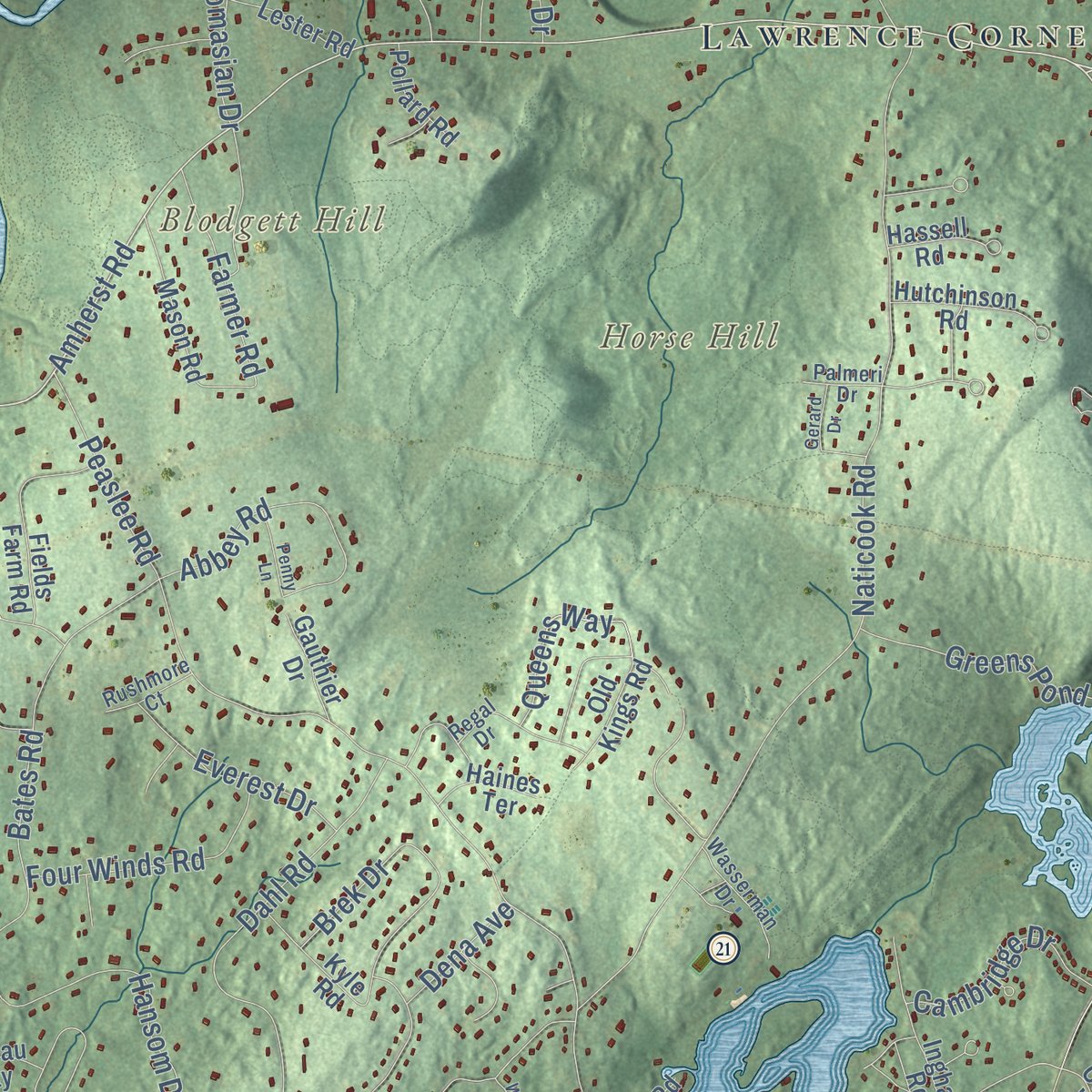
Combining modern data with the timeless character of a vintage atlas, this map is just as interesting up close as it is beautiful on the wall. Whether you grew up in Merrimack, spent memorable years there, or call it home today, this unique map is a great way to celebrate a place that means something to you. Zoom in on the preview to look for your street, and then order a print to put your memories on the wall.
Three ways to hang it
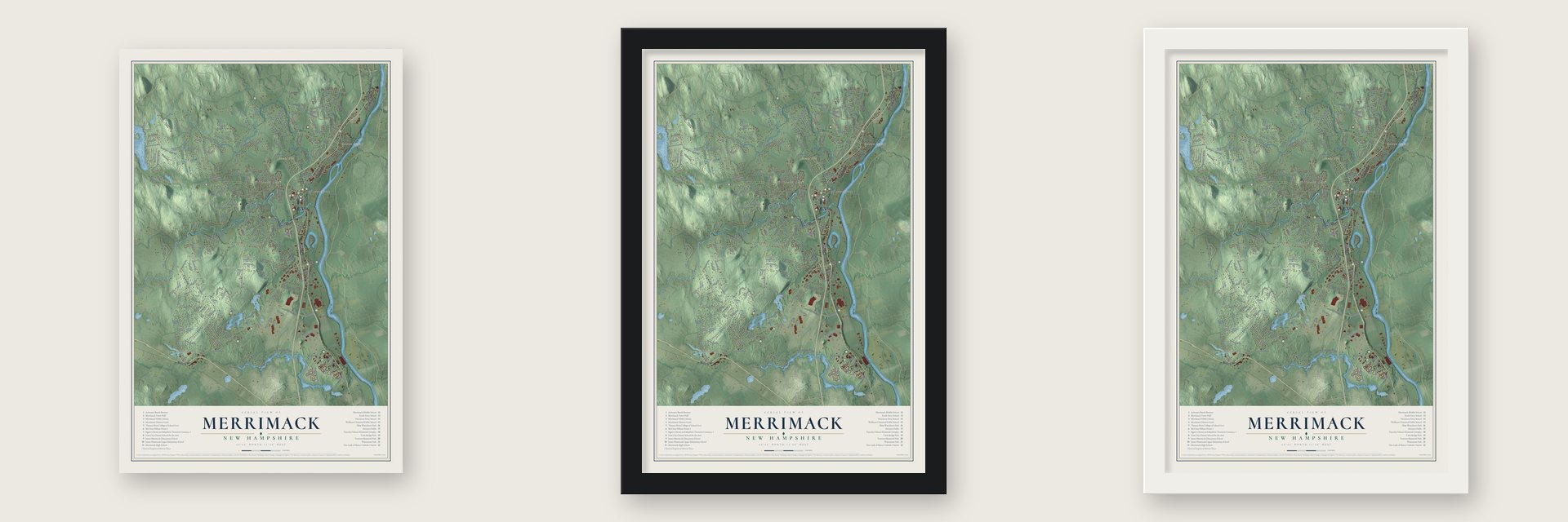
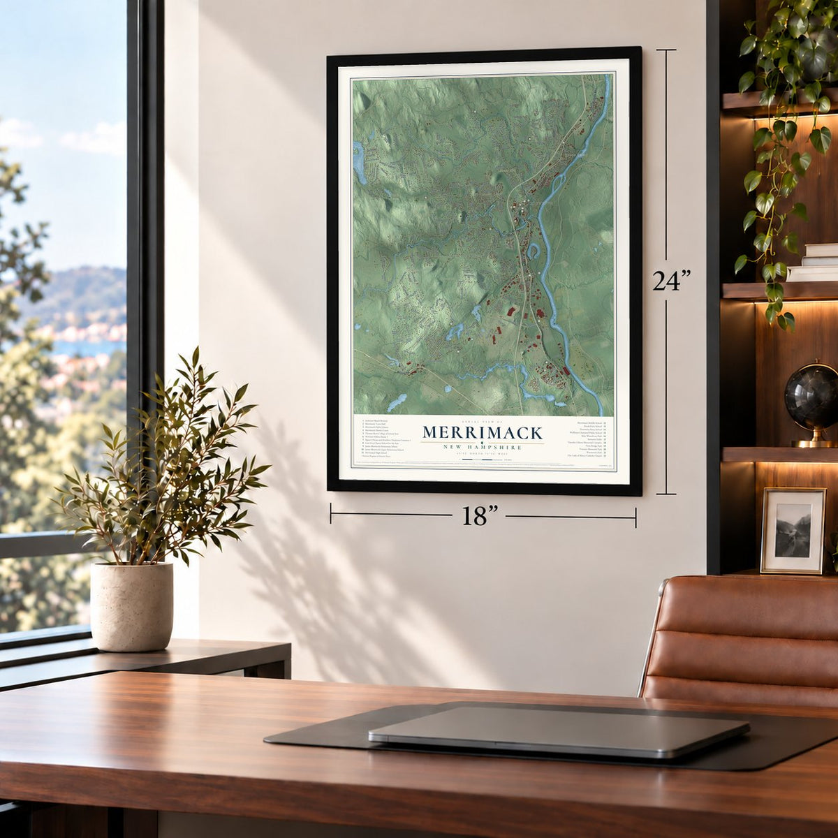
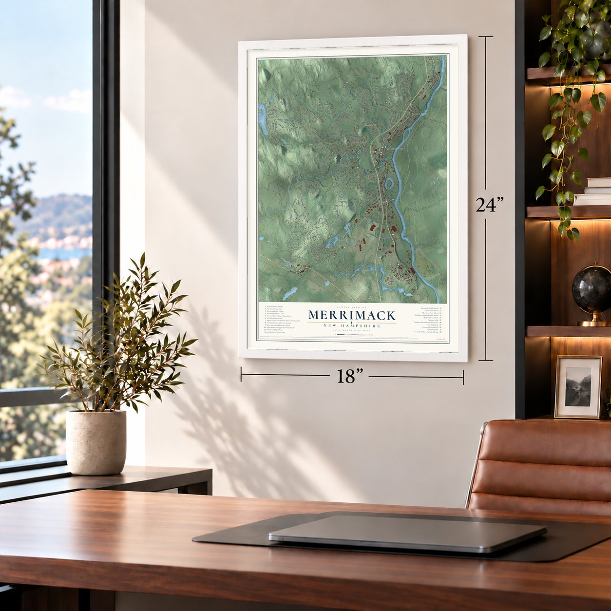
Unframed archival matte, a black wood frame or a white wood frame.
Up close
Geography Worth Displaying
This map was created using accurate cartographic data and authoritative geographic sources, including the U.S. Geological Survey (USGS) and FEMA. The map brings together terrain, waterways, roads, and building detail. The majority of the streets are labeled, houses are accurately depicted, and the topography is derived from government sources. Combining local data with carefully composed color and shading leads to this beautifully detailed Merrimack artwork for your wall.
Rather than simply showing street outlines, we’ve included as many of the street names as we could reasonably fit on the map while keeping their names legible. Zoom in on the high resolution preview to see exactly what’s on the map. We truly set out to create a statement piece for anyone who loves Merrimack. So whether it’s for you, or a gift for someone you love, we hope this map of Merrimack brings back fond memories.
Explore the full map of Merrimack, New Hampshire and read about the local places it shows.

Find your street
Names on the Merrimack map
Every name below is printed on this map. Look for your street, your school, the park where you played, or the pond down the road.
Places and landmarks9
- Downtown
- South Merrimack
- Reeds Ferry
- Woodland Park
- Blodgett Hill
- Bumbo Hill
- Horse Hill
- Grater Woods
- Lawrence Corner
Streets and roads256
- Daniel Webster Highway
- Milford Road
- Continental Boulevard
- Amherst Road
- Camp Sargent Road
- Industrial Drive
- Scott Drive
- Middlesex Road
- Spartan Way
- Baboosic Lake Road
- Naticook Road
- Bedford Road
- Turkey Hill Road
- Wire Road
- Wilson Hill Road
- Bean Road
- Joppa Road
- Peaslee Road
- Back River Road
- Woodward Road
- Patten Road
- Lawrence Road
- Tinker Road
- Hansom Drive
- Pearson Road
- Manchester Street
- Seaverns Bridge Road
- Marty Drive
- Erik Street
- Greatstone Drive
Show all 256 streets
- Front Street
- Belmont Drive
- Bates Road
- Dahl Road
- Parkhurst Road
- McQuestion Road
- Thornton Road West
- Meetinghouse Road
- South Baboosic Lake Road
- Heron Cove Drive
- Cota Road
- Parker Drive
- Greens Pond Road
- Brieann Drive
- Merrymeeting Drive
- Island Drive
- Lamson Drive
- Summit Road
- Davis Road
- West Chamberlain Road
- Country Club Lane
- Brenda Lane
- Brookside Drive
- Brek Drive
- Sandes Drive
- Whittier Road
- Craig Drive
- Berkley Street
- Abbey Road
- Waterville Drive
- Cathy Street
- Sarah Drive
- Greenleaf Street
- Whispering Pines Lane
- Beebe Lane
- Burt Street
- Four Winds Road
- O'Gara Drive
- West Road
- Center Street
- Davidson Avenue
- Cambridge Drive
- Old Blood Road
- Everest Drive
- Tomasian Drive
- Farmer Road
- Pheasant Run
- Gail Road
- Ichabod Lane
- Queens Way
- Cabot Road
- Windover Lane
- Sandhill Drive
- Currier Road
- Level Street
- Iris Drive
- Mast Road
- Depot Street
- Riverside Drive
- Bramber Lane
- Clay Street
- Jessica Lane
- Vista Way
- Jo Ellen Drive
- Ellie Drive
- Hartwood Drive
- French Court
- Star Drive
- Acacia Street
- Miriam Road
- Digital Drive
- Wright Avenue
- Al Paul Lane
- Longa Road
- Olde Road
- Dena Avenue
- Webb Drive
- Merrill Road
- Carrie Drive
- Lyons Road
- Berry Lane
- Jade Road
- Elm Street
- Technology Park Drive
- Mallard Point
- Spring Pond Road
- Springfield Circle
- Fairway Drive
- Cramer Hill Road
- Ministerial Drive
- Contra Way
- Windsor Road
- Old Kings Road
- Profile Drive
- Valleyview Drive
- Four Seasons Lane
- Boston Post Road
- Savannah Way
- Hillside Terrace
- Fields Farm Road
- Cobblestone Place
- Jakes Lane
- Contra Lane
- Hutchinson Road
- Tallant Road
- Scenic Vista Way
- Ingham Road
- McGaw Bridge Road
- Newton Street
- Beacon Drive
- Mason Road
- East Ridge Road
- Joey Road
- Bigwood Drive
- Raymond Drive
- Westminster Lane
- Cedar Lane
- Hilton Drive
- Courtland Drive
- Harrington Road
- Hassell Road
- Forest Drive
- Hoyt Street
- Kyle Road
- Sentry Way
- Coles Rock Road
- Lester Road
- Douglas Street
- Bryce Drive
- County Road
- Danbury Drive
- Woodbury Street
- Lesa Drive
- Dwyer Street
- Herrick Street
- Pilgrim Avenue
- Linda Lane
- Pollard Road
- Haise Way
- Victoria Drive
- Gauthier Drive
- Blair Road
- Upham Road
- Klara Drive
- Mill Street
- Catskill Road
- Landau Way
- May Drive
- Haines Terrace
- Dumas Lane
- Lakeside Drive
- Laurel Street
- Lorraine Road
- Jebb Road
- Bambi Trail
- Falcon Drive
- Linden Way
- Cassie Lane
- Drake Lane
- Ruby Way
- Pine Street
- Drouin Way
- Dirt Road
- Ries Drive
- Eagle Drive
- Heidi Lane
- Oak Street
- John Lane
- Fir Street
- Gull Lane
- Jay Road
- Loop Road
- Maidstone Drive
- Mitchell Street
- Harris Pond Road
- Railroad Avenue
- Charles Road
- Woodbine Lane
- Kittredge Lane
- Regal Drive
- Westcott Drive
- Mountain View Drive
- Ravencroft Drive
- Grapevine Road
- Colman Path
- Jefferson Drive
- Wasserman Drive
- Packard Drive
- Tamworth Lane
- Hitching Post Lane
- Twin Bridge Road
- Rushmore Court
- Candy Lane
- Hillcrest Drive
- Langer Way
- Matthew Drive
- Juniper Way
- Palmeri Drive
- Ash Lane
- Rose Lane
- Rocky Ledge
- Erla Road
- Indian Rock Road
- Souhegan Drive
- Jessica Drive
- McElwain Street
- Briarwood Drive
- Autumn Lane
- Dunbarton Drive
- Holts Landing
- Paige Drive
- Winchester Drive
- Winrow Drive
- Lantern Lane
- Nathan Hale Lane
- Harris Avenue
- Crestview Circle
- Penny Lane
- Edgewood Avenue
- Thornton Road
- Gerard Drive
- Griffin Street
- Worster Avenue
- Blood Road
- Shady Lane
- Bow Street
Names are listed as they appear on the printed map. Zoom into the product photos to find them.
About Merrimack, New Hampshire
Merrimack is a town of 26,632 people in Hillsborough County, on the Merrimack River between Manchester and Nashua. The town and the river share a name that comes from a Native word for sturgeon, a fish the Pennacook people once found here in huge numbers. In 1662 the Pennacook sachem Passaconaway petitioned the General Court of Massachusetts for land, and that autumn the court gave his people a strip of land a mile and a half across on each bank of the river.
The ground later became part of the 1673 Dunstable grant, and on June 25, 1734, Massachusetts organized it as Naticook, together with land that became Litchfield. When the provincial boundary was redrawn in 1746, New Hampshire took the area back, and on April 2, 1746, Governor Benning Wentworth chartered the Town of Merrymac, reaching from Pennichuck Brook to the Souhegan River. Fewer than 50 families lived there. On June 5, 1750, the town added 3 miles of land north of the Souhegan, known as Souhegan East.
- A signer of the DeclarationMatthew Thornton practiced medicine in Londonderry, led the provincial congress and served as speaker of the state house. Arriving in Philadelphia in November 1776, he signed the Declaration months after the July signing. In 1780 he settled in Merrimack, farming while his family ran a river ferry. He later sat in the state House for the town and in the state Senate for Hillsborough County. He died in 1803, and the village of Thorntons Ferry carries his name.
- The Signer's HouseThornton owned this two-story Georgian double house starting in 1780 and sold it to his son James in 1797, though old papers suggest another son, Matthew Jr., built it. No other house from its era survives in Merrimack. Thornton is buried in the cemetery on the other side of the Daniel Webster Highway, which holds a 1742 gravestone, the oldest in town. The Signer's House and Matthew Thornton Cemetery entered the National Register together in 1978.
- A house from about 1740William McClure bought his first land here in 1741, and the style of his house on Tinker Road points to about 1740, though family stories claim 1722. His descendants kept the place until 1942. Stencils painted in the hall are thought to be the work of Moses Eaton Sr. or Moses Eaton Jr., and an old barn still stands across the road. The McClure-Hilton House joined the National Register in 1989.
- Reeds Ferry station, 1842 to 1967William Reed ran a ferry across the Merrimack from a landing where Depot Street now meets the river, and the northern part of town took his name. The Boston and Maine later ran its tracks through Merrimack, and the Reeds Ferry station served riders from 1842 to 1967. Once cars arrived, the old farming town became a bedroom community for Boston and nearby cities. The station site is now a boat ramp.
- Clydesdales since 1970Anheuser-Busch opened a brewery in Merrimack in 1970, the company's easternmost plant. Visitors can take a brewery tour and see one of the five stables that house the Budweiser Clydesdales.
Keep exploring New Hampshire
Merrimack is one of 264 New Hampshire towns we've mapped. Every dot on the map is a print of its own.
The search covers every state, New Hampshire first.
Near Merrimack
Order 2 or more town maps and save 10%. Shown in the size and finish you picked above, so they hang as a set.
- East Merrimack 12" x 18" / Archival Matte Print $39.99
- Litchfield 12" x 18" / Archival Matte Print $39.99
- Amherst 12" x 18" / Archival Matte Print $39.99


More maps nearby: Bedford, Londonderry, Nashua, North Londonderry and Hollis.
The art of mapping a place
How This Map Was Made
Real places. Remarkable detail. Discover the layers that turn geographic data into a map of home.

The view from above
Aerial imagery reveals the character of the land: woodland, open fields, and the patterns of a place.

The shape of the land
Elevation data brings hills, valleys, and subtle changes in the landscape into view.

The details of home
Roads, waterways, and building footprints come together to make the map feel unmistakably local.

Geography becomes art
Considered color, shading, and typography bring the layers together in a map made for your wall.


Process illustrated with Mendon, Massachusetts. Aerial imagery: USDA NAIP. Terrain: USGS 3D Elevation Program. Map details and finished artwork: KNOWOL.
The Details
About This Print
Choose an archival matte print, or a black or white Ayous wood frame. The archival matte print is unframed.
Select your size and finish above to see the matching product image and price.
Materials & Craftsmanship
A contemporary map with the character of a classic atlas, printed on archival matte paper. Optional frames are made from Ayous wood.
Your printed map does not include the watermark shown in the full-map preview.
Shipping & Delivery
Free shipping within the United States. Every print is made to order in the USA.
Buying a gift? Add a note in your cart and we'll include it. We never put prices in the package.
Prints ship within 2 to 3 business days. Allow 7 to 10 days total from ordering for delivery. Timing may vary during holidays or periods of high order volume.
Read our shipping policy.
Returns and damaged prints
Each print is made to order. Change-of-mind refunds are not available after production.
If your print arrives damaged, misprinted or incorrect, contact support@knowol.com within 30 days of receiving it. Include your order number, photos and a description of the issue.
Read our full refund and replacement policy. For questions about your order, email support@knowol.com.