
Search for another town



Free U.S. delivery 7 to 10 days after you order
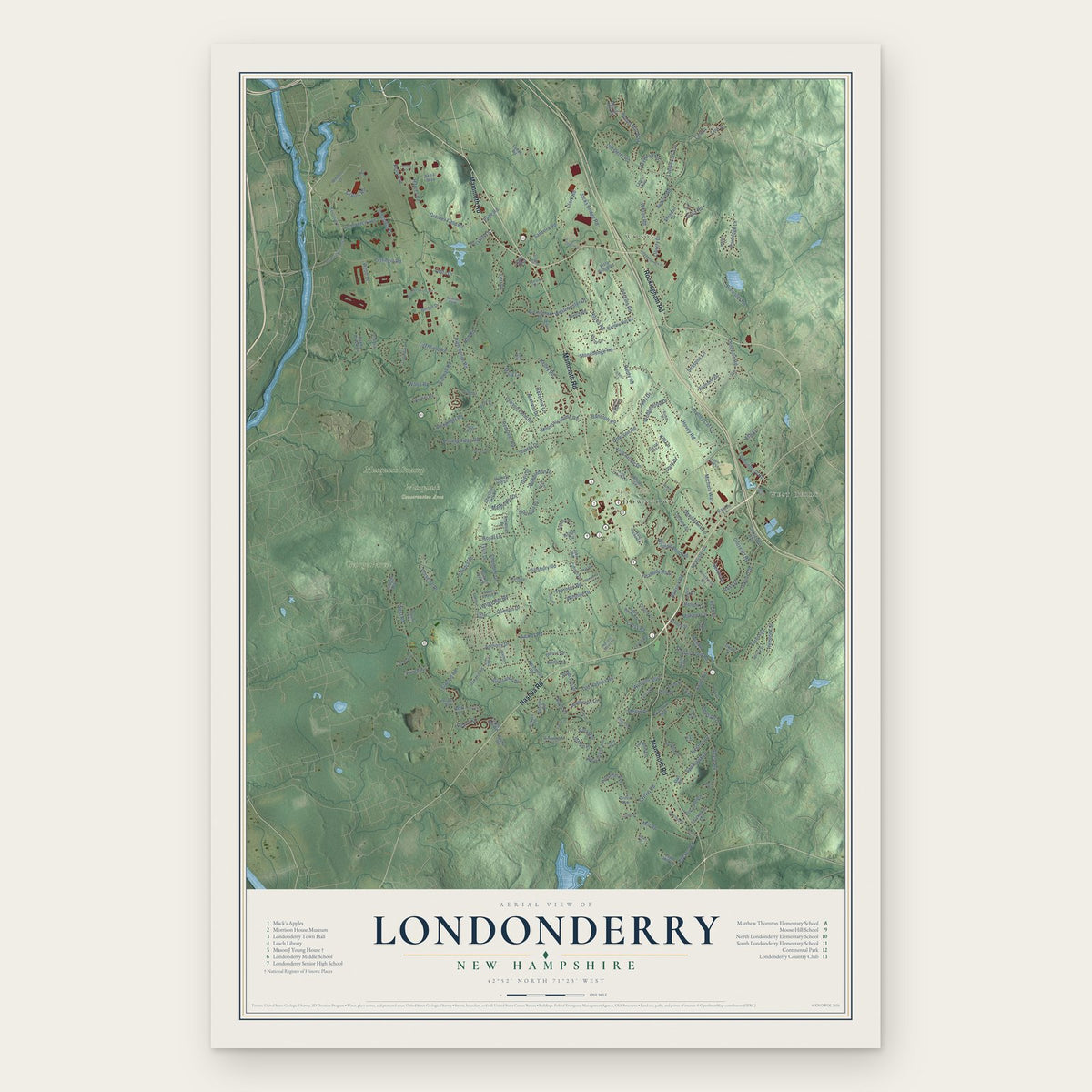
Londonderry, New Hampshire Map Art
Building by building, with labeled streets and shaded relief.
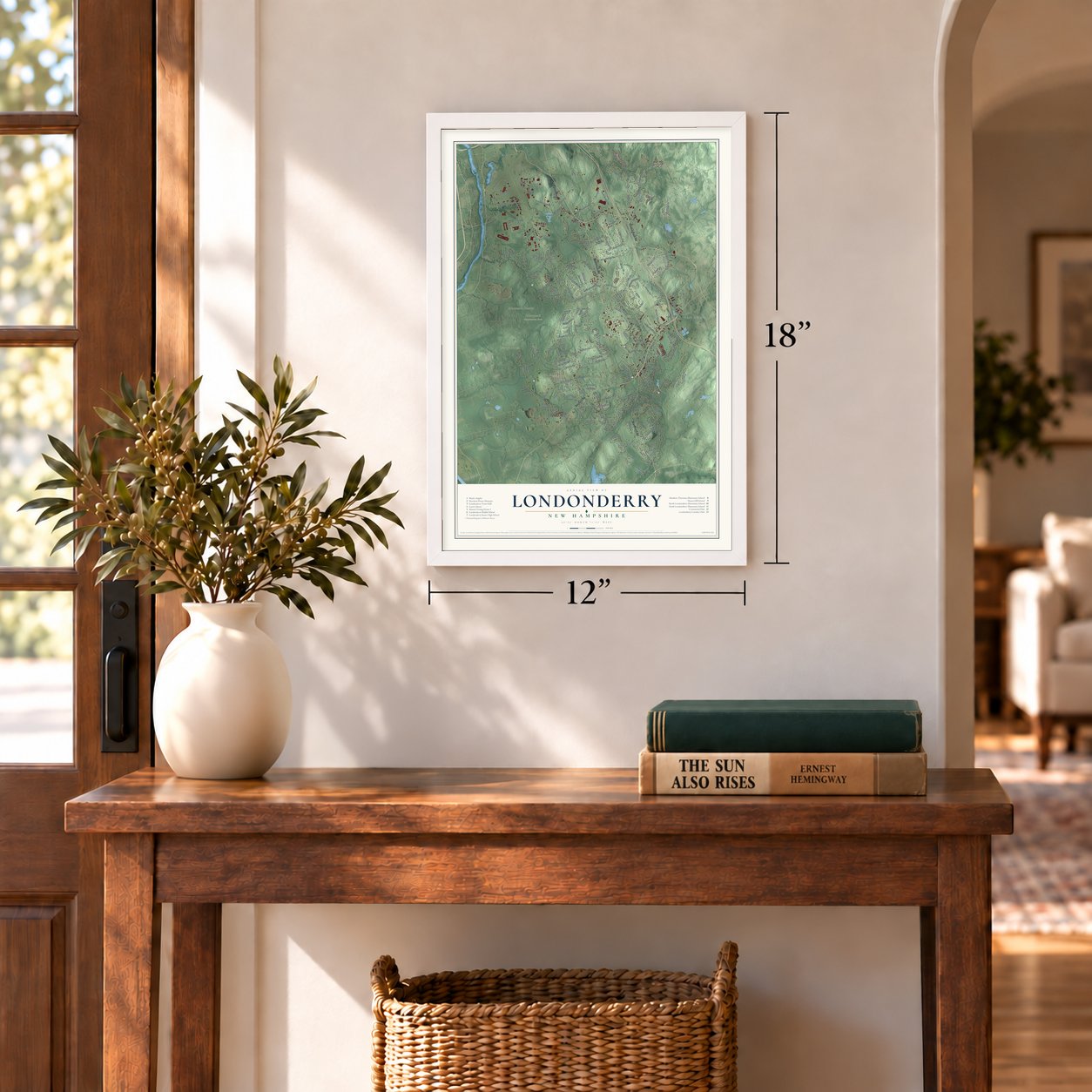
12" x 18" Archival Matte Print
A Map of Home. A Work of Art.
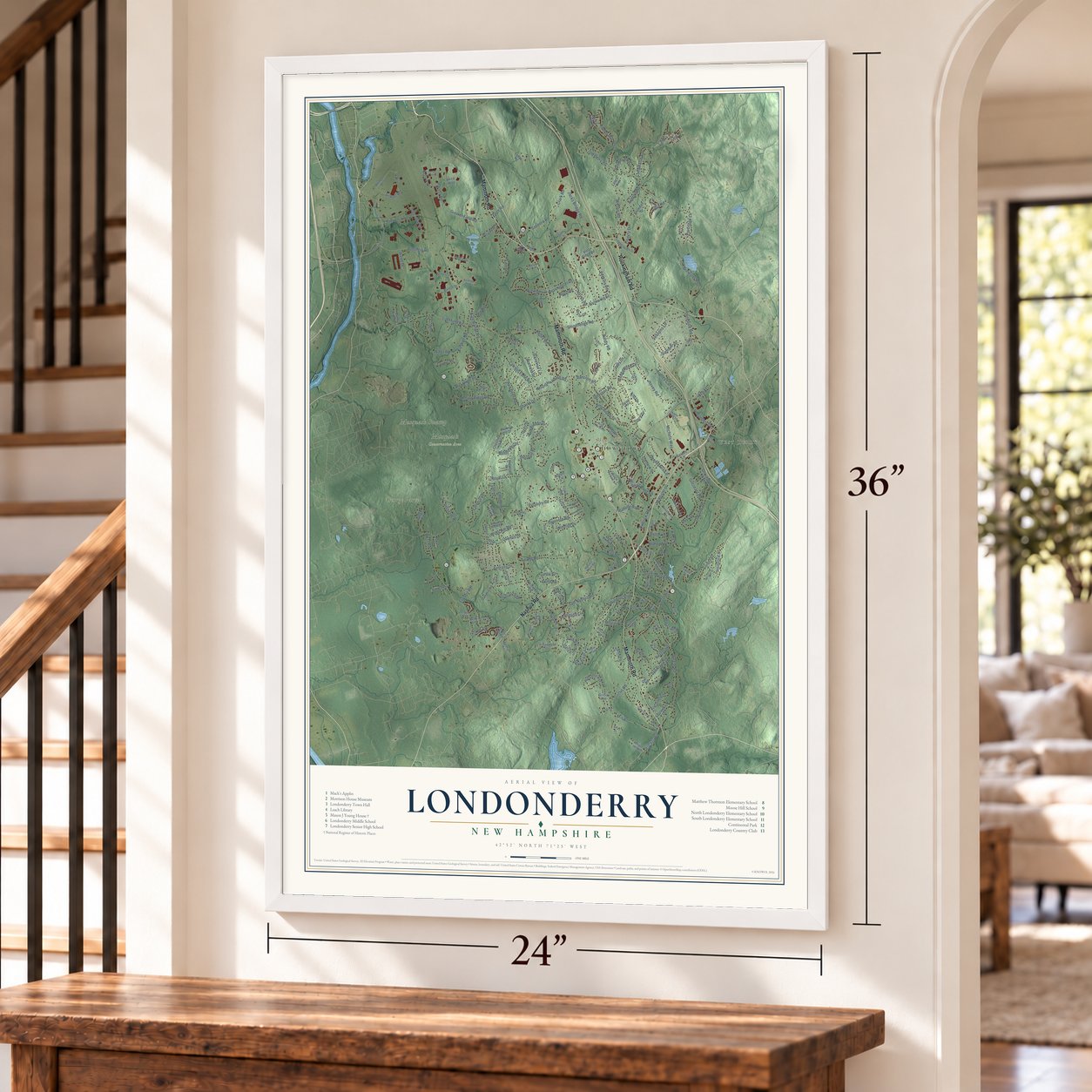
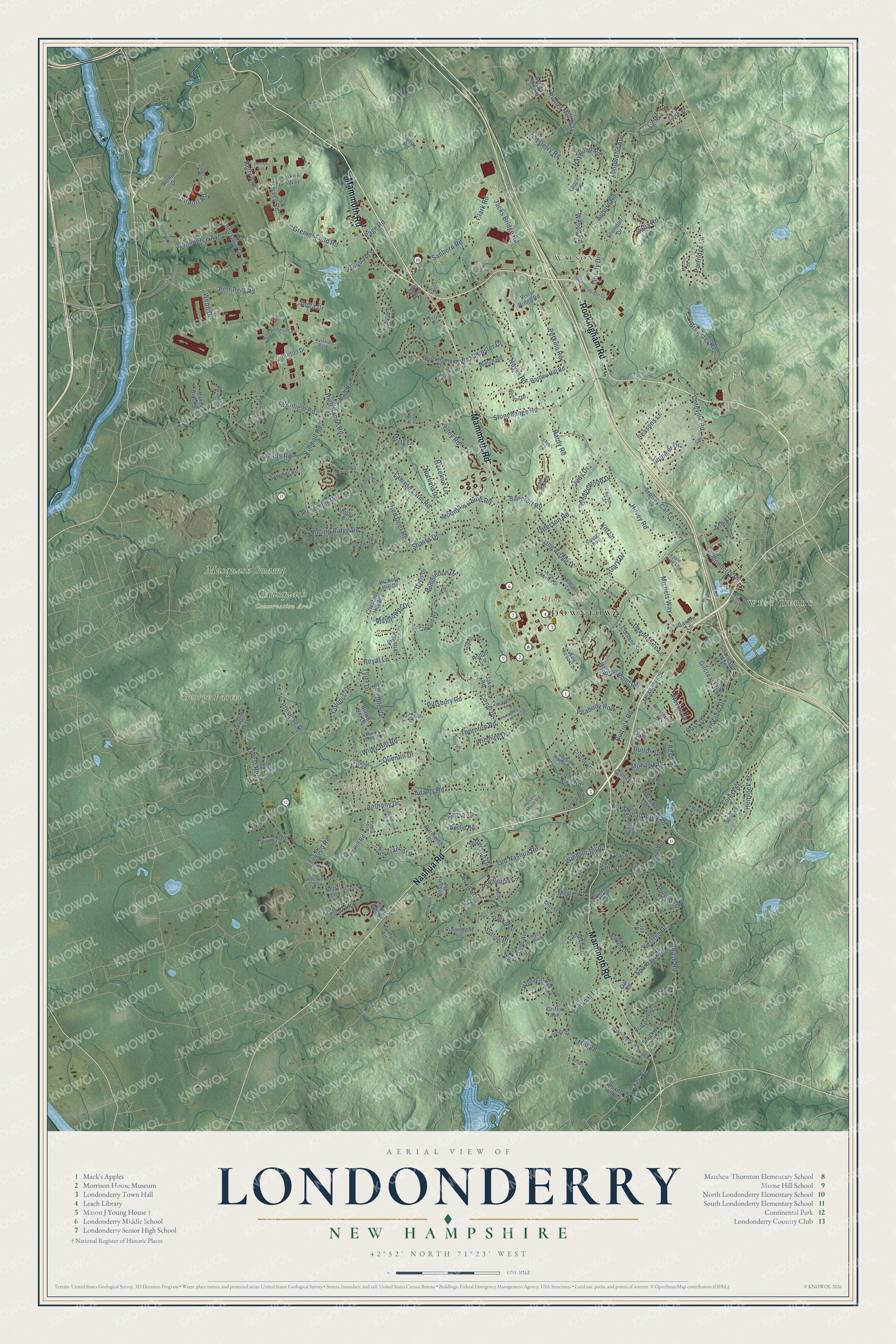
Explore Londonderry, New Hampshire from a whole new perspective. Created using aerial imagery and detailed geographic data, this map captures Londonderry building by building, with labeled streets, familiar landmarks, and shaded topographical relief that highlights the natural contours of the landscape.
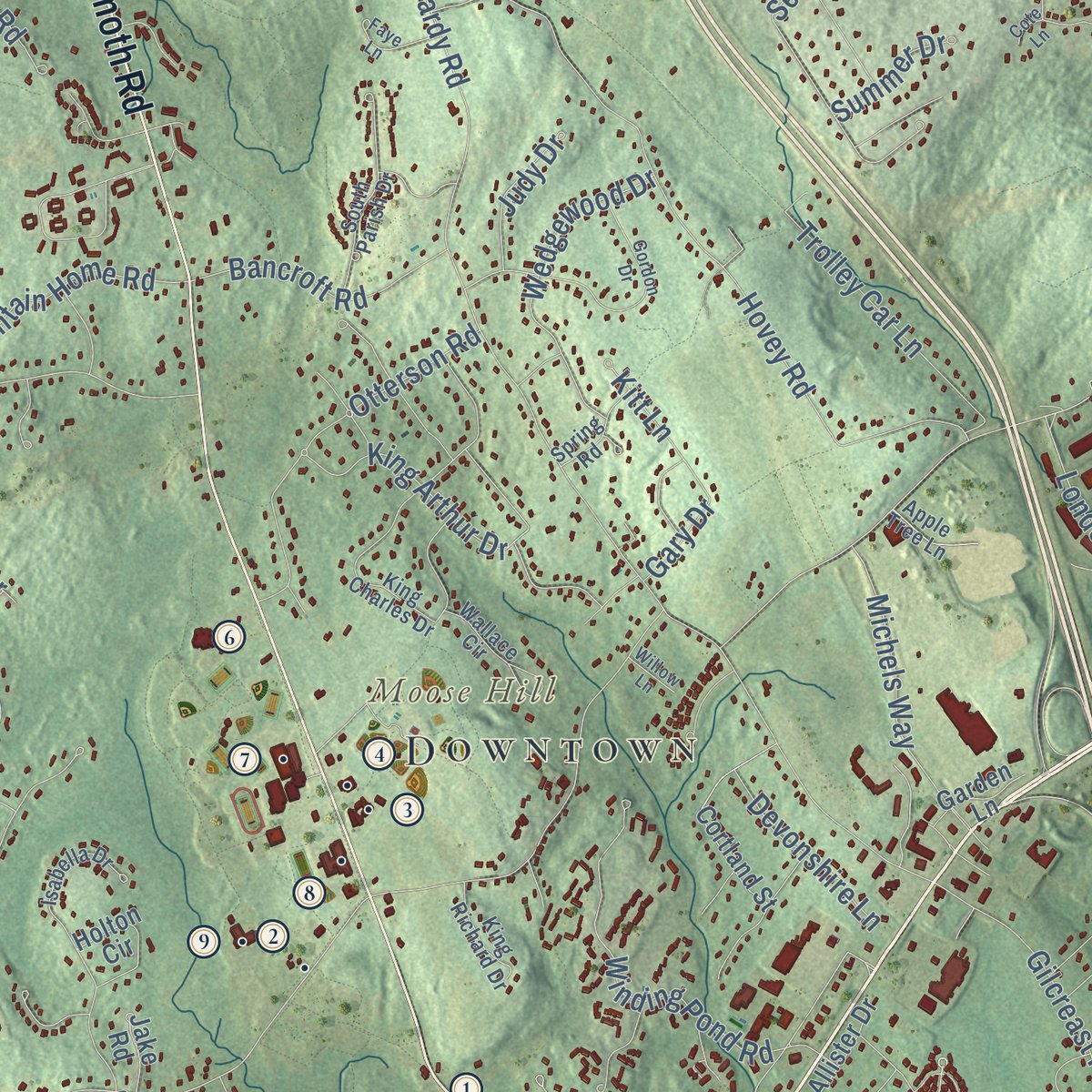
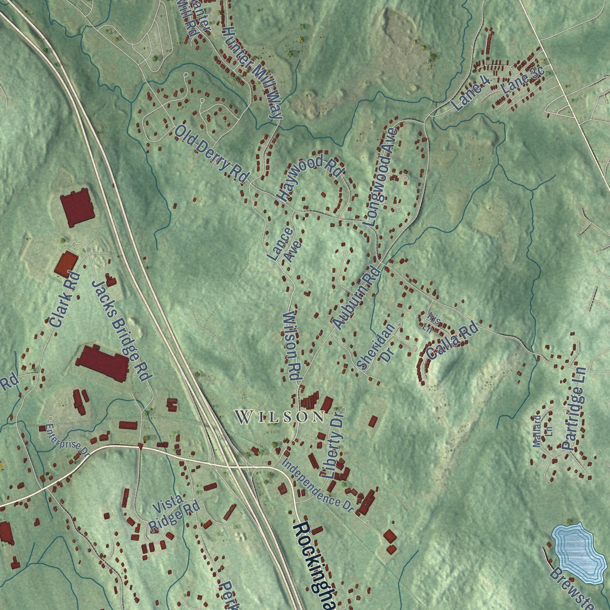
Combining modern data with the timeless character of a vintage atlas, this map is just as interesting up close as it is beautiful on the wall. Whether you grew up in Londonderry, spent memorable years there, or call it home today, this unique map is a great way to celebrate a place that means something to you. Zoom in on the preview to look for your street, and then order a print to put your memories on the wall.
Three ways to hang it
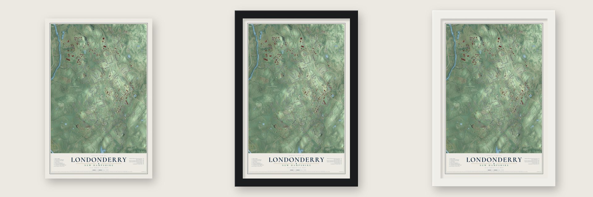
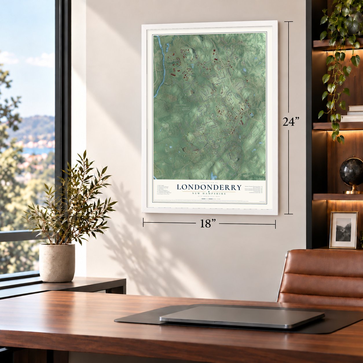
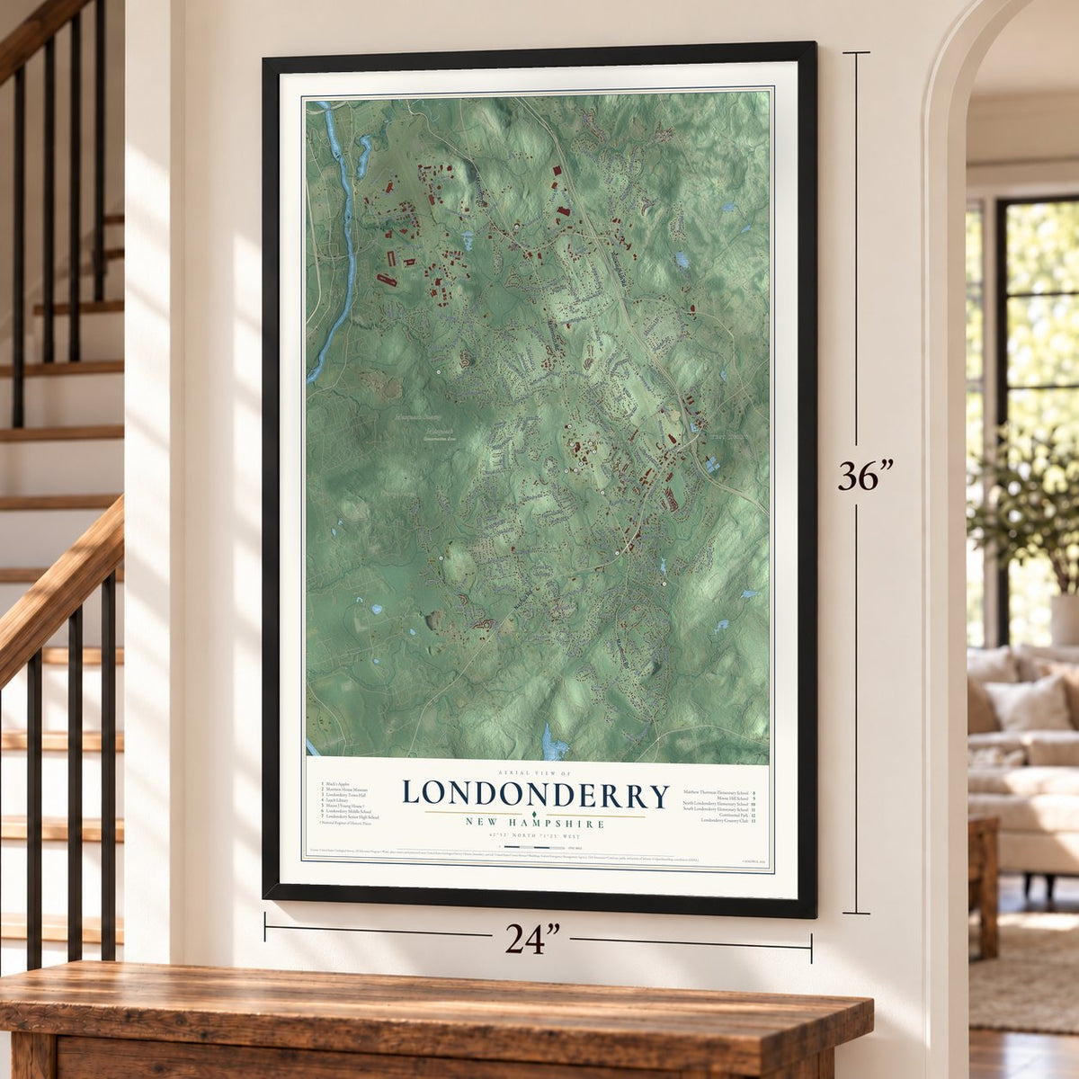
Unframed archival matte, a black wood frame or a white wood frame.
Up close
Geography Worth Displaying
This map was created using accurate cartographic data and authoritative geographic sources, including the U.S. Geological Survey (USGS) and FEMA. The map brings together terrain, waterways, roads, and building detail. The majority of the streets are labeled, houses are accurately depicted, and the topography is derived from government sources. Combining local data with carefully composed color and shading leads to this beautifully detailed Londonderry artwork for your wall.
Rather than simply showing street outlines, we’ve included as many of the street names as we could reasonably fit on the map while keeping their names legible. Zoom in on the high resolution preview to see exactly what’s on the map. We truly set out to create a statement piece for anyone who loves Londonderry. So whether it’s for you, or a gift for someone you love, we hope this map of Londonderry brings back fond memories.
Explore the full map of Londonderry, New Hampshire and read about the local places it shows.
Find your street
Names on the Londonderry map
Every name below is printed on this map. Look for your street, your school, the park where you played, or the pond down the road.
Places and landmarks10
- Downtown
- Wilson
- West Derry
- Moose Hill
- Wiley Hill
- Musquash Swamp
- George Parcel
- Musquash Conservation Area
- Aviation Park
- Hyde Park
Streets and roads235
- Nashua Road
- Mammoth Road
- Rockingham Road
- Cross Road
- Kendall Pond Road
- Ash Street
- Wiley Hill Road
- Kelly Avenue
- High Range Road
- Pillsbury Road
- Litchfield Road
- South Road
- Harvey Road
- Auburn Road
- Old Derry Road
- West Road
- Gilcreast Road
- Hardy Road
- Chase Road
- Adams Road
- Hovey Road
- Old Nashua Road
- Hall Road
- Stonehenge Road
- Seasons Lane
- Wilson Road
- Elwood Road
- Page Road
- Shasta Drive
- Alexander Road
Show all 235 streets
- Perkins Road
- Lawson Farm Road
- Anthony Drive
- Airport Road
- Clark Road
- Griffin Road
- Winding Pond Road
- Noyes Road
- Pettingill Road
- Tokanel Drive
- Windsor Boulevard
- Kimball Road
- Hunter Mill Way
- Otterson Road
- Grenier Field Road
- Holstein Avenue
- Industrial Drive
- Merlin Place
- Jacks Bridge Road
- Forest Street
- Buttrick Road
- Wilshire Drive
- Pendleton Lane
- Royal Lane
- Sparhawk Drive
- Trolley Car Lane
- Sanborn Road
- Rolling Ridge Road
- Mill Road
- Boyd Road
- Wedgewood Drive
- Colonial Drive
- Michels Way
- Pleasant Drive
- Reed Street
- Bockes Road
- Chandler Drive
- Coteville Road
- Mountain Home Road
- Commerce Avenue
- Red Deer Road
- Mohawk Drive
- Bancroft Road
- Londonderry Road
- Severance Drive
- Ross Drive
- King Arthur Drive
- Brewster Road
- Jefferson Drive
- Delta Drive
- Preserve Drive
- Lantern Lane
- Longwood Avenue
- Haywood Road
- Pine Street
- Lane 4
- Thornton Road
- Wimbledon Drive
- Peabody Row
- Liberty Drive
- Partridge Lane
- Quentin Drive
- Westminster Drive
- Mayflower Drive
- Hazelnut Lane
- Nutfield Drive
- Devonshire Lane
- Hemlock Street
- Kestree Drive
- Kitt Lane
- Sutton Place
- Webb Drive
- Lori Lane
- Judy Drive
- Summer Drive
- Tyler Drive
- Watts Road
- Nevins Drive
- Quarry Road
- Calla Road
- Park Avenue
- Kelley Road
- Misty Lane
- Button Drive
- Gary Drive
- Crosby Lane
- White Plains Avenue
- Buckingham Drive
- Bartley Hill Road
- Sherwood Road
- Manter Mill Road
- Tanager Way
- Holton Circle
- Parmenter Road
- Justin Circle
- Bunker Hill Drive
- Vista Ridge Road
- Moulton Drive
- Cortland Street
- Charleston Avenue
- Ammon Drive
- Currier Drive
- Welch Road
- McAllister Drive
- Ridgemont Drive
- Overlook Avenue
- Davis Drive
- Buckthorn Street
- Robin Hood Drive
- Grove Street
- Chestnut Hill Drive
- Quincy Road
- Dianna Road
- Meadow Drive
- Loop Street
- Sandy Brook Lane
- Jay Drive
- Faucher Road
- Rossini Road
- Elijah Hill Lane
- Sheridan Drive
- Young Road
- Southwood Drive
- Dan Hill Road
- Akira Way
- Granite Street
- Griffin Avenue
- Apollo Road
- Garden Lane
- Avery Road
- Imperial Drive
- Burton Drive
- Lance Avenue
- Tavern Hill Road
- Jake Road
- Hickory Hill Drive
- Golen Drive
- Lucas Road
- Eglin Boulevard
- Betty Lane
- Owl Road
- Fir Street
- South Parish Drive
- Burbank Road
- Independence Drive
- King Charles Drive
- Isabella Drive
- Wallace Circle
- Apple Blossom Drive
- Spring Road
- Constitution Drive
- Woodside Drive
- Victoria Drive
- Oakridge Drive
- Executive Drive
- Cheshire Court
- Morway Drive
- Harvest Moon Road
- Spruce Street
- Stokes Road
- Recovery Way
- King Richard Drive
- Estey Drive
- Carousel Court
- Beech Hill Drive
- Rabbit Run
- Apple Tree Lane
- Noonan Drive
- Jersey Street
- Mount Vernon Drive
- Berland Road
- Brian Drive
- Paula Avenue
- Leelynn Circle
- Lane Way
- Angelo Lane
- Raymond Wieczorek Drive
- Gordon Drive
- North Wentworth Avenue
- Priscilla Lane
- Bayberry Lane
- Pine Hollow Drive
- Brookview Drive
- East Yellowstone Drive
- Mallard Lane
- Enterprise Drive
- Hawthorne Road
- Columbia Drive
- Sunrise Drive
- Coleman Place
- Abby Road
- Berkshire Lane
- Hampshire Lane
- George Avenue
- Action Boulevard
- Abington Drive
- Faye Lane
- Everts Street
- Edward Circle
- Harmony Drive
- Iris Lane
- Birch Wood Drive
- Willow Lane
- Green Drive
- Cote Lane
Names are listed as they appear on the printed map. Zoom into the product photos to find them.
About Londonderry, New Hampshire
Londonderry is a New Hampshire community in western Rockingham County, where the 2020 census counted 25,826 residents. The town extends across 42.1 square miles.
- 25,826 residentsCounted in the 2020 census.
- Rockingham CountyLondonderry is one of the New Hampshire communities located in western Rockingham County.
- 42.1 square milesThe Census Bureau gives this as Londonderry's total area.
- Incorporated in 1741The town was incorporated in 1741.
Keep exploring New Hampshire
Londonderry is one of 271 New Hampshire towns we've mapped. Every dot on the map is a print of its own.
The search covers every state, New Hampshire first.
Near Londonderry
Order 2 or more town maps and save 10%. Shown in the size and finish you picked above, so they hang as a set.
- North Londonderry 12" x 18" / Archival Matte Print $39.99
- Litchfield 12" x 18" / Archival Matte Print $39.99
- East Merrimack 12" x 18" / Archival Matte Print $39.99


More maps nearby: Derry, Windham, Merrimack, Manchester and Auburn.
The art of mapping a place
How This Map Was Made
Real places. Remarkable detail. Discover the layers that turn geographic data into a map of home.

The view from above
Aerial imagery reveals the character of the land: woodland, open fields, and the patterns of a place.

The shape of the land
Elevation data brings hills, valleys, and subtle changes in the landscape into view.

The details of home
Roads, waterways, and building footprints come together to make the map feel unmistakably local.

Geography becomes art
Considered color, shading, and typography bring the layers together in a map made for your wall.


Process illustrated with Mendon, Massachusetts. Aerial imagery: USDA NAIP. Terrain: USGS 3D Elevation Program. Map details and finished artwork: KNOWOL.
The Details
About This Print
Choose an archival matte print, or a black or white Ayous wood frame. The archival matte print is unframed.
Select your size and finish above to see the matching product image and price.
Materials & Craftsmanship
A contemporary map with the character of a classic atlas, printed on archival matte paper. Optional frames are made from Ayous wood.
Your printed map does not include the watermark shown in the full-map preview.
Shipping & Delivery
Free shipping within the United States. Every print is made to order in the USA.
Buying a gift? Add a note in your cart and we'll include it. We never put prices in the package.
Prints ship within 2 to 3 business days. Allow 7 to 10 days total from ordering for delivery. Timing may vary during holidays or periods of high order volume.
Read our shipping policy.
Returns and damaged prints
Each print is made to order. Change-of-mind refunds are not available after production.
If your print arrives damaged, misprinted or incorrect, contact support@knowol.com within 30 days of receiving it. Include your order number, photos and a description of the issue.
Read our full refund and replacement policy. For questions about your order, email support@knowol.com.