
Search for another town



Free U.S. delivery 7 to 10 days after you order
Manchester, New Hampshire Map Art
Building by building, with labeled streets and shaded relief.
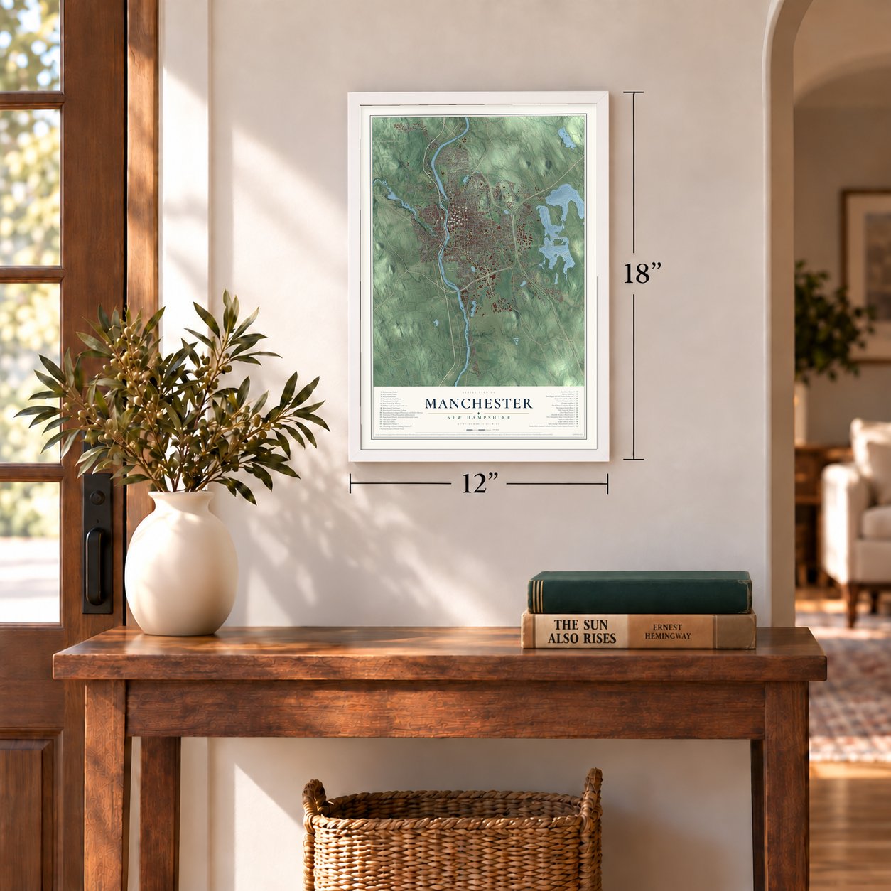
12" x 18" Archival Matte Print
A Map of Home. A Work of Art.
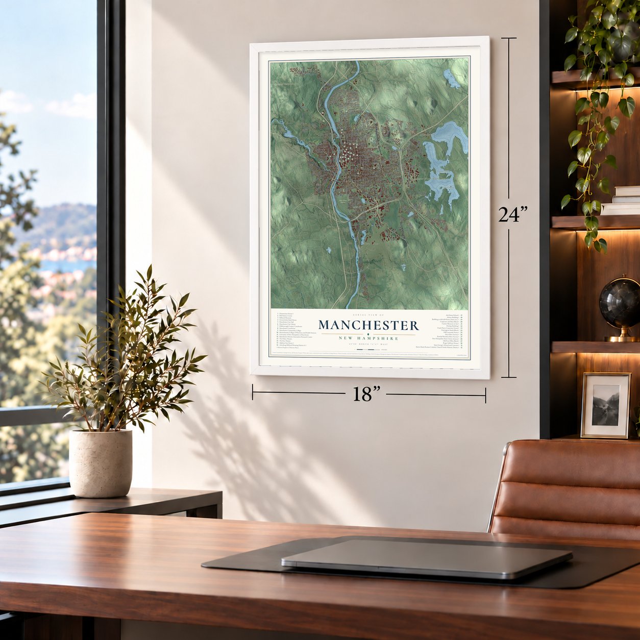
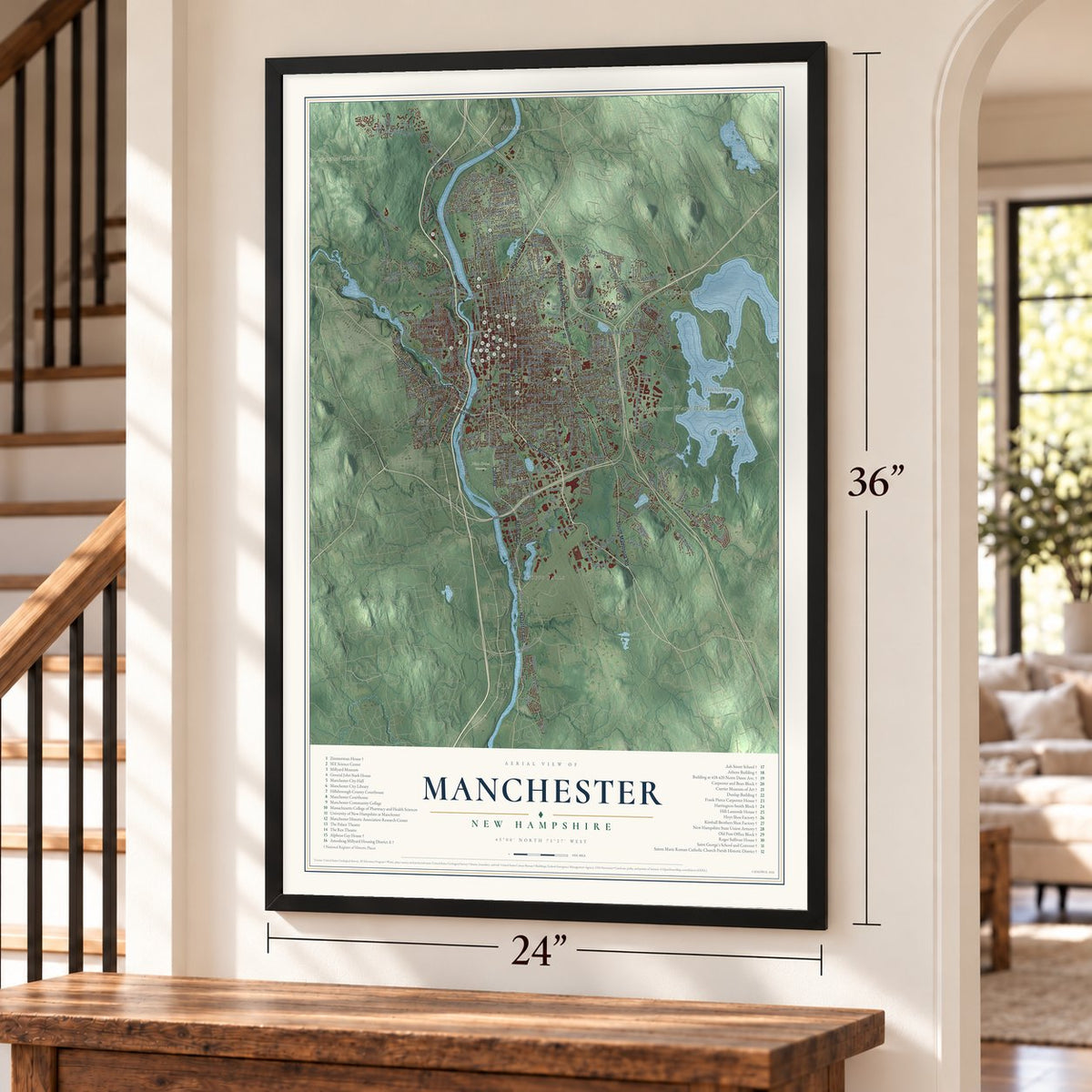
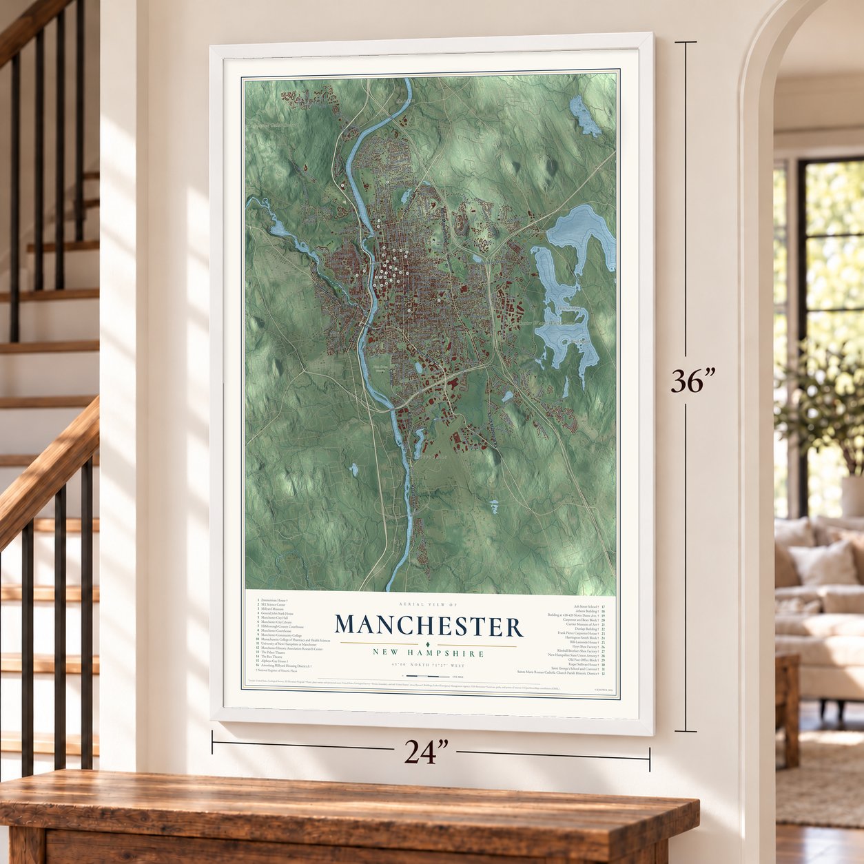
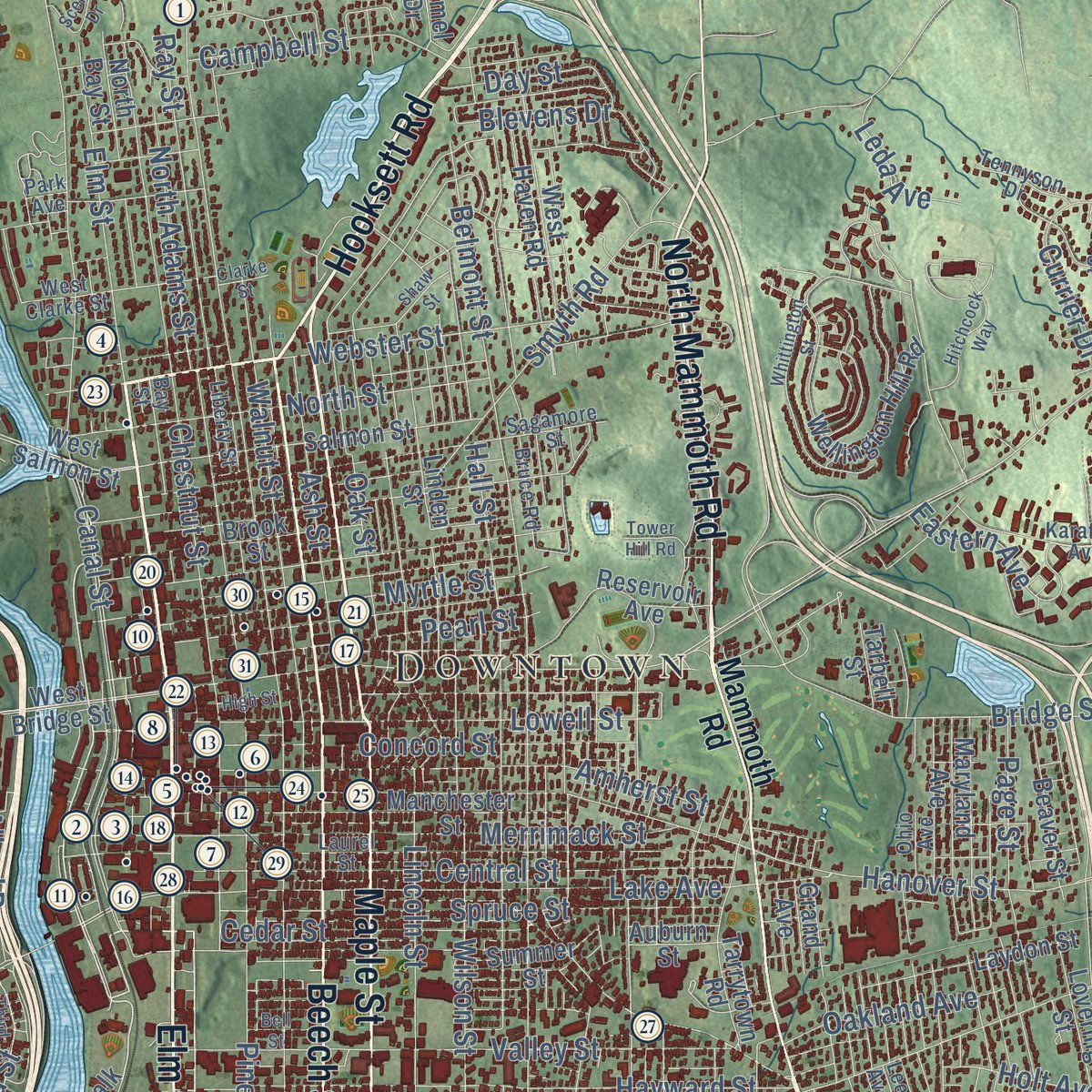
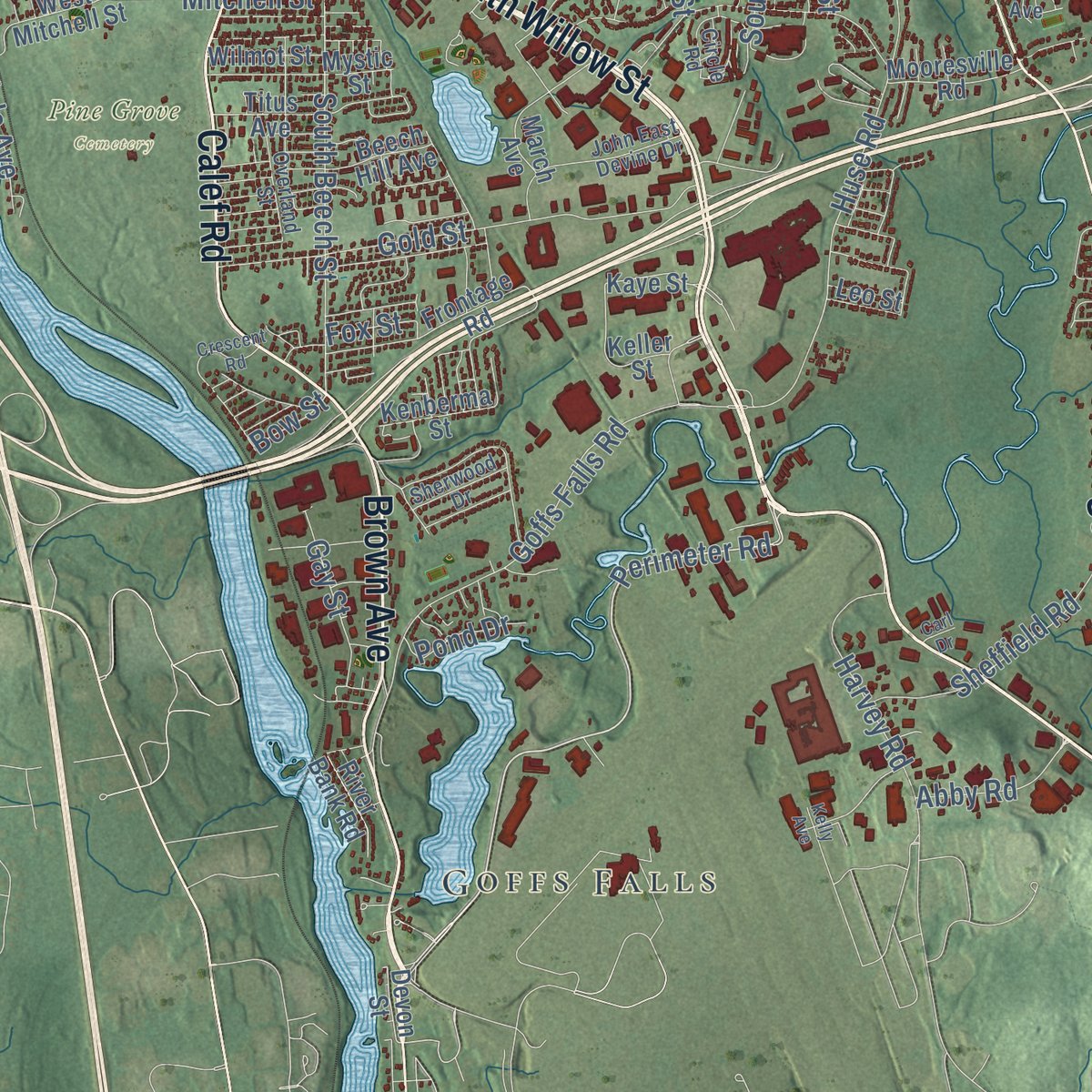
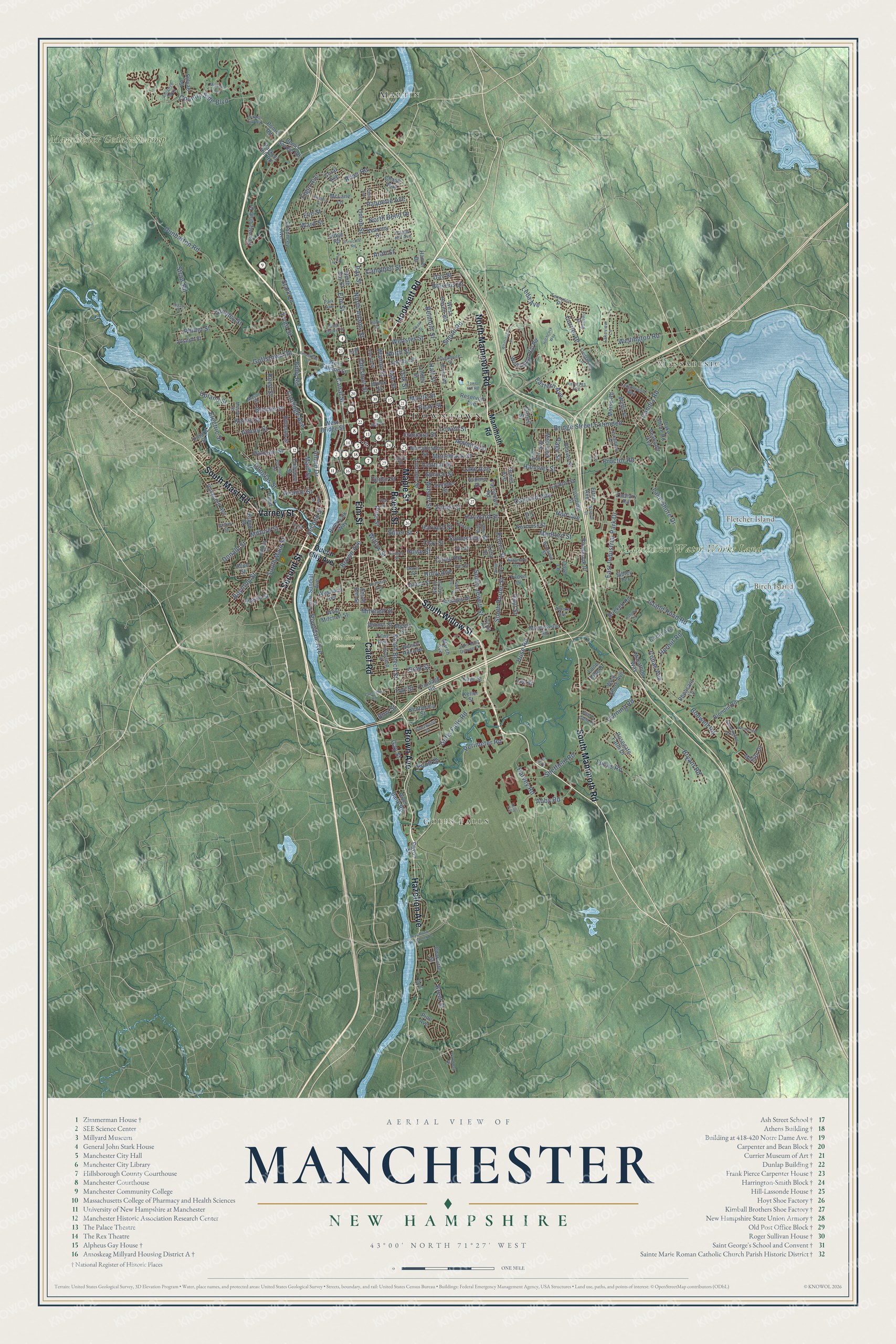
Explore Manchester, New Hampshire from a whole new perspective. Created using aerial imagery and detailed geographic data, this map captures Manchester building by building, with labeled streets, familiar landmarks, and shaded topographical relief that highlights the natural contours of the landscape.
Combining modern data with the timeless character of a vintage atlas, this map is just as interesting up close as it is beautiful on the wall. Whether you grew up in Manchester, spent memorable years there, or call it home today, this unique map is a great way to celebrate a place that means something to you. Zoom in on the preview to look for your street, and then order a print to put your memories on the wall.
Three ways to hang it
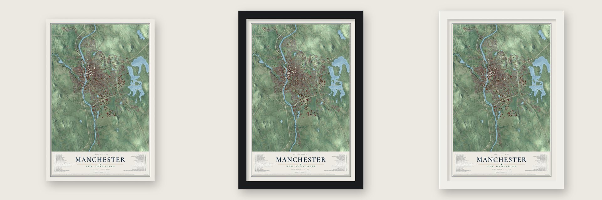
Unframed archival matte, a black wood frame or a white wood frame.
Up close
Geography Worth Displaying
This map was created using accurate cartographic data and authoritative geographic sources, including the U.S. Geological Survey (USGS) and FEMA. The map brings together terrain, waterways, roads, and building detail. The majority of the streets are labeled, houses are accurately depicted, and the topography is derived from government sources. Combining local data with carefully composed color and shading leads to this beautifully detailed Manchester artwork for your wall.
Rather than simply showing street outlines, we’ve included as many of the street names as we could reasonably fit on the map while keeping their names legible. Zoom in on the high resolution preview to see exactly what’s on the map. We truly set out to create a statement piece for anyone who loves Manchester. So whether it’s for you, or a gift for someone you love, we hope this map of Manchester brings back fond memories.
Explore the full map of Manchester, New Hampshire and read about the local places it shows.

Find your street
Names on the Manchester map
Every name below is printed on this map. Look for your street, your school, the park where you played, or the pond down the road.
Places and landmarks10
- Downtown
- Massabesic
- Goffs Falls
- Bald Hill
- Birch Island
- Fletcher Island
- Manchester Water Works Land
- Manchester Cedar Swamp
- Pine Grove Cemetery
- Martin
Streets and roads279
- South Willow Street
- Beech Street
- Hooksett Road
- Elm Street
- Brown Avenue
- Calef Road
- Second Street
- Varney Street
- Maple Street
- North Mammoth Road
- South Mammoth Road
- South Mast Road
- Hazelton Avenue
- Perimeter Road
- Cedar Street
- Willow Street
- South Main Street
- Cilley Road
- Main Street
- Front Street
- Wellington Road
- South Beech Street
- Boynton Street
- Milford Street
- River Road
- Amory Street
- Canal Street
- North Adams Street
- Union Street
- Hanover Street
Show all 279 streets
- Belmont Street
- Candia Road
- Chestnut Street
- Bodwell Road
- Lake Shore Drive
- Hall Street
- Pine Street
- Island Pond Road
- Huse Road
- Dunbarton Road
- Cohas Avenue
- Lake Avenue
- Bridge Street Extended
- Goffstown Road
- Goffs Falls Road
- Hayward Street
- Amherst Street
- Walnut Street
- Oak Street
- Smyth Road
- Valley Street
- Central Street
- Somerville Street
- Lincoln Street
- East Industrial Park Drive
- Merrimack Street
- Spruce Street
- Brent Street
- Gold Street
- Lowell Street
- Wilson Street
- Granite Street
- Bryant Road
- Ray Street
- Concord Street
- Douglas Street
- Bremer Street
- Country Side Boulevard
- Straw Road
- Coolidge Avenue
- Holt Avenue
- Myrtle Street
- Ash Street
- North Street
- Corning Road
- South Porter Street
- Silver Street
- Pearl Street
- Clay Street
- Lucas Road
- Holly Avenue
- Upland Street
- Kelley Street
- Sheffield Road
- Harvey Road
- Page Street
- Webster Street
- Hermit Road
- Proctor Road
- Stark Lane
- Currier Drive
- Campbell Street
- Elgin Avenue
- Howe Street
- Harvard Street
- Blevens Drive
- Putnam Street
- Eddy Road
- Medford Street
- Eastern Avenue
- Greeley Street
- Arah Street
- South Jewett Street
- Porter Street
- Oakland Avenue
- Riverdale Avenue
- Reed Street
- Day Street
- North Bend Drive
- Paquette Avenue
- Phillip Street
- Abby Road
- Gay Street
- Mitchell Street
- Eve Street
- Electric Street
- Donald Street
- Hoyt Street
- Allard Drive
- Ward Street
- Leda Avenue
- Pond Drive
- Fox Street
- Bow Street
- Queen City Avenue
- Mammoth Road
- Rockland Avenue
- West Salmon Street
- South Elm Street
- Devon Street
- Poore Road
- West Bridge Street
- Ridge Road
- Kearney Street
- Lake Shore Road
- Auburn Street
- Wellington Hill Road
- Manchester Street
- Country Club Drive
- Salmon Street
- Linden Street
- Coral Avenue
- Dubuque Street
- Rimmon Street
- Vinton Street
- North Bay Street
- Reservoir Avenue
- Titus Avenue
- Tarrytown Road
- Megan Drive
- Sundial Avenue
- Frontage Road
- West Mitchell Street
- Seames Drive
- Laydon Street
- Summer Street
- March Avenue
- Brook Street
- Charlotte Street
- Hackett Hill Road
- Kaye Street
- Rosegate Farm Drive
- Mystic Street
- Sibley Terrace
- Chase Way
- Joseph Street
- West Haven Road
- Beaver Street
- Maryland Avenue
- Sylvan Lane
- Lovering Street
- Chauncey Avenue
- Blondin Road
- Norcross Street
- Allen Street
- Pinebrook Place
- Peabody Avenue
- Keller Street
- Canal Avenue
- Mooresville Road
- Morse Road
- Brickett Road
- Bemis Savoie Road
- Wells Street
- Wilmot Street
- Oneida Street
- Kenberma Street
- Marathon Way
- Pheasant Lane
- River Bank Road
- West Shore Avenue
- Riverwalk Way
- Pinard Street
- Beech Hill Avenue
- Brock Street
- Westland Avenue
- McLane Lane
- Grand Avenue
- Head Street
- Zachary Road
- Tarbell Street
- Tilden Drive
- Lone Pine Drive
- Hamel Drive
- Leo Street
- Kilby Street
- Elton Avenue
- Pine Avenue
- Dove Lane
- Lakeview Lane
- Sagamore Street
- Laurel Street
- Circle Road
- Alliance Way
- Dix Street
- Shasta Street
- Mason Street
- Walnut Hill Avenue
- Blucher Street
- Karatzas Avenue
- South Hall Street
- John East Devine Drive
- Lindstrom Lane
- Ledgewood Way
- Bruce Road
- Benjamin Street
- Moore Street
- Morey Street
- Stonington Drive
- Dunbar Street
- Bay Street
- Broadway Avenue
- Ohio Avenue
- Liberty Street
- Tennyson Drive
- Sherwood Drive
- Overland Street
- Maynard Avenue
- West Clarke Street
- Vandora Drive
- Fleming Street
- Filip's Glen Drive
- Riley Avenue
- Aurore Avenue
- Dickey Street
- Lee Avenue
- Park Avenue
- Amoskeag Street
- Young Street
- Raymond Wieczorek Drive
- South Taylor Street
- Whittington Street
- Crescent Road
- Hidden Oak Way
- Hitchcock Way
- Clarke Street
- Scenic Drive
- Millstone Avenue
- Waverly Street
- Villa Street
- Rosedale Avenue
- Bell Street
- Pinecrest Road
- Third Street
- Huntress Street
- Rosecliff Lane
- Shaw Street
- South Gray Street
- Arizona Street
- Legacy Drive
- Tower Hill Road
- Goffe Street
- High Street
- Katinka Drive
- Paule Avenue
- Lilac Street
- Kelly Avenue
- Foch Street
- Carl Drive
Names are listed as they appear on the printed map. Zoom into the product photos to find them.
About Manchester, New Hampshire
Manchester is a New Hampshire community in Hillsborough County, where the 2020 census counted 115,644 residents. The town extends across 34.9 square miles.
- 115,644 residentsCounted in the 2020 census.
- Hillsborough CountyManchester is one of the New Hampshire communities located in Hillsborough County.
- 34.9 square milesThe Census Bureau gives this as Manchester's total area.
- Incorporated in 1831The town was incorporated in 1831.
Keep exploring New Hampshire
Manchester is one of 264 New Hampshire towns we've mapped. Every dot on the map is a print of its own.
The search covers every state, New Hampshire first.
Near Manchester
Order 2 or more town maps and save 10%. Shown in the size and finish you picked above, so they hang as a set.
- South Hooksett 12" x 18" / Archival Matte Print $39.99
- Pinardville 12" x 18" / Archival Matte Print $39.99
- Auburn 12" x 18" / Archival Matte Print $39.99


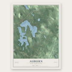
More maps nearby: North Londonderry, Bedford, Goffstown, Hooksett and Candia.
The art of mapping a place
How This Map Was Made
Real places. Remarkable detail. Discover the layers that turn geographic data into a map of home.

The view from above
Aerial imagery reveals the character of the land: woodland, open fields, and the patterns of a place.

The shape of the land
Elevation data brings hills, valleys, and subtle changes in the landscape into view.

The details of home
Roads, waterways, and building footprints come together to make the map feel unmistakably local.

Geography becomes art
Considered color, shading, and typography bring the layers together in a map made for your wall.


Process illustrated with Mendon, Massachusetts. Aerial imagery: USDA NAIP. Terrain: USGS 3D Elevation Program. Map details and finished artwork: KNOWOL.
The Details
About This Print
Choose an archival matte print, or a black or white Ayous wood frame. The archival matte print is unframed.
Select your size and finish above to see the matching product image and price.
Materials & Craftsmanship
A contemporary map with the character of a classic atlas, printed on archival matte paper. Optional frames are made from Ayous wood.
Your printed map does not include the watermark shown in the full-map preview.
Shipping & Delivery
Free shipping within the United States. Every print is made to order in the USA.
Buying a gift? Add a note in your cart and we'll include it. We never put prices in the package.
Prints ship within 2 to 3 business days. Allow 7 to 10 days total from ordering for delivery. Timing may vary during holidays or periods of high order volume.
Read our shipping policy.
Returns and damaged prints
Each print is made to order. Change-of-mind refunds are not available after production.
If your print arrives damaged, misprinted or incorrect, contact support@knowol.com within 30 days of receiving it. Include your order number, photos and a description of the issue.
Read our full refund and replacement policy. For questions about your order, email support@knowol.com.