


Search for another town





Free U.S. delivery 7 to 10 days after you order
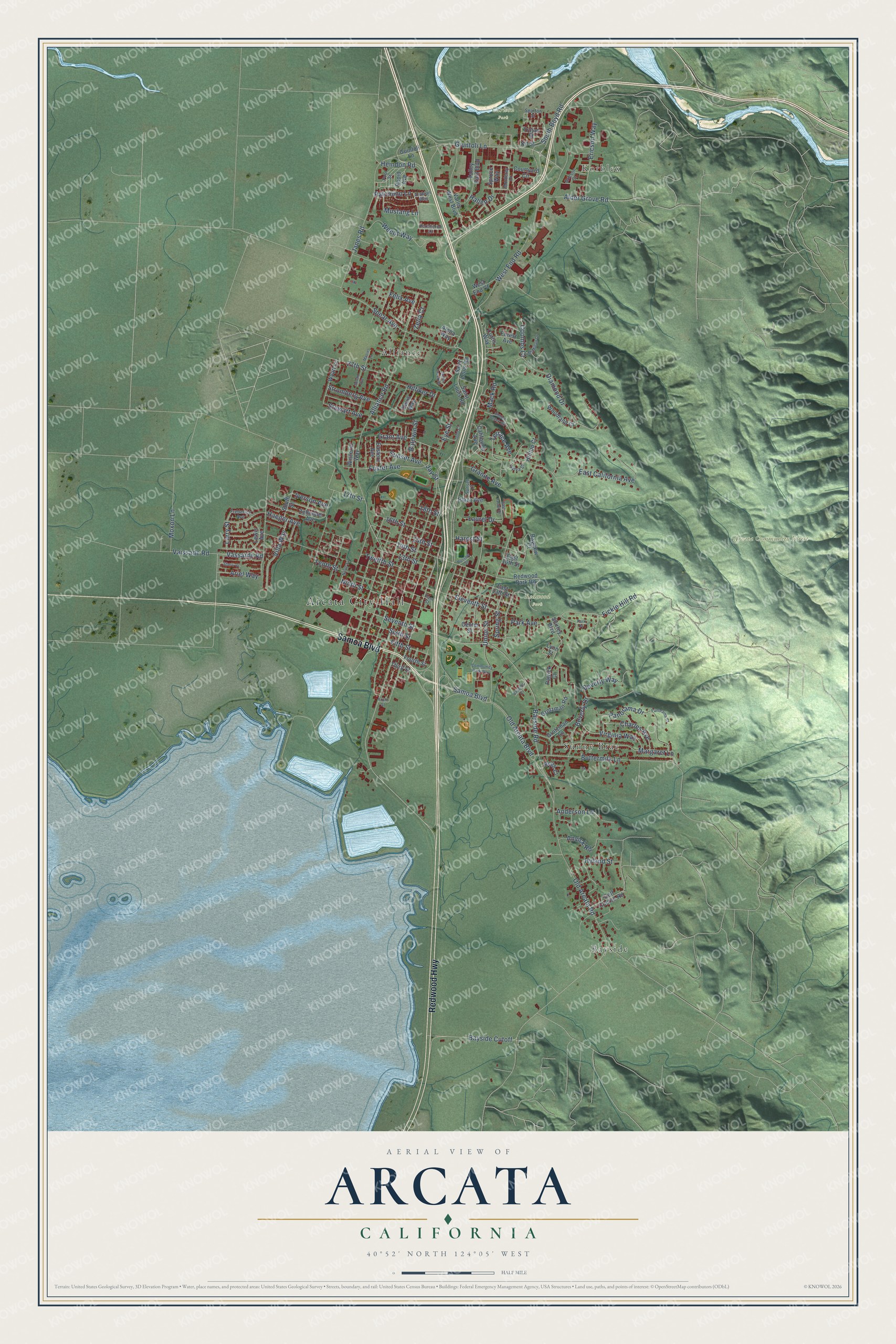
Arcata, California Map Art
Building by building, with labeled streets and shaded relief.
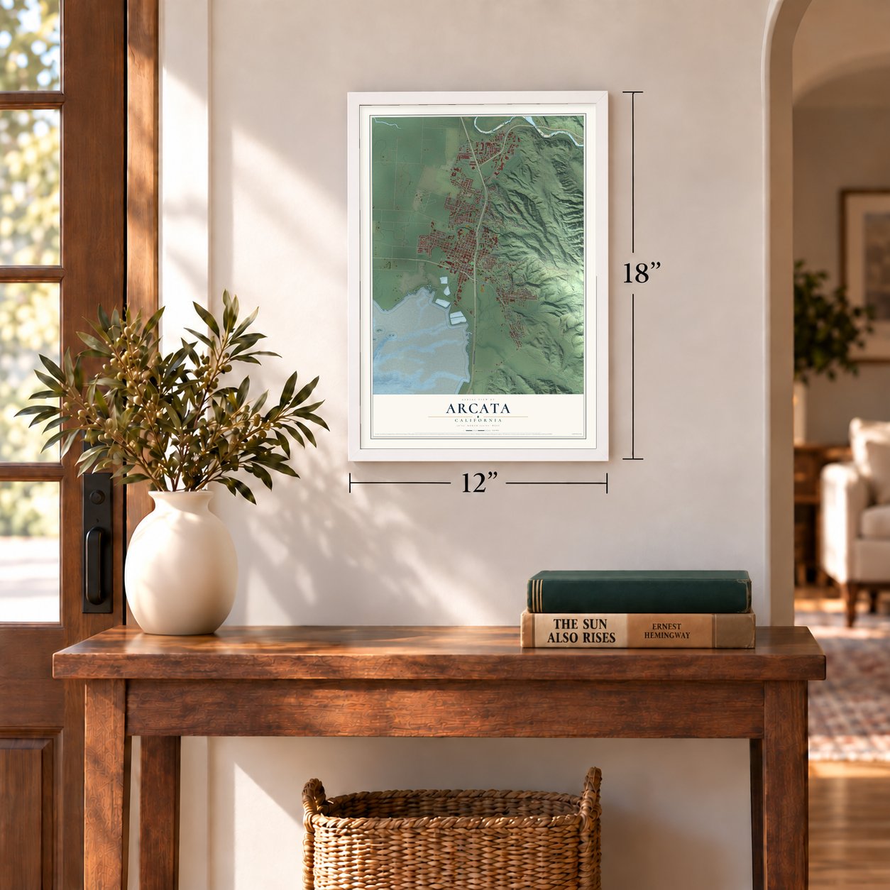
12" x 18" Archival Matte Print
A Map of Home. A Work of Art.
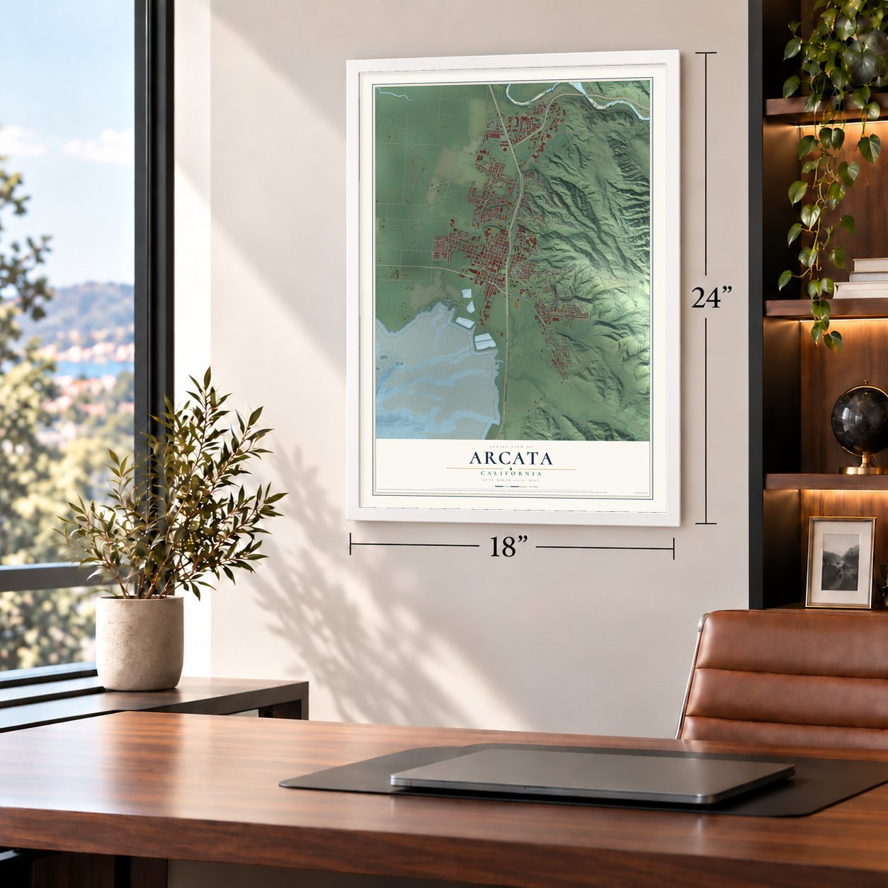
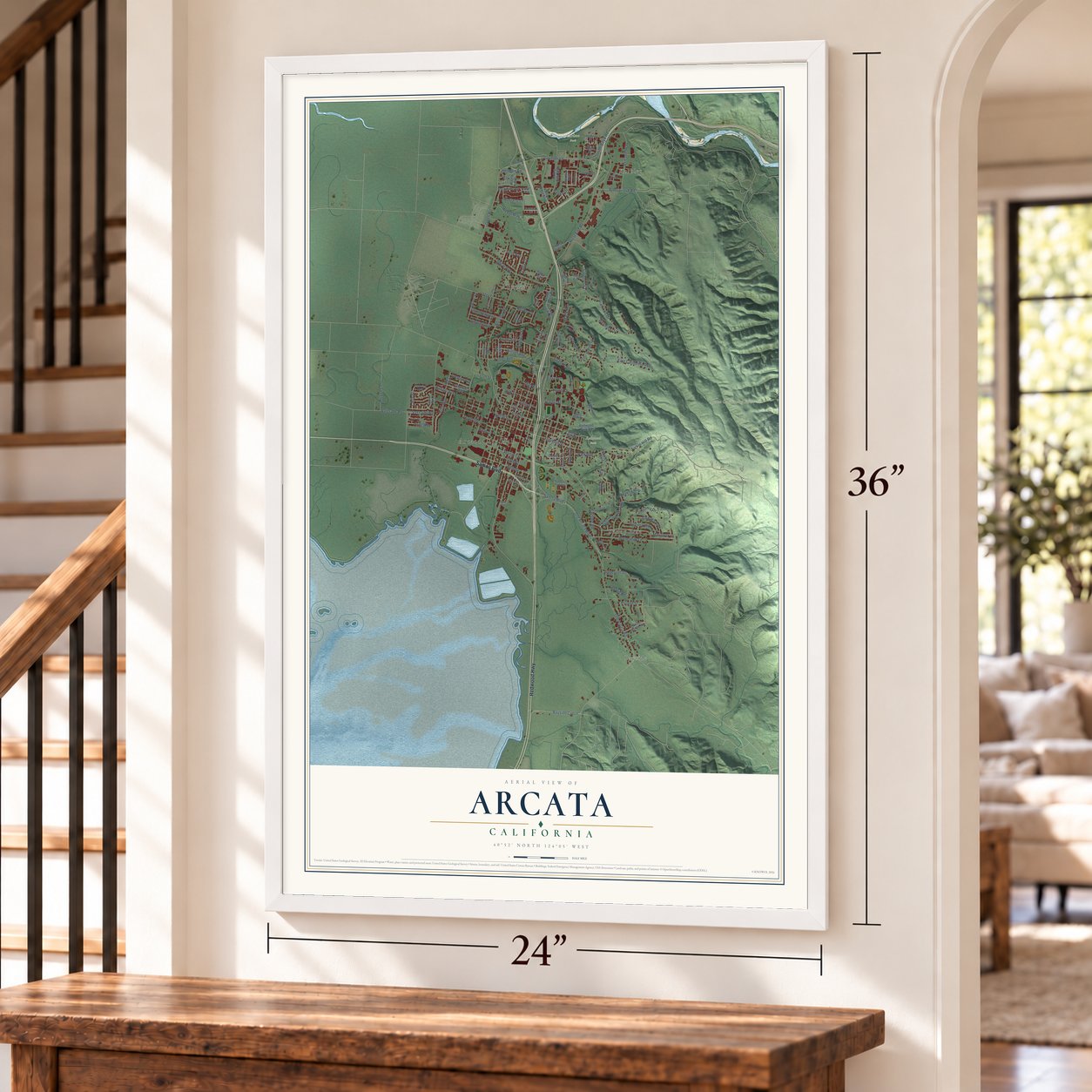
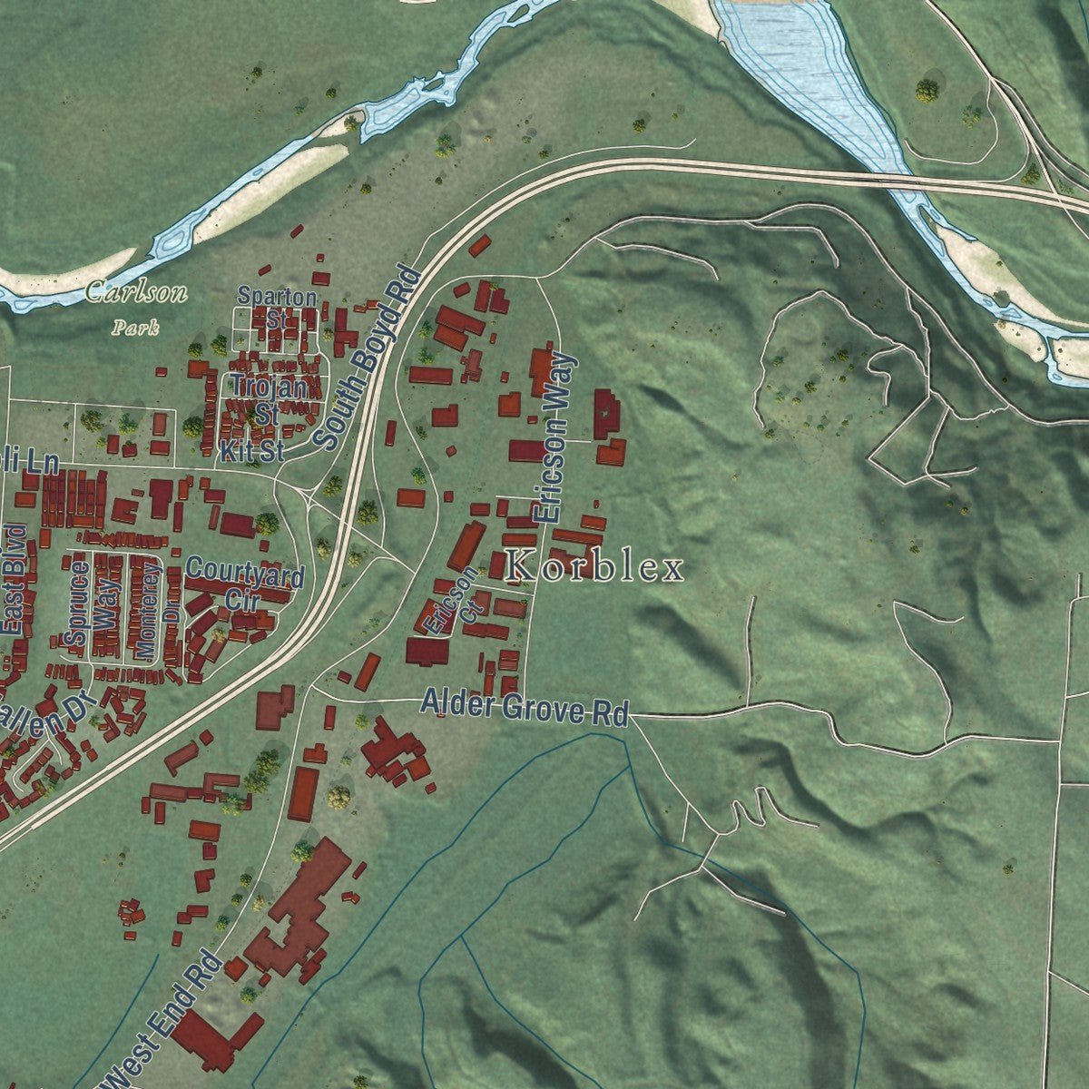
Explore Arcata, California from a whole new perspective. Created using aerial imagery and detailed geographic data, this map captures Arcata building by building, with labeled streets, familiar landmarks, and shaded topographical relief that highlights the natural contours of the landscape.
Combining modern data with the timeless character of a vintage atlas, this map is just as interesting up close as it is beautiful on the wall. Whether you grew up in Arcata, spent memorable years there, or call it home today, this unique map is a great way to celebrate a place that means something to you. Zoom in on the preview to look for your street, and then order a print to put your memories on the wall.
Three ways to hang it
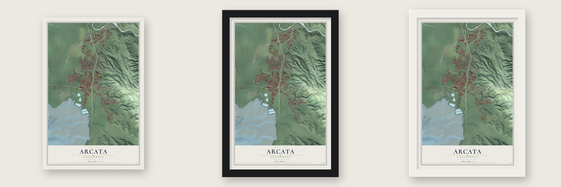
Unframed archival matte, a black wood frame or a white wood frame.
Up close
Geography Worth Displaying
This map was created using accurate cartographic data and authoritative geographic sources, including the U.S. Geological Survey and the Census Bureau. The map brings together terrain, waterways, roads, and building detail. The majority of the streets are labeled, houses are accurately depicted, and the topography is derived from government sources. Combining local data with carefully composed color and shading leads to this beautifully detailed Arcata artwork for your wall.
Rather than simply showing street outlines, we’ve included as many of the street names as we could reasonably fit on the map while keeping their names legible. Zoom in on the high resolution preview to see exactly what’s on the map. We truly set out to create a statement piece for anyone who loves Arcata. So whether it’s for you, or a gift for someone you love, we hope this map of Arcata brings back fond memories.
Read the story behind this map of Arcata, California from 2026.

Find your street
Names on the Arcata map
Every name below is printed on this map. Look for your street, your school, the park where you played, or the pond down the road.
Places and landmarks8
- Arcata City Hall
- Korblex
- Arcata Community Forest
- Carlson Park
- Redwood Park
- Alliance
- Bayside
- Sunny Brae
Streets and roads137
- Samoa Boulevard
- Redwood Highway
- Old Arcata Road
- Bayside Road
- Jay Street
- Grant Avenue
- Vassaide Road
- Seventh Street
- Old Arcata Boulevard
- Coombs Court
- Weeot Way
- 15th Street
- West End Road
- Alliance Road
- Eleventh Street
- Janes Road
- Diamond Drive
- Union Street
- East California Avenue
- Fickle Hill Road
- South Boyd Road
- Giuntoli Lane
- Twelfth Street
- Buttermilk Lane
- 13th Street
- Foster Avenue
- Spear Avenue
- Tenth Street
- 14th Street
- Stromberg Avenue
Show all 137 streets
- Beverly Drive
- Panorama Drive
- Ninth Street
- Ericson Way
- Park Avenue
- Sunset Avenue
- 17th Street
- Fifth Street
- Bayside Cutoff
- Terrace Avenue
- Haeger Avenue
- Heindon Road
- Virginia Way
- Anvick Road
- Charles Avenue
- Hyland Street
- 27th Street
- Villa Way
- 16th Street
- Alder Grove Road
- Beverly Way
- Anderson Lane
- Moxon Lane
- Baldwin Street
- Sixth Street
- Spring Street
- Stewart Avenue
- Hilfiker Drive
- Vaissade Road
- Margaret Lane
- Ariel Way
- Eye Street
- Granite Avenue
- Palomino Lane
- Laurel Drive
- Iverson Avenue
- Mustang Lane
- Hallen Drive
- Mack Road
- Larry Street
- Harpst Street
- Felix Avenue
- Zelia Court
- 18th Street
- Kit Street
- Shirley Boulevard
- California Avenue
- Saint Louis Road
- Courtyard Circle
- Golf Course Road
- Valley West Boulevard
- East 13th Street
- Valley East Boulevard
- Zehndner Avenue
- Redwood Park Road
- Lewis Avenue
- Guintoli Lane
- Grotzman Road
- Wyatt Lane
- Bayview Court
- Woodland Court
- West End Court
- Grotzman Lane
- Forest Avenue
- Eastern Avenue
- South Street
- Lynn Street
- Davis Way
- Hilltop Court
- Curtis Way
- Plaza Avenue
- Center Street
- Fourth Street
- Wisteria Way
- Spruce Way
- Aloha Way
- Beith Court
- Patrick Court
- Trojan Street
- East 16th Street
- Third Street
- Rapid Avenue
- Sparton Street
- East Street
- Monterey Drive
- Arabian Way
- Ericson Court
- Frederick Avenue
- Percheron Lane
- Sylva Street
- Sunset Court
- Pool Street
- Hidden Creek Road
- Rossow Street
- Janes Creek Drive
- Community Park Way
- North Street
- McMillan Drive
- Todd Court
- East Laurel Drive
- Panorama Court
- Bayside Court
- Sherri Court
- Maciel Lane
- Susan Avenue
- Front Street
- Park Place
Names are listed as they appear on the printed map. Zoom into the product photos to find them.
About Arcata, California
Arcata is a city of 18,857 people in Humboldt County, on the northern arm of Humboldt Bay. The Wiyot had a settlement here called Kori, and the city's name comes from the Yurok word oket'oh, meaning "where there is a lagoon." In the spring of 1850, workers for the Union Company laid out a plaza and the first streets. Their new town of Union became a port and supply stop for gold miners working up in the Trinity, Klamath and Salmon mountains.
Union sat a little closer to the mines than Eureka did, and for a short time it was the county seat. Its post office opened in 1852, and the town was officially established in 1858. As the gold ran out, redwood lumber took over the local economy. Eureka had the better harbor, and before the 1850s were over it had taken the county seat away. In 1860 Union took the name Arcata.
- Mule trains on the PlazaIn the 1850s, goods bound for the Trinity County mines were packed onto mule trains on the Plaza. From 1906 the center of the Plaza held Haig Patigian's statue of President William McKinley. After years of debate, the city council voted in February 2018 to remove it, and voters defeated a referendum to keep it that November. On February 28, 2019, crews took it down to send to the McKinley Presidential Library and Museum in Canton, Ohio.
- California's first city forestThe city bought the Arcata Community Forest in 1955 to protect its water supply, and it became the first community forest owned by a city in California. In 1979 voters passed the Forest Management and Parkland Initiative, so that timber sales from the forest would pay for new parks. In 1998 it became the first city forest in the U.S. to earn Forest Stewardship certification. Today the city owns 2,100 acres of forest.
- A marsh that cleans wastewaterArcata built its marsh on top of an old city dump, and the first ponds were finished in 1979. The freshwater and saltwater ponds treat the city's wastewater. The project won an Innovations in Government award given by Harvard Kennedy School and the Ford Foundation, and it draws bird watchers, cyclists and joggers.
- Crabs baseball since 1945The Humboldt Crabs are the nation's oldest semi-pro baseball team to play without a break. They have taken the field every season since 1945. The only season they missed was 2020, when COVID-19 forced its cancellation.
- Nine on the National RegisterArcata's listed landmarks are the Schorlig House (1978), the Whaley House (1979), the Jacoby Building (1982), Hotel Arcata (1984) and the Pythian Castle (1986). The John G. Chapman House, the James Kleiser House, the Phillips House and the Stone House are listed too.
Keep exploring California
Arcata is one of 1,990 California towns we've mapped. Every dot on the map is a print of its own.
The search covers every state, California first.
Near Arcata
Order 2 or more town maps and save 10%. Shown in the size and finish you picked above, so they hang as a set.
- Indianola 12" x 18" / Archival Matte Print $39.99
- Blue Lake 12" x 18" / Archival Matte Print $39.99
- Manila 12" x 18" / Archival Matte Print $39.99

More maps nearby: Myrtletown, Eureka, McKinleyville, Samoa and Freshwater.
The art of mapping a place
How This Map Was Made
Real places. Remarkable detail. Discover the layers that turn geographic data into a map of home.

The view from above
Aerial imagery reveals the character of the land: woodland, open fields, and the patterns of a place.

The shape of the land
Elevation data brings hills, valleys, and subtle changes in the landscape into view.

The details of home
Roads, waterways, and building footprints come together to make the map feel unmistakably local.

Geography becomes art
Considered color, shading, and typography bring the layers together in a map made for your wall.


Process illustrated with Mendon, Massachusetts. Aerial imagery: USDA NAIP. Terrain: USGS 3D Elevation Program. Map details and finished artwork: KNOWOL.
The Details
About This Print
Choose an archival matte print, or a black or white Ayous wood frame. The archival matte print is unframed.
Select your size and finish above to see the matching product image and price.
Materials & Craftsmanship
A contemporary map with the character of a classic atlas, printed on archival matte paper. Optional frames are made from Ayous wood.
Your printed map does not include the watermark shown in the full-map preview.
Shipping & Delivery
Free shipping within the United States. Every print is made to order in the USA.
Buying a gift? Add a note in your cart and we'll include it. We never put prices in the package.
Prints ship within 2 to 3 business days. Allow 7 to 10 days total from ordering for delivery. Timing may vary during holidays or periods of high order volume.
Read our shipping policy.
Returns and damaged prints
Each print is made to order. Change-of-mind refunds are not available after production.
If your print arrives damaged, misprinted or incorrect, contact support@knowol.com within 30 days of receiving it. Include your order number, photos and a description of the issue.
Read our full refund and replacement policy. For questions about your order, email support@knowol.com.