
Search for another town





Free U.S. delivery 7 to 10 days after you order
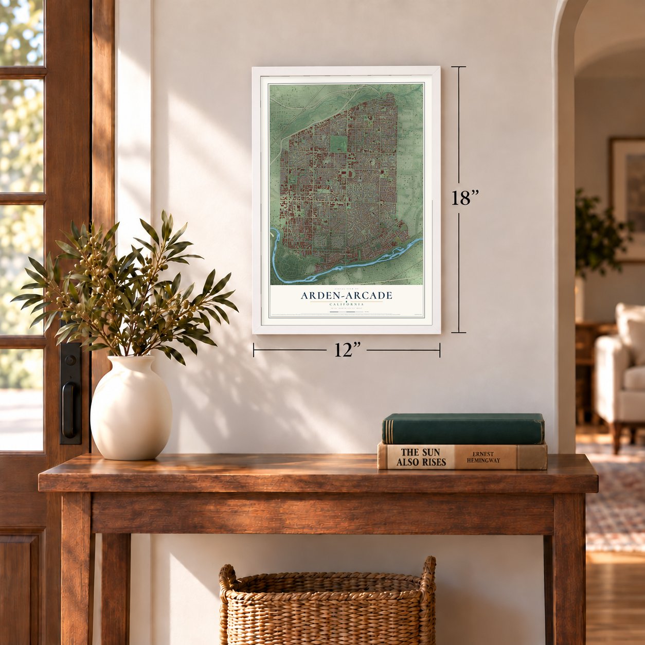
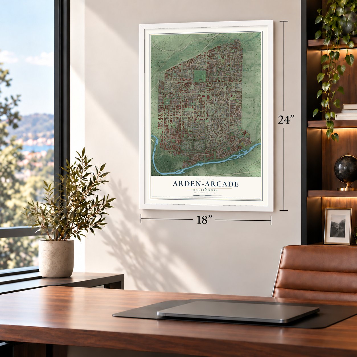
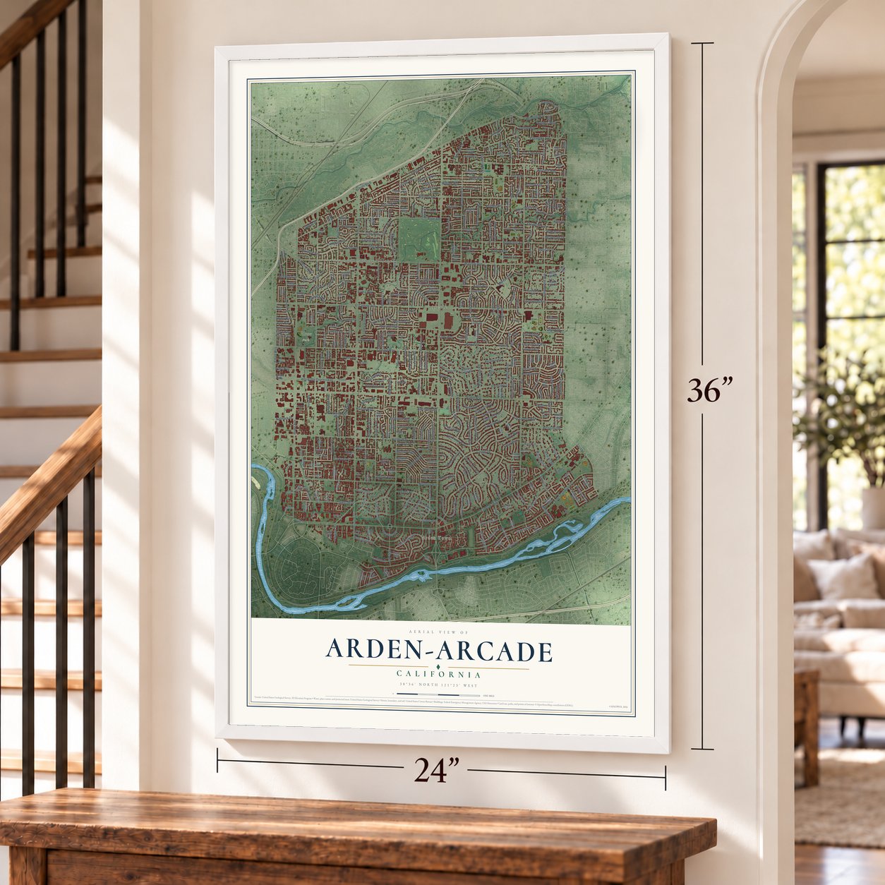
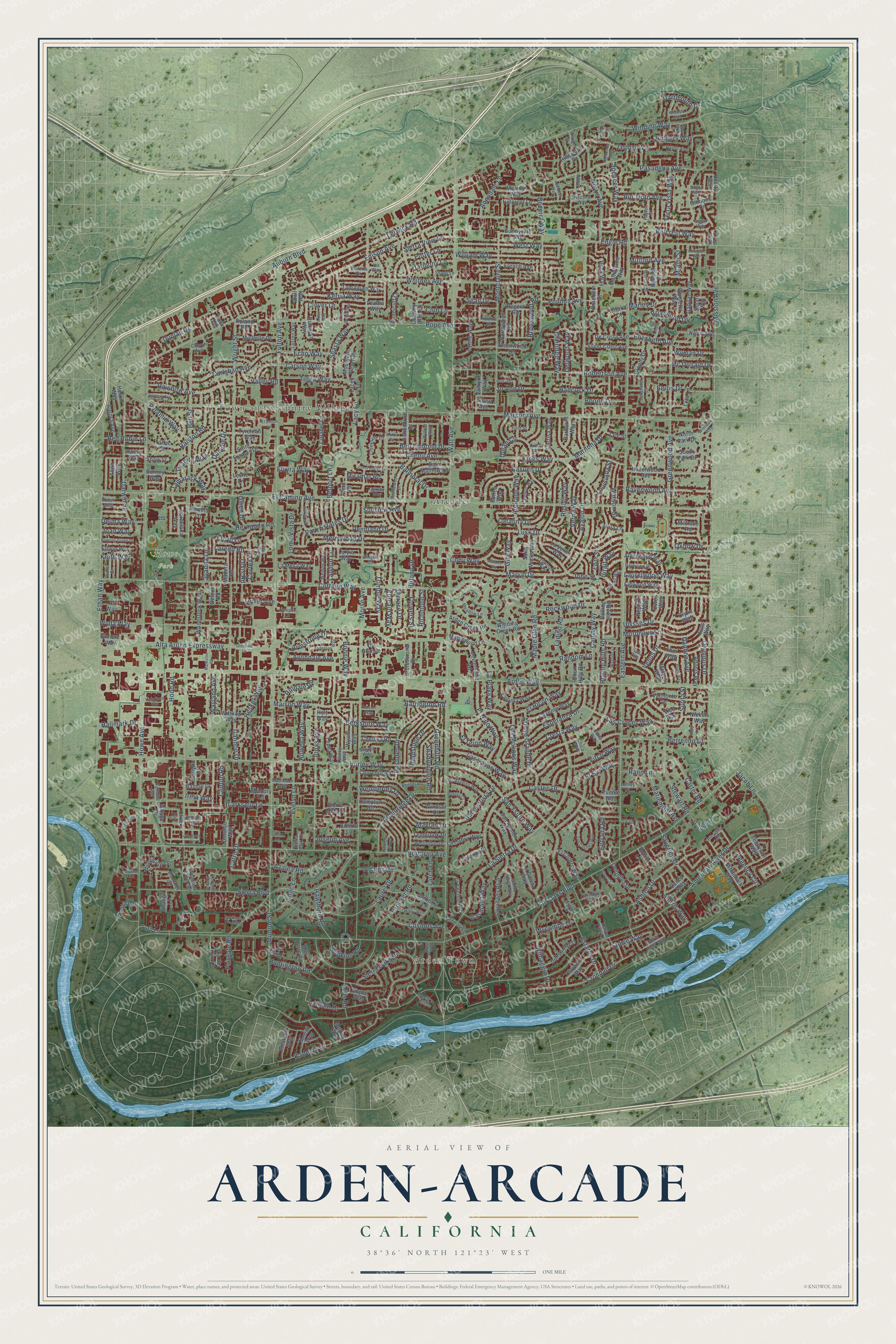
Arden-Arcade, California Map Art
Building by building, with labeled streets and shaded relief.
12" x 18" Archival Matte Print
A Map of Home. A Work of Art.
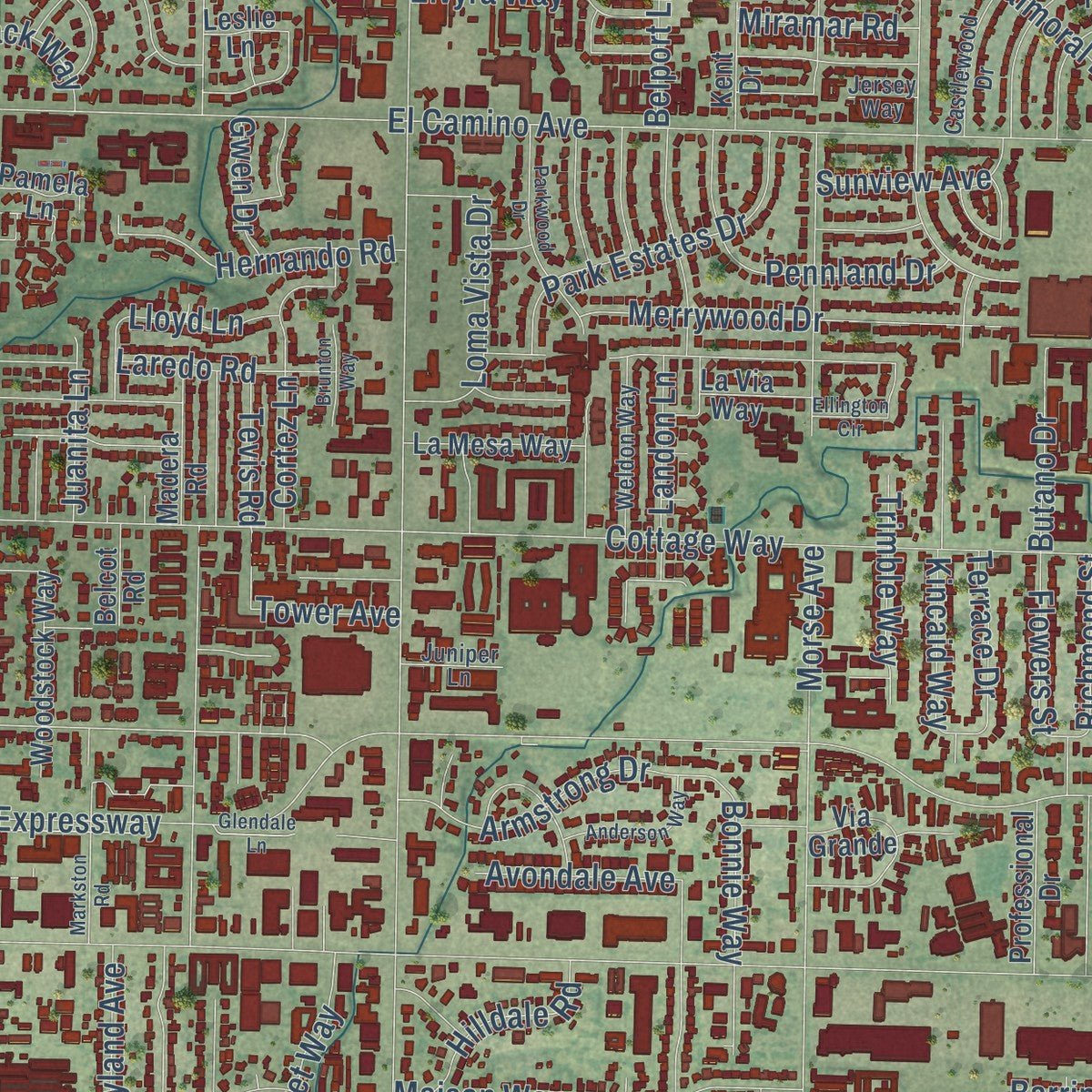
Explore Arden-Arcade, California from a whole new perspective. Created using aerial imagery and detailed geographic data, this map captures Arden-Arcade building by building, with labeled streets, familiar landmarks, and shaded topographical relief that highlights the natural contours of the landscape.
Combining modern data with the timeless character of a vintage atlas, this map is just as interesting up close as it is beautiful on the wall. Whether you grew up in Arden-Arcade, spent memorable years there, or call it home today, this unique map is a great way to celebrate a place that means something to you. Zoom in on the preview to look for your street, and then order a print to put your memories on the wall.
Three ways to hang it
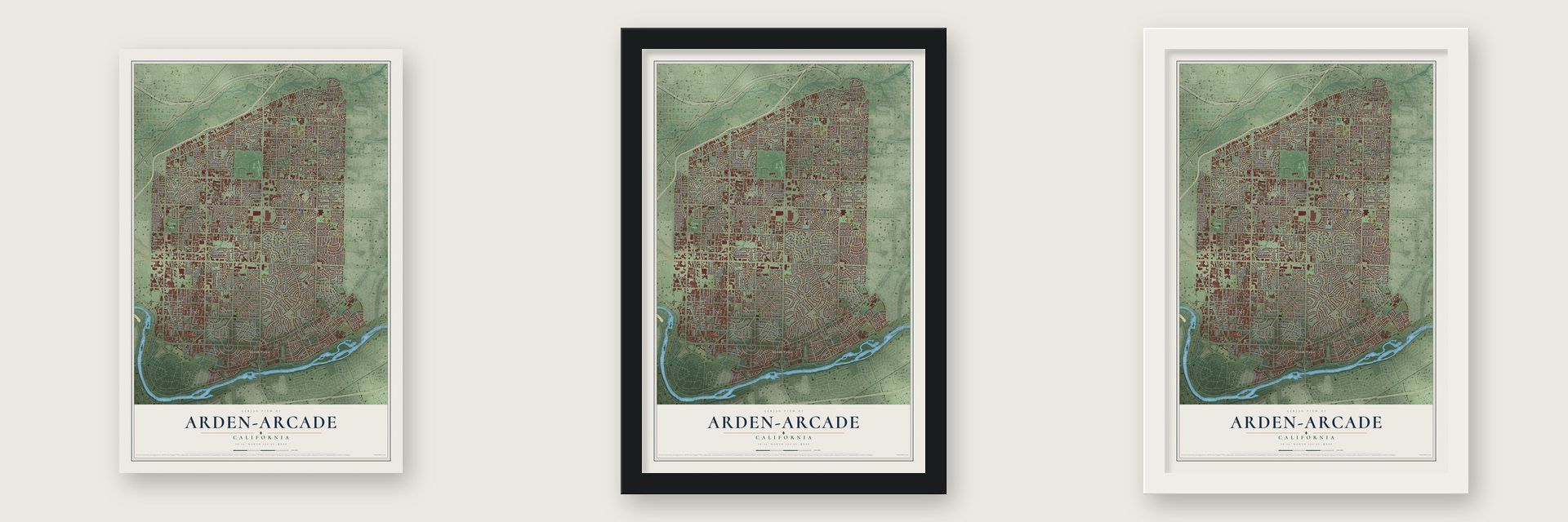
Unframed archival matte, a black wood frame or a white wood frame.
Up close
Geography Worth Displaying
This map was created using accurate cartographic data and authoritative geographic sources, including the U.S. Geological Survey and the Census Bureau. The map brings together terrain, waterways, roads, and building detail. The majority of the streets are labeled, houses are accurately depicted, and the topography is derived from government sources. Combining local data with carefully composed color and shading leads to this beautifully detailed Arden-Arcade artwork for your wall.
Rather than simply showing street outlines, we’ve included as many of the street names as we could reasonably fit on the map while keeping their names legible. Zoom in on the high resolution preview to see exactly what’s on the map. We truly set out to create a statement piece for anyone who loves Arden-Arcade. So whether it’s for you, or a gift for someone you love, we hope this map of Arden-Arcade brings back fond memories.
Read the story behind this map of Arden-Arcade, California from 2026.

Find your street
Names on the Arden-Arcade map
Every name below is printed on this map. Look for your street, your school, the park where you played, or the pond down the road.
Places and landmarks4
- Arden Town
- Howe Park
- Arcade
- Town and Country Village
Streets and roads455
- Latham Drive
- Maple Glen Road
- Watt Avenue
- Fair Oaks Boulevard
- Morse Avenue
- Fulton Avenue
- Eastern Avenue
- Edison Avenue
- Arden Way
- Marconi Avenue
- El Camino Avenue
- Howe Avenue
- American River Drive
- Mission Avenue
- Bell Street
- Auburn Boulevard
- Cottage Way
- Whitney Avenue
- Alta Arden Expressway
- Hurley Way
- Northrop Avenue
- Norris Avenue
- La Sierra Drive
- Ethan Way
- Pasadena Avenue
- Wright Street
- Maryal Drive
- Robertson Avenue
- Butano Drive
- Sierra Boulevard
Show all 455 streets
- Ione Street
- Becerra Way
- Pope Avenue
- Los Molinos Way
- Las Pasas Way
- Castec Drive
- Rockwood Drive
- Crocker Road
- Wyda Way
- Montclaire Street
- Greenwood Avenue
- Lerwick Road
- Berrendo Drive
- Avalon Drive
- Ashton Drive
- Jonas Avenue
- Random Lane
- Stewart Road
- Darwin Street
- Lusk Drive
- Sierra Oaks Drive
- Laurel Drive
- Esperanza Drive
- El Ricon Way
- Cathay Way
- Clinton Road
- Mills Road
- Huntington Road
- Jacob Lane
- Kadema Drive
- Engle Road
- Lacy Lane
- San Ysidro Way
- Crondall Drive
- Arroyo Grande Drive
- Kings Way
- Morpheus Lane
- Larch Lane
- Winding Way
- Ardenridge Drive
- Catalina Drive
- Cresta Way
- El Sur Way
- Estates Drive
- Greenhills Road
- Surita Street
- Ralston Road
- Verna Way
- Wemberley Drive
- Mayfair Drive
- Venus Drive
- Morris Way
- Carlsbad Avenue
- Berkshire Way
- Merrywood Drive
- Richmond Street
- Adams Road
- Wayland Avenue
- El Nido Way
- Mariemont Avenue
- Bertis Drive
- Rainbow Avenue
- Wilhaggin Drive
- Ulysses Drive
- Maison Way
- Laurelwood Way
- Ravenwood Avenue
- Evelyn Lane
- Larkspur Lane
- West Way
- William Way
- Fitch Way
- Wyman Drive
- Carson Way
- Rolling Hills Road
- Danube Drive
- Zephyr Way
- Park Estates Drive
- Hood Road
- Rushden Drive
- Hesket Way
- Potter Lane
- Gannon Drive
- Ladino Road
- Pennland Drive
- Munroe Street
- Kerria Way
- Las Cruces Way
- Oxbow Drive
- Belcrest Way
- Balmoral Drive
- Tioga Way
- Mulford Avenue
- Loma Vista Drive
- Gladstone Drive
- Cody Way
- Armstrong Drive
- Daphne Avenue
- Clairidge Way
- Regency Circle
- Kincaid Way
- Cortez Lane
- Marilona Drive
- La Playa Way
- Hernando Road
- Annadale Lane
- Azalea Road
- Chenu Avenue
- Carro Drive
- Shasta Way
- Laredo Road
- Ben Lomond Drive
- Watson Street
- Landon Lane
- Entrada Road
- Buena Vista Drive
- Roslyn Way
- Avondale Avenue
- Casmalia Way
- Carter Road
- Briarwood Drive
- Elizabeth Avenue
- Saverien Drive
- Andrade Way
- Granite Way
- Cosmos Avenue
- Hancock Drive
- Rowena Way
- Duran Circle
- Terra Vista Way
- Elvyra Way
- Sierra View Lane
- Pyramid Way
- Hawthorn Road
- Shadowglen Road
- Echo Way
- Tamarack Way
- Rutgers Way
- El Tejon Way
- Rio Tinto Avenue
- Lloyd Lane
- Olympus Drive
- Hopkins Road
- Marley Drive
- Terrace Drive
- Lilac Lane
- Tower Avenue
- Trimble Way
- Hilldale Road
- Harmony Lane
- Lasuen Drive
- Sunview Avenue
- Brookwood Road
- Dartmouth Drive
- Hallmark Drive
- Stowe Way
- Pounds Avenue
- Delma Way
- Rand Lane
- Flowers Street
- Joseph Avenue
- Boone Lane
- Jo Ann Drive
- Mc Donald Drive
- Valley Road
- Barrington Road
- Delwood Way
- Red Robin Lane
- Bonnie Way
- Gila Way
- Spencer Way
- Fairgate Road
- Wycombe Drive
- Birgit Way
- Louisiana Street
- Juanita Lane
- Miramar Road
- Club Lane
- Tevis Road
- Miami Street
- Keith Way
- Belport Lane
- Sean Drive
- Gwen Drive
- Dunlap Drive
- Joan Way
- Clover Lane
- Irma Way
- Winding Creek Road
- Barberry Lane
- San Ramon Way
- Coronado Boulevard
- Windsor Drive
- Valmonte Drive
- Hazelwood Avenue
- Hampton Road
- Rolling Hlls Road
- Hillcrest Lane
- Saint Francis Drive
- Tyrolean Way
- Woodside Lane
- Leatha Way
- South Park Drive
- Alderwood Way
- Saint Mathews Drive
- Churchill Road
- Claydon Way
- Cayente Way
- Mercury Way
- Woodstock Way
- North Park Drive
- Arden Creek Road
- Rubicon Way
- Lynne Way
- Thor Way
- Wittkop Way
- Juno Way
- Neptune Way
- Mountain View Avenue
- Adonis Way
- Thornwood Drive
- Wyant Way
- French Avenue
- Laguna Way
- Topaz Way
- Ceres Way
- El Encino Way
- Leta Lane
- Sierra Mills Lane
- Via Grande
- Dunster Way
- Sunnyvale Avenue
- Chelsea Road
- Tamalpais Way
- Mulholland Way
- La Via Way
- Barcelona Way
- Puente Way
- Lacey Lane
- Hillswood Drive
- Michelle Drive
- Bausell Street
- Silver Crest Avenue
- Whitehall Way
- Brophy Drive
- De Costa Avenue
- Ronk Way
- Ball Way
- La Goleta Way
- El Chorro Way
- Saint Marks Way
- Millrace Road
- Gordon Lane
- Gabilan Way
- La Habra Way
- Village Drive
- Figwood Way
- Maplewood Lane
- North Avenue
- La Mesa Way
- Northwood Road
- Borica Way
- Devonshire Road
- Professional Drive
- Hunnicutt Lane
- Corabel Lane
- Tembrook Drive
- Columbia Drive
- Merrily Way
- Aurora Avenue
- Madera Road
- Ashbourne Drive
- Scotty Way
- Carrisa Way
- Anna Way
- Burney Way
- Olive Lane
- Westcott Way
- Sienna Lane
- Braeburn Street
- Barbarell Way
- Solari Way
- Belcot Road
- Bret Harte Road
- Back Circle
- La Verne Way
- Merritt Way
- Tennyson Way
- Concetta Way
- Royce Way
- Edwin Way
- Ramon Drive
- Feature Drive
- Tolenas Court
- Kent Drive
- Dealynn Street
- Gibbons Drive
- Nickels Way
- Bailey Way
- Edith Street
- Short Hills Road
- Country Club Lane
- Valkyrie Way
- Doranjo Way
- Tallac Street
- Regent Road
- Moffatt Way
- Heron Way
- Pamela Lane
- Avila Lane
- Robin Lane
- Rassy Way
- Elmore Way
- Shaw Street
- Turn Lane
- Shangri Lane
- Al Way
- Holt Way
- Clytie Way
- Lyle Street
- Memory Lane
- Imran Drive
- Roland Road
- Albert Avenue
- Oterol Court
- Leslie Lane
- Vico Way
- Rio del Oro Lane
- Chica Way
- Picadilly Circle
- Castlewood Drive
- Lynwood Way
- North River Way
- Woodside Lane East
- Santa Rita Way
- Blackmer Circle
- Creekside Lane
- Cortlandt Drive
- Keeney Way
- Matheson Way
- Los Alamos Way
- Hillcrest Way
- Weldon Way
- Baywood Drive
- Ross Way
- Wellington Drive
- Bakula Way
- Fairlake Avenue
- Walton Way
- Lassen Way
- Meadow Lane
- Holly Drive
- Bristol Road
- Cambon Way
- Burrell Way
- Church Avenue
- Morrow Street
- Sandhurst Court
- Baron Avenue
- Sagar Avenue
- Payton Street
- Robert Way
- Violet Street
- Juniper Lane
- Victoria Drive
- Inman Way
- Patricia Way
- Mystic Lane
- Shady Lane
- Ashton Park Lane
- Sierra Park Lane
- Font Street
- Bolden Lane
- Mering Court
- Lantzy Court
- Debbie Lane
- Elva Way
- Jersey Way
- Iva Way
- Brule Court
- Corta Way
- Villanova Circle
- Los Coches Way
- Woodside Sierra
- Pavilions Lane
- Vesta Way
- Wrendale Way
- Glendale Lane
- Parkwood Drive
- Ellington Circle
- Vagabond Way
- Atwater Road
- Markston Road
- Sand Dollar Way
- Bodega Court
- Ardmore Road
- Enterprise Drive
- La Salle Drive
- Anderson Way
- Park Sierra Lane
- El Sutton Lane
- Juliesse Avenue
- Bowling Green Drive
- Wayside Lane
- Pluto Way
- Drake Circle
- Loreto Way
- Wellesly Way
- San Lucas Way
- Crest Haven Drive
- Alton Court
- Huff Way
- Joby Lane
- Brunton Way
- Bonita Drive
- Aberdeen Way
- Melzenda Way
- Pavilions Place Lane
- Georgian Avenue
- Libby Way
- Arbor Way
- Trussel Way
- Spanos Court
- Haven Glen Place
- Lunar Lane
Names are listed as they appear on the printed map. Zoom into the product photos to find them.
About Arden-Arcade, California
Arden-Arcade is a community of 94,659 people in Sacramento County, just east of the city of Sacramento. The Nisenan were its first residents. The land later became part of Rancho del Paso, a Mexican grant that John Sutter passed on August 10, 1843, to Eliab and Hiram Grimes and John Sinclair. James Ben Ali Haggin owned the rancho and bred race horses there.
The land speculator Orlando Robertson paid $1.5 million for the rancho for his Sacramento Colonization Company. He laid out streets and divided the land into tracts, and by 1916 he had sold farms to many families, a large share of them Scandinavian immigrants. So many Norwegians settled near Gibbons Park that people called it "Little Norway." Most of the houses that stand today went up between 1945 and 1970.
- A Kentucky Derby winnerBen Ali, a horse bred on Haggin's rancho, won the 12th Kentucky Derby in 1886 in world record time. Haggin shipped his horses east, mostly to Kentucky, on a rail spur he had laid out from the paddocks on the north side of the rancho, and his staff put up 24 barns there with 64 stalls in each.
- Where the name came fromArden most likely honors Arden Hills, Minnesota, Robertson's hometown. Arcade comes from the creek beside Haggin's headquarters, where a row of native oaks spread their limbs over the water like a line of arches.
- Streets named for inventorsRobertson is believed to have named the main streets around 1915 for inventors of the Industrial Revolution. Watt Avenue honors James Watt, Howe Avenue Elias Howe, Fulton Avenue Robert Fulton, Morse Avenue Samuel Morse, Edison Avenue Thomas Edison and Marconi Avenue Guglielmo Marconi.
- A governor's mansionA new home for California's governors, first meant for Ronald Reagan, stood on Lake Wilhaggin Drive by 1984. George Deukmejian, Pete Wilson and Gray Davis lived there. Arnold Schwarzenegger chose a hotel penthouse downtown instead, and the house was sold in 2004.
- Voters said no to a cityOn November 2, 2010, residents voted on Measure D, which would have made Arden-Arcade a city of its own. Supporters promised better services with no new taxes, while opponents feared the revenue estimates were too hopeful. The measure lost, 76% to 24%.
Keep exploring California
Arden-Arcade is one of 1,990 California towns we've mapped. Every dot on the map is a print of its own.
The search covers every state, California first.
Near Arden-Arcade
Order 2 or more town maps and save 10%. Shown in the size and finish you picked above, so they hang as a set.
- Ben Ali 12" x 18" / Archival Matte Print $39.99
- La Riviera 12" x 18" / Archival Matte Print $39.99
- Carmichael 12" x 18" / Archival Matte Print $39.99


More maps nearby: Rosemont, McClellan Park, North Highlands, Sacramento and Fruitridge Pocket.
The art of mapping a place
How This Map Was Made
Real places. Remarkable detail. Discover the layers that turn geographic data into a map of home.

The view from above
Aerial imagery reveals the character of the land: woodland, open fields, and the patterns of a place.

The shape of the land
Elevation data brings hills, valleys, and subtle changes in the landscape into view.

The details of home
Roads, waterways, and building footprints come together to make the map feel unmistakably local.

Geography becomes art
Considered color, shading, and typography bring the layers together in a map made for your wall.


Process illustrated with Mendon, Massachusetts. Aerial imagery: USDA NAIP. Terrain: USGS 3D Elevation Program. Map details and finished artwork: KNOWOL.
The Details
About This Print
Choose an archival matte print, or a black or white Ayous wood frame. The archival matte print is unframed.
Select your size and finish above to see the matching product image and price.
Materials & Craftsmanship
A contemporary map with the character of a classic atlas, printed on archival matte paper. Optional frames are made from Ayous wood.
Your printed map does not include the watermark shown in the full-map preview.
Shipping & Delivery
Free shipping within the United States. Every print is made to order in the USA.
Buying a gift? Add a note in your cart and we'll include it. We never put prices in the package.
Prints ship within 2 to 3 business days. Allow 7 to 10 days total from ordering for delivery. Timing may vary during holidays or periods of high order volume.
Read our shipping policy.
Returns and damaged prints
Each print is made to order. Change-of-mind refunds are not available after production.
If your print arrives damaged, misprinted or incorrect, contact support@knowol.com within 30 days of receiving it. Include your order number, photos and a description of the issue.
Read our full refund and replacement policy. For questions about your order, email support@knowol.com.