


Search for another town





Free U.S. delivery 7 to 10 days after you order
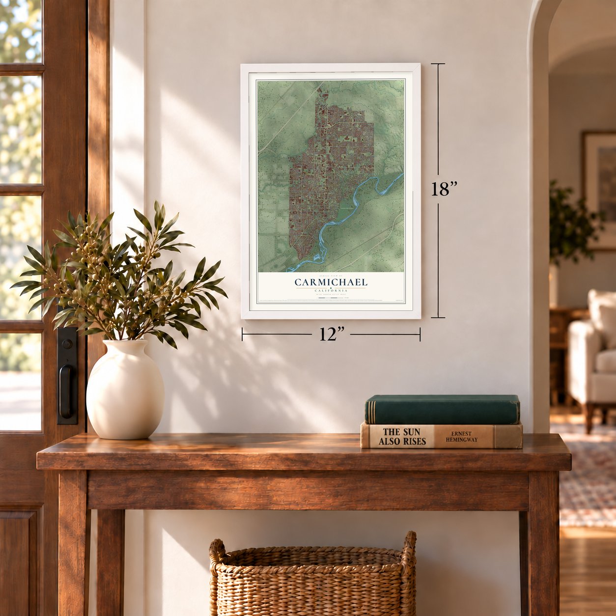
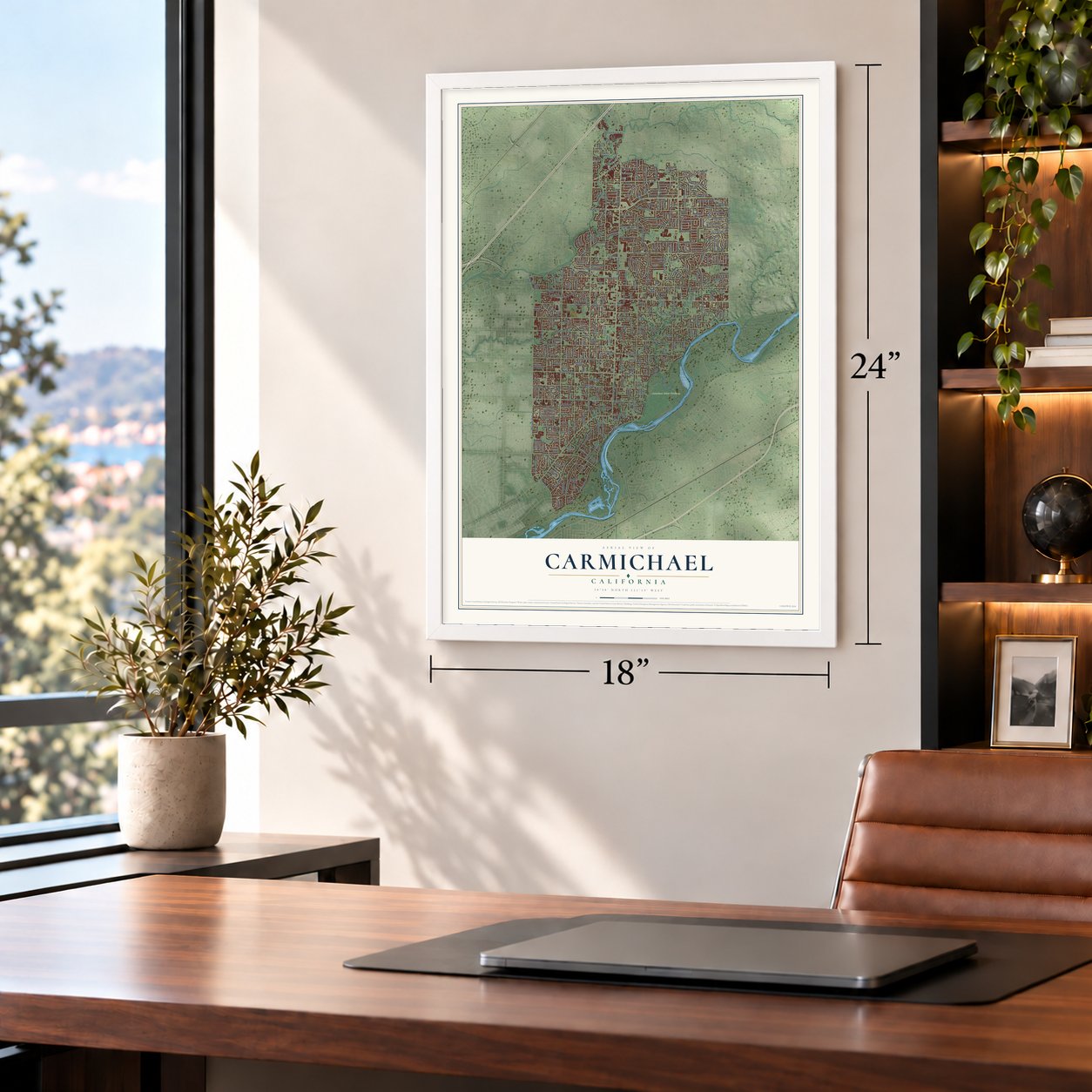
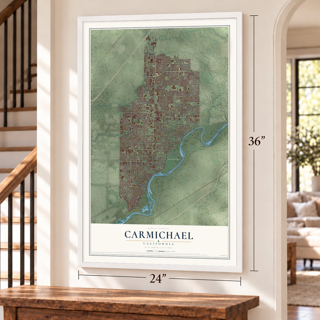
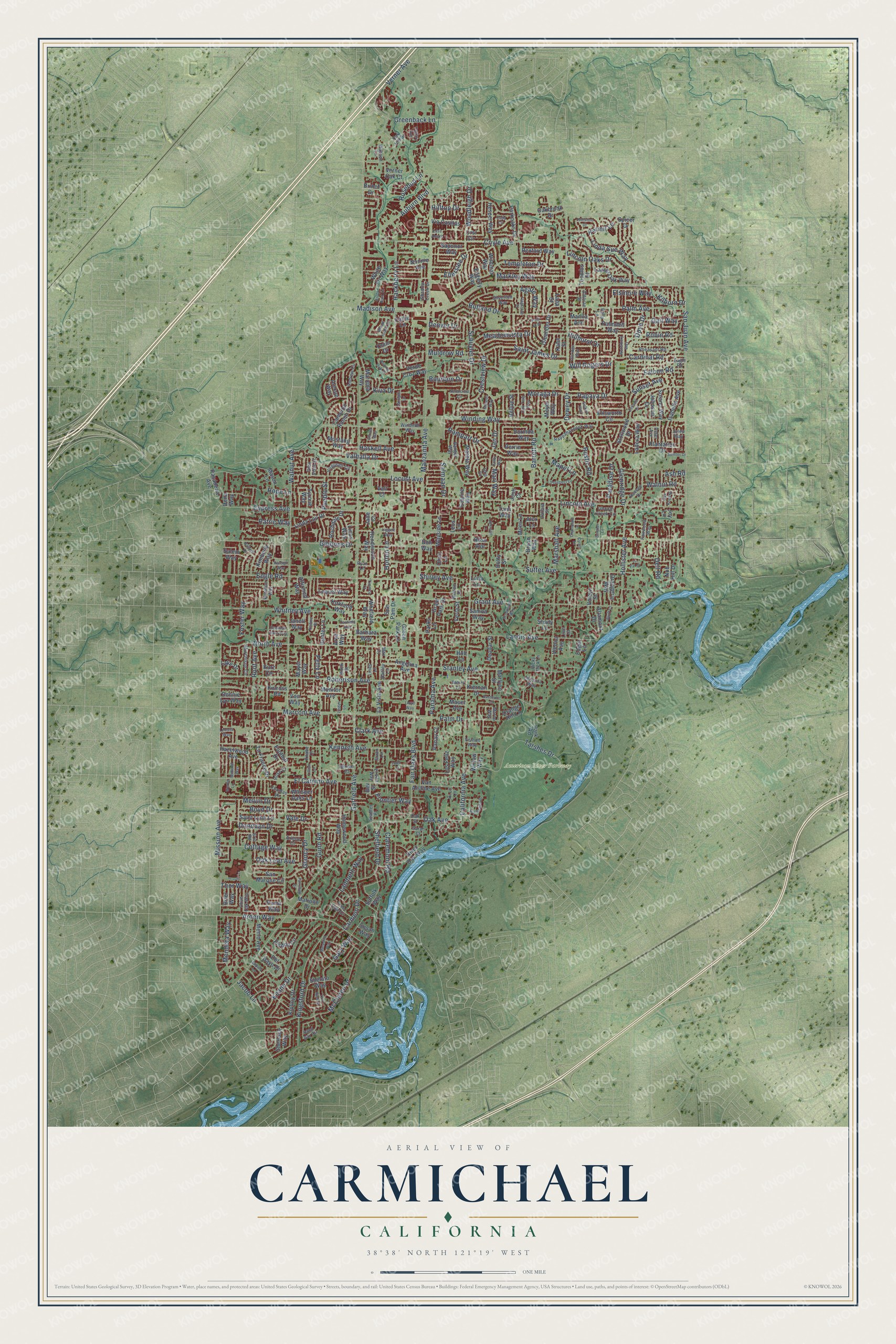
Carmichael, California Map Art
Building by building, with labeled streets and shaded relief.
12" x 18" Archival Matte Print
A Map of Home. A Work of Art.
Explore Carmichael, California from a whole new perspective. Created using aerial imagery and detailed geographic data, this map captures Carmichael building by building, with labeled streets, familiar landmarks, and shaded topographical relief that highlights the natural contours of the landscape.
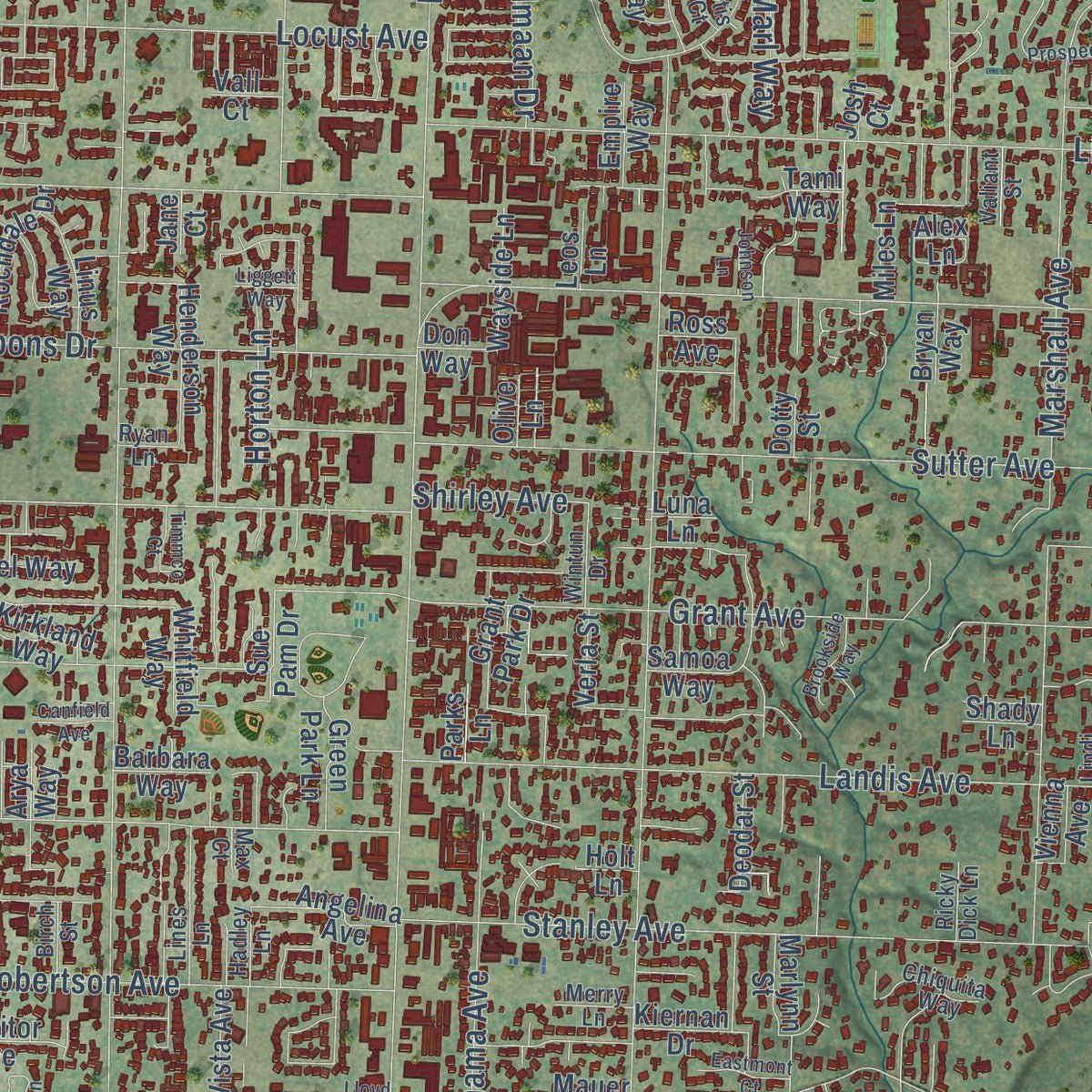
Combining modern data with the timeless character of a vintage atlas, this map is just as interesting up close as it is beautiful on the wall. Whether you grew up in Carmichael, spent memorable years there, or call it home today, this unique map is a great way to celebrate a place that means something to you. Zoom in on the preview to look for your street, and then order a print to put your memories on the wall.
Three ways to hang it
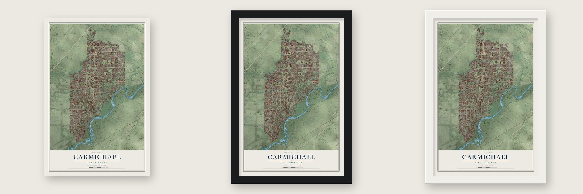
Unframed archival matte, a black wood frame or a white wood frame.
Up close
Geography Worth Displaying
This map was created using accurate cartographic data and authoritative geographic sources, including the U.S. Geological Survey and the Census Bureau. The map brings together terrain, waterways, roads, and building detail. The majority of the streets are labeled, houses are accurately depicted, and the topography is derived from government sources. Combining local data with carefully composed color and shading leads to this beautifully detailed Carmichael artwork for your wall.
Rather than simply showing street outlines, we’ve included as many of the street names as we could reasonably fit on the map while keeping their names legible. Zoom in on the high resolution preview to see exactly what’s on the map. We truly set out to create a statement piece for anyone who loves Carmichael. So whether it’s for you, or a gift for someone you love, we hope this map of Carmichael brings back fond memories.
Read the story behind this map of Carmichael, California from 2026.

Find your street
Names on the Carmichael map
Every name below is printed on this map. Look for your street, your school, the park where you played, or the pond down the road.
Places and landmarks1
- American River Parkway
Streets and roads338
- Fair Oaks Boulevard
- Garfield Avenue
- Winding Way
- Walnut Avenue
- Mission Avenue
- Manzanita Avenue
- Madison Avenue
- California Avenue
- San Juan Avenue
- Grant Avenue
- Sutter Avenue
- Kenneth Avenue
- Hackberry Lane
- Lincoln Avenue
- Palm Avenue
- Dewey Drive
- Cypress Avenue
- Marshall Avenue
- Engle Road
- North Avenue
- Robertson Avenue
- Marconi Avenue
- El Camino Avenue
- Landis Avenue
- Gibbons Drive
- Gunn Road
- Jan Drive
- Stanley Avenue
- Whitney Avenue
- Arden Way
Show all 338 streets
- Palm Drive
- McClaren Drive
- Coyle Avenue
- Papaya Drive
- Tarshes Drive
- Verner Avenue
- Locust Avenue
- Keane Drive
- Templeton Drive
- Gary Way
- Schuyler Drive
- Rampart Drive
- Muldrow Road
- Auburn Boulevard
- Kingsford Drive
- Root Avenue
- Hollister Avenue
- Saint James Drive
- Mapel Lane
- Woodleigh Drive
- Crestview Drive
- Rustic Road
- Jacob Lane
- Valhalla Drive
- Hilltop Drive
- Melvin Drive
- Barrett Road
- Foster Way
- Shelfield Drive
- Linda Sue Way
- Rutland Drive
- Lincoln Oaks Drive
- Sunset Avenue
- Boyd Drive
- Moraga Drive
- Falcon Road
- Panama Avenue
- Greenback Lane
- Lambeth Way
- Cardinal Road
- Thor Way
- Robin Road
- Markley Way
- Cottage Way
- Dove Drive
- Claremont Road
- Meadowvista Drive
- Haskell Avenue
- Oak Leaf Avenue
- Oak Avenue
- Hope Lane
- Donovan Drive
- Glancy Drive
- Elsinore Way
- Hillhurst Drive
- Carmelo Drive
- Mendota Way
- Clark Avenue
- Dell Road
- Glenridge Drive
- Ellerslee Drive
- Rosebud Lane
- Bourbon Drive
- Will Rogers Drive
- Walnut Road
- Gail Way
- Paradise Drive
- Shirley Avenue
- Patric Way
- Salmaan Drive
- Horton Lane
- Agate Way
- Frontier Way
- Denver Drive
- Kiva Drive
- Kermit Lane
- Petty Lane
- Pueblo Street
- Marl Way
- Kilborn Drive
- Vale Drive
- Ash Road
- Hesper Way
- Stollwood Drive
- Del Dayo Drive
- Perrin Way
- Ellsworth Circle
- Plantation Drive
- Shelato Way
- Cameron Ranch Drive
- Kipling Drive
- Van Alstine Avenue
- San Marque Circle
- Oleander Drive
- Elsdon Circle
- White Fir Way
- Angelina Avenue
- Solano Way
- River Oak Way
- Mason Lane
- Hazelwood Avenue
- Miles Lane
- Tyrone Way
- Dena Way
- Grant Park Drive
- Henderson Way
- Via Casitas
- Marione Drive
- Marble Way
- Salem Way
- Lequel Way
- Pasadena Avenue
- Parkoaks Drive
- Ladera Way
- Orsi Circle
- Laurel Oak Way
- Linda Lou Drive
- Sapunor Way
- Los Feliz Way
- Alex Lane
- Tami Way
- Homewood Way
- Mustang Way
- Palmdell Way
- Parks Lane
- Rochdale Drive
- La France Drive
- Callie Lane
- Kimberly Way
- Alexon Way
- Marlynn Street
- Saint Lynn Lane
- Suffolk Way
- Nob Hill Drive
- Nonnie Avenue
- Whitfield Way
- Isabella Avenue
- Orangerie Way
- La Vista Avenue
- Wayside Lane
- Donnie Lyn Way
- Edgerly Way
- Kiernan Drive
- Verde Cruz Way
- Sherlock Way
- Marietta Way
- Rexford Way
- Mayer Way
- Samoa Way
- Menlo Avenue
- Linus Way
- Dorinda Way
- Deodar Street
- Puma Way
- Janell Way
- Green Park Lane
- Kirkland Way
- Verner Oak Court
- Johnson Drive
- Oakbrook Drive
- Altamont Drive
- Sue Pam Drive
- Meyer Way
- Whisper Oaks Lane
- Toombs Street
- Lake Drive
- Hunter Lane
- Monitor Avenue
- Bellue Street
- Willow Way
- Affirmed Way
- Panay Court
- Wildmar Way
- Foothill Drive
- Orange Hill Lane
- Kahn Street
- Park Road
- Empire Way
- Vienna Avenue
- Brier Way
- Verla Street
- Barbara Way
- Kinross Road
- Shady Lane
- Manila Avenue
- Voleyn Street
- Omni Drive
- Spicer Drive
- Joy Lane
- Kurz Circle
- Susan Way
- Brinef Drive
- Olive Lane
- Von Way
- Don Way
- Mauer Avenue
- Bryan Way
- Leos Lane
- Arya Way
- Ross Avenue
- Edgar Lane
- Vall Court
- Josh Court
- Jane Court
- Dotty Street
- Holt Lane
- Luna Lane
- Lana Street
- Bev Street
- Shadow Creek Drive
- Olive Oak Way
- Ranger Way
- Eagle Road
- Oak Street
- Winston Way
- Pheasant Road
- Sand Bar Circle
- Rappahannock Way
- Hussey Drive
- Virgusell Circle
- Silverton Way
- Marco Way
- Lincoln Creek Circle
- Murchison Circle
- Chiquita Way
- El Vita Way
- Sarah Court
- Andrew Circle
- Vernon Way
- Tree Side Drive
- Windmill Way
- Fairwood Way
- Thomas Lane
- Eric Road
- Peter Avenue
- Glen Vista Street
- Wintun Drive
- Wasson Lane
- Aldorae Street
- Holly Lane
- Rose Court
- Hadley Lane
- Merry Lane
- Ricky Dick Lane
- Valiant Street
- Seabler Place
- Birch Street
- Lines Lane
- Arlene Court
- Miriam Court
- Knabe Court
- Javan Lane
- Oak Hill Drive
- Julep Way
- Ryan Lane
- Hi Lo Lane
- Lindi Court
- Otis Court
- Max Court
- Meredith Way
- Prospect Drive
- Hillridge Way
- Zelinda Drive
- Patti Jo Drive
- Linden Lane
- Los Rios Drive
- Northcrest Circle
- Oak Knoll Drive
- Oak Twig Way
- Judistine Drive
- Brook Park Lane
- Bowman Oaks Way
- Rio Bonito Drive
- Selkirk Way
- Flagstone Street
- Rolling Oak Drive
- Rhode Island Drive
- Topp Court
- Midland Way
- Leoleta Way
- Ballard Drive
- Fairchild Drive
- Waterbury Way
- Cada Circle
- Brookside Way
- Casa Alegre
- Sumter Drive
- Raleigh Way
- Champlain Lane
- Eastmont Court
- Nadine Street
- Johnson Lane
- Timmco Court
- Calgary Avenue
- Lillian Lane
- Carrigan Lane
- Bluff Court
- La Val Court
- Canfield Avenue
- Sumner Lane
- Cyrus Lane
- Minaret Way
- Mipaty Lane
- Colby Way
- Glover Way
- Liggett Way
- Werbe Lane
- Lloyd Way
Names are listed as they appear on the printed map. Zoom into the product photos to find them.
About Carmichael, California
Carmichael is an unincorporated suburb of 79,793 people in Sacramento County, where the American River winds past. The community carries the name of Daniel W. Carmichael, who was born in 1867 and came to California in 1885.
In 1909 Carmichael laid out his first colony on 2,000 acres that had once belonged to Rancho San Juan, a Mexican land grant. He later bought 1,000 more acres from the old Rancho Del Paso grant and called them Carmichael Colony No. 2. The new tract had the first colony on its east side, with Walnut Avenue on the west, Arden Way on the south and Sutter Avenue on the north.
“The Carmichael colony land, which joins Fair Oaks, is especially adapted to oranges and olives.”
- A governor's mansion left emptyCasa de los Gobernadores was built in Carmichael in 1974 to be the official home of California's governor. No governor ever lived there, and the house was sold to private owners in 1983.
- From high school to playhouseLa Sierra High School opened in 1957. Budget cuts forced the district to close several schools in 1983, and La Sierra, with the lowest attendance, was one of them. In 1985 the campus became La Sierra Community Center, and the Chautauqua Playhouse has staged comedies, dramas and musicals in its 95-seat theater ever since, with children's shows on Saturdays.
- 396 acres on the riverAncil Hoffman Park sits within the American River Parkway, under a canopy of oaks, with the river on two sides. It holds a golf course and the Effie Yeaw Nature Center, where rebuilt Maidu Indian homes stand at the entrance. Wild turkeys, deer, coyotes and hawks live in the park.
- The 38-acre Carmichael ParkCarmichael Park has six tennis courts, five ballfields and a disc golf course with nine holes. Inside it stand the Veterans' Memorial Building, the Community Clubhouse, a performing arts pavilion named in memory of Daniel Bishop, and the Great Wall of Carmichael. A farmers market fills the park every Sunday, all year.
Keep exploring California
Carmichael is one of 1,990 California towns we've mapped. Every dot on the map is a print of its own.
The search covers every state, California first.
Near Carmichael
Order 2 or more town maps and save 10%. Shown in the size and finish you picked above, so they hang as a set.
- North Highlands 12" x 18" / Archival Matte Print $39.99
- Arden-Arcade 12" x 18" / Archival Matte Print $39.99
- Foothill Farms 12" x 18" / Archival Matte Print $39.99


More maps nearby: Gold River, Fair Oaks, La Riviera, McClellan Park and Citrus Heights.
The art of mapping a place
How This Map Was Made
Real places. Remarkable detail. Discover the layers that turn geographic data into a map of home.

The view from above
Aerial imagery reveals the character of the land: woodland, open fields, and the patterns of a place.

The shape of the land
Elevation data brings hills, valleys, and subtle changes in the landscape into view.

The details of home
Roads, waterways, and building footprints come together to make the map feel unmistakably local.

Geography becomes art
Considered color, shading, and typography bring the layers together in a map made for your wall.


Process illustrated with Mendon, Massachusetts. Aerial imagery: USDA NAIP. Terrain: USGS 3D Elevation Program. Map details and finished artwork: KNOWOL.
The Details
About This Print
Choose an archival matte print, or a black or white Ayous wood frame. The archival matte print is unframed.
Select your size and finish above to see the matching product image and price.
Materials & Craftsmanship
A contemporary map with the character of a classic atlas, printed on archival matte paper. Optional frames are made from Ayous wood.
Your printed map does not include the watermark shown in the full-map preview.
Shipping & Delivery
Free shipping within the United States. Every print is made to order in the USA.
Buying a gift? Add a note in your cart and we'll include it. We never put prices in the package.
Prints ship within 2 to 3 business days. Allow 7 to 10 days total from ordering for delivery. Timing may vary during holidays or periods of high order volume.
Read our shipping policy.
Returns and damaged prints
Each print is made to order. Change-of-mind refunds are not available after production.
If your print arrives damaged, misprinted or incorrect, contact support@knowol.com within 30 days of receiving it. Include your order number, photos and a description of the issue.
Read our full refund and replacement policy. For questions about your order, email support@knowol.com.