
Search for another town



Free U.S. delivery 7 to 10 days after you order
Athens, Alabama Map Art
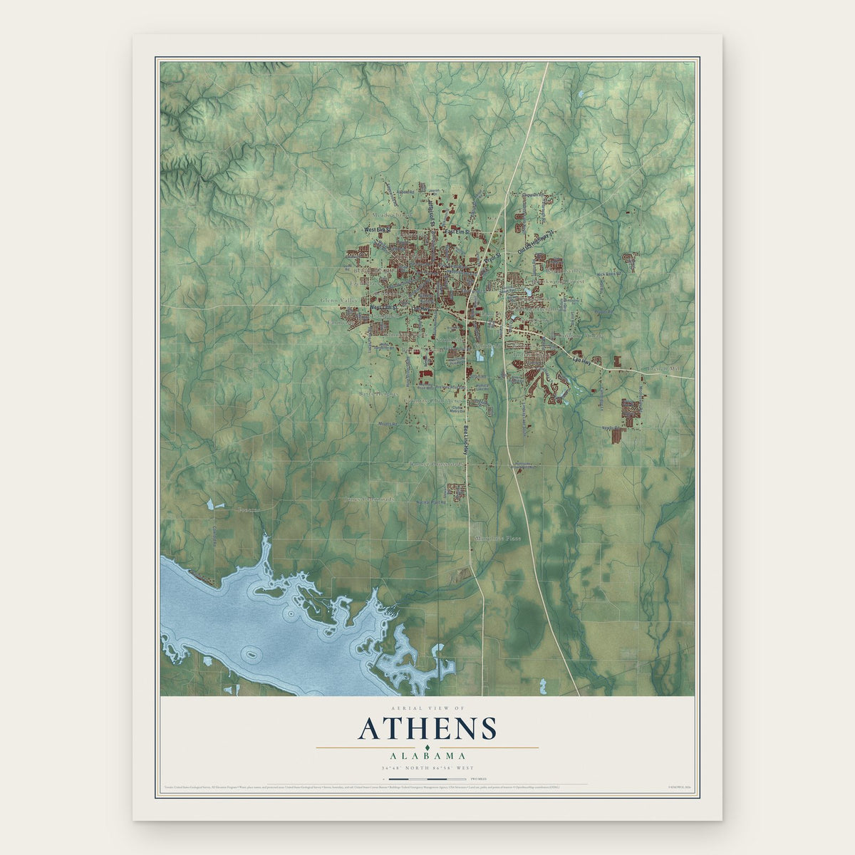
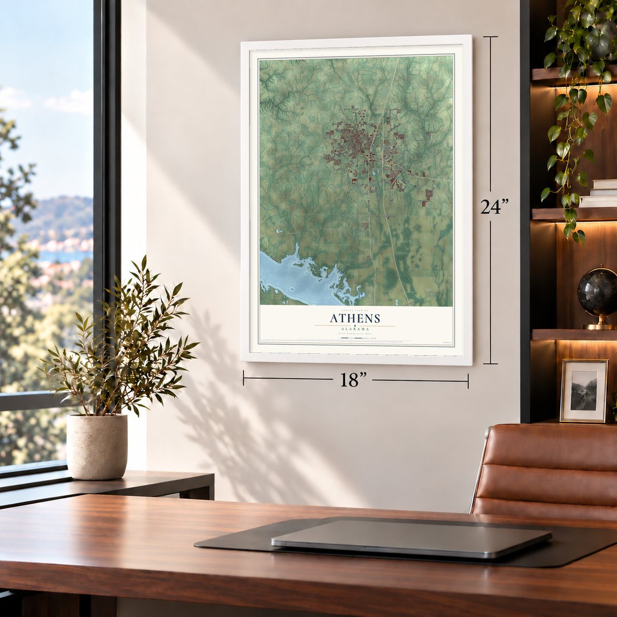
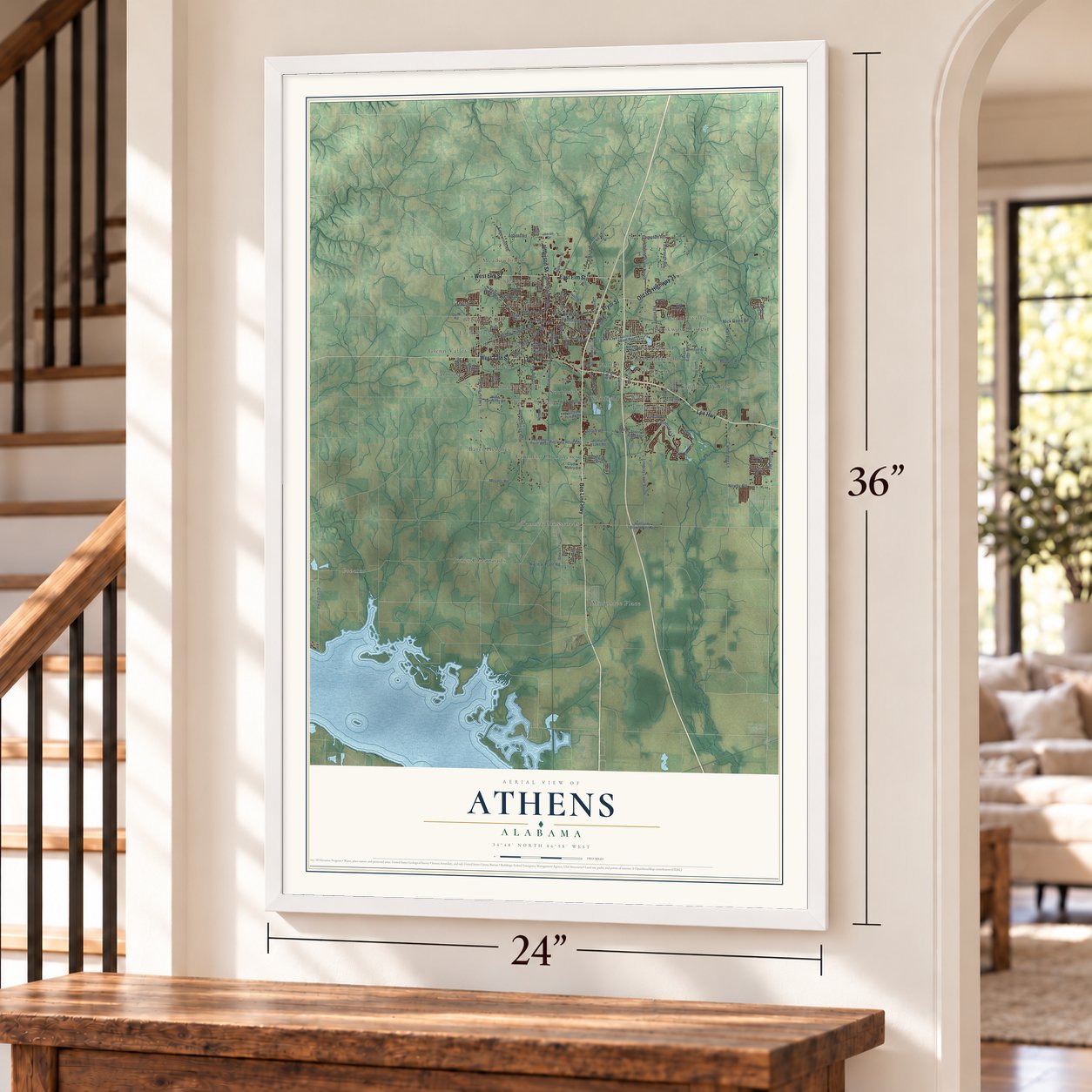
A new map of Athens, Alabama, made in 2026 and printed to order on thick archival matte paper.
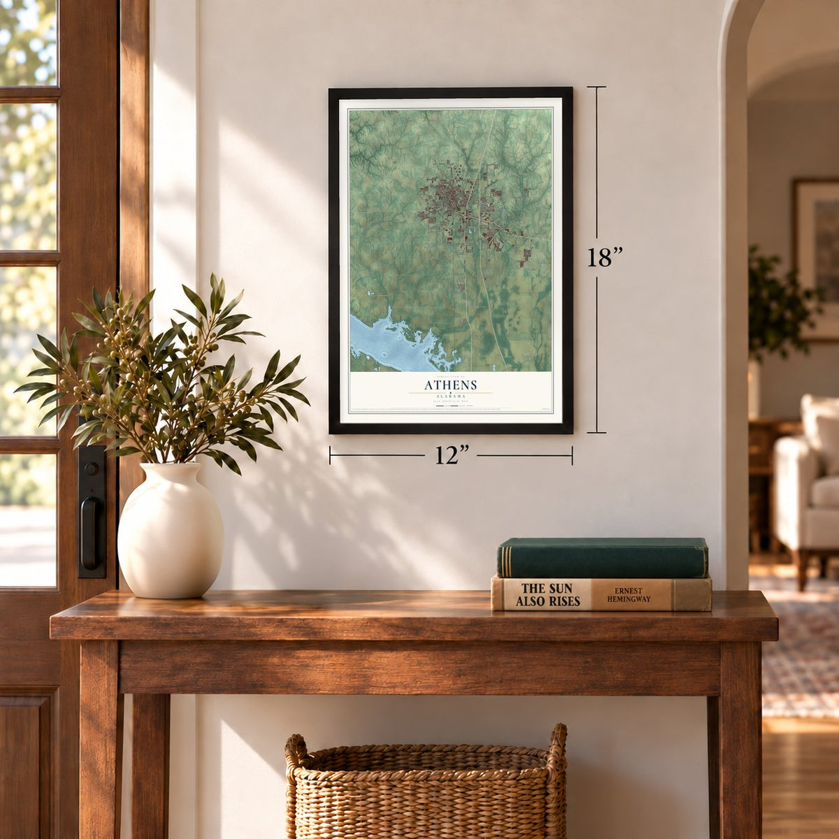
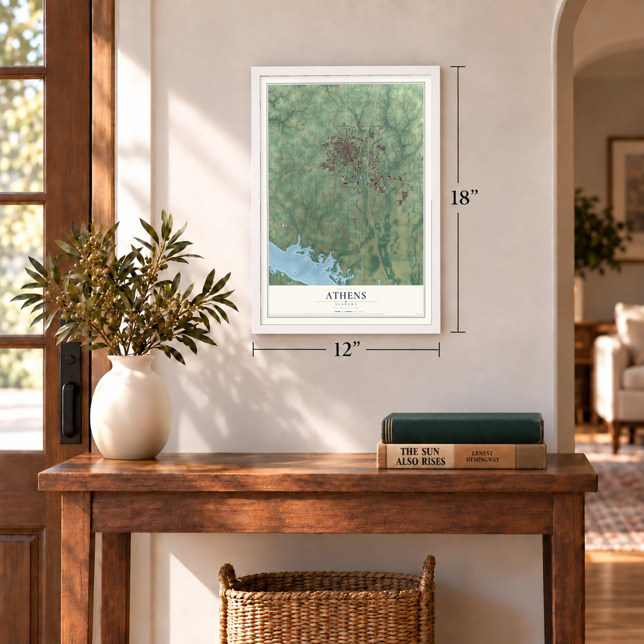
12" x 18" Archival Matte Print
A Map of Home. A Work of Art.
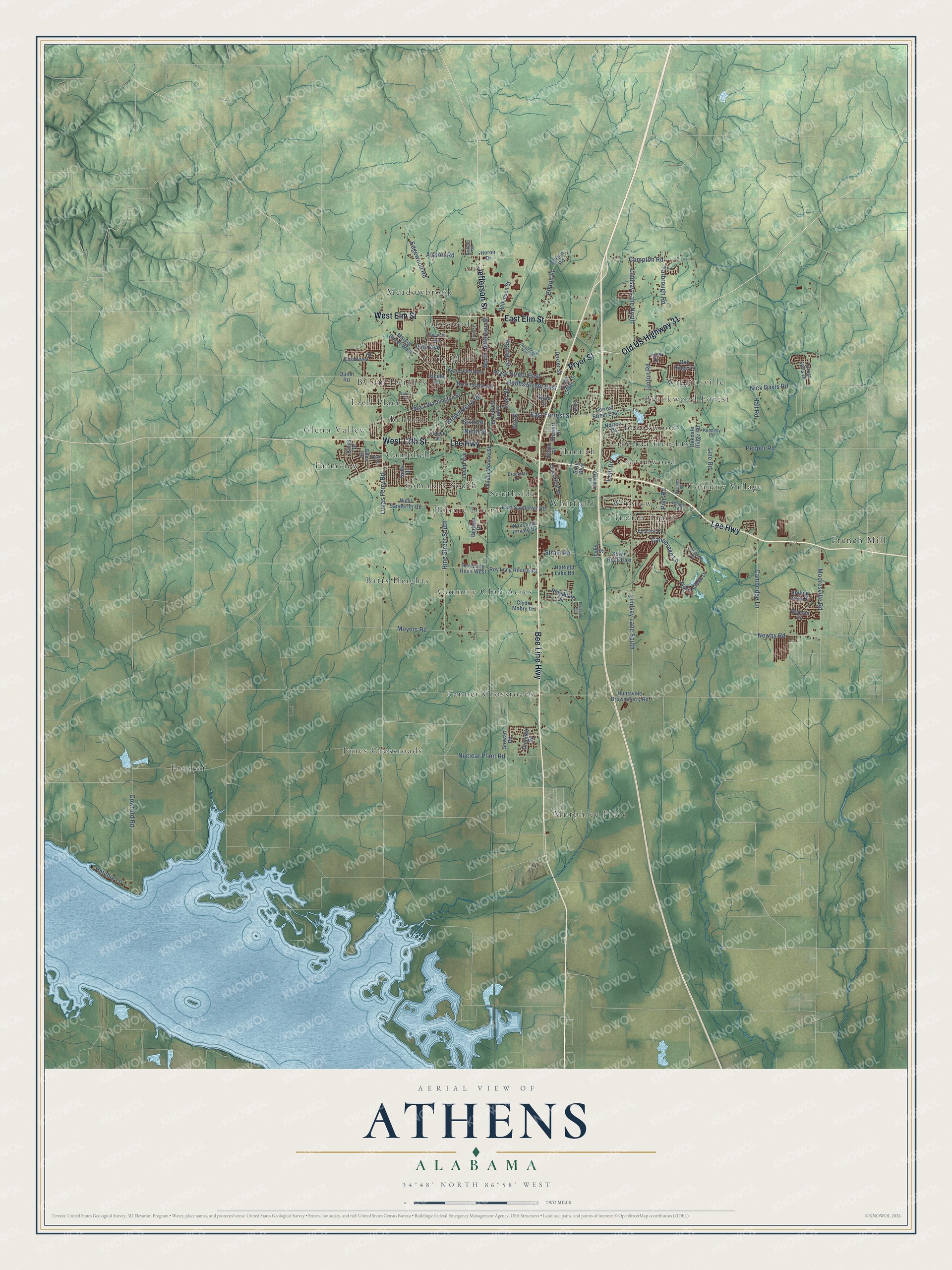
Explore Athens, Alabama from a whole new perspective. Created using aerial imagery and detailed geographic data, this map captures Athens building by building, with labeled streets, familiar landmarks, and shaded topographical relief that highlights the natural contours of the landscape.
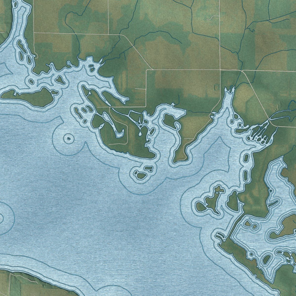
Combining modern data with the timeless character of a vintage atlas, this map is just as interesting up close as it is beautiful on the wall. Whether you grew up in Athens, spent memorable years there, or call it home today, this unique map is a great way to celebrate a place that means something to you. Zoom in on the preview to look for your street, and then order a print to put your memories on the wall.
Three ways to hang it
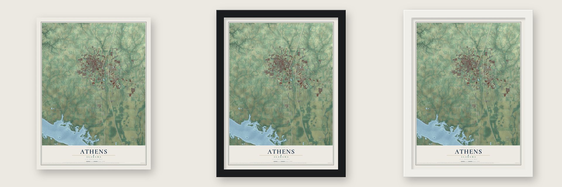
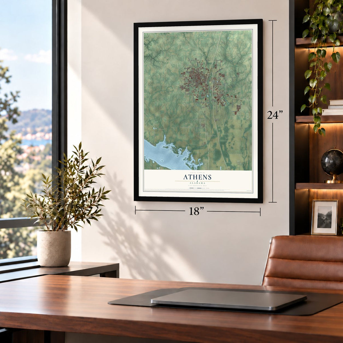
Unframed archival matte, a black wood frame or a white wood frame.
Up close
Geography Worth Displaying
This map was created using accurate cartographic data and authoritative geographic sources, including the U.S. Geological Survey and the Census Bureau. The map brings together terrain, waterways, roads, and building detail. The majority of the streets are labeled, houses are accurately depicted, and the topography is derived from government sources. Combining local data with carefully composed color and shading leads to this beautifully detailed Athens artwork for your wall.
Rather than simply showing street outlines, we’ve included as many of the street names as we could reasonably fit on the map while keeping their names legible. Zoom in on the high resolution preview to see exactly what’s on the map. We truly set out to create a statement piece for anyone who loves Athens. So whether it’s for you, or a gift for someone you love, we hope this map of Athens brings back fond memories.
Read the story behind this map of Athens, Alabama from 2026.

About Athens, Alabama
Athens is a city of 25,406 people and the seat of Limestone County, about 15 miles south of the Tennessee line. Settlers from Tennessee pushed onto Chickasaw land here in the early 1800s, and troops removed most of them, but by 1816 the Chickasaw Nation had given up its claims north and east of the Tennessee River. Partners Robert Beaty and John D. Carriell then bought the townsite at a government land auction and started selling lots in 1818.
Its founders called the place Athenson at first, then settled on the name of the ancient Greek city. It was incorporated on November 19, 1818, more than a year before Alabama became a state on December 14, 1819, and it was named the county seat on March 22, 1819. Its first mayor was Samuel Tanner. The fertile valley soil made Athens a cotton town, its first newspaper, The Athenian, started in 1819, and by 1859 the Tennessee and Alabama Railroad linked it to Decatur and Nashville.
“I shut my eyes for two hours. I see nothing”
- The Sack of Athens, 1862Federal troops occupied Athens in April 1862. On May 1, Confederate cavalry drove them back to Huntsville while many townspeople cheered. The Union army returned the next day, and while Col. John Basil Turchin rode out to look over defensive positions, his soldiers looted and terrorized the town. The Army later court-martialed Turchin over his treatment of Athens.
- A school since 1822Residents bought 5 acres in 1822 and put up a building for the Athens Female Academy. Its first college building, Founders Hall, went up in 1842 and 1843 and still holds classes; it joined the National Register in 1985. The school became Athens Female College under the Methodists, admitted men in 1932 as Athens College, and passed to the State of Alabama in 1974. Today it is Athens State University, the oldest institution of higher education in Alabama.
- Home of three governorsThomas Bibb, Alabama's second governor, lived in Athens, and his home still stands. Joshua L. Martin of Athens became governor in 1845. George S. Houston, born in Athens, served from 1874 to 1878 as the state's first Democratic governor after Reconstruction and cut the debts his predecessors had run up for railroad speculators. His house joined the National Register in 1986.
- Trinity SchoolDuring Reconstruction, Mary Fletcher Wells founded the Trinity School in Athens for the children of former slaves, with money from the American Missionary Association. A state historical marker dates Trinity's founding to 1865.
- First on TVA power, 1934In 1934 Athens became the first city in Alabama to draw its electricity from the Tennessee Valley Authority. In 1966 the TVA picked a site on Wheeler Lake near Athens for its first nuclear plant, Browns Ferry, which went online in December 1973 as the largest nuclear plant in the world at the time.
Find your street
Names on the Athens map
Every name below is printed on this map. Look for your street, your school, the park where you played, or the pond down the road.
Places and landmarks29
- City Hall
- Batts Heights
- Belmont
- Bonnie Doone
- Brookwood
- Brookwood Forest
- Byram Heights
- Campbell
- Cottonwood
- Country Club Acres
- Country Village
- Ezell Place
Show all 29 places
- Farmview
- French Mill
- Glenn Valley
- Hannah
- Indian Trace
- Jones Crossroads
- Lake Ida Heights
- Lakewood
- Meadowbrook
- Murphree Place
- Proctor
- Sommers South
- Southside
- Tanner Crossroads
- Whitfield
- Wigginsville
- Winslow
Streets and roads106
- Jefferson Street
- Old US Highway 31
- Pryor Street
- Bee Line Highway
- Lee Highway
- West Elm Street
- East Elm Street
- West 13th Street
- East Forrest Street
- North Jefferson Street
- Lindsay Lane North
- Pryor Street East
- Nuclear Plant Road
- Lucas Ferry Road
- Lindsay Lane South
- Hine Street South
- Brownsferry Road
- Elkton Street
- Nick Davis Road
- Pepper Road
- Moyers Road
- Cambridge Lane
- Canebrake Lane
- Cowford Road
- Mooresville Road
- Edgewood Road
- Compton Road
- Fifth Avenue
- Yarbrough Road
- Airport Road
Show all 106 streets
- Newby Road
- Linton Road
- Line Road
- Hobbs Street East
- Strain Road
- Frazier Street
- Hatchie Lane
- East Street
- Hall Road
- Sixth Street
- Kelli Drive
- Pike Road
- Ninth Street
- Forrest Street East
- Buck Island Road
- Market Street West
- West Washington Street
- Oakdale Ridge Road
- West Sanderfer Road
- Piney Creek Drive
- Huntsville Brownsferry Road
- Elkton Road
- Levert Avenue
- East Sanderfer Road
- South Clinton Street
- Jacobs Road
- Beacon Circle
- South Monroe Street
- Roy Long Road East
- Ridgedale Street
- Wilkinson Street
- Quinn Road
- Roy Long Road West
- Hatfield Lake Road
- Clearview Street
- Cloverleaf Drive
- Kings Drive
- Wauchula Private Drive
- Durham Drive
- Elles Drive
- Swan Creek Drive
- Rolling Vista Drive
- Stewart Road
- Norton Drive
- Drennen Drive
- Nella Drive
- Stewart Drive
- Clyde Mabry Drive
- Strain Road East
- Forest Hills Drive
- Box Street
- Oak Ridge Lane
- Dexter Street
- Bolyn Street
- Heron Drive
- Braly Boulevard
- Ryan Street
- Fyne Drive
- Luke Street
- Choctaw Lane
- Brookhill Drive
- Pryor Street West
- Seventh Avenue
- Irvin Street
- Kennedy Road
- Village Lane
- Twelfth Street
- Audubon Lane
- Airfield Street
- Shady Lane
- Davis Street
- Hastings Road
- Boardwalk Main Street
- Founders Circle
- Ingleside Street
- Bates Street
Names are listed as they appear on the printed map. Zoom into the product photos to find them.
The art of mapping a place
How This Map Was Made
Real places. Remarkable detail. Discover the layers that turn geographic data into a map of home.

The view from above
Aerial imagery reveals the character of the land: woodland, open fields, and the patterns of a place.

The shape of the land
Elevation data brings hills, valleys, and subtle changes in the landscape into view.

The details of home
Roads, waterways, and building footprints come together to make the map feel unmistakably local.

Geography becomes art
Considered color, shading, and typography bring the layers together in a map made for your wall.


Process illustrated with Mendon, Massachusetts. Aerial imagery: USDA NAIP. Terrain: USGS 3D Elevation Program. Map details and finished artwork: KNOWOL.
The Details
About This Print
Choose an archival matte print, or a black or white Ayous wood frame. The archival matte print is unframed.
Select your size and finish above to see the matching product image and price.
Materials & Craftsmanship
A contemporary map with the character of a classic atlas, printed on archival matte paper. Optional frames are made from Ayous wood.
Your printed map does not include the watermark shown in the full-map preview.
Shipping & Delivery
Free shipping within the United States. Every print is made to order in the USA.
Buying a gift? Add a note in your cart and we'll include it. We never put prices in the package.
Prints ship within 2 to 3 business days. Allow 7 to 10 days total from ordering for delivery. Timing may vary during holidays or periods of high order volume.
Read our shipping policy.
Returns and damaged prints
Each print is made to order. Change-of-mind refunds are not available after production.
If your print arrives damaged, misprinted or incorrect, contact support@knowol.com within 30 days of receiving it. Include your order number, photos and a description of the issue.
Read our full refund and replacement policy. For questions about your order, email support@knowol.com.
Find your town
Looking for another city?
Find a map of home in our Alabama collection, or any town in the country.
Nearby
Maps of towns near Athens
Know someone from one of these towns? Their map makes a great gift.
 Elkmont
, Alabama
From $39.99See the map
 Mooresville
, Alabama
From $39.99See the map
 Madison
, Alabama
From $39.99See the map
More maps nearby: Harvest, Decatur, Trinity, Ardmore and Hillsboro.