
Search for another town



Free U.S. delivery 7 to 10 days after you order
Madison, Alabama Map Art
A new map of Madison, Alabama, made in 2026 and printed to order on thick archival matte paper.
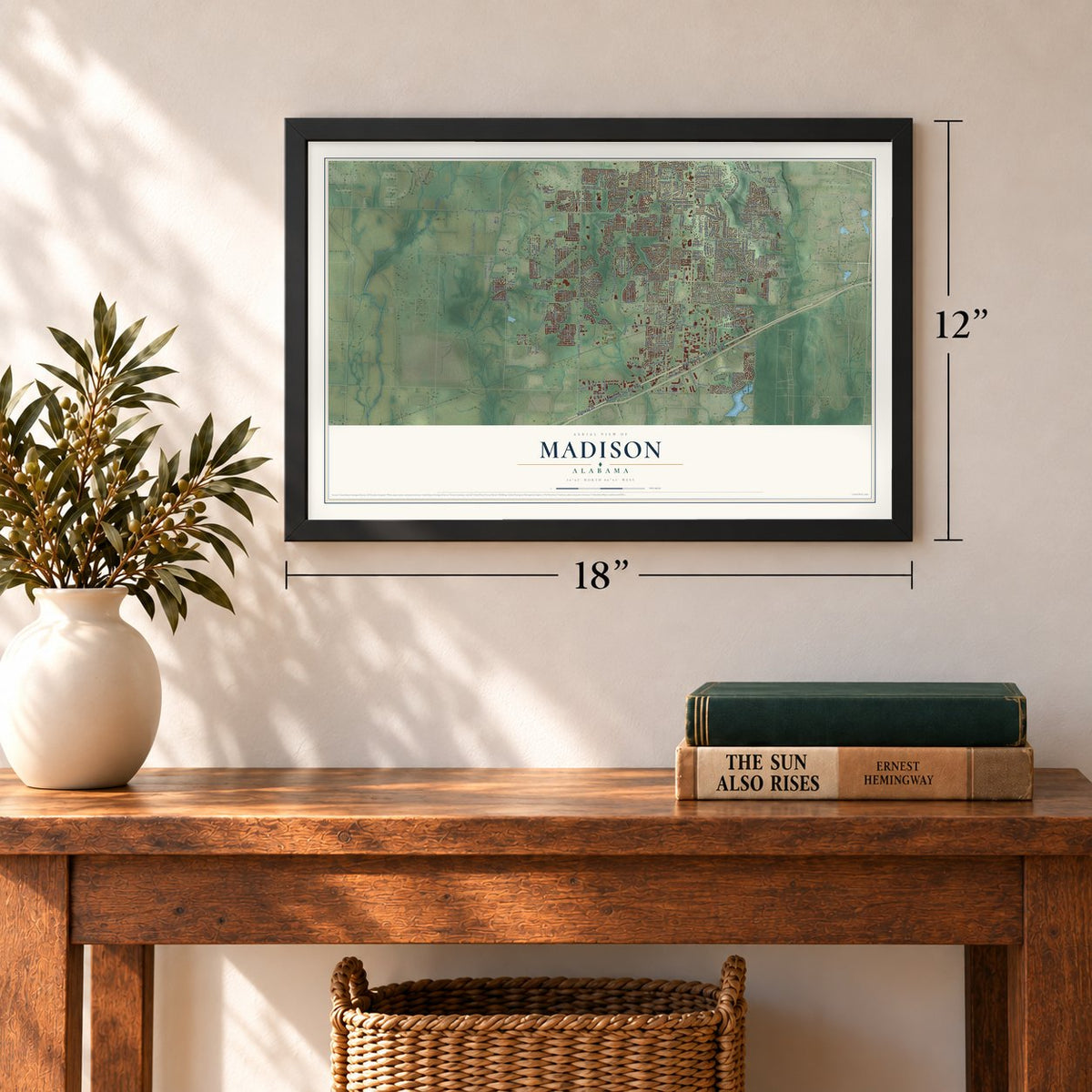
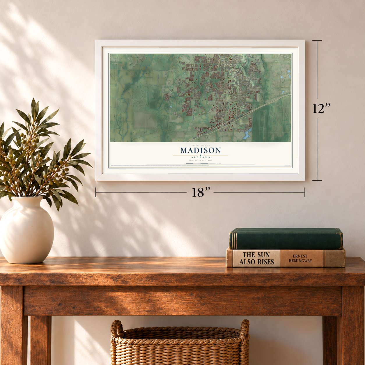
12" x 18" Archival Matte Print
A Map of Home. A Work of Art.
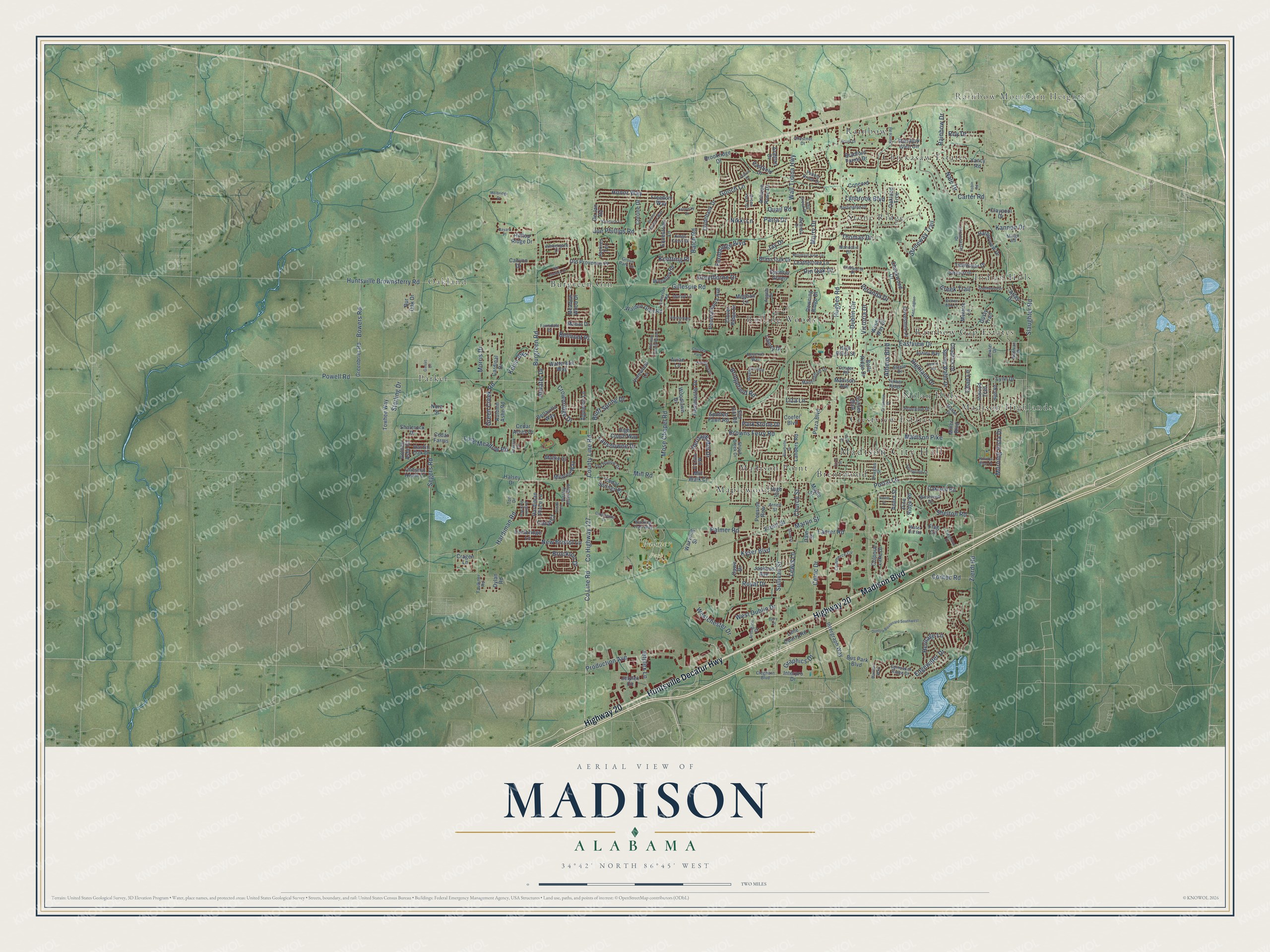
Explore Madison, Alabama from a whole new perspective. Created using aerial imagery and detailed geographic data, this map captures Madison building by building, with labeled streets, familiar landmarks, and shaded topographical relief that highlights the natural contours of the landscape.
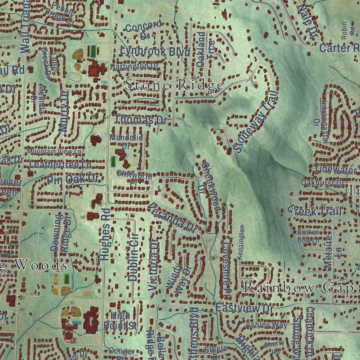
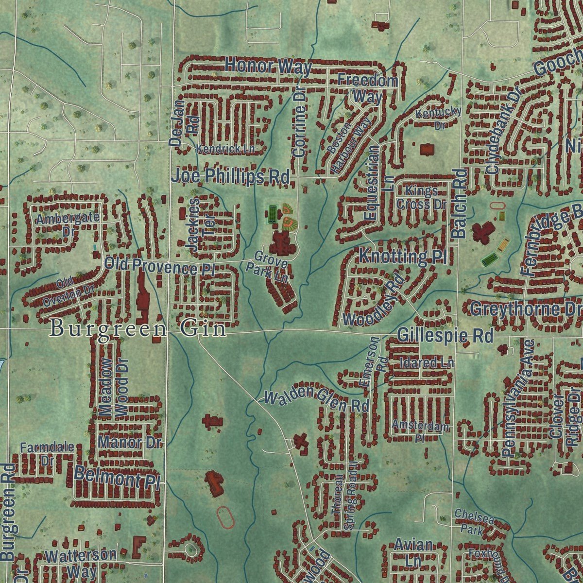
Combining modern data with the timeless character of a vintage atlas, this map is just as interesting up close as it is beautiful on the wall. Whether you grew up in Madison, spent memorable years there, or call it home today, this unique map is a great way to celebrate a place that means something to you. Zoom in on the preview to look for your street, and then order a print to put your memories on the wall.
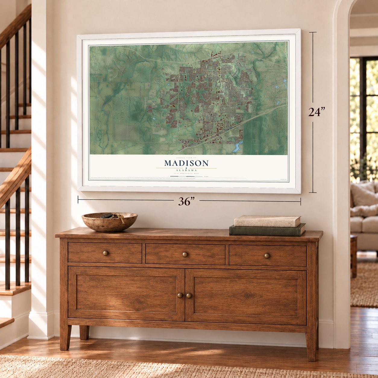
Three ways to hang it
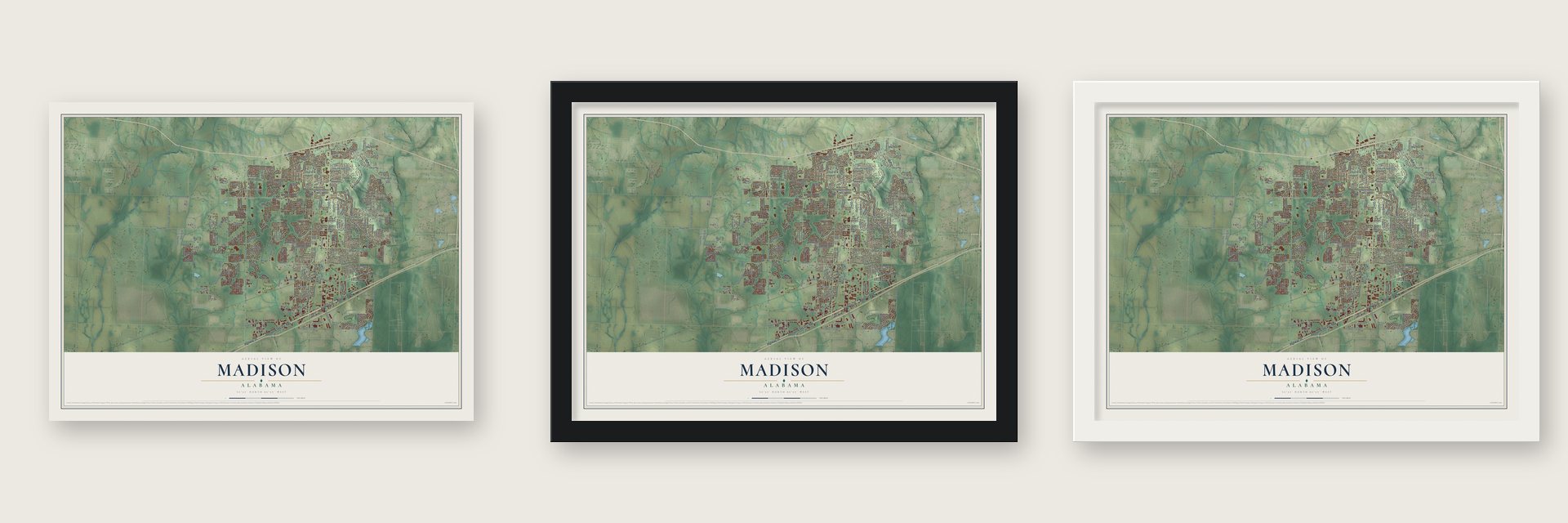
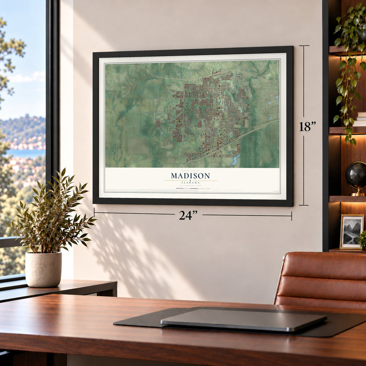
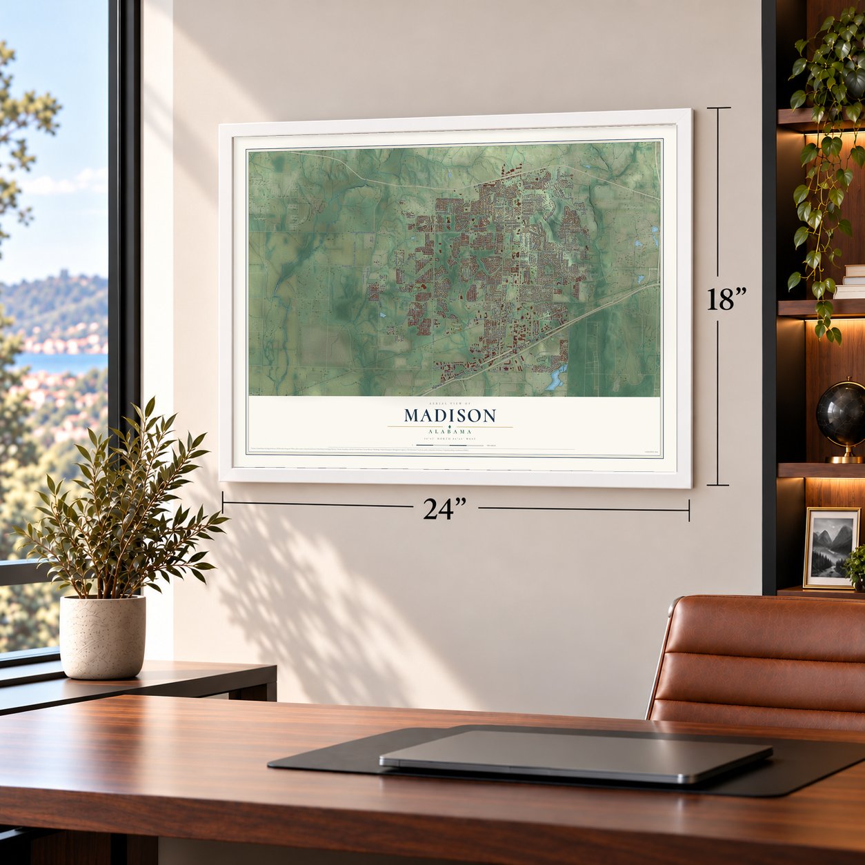
Unframed archival matte, a black wood frame or a white wood frame.
Up close
Geography Worth Displaying
This map was created using accurate cartographic data and authoritative geographic sources, including the U.S. Geological Survey and the Census Bureau. The map brings together terrain, waterways, roads, and building detail. The majority of the streets are labeled, houses are accurately depicted, and the topography is derived from government sources. Combining local data with carefully composed color and shading leads to this beautifully detailed Madison artwork for your wall.
Rather than simply showing street outlines, we’ve included as many of the street names as we could reasonably fit on the map while keeping their names legible. Zoom in on the high resolution preview to see exactly what’s on the map. We truly set out to create a statement piece for anyone who loves Madison. So whether it’s for you, or a gift for someone you love, we hope this map of Madison brings back fond memories.
Read the story behind this map of Madison, Alabama from 2026.
About Madison, Alabama
Madison is a city of 56,933 people, mostly in Madison County, with a western edge that reaches into Limestone County. John Cartwright, a Revolutionary War veteran, received a federal land grant and settled here in 1818. Little else happened until the Memphis and Charleston Railroad built its line through in 1856. In 1858 a town was laid out on land owned by James Clemens, with lots for sale beside the tracks and a new depot.
The settlement went first by the name Madison Station, and before long it had a blacksmith shop and a mill that both sawed lumber and ground grain. Its citizens voted to incorporate, and the town became Madison on December 2, 1869. It stayed small for most of the next century, with about 400 to 500 people from 1880 to 1950. Then jobs tied to Redstone Arsenal and the Jetport drew newcomers in the 1950s and 1960s. By 1980 Madison had 4,057 people, and by 2010 it had 42,938.
- A fight in the rain, 1864On May 17, 1864, Col. Josiah Patterson led about 1000 Confederate cavalry and a battery of artillery across the Tennessee River near Triana. In a driving rainstorm they struck about 350 men of the 13th Illinois Infantry who were guarding the depot. The Union troops fell back down the railroad line to Indian Creek, and Patterson's men seized the regiment's wagon train and 66 prisoners.
- Pushed back over the riverOnce they held the depot, Patterson's men burned the equipment and cotton stored there and tore up track. Union troops then got reinforcements from Huntsville, counterattacked and drove the Confederates back across the river. It was the biggest Civil War clash in Madison County, though few men on either side were hurt.
- The first town council, 1869William R. Johnson served as Madison's first mayor. Five aldermen served with him: William B. Dunn, the first depot agent; Thomas J. Clay, the first postmaster; George W. Martin, the first merchant; James H. Bibb, a planter; and Dr. George R. Sullivan. The James H. Bibb House joined the National Register in 1984.
- A railroad town of 426Madison counted 410 people in 1880, 350 in 1888 and 426 in 1912. By 1912 the town had the Bank of Madison, the Madison Training School and a volunteer fire department. Its industries were a sawmill, 2 cotton ginneries and 2 gristmills, all along the Southern Railway.
- Staying independent in 1986During World War II and the years after it, military and NASA work moved to Huntsville. New highways made it easy for workers to live farther out, and Madison grew into a suburb of its neighbor. In 1986 Madison voters overwhelmingly chose not to merge with Huntsville. Huntsville now surrounds the city on all sides, and in 2011 Money magazine named Madison one of its Top 100 Places to Live.
Find your street
Names on the Madison map
Every name below is printed on this map. Look for your street, your school, the park where you played, or the pond down the road.
Places and landmarks19
- Madison City Hall
- Rainbow Mountain Heights
- Oakland
- Palmer Park
- Brentwood
- Burgreen Gin
- Chickasaw Estates
- Crestview Estates
- Indian Hills
- Madison Highlands
- Madison Point
- Maplewood
Show all 19 places
- Nolan Hills
- Parker
- Rainbow
- Rainbow Gap Estates
- Rolling Woods
- Stone Ridge
- Chelsea Park
Streets and roads266
- Huntsville Decatur Highway
- Madison Boulevard
- Highway 20
- Production Avenue
- Madison Pike
- Slaughter Road
- Shelton Road
- Hardiman Road
- Hughes Road
- County Line Road
- Wall Triana Highway
- Browns Ferry Road
- Huntsville Brownsferry Road
- County Highway 127
- Mill Road
- Gillespie Road
- Sullivan Street
- Balch Road
- Eastview Drive
- Powell Road
- Palmer Road
- Gooch Lane
- Burgreen Road
- Stoneway Trail
- Highland Drive
- Lanier Road
- Rainbow Drive
- Segers Road
- Zierdt Road
- Veranda Drive
Show all 266 streets
- Bridgefield Road
- Portal Lane
- Crownridge Drive
- Mose Chapel Road
- Bowers Road
- Joe Phillips Road
- Carter Road
- Royal Drive
- Kyser Boulevard
- Celtic Drive
- Fernbridge Boulevard
- Honor Way
- Brockton Drive
- New Bristol Lane
- Westchester Drive
- Belmont Place
- Edgewater Drive
- Long Meadow Road
- Contec Road
- Morris Drive
- West Dublin Drive
- Heritage Lane
- Lansdowne Drive
- Dublin Circle
- Heritage Mill Drive
- Knotting Place
- Graphics Drive
- Jay Drive
- Nale Drive
- Murry Drive
- Jetplex Lane
- Lewis Lane
- Martin Street
- Pin Oak Drive
- Green Creek Road
- Morning Vista Drive
- Front Street
- Lynbrook Boulevard
- Victoria Drive
- Patra Drive
- Bluff Spring Drive
- Starling Drive
- Greythorne Drive
- Church Street
- Park Stone Drive
- Roy Drive
- Thomas Drive
- Kelso Boulevard
- Coral Court
- Athens Boulevard
- Kannon Drive
- Creek Trail
- Atwater Drive
- Chad Lane
- Quail Road
- Nikki Lane
- Liza Lane
- Miller Boulevard
- Liberty Drive
- Colonial Lake Drive
- Bradford Farms Drive
- Autumn Ashe Road
- Greenbrier Road
- Lime Quarry Road
- Oakland Trce
- Concord Drive
- Watterson Way
- Belle Ridge Drive
- Yancy Road
- Rainbow Glen Circle
- Freedom Way
- Inwood Trail
- Corrine Drive
- Sunset Boulevard
- Metaire Lane
- Pine Ridge Road
- Silo Hill Road
- Plaza Boulevard
- Clydebank Drive
- Intergraph Way
- High Coach Way
- Tidewater Drive
- Brookridge Drive
- Brass Oak Drive
- Jetplex Circle
- Antique Rose Drive
- Jackies Terrace
- Pension Row
- Landers Road
- Harborview Drive
- Leathertree Lane
- Pennsylvania Avenue
- Hilltop Ridge Drive
- Towhee Way
- Chadrick Drive
- Old Provence Place
- Maple Street
- Mill Walk Court
- Equestrian Lane
- Hardiman Place Lane
- Bellavilla Way
- Spring Water Drive
- De Jan Road
- Shalerock Drive
- Cardinal Drive
- Walden Glen Road
- Avian Lane
- Clover Ridge Drive
- Cheekwood Drive
- Arabian Drive
- Mattie Court
- Fieldmaster Drive
- Coveshire Place
- Dusty Trail
- Mildred Way
- Spotted Fawn Road
- Jackson Avenue
- Woodlawn Drive
- Appleton Lane
- Downing Ridge Drive
- Dawn Drive
- Woodley Road
- Cedar Acres Drive
- Golden Ashe Court
- Oakland Road
- Chesnut Heath Court
- Eastfield Drive
- Meadow Wood Drive
- Spencer Green
- Bus Park Boulevard
- Pembridge Lane
- Cedar Springs Place
- Madison Avenue
- Vinewood Lane
- Hardin Oak Drive
- Meghan Lane
- Waxwing Street
- Coefer Boulevard
- Manor Drive
- Interpro Drive
- Halsey Drive
- Claypool Drive
- Windy Way Drive
- Cain Street
- High Street
- Andra Street
- Cragen Lane
- Lynn Drive
- Flag Circle
- Canyon Drive
- Atlas Drive
- High Point Street
- Dylan Road
- Cedar Farms
- Bur Oak Drive
- Nora Street
- Manningham Drive
- Mahan Drive
- Intracoastal Drive
- Hartington Drive
- Reserve Way
- Steele Drive
- Commerce Circle
- Water Hill Road
- Oakhurst Drive
- Spinnaker Ridge Drive
- Ashley Way
- High Road
- Arnett Street
- Mill Park Lane
- Pebble Brook Drive
- Westscott Drive
- Grove Park Lane
- Fox Hollow Drive
- Arlington Drive
- Princeton Drive
- Farmdale Drive
- Shiloh Creek Drive
- Emerson Road
- Green Fern Street
- Wesley Clark Boulevard
- Ambergate Drive
- Long Creek Drive
- Douglas Street
- Faulkner Road
- Idared Lane
- Walking Trail Way
- Cliftworth Place
- Conger Road
- Mandolin Drive
- Chestnut Drive
- Cleghorn Boulevard
- Melinda Drive
- Kings Cross Drive
- Rodman Drive
- Timber Ridge
- Angela Drive
- Lewter Drive
- Mingo Road
- Tori Drive
- Old Overton Drive
- Dunlop Boulevard Southwest
- Nance Road
- Flagstone Drive
- Continental Drive
- Crestview Drive
- Amsterdam Place
- Southwood Drive
- Brighton Park Way
- Foxhound Drive
- Merganser Boulevard
- Prairie Drive
- Melbridge Drive
- Mountain View Lane
- Boston Harbour Way
- Sawrock Drive
- Kendrick Lane
- Springfield Lane
- Bluebelle Drive
- Thoreau Spring Road II
- Bayard Place
- Mainsail Way
- Cherry Road
- Larry Drive
- Broken Bow Lane
- Roma Drive
- Kensington
- Ivory Place
- Gimlet Drive
- Horizon View Court
- Kentucky Drive
- Alisha Circle
- Violet Drive
- Robin Road
- Short Street
- Carol Street
Names are listed as they appear on the printed map. Zoom into the product photos to find them.
The art of mapping a place
How This Map Was Made
Real places. Remarkable detail. Discover the layers that turn geographic data into a map of home.

The view from above
Aerial imagery reveals the character of the land: woodland, open fields, and the patterns of a place.

The shape of the land
Elevation data brings hills, valleys, and subtle changes in the landscape into view.

The details of home
Roads, waterways, and building footprints come together to make the map feel unmistakably local.

Geography becomes art
Considered color, shading, and typography bring the layers together in a map made for your wall.


Process illustrated with Mendon, Massachusetts. Aerial imagery: USDA NAIP. Terrain: USGS 3D Elevation Program. Map details and finished artwork: KNOWOL.
The Details
About This Print
Choose an archival matte print, or a black or white Ayous wood frame. The archival matte print is unframed.
Select your size and finish above to see the matching product image and price.
Materials & Craftsmanship
A contemporary map with the character of a classic atlas, printed on archival matte paper. Optional frames are made from Ayous wood.
Your printed map does not include the watermark shown in the full-map preview.
Shipping & Delivery
Free shipping within the United States. Every print is made to order in the USA.
Buying a gift? Add a note in your cart and we'll include it. We never put prices in the package.
Prints ship within 2 to 3 business days. Allow 7 to 10 days total from ordering for delivery. Timing may vary during holidays or periods of high order volume.
Read our shipping policy.
Returns and damaged prints
Each print is made to order. Change-of-mind refunds are not available after production.
If your print arrives damaged, misprinted or incorrect, contact support@knowol.com within 30 days of receiving it. Include your order number, photos and a description of the issue.
Read our full refund and replacement policy. For questions about your order, email support@knowol.com.
Find your town
Looking for another city?
Find a map of home in our Alabama collection, or any town in the country.
Nearby
Maps of towns near Madison
Know someone from one of these towns? Their map makes a great gift.
 Huntsville
, Alabama
From $39.99See the map
 Redstone Arsenal
, Alabama
From $39.99See the map
 Triana
, Alabama
From $39.99See the map
More maps nearby: Mooresville, Harvest, Athens, Priceville and Meridianville.