
Search for another town


Free U.S. delivery 7 to 10 days after you order
Harvest, Alabama Map Art
Building by building, with labeled streets and shaded relief.
12" x 18" Archival Matte Print
A Map of Home. A Work of Art.
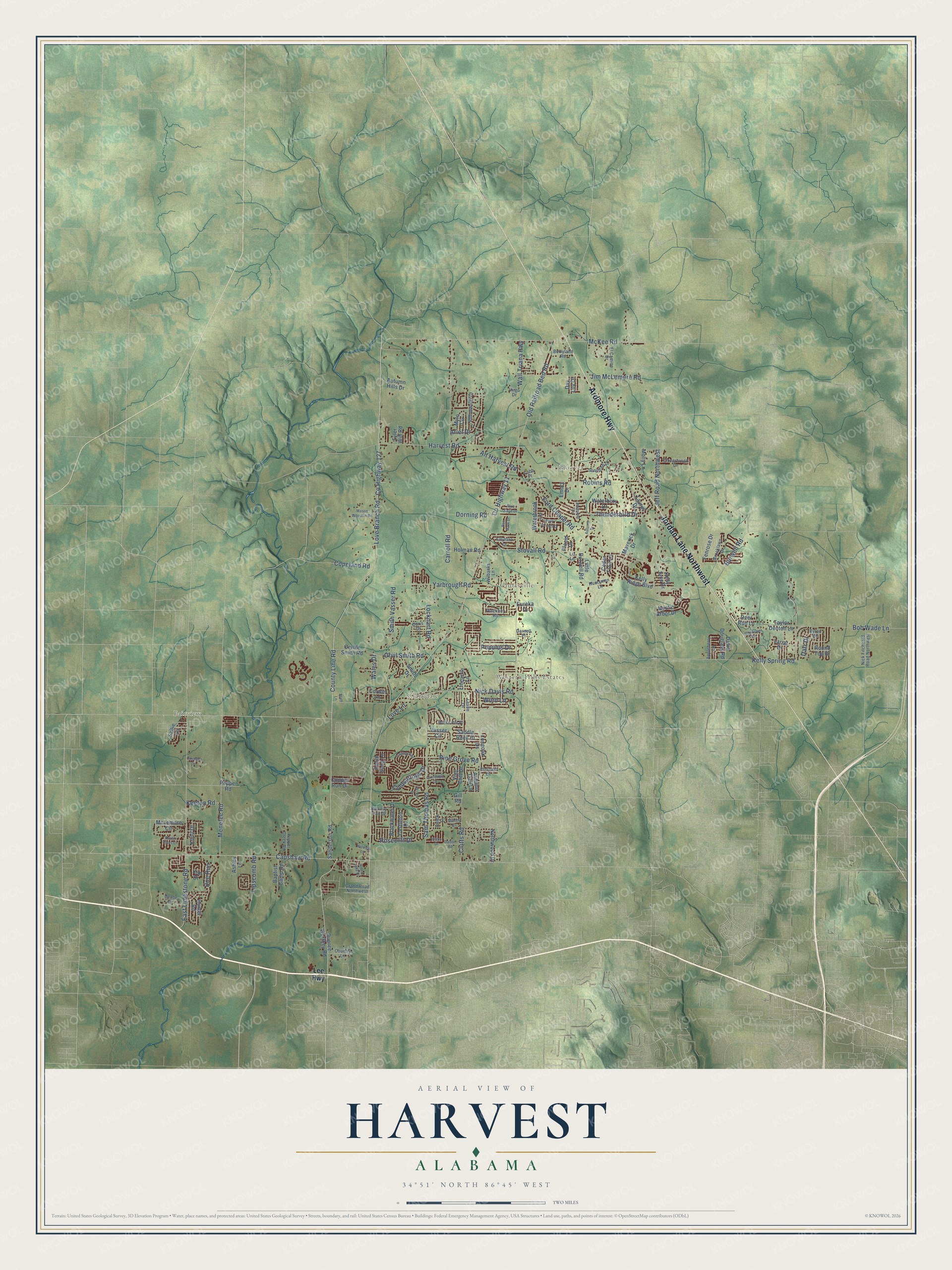
Explore Harvest, Alabama from a whole new perspective. Created using aerial imagery and detailed geographic data, this map captures Harvest building by building, with labeled streets, familiar landmarks, and shaded topographical relief that highlights the natural contours of the landscape.
Combining modern data with the timeless character of a vintage atlas, this map is just as interesting up close as it is beautiful on the wall. Whether you grew up in Harvest, spent memorable years there, or call it home today, this unique map is a great way to celebrate a place that means something to you. Zoom in on the preview to look for your street, and then order a print to put your memories on the wall.
Three ways to hang it

Unframed archival matte, a black wood frame or a white wood frame.
Up close
Geography Worth Displaying
This map was created using accurate cartographic data and authoritative geographic sources, including the U.S. Geological Survey and the Census Bureau. The map brings together terrain, waterways, roads, and building detail. The majority of the streets are labeled, houses are accurately depicted, and the topography is derived from government sources. Combining local data with carefully composed color and shading leads to this beautifully detailed Harvest artwork for your wall.
Rather than simply showing street outlines, we’ve included as many of the street names as we could reasonably fit on the map while keeping their names legible. Zoom in on the high resolution preview to see exactly what’s on the map. We truly set out to create a statement piece for anyone who loves Harvest. So whether it’s for you, or a gift for someone you love, we hope this map of Harvest brings back fond memories.
Read the story behind this map of Harvest, Alabama from 2026.

Find your street
Names on the Harvest map
Every name below is printed on this map. Look for your street, your school, the park where you played, or the pond down the road.
Places and landmarks5
- Hoover
- Fairview
- Western Hills Estates
- Clarkdale
- Cluttsville
Streets and roads140
- Ardmore Highway
- Jordan Lane Northwest
- Old Railroad Bed Road
- County Line Road
- Love Branch Road
- County Highway 127
- Capshaw Road
- McKee Road
- County Highway 11
- Wall Triana Highway
- Nick Davis Road
- Harvest Road
- Jeff Road Northwest
- Carroll Road
- Yarbrough Road
- East Limestone Road
- Ford Chapel Road
- Burwell Road
- Orvil Smith Road
- Pine Grove Road
- Kelly Spring Road
- Menefee Road
- Smith Vasser Road
- Jim McLemore Road
- Clutts Road
- Thunderbird Drive
- Robins Road
- Copeland Road
- Sam Thomas Road
- Coldsprings Drive
Show all 140 streets
- Bob Wade Lane
- Rosecliff Drive
- Lockhart Road
- Dorning Road
- Ariel Drive
- Lipscomb Road
- Doe Run
- Alt Harvest Road
- Stovall Road
- Keeton Road
- Populus Drive
- Darr Drive
- Word Lane
- Love Lane
- Wales Drive
- Lee Highway
- Dupree Worthey Road
- McLemore Circle
- Kelly Ridge Boulevard
- Maverick Drive
- Kim Drive
- Sanderson Road
- Round Top Drive
- Cedar Trail Lane
- Smith Drive
- Waterbury Drive
- Taurus Drive
- Vine Cliff Drive
- Saddle Rock Court
- Emory Drive
- Taylor Denton Lane
- Orville Smith Road
- Fenrose Drive
- Blackwater Drive
- Mylo Circle
- Hunter Road
- Mystic Arbor Drive
- Baptist Camp Road
- Little Burwell Road
- Deer Run Lane
- Holman Road
- Lincarrie Lane
- Northwood Drive
- Copper Run Drive
- David Douglass Road
- Waterbrook Lane
- Placid Drive
- Castleton Drive
- Vasser Circle
- Loneoak Drive
- Autumn Hills Drive
- Ashley Lane
- Autumn Oak Lane
- Pepper Road
- Robin Song Lane
- Corwin Lane
- Knoll Drive
- Molly Lane
- Tyler Will Road
- Lariat Drive
- Kelly June Drive
- Day Lily Drive
- Eureka Drive
- Sallie Lane
- Gill Road
- Denbo Circle
- Amberwood Drive
- Nick Fitcheard Road Northwest
- Pepper Creek Road
- Sunshine Drive
- Huntsmen Lane
- Cloverbrook Drive
- Appleberry Lane
- Grand Road Northwest
- Brooklawn Drive
- El Camino Drive
- Berryland Road
- Horse Pin Place
- Country Lane
- Delete Street
- Wilbanks Lane
- Pinckney Road
- Doris Drive
- Hickory Trail Drive
- Emerald Drive
- Darnell Place
- Leslie Lane
- Cobb Place
- Virgo Drive
- Byron Road
- Liz Lane
- Trailing Vine
- Seven Pines Lane
- Wilder Drive
- Mason Woodfin Road
- Twin Springs Drive
- Bilton Drive
- Hightower Road
- Eastland Drive
- Melody Circle
- Alden Lake Drive
- Waypoint Circle
- Kittyhawk Lane
- Laurelmill Drive
- Dalton Road
- Ben Mark Drive
- Staff Lane
- Blue Sage Drive
- Autumn Drive
- Holmes Lane
Names are listed as they appear on the printed map. Zoom into the product photos to find them.
About Harvest, Alabama
Harvest is a community of 5,893 people in northwestern Madison County, Alabama. The land belonged to the Cherokee until the early 1800s, and in 1808 a Methodist preacher named James Gwinn gathered a congregation in the home of Richard and Betsy Ford. That congregation became Ford's Chapel, one of the oldest Methodist churches in the region.
Late in the 1800s a rail line was built south from Fayetteville, Tennessee, and Harvest grew up beside it between Toney and Capshaw, where the tracks ended. Many of its early settlers came down from around Fayetteville. The Nashville, Chattanooga & St. Louis Railway later took over the line, but in 1929 it gave up on the route, tore out the rails and handed the land over to the county highway department. The old roadbed is now a two-lane road called Old Railroad Bed Road.
- Ford's Chapel, since 1808The Methodist Western Conference met in Williamson County, Tennessee, on Oct. 1-7, 1808, and assigned James Gwinn to the Tennessee River's "great bend." At the Fords' house he formed the first of six Methodist societies in the Flint Circuit, which circuit riders served for many years. Work on a church began in 1815, the Fords deeded the building and its land to trustees in 1824, and the present sanctuary was started in 1870 on the original foundation.
- Two F5 tornadoes in 1974On April 3, 1974, during the Super Outbreak, two F5 tornadoes struck Harvest within 30 minutes of each other. They wiped out most of the community, especially along Old Railroad Bed Road, along with nearby Tanner, and fifty people died.
- Struck again and againAn F4 tornado tore through the Anderson Hills subdivision on May 18, 1995, killing one person. On April 27, 2011, the EF5 tornado that leveled Hackleburg and Phil Campbell did EF4 damage in Harvest and wrecked Anderson Hills a second time. That storm took 72 lives over its whole route. An EF3 tornado followed on March 2, 2012, and hit the same neighborhoods. No one died, but some houses still being rebuilt were lost again.
- Capshaw MountainCapshaw Mountain rises to 1,250 feet, about 800 feet above the land around it. Local radio stations keep communications towers on its summit, and its watershed supplies the community's water.
Keep exploring Alabama
Harvest is one of 675 Alabama towns we've mapped. Every dot on the map is a print of its own.
The search covers every state, Alabama first.
Near Harvest
Order 2 or more town maps and save 10%. Shown in the size and finish you picked above, so they hang as a set.
- Monrovia 12" x 18" / Archival Matte Print $39.99
- East Limestone 12" x 18" / Archival Matte Print $39.99
- Cedar Hill 12" x 18" / Archival Matte Print $39.99
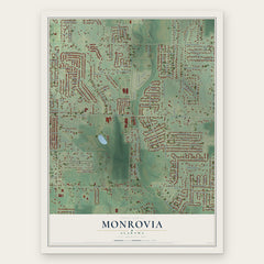
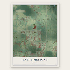
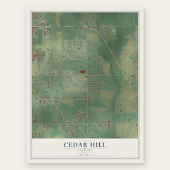
More maps nearby: Piney Chapel, Madison, Ardmore, Meridianville and Huntsville.
The art of mapping a place
How This Map Was Made
Real places. Remarkable detail. Discover the layers that turn geographic data into a map of home.

The view from above
Aerial imagery reveals the character of the land: woodland, open fields, and the patterns of a place.

The shape of the land
Elevation data brings hills, valleys, and subtle changes in the landscape into view.

The details of home
Roads, waterways, and building footprints come together to make the map feel unmistakably local.

Geography becomes art
Considered color, shading, and typography bring the layers together in a map made for your wall.


Process illustrated with Mendon, Massachusetts. Aerial imagery: USDA NAIP. Terrain: USGS 3D Elevation Program. Map details and finished artwork: KNOWOL.
The Details
About This Print
Choose an archival matte print, or a black or white Ayous wood frame. The archival matte print is unframed.
Select your size and finish above to see the matching product image and price.
Materials & Craftsmanship
A contemporary map with the character of a classic atlas, printed on archival matte paper. Optional frames are made from Ayous wood.
Your printed map does not include the watermark shown in the full-map preview.
Shipping & Delivery
Free shipping within the United States. Every print is made to order in the USA.
Buying a gift? Add a note in your cart and we'll include it. We never put prices in the package.
Prints ship within 2 to 3 business days. Allow 7 to 10 days total from ordering for delivery. Timing may vary during holidays or periods of high order volume.
Read our shipping policy.
Returns and damaged prints
Each print is made to order. Change-of-mind refunds are not available after production.
If your print arrives damaged, misprinted or incorrect, contact support@knowol.com within 30 days of receiving it. Include your order number, photos and a description of the issue.
Read our full refund and replacement policy. For questions about your order, email support@knowol.com.