
Search for another town





Free U.S. delivery 7 to 10 days after you order
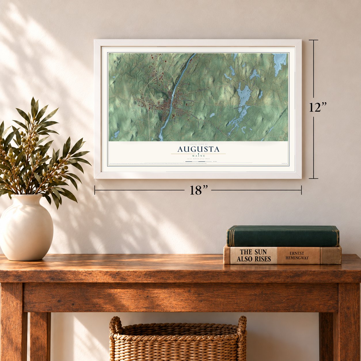
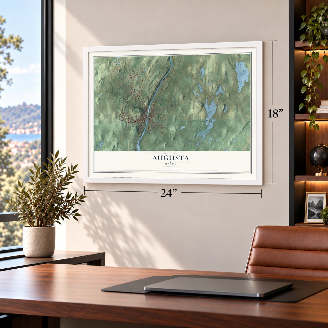
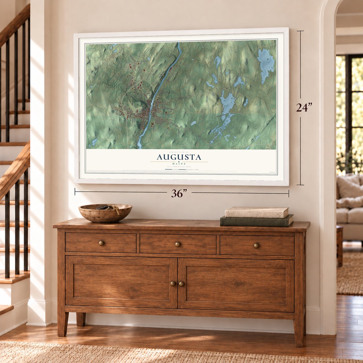
Augusta, Maine Map Art
Building by building, with labeled streets and shaded relief.
12" x 18" Archival Matte Print
A Map of Home. A Work of Art.
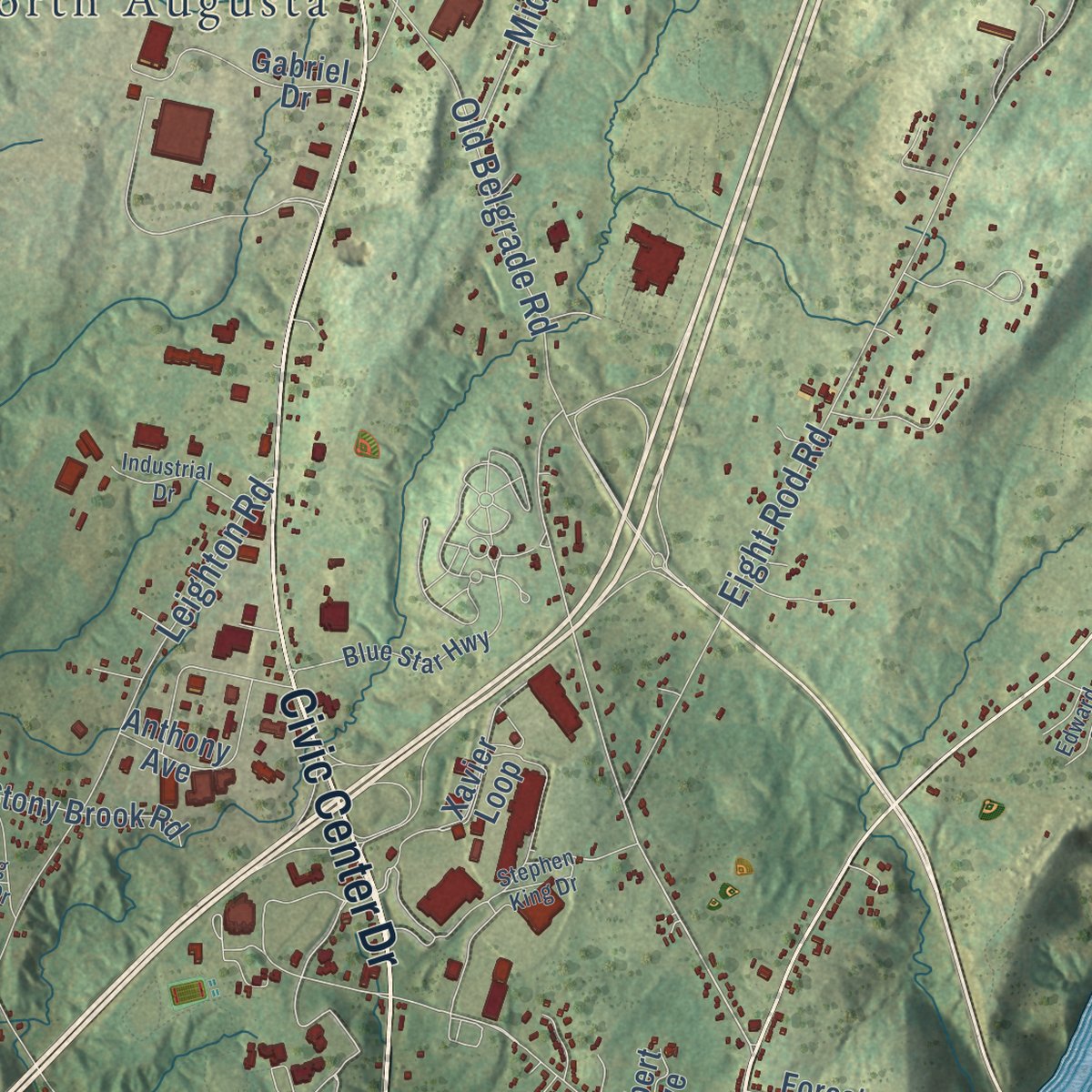
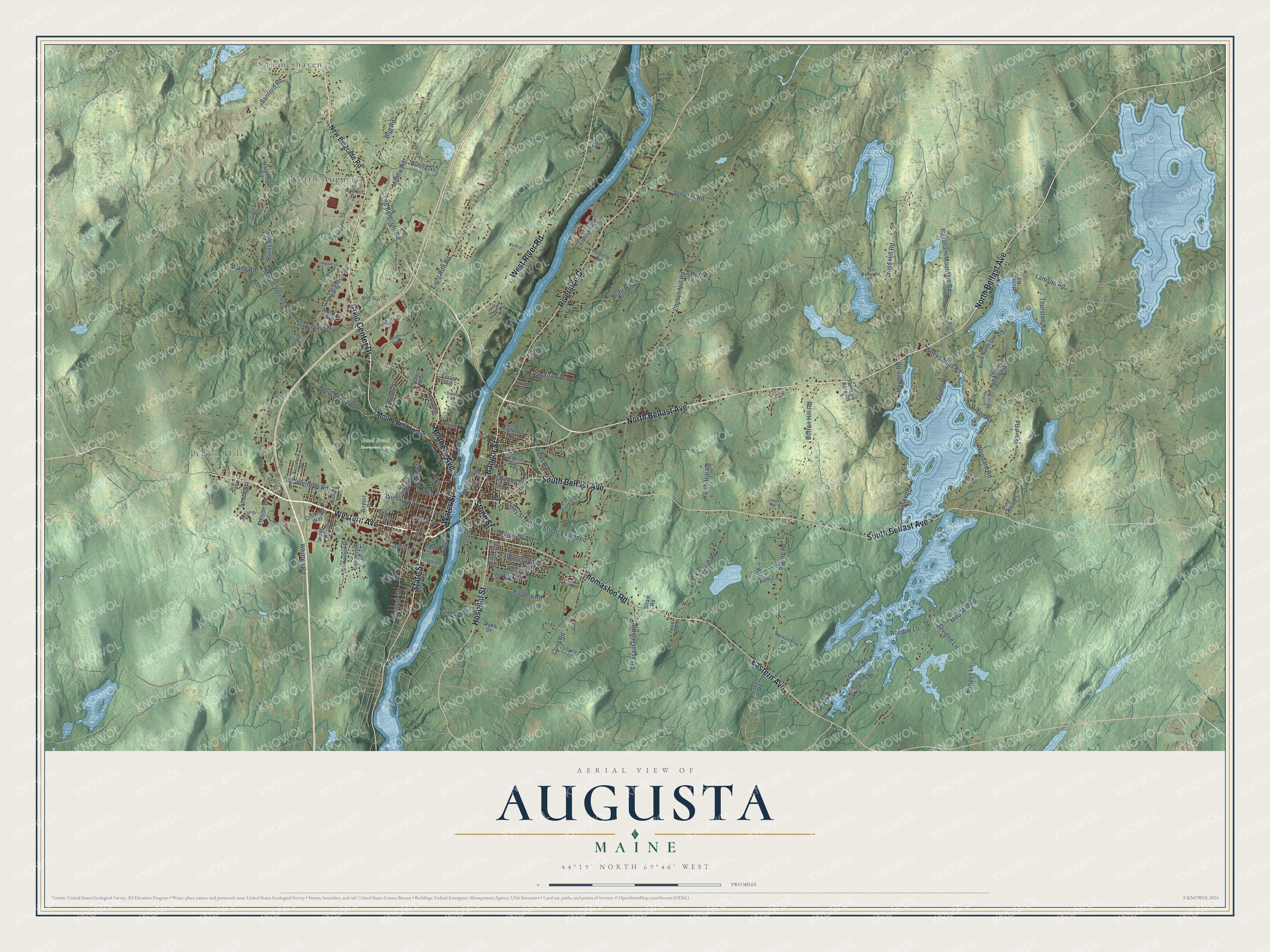
Explore Augusta, Maine from a whole new perspective. Created using aerial imagery and detailed geographic data, this map captures Augusta building by building, with labeled streets, familiar landmarks, and shaded topographical relief that highlights the natural contours of the landscape.
Combining modern data with the timeless character of a vintage atlas, this map is just as interesting up close as it is beautiful on the wall. Whether you grew up in Augusta, spent memorable years there, or call it home today, this unique map is a great way to celebrate a place that means something to you. Zoom in on the preview to look for your street, and then order a print to put your memories on the wall.
Three ways to hang it
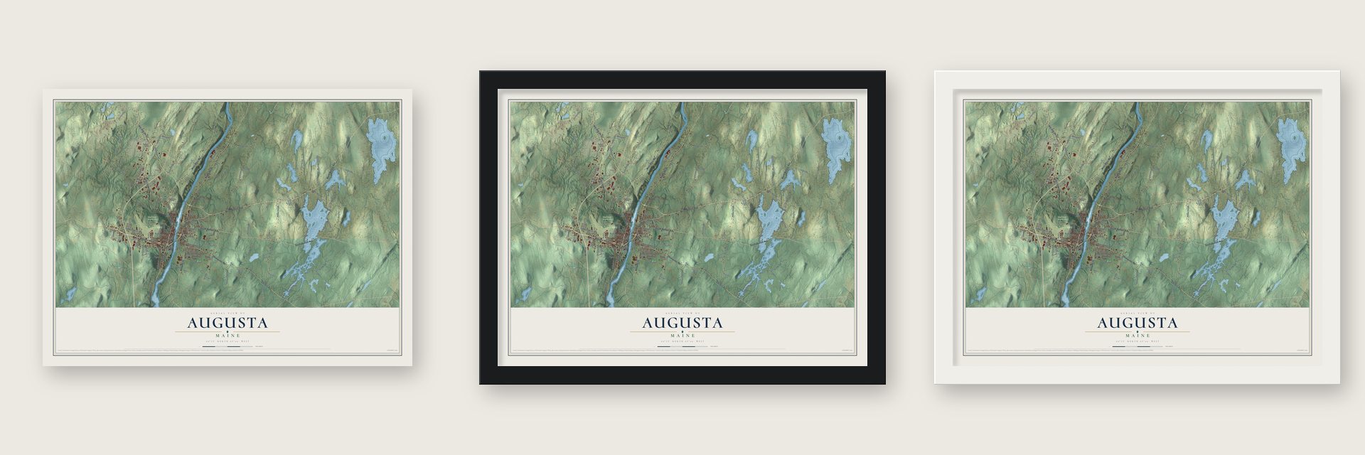
Unframed archival matte, a black wood frame or a white wood frame.
Up close
Geography Worth Displaying
This map was created using accurate cartographic data and authoritative geographic sources, including the U.S. Geological Survey (USGS) and FEMA. The map brings together terrain, waterways, roads, and building detail. The majority of the streets are labeled, houses are accurately depicted, and the topography is derived from government sources. Combining local data with carefully composed color and shading leads to this beautifully detailed Augusta artwork for your wall.
Rather than simply showing street outlines, we’ve included as many of the street names as we could reasonably fit on the map while keeping their names legible. Zoom in on the high resolution preview to see exactly what’s on the map. We truly set out to create a statement piece for anyone who loves Augusta. So whether it’s for you, or a gift for someone you love, we hope this map of Augusta brings back fond memories.
Explore the full map of Augusta, Maine and read about the local places it shows.

Find your street
Names on the Augusta map
Every name below is printed on this map. Look for your street, your school, the park where you played, or the pond down the road.
Places and landmarks4
- Summerhaven
- Pelton Hill
- Bond Brook Recreation Area
- North Augusta
Streets and roads146
- North Belfast Avenue
- Water Street
- Western Avenue
- Northern Avenue
- State Street
- West River Road
- Civic Center Drive
- Riverside Drive
- Eastern Avenue
- Hospital Street
- South Belfast Avenue
- Thomaston Road
- Bangor Street
- Stone Street
- Green Street
- Old Belgrade Road
- Sewall Street
- Bog Road
- Gage Street
- Winthrop Street
- Capitol Street
- Church Hill Road
- Leighton Road
- Eight Rod Road
- Cross Hill Road
- Mud Mill Road
- Cony Road
- Mount Vernon Road
- Ingraham Mountain Road
- Spring Road
Show all 146 streets
- Bolton Hill Road
- Burns Road
- Weeks Mills Road
- Ward Road
- Middle Road
- Sanford Road
- Bond Brook Road
- Cony Street Extended
- Leavitt Road
- Arsenal Street
- Pappys Lane
- Old Winthrop Road
- Whitten Road
- Young Road
- Outlet Road
- Wade Road
- Blair Road
- Stevens Road
- Lamson Road
- Pleasant Hill Road
- Albee Road
- Tasker Road
- Hatch Hill Road
- Piggery Road
- Rocque Lane
- Thurston Road
- Sparrow Drive
- Duncan Road
- Hayden Road
- Woodard Road
- Windsor Avenue
- Lipman Road
- Cony Street
- Witham Lane
- Fairview Avenue
- Quimby Street
- Smith Street
- Hicks Road
- Edison Drive
- Huff Road
- Divided Lane
- Windy Street
- Bunny Street
- North Street
- Willow Street
- Mount Vernon Avenue
- New Belgrade Road
- Highland Avenue
- Albert Avenue
- Togus Road
- Airport Road
- Xavier Loop
- Buck North Doe Trail
- Parkwood Drive
- Lone Indian Trail
- Crossing Way
- Pierce Drive
- Purinton Avenue
- Gabriel Drive
- Kennedy Road
- Ganneston Drive
- Hatchery Road
- Stony Brook Road
- Anthony Avenue
- Union Street
- Rumery Road
- Bridge Street
- Gerabro Acre Road
- Lafayette Street
- Dyer Drive
- Forest Avenue
- Child Street
- Pine Tree Lane
- Fuller Road
- Ridge Road
- Holmes Road
- Claire Street
- Lynn Road
- Shaw Road
- Drew Street
- Lyon Lane
- First Avenue
- Fifth Avenue
- Griffin Point Road
- Blue Star Highway
- Allenwood Park Road
- School Street
- Court Street
- Westwood Road
- Gypsy Lane
- Morrisette Lane
- Blaisdell Street
- High Street
- Chase Avenue
- Brann Avenue
- Tracy Street
- Hayes Road
- Chapel Street
- Dam Pond Road
- Industrial Drive
- Hutchinson Drive
- Canal Street
- Balsam Drive
- Stephen King Drive
- Kamich
- Maple Street
- New England Road
- Monroe Street
- Linwood Avenue
- Caswell Street
- Pond Drive
- Edward Street
- Central Street
- Knight Road
- King Pine Drive
- Ledge Road
Names are listed as they appear on the printed map. Zoom into the product photos to find them.
About Augusta, Maine
Augusta is the capital of Maine and the seat of Kennebec County, a city of 18,899 people where the tide ends on the Kennebec River. Traders from Plymouth Colony set up a post on the east bank around 1628 and used the Native name for the spot, Cushnoc. The fur trade faded, and Plymouth sold its Kennebec Patent in 1661, leaving the place empty for decades.
In 1754 the Kennebec Proprietors put up Fort Western near the old post, and a village called "the Fort" grew around it. It belonged to Hallowell from 1771 until February 1797, when it became the town of Harrington, and that August it took the name Augusta to honor Pamela Augusta Dearborn, Henry Dearborn's daughter. Augusta became the county seat in 1799, beat out Portland, Brunswick and Hallowell to become the capital in 1827, and was incorporated as a city in 1849.
- Arnold's stop in 1775Fort Western was meant to supply Fort Halifax farther up the Kennebec and to guard against the French. No enemy ever attacked it directly. In 1775 Benedict Arnold and his 1,100 troops paused here to fix their bateaux, then pushed upriver toward Quebec. The fort's main house survives from the original, and it opened as a museum on July 4, 1922.
- Bulfinch's granite State HouseAugusta's people gave the land where the State House would stand and opened State Street as the road leading up to it. Lawmakers kept meeting in Portland until Charles Bulfinch's Maine State House, built of Hallowell granite, was ready, and they first sat there on January 4, 1832. In 1909 and 1910 the building was doubled in length and topped with a 185-foot dome, crowned by a gilt copper Minerva.
- A dam and its millsIn 1837 a dam was built across the river at the falls, which drop 15 feet there, and by 1838 contracts called for 10 sawmills. The Edwards Manufacturing Company bought the A. & W. Sprague property in 1883 and built large brick mills to spin cotton from the South. Edwards Dam stood until 1999, when the government removed it over its owner's objections, opening 17 miles of river.
- Water Street's ups and downsFor most of Augusta's history, business crowded along Water Street on the west bank, where a fire in 1865 burned nearly 100 buildings. Trolleys ran down the street to Gardiner and Hallowell from 1890 until buses took over in 1932. Once Interstate 95 and the Maine Turnpike opened in 1955, stores drifted toward the highway, and about 60 percent of downtown storefronts went empty. Since the late 2000s the city and the Augusta Downtown Alliance have worked to revive it.
Keep exploring Maine
Augusta is one of 536 Maine towns we've mapped. Every dot on the map is a print of its own.
The search covers every state, Maine first.
Near Augusta
Order 2 or more town maps and save 10%. Shown in the size and finish you picked above, so they hang as a set.
- Chelsea 12" x 18" / Archival Matte Print $39.99
- Hallowell 12" x 18" / Archival Matte Print $39.99
- Manchester 12" x 18" / Archival Matte Print $39.99

More maps nearby: Randolph, Farmingdale, Sidney, Vassalboro and Windsor.
The art of mapping a place
How This Map Was Made
Real places. Remarkable detail. Discover the layers that turn geographic data into a map of home.

The view from above
Aerial imagery reveals the character of the land: woodland, open fields, and the patterns of a place.

The shape of the land
Elevation data brings hills, valleys, and subtle changes in the landscape into view.

The details of home
Roads, waterways, and building footprints come together to make the map feel unmistakably local.

Geography becomes art
Considered color, shading, and typography bring the layers together in a map made for your wall.


Process illustrated with Mendon, Massachusetts. Aerial imagery: USDA NAIP. Terrain: USGS 3D Elevation Program. Map details and finished artwork: KNOWOL.
The Details
About This Print
Choose an archival matte print, or a black or white Ayous wood frame. The archival matte print is unframed.
Select your size and finish above to see the matching product image and price.
Materials & Craftsmanship
A contemporary map with the character of a classic atlas, printed on archival matte paper. Optional frames are made from Ayous wood.
Your printed map does not include the watermark shown in the full-map preview.
Shipping & Delivery
Free shipping within the United States. Every print is made to order in the USA.
Buying a gift? Add a note in your cart and we'll include it. We never put prices in the package.
Prints ship within 2 to 3 business days. Allow 7 to 10 days total from ordering for delivery. Timing may vary during holidays or periods of high order volume.
Read our shipping policy.
Returns and damaged prints
Each print is made to order. Change-of-mind refunds are not available after production.
If your print arrives damaged, misprinted or incorrect, contact support@knowol.com within 30 days of receiving it. Include your order number, photos and a description of the issue.
Read our full refund and replacement policy. For questions about your order, email support@knowol.com.