
Search for another town




Free U.S. delivery 7 to 10 days after you order
Austintown, Ohio Map Art
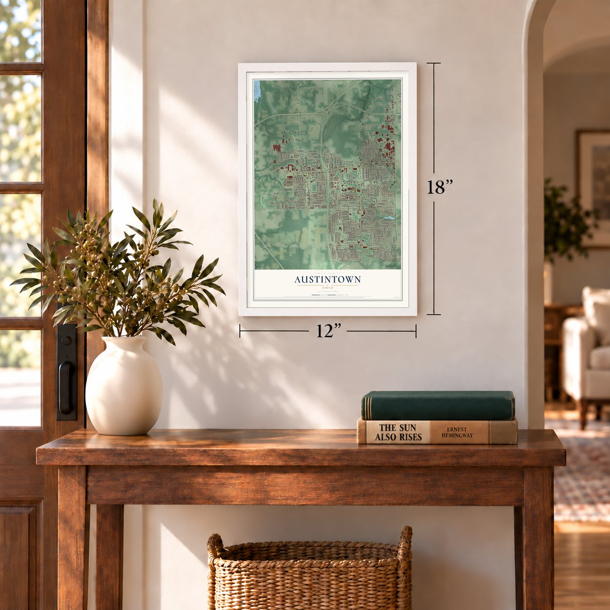
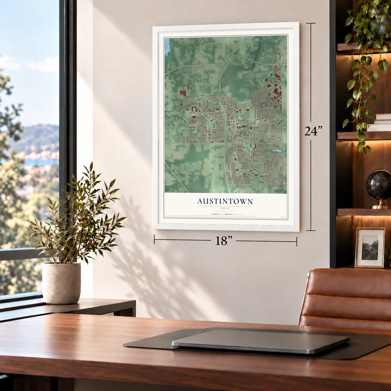
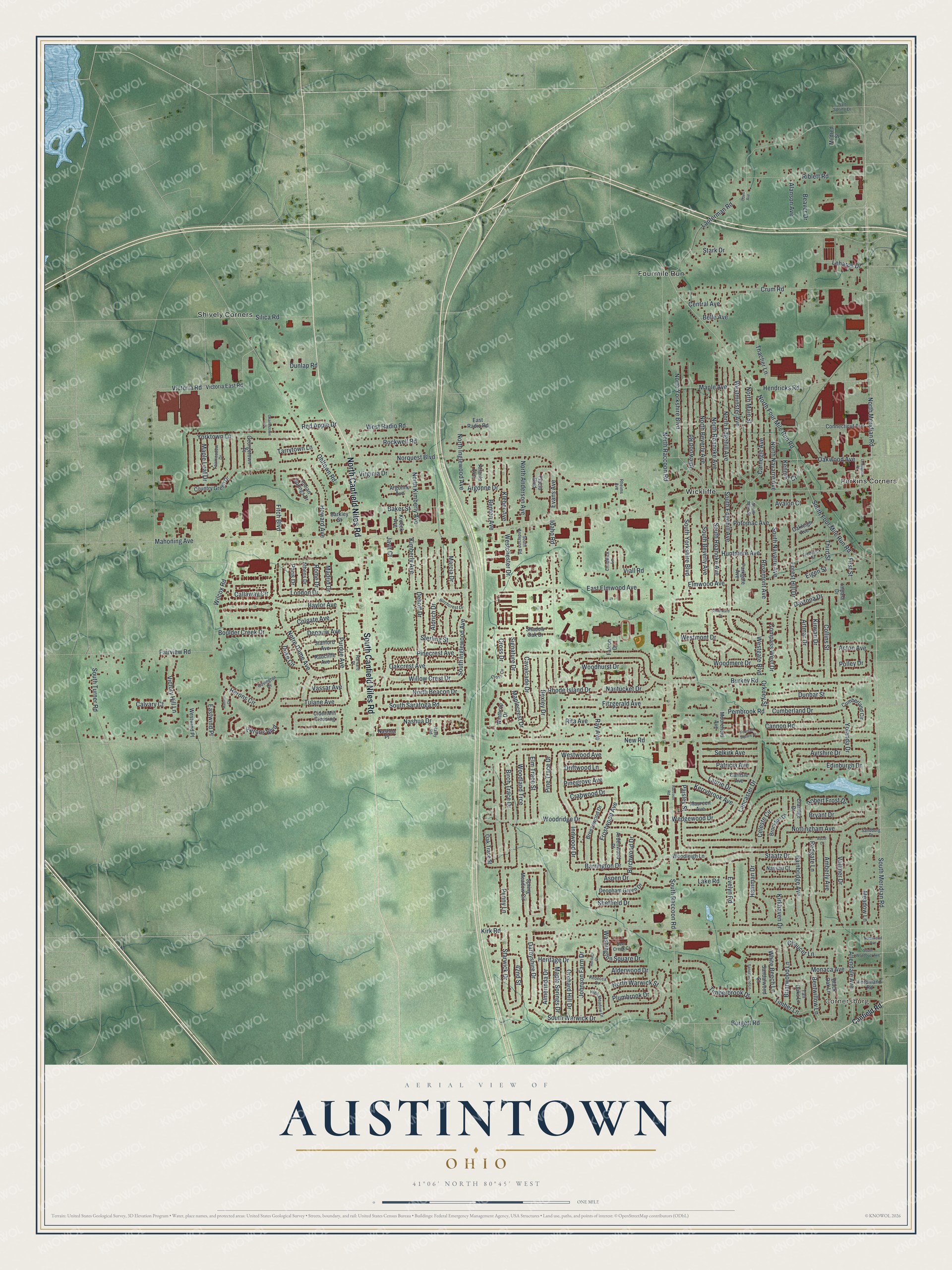
A new map of Austintown, Ohio, made in 2026 and printed to order on thick archival matte paper.
12" x 18" Archival Matte Print
A Map of Home. A Work of Art.
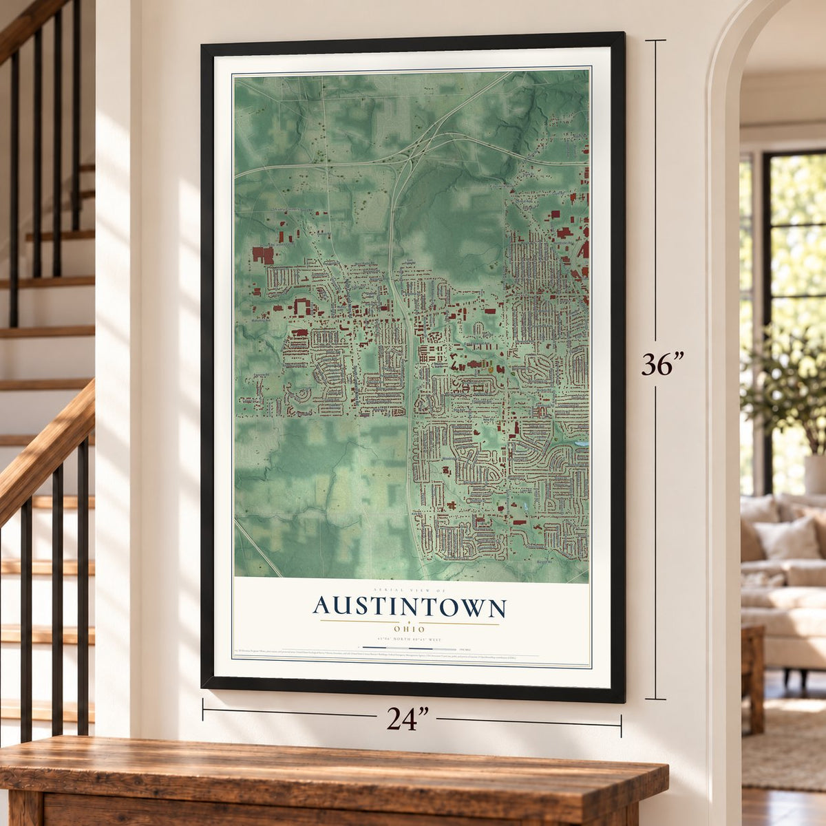
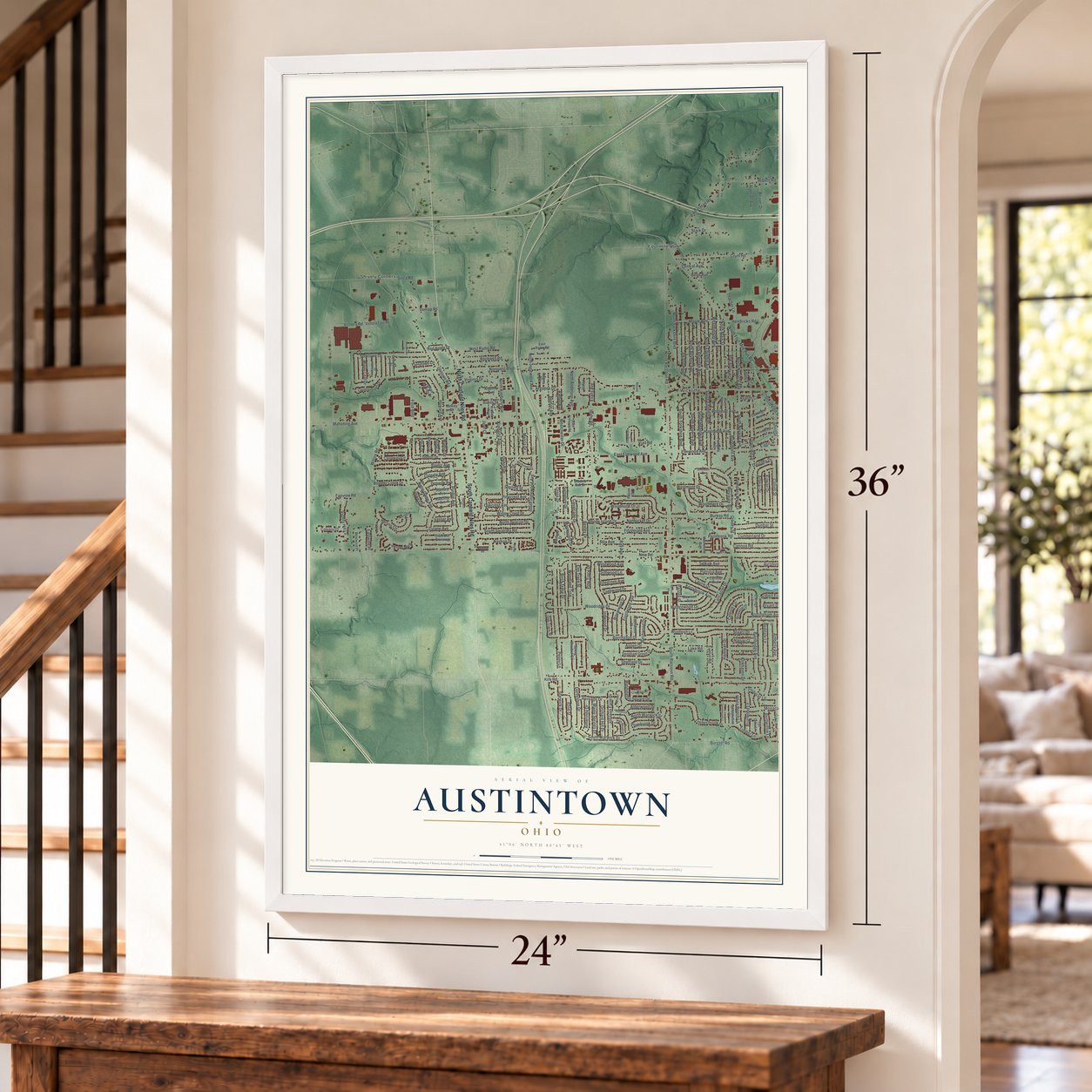
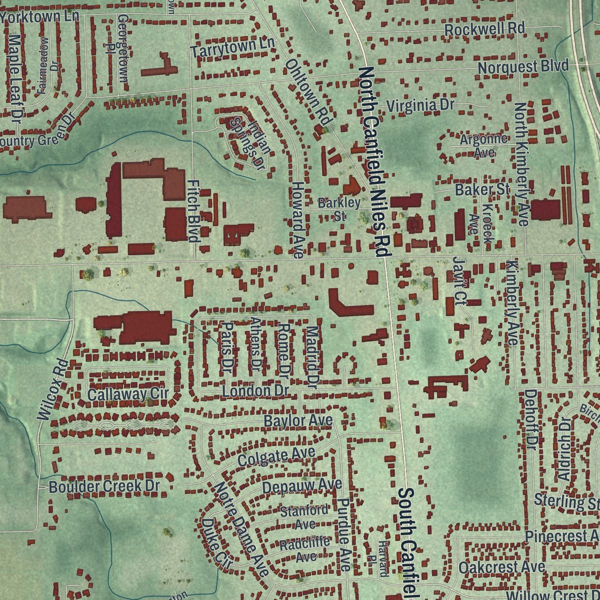
Explore Austintown, Ohio from a whole new perspective. Created using aerial imagery and detailed geographic data, this map captures Austintown building by building, with labeled streets, familiar landmarks, and shaded topographical relief that highlights the natural contours of the landscape.
Combining modern data with the timeless character of a vintage atlas, this map is just as interesting up close as it is beautiful on the wall. Whether you grew up in Austintown, spent memorable years there, or call it home today, this unique map is a great way to celebrate a place that means something to you. Zoom in on the preview to look for your street, and then order a print to put your memories on the wall.
Three ways to hang it
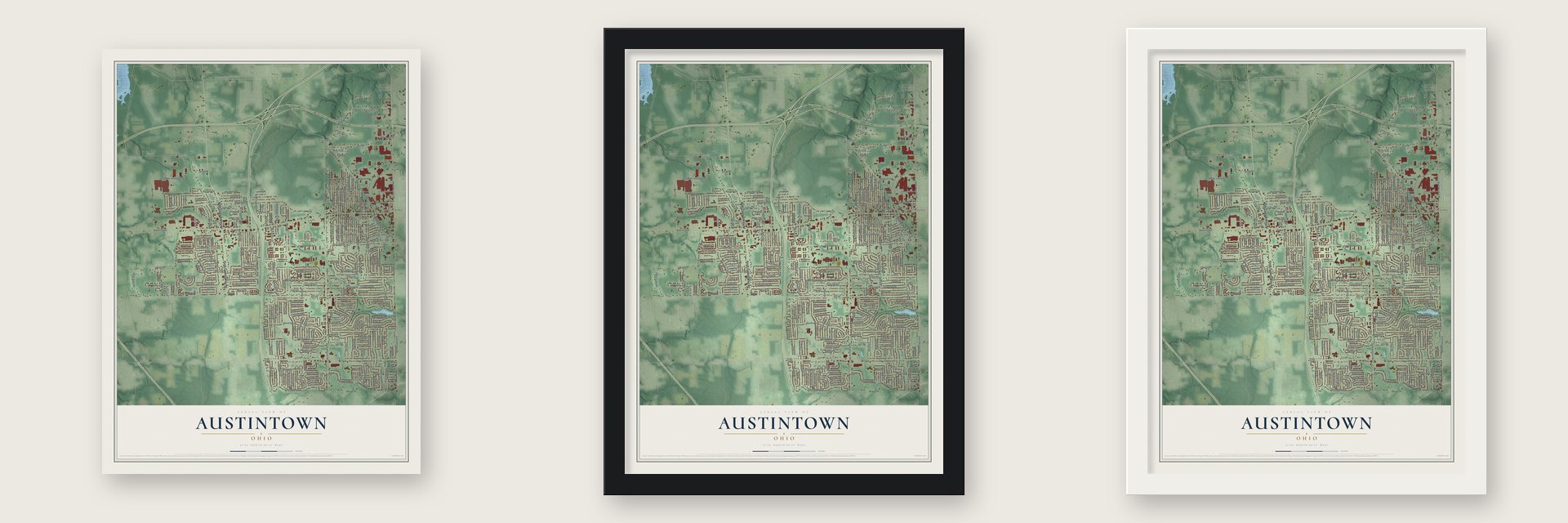
Unframed archival matte, a black wood frame or a white wood frame.
Up close
Geography Worth Displaying
This map was created using accurate cartographic data and authoritative geographic sources, including the U.S. Geological Survey and the Census Bureau. The map brings together terrain, waterways, roads, and building detail. The majority of the streets are labeled, houses are accurately depicted, and the topography is derived from government sources. Combining local data with carefully composed color and shading leads to this beautifully detailed Austintown artwork for your wall.
Rather than simply showing street outlines, we’ve included as many of the street names as we could reasonably fit on the map while keeping their names legible. Zoom in on the high resolution preview to see exactly what’s on the map. We truly set out to create a statement piece for anyone who loves Austintown. So whether it’s for you, or a gift for someone you love, we hope this map of Austintown brings back fond memories.
Read the story behind this map of Austintown, Ohio from 2026.

About Austintown, Ohio
Austintown is a census_designated_place in Mahoning County, Ohio, where the 2020 census recorded 29,594 residents. The community was founded in 1793. The census_designated_place covers 11.7 square miles in all.
- 29,594 peopleCounted in the 2020 census.
- Founded 1793The community was founded in 1793.
- Named for Warren resident and WesternThe community's name honors Warren resident and Western Reserve judge Calvin Austin.
- Established November 15, 1815The community was established on November 15, 1815.
Find your street
Names on the Austintown map
Every name below is printed on this map. Look for your street, your school, the park where you played, or the pond down the road.
Places and landmarks5
- Cornersburg
- Fourmile Run
- Perkins Corners
- Shively Corners
- Wickliffe
Streets and roads268
- North Canfield Niles Road
- South Canfield Niles Road
- South Meridian Road
- North Meridian Road
- Wilcox Road
- North Four Mile Run Road
- Kirk Road
- Idaho Road
- South Edgehill Avenue
- Innwood Drive
- Willow Crest Drive
- South Raccoon Road
- Purdue Avenue
- Signature Drive
- Duke Circle
- New Road
- Mahoning Avenue
- Norquest Boulevard
- Burkey Road
- Victoria Road
- Lanterman Road
- Elmwood Avenue
- North Raccoon Road
- Ohltown Road
- Nottingham Avenue
- Oakwood Avenue
- Forest Hill Drive
- Penny Lane
- Crum Road
- Woodridge Drive
Show all 268 streets
- Rockwell Road
- Yorktown Lane
- Dehoff Drive
- South Warwick Drive
- Fairview Road
- Huntmere Avenue
- Viall Road
- Lancaster Drive
- Idlewood Road
- Woodhurst Drive
- Nashua Drive
- Notre Dame Avenue
- South Inglewood Avenue
- North Yorkshire Boulevard
- Rosemont Avenue
- North Roanoke Avenue
- London Drive
- North Edgehill Avenue
- Herons Boulevard
- Edinburgh Drive
- Westminster Avenue
- Riblett Road
- East Elmwood Avenue
- Hendricks Road
- Redgate Lane
- Birch Trace Drive
- Fitzgerald Avenue
- North Kimberly Avenue
- Monaca Avenue
- South Yorkshire Boulevard
- Silica Road
- Potomac Avenue
- Yolanda Drive
- Ayrshire Drive
- Aldrich Drive
- Staatz Drive
- North Beverly Avenue
- Lake Road
- Fitch Boulevard
- Westchester Drive
- Callaway Circle
- Vollmer Drive
- Cannon Road
- North Main Street
- South Four Mile Run Road
- Burgett Road
- Artmar Drive
- Colgate Avenue
- Pine Trace Drive
- Pembrook Road
- Allendale Avenue
- Timberbrook Drive
- Bexley Drive
- Oakcrest Avenue
- Starwick Drive
- South Beverly Avenue
- South Turner Road
- South Roanoke Avenue
- Benton Avenue
- Barrington Drive
- South Navarre Avenue
- Marcia Drive
- Bainbridge Avenue
- North Anderson Avenue
- Rita Avenue
- Carnegie Avenue
- Westgate Boulevard
- Evelyn Road
- Herons Circle
- Darbyshire Drive
- Laurie Drive
- Collins Street
- Frostwood Avenue
- North Inglewood Avenue
- North Beacon Drive
- South Saratoga Road
- Woodmere Drive
- Victory Hill Lane
- Westmont Drive
- Cumberland Drive
- Hamman Drive
- Nantucket Drive
- Howard Avenue
- Madrid Drive
- 42nd Street
- Kerrybrook Avenue
- Dunbar Street
- Aspen Drive
- Argonne Drive
- North Navarre Avenue
- West Radio Road
- Pinecrest Avenue
- Timber Lane
- Maple Avenue
- Cavalcade Drive
- Robert Frost Drive
- White Beech Lane
- Compass West Drive
- Woodland Trce
- Johnson Farm Drive
- Elm Trace Street
- Washington Square Drive
- Wedgewood Drive
- Bryant Drive
- Tulane Avenue
- Kleber Avenue
- Stark Drive
- Briarwood Lane
- Baylor Avenue
- Heritage Drive
- Plumbrook Drive
- North Warwick Street
- Orkney Street
- Evans Avenue
- Rhode Island Drive
- Paisley Street
- Kirwan Drive
- Amberly Avenue
- Orchard Hill Drive
- Maple Springs Drive
- Patricia Avenue
- Selkirk Avenue
- Kimberly Avenue
- Bentwillow Lane
- Third Street
- Boulder Creek Drive
- Almerinda Drive
- Crabwood Drive
- Celeste Circle
- Maple Leaf Drive
- Maplecrest Drive
- Alderwood Drive
- Virginia Drive
- Thacher Lane
- Leharps Drive
- Daytona Drive
- Depauw Avenue
- Central Avenue
- Sheffield Drive
- Dunlap Road
- Birchwood Drive
- Chaucer Lane
- Alanson Avenue
- Vassar Avenue
- Beaver Drive
- Pinegrove Avenue
- Driftwood Lane
- Westwood Avenue
- Javit Court
- Sterling Street
- Calvary Court
- Polley Drive
- Meadow Lane
- Acton Avenue
- Eastwind Place
- Baker Street
- Ray Avenue
- Tarrytown Lane
- Kenmar Court
- Kirkhaven Drive
- Red Apple Drive
- Belle Avenue
- Cross Drive
- Rome Drive
- Paris Drive
- First Street
- Avalon Court
- Eigen Street
- Canfield Road
- Spring Meadow Circle
- Cider Mill Crossing
- Claridge Drive
- Parkgate Avenue
- Country Green Drive
- Indian Springs Drive
- Winthrop Drive
- Victoria East Road
- Black Oak Lane
- Breezewood Drive
- Cumberland Circle
- Oak Trace Street
- Brockton Drive
- Placid Boulevard
- Deopham Green Drive
- Woodleigh Lane
- Connecticut Avenue
- Argonne Avenue
- Atlanta Avenue
- Tall Oaks Lane
- Stanford Avenue
- Maureen Avenue
- Radcliffe Avenue
- Carlisle Avenue
- Georgetown Place
- Ardenwood Place
- Barkley Street
- Westwind Place
- Kroeck Avenue
- Oakleigh Avenue
- Nassau Court
- Sandalwood Court
- Ferdinand Road
- Athens Drive
- East Radio Road
- Shadow Oak Drive
- Moorefield Avenue
- Mildred Street
- Nashua Place
- Impala Drive
- Falcon Drive
- Deer Creek Court
- South Main Street
- Frederick Street
- Rebecca Drive
- Fairmeadow Drive
- High Meadow Drive
- Birchcrest Drive
- South Anderson Road
- Chadwick Lane
- Cross Cv
- Covington Cv
- Sandburg Drive
- Rheims Avenue
- Salt Spring Drive
- Hasty Road
- Harvard Place
- Southward Drive
- Sandalwood Lane
- Fountain Square Drive
- South Wendover Avenue
- Ascot Court
- Lexington Place
- Northwood Avenue
- Raccoon Road
- Charlestown Place
- Mallard Court
- Heritage Court
- Oden Avenue
Names are listed as they appear on the printed map. Zoom into the product photos to find them.
The art of mapping a place
How This Map Was Made
Real places. Remarkable detail. Discover the layers that turn geographic data into a map of home.

The view from above
Aerial imagery reveals the character of the land: woodland, open fields, and the patterns of a place.

The shape of the land
Elevation data brings hills, valleys, and subtle changes in the landscape into view.

The details of home
Roads, waterways, and building footprints come together to make the map feel unmistakably local.

Geography becomes art
Considered color, shading, and typography bring the layers together in a map made for your wall.


Process illustrated with Mendon, Massachusetts. Aerial imagery: USDA NAIP. Terrain: USGS 3D Elevation Program. Map details and finished artwork: KNOWOL.
The Details
About This Print
Choose an archival matte print, or a black or white Ayous wood frame. The archival matte print is unframed.
Select your size and finish above to see the matching product image and price.
Materials & Craftsmanship
A contemporary map with the character of a classic atlas, printed on archival matte paper. Optional frames are made from Ayous wood.
Your printed map does not include the watermark shown in the full-map preview.
Shipping & Delivery
Free shipping within the United States. Every print is made to order in the USA.
Buying a gift? Add a note in your cart and we'll include it. We never put prices in the package.
Prints ship within 2 to 3 business days. Allow 7 to 10 days total from ordering for delivery. Timing may vary during holidays or periods of high order volume.
Read our shipping policy.
Returns and damaged prints
Each print is made to order. Change-of-mind refunds are not available after production.
If your print arrives damaged, misprinted or incorrect, contact support@knowol.com within 30 days of receiving it. Include your order number, photos and a description of the issue.
Read our full refund and replacement policy. For questions about your order, email support@knowol.com.
Find your town
Looking for another city?
Find a map of home in our Ohio collection, or any town in the country.
Nearby
Maps of towns near Austintown
Know someone from one of these towns? Their map makes a great gift.
 Mineral Ridge
, Ohio
From $39.99See the map
 Canfield
, Ohio
From $39.99See the map
 Youngstown
, Ohio
From $39.99See the map
More maps nearby: Hilltop, McDonald, Girard, Churchill and Niles.