
Search for another town

Free U.S. delivery 7 to 10 days after you order
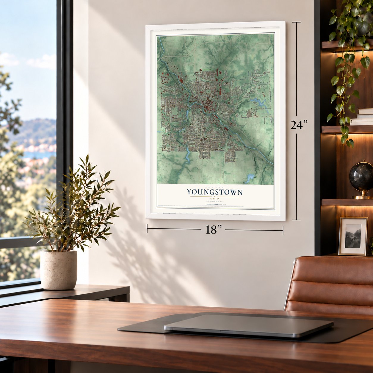
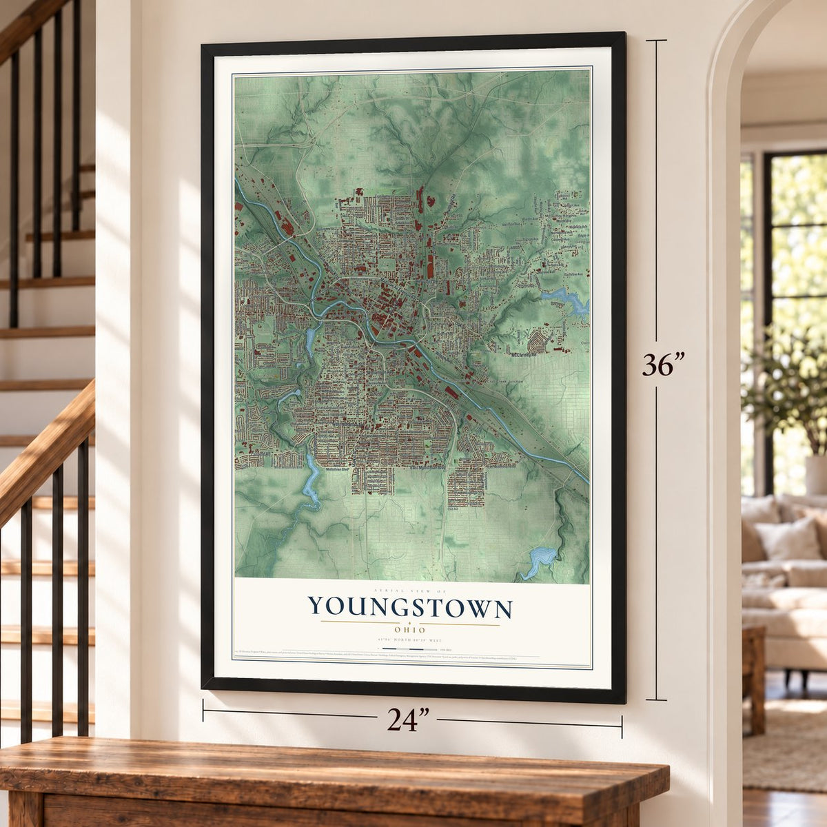
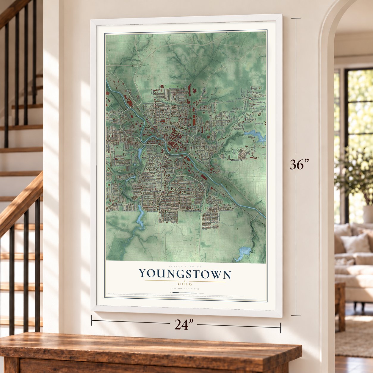
Youngstown, Ohio Map Art
Building by building, with labeled streets and shaded relief.
12" x 18" Archival Matte Print
A Map of Home. A Work of Art.
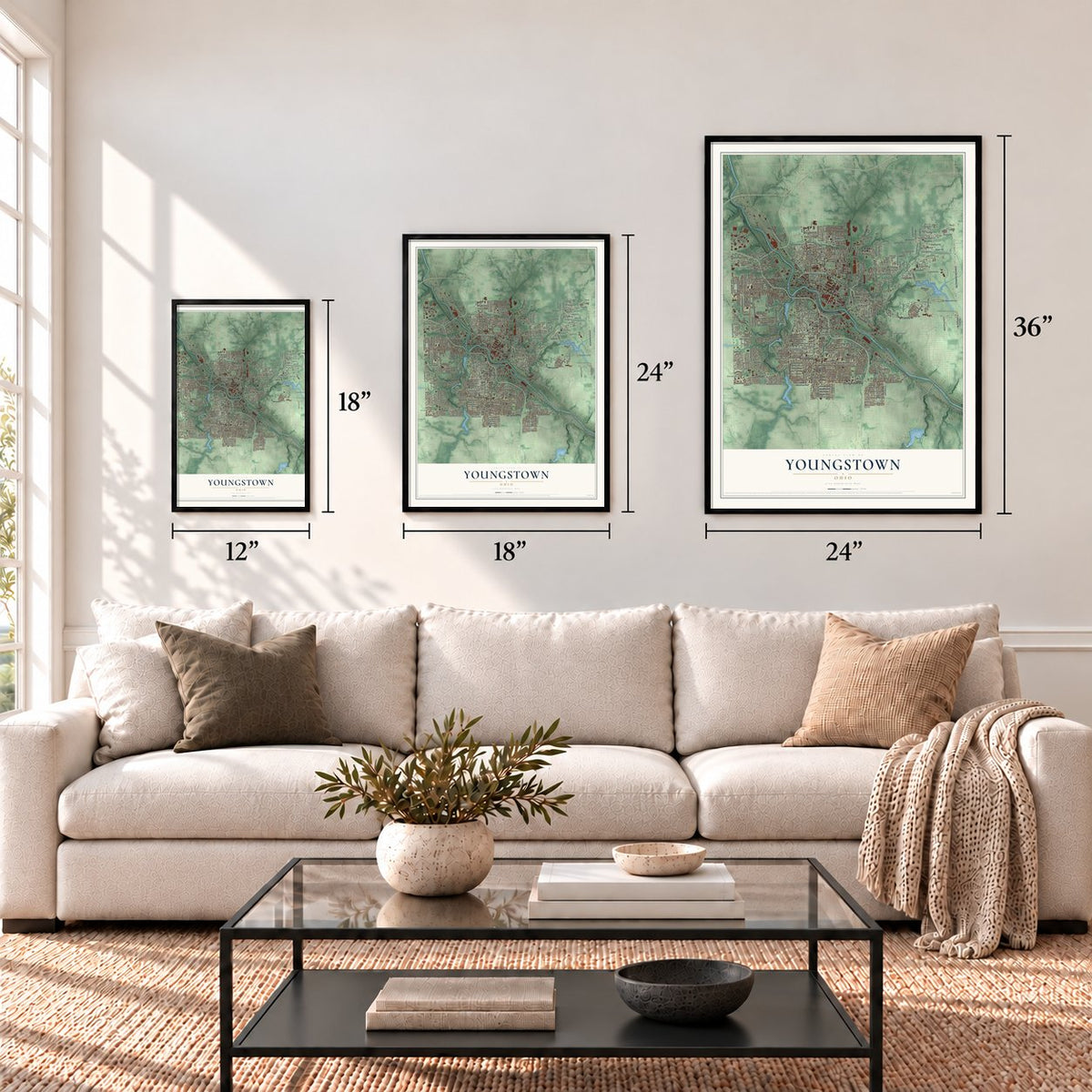
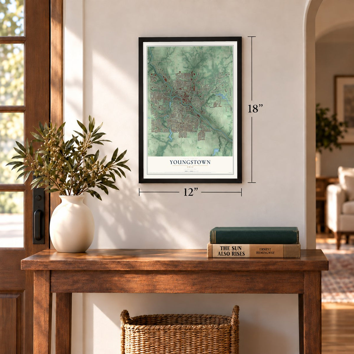
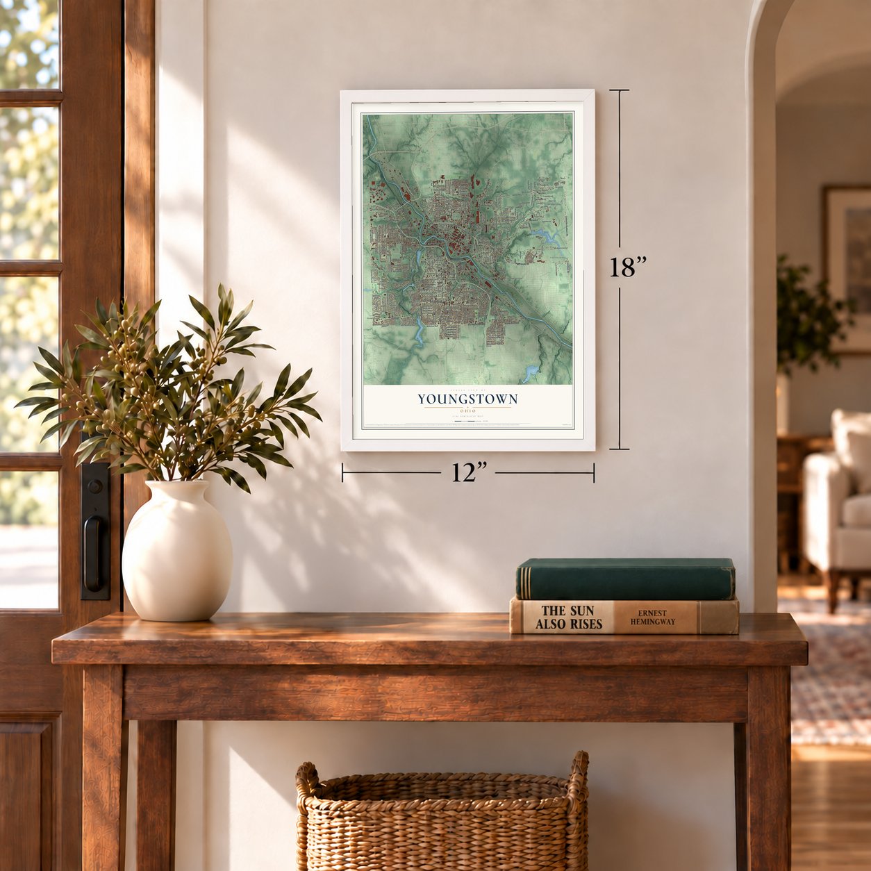
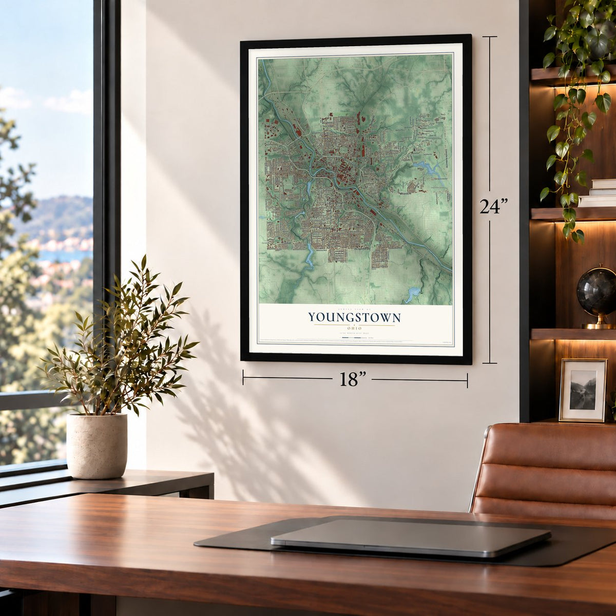
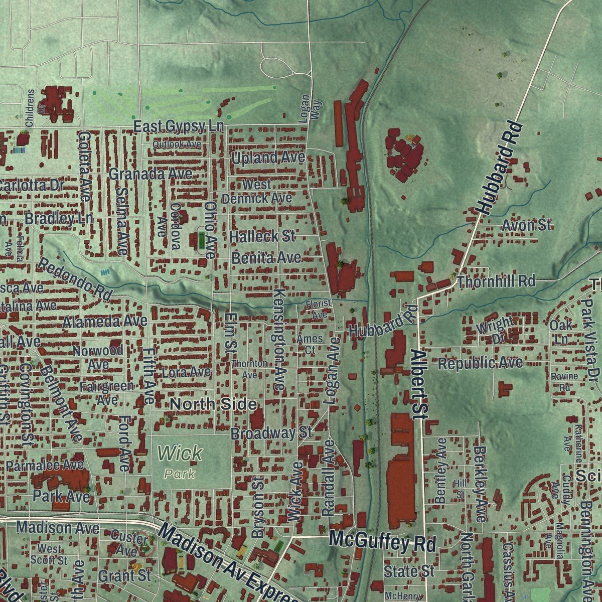
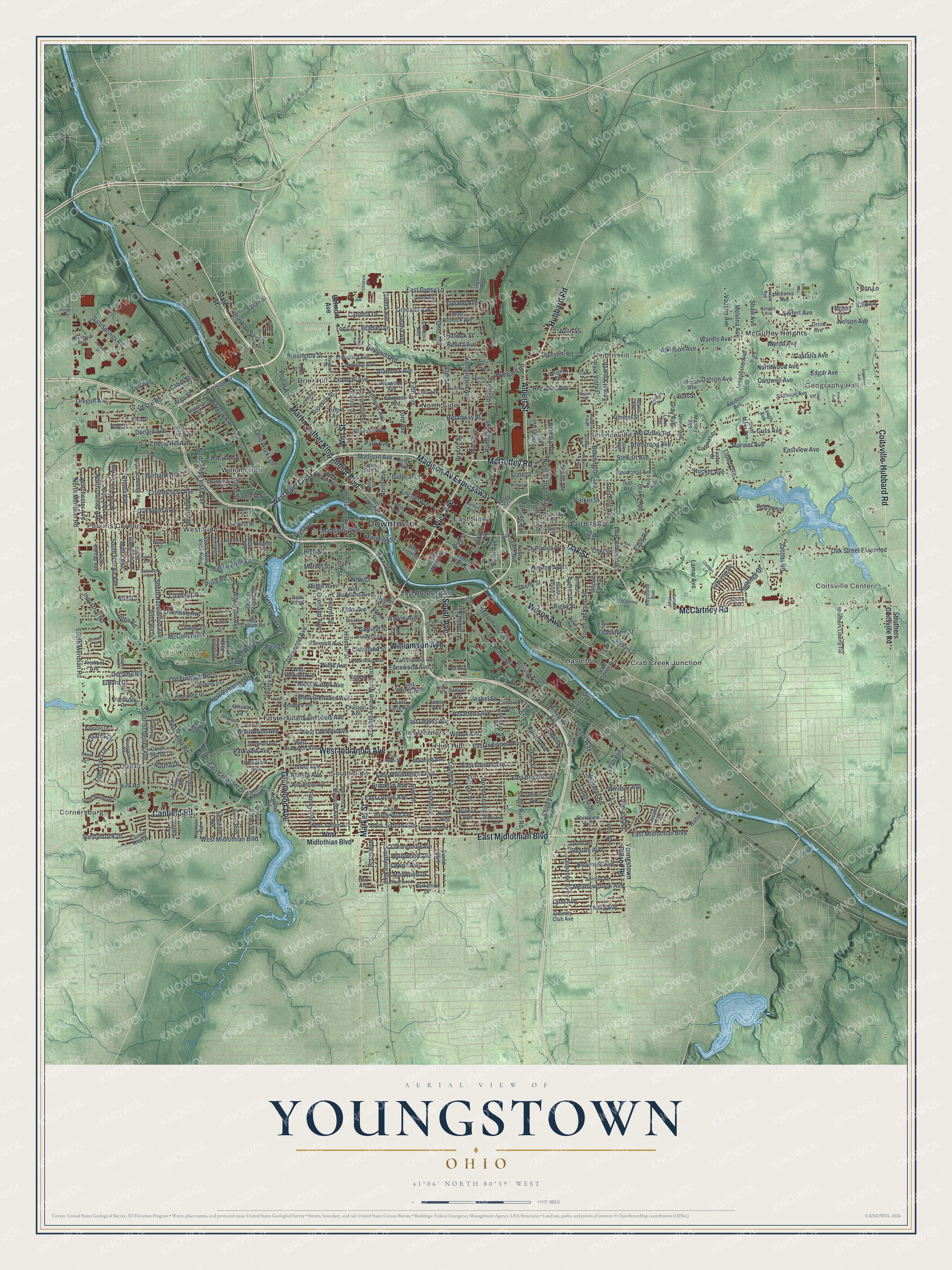
Explore Youngstown, Ohio from a whole new perspective. Created using aerial imagery and detailed geographic data, this map captures Youngstown building by building, with labeled streets, familiar landmarks, and shaded topographical relief that highlights the natural contours of the landscape.
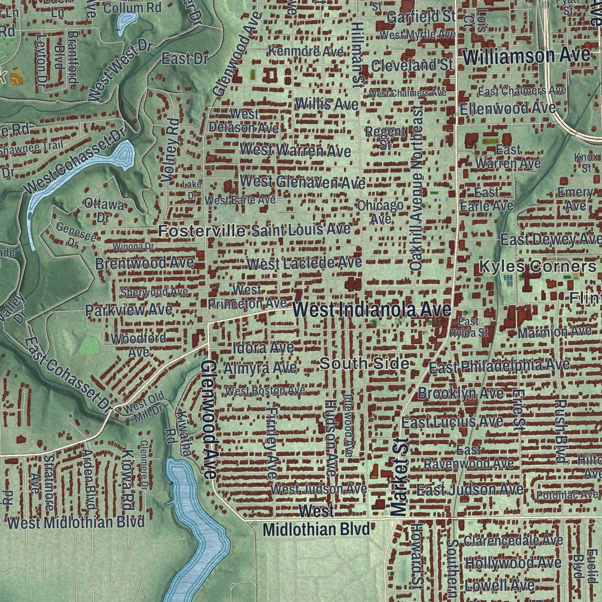
Combining modern data with the timeless character of a vintage atlas, this map is just as interesting up close as it is beautiful on the wall. Whether you grew up in Youngstown, spent memorable years there, or call it home today, this unique map is a great way to celebrate a place that means something to you. Zoom in on the preview to look for your street, and then order a print to put your memories on the wall.
Three ways to hang it
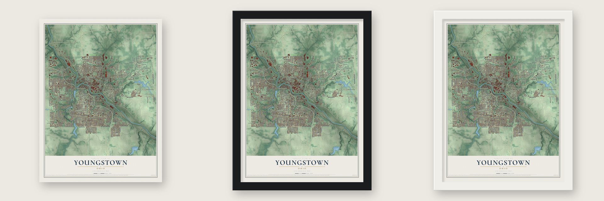
Unframed archival matte, a black wood frame or a white wood frame.
Up close
Geography Worth Displaying
This map was created using accurate cartographic data and authoritative geographic sources, including the U.S. Geological Survey and the Census Bureau. The map brings together terrain, waterways, roads, and building detail. The majority of the streets are labeled, houses are accurately depicted, and the topography is derived from government sources. Combining local data with carefully composed color and shading leads to this beautifully detailed Youngstown artwork for your wall.
Rather than simply showing street outlines, we’ve included as many of the street names as we could reasonably fit on the map while keeping their names legible. Zoom in on the high resolution preview to see exactly what’s on the map. We truly set out to create a statement piece for anyone who loves Youngstown. So whether it’s for you, or a gift for someone you love, we hope this map of Youngstown brings back fond memories.
Read the story behind this map of Youngstown, Ohio from 2026.
Find your street
Names on the Youngstown map
Every name below is printed on this map. Look for your street, your school, the park where you played, or the pond down the road.
Places and landmarks24
- Downtown
- Geography Hall
- Coitsville Center
- Calvary Cemetery
- Lincoln Park
- Mill Creek Park
- Tod Homestead Cemetery
- Wick Park
- Brier Hill
- Cornersburg
- Crab Creek Junction
- East Side
Show all 24 places
- Flint Hill
- Fosterville
- Haselton
- Kyles Corners
- McGuffey Heights
- North Side
- Perkins Corners
- Scienceville
- South Side
- Thorn Hill
- West Side
- Williamston
Streets and roads443
- Madison Av Expressway
- Coitsville-Hubbard Road
- Martin Luther King Junior Boulevard
- East Midlothian Boulevard
- Canfield Road
- West Indianola Avenue
- McGuffey Road
- Wick Avenue
- Glenwood Avenue
- South Avenue
- Oak Street
- Market Street
- Hubbard Road
- Albert Street
- Wilson Avenue
- McCartney Road
- Wirt Street
- Williamson Avenue
- Watt Street
- Castalia Avenue
- East Gypsy Lane
- Jacobs Road
- North Meridian Road
- South Meridian Road
- Edgar Avenue
- Lansdowne Boulevard
- Poland Avenue
- South Schenley Avenue
- Bears Den Road
- Mahoning Avenue
Show all 443 streets
- Fifth Avenue
- Salt Springs Road
- Erie Street
- Oak Street Extended
- East Cohasset Drive
- Hillman Street
- Rush Boulevard
- Southern Boulevard
- Oakhill Avenue Northeast
- Liberty Road
- Elm Street
- Gibson Street
- Sheridan Road
- East Indianola Avenue
- Atkinson Avenue
- East Boston Avenue
- East Florida Avenue
- Belmont Avenue
- Early Road
- Tod Lane
- North Garland Avenue
- Oakwood Avenue
- Stewart Avenue
- Ohio Avenue
- East Philadelphia Avenue
- Nelson Avenue
- West Laclede Avenue
- East Lucius Avenue
- Logan Avenue
- Alameda Avenue
- Zedaker Street
- Volney Road
- Broadway Street
- Edwards Street
- Old Furnace Road
- East High Avenue
- Bennington Avenue
- East Dewey Avenue
- Kensington Avenue
- Shirley Road
- Connecticut Avenue
- Crandall Avenue
- Kirk Road
- Ford Avenue
- East Judson Avenue
- Shady Run Road
- Hudson Avenue
- West Warren Avenue
- Waverly Avenue
- Powers Way
- Homestead Avenue
- South Hazelwood Avenue
- Covington Street
- Madison Avenue
- Shehy Street
- Pasadena Avenue
- Bryson Street
- Ohio Works Drive
- Price Road
- Cantwell Avenue
- Himrod Avenue
- Granada Avenue
- Willis Avenue
- Redondo Road
- Saint Louis Avenue
- North Belle Vista Avenue
- Park Avenue
- Division Street
- McCollum Road
- Burbank Avenue
- Ridge Avenue
- Griffith Street
- Vestal Road
- Kimmel Street
- Overland Avenue
- Roy Street
- Windsor Avenue
- Irma Avenue
- Cleveland Street
- Burlington Street
- Marshall Street
- South Jackson Street
- Josephine Avenue
- East Drive
- West Glenaven Avenue
- Republic Avenue
- Oran Drive
- Falls Avenue
- Firnley Avenue
- Lincoln Avenue
- Sunshine Avenue
- Parkview Avenue
- Loveland Road
- Performance Place
- Steel Street
- Garfield Street
- Rutledge Drive
- Wardle Avenue
- Lemoyne Avenue
- Rhoda Avenue
- Mabel Street
- Oregon Avenue
- North Bon Air Avenue
- Decamp Road
- Northwood Avenue
- West Glacier Drive
- West Cohasset Drive
- Thornhill Road
- Overlook Avenue
- Thalia Avenue
- Meadowbrook Avenue
- Donald Avenue
- Brownlee Avenue
- Lynn Avenue
- Benita Avenue
- South Bon Air Avenue
- High Street
- Weston Avenue
- Rigby Street
- Upland Avenue
- Calvary Run Drive
- Sunnybrook Drive
- Datson Avenue
- Armstrong Avenue
- Goleta Avenue
- Parker Street
- Tod Avenue
- Dearborn Street
- Jean Street
- Vaughn Avenue
- East Woodland Avenue
- Chaney Circle
- West Midlothian Boulevard
- Cherry Hill Avenue
- Cooper Street
- Gladstone Street
- North Avenue
- Mariner Avenue
- Gray Avenue
- Shaw Avenue
- West West Drive
- Industrial Road
- Hollywood Avenue
- Wilkinson Avenue
- Maywood Drive
- Park Vista Drive
- Winchester Avenue
- Forest View Drive
- Selma Avenue
- Hunter Avenue
- North Dunlap Avenue
- Lamar Avenue
- Glen Oaks Drive
- Matta Avenue
- Ayers Street
- Bradley Lane
- Wayne Avenue
- Estates Circle
- Clay Street
- Idora Avenue
- Almyra Avenue
- Lilburne Drive
- Howard Street
- Drake Avenue
- Carlotta Drive
- Stocker Avenue
- Brentwood Avenue
- Berkley Avenue
- Ellenwood Avenue
- Lowell Avenue
- Franklin Avenue
- Brooklyn Avenue
- Sarah Street
- Superior Street
- Randall Avenue
- Lansing Avenue
- Halleck Street
- Leo Avenue
- Bott Street
- Eastview Avenue
- Melvina Avenue
- Guss Avenue
- Seifert Avenue
- State Street
- Millet Avenue
- Mercer Street
- Myron Avenue
- Plum Street
- Choice
- Wilbur Avenue
- Kiowa Road
- Eldora Drive
- Avon Street
- Poplar Avenue
- Tangent Street
- Oneta Street
- Upton Road
- Penn Avenue
- Argo Street
- Burma Drive
- Leah Avenue
- Cabot Street
- Center Street
- Grant Street
- Pike Street
- Noel Drive
- New Court
- Ron Lane
- West River Cros
- Struthers Coitsville Road
- Youngstown Poland Road
- West Federal Street
- West Rayen Avenue
- Federal Plaza East
- North Lane Avenue
- Euclid Boulevard
- Shannon Avenue
- Arcacia Avenue
- Andrews Avenue
- South Belle Vista Avenue
- Orrin Avenue
- Fairgreen Avenue
- Norwood Avenue
- West Princeton Avenue
- West Delason Avenue
- West Woodland Avenue
- Detroit Avenue
- Kenmore Avenue
- North Schenley Avenue
- Hilton Avenue
- East Ravenwood Avenue
- Catalina Avenue
- West Judson Avenue
- Chicago Avenue
- Marmion Avenue
- Country Club Avenue
- Cameron Avenue
- Valley Street
- North Pearl Street
- Woodcrest Avenue
- Birch Hill Drive
- Miami Avenue
- Cherokee Drive
- Kiwatha Road
- Glacier Heights Road
- West Dennick Avenue
- Lora Avenue
- Oxford Avenue
- Palmer Avenue
- West Front Street
- Struthers Liberty Road
- Lincoln Park Drive
- Pointview Avenue
- Francisca Avenue
- Cranbrook Drive
- Hermosa Drive
- South Walnut Street
- Valley Drive
- Homewood Avenue
- North West Avenue
- South Glenellen Avenue
- South Dunlap Avenue
- Clarencedale Avenue
- Coral Sea Drive
- Milton Avenue
- South Center Street
- South Bruce Street
- Bentley Avenue
- Keogh Avenue
- East Warren Avenue
- Union Street
- Ives Avenue
- Cordova Avenue
- Charlotte Avenue
- Arden Boulevard
- Parmalee Avenue
- Fairfax Street
- Cassius Avenue
- Fremont Avenue
- Devon Avenue
- Woodford Avenue
- Mc Collum Road
- Bryn Mawr Avenue
- Brittain Street
- Frost Avenue
- Custer Avenue
- Desoto Avenue
- Beachwood Drive
- Walton Street
- Cornwall Street
- Louise Rita Court
- Megan Circle
- Hartzell Avenue
- Stratmore Avenue
- Eden Lane
- Park Hill Drive
- Imperial Street
- Hopkins Road
- Samuel Avenue
- Miltonia Avenue
- Baymar Drive
- Thurber Lane
- Berkshire Drive
- Leyton Drive
- Keystone Avenue
- Hickory Street
- Ottawa Drive
- Hughes Street
- Turin Street
- Regent Street
- East Earle Avenue
- Wright Drive
- Brantford Boulevard
- Emery Avenue
- Manley Avenue
- Lee Avenue
- Elva Avenue
- Ella Avenue
- First Street
- Essex Street
- Oak Lane
- Lois Court
- Logan Way
- Sherwood Avenue
- West Scott Street
- West Earle Avenue
- West Boston Avenue
- West Myrtle Avenue
- Breaden Street
- Cascade Road
- Foster Street
- Bancroft Avenue
- North Osborn Avenue
- Kenneth Street
- Idlewood Avenue
- Manhattan Avenue
- Everett Avenue
- Dean Avenue
- Shawnee Trail
- Brunswick Road
- Stiles Avenue
- Byron Street
- West Wood Street
- Pyatt Street
- South Wendover Circle
- East Chalmers Avenue
- Lyden Avenue
- Wychwood Lane
- Eddie Street
- Susan Circle
- Margaret Street
- South Portland Avenue
- Ameritech Boulevard
- Grandview Avenue
- Kingston Lane
- Clingan Avenue
- Hawn Street
- West Old Mill Drive
- Potomac Avenue
- Hillsdale Avenue
- Gregory Avenue
- Lorentz Avenue
- Skywae Drive
- Ames Court
- Genesee Drive
- Camden Avenue
- School Street
- Chapel Hill
- Cuddy Avenue
- East Hylda Street
- Carlton Avenue
- Scheetz Street
- Quinn Street
- Wilcox Street
- Knox Street
- Third Street
- West Chalmers Avenue
- Katherine Avenue
- Thornton Avenue
- Roxbury Avenue
- Winona Drive
- Chatham Lane
- Karl Street
- Knapp Avenue
- Wilshire Drive
- Glenmere Drive
- Tippecanoe Avenue
- Outlook Avenue
- Magnolia Avenue
- Kent Avenue
- Craiger Avenue
- Lafayette Street
- Robinwood Place
- Park Drive
- Mayfield Avenue
- Augustine Avenue
- Lloyd Street
- Intertech Drive
- Wickliffe Svc Road
- Nair Street
- Stansbury Drive
- Wilmette Lane
- Hill Street
- Lake Drive
- Felicia Avenue
- Ravine Road
- Childrens Drive
- McHenry Street
- Austin Avenue
- Harper Avenue
- Revere Avenue
- Florist Avenue
- Cedar Street
Names are listed as they appear on the printed map. Zoom into the product photos to find them.
About Youngstown, Ohio
Youngstown is a Mahoning County city on the Mahoning River, with 60,068 residents counted in the 2020 census. Founded by John Young in 1797, it developed into a steel production center before industry contracted during the 1970s. Mill Creek Park preserves landmarks from the city's early settlement and industrial history.
- Founded in 1797John Young established the community and built its first sawmill and gristmill beside the Mahoning River.
- County Seat Since 1876Youngstown became the seat of Mahoning County when the county's administrative center moved from Canfield in 1876.
- Steel Industry LegacySteel mills drew immigrant workers to Youngstown, but major plant closures beginning in 1977 transformed the local economy.
- Pioneer PavilionJames Heaton built this sandstone wool mill in 1821, and Volney Rogers restored and renamed it in 1893.
- Kyle-McCollum HouseCompleted in 1813 with two-foot-thick stone walls, the house is believed to be Youngstown's oldest occupied home on its original site.
Keep exploring Ohio
Youngstown is one of 1,389 Ohio towns we've mapped. Every dot on the map is a print of its own.
The search covers every state, Ohio first.
Near Youngstown
Order 2 or more town maps and save 10%. Shown in the size and finish you picked above, so they hang as a set.
- Campbell 12" x 18" / Archival Matte Print $39.99
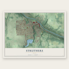
- Struthers 12" x 18" / Archival Matte Print $39.99
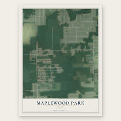
- Maplewood Park 12" x 18" / Archival Matte Print $39.99

More maps nearby: Austintown, Churchill, Summit, Boardman and Girard.
The art of mapping a place
How This Map Was Made
Real places. Remarkable detail. Discover the layers that turn geographic data into a map of home.

The view from above
Aerial imagery reveals the character of the land: woodland, open fields, and the patterns of a place.

The shape of the land
Elevation data brings hills, valleys, and subtle changes in the landscape into view.

The details of home
Roads, waterways, and building footprints come together to make the map feel unmistakably local.

Geography becomes art
Considered color, shading, and typography bring the layers together in a map made for your wall.


Process illustrated with Mendon, Massachusetts. Aerial imagery: USDA NAIP. Terrain: USGS 3D Elevation Program. Map details and finished artwork: KNOWOL.
The Details
About This Print
Choose an archival matte print, or a black or white Ayous wood frame. The archival matte print is unframed.
Select your size and finish above to see the matching product image and price.
Materials & Craftsmanship
A contemporary map with the character of a classic atlas, printed on archival matte paper. Optional frames are made from Ayous wood.
Your printed map does not include the watermark shown in the full-map preview.
Shipping & Delivery
Free shipping within the United States. Every print is made to order in the USA.
Buying a gift? Add a note in your cart and we'll include it. We never put prices in the package.
Prints ship within 2 to 3 business days. Allow 7 to 10 days total from ordering for delivery. Timing may vary during holidays or periods of high order volume.
Read our shipping policy.
Returns and damaged prints
Each print is made to order. Change-of-mind refunds are not available after production.
If your print arrives damaged, misprinted or incorrect, contact support@knowol.com within 30 days of receiving it. Include your order number, photos and a description of the issue.
Read our full refund and replacement policy. For questions about your order, email support@knowol.com.