
Search for another town





Free U.S. delivery 7 to 10 days after you order
Summit, Ohio Map Art
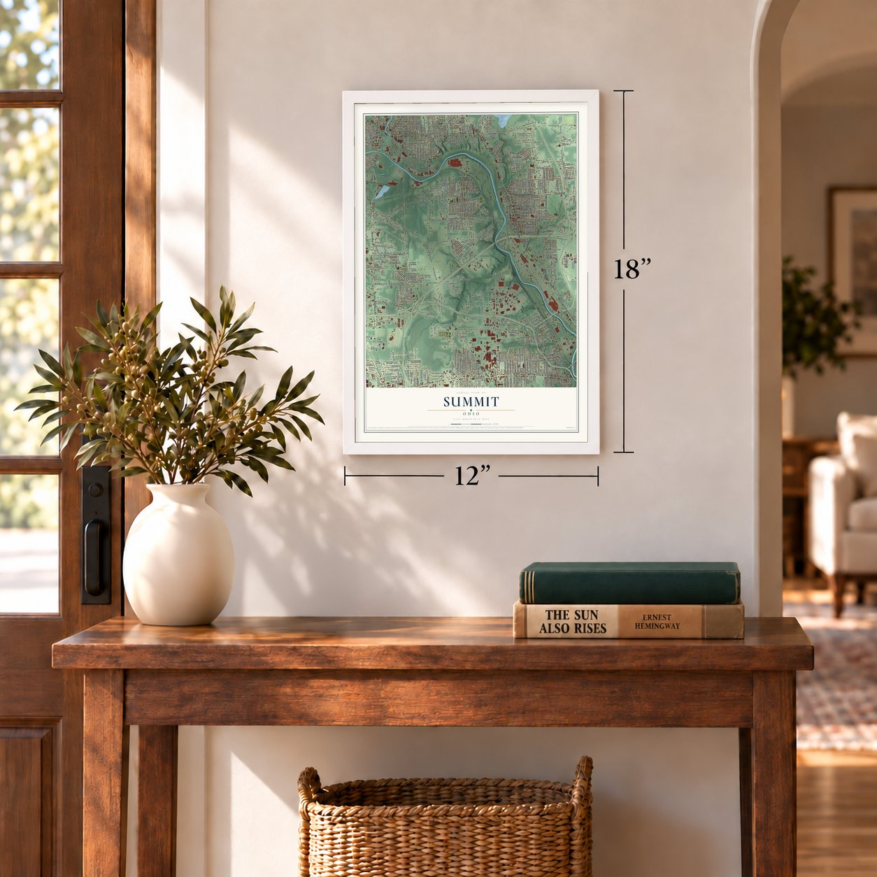
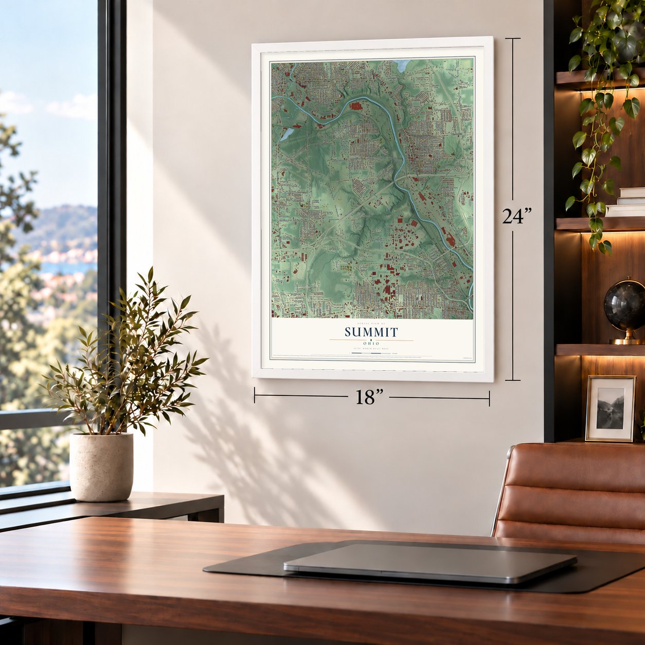
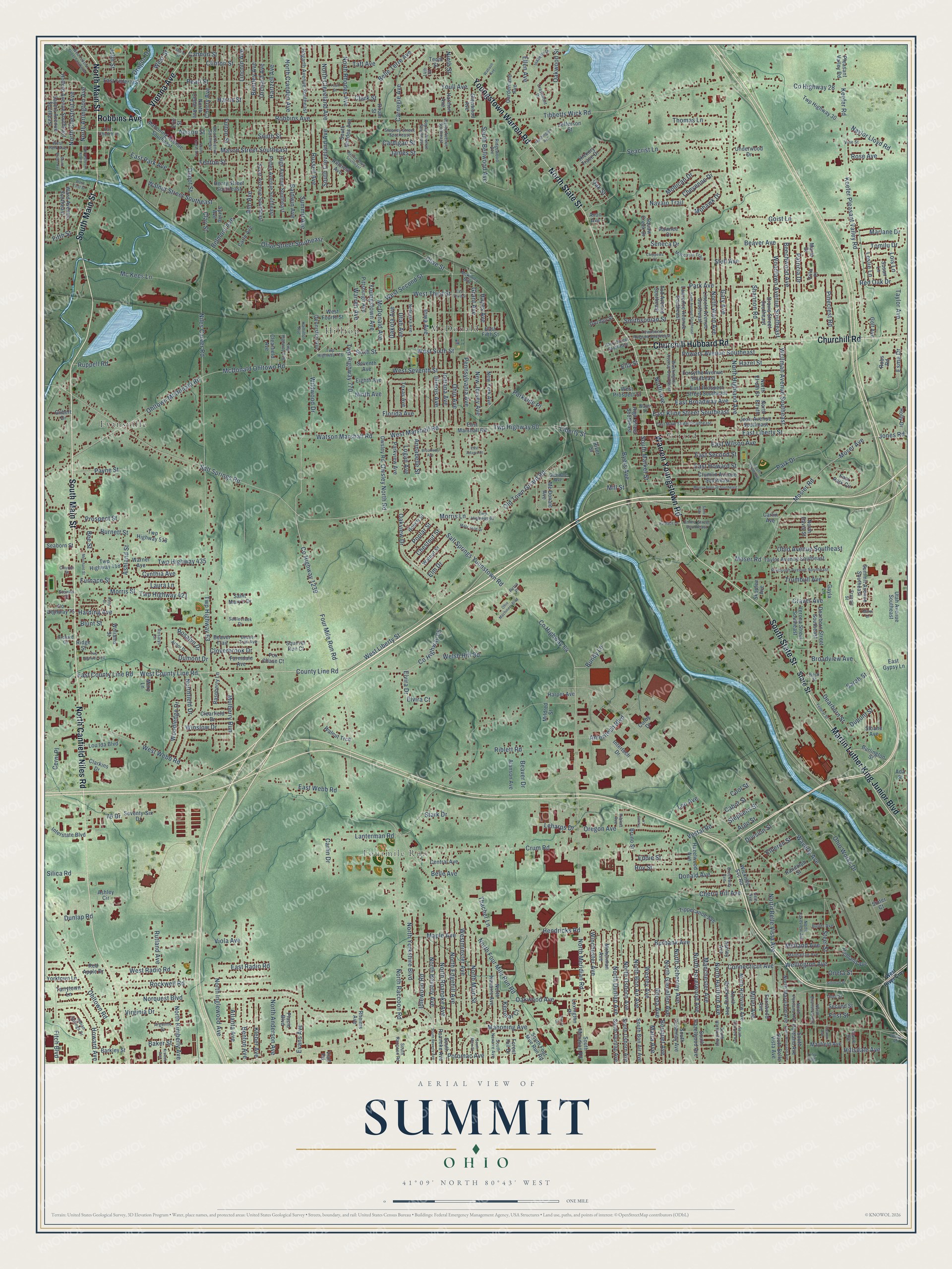
A new map of Summit, Ohio, made in 2026 and printed to order on thick archival matte paper.
12" x 18" Archival Matte Print
A Map of Home. A Work of Art.
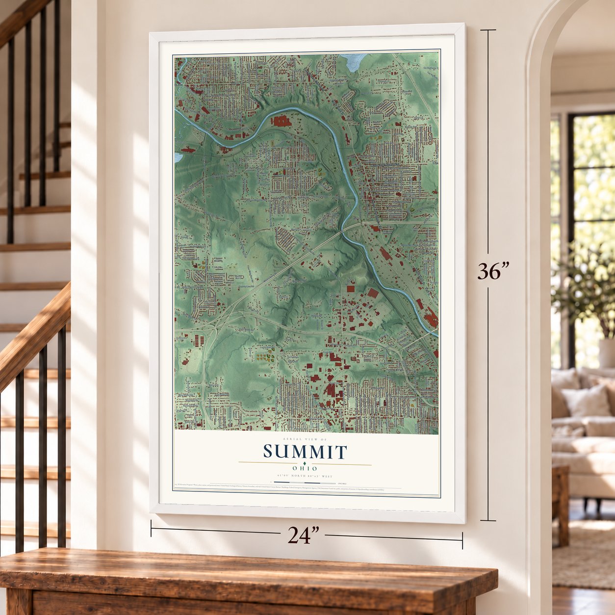
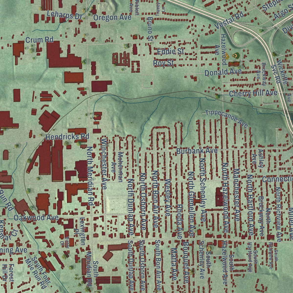
Explore Summit, Ohio from a whole new perspective. Created using aerial imagery and detailed geographic data, this map captures Summit building by building, with labeled streets, familiar landmarks, and shaded topographical relief that highlights the natural contours of the landscape.
Combining modern data with the timeless character of a vintage atlas, this map is just as interesting up close as it is beautiful on the wall. Whether you grew up in Summit, spent memorable years there, or call it home today, this unique map is a great way to celebrate a place that means something to you. Zoom in on the preview to look for your street, and then order a print to put your memories on the wall.
Three ways to hang it
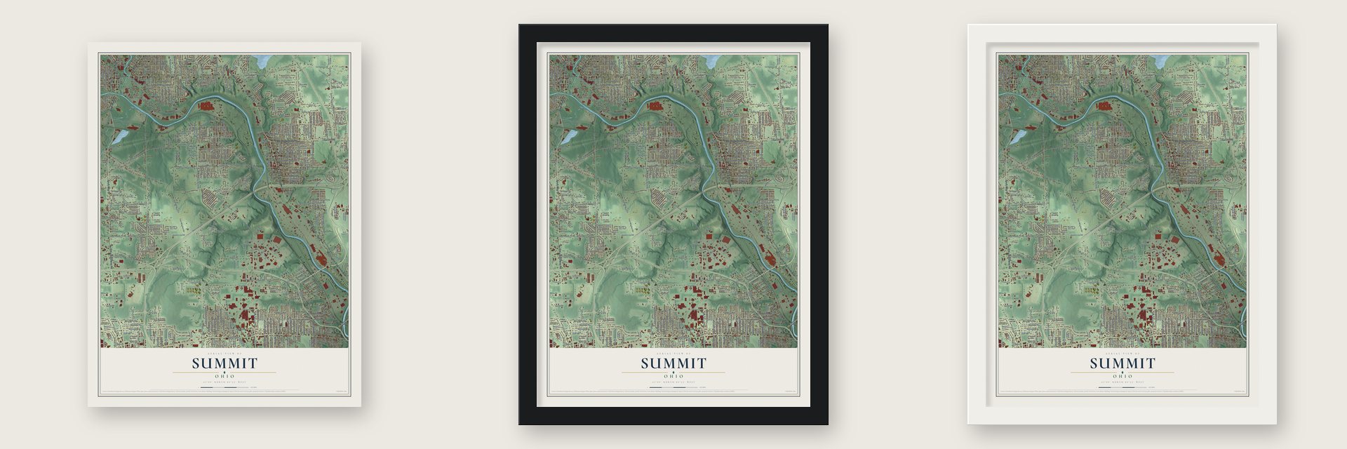
Unframed archival matte, a black wood frame or a white wood frame.
Up close
Geography Worth Displaying
This map was created using accurate cartographic data and authoritative geographic sources, including the U.S. Geological Survey and the Census Bureau. The map brings together terrain, waterways, roads, and building detail. The majority of the streets are labeled, houses are accurately depicted, and the topography is derived from government sources. Combining local data with carefully composed color and shading leads to this beautifully detailed Summit artwork for your wall.
Rather than simply showing street outlines, we’ve included as many of the street names as we could reasonably fit on the map while keeping their names legible. Zoom in on the high resolution preview to see exactly what’s on the map. We truly set out to create a statement piece for anyone who loves Summit. So whether it’s for you, or a gift for someone you love, we hope this map of Summit brings back fond memories.
Read the story behind this map: Detailed Map of Summit, Ohio.

Find your street
Names on the Summit map
Every name below is printed on this map. Look for your street, your school, the park where you played, or the pond down the road.
Places and landmarks5
- Fourmile Run
- Evansville
- Girard
- Hilltop
- McDonald
Streets and roads510
- South Main Street
- North Main Street
- Robbins Avenue
- North Canfield Niles Road
- North State Street
- South State Street
- Warren Youngstown Road
- Churchill Hubbard Road
- Churchill Road
- Youngstown Warren Road
- Martin Luther King Junior Boulevard
- Vienna Avenue
- North Meridian Road
- County Line Road
- East County Line Road
- Watson Marshall Road
- County Highway 1239
- Four Mile Run Road
- Sixth Street
- West Sixth Street
- West Marshall Road
- North Four Mile Run Road
- Elvira Drive
- James Street
- County Highway 64
- Park Avenue
- Hazel Street
- Vestal Road
- North Hartford Avenue
- Owsley North Road
Show all 510 streets
- Elvira Court
- Salt Springs Road
- Mahoning Avenue
- Salt Springs Younstown Road
- Oakwood Avenue
- County Highway 28
- Tibbetts Wick Road
- West Liberty Street
- Lanterman Road
- Ohltown McDonald Road
- Twp Highway 60
- Norquest Boulevard
- Niles Carver Road
- Twp Highway 63
- McDonald Ohltown Road
- Old Town Girard Road
- Trumbull Avenue
- Connecticut Avenue
- East Liberty Street
- Shannon Road
- Keefer Pleasant Valley Road
- Keefer Road
- Ohio Avenue
- North Raccoon Road
- Belmont Avenue
- McDonald Avenue
- Carnegie Avenue
- Pennsylvania Avenue
- Mosier Road
- Summit Avenue
- North Ward Avenue
- Olive Street Southeast
- Iowa Avenue
- Waverly Avenue
- Illinois Avenue
- West Webb Road
- Oregon Avenue
- Crum Road
- Ohio Works Drive
- West County Line Road
- North Highland Avenue
- Moser Avenue
- North Belle Vista Avenue
- Division Street
- Burbank Avenue
- Ohltown Road
- Roy Street
- Russell Avenue
- Mason Street Southeast
- Rockwell Road
- East Kline Street Southeast
- Naylor Lloyd Road
- West Second Street
- East Broadway Avenue
- Park Drive
- North Schenley Avenue
- Lincoln Avenue
- Clinton Street
- Indiana Avenue
- North Avenue
- Steel Street
- Benton Avenue
- Warren Avenue
- Twp Highway 770
- Olive Street
- Idlewood Road
- Rhoda Avenue
- Mc Kees Lane
- North Hazelwood Avenue
- North Bon Air Avenue
- Smithsonian Street
- Hartzell Avenue
- North Yorkshire Boulevard
- Pearl Street
- Morris Street
- Twp Highway 421
- Donald Avenue
- North Roanoke Avenue
- North Edgehill Avenue
- Seacrist Lane
- Westminster Avenue
- Riblett Road
- North Osborn Avenue
- New Jersey Avenue
- Fenton Street
- Hendricks Road
- West Third Street
- Manchester Avenue
- East Wilson Avenue
- Ann Avenue
- Woodlawn Avenue Southeast
- Beechwood Avenue
- Dearborn Street
- Goist Lane
- Beaver Avenue
- Wesley Avenue
- Chestnut Street
- Potomac Avenue
- Burnett Street
- North Kimberly Avenue
- East Webb Road
- Broadview Avenue
- North Beverly Avenue
- Liberty Street
- Cherry Hill Avenue
- Youngstown Avenue
- Wellman Avenue Southeast
- Fifth Street
- Powers Avenue Southeast
- Winchester Avenue
- Fitch Boulevard
- East Second Street
- Oakview Drive
- North Dunlap Avenue
- Gary Avenue
- Twp Highway 435
- Oak Street
- Wellington Avenue
- East Park Avenue
- North Anderson Avenue
- North Inglewood Avenue
- North Cleveland Avenue
- Florida Avenue
- Wildwood Drive
- South Bellwood Avenue
- North Glenellen Avenue
- Midland Avenue
- Ohio Avenue Southeast
- Prospect Street
- North Rhodes Avenue
- Cherry Avenue
- West Seventh Street
- North Crandon Avenue
- Bentley Avenue
- Mulberry Run
- Oakwood Street
- South Cleveland Avenue
- Clark Street
- Walnut Street Southeast
- Viola Avenue
- East Howard Street
- Esme Drive
- North Chestnut Avenue
- Baldwin Avenue
- Woodledge Drive
- Fulton Street
- 76 Drive
- Evans Avenue
- Morris Lane
- Belle Terre Avenue
- Sarah Street
- West Radio Road
- Dakota Avenue
- Eddie Street
- Howard Avenue
- Harris Street
- South Street
- Thomas Lane
- Maple Avenue
- Elberen Street
- Leo Avenue
- Pinecrest Road
- Payne Street
- Depot Street
- North Arlington Avenue
- Dumont Drive
- Taft Avenue
- Mill Street
- Harding Avenue
- Tomilu Drive
- Rosalyn Drive
- Kleber Avenue
- Navajo Trail
- South Market Street
- West Street
- Stark Drive
- Ameritech Boulevard
- Millet Avenue
- Orchard Avenue
- County Highway 65
- Ninth Street
- Marlane Drive
- East Radio Road
- Mohican Drive
- Grant Avenue
- Jones Road
- Welsh Hill Road
- Allison Street
- Byers Avenue
- Parkside Place
- Furnace Street
- Ashland Street
- Taylor Avenue
- Oneta Street
- Utah Avenue
- Dunlap Road
- Cerni Place
- Cynthia Avenue
- Bouquet Avenue
- Matta Avenue
- Winslow Drive
- Mohawk Drive
- Ruppell Road
- Youll Avenue
- Cloverbrook Drive
- Rutland Avenue
- Cheyenne Drive
- Virginia Drive
- Hayes Avenue
- Northfield Drive
- Argo Street
- Annabelle Street
- Stephens Street
- Red Oak Drive
- Silica Road
- Thacher Lane
- Leharps Drive
- Poplar Street
- Rose Avenue
- Laura Lane
- Patricia Drive
- Dragon Drive
- Carlin Drive
- Cabot Street
- Logan Avenue
- Cardigan Street
- Craver Avenue
- Beaver Drive
- Hillsdale Avenue
- Atlanta Avenue
- Stull Avenue
- Leslie Lane
- Clay Street
- Lois Lane
- John Street
- Ella Street
- Seneca Drive
- Dupont Street
- Elm Drive
- Baker Street
- Blunt Street
- Kenmar Court
- Ellen Avenue
- Ninth Avenue
- Belle Avenue
- Cannon Street
- Bundy Lane
- Moser Road
- First Street
- Cool Street
- Bee Street
- State Street
- Denniston Avenue
- Fox Chase Court
- East Marshall Road
- Owsley Road
- Twp Highway 30
- East Prospect Street Southeast
- Lawrence Avenue Southeast
- Forsythe Avenue Southeast
- Mahoning Avenue Southeast
- North Richview Avenue
- Twp Highway 518
- Henry Street Southeast
- Dearborn Street Southeast
- North Brockway Avenue
- Pittsburgh Avenue
- Warner Avenue
- Gardenland Avenue
- Utah Avenue Southeast
- West Fourth Street
- Joan Avenue Southeast
- Hogarth Avenue Southeast
- North Cedar Avenue
- Scott Avenue Southeast
- High Avenue Southeast
- Peffer Avenue Southeast
- Seventy-Six Drive
- Crumlin Avenue Southeast
- Mayfield Avenue
- Holford Avenue Southeast
- Taylor Avenue Southeast
- North Navarre Avenue
- East Federal Street
- Hazelwood Avenue
- North Davis Street
- Interstate Boulevard
- Moherman Avenue
- Verona Street Southeast
- North Maryland Avenue
- Burlington Street
- North Elruth Street
- Lincoln Avenue Southeast
- Dravis Street Southeast
- Sayers Avenue Southeast
- Ward Avenue Southeast
- Twp Highway 418
- Summit Avenue Southeast
- East Park Circle
- Raspberry Lane
- East Fifth Street
- Hillcrest Avenue
- Tippecanoe Avenue
- Forest Hill Drive
- Placid Boulevard
- Tenth Street
- South Schenley Avenue
- South Bon Air Avenue
- South Osborn Avenue
- South Dunlap Avenue
- South Hazelwood Avenue
- Walnut Street
- Lou Ida Boulevard
- South Four Mile Run Road
- South Meridian Road
- Pleasant Valley Road
- South Belle Vista Avenue
- Central Avenue
- Saint Mary's Drive
- Alanson Avenue
- South Portland Avenue
- Parkview Avenue
- Hiram Street
- Mc Donald Avenue
- Walnut Trce
- Villa Place
- New York Avenue
- South Roanoke Avenue
- Clearfield Drive
- Yorktown Lane
- Richland Avenue
- West Prospect Street
- East Gypsy Lane
- Tod Avenue Southeast
- Randolph Street
- Jefferson Street
- Farmdale Avenue
- Underwood Drive
- High Street Southeast
- North Elruth
- Tarrytown Lane
- Squirrel Run Court
- Intertech Drive
- Wickliffe Svc Road
- Clearfield Avenue
- Texas Avenue
- Glenwood Avenue
- Red Apple Drive
- Seventh Avenue
- Beaver Trail
- Harmon Avenue
- Eighth Avenue
- South Rhodes Avenue
- Barkley Street
- County Highway 75
- Beech Street
- Hickory Trace Drive
- Seaborn Street
- Spring Avenue
- Carle Avenue
- Rheims Avenue
- Harper Avenue
- Fernwood Avenue
- Clarkins Drive
- Second Street
- Erie Street
- Susan Lane
- Mildred Street
- Holly Drive
- Gordon Street
- Lexington Place
- Ashley Circle
- Williams Street
- Skoplee Avenue
- Golf Avenue
- Mary Lane
- Gayla Lane
- Gilbert Drive
- Bruno Street
- Ashley Avenue
- Pawnee Court
- Carlin Avenue
- Marie Drive
- Ada Street
- Corby Drive
- Avon Avenue
- Sloane Avenue
- Viall Road
- Sinter Court
- Ridge Street
- Robs Road
- River Street
- Twp Highway 776
- South Hartford Avenue
- East Church Street
- Beaver Trail Avenue
- Washington Avenue Southeast
- Manhattan Avenue
- North Lakeview Avenue
- Indian Springs Drive
- Stepney Street Southeast
- Wood Avenue Southeast
- Twp Highway 62
- Argonne Drive
- East Main Street Southeast
- Crestmont Drive
- Plymouth Avenue Southeast
- McKinley Boulevard
- Moccasin Trail
- West Park Avenue
- Sablecreek Drive
- Townsend Avenue Southeast
- Isabelle Drive
- Nebraska Avenue
- Glendale Avenue
- South Navarre Avenue
- Brockway Avenue
- Glacier Avenue
- Higley Avenue Southeast
- Poplar Avenue Southeast
- North Evanston Avenue
- Vine Street
- Twp Highway 838
- North Portland Avenue
- Ridgewood Avenue
- South Raccoon Road
- Arbor Drive
- Rosalyn Circle
- Harry Street Southeast
- Emma Street Southeast
- Water Street
- Third Street
- Butler Avenue
- Hamilton Avenue
- Francis Street
- Orchard Court
- Beck Street
- Church Street
- Stewart Street
- Riblett Avenue
- 14th Street
- Petro Place
- Troy Avenue
- Gem Avenue
- West River Cros
- Federal Street
- Morris Avenue Southeast
- Youll Street
- Krehl Avenue Southeast
- South Elruth Avenue
- West Federal Street Southeast
- Silliman Street
- South Cedar Avenue
- Ohio Machinery Boulevard
- Kelly Street
- East Third Street
- South Maryland Avenue
- Weaver Road
- South Beverly Avenue
- Broadway Avenue
- Ravine Court Southeast
- Twp Highway 426
- Washington Avenue
- Merchant Street
- South Arlington Avenue
- West First Street
- Kroeck Avenue
- Wabash Avenue
- South Butler Avenue
- South Richview Avenue
- Mary Jane Drive
- Furnace Lane
- Chippewa Court
- East Adams Street
- Eleanor Avenue
- Blaine Street
- Tracey Lane
- Victor Court
- Miller Drive
- Saint Clair
Names are listed as they appear on the printed map. Zoom into the product photos to find them.
The art of mapping a place
How This Map Was Made
Real places. Remarkable detail. Discover the layers that turn geographic data into a map of home.

The view from above
Aerial imagery reveals the character of the land: woodland, open fields, and the patterns of a place.

The shape of the land
Elevation data brings hills, valleys, and subtle changes in the landscape into view.

The details of home
Roads, waterways, and building footprints come together to make the map feel unmistakably local.

Geography becomes art
Considered color, shading, and typography bring the layers together in a map made for your wall.


Process illustrated with Mendon, Massachusetts. Aerial imagery: USDA NAIP. Terrain: USGS 3D Elevation Program. Map details and finished artwork: KNOWOL.
The Details
About This Print
Choose an archival matte print, or a black or white Ayous wood frame. The archival matte print is unframed.
Select your size and finish above to see the matching product image and price.
Materials & Craftsmanship
A contemporary map with the character of a classic atlas, printed on archival matte paper. Optional frames are made from Ayous wood.
Your printed map does not include the watermark shown in the full-map preview.
Shipping & Delivery
Free shipping within the United States. Every print is made to order in the USA.
Buying a gift? Add a note in your cart and we'll include it. We never put prices in the package.
Prints ship within 2 to 3 business days. Allow 7 to 10 days total from ordering for delivery. Timing may vary during holidays or periods of high order volume.
Read our shipping policy.
Returns and damaged prints
Each print is made to order. Change-of-mind refunds are not available after production.
If your print arrives damaged, misprinted or incorrect, contact support@knowol.com within 30 days of receiving it. Include your order number, photos and a description of the issue.
Read our full refund and replacement policy. For questions about your order, email support@knowol.com.
Find your town
Looking for another city?
Find a map of home in our Ohio collection, or any town in the country.
Nearby
Maps of towns near Summit
Know someone from one of these towns? Their map makes a great gift.
 McDonald
, Ohio
From $39.99See the map
 Hilltop
, Ohio
From $39.99See the map
 Girard
, Ohio
From $39.99See the map
More maps nearby: Mineral Ridge, McKinley Heights, Churchill, Niles and Austintown.