
Search for another town


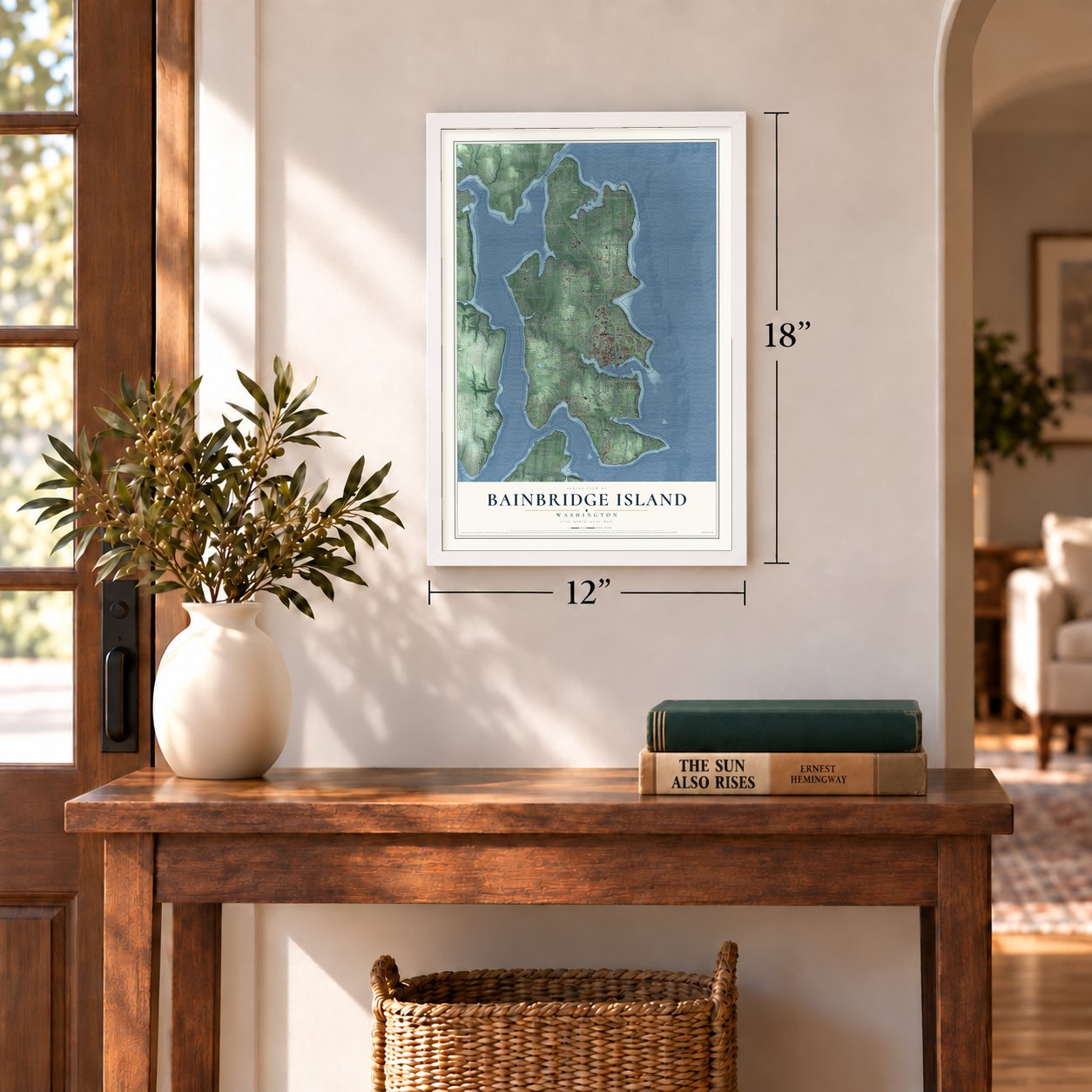
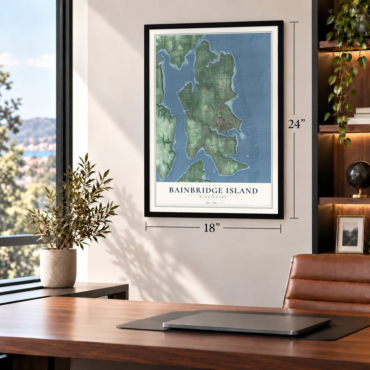
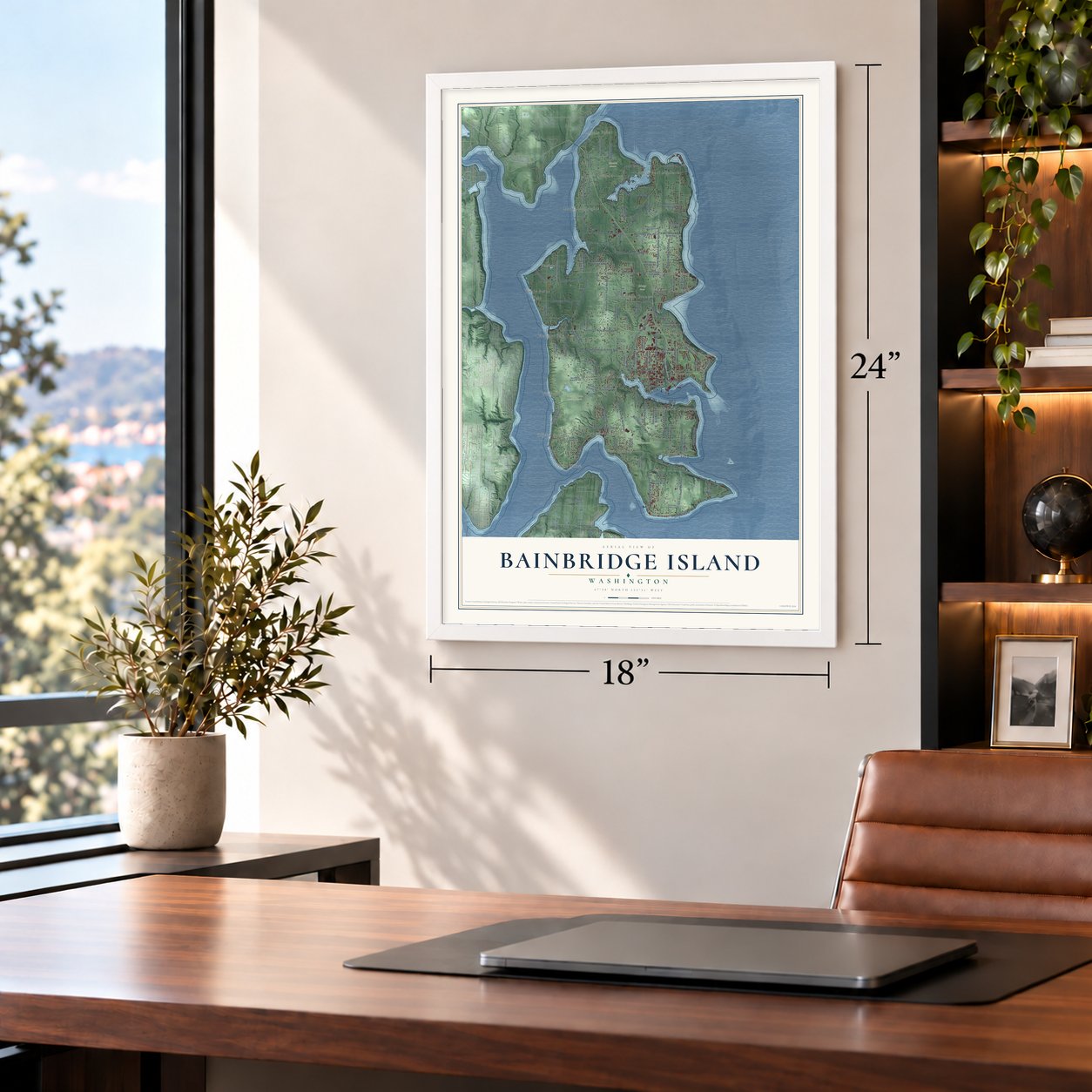

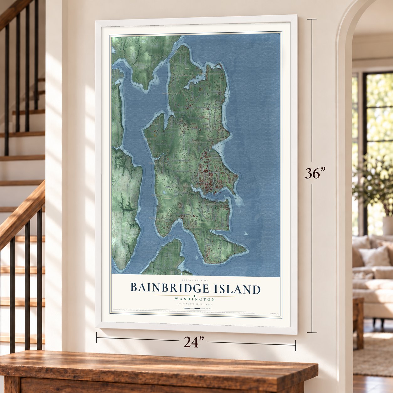

Free U.S. delivery 7 to 10 days after you order
Bainbridge Island, Washington Map Art
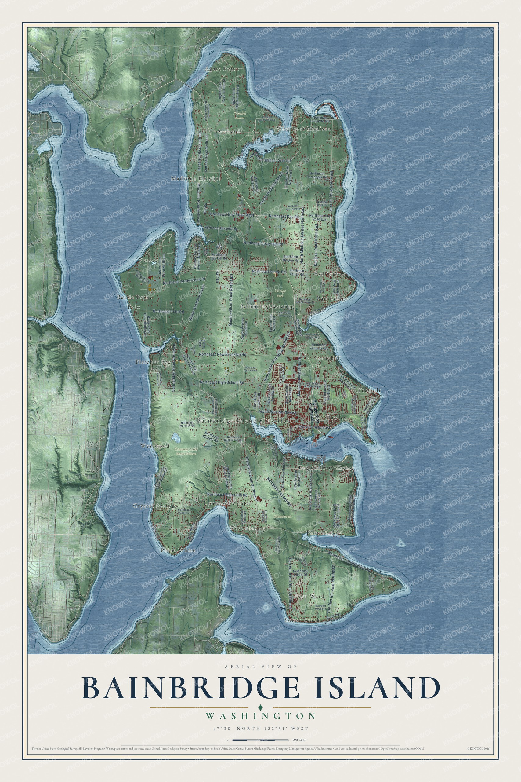
A new map of Bainbridge Island, Washington, made in 2026 and printed to order on thick archival matte paper.
12" x 18" Archival Matte Print
A Map of Home. A Work of Art.
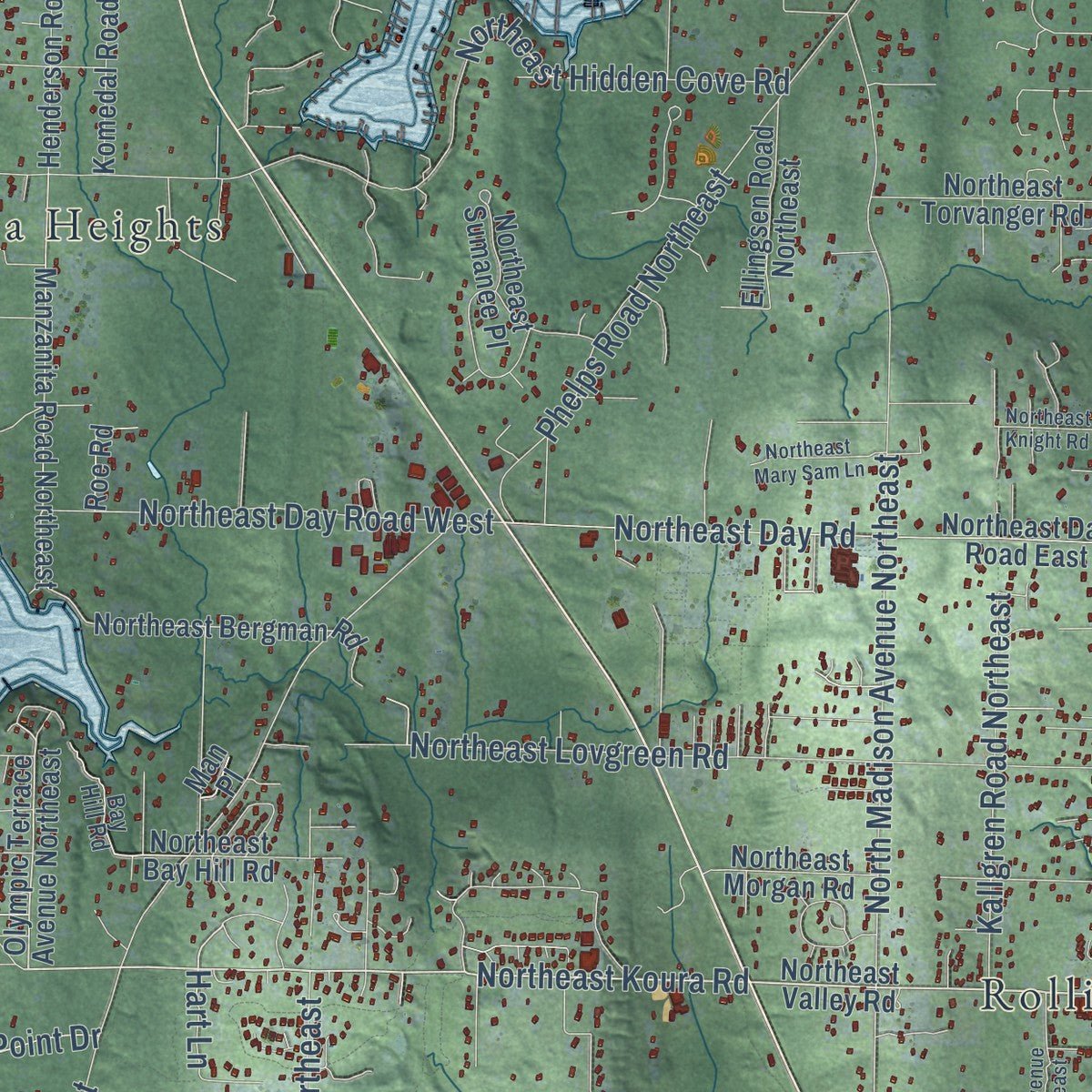
Explore Bainbridge Island, Washington from a whole new perspective. Created using aerial imagery and detailed geographic data, this map captures Bainbridge Island building by building, with labeled streets, familiar landmarks, and shaded topographical relief that highlights the natural contours of the landscape.
Combining modern data with the timeless character of a vintage atlas, this map is just as interesting up close as it is beautiful on the wall. Whether you grew up in Bainbridge Island, spent memorable years there, or call it home today, this unique map is a great way to celebrate a place that means something to you. Zoom in on the preview to look for your street, and then order a print to put your memories on the wall.
Three ways to hang it
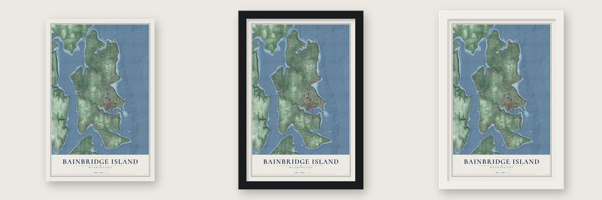
Unframed archival matte, a black wood frame or a white wood frame.
Up close
Geography Worth Displaying
This map was created using accurate cartographic data and authoritative geographic sources, including the U.S. Geological Survey and the Census Bureau. The map brings together terrain, waterways, roads, and building detail. The majority of the streets are labeled, houses are accurately depicted, and the topography is derived from government sources. Combining local data with carefully composed color and shading leads to this beautifully detailed Bainbridge Island artwork for your wall.
Rather than simply showing street outlines, we’ve included as many of the street names as we could reasonably fit on the map while keeping their names legible. Zoom in on the high resolution preview to see exactly what’s on the map. We truly set out to create a statement piece for anyone who loves Bainbridge Island. So whether it’s for you, or a gift for someone you love, we hope this map of Bainbridge Island brings back fond memories.
Read the story behind this map of Bainbridge Island, Washington from 2026.
About Bainbridge Island, Washington
Bainbridge Island is a city of 24,825 people in Kitsap County, and its city limits take in the whole island in Puget Sound. For thousands of years Suquamish people lived here in nine villages. Their winter homes stood at places like Port Madison, Battle Point and Eagle Harbor, and they spent summers at Manzanita, Fletcher Bay and Rolling Bay. In 1855 the tribe signed the Point Elliott Treaty. It gave up the island in return for a reservation at Port Madison and the right to fish in the Sound.
In 1792 Captain George Vancouver anchored HMS Discovery off the island's southern tip. On May 29 he named Restoration Point in honor of King Charles II. His crews never found Agate Passage, so his charts showed the island as a peninsula. In 1841 Lt. Charles Wilkes of the U.S. Navy named it for Commodore William Bainbridge, who led the USS Constitution during the War of 1812. Settlers came to cut its huge cedars, prized for masts, and to build ships. Port Madison, on the north end, became the first Kitsap County seat.
- First sent to the campsThe first Japanese immigrants, the Issei, arrived in 1883. During World War II, the island's Japanese American families were the first sent to internment camps, and the government held them until the war was over. The Bainbridge Island Japanese American Exclusion Memorial, opened in 2011, remembers them.
- Pickleball, invented in 1965The family of Congressman Joel Pritchard made up pickleball at their summer home on the island in 1965. The game borrows from badminton and tennis, but players use paddles and a light plastic ball.
- Winslow took in the islandWinslow was incorporated on August 9, 1947, and covered just 1.5 square miles. Voters narrowly approved a referendum in November 1990, and Winslow annexed the rest of the island on February 28, 1991. On November 7, 1991, the city changed its name to Bainbridge Island.
- Snow Falling on CedarsThe fictional San Piedro Island in David Guterson's 1994 novel Snow Falling on Cedars is modeled on Bainbridge. Guterson lives here and spent ten years teaching at Bainbridge High School.
Find your street
Names on the Bainbridge Island map
Every name below is printed on this map. Look for your street, your school, the park where you played, or the pond down the road.
Places and landmarks29
- Bainbridge Island City Hall
- Agate Point
- South Beach
- Bloedel Reserve
- Gazzam Lake Nature Preserve
- Islandwood
- Meigs Park
- Bainbridge
- Bainbridge Grange
- Battle Point
- Creosote
- Crystal Springs
Show all 29 places
- Eagledale
- Ferncliff
- Fletcher Bay
- Fort Ward
- Hawley
- Lynwood Center
- Madrona Heights
- Point White
- Port Blakely
- Rollingbay
- Seabold
- Tolo
- Venice
- West Blakely
- West Port Madison
- Westwood
- Yeomalt
Streets and roads104
- Northeast Koura Road
- Sunrise Drive Northeast
- North Madison Avenue Northeast
- Miller Road Northeast
- Northeast High School Road
- Northeast Country Club Road
- Blakely Avenue Northeast
- Northeast Hidden Cove Road
- Northeast New Brooklyn Road
- Northeast Baker Hill Road
- Northeast Old Mill Road
- Mandus Olson Road Northeast
- Northeast Arrow Point Drive
- Sportsman Club Road Northeast
- Fort Ward Hill Road Northeast
- Phelps Road Northeast
- Madison Avenue North
- Springridge Road Northeast
- Northeast Day Road
- Northeast Lovgreen Road
- Toe Jam Hill Road Northeast
- Northeast Tolo Road
- Northeast Day Road West
- Kallgren Road Northeast
- Wyatt Way Northwest
- Winslow Way East
- Hart Lane
- Olympic Way Southeast
- Northeast Valley Road
- Manzanita Road Northeast
Show all 104 streets
- Olympic Terrace Avenue Northeast
- Fletcher Bay Road Northeast
- Battle Point Drive Northeast
- Crystal Springs Drive Northeast
- Arrow Point Drive Northeast
- Ferncliff Avenue Northeast
- Northeast South Beach Drive
- Point White Drive Northeast
- Northeast Day Road East
- Lynwood Center Road Northeast
- Rockaway Beach Road Northeast
- Sands Avenue Northeast
- Rose Loop Northeast
- Taylor Avenue Northeast
- Grand Avenue Northeast
- Agate Point Road Northeast
- Northeast Bay Hill Road
- Weaver Road Northwest
- Northeast Lafayette Avenue
- Grow Avenue Northwest
- Henderson Road Northeast
- Komedal Road Northeast
- Agate Pass Road Northeast
- Northeast Torvanger Road
- Northeast Bergman Road
- Northeast Kitsap Street
- Northeast Yaquina Avenue
- Moran Road Northeast
- Ellingsen Road Northeast
- Northeast Sumanee Place
- Northeast Vincent Road
- Falk Road Northeast
- Rose Avenue Northeast
- Finch Road Northeast
- Rockaway Bluff Road Northeast
- Bucsit Lane Northeast
- Northeast Morgan Road
- Holly Farm Lane
- Northeast Madrona Drive
- Roe Road
- Man Place
- Northeast Hansen Road
- Northeast Marshall Road
- New Sweden Road Northeast
- Northeast Bucklin Hill Road
- Northeast Beach Crest Drive
- Cherry Avenue Northeast
- Northeast Tani Creek Road
- Agatewood Road Northeast
- Wing Point Road Northeast
- Bay Hill Road
- Commodore Lane Northwest
- Lytle Road Northeast
- Northeast Lofgren Road
- Skinner Road Northeast
- Northeast Dapple Court
- Corpuz Lane
- Manitou Beach Drive Northeast
- Northeast County Park Road
- Northeast Eagle Harbor Drive
- Northeast Wardwell Road
- Island Center Road Northeast
- High School Road Northeast
- Crystal Spring Drive Northeast
- Hyla Avenue Northeast
- Northeast Darden Lane
- Northeast Bolero Lane
- Upper Farms Road Northeast
- Northeast Mary Sam Lane
- Aaron Avenue
- Wood Avenue Southwest
- Northeast Knight Road
- Northeast Quail Hill Road
- Northeast Birkland Road
Names are listed as they appear on the printed map. Zoom into the product photos to find them.
The art of mapping a place
How This Map Was Made
Real places. Remarkable detail. Discover the layers that turn geographic data into a map of home.

The view from above
Aerial imagery reveals the character of the land: woodland, open fields, and the patterns of a place.

The shape of the land
Elevation data brings hills, valleys, and subtle changes in the landscape into view.

The details of home
Roads, waterways, and building footprints come together to make the map feel unmistakably local.

Geography becomes art
Considered color, shading, and typography bring the layers together in a map made for your wall.


Process illustrated with Mendon, Massachusetts. Aerial imagery: USDA NAIP. Terrain: USGS 3D Elevation Program. Map details and finished artwork: KNOWOL.
The Details
About This Print
Choose an archival matte print, or a black or white Ayous wood frame. The archival matte print is unframed.
Select your size and finish above to see the matching product image and price.
Materials & Craftsmanship
A contemporary map with the character of a classic atlas, printed on archival matte paper. Optional frames are made from Ayous wood.
Your printed map does not include the watermark shown in the full-map preview.
Shipping & Delivery
Free shipping within the United States. Every print is made to order in the USA.
Buying a gift? Add a note in your cart and we'll include it. We never put prices in the package.
Prints ship within 2 to 3 business days. Allow 7 to 10 days total from ordering for delivery. Timing may vary during holidays or periods of high order volume.
Read our shipping policy.
Returns and damaged prints
Each print is made to order. Change-of-mind refunds are not available after production.
If your print arrives damaged, misprinted or incorrect, contact support@knowol.com within 30 days of receiving it. Include your order number, photos and a description of the issue.
Read our full refund and replacement policy. For questions about your order, email support@knowol.com.
Find your town
Looking for another city?
Find a map of home in our Washington collection, or any town in the country.
Nearby
Maps of towns near Bainbridge Island
Know someone from one of these towns? Their map makes a great gift.
 Enetai
, Washington
From $39.99See the map
 Keyport
, Washington
From $39.99See the map
 Manchester
, Washington
From $39.99See the map
More maps nearby: Suquamish, Tracyton, Seattle, Indianola and Rocky Point.