
Search for another town



Free U.S. delivery 7 to 10 days after you order
Seattle, Washington Map Art
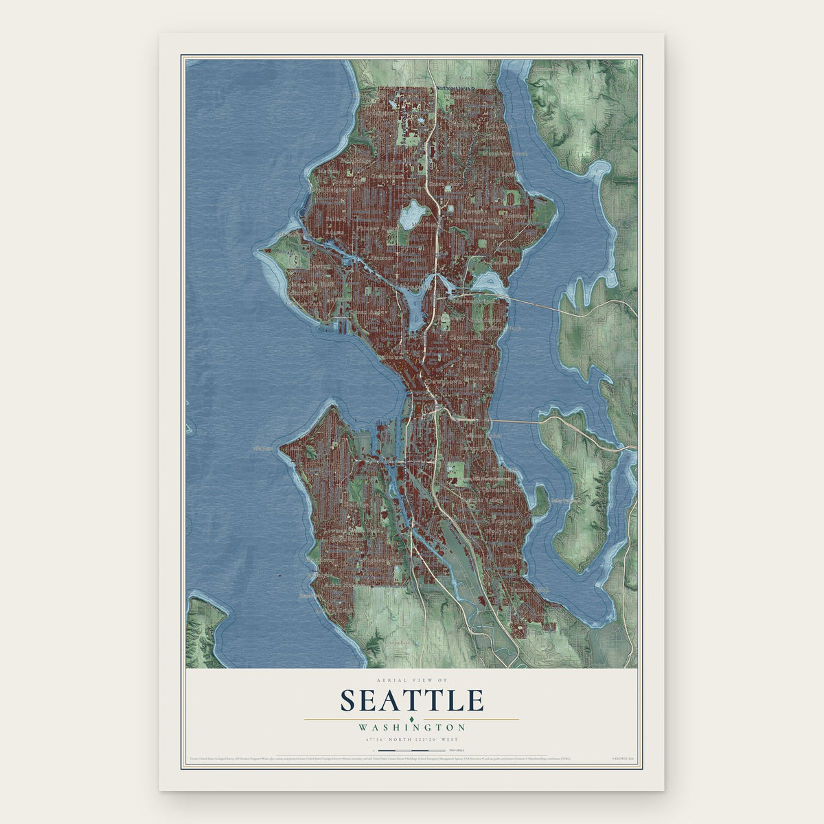
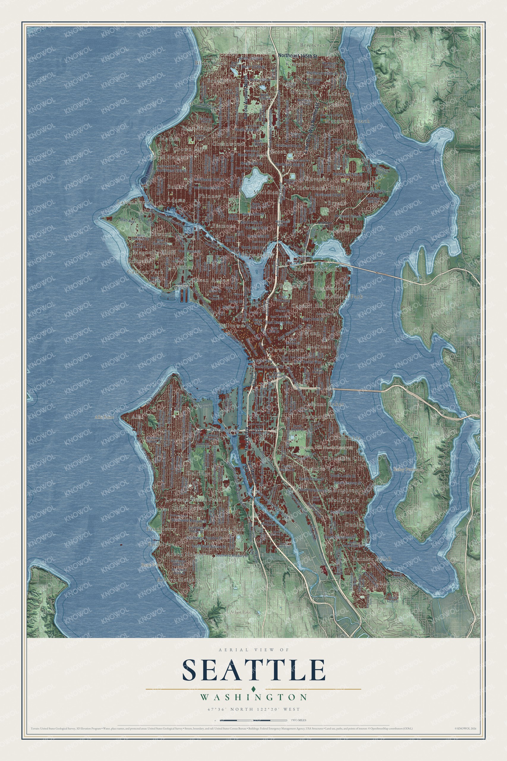
A new map of Seattle, Washington, made in 2026 and printed to order on thick archival matte paper.
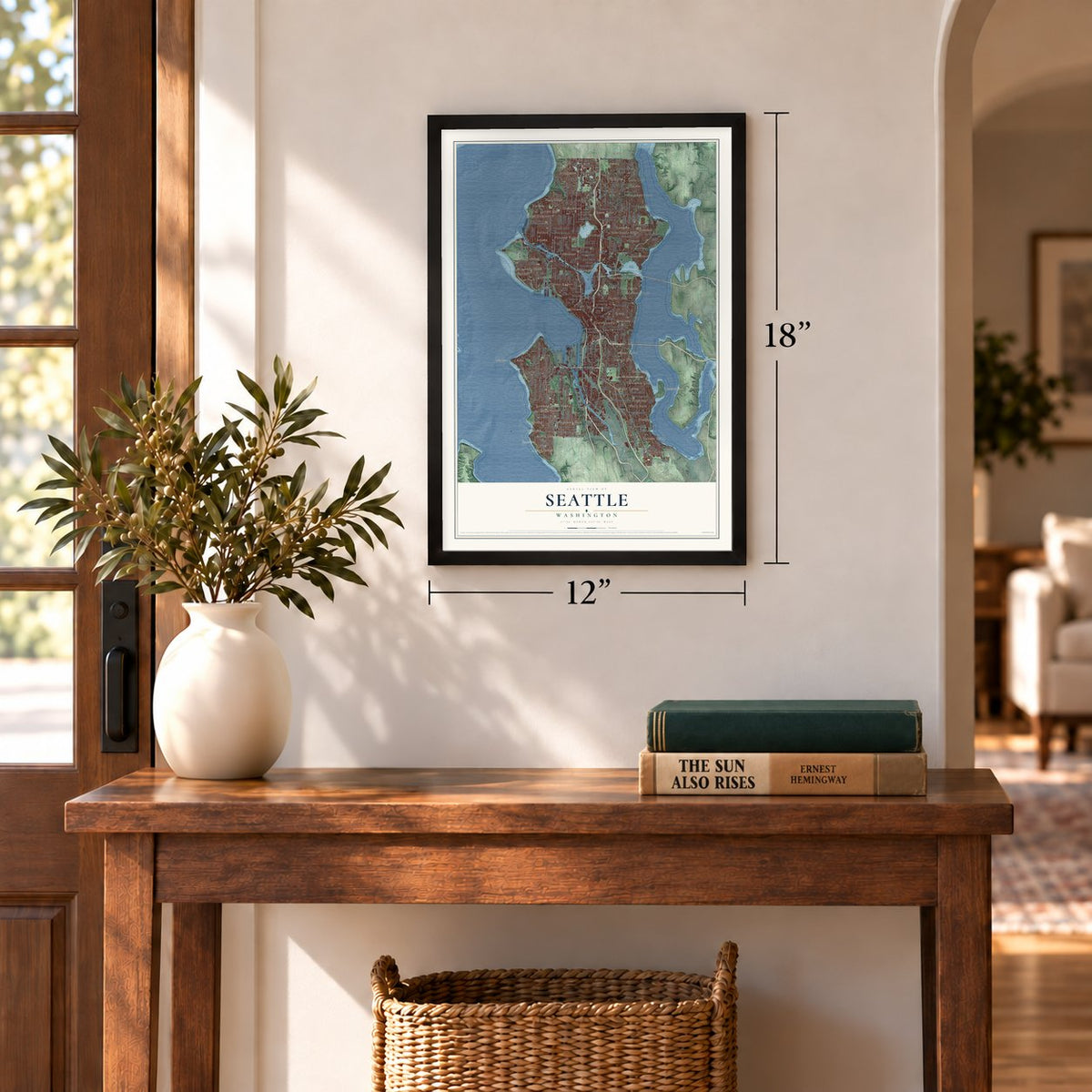
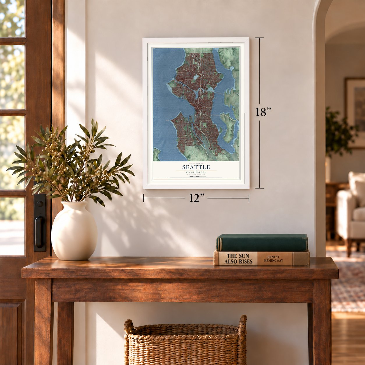
12" x 18" Archival Matte Print
A Map of Home. A Work of Art.
Explore Seattle, Washington from a whole new perspective. Created using aerial imagery and detailed geographic data, this map captures Seattle building by building, with labeled streets, familiar landmarks, and shaded topographical relief that highlights the natural contours of the landscape.
Combining modern data with the timeless character of a vintage atlas, this map is just as interesting up close as it is beautiful on the wall. Whether you grew up in Seattle, spent memorable years there, or call it home today, this unique map is a great way to celebrate a place that means something to you. Zoom in on the preview to look for your street, and then order a print to put your memories on the wall.
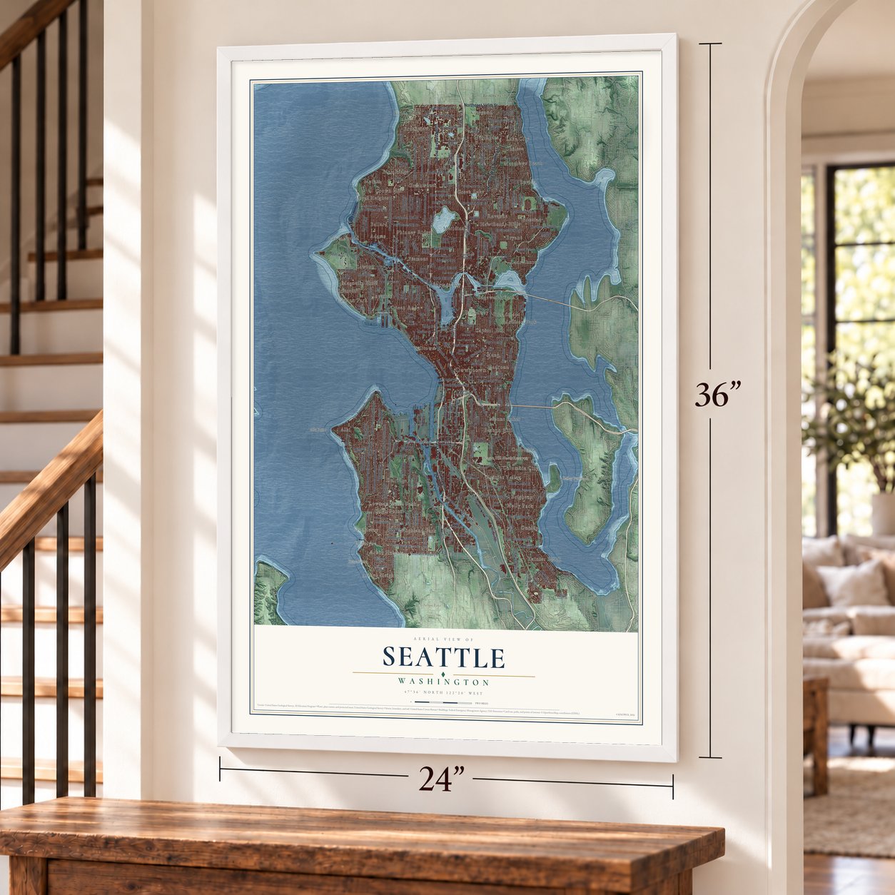
Three ways to hang it
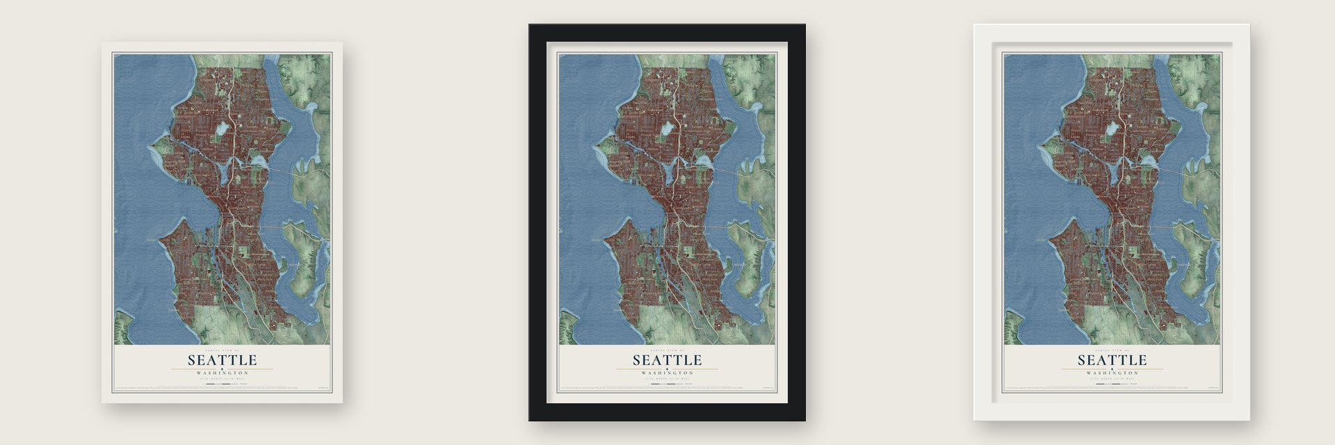
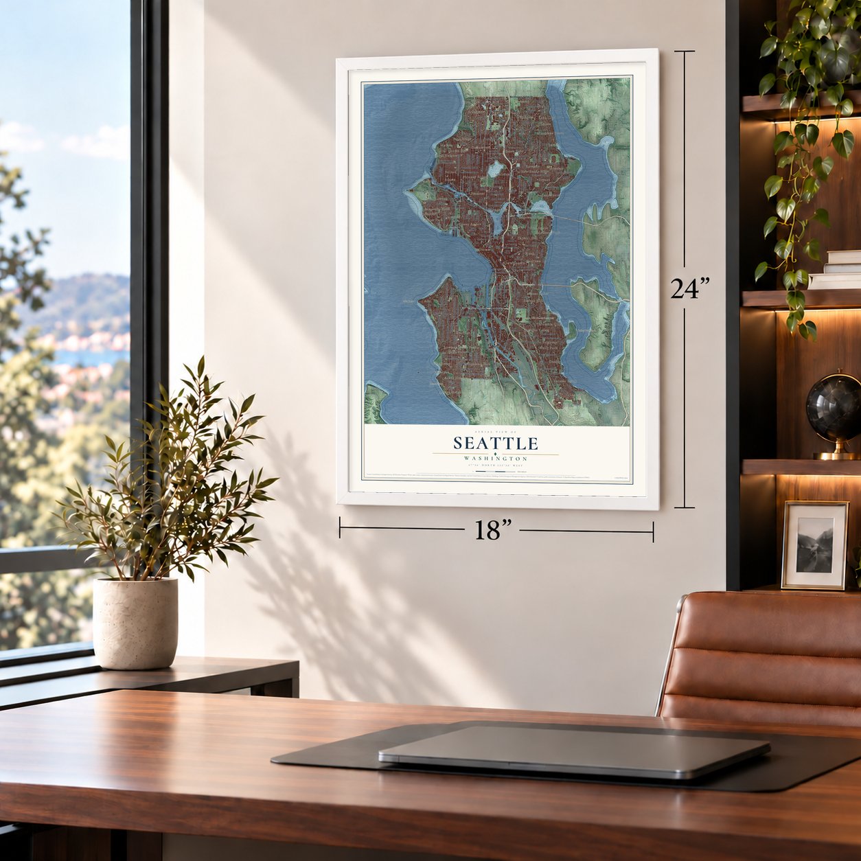
Unframed archival matte, a black wood frame or a white wood frame.
Up close
Geography Worth Displaying
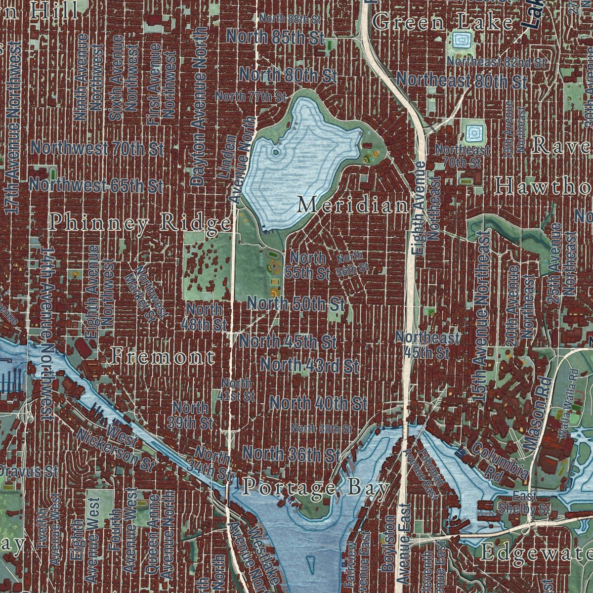
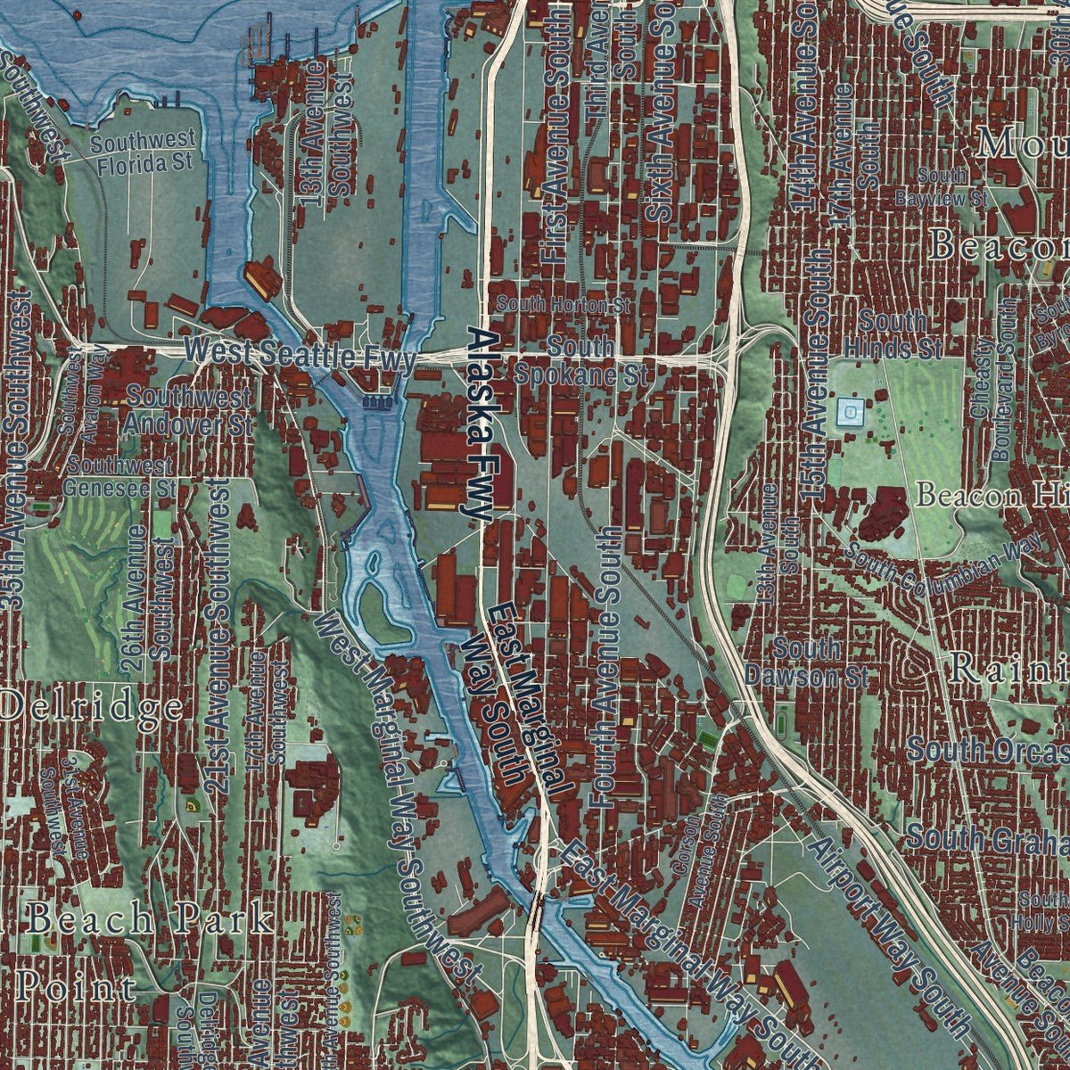
This map was created using accurate cartographic data and authoritative geographic sources, including the U.S. Geological Survey and the Census Bureau. The map brings together terrain, waterways, roads, and building detail. The majority of the streets are labeled, houses are accurately depicted, and the topography is derived from government sources. Combining local data with carefully composed color and shading leads to this beautifully detailed Seattle artwork for your wall.
Rather than simply showing street outlines, we’ve included as many of the street names as we could reasonably fit on the map while keeping their names legible. Zoom in on the high resolution preview to see exactly what’s on the map. We truly set out to create a statement piece for anyone who loves Seattle. So whether it’s for you, or a gift for someone you love, we hope this map of Seattle brings back fond memories.
Read the story behind this map of Seattle, Washington from 2026.

About Seattle, Washington
Seattle is a city of 737,015 people and the seat of King County, set between Puget Sound and Lake Washington. Arthur Denny's party came ashore from the schooner Exact at Alki Beach on a rainy November 13, 1851. They had followed the Oregon Trail from Illinois to build a city where they expected a transcontinental railroad to end. The anchorage at Alki proved too open to the weather, so in April 1852 most of them moved to the eastern shore of Elliott Bay. Doc Maynard talked them into naming the town Seattle, after the chief of the Duwamish and Suquamish, instead of Duwamps.
That fall Henry Yesler, won over with cash and land, built Puget Sound's first steam sawmill in Seattle, and in December 1852 the town became the seat of the new King County. It lost the race for territorial capital to Olympia but got the Territorial University in 1861. When the Northern Pacific Railroad picked Tacoma for its terminus in 1874, the founders laid their own short lines to newly found coal, and Seattle's population, 1,100 in 1870, tripled by 1880.
“There is plenty of room for one thousand settlers. Come at once.”
- The fire of 1889On June 6, 1889, a glue pot that got too hot started a fire, the private water system failed, and 64 acres of wooden buildings and docks burned. Seattle rebuilt in stone and brick and raised the streets of Pioneer Square, which created the passages now toured as Underground Seattle. A month after the fire, voters approved a public water system, and City Engineer R. H. Thomson piped water from the Cedar River, 40 miles away.
- Gateway to AlaskaThe Panic of 1893 sank Seattle into a depression until 1897, when the steamship Portland arrived carrying gold from the Klondike. The city sold itself as the Gateway to Alaska, and its merchants outfitted tens of thousands of prospectors heading north. Seattle closed the decade with 82,000 residents.
- Two world's fairsThe Alaska-Yukon-Pacific Exposition of 1909 shaped the layout of the University of Washington campus. The Century 21 Exposition of 1962 left the city the Space Needle, the Monorail and Seattle Center, and its Washington State Coliseum is now on the National Register.
- The general strike of 1919Shipyards grew huge during World War I, and when the work fell off, Seattle's labor unions walked out in 1919 in the nation's first general strike.
- UPS started hereJames E. Casey was only 19 when he started the American Messenger Company in 1907 with $100 he had borrowed from a friend. The company later became UPS. Nordstrom and Eddie Bauer also got their start in Seattle in those boom years.
Find your street
Names on the Seattle map
Every name below is printed on this map. Look for your street, your school, the park where you played, or the pond down the road.
Places and landmarks68
- Downtown
- Alki Point
- Arrowhead Point
- Bailey Peninsula
- Brace Point
- Arbor Lake
- Beacon Hill North Reservoir
- Adams
- Alki
- Arbor Heights
- Arroyo Heights
- Ballard
Show all 68 places
- Beacon Hill
- Belltown
- Bitter Lake
- Blue Ridge
- Briarcliff
- Briercrest
- Brighton
- Broadmoor
- Broadview
- Broadway
- Bryant
- Capitol Hill
- Carlton Park
- Chelsea
- Columbia
- Columbia City
- Crown Hill
- Delridge
- Dunlap
- Edgewater Park
- Endolyne
- Fauntleroy
- Foy
- Fremont
- Green Lake
- Greenwood
- Hawthorne Hills
- High Point
- Highland Park
- Holly Park
- Interbay
- Kenwood
- Lake City
- Lakeridge
- Laurelhurst
- Lavilla
- Lawton
- Lawtonwood
- Lowman Beach Park
- Loyal Heights
- Madison Park
- Madrona
- Magnolia Bluff
- Mann
- Matthews Beach
- Meridian
- Metum
- Mount Baker
- Northgate
- Phinney Ridge
- Pontiac
- Portage Bay
- Queen Anne
- Rainier Beach
- Rainier Valley
- Ravenna
Streets and roads259
- Aurora Avenue North
- Alaska Fwy
- Lake City Way Northeast
- Northeast 145th Street
- First Avenue South
- West Marginal Way Southwest
- East Marginal Way South
- Southwest Barton Street
- North 45th Street
- Seventh Avenue
- Yesler Way
- Alaskan Way
- South Lucile Street
- 15th Avenue South
- Rainier Avenue South
- Airport Way South
- 15th Avenue Northeast
- California Avenue Southwest
- Third Avenue Northwest
- Fifth Avenue Northeast
- West Seattle Fwy
- 35th Avenue Southwest
- First Avenue Northeast
- Fremont Avenue North
- 35th Avenue Northeast
- Roosevelt Way Northeast
- 47th Avenue Southwest
- Dayton Avenue North
- Fourth Avenue South
- 45th Avenue Southwest
Show all 259 streets
- 14th Avenue Northwest
- Alki Avenue Southwest
- Sixth Avenue South
- Northeast 65th Street
- 38th Avenue Southwest
- South Orcas Street
- 14th Avenue South
- Beach Drive Southwest
- 21st Avenue Southwest
- Northeast 75th Street
- East Madison Street
- 17th Avenue Northwest
- South Cloverdale Street
- Northeast 80th Street
- Northwest 65th Street
- Southwest Kenyon Street
- South Graham Street
- South Jackson Street
- Northeast 62nd Street
- Northwest 70th Street
- Dexter Avenue North
- East Denny Way
- Southwest Trenton Street
- Northwest 75th Street
- South Juneau Street
- East John Street
- Northeast 135th Street
- 28th Avenue West
- South Othello Street
- Second Avenue
- North 50th Street
- North 85th Street
- East Yesler Way
- Boren Avenue
- West Commodore Way
- North 137th Street
- Mercer Street
- North 80th Street
- North 43rd Street
- North 143rd Street
- Elliott Avenue West
- North 36th Street
- North 40th Street
- Utah Avenue
- 32nd Avenue
- North 100th Street
- Aloha Street
- 37th Avenue
- Mason Road
- Second Avenue South
- South Spokane Street
- South Kenyon Street
- East Prospect Street
- West Emerson Street
- North 120th Street
- North 55th Street
- First Avenue Northwest
- 30th Avenue South
- Martin Luther King Junior Way South
- Beacon Avenue South
- Greenwood Avenue North
- Eighth Avenue Northwest
- 16th Avenue Southwest
- 17th Avenue Northeast
- 37th Avenue Southwest
- 20th Avenue Northeast
- Eighth Avenue Northeast
- 41st Avenue Southwest
- Meridian Avenue North
- Linden Avenue North
- Renton Avenue South
- Ninth Avenue Northwest
- 46th Avenue Southwest
- 25th Avenue Northeast
- 30th Avenue Northeast
- Sixth Avenue Northwest
- 40th Avenue Northeast
- 39th Avenue South
- 51st Avenue South
- 40th Avenue Southwest
- Seward Park Road
- Harbor Avenue Southwest
- South Dawson Street
- 49th Avenue Southwest
- 42nd Avenue Northeast
- Westlake Avenue North
- 23rd Avenue South
- Northeast 60th Street
- West Dravus Street
- 26th Avenue Southwest
- Eastlake Avenue East
- 55th Avenue South
- Northeast 45th Street
- Third Avenue South
- Northeast 50th Street
- Southwest Roxbury Street
- Queen Anne Avenue North
- 17th Avenue South
- Southwest Thistle Street
- Southwest Andover Street
- Perimeter Road South
- 13th Avenue Southwest
- West Garfield Street
- Eighth Avenue West
- 50th Avenue Southwest
- South King Street
- Seaview Avenue Northwest
- East Pine Street
- Northeast 91st Street
- 32nd Avenue Northwest
- Southwest Dakota Street
- 24th Avenue East
- East Mercer Street
- South Henderson Street
- South Dearborn Street
- Northeast 117th Street
- West Ruffner Street
- Northeast 130th Street
- South Hinds Street
- Fourth Avenue West
- Northeast 140th Street
- West Nickerson Street
- West Howe Street
- Fourth Avenue North
- Boylston Avenue East
- Sixth Avenue
- East Marion Street
- Lakeside Avenue South
- North 130th Street
- 30th Avenue
- Denny Way
- North 39th Street
- Valley Street
- North 92nd Street
- Lake Washington Boulevard
- 26th Avenue
- East Fir Street
- North 48th Street
- West Galer Street
- North 34th Street
- Southwest 100th Street
- Southwest 104th Street
- Galer Street
- Northeast Noaa Drive
- Texas Way
- Columbia Road
- Myers Way South
- South 115th Street
- South Taft Street
- Delridge Way Southwest
- Fifth Avenue South
- Northwest Market Street
- Fairview Avenue East
- Sand Point Way Northeast
- 27th Avenue Northeast
- 45th Avenue Northeast
- Twelfth Avenue Northwest
- 37th Avenue South
- Northeast 70th Street
- 13th Avenue South
- West Bertona Street
- 17th Avenue Southwest
- Southwest Genesee Street
- Northeast 82nd Street
- Northwest 77th Street
- Northeast 97th Street
- Twelfth Avenue West
- East Thomas Street
- South Columbian Way
- Eleventh Avenue East
- East Spruce Street
- North 41st Street
- Cheasty Boulevard South
- North 77th Street
- South Director Street
- Southwest Florida Street
- Northeast 110th Street
- John Street
- Tenth Avenue Southwest
- Northwest Carkeek Park Road
- Gilman Avenue West
- 24th Avenue
- South Sullivan Street
- 42nd Avenue East
- West Prospect Street
- Northwest 105th Street
- East Shelby Street
- North 138th Street
- Illinois Avenue
- Alaskan Way South
- Corson Avenue South
- North 56th Street
- Fauntleroy Way Southwest
- 31st Avenue Southwest
- 30th Avenue Southwest
- 19th Avenue Northeast
- 37th Avenue Northeast
- 32nd Avenue Northeast
- Seward Park Avenue South
- Northeast 95th Street
- First Avenue West
- West Armour Street
- South Holly Street
- Twelfth Avenue Southwest
- South Horton Street
- Third Avenue Northeast
- Waters Avenue South
- East Harrison Street
- Northwest 95th Street
- South Bayview Street
- 59th Avenue South
- North 38th Street
- North 103rd Street
- Northeast 127th Street
- 20th Avenue
- North 95th Street
- Harrison Street
- 59th Avenue Southwest
- North 122nd Street
- North 88th Street
- Shilshole Avenue Northwest
- Walla Walla Road
- Highland Drive
- Southwest Avalon Way
- Southwest Ida Street
- Fuhrman Avenue East
- Island Drive South
- Boeing Field King Co Intl
- South Byron Street
Names are listed as they appear on the printed map. Zoom into the product photos to find them.
The art of mapping a place
How This Map Was Made
Real places. Remarkable detail. Discover the layers that turn geographic data into a map of home.

The view from above
Aerial imagery reveals the character of the land: woodland, open fields, and the patterns of a place.

The shape of the land
Elevation data brings hills, valleys, and subtle changes in the landscape into view.

The details of home
Roads, waterways, and building footprints come together to make the map feel unmistakably local.

Geography becomes art
Considered color, shading, and typography bring the layers together in a map made for your wall.


Process illustrated with Mendon, Massachusetts. Aerial imagery: USDA NAIP. Terrain: USGS 3D Elevation Program. Map details and finished artwork: KNOWOL.
The Details
About This Print
Choose an archival matte print, or a black or white Ayous wood frame. The archival matte print is unframed.
Select your size and finish above to see the matching product image and price.
Materials & Craftsmanship
A contemporary map with the character of a classic atlas, printed on archival matte paper. Optional frames are made from Ayous wood.
Your printed map does not include the watermark shown in the full-map preview.
Shipping & Delivery
Free shipping within the United States. Every print is made to order in the USA.
Buying a gift? Add a note in your cart and we'll include it. We never put prices in the package.
Prints ship within 2 to 3 business days. Allow 7 to 10 days total from ordering for delivery. Timing may vary during holidays or periods of high order volume.
Read our shipping policy.
Returns and damaged prints
Each print is made to order. Change-of-mind refunds are not available after production.
If your print arrives damaged, misprinted or incorrect, contact support@knowol.com within 30 days of receiving it. Include your order number, photos and a description of the issue.
Read our full refund and replacement policy. For questions about your order, email support@knowol.com.
Find your town
Looking for another city?
Find a map of home in our Washington collection, or any town in the country.
Nearby
Maps of towns near Seattle
Know someone from one of these towns? Their map makes a great gift.
 Medina
, Washington
From $39.99See the map
 Hunts Point
, Washington
From $39.99See the map
 Clyde Hill
, Washington
From $39.99See the map
More maps nearby: Yarrow Point, Mercer Island, Beaux Arts Village, Bainbridge Island and Boulevard Park.