


Search for another town



Free U.S. delivery 7 to 10 days after you order
Bala Cynwyd, Pennsylvania Map Art
Building by building, with labeled streets and shaded relief.
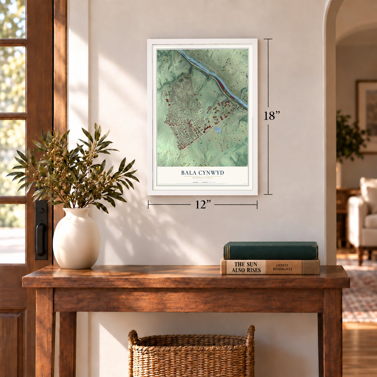
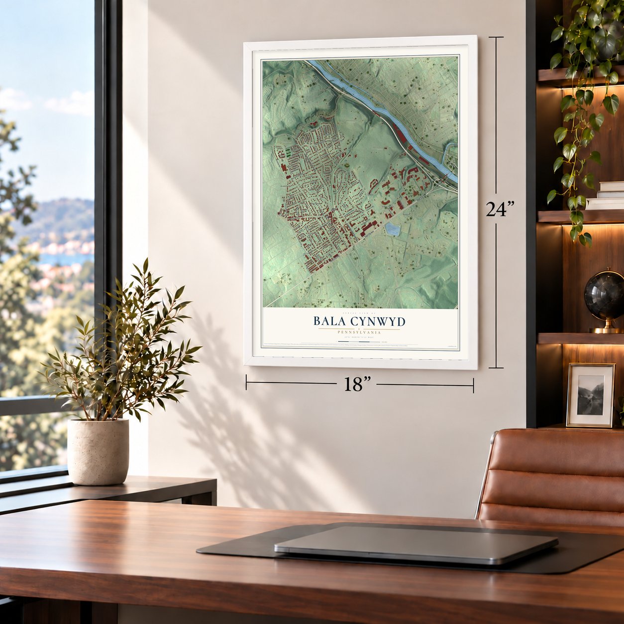
12" x 18" Archival Matte Print
A Map of Home. A Work of Art.
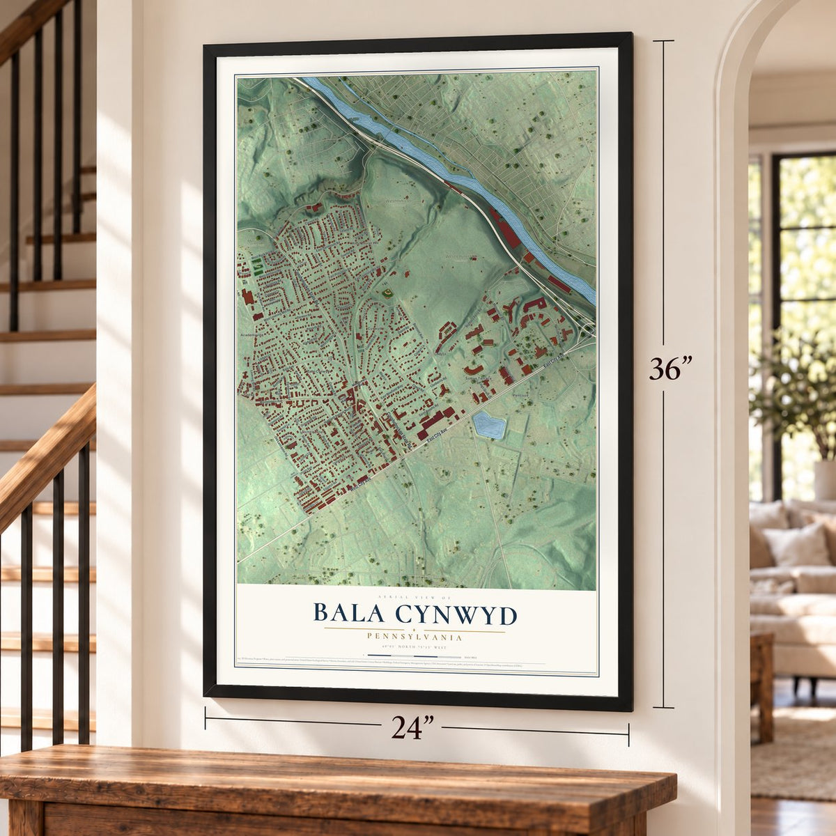
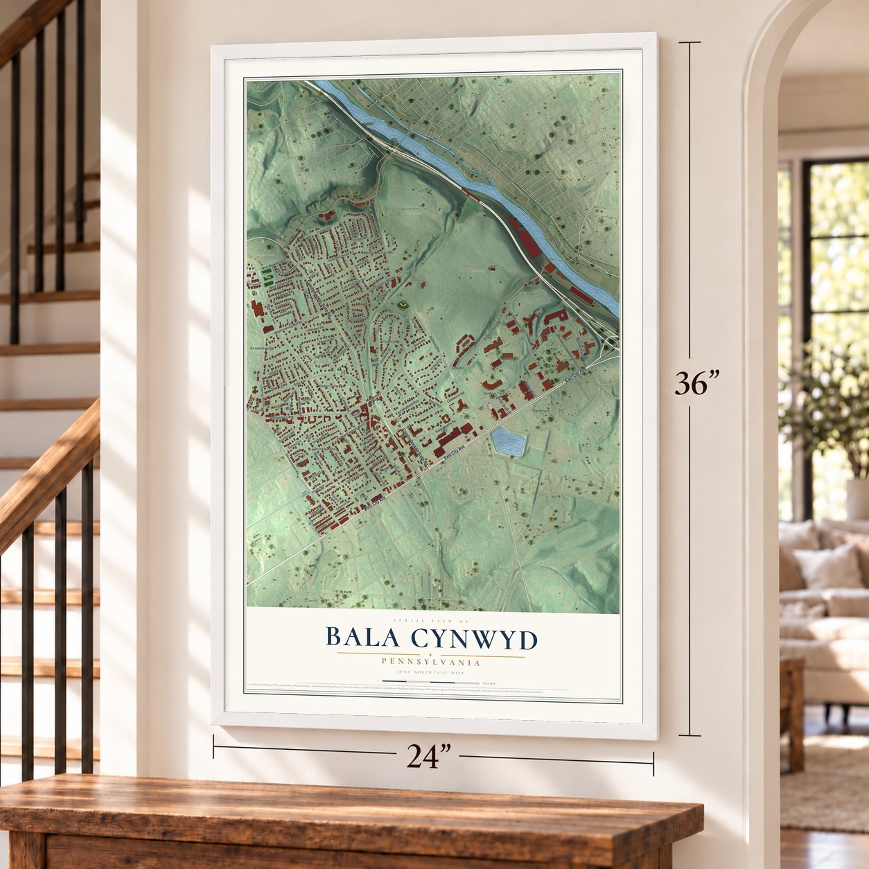
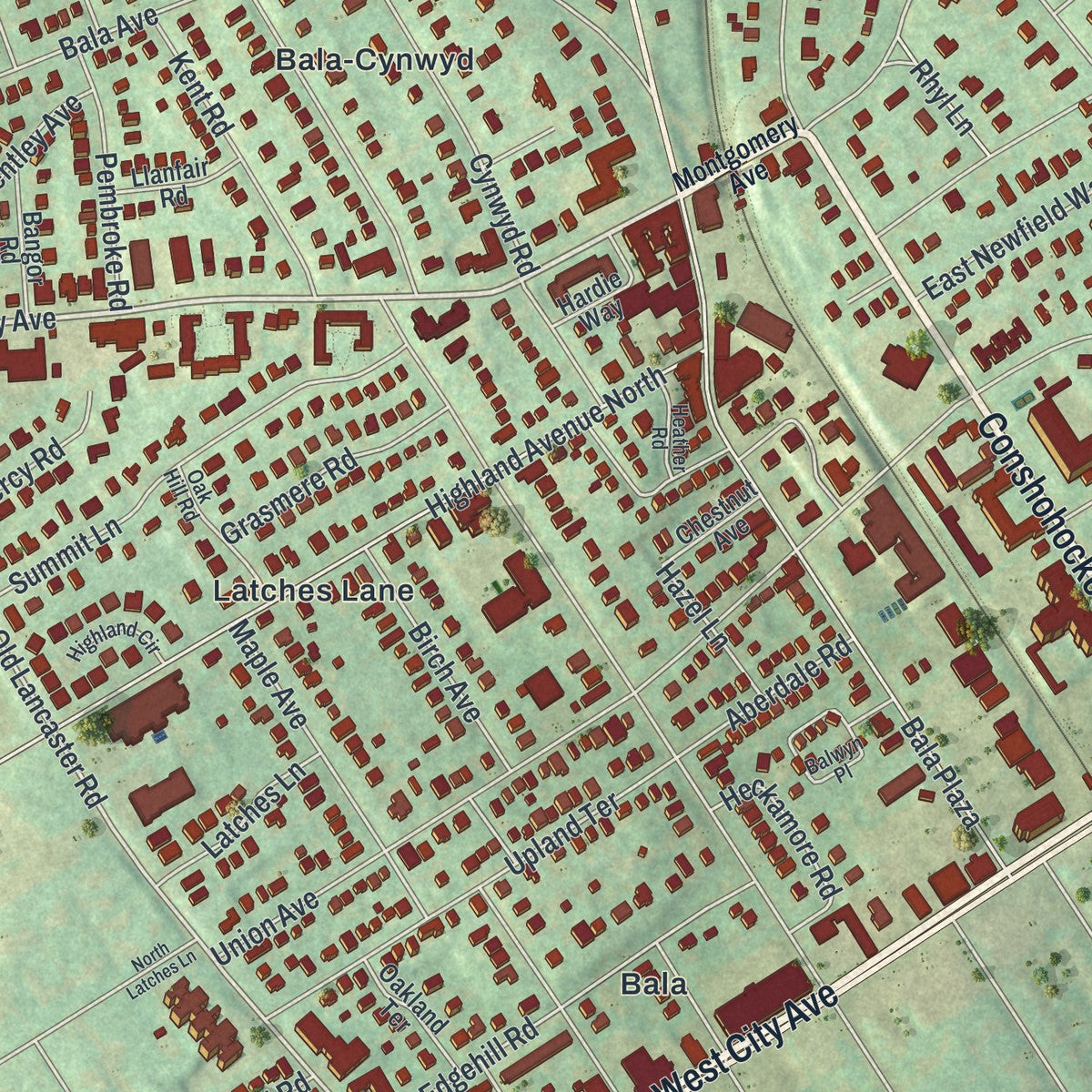
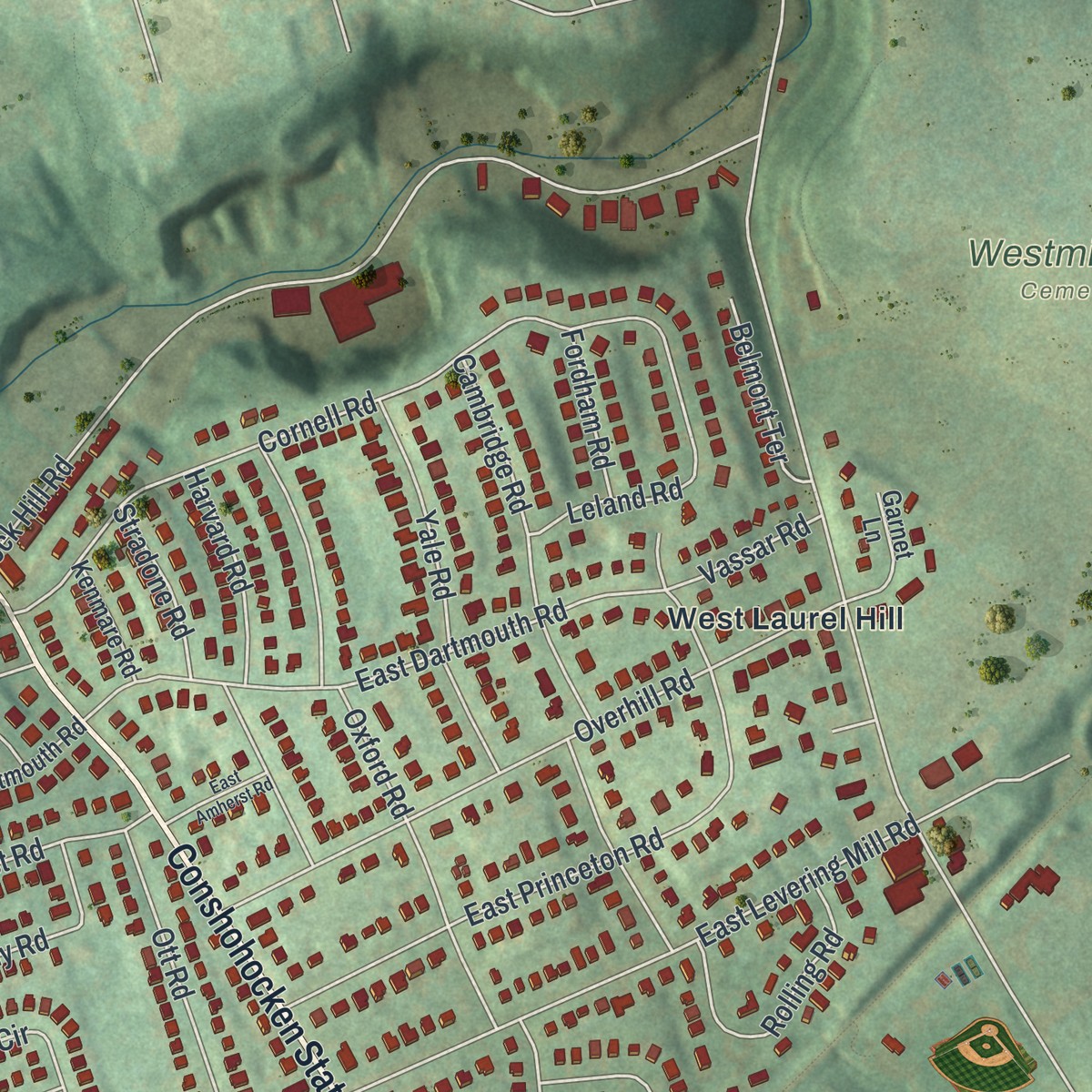
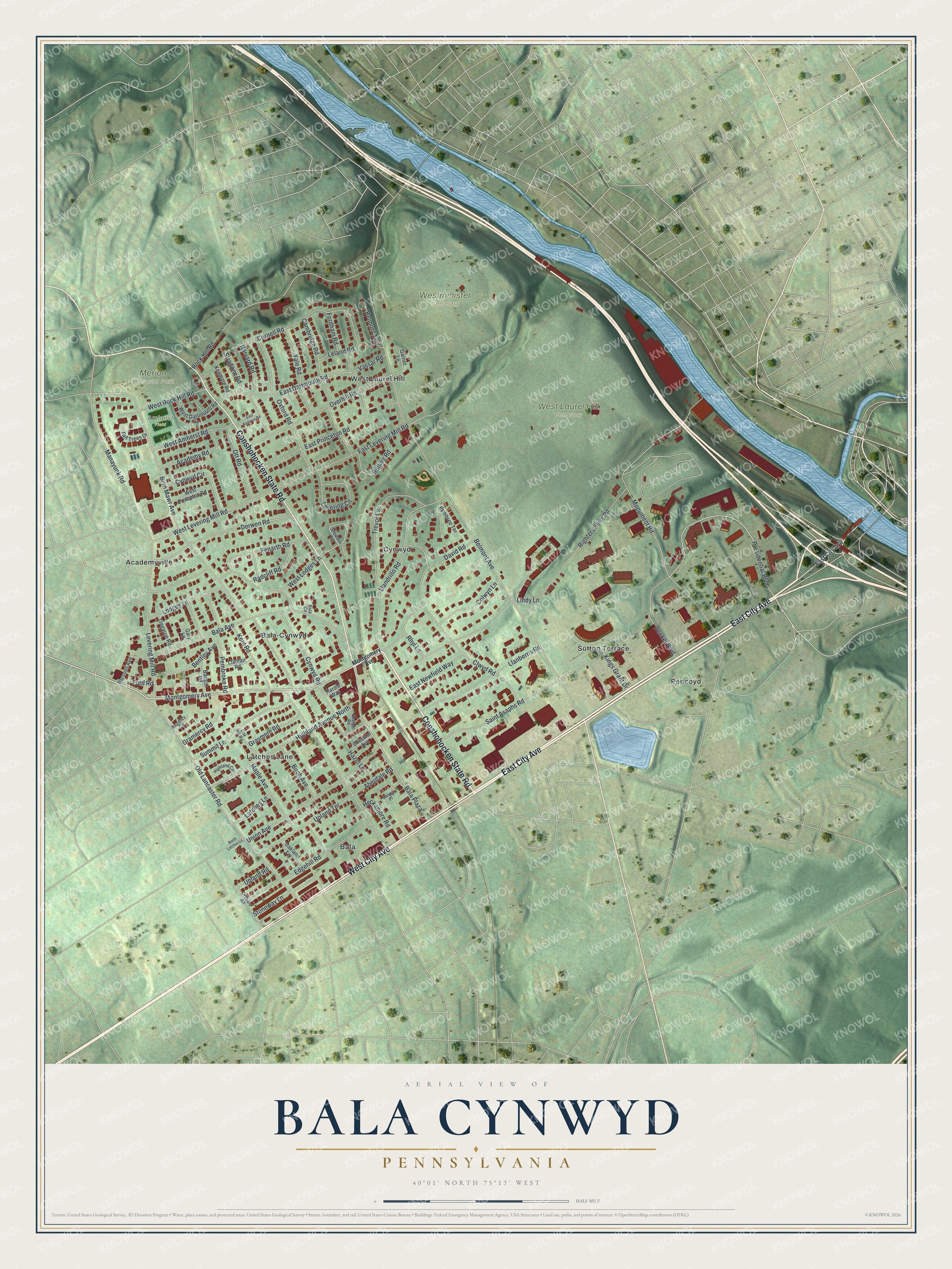
Explore Bala Cynwyd, Pennsylvania from a whole new perspective. Created using aerial imagery and detailed geographic data, this map captures Bala Cynwyd building by building, with labeled streets, familiar landmarks, and shaded topographical relief that highlights the natural contours of the landscape.
Combining modern data with the timeless character of a vintage atlas, this map is just as interesting up close as it is beautiful on the wall. Whether you grew up in Bala Cynwyd, spent memorable years there, or call it home today, this unique map is a great way to celebrate a place that means something to you. Zoom in on the preview to look for your street, and then order a print to put your memories on the wall.
Three ways to hang it
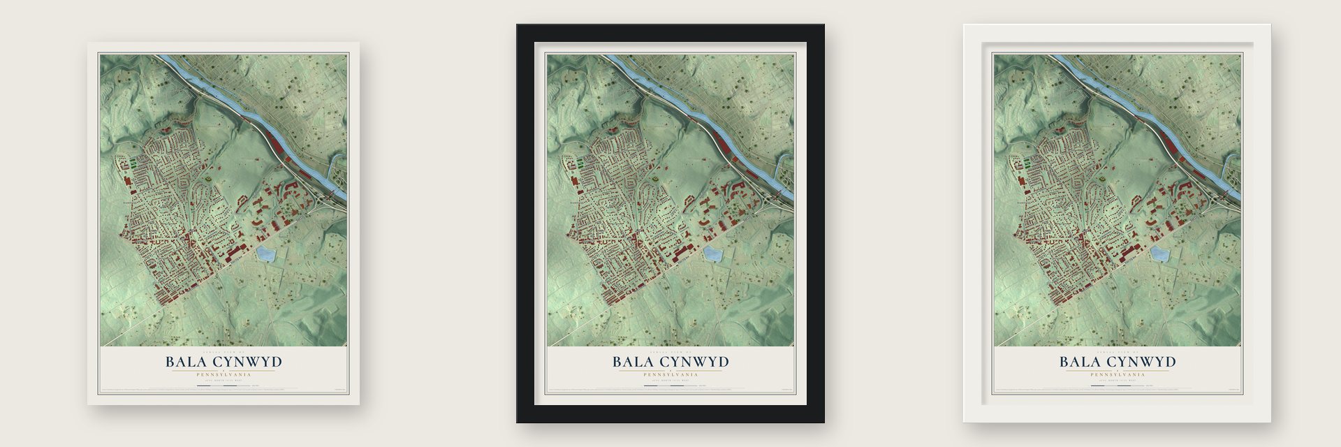
Unframed archival matte, a black wood frame or a white wood frame.
Up close
Geography Worth Displaying
This map was created using accurate cartographic data and authoritative geographic sources, including the U.S. Geological Survey and the Census Bureau. The map brings together terrain, waterways, roads, and building detail. The majority of the streets are labeled, houses are accurately depicted, and the topography is derived from government sources. Combining local data with carefully composed color and shading leads to this beautifully detailed Bala Cynwyd artwork for your wall.
Rather than simply showing street outlines, we’ve included as many of the street names as we could reasonably fit on the map while keeping their names legible. Zoom in on the high resolution preview to see exactly what’s on the map. We truly set out to create a statement piece for anyone who loves Bala Cynwyd. So whether it’s for you, or a gift for someone you love, we hope this map of Bala Cynwyd brings back fond memories.
Read the story behind this map of Bala Cynwyd, Pennsylvania from 2026.

Find your street
Names on the Bala Cynwyd map
Every name below is printed on this map. Look for your street, your school, the park where you played, or the pond down the road.
Places and landmarks12
- Merion Memorial Park
- West Laurel Hill Cemetery
- Westminister Cemetery
- Amherst Field
- Bala
- Pencoyd
- Bala-Cynwyd
- Cynwyd
- West Laurel Hill
- Academyville
- Latches Lane
- Sutton Terrace
Streets and roads97
- East City Avenue
- West City Avenue
- Conshohocken State Road
- Montgomery Avenue
- Presidential Boulevard
- Old Lancaster Road
- West Levering Mill Road
- Belmont Avenue
- Bryn Mawr Avenue
- Bala Avenue
- Righters Ferry Road
- Saint Asaphs Road
- Cynwyd Road
- Rock Hill Road
- Clwyd Road
- Union Avenue
- Cornell Road
- Manayunk Road
- Llandrillo Road
- East Levering Mill Road
- Bala Plaza
- Monument Road
- Highland Avenue North
- East Dartmouth Road
- Overhill Road
- Penarth Road
- Levering Mill Road
- Derwen Road
- Edgehill Road
- Maple Avenue
Show all 97 streets
- Cambridge Road
- Oxford Road
- Colwyn Lane
- East Princeton Road
- Trevor Lane
- Llanberris Road
- Lindy Lane
- West Lodges Lane
- Summit Lane
- Kent Road
- Upland Terrace
- Levering Circle
- Pembroke Road
- Harvard Road
- West Rock Hill Road
- Yale Road
- Cynwyd Circle
- West Amherst Road
- Lodges Lane
- Academy Road
- Bentley Avenue
- Ott Road
- Rolling Road
- Stoneway Lane
- East Newfield Way
- Birch Avenue
- Grasmere Road
- Radcliff Road
- Heckamore Road
- David Road
- Decker Boulevard
- Fordham Road
- Gramercy Road
- Aberdale Road
- Belmont Terrace
- Kings Grant Drive
- Stradone Road
- Rhyl Lane
- Leland Road
- Vassar Road
- Hazel Lane
- Upland Road
- Ford Road
- Oakland Terrace
- Tregaron Road
- West Dartmouth Road
- West Princeton Road
- Bangor Road
- Hardie Way
- Tall Trees Drive
- Garnet Lane
- Llanfair Road
- Pembree Terrace
- Kenmare Road
- Parsons Avenue
- Chestnut Avenue
- Gary Lane
- Snowden Road
- Balwyn Place
- Orchard Road
- Oak Hill Road
- Highland Circle
- Heather Road
- Regency Circle
- Bala Circle
- East Amherst Road
- North Latches Lane
Names are listed as they appear on the printed map. Zoom into the product photos to find them.
About Bala Cynwyd, Pennsylvania
Bala Cynwyd is a community of 9,285 people in Lower Merion Township, Montgomery County, on the western edge of Philadelphia along City Avenue. Welsh Quakers settled this corner of the Welsh Tract in the 1680s. In November 1683 John Roberts, a gentleman farmer, landed from the sailing ship Morning Star and named his new home Pencoyd, for the place in Wales his family had come from.
The Welsh names returned with the railroad two centuries later. George B. Roberts, who led the Pennsylvania Railroad, opened the company's new Schuylkill Valley Division in 1884, with three stops in Lower Merion. He called the first one Bala, for the town in the Welsh lake country where his ancestors had lived, and the other two became Cynwyd and Barmouth. Bala and Cynwyd grew up as separate towns, but a single post office branch served both, later under ZIP Code 19004, and they came to be known as one community, long spelled Bala-Cynwyd.
- Buck Rogers, born 1928Philip Francis Nowlan, the 40-year-old financial editor of the Philadelphia Ledger, lived and worked in Bala Cynwyd. In August 1928, at 126 Cynwyd Road, he created the hero Buck Rogers. Working with the illustrator Dick Calkins, Nowlan turned the character into the first science fiction comic strip.
- A Fourth of July paradeThe Neighborhood Club of Bala Cynwyd, founded in 1906 to protect the neighborhood's residential character and build community spirit, sponsors a celebration every July 4. Marchers gather at the Union Fire Association's Montgomery Avenue building and finish at the Bala Cynwyd Playground. Children ride decorated bicycles alongside costumed marchers, clowns, floats, fire trucks, police and public officials.
- Television on City AvenueIn 1952 WCAU-TV, then a CBS station, put up its headquarters where City Avenue meets Monument Road. The station later came under NBC ownership and kept its studios there until 2018, when they left for the Comcast Technology Center in Philadelphia's Center City. From 1946 to 1960 the National Football League also kept its headquarters in Bala Cynwyd.
- Merion Memorial ParkMany prominent Black Philadelphians are buried in this historic cemetery. Its eight sections honor figures from the 19th-century fight against slavery and for civil rights: Sumner, Stevens, White, Reynolds, Montgomery, Lincoln, Catto and Banneker. The blues musician Skip James and James A. Bland, the minstrel composer who wrote Oh, Dem Golden Slippers, are buried here.
Keep exploring Pennsylvania
Bala Cynwyd is one of 3,725 Pennsylvania towns we've mapped. Every dot on the map is a print of its own.
The search covers every state, Pennsylvania first.
Near Bala Cynwyd
Order 2 or more town maps and save 10%. Shown in the size and finish you picked above, so they hang as a set.
- Wissahickon 12" x 18" / Archival Matte Print $39.99
- Manayunk 12" x 18" / Archival Matte Print $39.99
- Merion Station 12" x 18" / Archival Matte Print $39.99


More maps nearby: Wynnefield, Penn Valley, Narberth, East Falls and Belmont Hills.
The art of mapping a place
How This Map Was Made
Real places. Remarkable detail. Discover the layers that turn geographic data into a map of home.

The view from above
Aerial imagery reveals the character of the land: woodland, open fields, and the patterns of a place.

The shape of the land
Elevation data brings hills, valleys, and subtle changes in the landscape into view.

The details of home
Roads, waterways, and building footprints come together to make the map feel unmistakably local.

Geography becomes art
Considered color, shading, and typography bring the layers together in a map made for your wall.


Process illustrated with Mendon, Massachusetts. Aerial imagery: USDA NAIP. Terrain: USGS 3D Elevation Program. Map details and finished artwork: KNOWOL.
The Details
About This Print
Choose an archival matte print, or a black or white Ayous wood frame. The archival matte print is unframed.
Select your size and finish above to see the matching product image and price.
Materials & Craftsmanship
A contemporary map with the character of a classic atlas, printed on archival matte paper. Optional frames are made from Ayous wood.
Your printed map does not include the watermark shown in the full-map preview.
Shipping & Delivery
Free shipping within the United States. Every print is made to order in the USA.
Buying a gift? Add a note in your cart and we'll include it. We never put prices in the package.
Prints ship within 2 to 3 business days. Allow 7 to 10 days total from ordering for delivery. Timing may vary during holidays or periods of high order volume.
Read our shipping policy.
Returns and damaged prints
Each print is made to order. Change-of-mind refunds are not available after production.
If your print arrives damaged, misprinted or incorrect, contact support@knowol.com within 30 days of receiving it. Include your order number, photos and a description of the issue.
Read our full refund and replacement policy. For questions about your order, email support@knowol.com.