
Search for another town


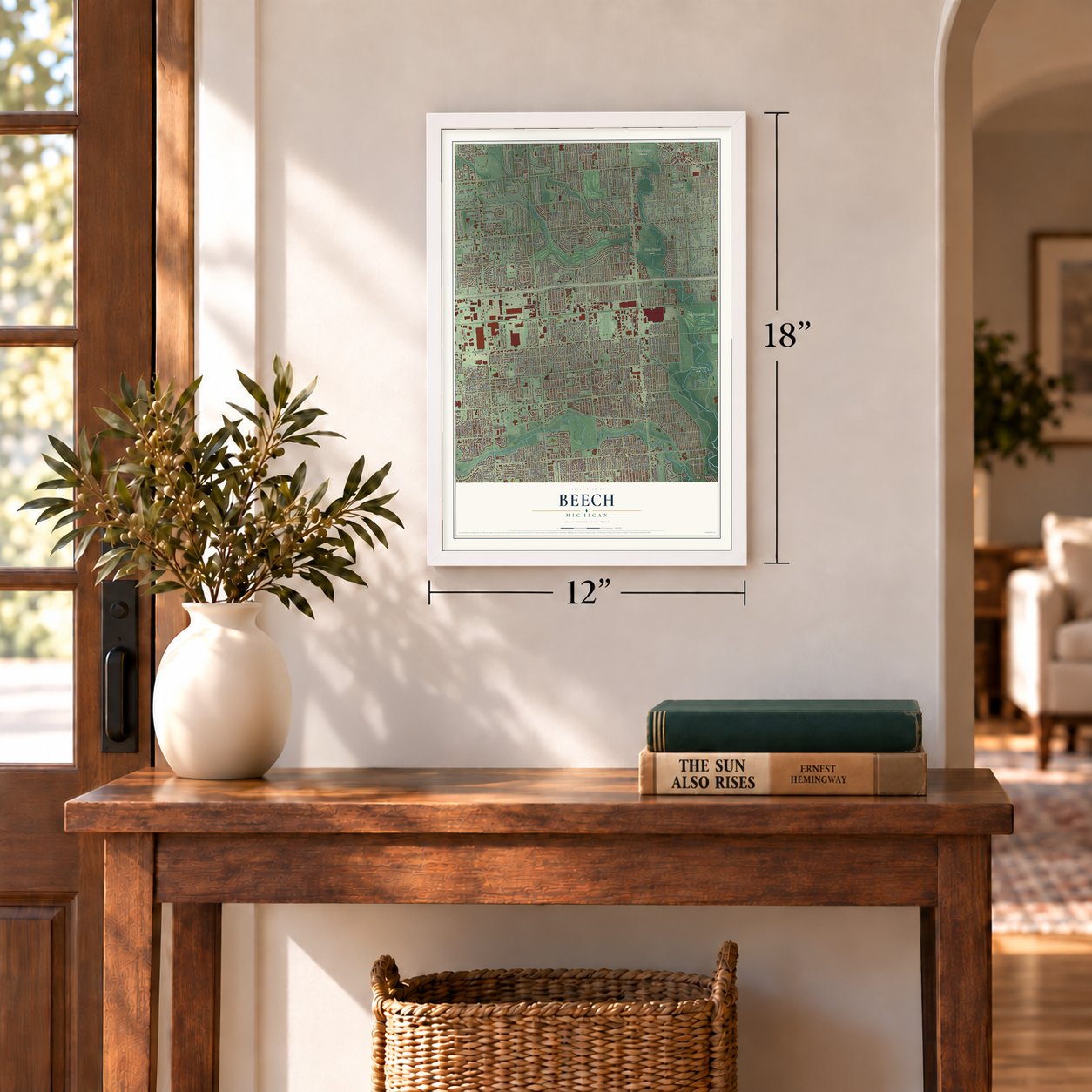

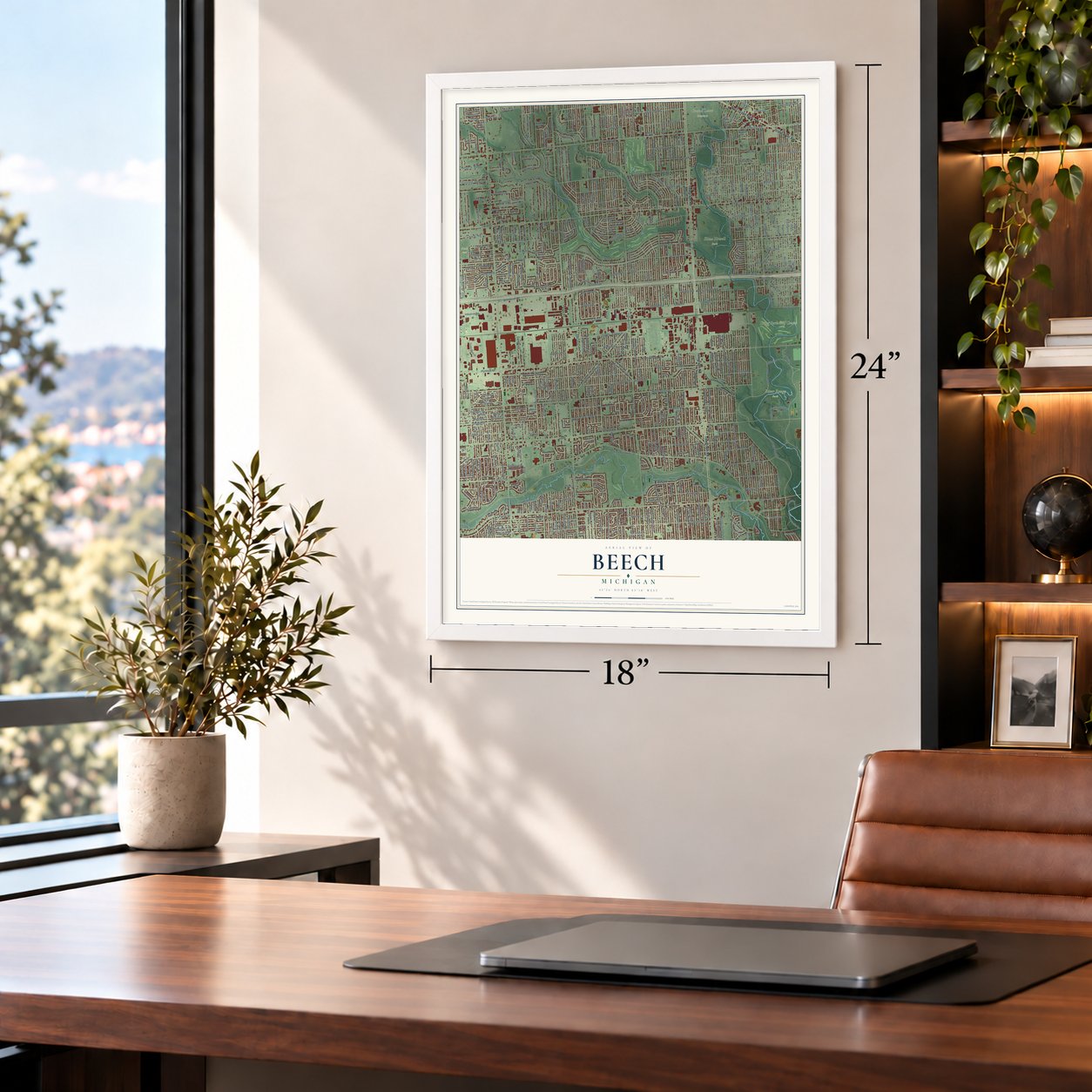

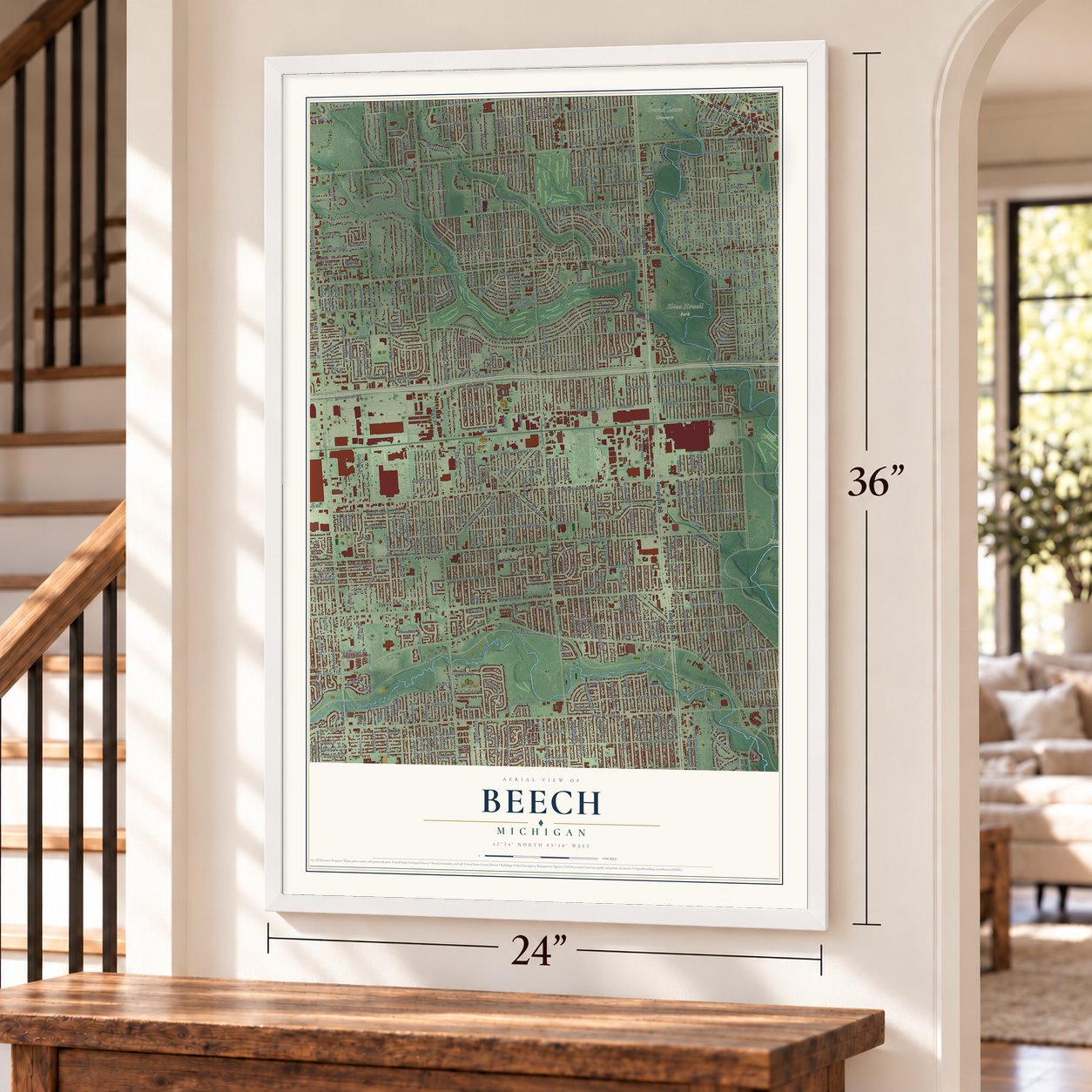

Free U.S. delivery 7 to 10 days after you order
Beech, Michigan Map Art
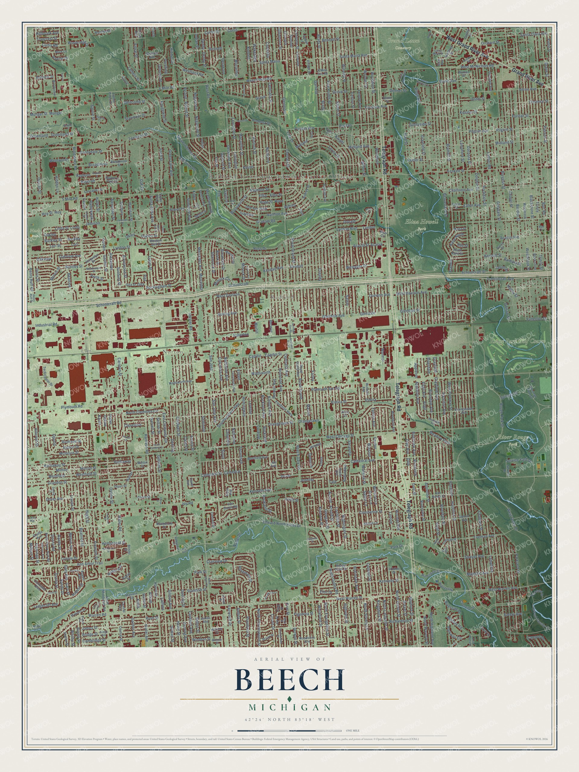
A new map of Beech, Michigan, made in 2026 and printed to order on thick archival matte paper.
12" x 18" Archival Matte Print
A Map of Home. A Work of Art.
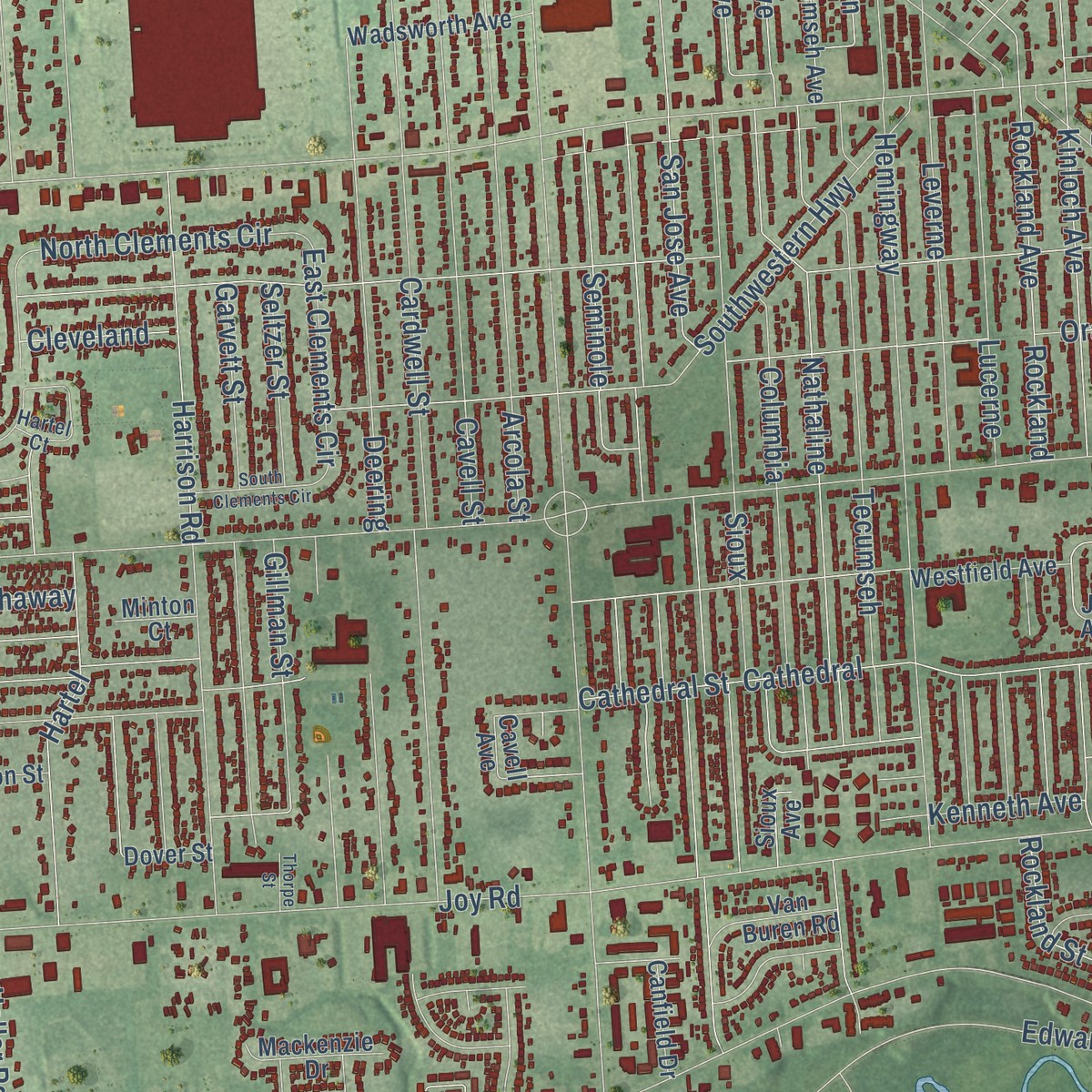
Explore Beech, Michigan from a whole new perspective. Created using aerial imagery and detailed geographic data, this map captures Beech building by building, with labeled streets, familiar landmarks, and shaded topographical relief that highlights the natural contours of the landscape.
Combining modern data with the timeless character of a vintage atlas, this map is just as interesting up close as it is beautiful on the wall. Whether you grew up in Beech, spent memorable years there, or call it home today, this unique map is a great way to celebrate a place that means something to you. Zoom in on the preview to look for your street, and then order a print to put your memories on the wall.
Three ways to hang it
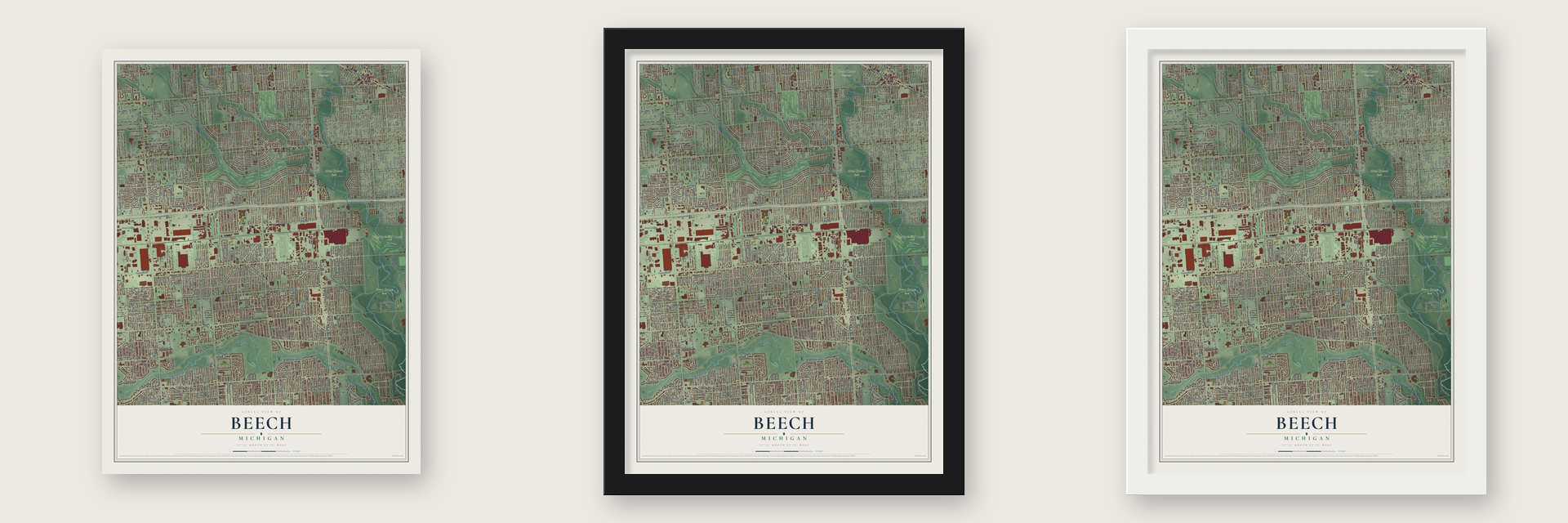
Unframed archival matte, a black wood frame or a white wood frame.
Up close
Geography Worth Displaying
This map was created using accurate cartographic data and authoritative geographic sources, including the U.S. Geological Survey and the Census Bureau. The map brings together terrain, waterways, roads, and building detail. The majority of the streets are labeled, houses are accurately depicted, and the topography is derived from government sources. Combining local data with carefully composed color and shading leads to this beautifully detailed Beech artwork for your wall.
Rather than simply showing street outlines, we’ve included as many of the street names as we could reasonably fit on the map while keeping their names legible. Zoom in on the high resolution preview to see exactly what’s on the map. We truly set out to create a statement piece for anyone who loves Beech. So whether it’s for you, or a gift for someone you love, we hope this map of Beech brings back fond memories.
Read the story behind this map: Detailed Map of Beech, Michigan.

Find your street
Names on the Beech map
Every name below is printed on this map. Look for your street, your school, the park where you played, or the pond down the road.
Places and landmarks11
- Redford Township Administrative Offices
- Elm
- Norton
- Redford
- Eliza Howell Park
- Grand Lawn Cemetery
- Handy Park
- Nash Park
- River Rouge Park
- Rouge Park Golf Course
- Meadow Park
Streets and roads592
- Telegraph Road
- West Grand River Avenue
- Grand River Avenue
- West Outer Drive
- Schoolcraft Road
- Schoolcraft
- Beech Daly Road
- Inkster Road
- Middlebelt Road
- Ann Arbor Trail
- Edward North Hines Drive
- Plymouth Road
- Joy Road
- West Chicago Street
- Bramell Street
- Beaverland Street
- Lyndon
- West Parkway Street
- Kinloch
- Elmira Street
- 5 Mile Road
- Norborne
- West Warren Street
- West McNichols Road
- Harrison Street
- Chatham Street
- Elmira
- Centralia
- Trinity Street
- Keeler Street
Show all 592 streets
- Fenton
- Dolphin Street
- Garfield
- Burt Road
- Rockdale Street
- Cardwell Street
- Westbrook Street
- Kinloch Street
- Bentler Street
- Lyndon Street
- Chapel Street
- Orangelawn Street
- Brady
- Lenore Avenue
- Lenore
- Lamphere Street
- Dacosta Street
- Puritan
- Fenton Street
- Dixie
- Wormer
- Blackstone Street
- Woodbine
- Bennett Street
- Orangelawn
- Grayfield
- Westfield
- Burgess Street
- Arcola Street
- Mercedes
- Cavell Street
- Hazelton Street
- Centralia Street
- West 6 Mile Road
- Pierson Street
- Richardson Street
- Warren Road
- Deering Street
- Pilgrim Street
- Lyndon Boulevard
- Arnold
- Winston
- Hazelton
- Schoolcraft Street
- Berwyn
- Grayfield Street
- Puritan Avenue
- Puritan Street
- Cathedral
- Hemingway
- Ross Drive
- Dale Street
- Melvin Street
- Columbia
- Spinoza Drive
- Riverview Street
- Lahser Road
- San Jose
- San Jose Avenue
- Beatrice Street
- Midland Avenue
- Delaware Avenue
- Appleton
- Midland
- Sarasota
- Graham Road
- Virgil
- Norborne Avenue
- Parkland Street
- Hartel Street
- Riverdale
- Mercedes Avenue
- Florence Avenue
- Henry Ruff Road
- Glendale
- Glendale Avenue
- Lola Drive
- Virgil Street
- Lathers Street
- Nathaline
- Fenkell Street
- Dover Avenue
- Dover
- Seminole
- Louise Street
- Fenton Avenue
- Fox
- Fox Street
- Deering
- Plymouth Svc Road
- Rockland
- Florence Street
- Grove Street
- Midland Street
- Pilgrim Avenue
- Crosley
- 6 Mile Road
- Garden Street
- Constance Street
- Tecumseh
- Greydale Street
- Marion
- Kennedy Street
- Riverdale Avenue
- Robindale Avenue
- Keeler
- Farley
- Seminole Avenue
- Leverne
- North Silvery Lane
- Cambridge Street
- Salem
- Macarthur Street
- Pomona Drive
- Sioux
- Rush Street
- Meadowbrook
- Meadowbrook Road
- Acacia
- Nightingale Street
- Bennett
- Westfield Street
- Woodbine Street
- Wakenden
- Centralia Avenue
- Nathaline Avenue
- Lennane
- Lennane Street
- Delaware
- Lucerne
- Rockland Avenue
- Grandon Street
- Capitol
- Fremont Street
- Acacia Avenue
- Grove Avenue
- Glendale Street
- Royal Grand
- Lexington
- Lexington Street
- Salem Street
- Berwyn Avenue
- Garden
- Colonial Street
- Braile Street
- Verne Avenue
- Wadsworth
- West Davison Avenue
- Buckingham Street
- Rouge Park Drive
- Eaton Avenue
- Woodworth Street
- Sunbury Street
- Fordson Highway
- Sumner
- Curtis Street
- Kinloch Avenue
- Minton
- Minton Street
- Appleton Street
- Hathaway
- Hathaway Street
- Kendall Street
- Hugh Street
- Gaylord Street
- Lyons Street
- Santa Maria Avenue
- Cathedral Street
- Southwestern Highway
- Ryland
- Ryland Street
- Floral Street
- Five Points Street
- Gaylord
- Flamingo Street
- Whitefield Street
- Terrence Street
- Beatrice
- Riverview
- Kinmore Street
- Donna Road
- Donna Street
- Winston Street
- Schoolcraft Avenue
- August Street
- Columbia Avenue
- Cathedral Avenue
- North Charlesworth Street
- Amboy Street
- Barkley
- Barkley Street
- Haller Street
- Hartel
- Harrison Road
- Brentwood Street
- Doris Street
- West Warren Avenue
- Oakley Street
- Wormer Street
- Capitol Street
- North Lafayette Street
- North Evangeline Street
- North Gulley Road
- Rosemary Street
- Kingsbury Street
- Brady Street
- Leona Drive
- Hazelton Avenue
- Curtis
- Gilman Street
- Plainfield Street
- Fullerton
- Melvin Avenue
- Negaunee Street
- Highview Street
- Alexander
- Alexander Street
- Santa Maria
- Drexel Street
- James Street
- Bridge Street
- Rougeway Street
- Bentley Street
- Tireman Avenue
- North Vernon Street
- Berwyn Street
- Donald
- Glenmore
- Ivanhoe Avenue
- Negaunee
- Randy Street
- Lamphere
- Jamison
- Denby
- Denby Street
- Oxbow Street
- Grayfield Avenue
- Clairview Drive
- Santa Clara Avenue
- Foch Street
- Sunnydale Street
- Mayburn Street
- Bramell
- Fullerton Street
- Oporto Street
- Macarthur
- Cardwell Avenue
- Deering Avenue
- Gilman Avenue
- Sawyer Avenue
- Riverdale Street
- Dow
- Curtis Road
- Kendall
- McIntyre Street
- Winston Lane
- Industrial Road
- Perth Street
- Arnold Street
- Sunbury
- Indian Street
- Lori
- Lori Street
- Gary Avenue
- Gary Street
- Camden Street
- Lochdale Street
- Richland Street
- Royal Grand Street
- Dale Avenue
- Robert Drive
- North Highland Avenue
- North Waverly Street
- Elba
- Elba Street
- Fairwood Drive
- Wormer Avenue
- Dolores Street
- Broadmoor
- Majestic Avenue
- Acacia Street
- Dale
- Riverview Avenue
- Aubrey
- Military Road
- Olympia
- Davison Avenue
- Westgate Drive
- Iliad Street
- Oak Drive
- Hillcrest Street
- Gillman Street
- Oakview
- Oakview Avenue
- Greenland
- Greenland Street
- Chalfonte Avenue
- Bobrich Street
- Rockland Street
- Elsinore Street
- Santa Anita Avenue
- Breakfast Drive
- Ivanhoe
- Dixie Lane
- Green Lane Avenue
- Munger
- Munger Street
- Oakley
- Standish Street
- Parkway Circle
- Haller
- Riverside Drive
- Westland Road
- Oporto
- Dehner Street
- Appleton Avenue
- West Road
- Virgil Avenue
- Shamrock Drive
- Cronin Drive
- Hope
- Hope Street
- North Clements Circle
- Windsor Street
- Seneca
- Hoy
- Hoy Street
- Okley
- Helen Street
- Salem Lane
- Whitcomb Street
- Louis
- Barbara Street
- Glengary Street
- Linda
- Linda Street
- Orchard Street
- Brook Drive
- Hartel Avenue
- Deborah
- Garden Avenue
- Burnly Street
- Jerome
- Trinity
- Ridge Road
- Grove
- East Clements Circle
- Glenmore Street
- Brody Avenue
- Savoie Street
- Boeing Avenue
- Haller Road
- Nollar Drive
- Elon Drive
- Sunnyside Street
- Knight
- Minock Drive
- Robindale
- Randy Drive
- Garvett Street
- West Davison
- Service Yard Drive
- Ledgecliff Avenue
- Seltzer Street
- Figueroa Street
- Campus Drive
- Chelsea Street
- Kane North
- Pershing
- Minock Circle
- Warwick Street
- Belton Street
- Harrison
- Ulster Street
- Kessler Street
- Cavour
- Paderewski
- Wentworth
- Jennifer
- First Street
- Rayburn
- Dolson Street
- Hempstead Street
- Roycroft
- Kendall Avenue
- Woodridge Drive
- Hidden Lane
- Trancrest Street
- Hillbrook Avenue
- Halley Street
- Affeldt
- Stanmoor Drive
- Ray Street
- Whitby Street
- Cleveland
- Kenneth Avenue
- Park Drive
- Ravine Drive
- Gita
- Milburn Street
- Emery Avenue
- Kipke
- Keith Street
- Wilbur Street
- Hizmet Drive
- Oxbow
- Karen
- Lathers
- Kubis
- Lonnie Drive
- Carol
- Jason Street
- Eileen
- Marlin
- Park Street
- Tate
- Foch
- Orangelawn Avenue
- Rouge River Drive
- Westfield Avenue
- Belton Avenue
- Van Buren Street
- Tech Center Drive
- Royal Grand Avenue
- Mackenzie Drive
- Jacquelyn Drive
- 6 Mile Svc Road
- Malvern Street
- Wadsworth Avenue
- North Henry Ruff Road
- Howard Cassidy Drive
- Woodbine Avenue
- Broadmoor Street
- James Avenue
- Aubrey Street
- Gladys Avenue
- Van Buren Road
- Tireman Street
- Parkland Drive
- August Avenue
- Dow Avenue
- Malvern Drive
- Howell Road
- Central Avenue
- Bell Creek Road
- Brennan Pool Drive
- Village Drive
- Western Golf Drive
- Seneca Avenue
- Brookview
- Greydale Avenue
- Bayberry Park Drive
- Patton Street
- Northrop Street
- Central Street
- Westbrook
- Cooley Street
- Carrousel Boulevard
- Sylvan Lane
- Badalt Street
- Warrendale
- Hickory Court
- Dover Street
- North Middlebelt Road
- Olson Street
- Woodshire Avenue
- Lancaster Street
- Indian
- Circle Drive
- Garfield Avenue
- Eaton Street
- Third Street
- Tecumseh Avenue
- Sioux Avenue
- South Kane Street
- Warendale Street
- Marshall Drive
- Canfield Drive
- Mark Lane
- Gita Street
- Brentwood
- Alton
- Floral Avenue
- Coonville Drive
- Darcy Street
- Fulton Pines Court
- Bennett Avenue
- Blackstone
- Winston Avenue
- Shaller Street
- Service Drive
- Bryan Street
- Brady Avenue
- Belton Lane
- Riga
- Malta Street
- Wyman Street
- Taylor Boulevard
- Shields Drive
- Bristol Street
- Doris Court
- Minton Court
- River Circle
- Verne Street
- Cavell Avenue
- Jay Street
- Gore Avenue
- Jan Avenue
- Henry Ruff Street
- Jamison Street
- Meadowlark Street
- Redford Street
- Hillcrest Boulevard
- Valleyview Circle
- Santa Maria Street
- Brandt Avenue
- Danzig Street
- Cavour Street
- Bridge Avenue
- Hartel Court
- Shadowlawn Street
- Henry Street
- Riverpark Avenue
- Avon Place
- Savoie Court
- Dalby
- Hillside Drive
- Maple Grove
- Michele Street
- Middle Court
- Mark Street
- Bern Street
- Taylor
- Burt Court
- Woodworth
- Santa Anita Street
- Lucerne Avenue
- North Inkster Road
- Bobrich
- Shackett
- Knight Street
- Woodworth Circle
- Rayburn Street
- Woodrow
- Manchester Street
- West Riverdale Drive
- East Frumin Court
- Kipke Street
- Hill
- Dow Street
- South Clements Circle
- South Riverdale Drive
- Lanewood Road
- Southwest Svc Road
- Northeast Svc Road
- North Martha Street
- Ridgeway Street
- Cooley Boulevard
- Marene Street
- Thorpe Street
- West Perrin
- Ross Court
Names are listed as they appear on the printed map. Zoom into the product photos to find them.
The art of mapping a place
How This Map Was Made
Real places. Remarkable detail. Discover the layers that turn geographic data into a map of home.

The view from above
Aerial imagery reveals the character of the land: woodland, open fields, and the patterns of a place.

The shape of the land
Elevation data brings hills, valleys, and subtle changes in the landscape into view.

The details of home
Roads, waterways, and building footprints come together to make the map feel unmistakably local.

Geography becomes art
Considered color, shading, and typography bring the layers together in a map made for your wall.


Process illustrated with Mendon, Massachusetts. Aerial imagery: USDA NAIP. Terrain: USGS 3D Elevation Program. Map details and finished artwork: KNOWOL.
The Details
About This Print
Choose an archival matte print, or a black or white Ayous wood frame. The archival matte print is unframed.
Select your size and finish above to see the matching product image and price.
Materials & Craftsmanship
A contemporary map with the character of a classic atlas, printed on archival matte paper. Optional frames are made from Ayous wood.
Your printed map does not include the watermark shown in the full-map preview.
Shipping & Delivery
Free shipping within the United States. Every print is made to order in the USA.
Buying a gift? Add a note in your cart and we'll include it. We never put prices in the package.
Prints ship within 2 to 3 business days. Allow 7 to 10 days total from ordering for delivery. Timing may vary during holidays or periods of high order volume.
Read our shipping policy.
Returns and damaged prints
Each print is made to order. Change-of-mind refunds are not available after production.
If your print arrives damaged, misprinted or incorrect, contact support@knowol.com within 30 days of receiving it. Include your order number, photos and a description of the issue.
Read our full refund and replacement policy. For questions about your order, email support@knowol.com.
Find your town
Looking for another city?
Find a map of home in our Michigan collection, or any town in the country.
Nearby
Maps of towns near Beech
Know someone from one of these towns? Their map makes a great gift.
 Redford
, Michigan
From $39.99See the map
 Brightmoor
, Michigan
From $39.99See the map
 Dearborn Heights
, Michigan
From $39.99See the map
More maps nearby: Rosedale Park, Warrendale, Livonia, Garden City and Inkster.