
Search for another town




Free U.S. delivery 7 to 10 days after you order
Bellingham, Washington Map Art
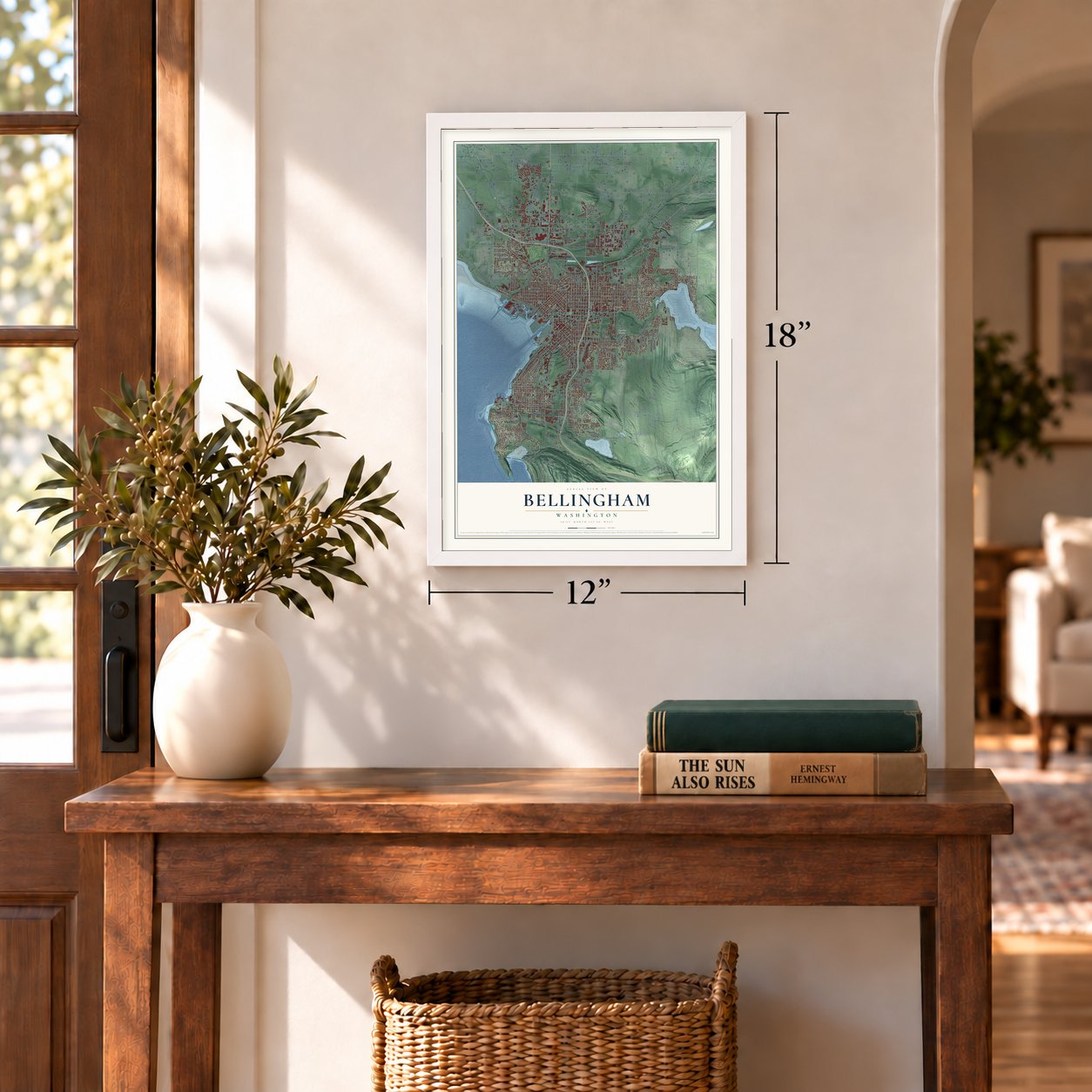
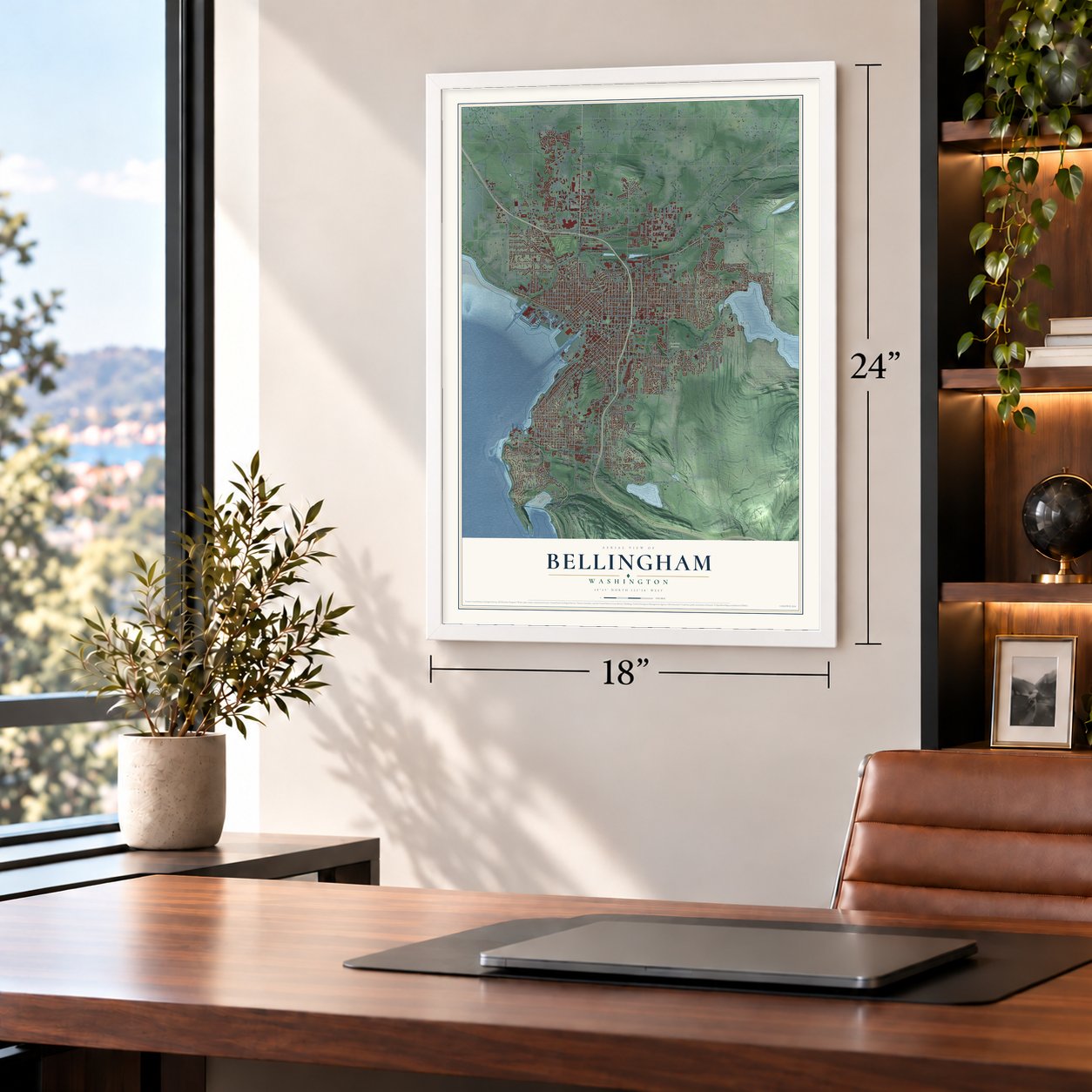
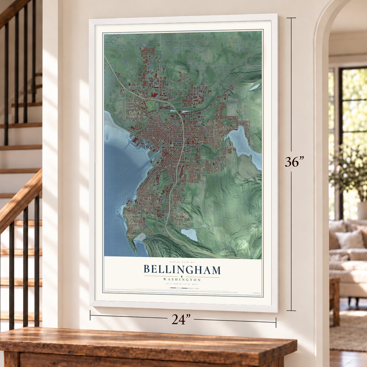
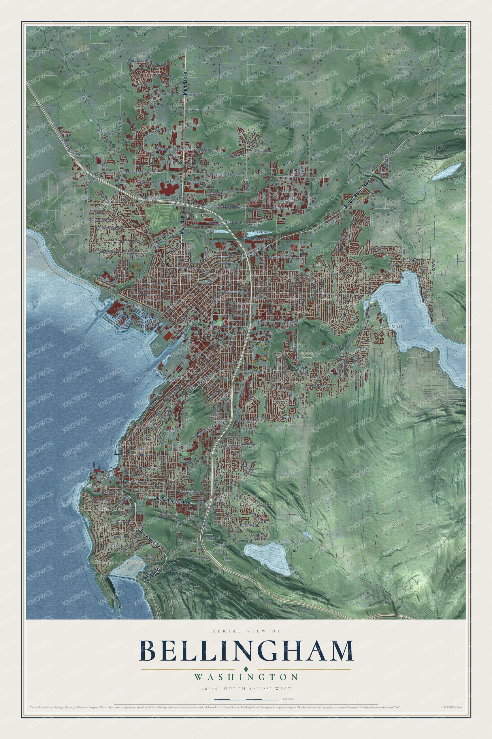
A new map of Bellingham, Washington, made in 2026 and printed to order on thick archival matte paper.
12" x 18" Archival Matte Print
A Map of Home. A Work of Art.
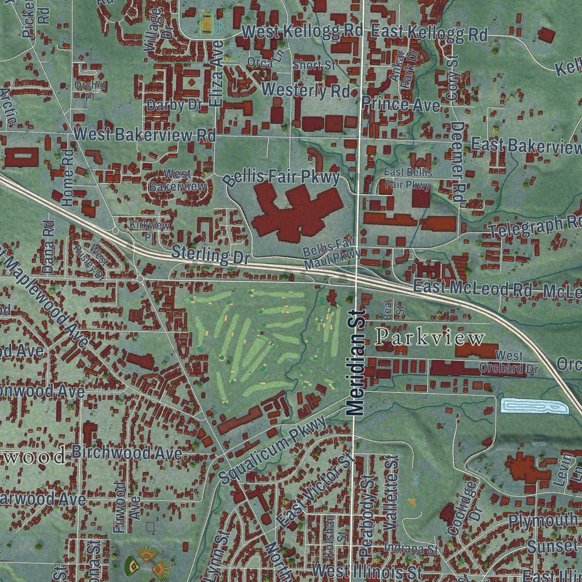
Explore Bellingham, Washington from a whole new perspective. Created using aerial imagery and detailed geographic data, this map captures Bellingham building by building, with labeled streets, familiar landmarks, and shaded topographical relief that highlights the natural contours of the landscape.
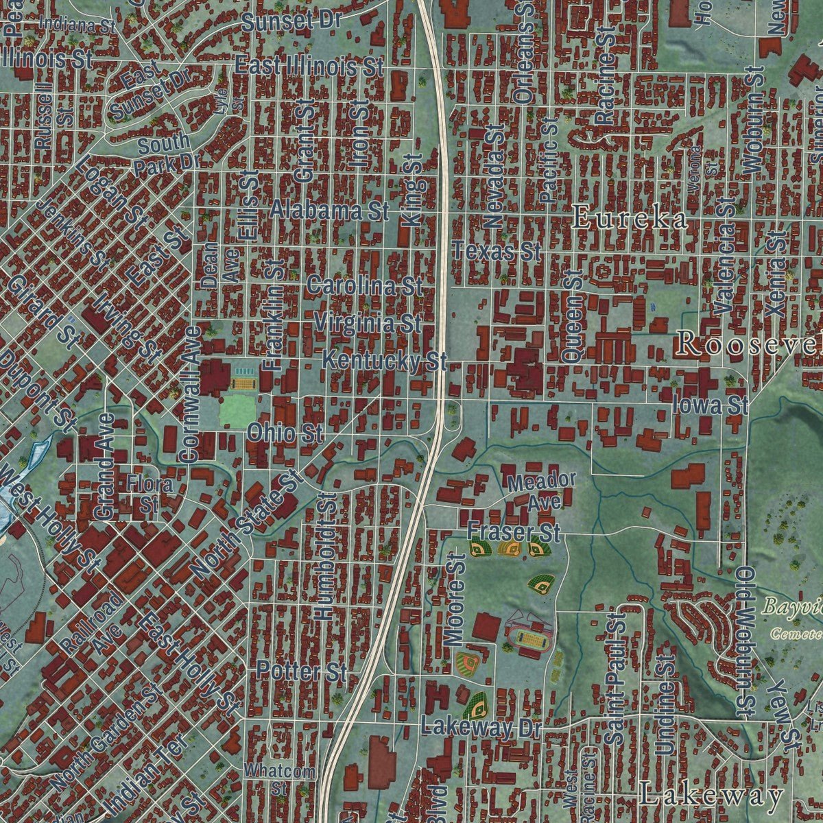
Combining modern data with the timeless character of a vintage atlas, this map is just as interesting up close as it is beautiful on the wall. Whether you grew up in Bellingham, spent memorable years there, or call it home today, this unique map is a great way to celebrate a place that means something to you. Zoom in on the preview to look for your street, and then order a print to put your memories on the wall.
Three ways to hang it
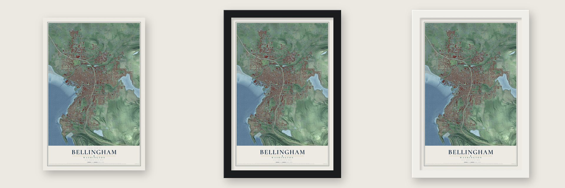
Unframed archival matte, a black wood frame or a white wood frame.
Up close
Geography Worth Displaying
This map was created using accurate cartographic data and authoritative geographic sources, including the U.S. Geological Survey and the Census Bureau. The map brings together terrain, waterways, roads, and building detail. The majority of the streets are labeled, houses are accurately depicted, and the topography is derived from government sources. Combining local data with carefully composed color and shading leads to this beautifully detailed Bellingham artwork for your wall.
Rather than simply showing street outlines, we’ve included as many of the street names as we could reasonably fit on the map while keeping their names legible. Zoom in on the high resolution preview to see exactly what’s on the map. We truly set out to create a statement piece for anyone who loves Bellingham. So whether it’s for you, or a gift for someone you love, we hope this map of Bellingham brings back fond memories.
Read the story behind this map of Bellingham, Washington from 2026.

About Bellingham, Washington
Bellingham is a city of 91,482 people and the seat of Whatcom County, on Bellingham Bay. In December 1852 Captain Henry Roeder and Russell V. Peabody came north from Portland. They hoped to sell lumber to San Francisco, which a fire had nearly wiped out. The Lummi chief Chow'it'sut pointed them to the falls at Whatcom, a name meaning "noisy, rumbling water," and they built a sawmill there with Lummi help. By the time it ran, San Francisco was mostly rebuilt and prices had dropped. Most of the mill's lumber went north to Victoria, British Columbia, instead.
Four towns grew up on the bay: Whatcom, Sehome, Bellingham and Fairhaven. A Fairhaven developer bought little Bellingham in 1890, and Whatcom and Sehome joined as New Whatcom in 1891. Whatcom voters would not accept a city called Fairhaven, and Fairhaven voters would not accept Whatcom. So they agreed on Bellingham, after the bay George Vancouver had named in 1792 for Sir William Bellingham. The final merger passed 2,163 to 596, and the city was incorporated on December 28, 1903.
“Developers put up buildings in downtown Fairhaven so quickly that they forgot to leave space for alleys behind them.”
- A colony from KansasFire destroyed the Whatcom mill in 1873. In 1881 Roeder and Peabody's heirs gave the site to utopian Kansas colonists, promising to rebuild it and add a wharf, church, school and 50 houses. Their Washington Colony shipped the area's first big lumber load to San Francisco in 1883, but never topped 25 families. Feuding heirs, lawsuits and debt ruined it; after investor J. H. Stenger took the mill, two angry colonists bombed his house. It stood empty by 1885.
- Coal under downtownRoeder found a 17-foot coal seam on his land, mined 60 tons and got $16 a ton for it in San Francisco. He sold the land to the Bellingham Bay Coal Company, whose Sehome mine, named for the Samish leader Sea-hom, was for a time the territory's largest employer. It survived cave-ins, fires and floods for two decades before closing in 1878. Mining under the city continued until the last mine shut in 1955.
- Captain Pickett's fortCaptain George E. Pickett arrived in 1856 under Army orders to build a fort on the bay and protect the Sehome mine from northern raiders. He later led the failed Confederate charge at Gettysburg.
- The gold rush that vanishedIn 1858 gold turned up on the Fraser River in British Columbia, and Whatcom sat on the shortcut from the sea. Thousands of miners camped on the beach while crews built the Whatcom Trail into Canada. By the time it was done, the diggings had moved on to the Cariboo, and Canada was making miners stop in Victoria for supplies and permits. The boom ended as fast as it began.
- From normal school to universityThe New Whatcom Normal School trained teachers. The state let it grant bachelor's degrees in education in 1933, and veterans on the GI Bill helped it grow after World War II. It became Western Washington State College by 1961 and a university in 1977. Its Old Main is on the National Register.
Find your street
Names on the Bellingham map
Every name below is printed on this map. Look for your street, your school, the park where you played, or the pond down the road.
Places and landmarks15
- Chuckanut Village
- Edgemoor
- Bayview Cemetery
- Alabama Hill
- Birchwood
- Eureka
- Fairhaven
- Forest Ridge
- Happy Valley
- Lakeway
- Larson Mill
- Parkview
Show all 15 places
- Roosevelt
- Silver Beach
- South Bellingham
Streets and roads339
- Meridian Street
- Chuckanut Drive
- East Sunset Drive
- Old Fairhaven Parkway
- Mount Baker Highway
- McLeod Road
- North State Street
- Vining Street
- Eldridge Avenue
- Saint Paul Street
- Tremont Avenue
- West Kellogg Road
- South State Street
- West Holly Street
- Boulevard Street
- Tenth Street
- South Garden Street
- Girard Street
- East Kellogg Road
- East Holly Street
- Lakeway Drive
- Indian Terrace
- Kellogg Road
- Grand Avenue
- Otis Street
- Taylor Avenue
- Iron Gate Road
- Lindbergh Avenue
- Samish Way
- James Street
Show all 339 streets
- Squalicum Parkway
- Cornwall Avenue
- Barkley Boulevard
- Alabama Street
- East Bakerview Road
- Woburn Street
- Lincoln Street
- Ellis Street
- Birchwood Avenue
- Cordata Parkway
- 40th Street
- Humboldt Street
- 36th Street
- Texas Street
- Yew Street
- Northshore Drive
- Northwest Avenue
- Grant Street
- Franklin Street
- Fieldston Road
- Racine Street
- West Maplewood Avenue
- Hannegan Road
- Nevada Street
- Donovan Avenue
- 32nd Street
- Kentucky Street
- West Bakerview Road
- 38th Street
- East Illinois Street
- Bayside Road
- 21st Street
- North Forest Street
- West Illinois Street
- King Street
- Iron Street
- Bellis Fair Parkway
- Old Samish Road
- Mill Avenue
- Roeder Avenue
- Harris Avenue
- Briar Road
- 16th Street
- Telegraph Road
- 34th Street
- Fraser Street
- McKenzie Avenue
- Queen Street
- Broadway
- 17th Street
- Orleans Street
- 24th Street
- Iowa Street
- Northwest Drive
- Carolina Street
- West North Street
- Wilson Avenue
- Moore Street
- Puget Street
- Aldrich Road
- Pacific Highway
- Bill McDonald Parkway
- Valencia Street
- Cedarwood Avenue
- Douglas Avenue
- Saint Clair Street
- High Street
- East McLeod Road
- Highland Drive
- 14th Street
- 30th Street
- Electric Avenue
- Walnut Street
- Twelfth Street
- 22nd Street
- South 34th Street
- Dakin Street
- Sunset Drive
- Jefferson Street
- Undine Street
- 20th Street
- Alderwood Avenue
- Lynn Street
- Wilkin Street
- Erie Street
- Xenia Street
- Monroe Street
- Horton Road
- Deemer Road
- Mahogany Avenue
- 37th Street
- Elm Street
- Vallette Street
- Viewcrest Road
- Virginia Street
- Michigan Street
- Chandler Parkway
- Stuart Road
- Peabody Street
- 33rd Street
- Willow Road
- Van Wyck Road
- Birch Street
- Knox Avenue
- Ohio Street
- Byron Avenue
- Cottonwood Avenue
- Plymouth Drive
- Silver Beach Road
- East Oregon Street
- 25th Street
- Bakerview Spr
- Sylvan Street
- Irving Street
- Westerly Road
- East Street
- Sterling Drive
- Alvarado Drive
- Orchard Drive
- Raymond Street
- Airport Drive
- Division Street
- Clover Lane
- California Street
- East Victor Street
- 23rd Street
- Ross Street
- Iowa Drive
- Eliza Avenue
- Potter Street
- Roland Street
- 19th Street
- Fuchsia Drive
- Parkhurst Drive
- Kenoyer Drive
- West Kline Road
- Harrison Street
- Dupont Street
- San Juan Boulevard
- Old Woburn Street
- Illinois Lane
- Woodstock Way
- Madrona Street
- Prince Avenue
- Astor Street
- Logan Street
- Nome Street
- Key Street
- Shasta Boulevard
- Hammer Drive
- Kramer Lane
- Fir Street
- 48th Street
- Pine Street
- Mason Street
- King Avenue
- Crown Lane
- Alice Street
- Chuckanut Drive North
- Elwood Avenue
- Wharf Street
- North Shore Drive
- North Garden Street
- Pacific Street
- Cowgill Avenue
- 15th Street
- Crestline Drive
- Fruitland Drive
- York Street
- Linden Road
- Edwards Street
- Eleventh Street
- Meador Avenue
- Adams Avenue
- Ontario Street
- Lakeshore Drive
- Utter Street
- 18th Street
- Coolidge Drive
- Hawthorn Road
- Railroad Avenue
- Cherrywood Avenue
- College Street
- Cody Avenue
- Sea Pines Road
- Superior Street
- Newton Street
- Britton Road
- Lenora Court
- Parkridge Road
- Firwood Avenue
- Home Road
- Clark Road
- Church Street
- Bennett Drive
- Jenkins Street
- West Street
- Fielding Avenue
- Dean Avenue
- Northridge Way
- South Park Drive
- Victoria Street
- June Road
- Coho Way
- West Stuart Road
- Birch Falls Drive
- Village Drive
- Montgomery Road
- Newmarket Street
- College Avenue
- Toad Lake Road
- Darby Drive
- Ashley Avenue
- Gooding Avenue
- Strider Loop Road
- Russell Street
- Britton Loop Road
- Ridgemont Way
- Magrath Road
- Sussex Drive
- Bellwether Way
- Portal Drive
- East Orchard Drive
- 26th Street
- Flora Street
- Dewey Road
- Ridgeway Drive
- Cory Street
- Arctic Avenue
- Alpine Way
- 46th Street
- Amanda Lane
- Grady Way
- Wildwood Drive
- Dumas Avenue
- Keesling Street
- Dana Road
- Howe Place
- Flint Street
- Pickett Road
- Idaho Street
- Levin Lane
- 27th Street
- 40th Place
- North 34th Street
- Bellis Fair Maul Parkway
- East North Street
- Whatcom Street
- Victor Street
- Broad Street
- Kulshan Street
- Indian Street
- West Orchard Drive
- Washington Street
- West Bakerview
- Midway Lane
- Indiana Street
- 39th Street
- South College Drive
- Larrabee Road
- Lopez Street
- Orca Lane
- Celia Way
- Ankar Park Drive
- Haggin Street
- Creekwood Lane
- East Lopez Court
- West Racine Street
- Evergreen Avenue
- West Laurel Street
- Keystone Way
- Erie Terrace
- Hilton Avenue
- Short Street
- Likely Drive
- Ryzex Way
- Burns Street
- 44th Street
- Allen Avenue
- Bedford Avenue
- Verona Street
- Niagara Street
- Fieldstone Road
- Lindsay Avenue
- Connelly Avenue
- Viking Circle
- Arbor Street
- Woodside Way
- Cody Circle
- North Samish Way
- Birch Circle
- Chuckanut Crest Drive
- Squalicum Way
- Meadowbrook Court
- East Bellis Fair Parkway
- East Horton Road
- Brandywine Way
- West Rusley Drive
- Kirkview Place
- Cougar Road
- Lyle Street
- Richard Avenue
- Scenic Avenue
- Orchid Place
- Pattle Street
- Iris Lane
- Lisa Lane
- Beal Street
- Idell Street
Names are listed as they appear on the printed map. Zoom into the product photos to find them.
The art of mapping a place
How This Map Was Made
Real places. Remarkable detail. Discover the layers that turn geographic data into a map of home.

The view from above
Aerial imagery reveals the character of the land: woodland, open fields, and the patterns of a place.

The shape of the land
Elevation data brings hills, valleys, and subtle changes in the landscape into view.

The details of home
Roads, waterways, and building footprints come together to make the map feel unmistakably local.

Geography becomes art
Considered color, shading, and typography bring the layers together in a map made for your wall.


Process illustrated with Mendon, Massachusetts. Aerial imagery: USDA NAIP. Terrain: USGS 3D Elevation Program. Map details and finished artwork: KNOWOL.
The Details
About This Print
Choose an archival matte print, or a black or white Ayous wood frame. The archival matte print is unframed.
Select your size and finish above to see the matching product image and price.
Materials & Craftsmanship
A contemporary map with the character of a classic atlas, printed on archival matte paper. Optional frames are made from Ayous wood.
Your printed map does not include the watermark shown in the full-map preview.
Shipping & Delivery
Free shipping within the United States. Every print is made to order in the USA.
Buying a gift? Add a note in your cart and we'll include it. We never put prices in the package.
Prints ship within 2 to 3 business days. Allow 7 to 10 days total from ordering for delivery. Timing may vary during holidays or periods of high order volume.
Read our shipping policy.
Returns and damaged prints
Each print is made to order. Change-of-mind refunds are not available after production.
If your print arrives damaged, misprinted or incorrect, contact support@knowol.com within 30 days of receiving it. Include your order number, photos and a description of the issue.
Read our full refund and replacement policy. For questions about your order, email support@knowol.com.
Find your town
Looking for another city?
Find a map of home in our Washington collection, or any town in the country.
Nearby
Maps of towns near Bellingham
Know someone from one of these towns? Their map makes a great gift.
 Geneva
, Washington
From $39.99See the map
 Marietta-Alderwood
, Washington
From $39.99See the map
 Sudden Valley
, Washington
From $39.99See the map
More maps nearby: Ferndale, Alger, Deming, Acme and Everson.