
Search for another town





Free U.S. delivery 7 to 10 days after you order
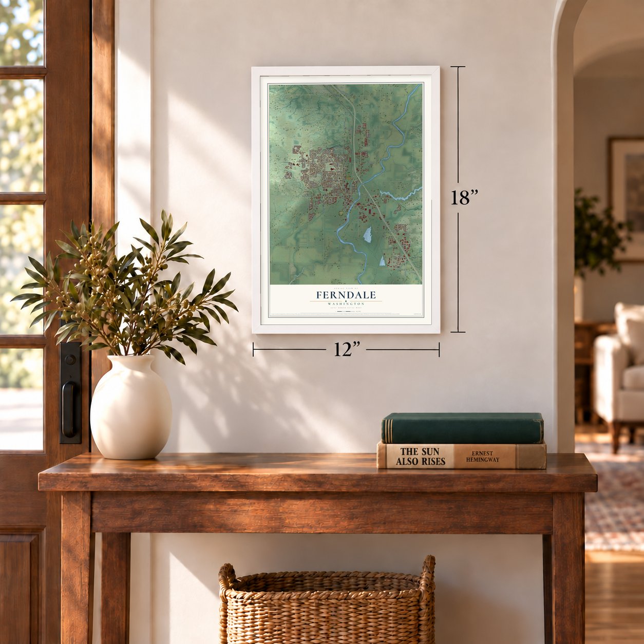
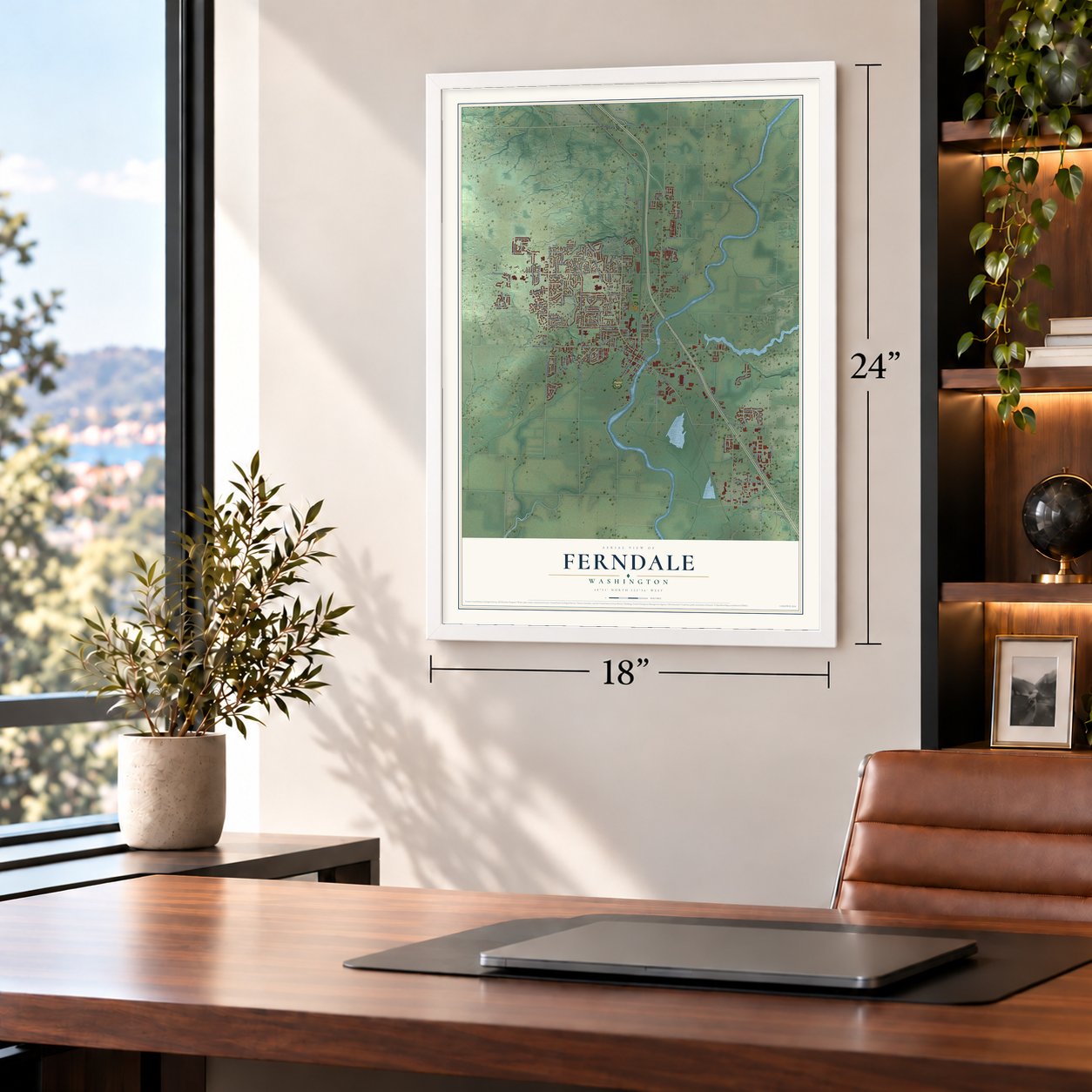
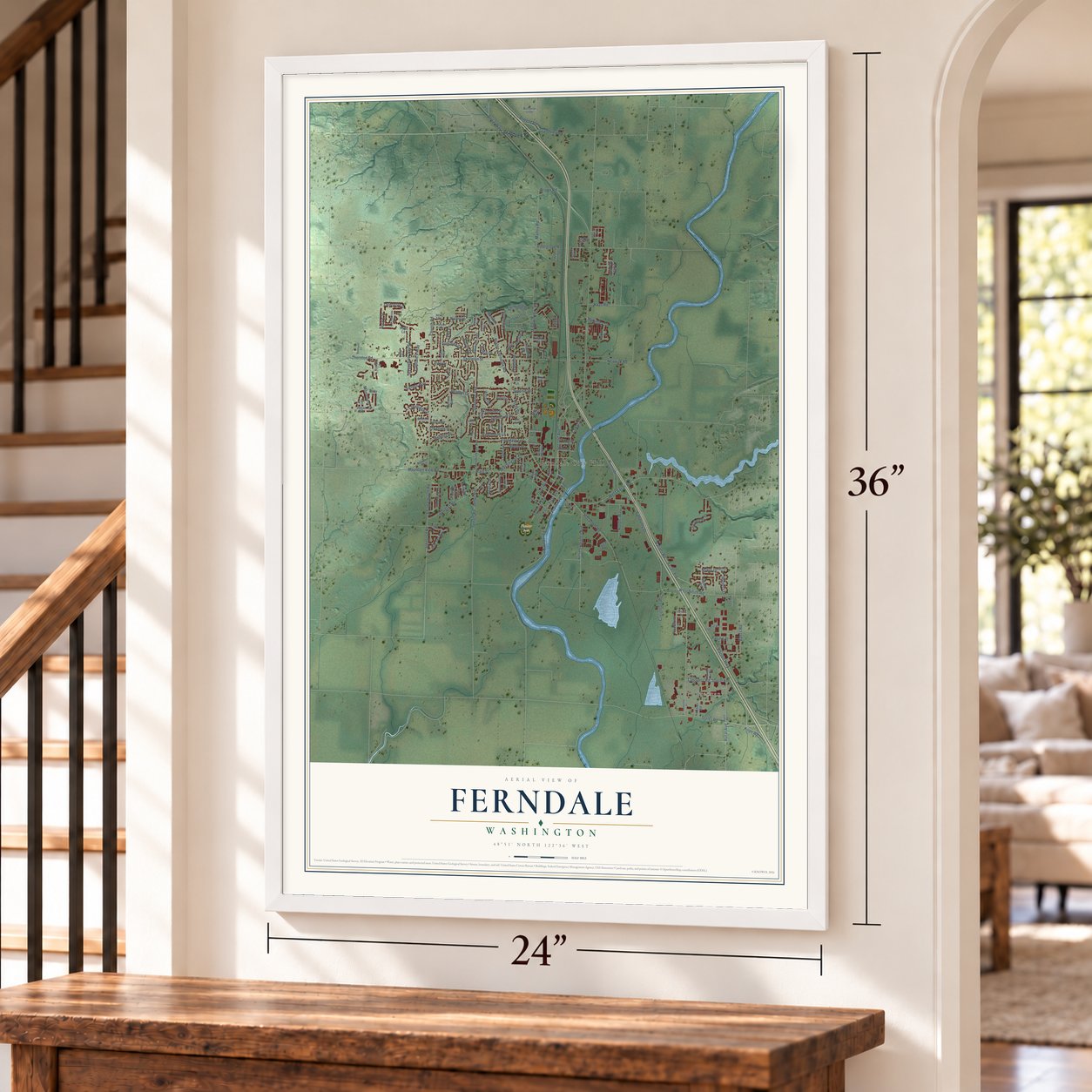
Ferndale, Washington Map Art
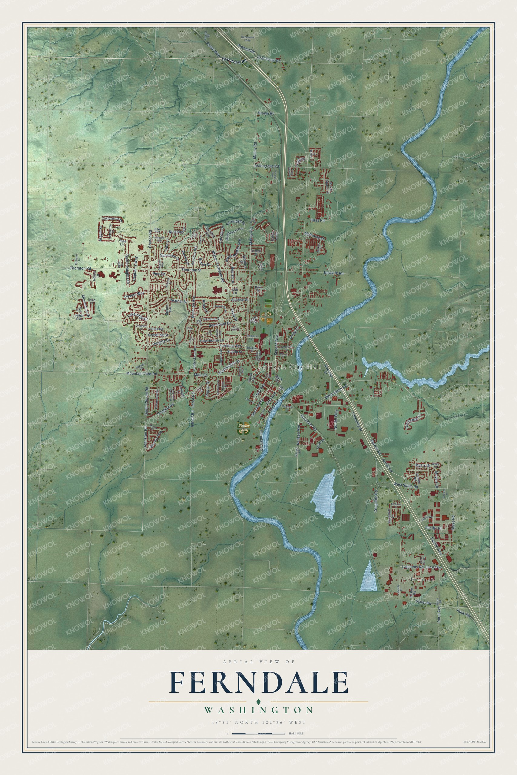
A new map of Ferndale, Washington, made in 2026 and printed to order on thick archival matte paper.
12" x 18" Archival Matte Print
A Map of Home. A Work of Art.
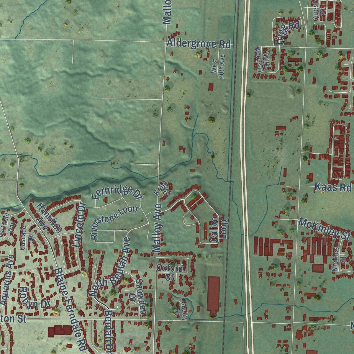
Explore Ferndale, Washington from a whole new perspective. Created using aerial imagery and detailed geographic data, this map captures Ferndale building by building, with labeled streets, familiar landmarks, and shaded topographical relief that highlights the natural contours of the landscape.
Combining modern data with the timeless character of a vintage atlas, this map is just as interesting up close as it is beautiful on the wall. Whether you grew up in Ferndale, spent memorable years there, or call it home today, this unique map is a great way to celebrate a place that means something to you. Zoom in on the preview to look for your street, and then order a print to put your memories on the wall.
Three ways to hang it
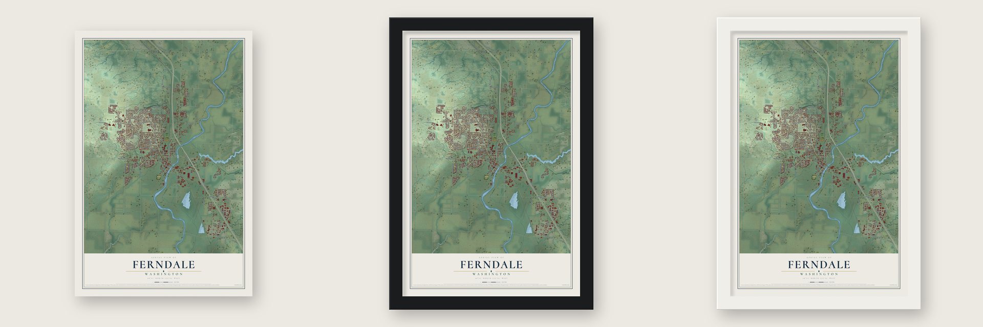
Unframed archival matte, a black wood frame or a white wood frame.
Up close
Geography Worth Displaying
This map was created using accurate cartographic data and authoritative geographic sources, including the U.S. Geological Survey and the Census Bureau. The map brings together terrain, waterways, roads, and building detail. The majority of the streets are labeled, houses are accurately depicted, and the topography is derived from government sources. Combining local data with carefully composed color and shading leads to this beautifully detailed Ferndale artwork for your wall.
Rather than simply showing street outlines, we’ve included as many of the street names as we could reasonably fit on the map while keeping their names legible. Zoom in on the high resolution preview to see exactly what’s on the map. We truly set out to create a statement piece for anyone who loves Ferndale. So whether it’s for you, or a gift for someone you love, we hope this map of Ferndale brings back fond memories.
Read the story behind this map of Ferndale, Washington from 2026.
About Ferndale, Washington
Ferndale is a city of 15,048 people in Whatcom County, on the Nooksack River. In the 1860s and 1870s, settlers heading north by river found their way blocked by the Big Jam. It was a mass of fallen timber about a mile below today's town, wedged from one bank to the other and so old that trees grew on top of it. Settlers had to carry their loads around it on a trail along the east side. On those detours, John Tennant and others found the prairies and rich river land here, and many of them stayed.
Residents asked Congress for money to break up the jam in 1873 and again in 1875, but got nothing. In 1876 Phoebe Judson, the "Mother of Lynden," raised money across the county. John Plaster then took the job for less than half of what it was expected to cost. Neighbors pitched in, heavy autumn rains helped, and by February 20, 1877, the jam was reported gone. With the river open all the way to Lynden, out-of-work coal miners and mill hands from Bellingham Bay moved into the valley to farm and dairy.
“About two years before the Big Jam was cleared, Ferndale received its name, thanks to Alice Eldridge (1857-1886), the community's first schoolteacher.”
- Not named JamOn August 3, 1874, the county commissioners named the voting precinct "Jam," after the logjam, but settlers didn't want their home named for an obstacle. One evening the teacher, boarding with M. T. Tawes's family, paused in a letter to her father, unsure what place to write at the top. She chose Ferndale for the many ferns around the schoolhouse. The Bellingham Bay Mail first printed the name on June 25, 1875, and it became official in 1876.
- Billy Clark's canoe ferryIn 1873 Billy Clark, a Texan, came from Sehome and built an alder cabin on the west bank. He lived there with his wife, Cecelia Chanique, a daughter of the Semiahmoo chief. From 1875 he ferried travelers across the Nooksack, and the spot became Clark's Crossing. His land claim failed because working for the Hudson's Bay Company had made him a British subject. On November 20, 1882, Darius Rogers received the patent and became "the legal father of Ferndale."
- Sil-ats-its, today's Tennant LakeThis shallow lake was a traditional fishing and hunting ground of the Lummi, Nooksack and Semiahmoo peoples. An underwater spring fed it, so it never froze over and drew waterfowl all winter. In 1859 John Tennant settled one mile southeast of the future town. He lived on the treaty allotment of his wife, Clara, a niece of Lummi Chief Chowitzit.
- Incorporated in 1907Ferndale became a city on March 19, 1907. Its living came first from timber and then from the farms around it, and the Carnation dairy plant was a major employer. The Ferndale Refinery, built west of town in the 1950s, set off a population boom, and the Cherry Point Refinery followed in the 1970s.
Find your street
Names on the Ferndale map
Every name below is printed on this map. Look for your street, your school, the park where you played, or the pond down the road.
Places and landmarks4
- Ferndale City Hall
- Brennan
- Pioneer Park
- Lamplighter Mobile Park
Streets and roads155
- Second Avenue
- Front Avenue
- Poplar Drive
- First Avenue
- Labounty Road
- Malloy Avenue
- Labounty Drive
- Rural Avenue
- Hovander Road
- Beulah Drive
- Blaine-Ferndale Road
- Vista Drive
- Trigg Road
- Slater Road
- Seamount Drive
- North Beulah Avenue
- Johnston Road
- Portal Way
- Main Street
- Pacific Highway
- Thornton Street
- Barrett Road
- Church Road
- West Axton Road
- Malloy Road
- West Smith Road
- Shannon Avenue
- Mountain View Road
- Douglas Road
- Thornton Road
Show all 155 streets
- Pacific Heights Drive
- Washington Street
- Newkirk Road
- South Church Road
- Sunshine Drive
- Ferndale Terrace
- Monument Drive
- Kope Road
- Pine Drive
- Heather Drive
- Imhoff Road
- Byers Road
- Third Avenue
- Neilsen Avenue
- Ferndale Road
- Meyers Drive
- Myers Drive
- Artist Drive
- Old Settler Drive
- Apollo Drive
- Grandview Road
- Sunrise Street
- Fernridge Drive
- Atwood Road
- Captain's Way
- Lincoln Drive
- Hawthorne Lane
- Imhof Road
- Kaas Road
- Nordic Way
- Lakeridge Drive
- Heights Drive
- Creighton Road
- Sievers Way
- Argyle Street
- Siddle Street
- Aldergrove Road
- Crestline Street
- Nicholas Drive
- Tyler Lane
- Pacific Place
- Brown Road
- Robyn Drive
- McKinley Street
- Cedar Place
- Bass Drive
- Calico Loop
- Portal Manor Drive
- Barrett Avenue
- Riverside Drive
- Sunset Avenue
- Clearview Drive
- Riverstone Loop
- Jenjar Avenue
- Lochcarron Drive
- Sunlight Lane
- Gardiner Drive
- Shields Road
- Blue Sky Way
- Hendrickson Avenue
- Hamilton Avenue
- Legoe Avenue
- Aquarius Avenue
- Snowden Drive
- Spoonbill Lane
- Oxford Court
- Fourth Avenue
- Hilltop Road
- Spruce Avenue
- Kester Road
- Rossie Lane
- Scout Place
- Hope Lane
- Diane Court
- Kiwi Drive
- Ebir Lane
- Somerset Street
- Bass Street
- Correll Drive
- Wynn Road
- Nielsen Road
- Lochearron Drive
- Buchanan Loop
- Golden Eagle Drive
- Norway Road
- Augustine Drive
- Sterling Avenue
- Azalea Avenue
- Nickles Street
- Shuksan Drive
- Crescent Street
- Proctor Road
- Chloe Lane
- April Lane
- Aspen Avenue
- Kona Court
- New 3 Road
- Quest Street
- Della Drive
- Wiley Court
- Ariel Court
- Applewood Drive
- Cherry Street
- Evergreen Way
- Blomquist Lane
- Trigg Woods Lane
- Riverfront Street
- Parkland Way
- Birch Drive
- Pheasant Way
- Stratus Place
- Admiral Way
- Cascade Drive
- West 20th Avenue
- Willard Street
- Memorial Drive
- Labounty Place
- Westview Drive
- Sunset Park Place
- Seahawk Drive
- Saratoga Place
- Shelby Court
- East View Place
- Sherry Place
- Kristi Place
Names are listed as they appear on the printed map. Zoom into the product photos to find them.
The art of mapping a place
How This Map Was Made
Real places. Remarkable detail. Discover the layers that turn geographic data into a map of home.

The view from above
Aerial imagery reveals the character of the land: woodland, open fields, and the patterns of a place.

The shape of the land
Elevation data brings hills, valleys, and subtle changes in the landscape into view.

The details of home
Roads, waterways, and building footprints come together to make the map feel unmistakably local.

Geography becomes art
Considered color, shading, and typography bring the layers together in a map made for your wall.


Process illustrated with Mendon, Massachusetts. Aerial imagery: USDA NAIP. Terrain: USGS 3D Elevation Program. Map details and finished artwork: KNOWOL.
The Details
About This Print
Choose an archival matte print, or a black or white Ayous wood frame. The archival matte print is unframed.
Select your size and finish above to see the matching product image and price.
Materials & Craftsmanship
A contemporary map with the character of a classic atlas, printed on archival matte paper. Optional frames are made from Ayous wood.
Your printed map does not include the watermark shown in the full-map preview.
Shipping & Delivery
Free shipping within the United States. Every print is made to order in the USA.
Buying a gift? Add a note in your cart and we'll include it. We never put prices in the package.
Prints ship within 2 to 3 business days. Allow 7 to 10 days total from ordering for delivery. Timing may vary during holidays or periods of high order volume.
Read our shipping policy.
Returns and damaged prints
Each print is made to order. Change-of-mind refunds are not available after production.
If your print arrives damaged, misprinted or incorrect, contact support@knowol.com within 30 days of receiving it. Include your order number, photos and a description of the issue.
Read our full refund and replacement policy. For questions about your order, email support@knowol.com.
Find your town
Looking for another city?
Find a map of home in our Washington collection, or any town in the country.
Nearby
Maps of towns near Ferndale
Know someone from one of these towns? Their map makes a great gift.
 Custer
, Washington
From $39.99See the map
 Marietta-Alderwood
, Washington
From $39.99See the map
 Birch Bay
, Washington
From $39.99See the map
More maps nearby: Bellingham, Lynden, Geneva, Everson and Blaine.