
Search for another town




Free U.S. delivery 7 to 10 days after you order
Belmont, Massachusetts Map Art
Building by building, with labeled streets and shaded relief.
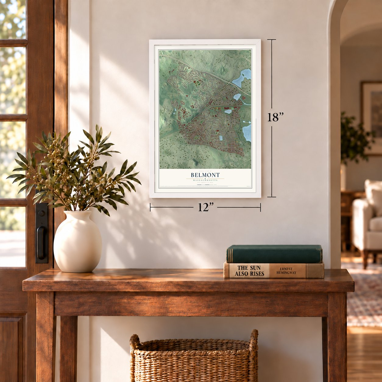
12" x 18" Archival Matte Print
A Map of Home. A Work of Art.
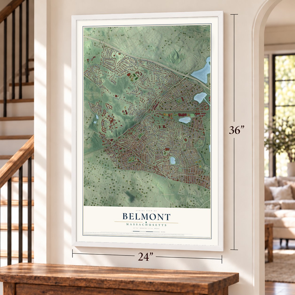
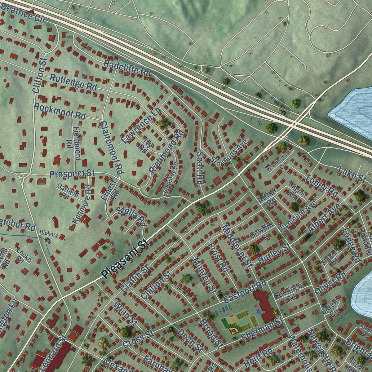
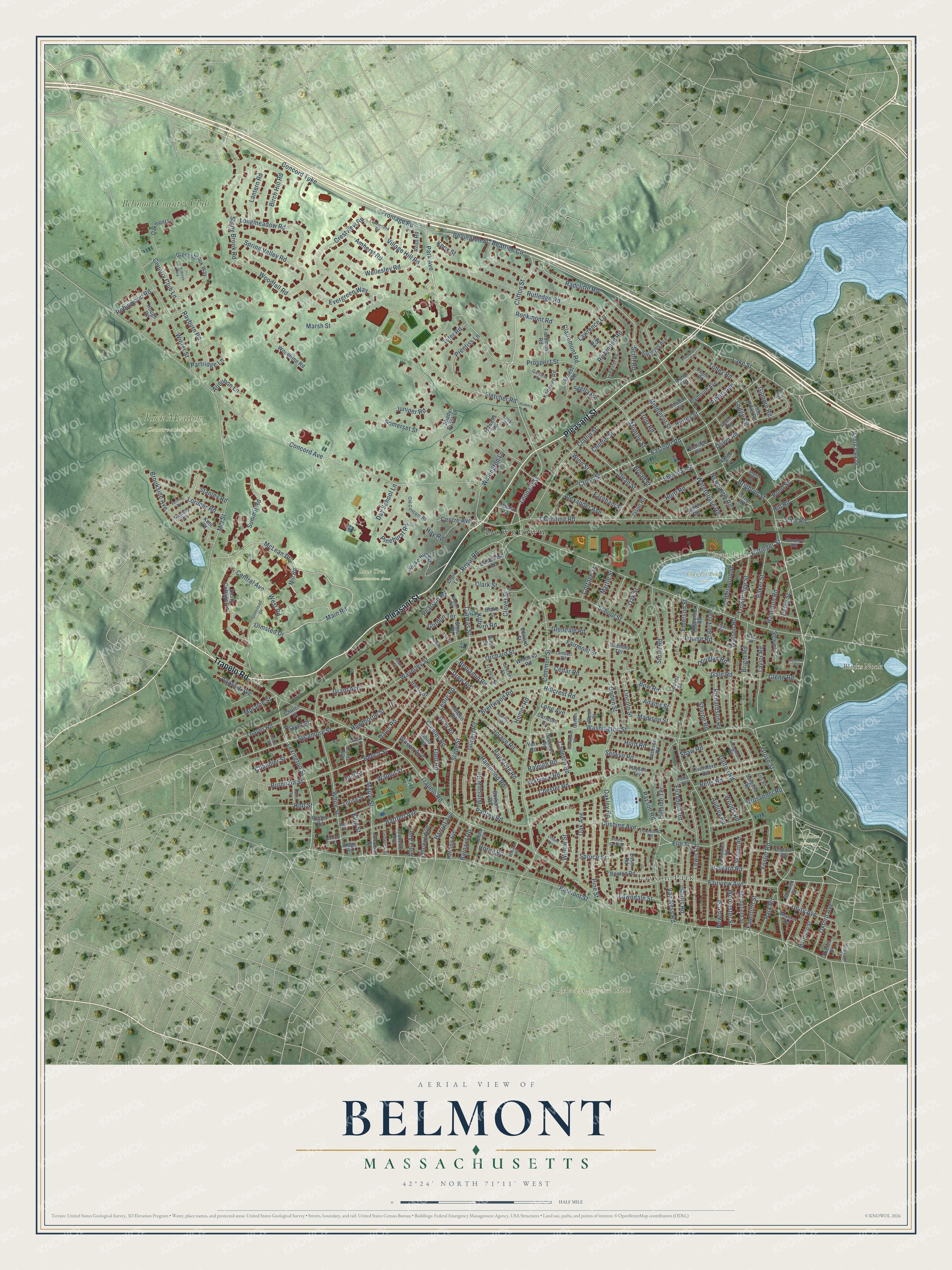
Explore Belmont, Massachusetts from a whole new perspective. Created using aerial imagery and detailed geographic data, this map captures Belmont building by building, with labeled streets, familiar landmarks, and shaded topographical relief that highlights the natural contours of the landscape.
Combining modern data with the timeless character of a vintage atlas, this map is just as interesting up close as it is beautiful on the wall. Whether you grew up in Belmont, spent memorable years there, or call it home today, this unique map is a great way to celebrate a place that means something to you. Zoom in on the preview to look for your street, and then order a print to put your memories on the wall.
Three ways to hang it
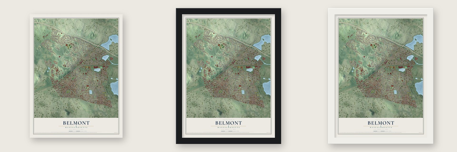
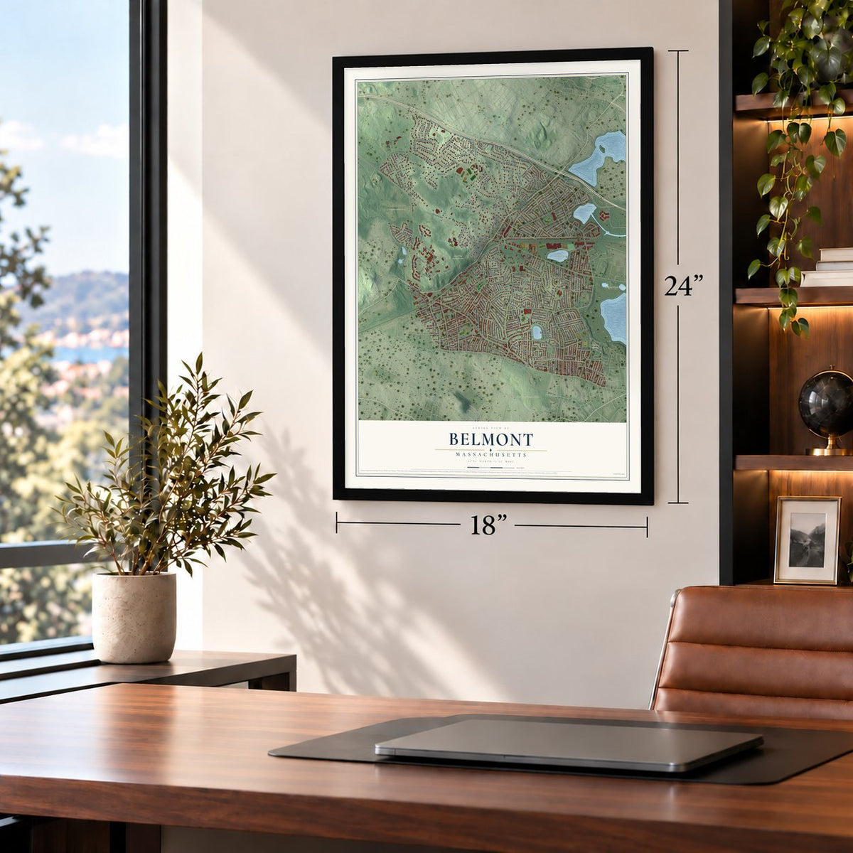
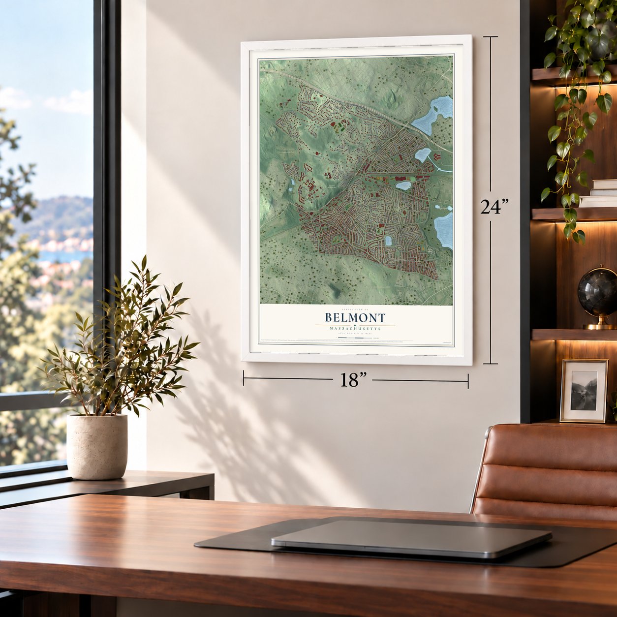
Unframed archival matte, a black wood frame or a white wood frame.
Up close
Geography Worth Displaying
This map was created using accurate cartographic data and authoritative geographic sources, including the U.S. Geological Survey (USGS) and FEMA. The map brings together terrain, waterways, roads, and building detail. The majority of the streets are labeled, houses are accurately depicted, and the topography is derived from government sources. Combining local data with carefully composed color and shading leads to this beautifully detailed Belmont artwork for your wall.
Rather than simply showing street outlines, we’ve included as many of the street names as we could reasonably fit on the map while keeping their names legible. Zoom in on the high resolution preview to see exactly what’s on the map. We truly set out to create a statement piece for anyone who loves Belmont. So whether it’s for you, or a gift for someone you love, we hope this map of Belmont brings back fond memories.
Explore the full map of Belmont, Massachusetts and read about the local places it shows.

Find your street
Names on the Belmont map
Every name below is printed on this map. Look for your street, your school, the park where you played, or the pond down the road.
Places and landmarks12
- Downtown
- Meetinghouse Hill
- Blacks Nook
- Claypit Pond
- Belmont Cemetery
- Clay Pit Pond Park
- Lone Tree Conservation Area
- Rock Meadow Conservation Area
- Payson Park
- Waverley
- Belmont Country Club
- Greybirch Park
Streets and roads317
- Pleasant Street
- Trapelo Road
- Clifton Street
- Main Road
- McLean Drive
- Park Avenue
- Hittinger Street
- Concord Turnpike
- Harriet Avenue
- Pearson Road
- Beech Street
- Lexington Street
- Radcliffe Road
- Wellesley Road
- Leonard Street
- Village Hill Road
- Albert Avenue
- Eastport Road
- Concord Avenue
- Belmont Street
- School Street
- Common Street
- Marsh Street
- Payson Road
- Orchard Street
- Mill Street
- Brighton Street
- Cross Street
- Waverley Street
- Winter Street
Show all 317 streets
- Frontage Road
- Somerset Street
- Channing Road
- Washington Street
- Grove Street
- Prospect Street
- Claflin Street
- Slade Street
- Rutledge Road
- Oakley Road
- Fairview Avenue
- Dalton Road
- White Street
- Goden Street
- West Road
- Lewis Road
- Cushing Avenue
- Elm Street
- Sherman Street
- Stony Brook Road
- Dean Street
- Olmsted Drive
- Alexander Avenue
- Bartlett Avenue
- Pinehurst Road
- Watson Road
- Crestview Road
- Chilton Street
- Gilbert Road
- Bright Road
- Fletcher Road
- Woodfall Road
- Sycamore Street
- Longmeadow Road
- Pine Street
- Brookside Avenue
- Birch Hill Road
- Juniper Road
- Hillside Terrace
- Oliver Road
- Beatrice Circle
- Creeley Road
- Maple Street
- Winn Street
- Summit Road
- Hammond Road
- Spring Valley Road
- Waterhouse Road
- Evergreen Way
- Shaw Road
- Clairemont Road
- Clark Street
- Walnut Street
- Chester Road
- Oak Avenue
- Country Club Lane
- Stults Road
- Betts Road
- Long Avenue
- Lake Street
- Baker Street
- Douglas Road
- Louise Road
- Hoitt Road
- Horace Road
- Farnham Street
- Richmond Road
- Lorimer Road
- Unity Avenue
- Brettwood Road
- Kilburn Road
- Bay State Road
- Bow Road
- Royal Road
- Van Ness Road
- Taylor Road
- Hillcrest Road
- Lincoln Street
- Partridge Lane
- Munroe Street
- Palfrey Road
- Grant Avenue
- Tyler Road
- Davis Road
- Trowbridge Street
- Broad Street
- Fairmont Street
- Tobey Road
- Flett Road
- Hull Street
- Hawthorne Street
- Cedar Road
- Hamilton Road
- Agassiz Avenue
- Stone Road
- Bellington Street
- Lawrence Lane
- Foster Road
- Prentiss Lane
- Middlecot Street
- Elizabeth Road
- Lantern Road
- Rayburn Road
- Amherst Road
- Glenn Road
- Pond Street
- Vale Road
- Oxford Avenue
- Thomas Street
- Gordon Terrace
- Richardson Road
- Scott Road
- Carleton Road
- Horne Road
- Winslow Road
- Central Avenue
- Wilson Avenue
- Underwood Street
- Gale Road
- Moraine Street
- Rockmont Road
- Centre Avenue
- Glendale Road
- Selwyn Road
- Alma Avenue
- Newcastle Road
- Warwick Road
- Vincent Avenue
- Stella Road
- Falmouth Street
- Robinwood Road
- Sharpe Road
- Thayer Road
- Hurd Road
- Park Road
- Worcester Street
- Newton Street
- Hill Road
- Lawndale Street
- Benjamin Road
- Audrey Road
- Willow Street
- Hay Road
- Frost Road
- Woods Road
- Drew Road
- Wellington Lane
- Homer Road
- Leslie Road
- Raleigh Road
- Clover Street
- Oak Street
- Burnham Street
- Day School Lane
- Chandler Street
- Grosvenor Road
- Harvard Road
- Myrtle Street
- Emerson Street
- Madison Street
- Cottage Street
- Gilmore Road
- Barnard Road
- Audubon Lane
- Thayer Street
- Stanley Road
- Knox Street
- Holt Street
- Hurley Street
- Adams Street
- Colby Street
- Lodge Road
- Spruce Street
- King Street
- Mill Road
- South Cottage Road
- Greensbrook Way
- Woodbine Road
- Livermore Road
- Snake Hill Road
- Marlboro Street
- Statler Road
- Edgemoor Road
- Becket Road
- Simmons Avenue
- Benton Road
- Springfield Street
- Gorham Road
- Plymouth Avenue
- Harding Avenue
- Oakmont Lane
- Ross Road
- Choate Road
- Fieldmont Road
- Howells Road
- Dunbarton Road
- Marion Road
- Kenmore Road
- Payson Terrace
- Jeanette Avenue
- Loring Street
- Acorn Park Drive
- Wiley Road
- Skahan Road
- Shady Brook Lane
- Winthrop Road
- Little Pond Road
- Harris Street
- Stewart Terrace
- Cowdin Street
- Bellevue Road
- Ernest Road
- Carleton Circle
- Coolidge Road
- Chenery Terrace
- Hough Road
- Ridge Road
- Jonathan Street
- Jackson Road
- Holden Road
- Sargent Road
- Ripley Road
- Blake Street
- Jason Road
- Ivy Road
- Berwick Street
- Shean Road
- Church Street
- Arthur Road
- West Street
- Clark Lane
- Moore Street
- Essex Road
- Edward Street
- Kent Street
- Dante Avenue
- York Road
- Exeter Street
- Locust Street
- Troy Road
- Larch Circle
- Birch Street
- Olmstead Drive
- Weber Road
- Leicester Road
- Townsend Road
- Old Concord Road
- Poplar Street
- Frederick Street
- Mayfield Road
- Franklin Street
- Clarendon Road
- Stearns Road
- Clyde Street
- George Street
- Anis Road
- Lambert Road
- Flanders Road
- Garfield Road
- Houghton Road
- Pilgrim Road
- Sabina Way
- Ericsson Street
- Pearl Street
- Davis Street
- Locke Road
- Maple Terrace
- Garden Street
- Ash Street
- Dana Road
- Philip Road
- Vernon Road
- Hastings Road
- Sandrick Road
- Branchaud Road
- Cumberland Road
- Preble Gardens
- Fitzmaurice Circle
- Garrison Road
- Cutter Street
- Linden Avenue
- Banks Street
- Williston Road
- Midland Street
- Hickory Lane
- Russell Terrace
- Mannix Circle
Names are listed as they appear on the printed map. Zoom into the product photos to find them.
About Belmont, Massachusetts
Belmont is a town of 27,295 people in Middlesex County, west of Boston. In 1854 Charles Stone and 127 others, mostly farm families around Wellington Hill, asked the Legislature to make them a town of their own. Watertown, West Cambridge and Waltham fought the plan every year. Watertown's lawyer mocked it as a little community of rich men, and one senator charged that the crooked boundary curved to capture a row of icehouses, letting Belmont tax ice harvested in West Cambridge.
The Senate passed a Belmont bill in 1856 by a vote of 17 to 13, but the House voted it down. Jacob Hittinger led the petition year after year until Governor Nathaniel P. Banks signed the act on March 18, 1859, and the first town meeting followed on March 28. The new town then voted to cover the petitioners' lobbying costs, but in 1862 the Supreme Court ordered that money returned to the treasury.
“Their wealth, Sir, is the rich reward of persevering industry.”
- Named for a China trader's estateJohn Perkins Cushing, rich from the China trade, built a mansion about 1830 on his Belmont estate, with a deer park, walled flower garden and grand conservatory. Open to the public, it drew thousands each season. The Back Road and then the new town took its name; Cushing, the town's top founding donor, is honored by Cushing Square. Samuel R. Payson owned it after Cushing died in 1862, and the Payson Park Land Company began subdividing it in 1886.
- First strawberries in BostonFarming went on long after 1859. According to the 1890 county history, Belmont berries reached the Boston markets ahead of everyone else's, and visitors came from near and far to its strawberry festivals. In January, growers raised lettuce, spinach and dandelions under glass, and on one day the Hittinger greenhouses shipped 14,000 cucumbers to Boston. In the 1885 state census Belmont led Middlesex County in fruit value, and the 1882 town seal shows Pomona, goddess of fruits and gardens.
- Winslow Homer's BelmontThe Boston merchant William Flagg Homer built a 15-room Italianate summer house on Pleasant Street in 1853. The painter Winslow Homer, his nephew, passed many of his young years close by, and he set his 1861 picture The War, Making Havelocks for the Volunteers in its parlor. On the day Belmont was incorporated, he drew The New Town of Belmont. The Belmont Woman's Club bought the house in 1927 to keep it from being torn down.
- From brickyard to pondParry Brothers started a brickyard off Concord Avenue in 1888. Once 1900 had passed, the New England Brick Company was making 15 million bricks a year on the site. When the best clay gave out by 1926, the town paid $22,500 for the pit in 1927 and used it as a dump. In 1933 the town ran Wellington Brook into the hole through a culvert, and 80 million gallons of water made Claypit Pond, now beside Belmont High School.
- A fieldstone station, 1908Trains once crossed the roads of Belmont Center at grade. In 1907 the railroad lifted its tracks onto an embankment and a stone arch bridge over the road, and in 1908 a two-story station went up, built of 365 tons of fieldstone that a local farmer quarried on Belmont Hill. The Belmont Lions Club now owns the Belmont Railroad Station, which joined the National Register in 1998.
Keep exploring Massachusetts
Belmont is one of 468 Massachusetts towns we've mapped. Every dot on the map is a print of its own.
The search covers every state, Massachusetts first.
Near Belmont
Order 2 or more town maps and save 10%. Shown in the size and finish you picked above, so they hang as a set.
- Strawberry Hill 12" x 18" / Archival Matte Print $39.99
- Watertown 12" x 18" / Archival Matte Print $39.99
- Arlington 12" x 18" / Archival Matte Print $39.99


More maps nearby: North Cambridge, Davis Square, Waltham, Ball Square and Cambridge.
The art of mapping a place
How This Map Was Made
Real places. Remarkable detail. Discover the layers that turn geographic data into a map of home.

The view from above
Aerial imagery reveals the character of the land: woodland, open fields, and the patterns of a place.

The shape of the land
Elevation data brings hills, valleys, and subtle changes in the landscape into view.

The details of home
Roads, waterways, and building footprints come together to make the map feel unmistakably local.

Geography becomes art
Considered color, shading, and typography bring the layers together in a map made for your wall.


Process illustrated with Mendon, Massachusetts. Aerial imagery: USDA NAIP. Terrain: USGS 3D Elevation Program. Map details and finished artwork: KNOWOL.
The Details
About This Print
Choose an archival matte print, or a black or white Ayous wood frame. The archival matte print is unframed.
Select your size and finish above to see the matching product image and price.
Materials & Craftsmanship
A contemporary map with the character of a classic atlas, printed on archival matte paper. Optional frames are made from Ayous wood.
Your printed map does not include the watermark shown in the full-map preview.
Shipping & Delivery
Free shipping within the United States. Every print is made to order in the USA.
Buying a gift? Add a note in your cart and we'll include it. We never put prices in the package.
Prints ship within 2 to 3 business days. Allow 7 to 10 days total from ordering for delivery. Timing may vary during holidays or periods of high order volume.
Read our shipping policy.
Returns and damaged prints
Each print is made to order. Change-of-mind refunds are not available after production.
If your print arrives damaged, misprinted or incorrect, contact support@knowol.com within 30 days of receiving it. Include your order number, photos and a description of the issue.
Read our full refund and replacement policy. For questions about your order, email support@knowol.com.