
Search for another town





Free U.S. delivery 7 to 10 days after you order
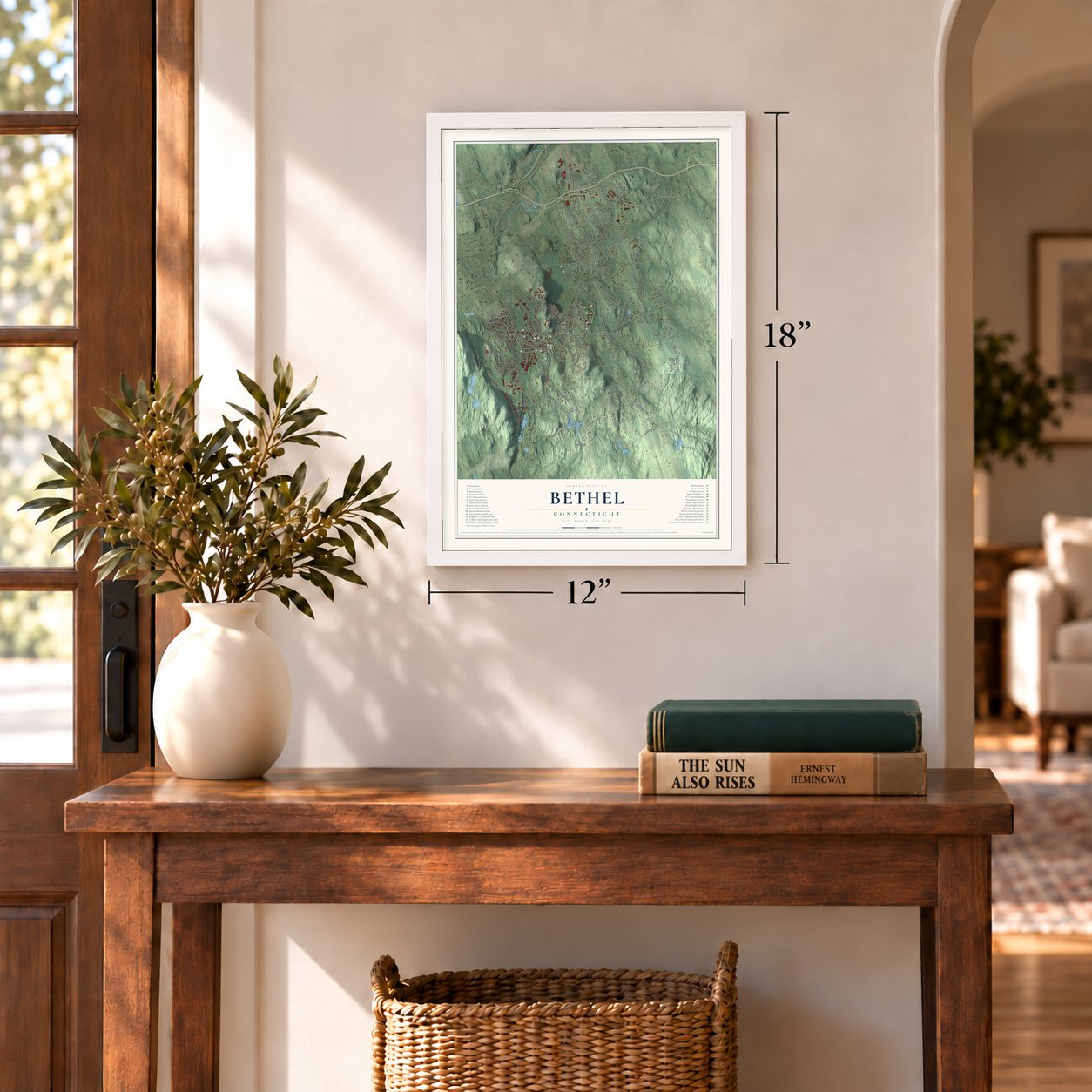
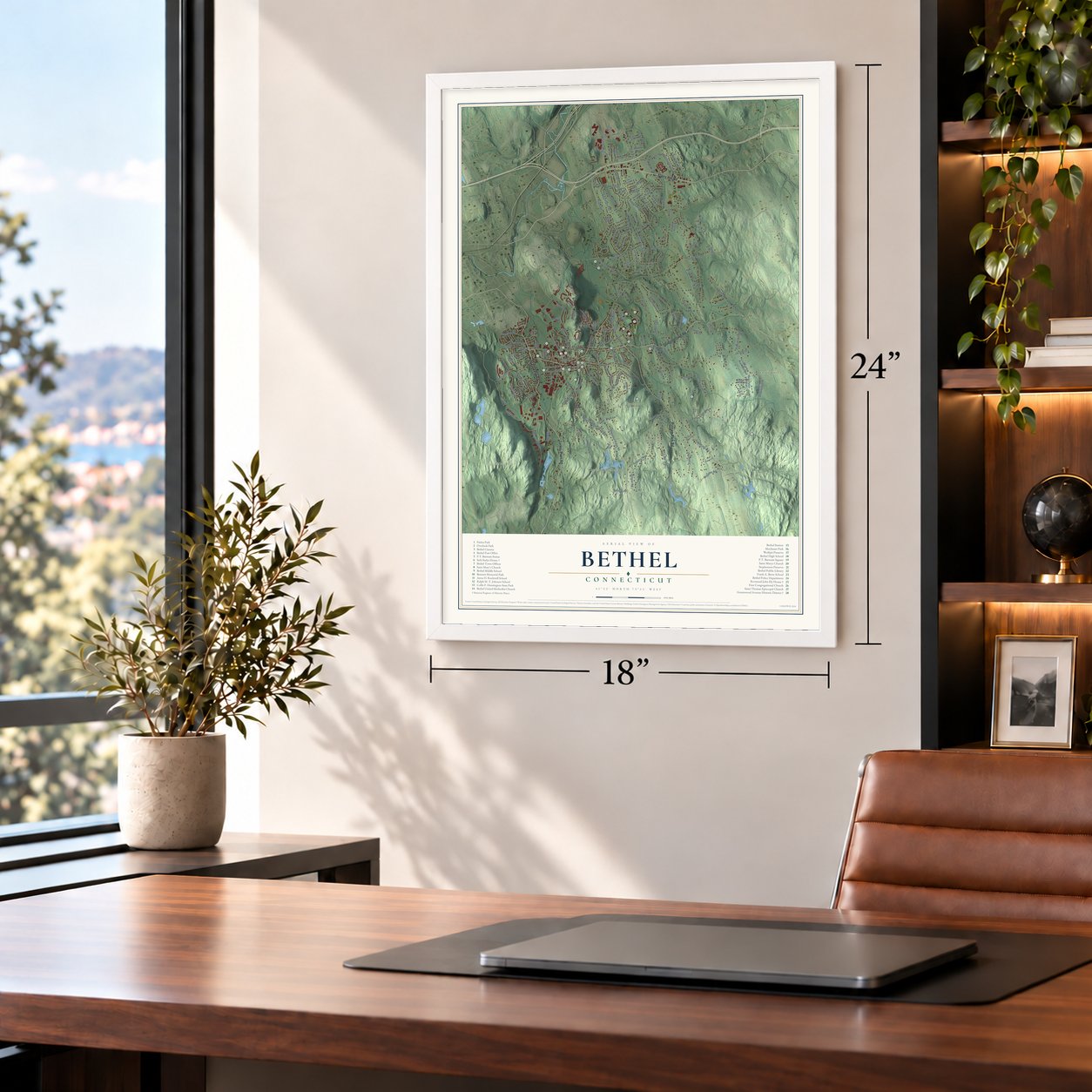
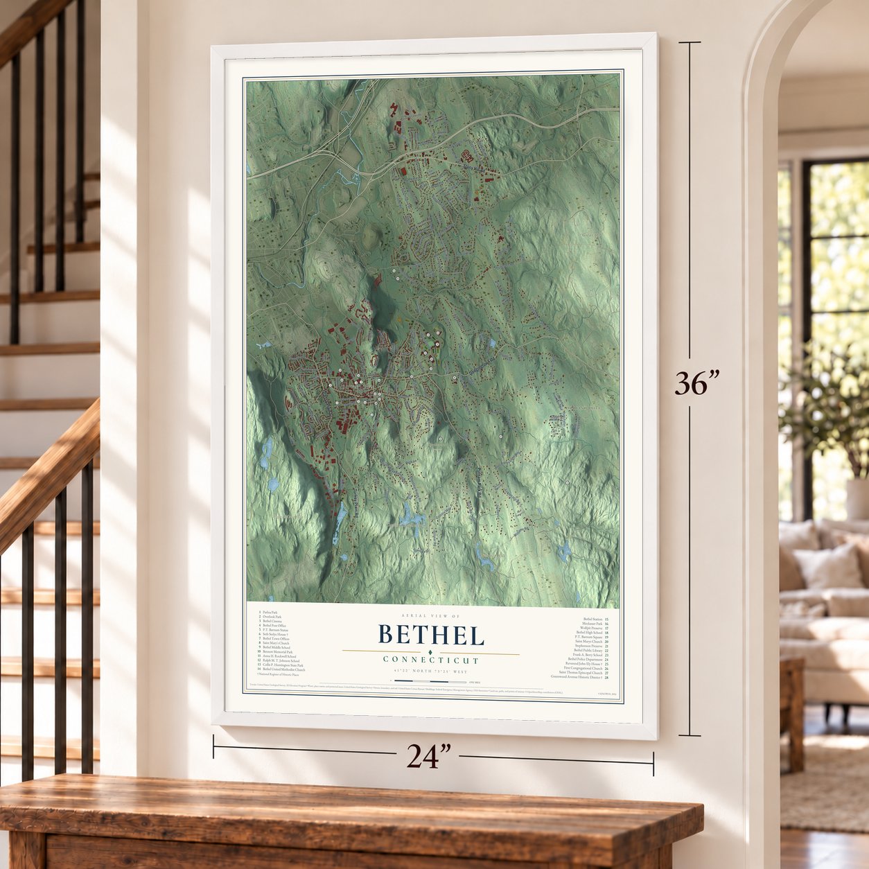
Bethel, Connecticut Map Art
Building by building, with labeled streets and shaded relief.
12" x 18" Archival Matte Print
A Map of Home. A Work of Art.
Explore Bethel, Connecticut from a whole new perspective. Created using aerial imagery and detailed geographic data, this map captures Bethel building by building, with labeled streets, familiar landmarks, and shaded topographical relief that highlights the natural contours of the landscape.
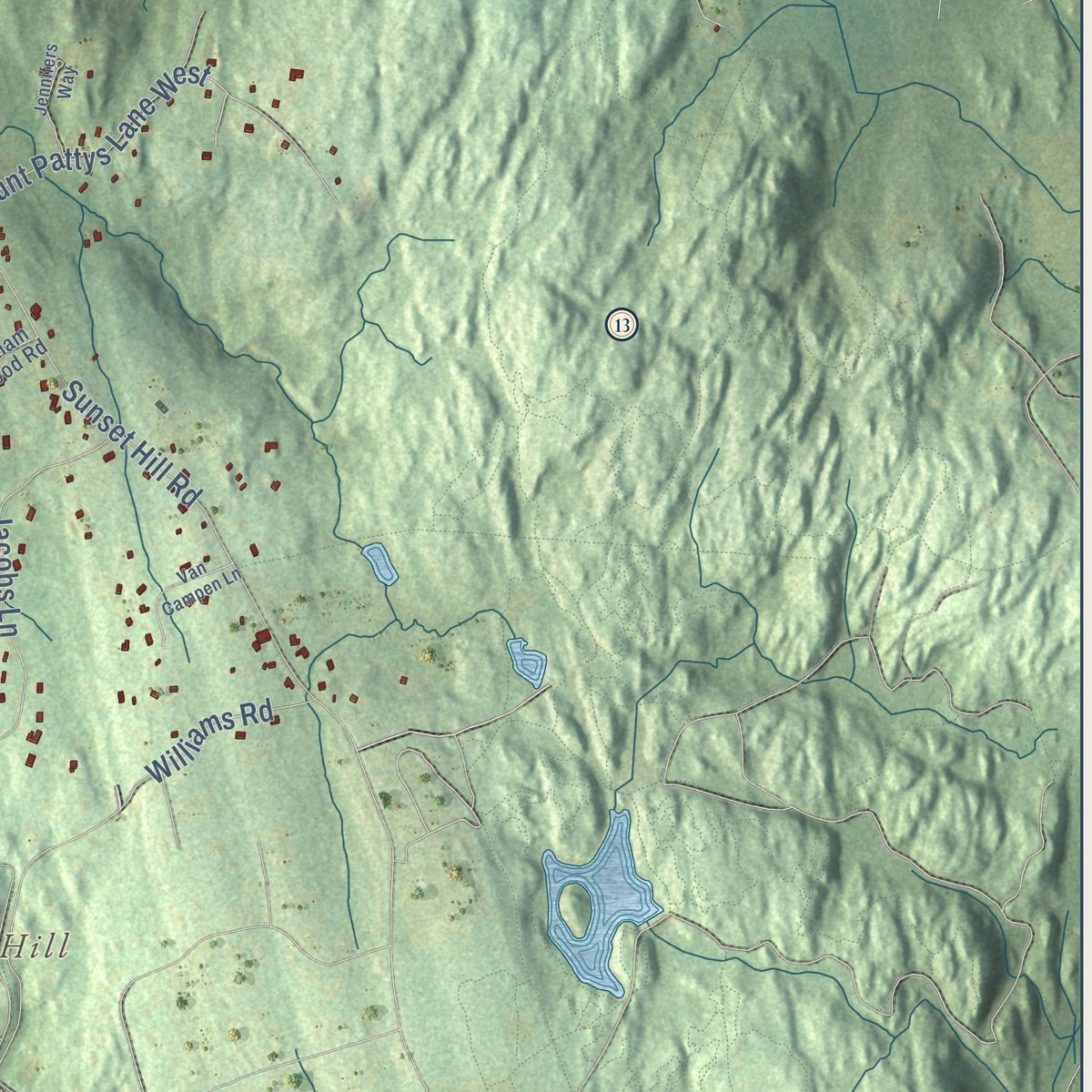
Combining modern data with the timeless character of a vintage atlas, this map is just as interesting up close as it is beautiful on the wall. Whether you grew up in Bethel, spent memorable years there, or call it home today, this unique map is a great way to celebrate a place that means something to you. Zoom in on the preview to look for your street, and then order a print to put your memories on the wall.

Three ways to hang it
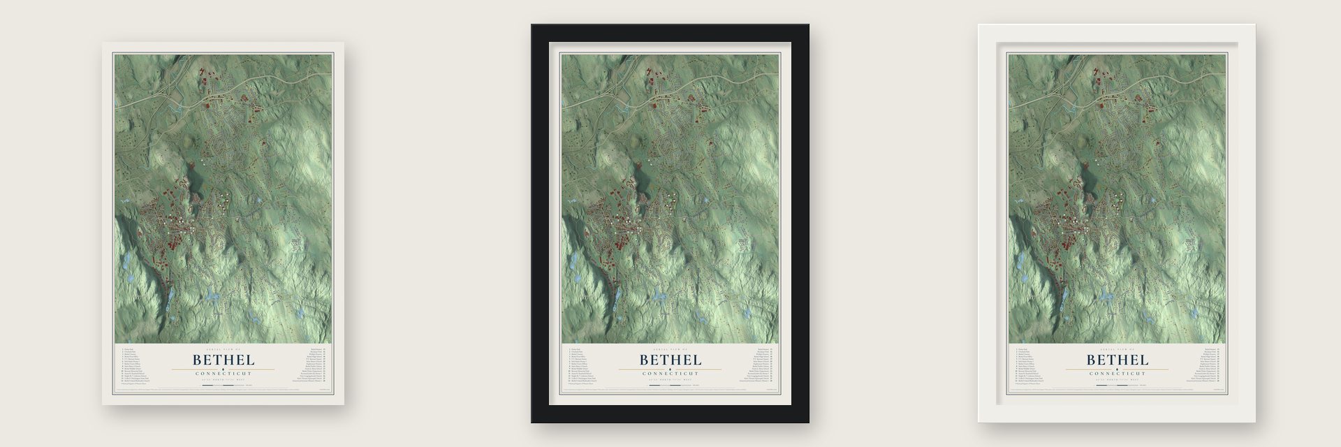
Unframed archival matte, a black wood frame or a white wood frame.
Up close
Geography Worth Displaying
This map was created using accurate cartographic data and authoritative geographic sources, including the U.S. Geological Survey (USGS) and FEMA. The map brings together terrain, waterways, roads, and building detail. The majority of the streets are labeled, houses are accurately depicted, and the topography is derived from government sources. Combining local data with carefully composed color and shading leads to this beautifully detailed Bethel artwork for your wall.
Rather than simply showing street outlines, we’ve included as many of the street names as we could reasonably fit on the map while keeping their names legible. Zoom in on the high resolution preview to see exactly what’s on the map. We truly set out to create a statement piece for anyone who loves Bethel. So whether it’s for you, or a gift for someone you love, we hope this map of Bethel brings back fond memories.
Explore the full map of Bethel, Connecticut and read about the local places it shows.

Find your street
Names on the Bethel map
Every name below is printed on this map. Look for your street, your school, the park where you played, or the pond down the road.
Places and landmarks8
- Downtown
- Codfish Hill
- Bogus Mountain
- Great Hill
- Prospect Hill
- Bethels Pond
- Chestnut Ridge Reservoir
- Stephenson Preserve
Streets and roads182
- Stony Hill Road
- Putnam Park Road
- Dodgingtown Road
- Grassy Plain Street
- Turkey Plain Road
- Chestnut Street
- Cortland Drive
- Maple Avenue
- Sky Edge Lane
- Chestnut Ridge Road
- Starr Lane
- Old Hawleyville Road
- Walnut Hill Road
- Plumtrees Road
- Codfish Hill Road
- Rockwell Road
- Nashville Road
- Taylor Road
- Payne Road
- Sunset Hill Road
- Linda Lane
- Wolfpits Road
- Benedict Road
- Nashville Road Extended
- Wooster Street
- Whittlesey Drive
- Jacobs Lane
- Hoyts Hl
- Ridgedale Road
- Hawleyville Road
Show all 182 streets
- Country Way
- Oak Ridge Road
- Redwood Drive
- South Street
- Aunt Pattys Lane West
- Shelly Road
- Whippoorwill Road
- Reservoir Street
- Apollo Road
- Quaker Ridge Road
- Trowbridge Drive
- Vail Road
- Vale Road
- Weed Road
- Shelter Rock Road
- Katrina Circle
- Hearthstone Drive
- Pell Mell Drive
- Kellogg Street
- Chimney Drive
- Durant Avenue
- Knollwood Drive
- Wine Sap Run
- Dittmar Road
- Kayview Avenue
- Research Drive
- Garella Road
- Hoyt Road
- Berkshire Boulevard
- Kristy Drive
- Shelley Road
- Green Pasture Road
- Fleetwood Avenue
- Juniper Road
- Mansfield Street
- Adams Drive
- Bethpage Drive
- Judd Avenue
- Goodhill Road
- Far Horizons Drive
- Budd Drive
- Ridge Road
- Williams Road
- Vining Road
- Domain Drive
- Daniska Drive
- McNeil Road
- Dvwy
- Starr Road
- Cherry Lane
- Settlers Road
- Wagon Road
- Deer Run
- Roberts Drive
- Henry Street
- Cindy Lane
- Peck Lane
- Terry Drive
- Cole Lane
- Sky Edge Drive
- Codfish Hill Road Extended
- Taylor Avenue
- Maple Avenue Extended
- Great Hill Drive
- Spring Hill Lane
- Long Meadow Lane
- Midway Drive
- Apple Tree Road
- Old Dodgingtown Road
- Winthrop Road
- Birch Drive
- Castle Hill Drive
- Park Lawn Drive
- Ichabod Lane
- Pound Sweet Hill
- Pleasant Street
- Evergreen Drive
- Fox Den Road
- Colonial Drive
- Hickok Avenue
- Highview Terrace
- Sympaug Park Road
- Sunny Acres Road
- Sand Hill Road
- Maple Row
- Saxon Road
- Highland Avenue
- Karen Drive
- Stone Dam Road
- Granite Drive
- Oxford Street
- Aunt Pattys Lane East
- Second Lane
- East Brook Court
- Fawn Road
- Elizabeth Street
- Cross Hill Road
- Meadow Lane
- Phillips Drive
- Farnum Hl
- Allan Way
- Turnage Lane
- Ballfield Road
- Elgin Avenue
- Saras Way
- Passage Road
- Rocky Lane
- Hillside Court
- Webb Road
- Rita Drive
- Paul Street
- East Lane
- Falls Lane
- Bayberry Hill Road
- Kingswood Drive
- Shared Dvwy
- Meckauer Circle
- Reynolds Ridge
- Partridge Drive
- Prospect Street
- Canaan Drive
- Long Hill Road
- Empire Drive
- Old Turnpike Road
- Briar Ridge Drive
- Birnam Wood Road
- Legend Drive
- Honey Hollow Road
- Grassy Plain Terrace
- School Street
- Hunting Ridge Lane
- Old Town Road
- Old Field Drive
- Topstone Drive
- Governors Lane
- Woodlawn Drive
- Sharon Court
- Van Campen Lane
- Briarcliff Manor
- Pound Sweet Hl
- Jennifers Way
- Grandview Avenue
- Hollyberry Road
- Putnum Park Road
- Park Ridge Road
- Cedar Drive
- Pleasant View Terrace
- Winding Brook Drive
- Terrace Drive
- Rector Street
- Forest Way
- Farm Court
Names are listed as they appear on the printed map. Zoom into the product photos to find them.
About Bethel, Connecticut
Bethel is a town of 20,358 people in Fairfield County. People first settled here around 1700, when the land was an outlying corner of Danbury, and in October 1759 Bethel became a church society of its own. Its first meeting house went up in 1760, with the Rev. Noah Wetmore as minister.
Hats built the village. By 1835 Bethel had about fifty houses, and its fifteen hat shops employed 200 people, women among them, turning out about 125,000 hats a year, while about twelve comb makers employed 180 more. The railroad reached Bethel in 1852, and in 1855 the village was set off from Danbury as a town of 1,711 people. In 1934 Rudolph Kunett opened America's first vodka distillery in Bethel, using rights he had bought from the exiled Smirnoff family.
“The old village meeting house, without steeple or bell, where in the square family pew I sweltered in summer and shivered through my Sunday-school lessons in winter.”
- The railroad bends to BethelThe first survey for the line up from Norwalk skipped Bethel and followed Simpaug Brook. The engineer, Mr. Twining, proposed swinging east through Grassy Plain for an important station at little extra distance, and the plan changed. One doubter claimed two twelve-foot rails could sink into the boggy flat below the village without hitting bottom. Trains came anyway in 1852, and Center Street, now Greenwood Avenue, filled in from the depot to the hat shops.
- Barnum's hometownThe showman P. T. Barnum was born here in 1810 and started a newspaper, the Herald of Freedom, in 1831. A libel case put him in the county jail for sixty days, and afterward a six-horse coach, forty riders, sixty carriages and a band escorted him home. In 1881 he gave the town a park with a German-made bronze fountain.
- Hat Makers Union No. 1Bethel's hat makers organized Hat Makers Union No. 1 in 1856, and the finishers formed Union No. 2 in July 1860. The makers secured Saturday afternoons off and liked to say that in Bethel nobody worked without a union card. The comb trade faded instead: by 1881 a county history counted the comb makers as a thing of the past, and a former comb shop in Plumtrees had been turned into a saw and cider mill.
- The minister's house of 1792The parish's second minister, Rev. John Ely, got a new house about 1792, and it still keeps much of its 18th century woodwork. A later owner, Oliver Shepard, had opened his own hat shop on Fountain Place in 1806, became Bethel's first postmaster and helped make Bethel a separate town in 1855. The Rev. John Ely House joined the National Register in 2001.
- The Seelye house, now the librarySeth Seelye, who owned much land and had a stake in hat shops and the store across the street, built his house on Greenwood Avenue about 1842. Fluted Doric columns hold up its tall front portico. His sons gave the house to the town, and it is now the Bethel Public Library. The Seth Seelye House joined the National Register in 1977.
Keep exploring Connecticut
Bethel is one of 382 Connecticut towns we've mapped. Every dot on the map is a print of its own.
The search covers every state, Connecticut first.
Near Bethel
Order 2 or more town maps and save 10%. Shown in the size and finish you picked above, so they hang as a set.
- Dodgingtown 12" x 18" / Archival Matte Print $39.99
- Redding Center 12" x 18" / Archival Matte Print $39.99
- Redding 12" x 18" / Archival Matte Print $39.99

More maps nearby: Hawleyville, Danbury, Newtown, Route 7 Gateway and Topstone.
The art of mapping a place
How This Map Was Made
Real places. Remarkable detail. Discover the layers that turn geographic data into a map of home.

The view from above
Aerial imagery reveals the character of the land: woodland, open fields, and the patterns of a place.

The shape of the land
Elevation data brings hills, valleys, and subtle changes in the landscape into view.

The details of home
Roads, waterways, and building footprints come together to make the map feel unmistakably local.

Geography becomes art
Considered color, shading, and typography bring the layers together in a map made for your wall.


Process illustrated with Mendon, Massachusetts. Aerial imagery: USDA NAIP. Terrain: USGS 3D Elevation Program. Map details and finished artwork: KNOWOL.
The Details
About This Print
Choose an archival matte print, or a black or white Ayous wood frame. The archival matte print is unframed.
Select your size and finish above to see the matching product image and price.
Materials & Craftsmanship
A contemporary map with the character of a classic atlas, printed on archival matte paper. Optional frames are made from Ayous wood.
Your printed map does not include the watermark shown in the full-map preview.
Shipping & Delivery
Free shipping within the United States. Every print is made to order in the USA.
Buying a gift? Add a note in your cart and we'll include it. We never put prices in the package.
Prints ship within 2 to 3 business days. Allow 7 to 10 days total from ordering for delivery. Timing may vary during holidays or periods of high order volume.
Read our shipping policy.
Returns and damaged prints
Each print is made to order. Change-of-mind refunds are not available after production.
If your print arrives damaged, misprinted or incorrect, contact support@knowol.com within 30 days of receiving it. Include your order number, photos and a description of the issue.
Read our full refund and replacement policy. For questions about your order, email support@knowol.com.