
Search for another town





Free U.S. delivery 7 to 10 days after you order
Billings, Montana Map Art
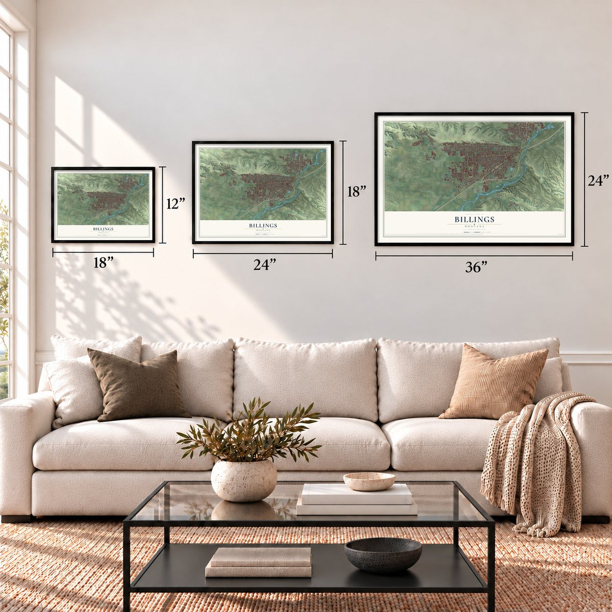
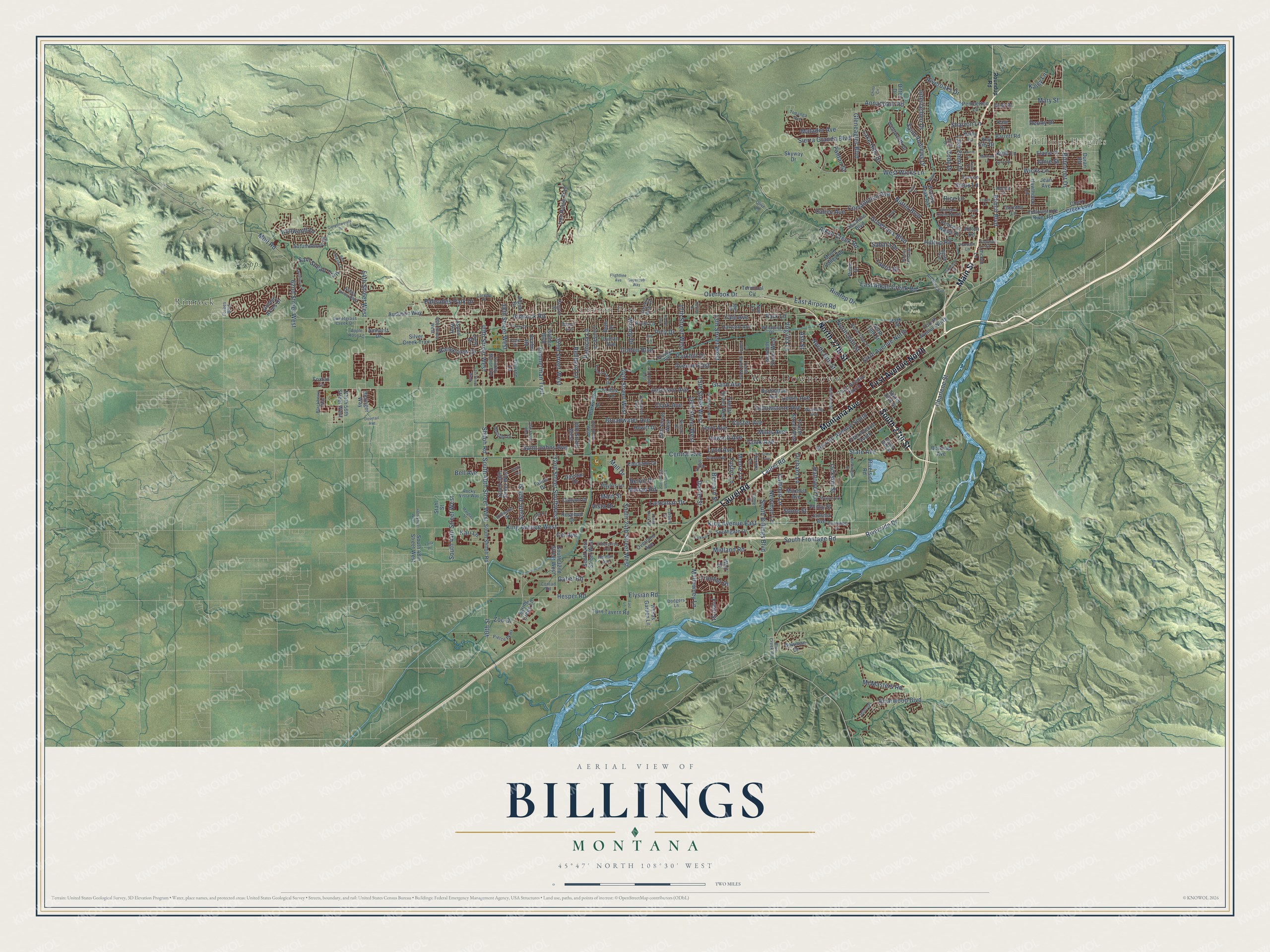
A new map of Billings, Montana, made in 2026 and printed to order on thick archival matte paper.
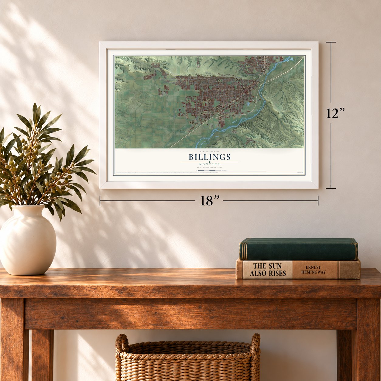
12" x 18" Archival Matte Print
A Map of Home. A Work of Art.
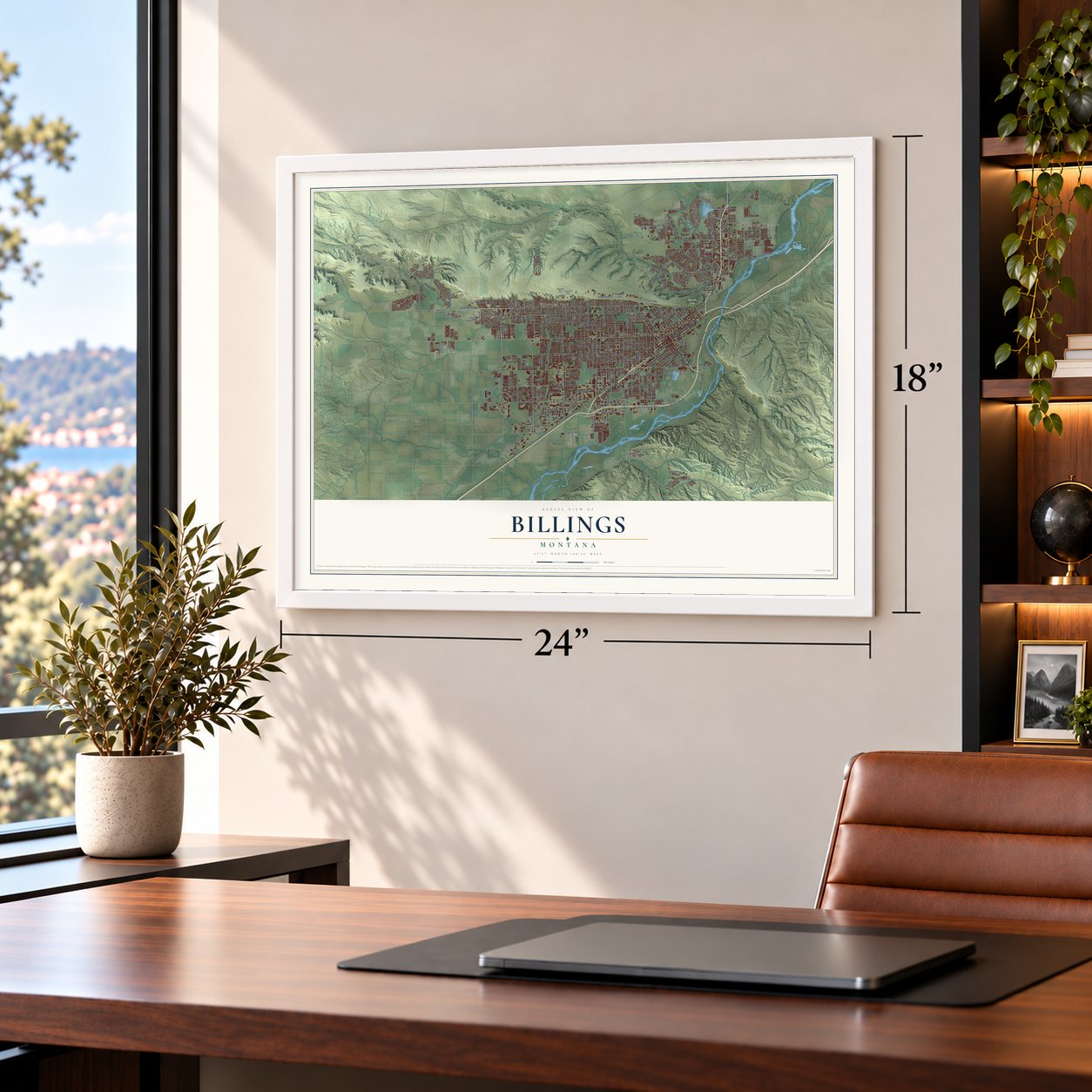
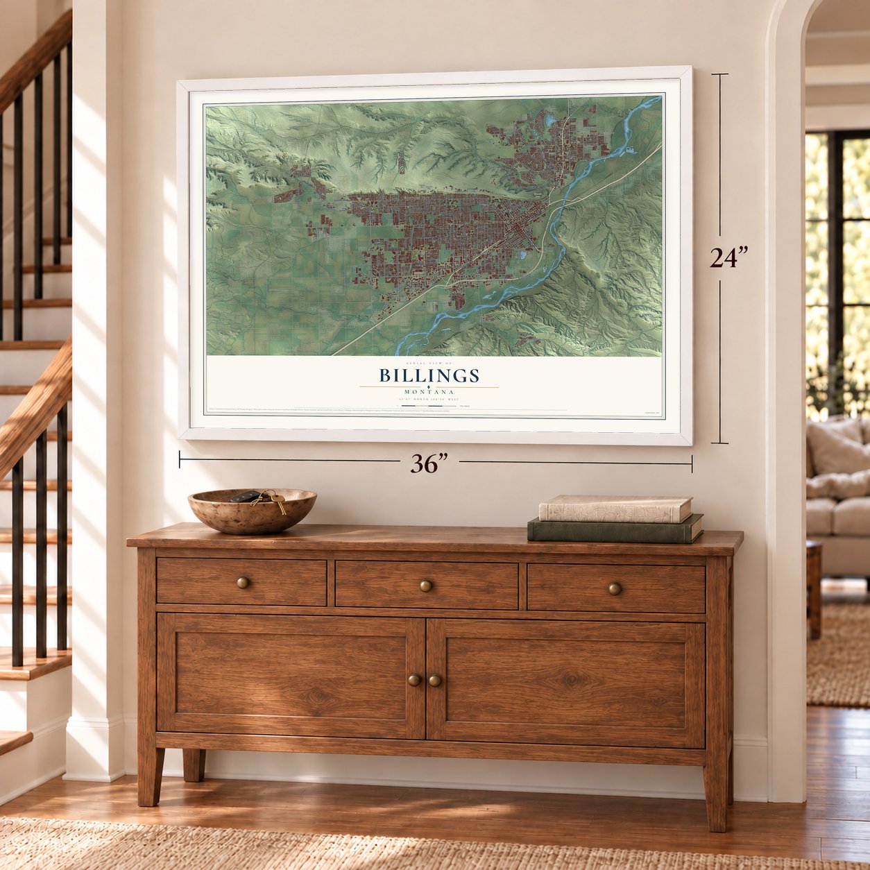
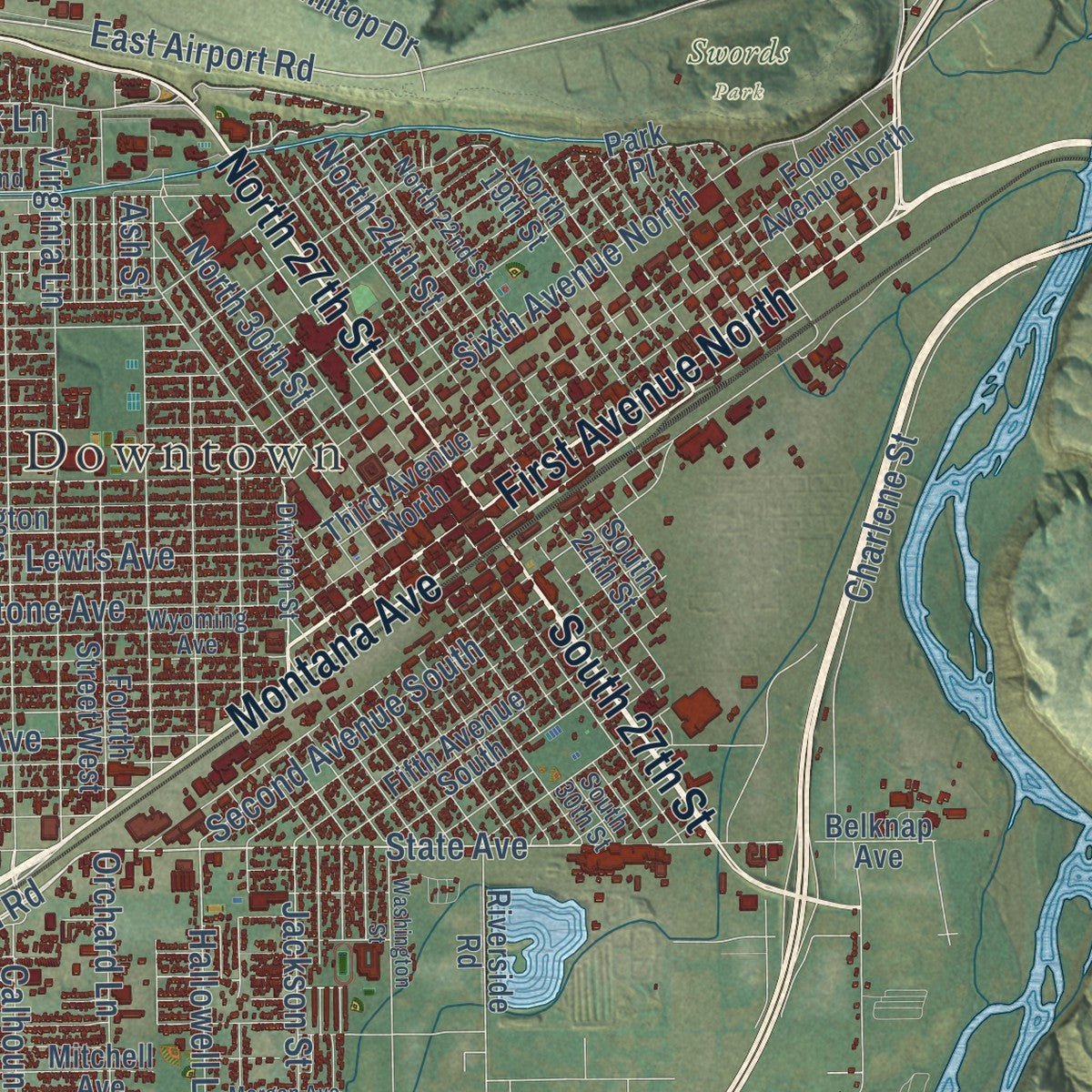
Explore Billings, Montana from a whole new perspective. Created using aerial imagery and detailed geographic data, this map captures Billings building by building, with labeled streets, familiar landmarks, and shaded topographical relief that highlights the natural contours of the landscape.
Combining modern data with the timeless character of a vintage atlas, this map is just as interesting up close as it is beautiful on the wall. Whether you grew up in Billings, spent memorable years there, or call it home today, this unique map is a great way to celebrate a place that means something to you. Zoom in on the preview to look for your street, and then order a print to put your memories on the wall.
Three ways to hang it
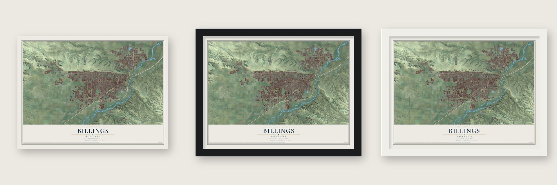
Unframed archival matte, a black wood frame or a white wood frame.
Up close
Geography Worth Displaying
This map was created using accurate cartographic data and authoritative geographic sources, including the U.S. Geological Survey and the Census Bureau. The map brings together terrain, waterways, roads, and building detail. The majority of the streets are labeled, houses are accurately depicted, and the topography is derived from government sources. Combining local data with carefully composed color and shading leads to this beautifully detailed Billings artwork for your wall.
Rather than simply showing street outlines, we’ve included as many of the street names as we could reasonably fit on the map while keeping their names legible. Zoom in on the high resolution preview to see exactly what’s on the map. We truly set out to create a statement piece for anyone who loves Billings. So whether it’s for you, or a gift for someone you love, we hope this map of Billings brings back fond memories.
Read the story behind this map of Billings, Montana from 2026.

About Billings, Montana
From the Montana Historical Society: "Offering an eclectic architectural mix, Old Town tells the story of Billings’ growth. The Northern Pacific founded the community as a railroad hub in 1882, and by the end of 1883, some 400 canvas tents and crude buildings lined the streets."
Find your street
Names on the Billings map
Every name below is printed on this map. Look for your street, your school, the park where you played, or the pond down the road.
Places and landmarks6
- West Downtown
- Billings Heights
- Phipps Park
- Swords Park
- Cameron Park
- Rimrock
Streets and roads303
- Montana Avenue
- Main Street
- Laurel Road
- North 27th Street
- First Avenue North
- South 27th Street
- Grand Avenue
- East Airport Road
- Bench Boulevard
- Sixth Avenue North
- State Avenue
- Alkali Creek Road
- Governors Boulevard
- Midland Road
- South 40th Street West
- Hilltop Road
- South Frontage Road
- Daniel Street
- King Avenue West
- Lewis Avenue
- Nutter Boulevard
- Rimrock Road
- Poly Drive
- Broadwater Avenue
- Central Avenue
- Monad Road
- Custer Avenue
- Colton Boulevard
- Miles Avenue
- Parkhill Drive
Show all 303 streets
- Yellowstone Avenue
- Howard Avenue
- Avenue East
- Lake Elmo Drive
- Saint Johns Avenue
- King Avenue East
- Terry Avenue
- Clark Avenue
- Cook Avenue
- Zimmerman Trail
- Alderson Avenue
- Wicks Lane
- West Wicks Lane
- 17th Street West
- Gabel Road
- Briarwood Boulevard
- 32nd Street Southwest
- 13th Street West
- South 24th Street West
- 40th Street West
- 54th Street West
- 24th Street West
- Elysian Road
- Lynn Avenue
- 15th Street West
- Charlene Street
- Shiloh Road
- 40th Street
- Second Avenue South
- Riverside Drive
- Lampman Drive
- Hesper Road
- Bitterroot Drive
- 38th Street West
- 32nd Street West
- North 30th Street
- South Billings Boulevard
- 16th Street West
- Orchard Lane
- East Alkali Creek Road
- Jackson Street
- Palisades Park Drive
- Matador Avenue
- Saint Andrews Drive
- Rimtop Drive
- North 24th Street
- South 36th Street
- Patricia Lane
- Riveroaks Drive
- Hallowell Lane
- Rehberg Lane
- Mullowney Lane
- Virginia Lane
- Gleneagles Boulevard
- 62nd Street West
- Stone Street
- South 44th Street West
- Constitution Avenue
- Lake Hills Drive
- Ironwood Drive
- Overlook Drive
- Annandale Road
- Sierra Granda Boulevard
- Mary Street
- Calhoun Lane
- Woody Drive
- Rangeview Drive
- Interlachen Drive
- McMasters Road
- Moore Lane
- Sam Snead Trail
- Zoo Drive
- Sharron Lane
- Janie Street
- Fantan Street
- Tabriz Drive
- Calico Avenue
- Sahara Drive
- Sioux Lane
- Frontier Drive
- Kyhl Lane
- Yale Avenue
- Foster Lane
- Peony Drive
- Cody Drive
- Newman Lane
- Beloit Drive
- Vista Drive
- Cel Avenue
- Bernard Street
- Park Lane
- Bell Avenue
- Mall Drive
- Kari Lane
- Kaley Lane
- Front Street
- Molt Road
- Rice Lane
- Ash Street
- Golden Boulevard
- Yellowstone River Road
- Jean Avenue
- South Shiloh Road
- Burlington Avenue
- Twelfth Street West
- South 32nd Street West
- Fourth Avenue North
- Third Avenue North
- Seventh Street West
- Hawthorne Lane
- 19th Street West
- Audubon Way
- South 29th Street West
- Rosebud Drive
- Canyon Drive
- Overland Avenue
- Fifth Avenue South
- Iron Horse Trail
- Cherry Creek Loop
- Fourth Street West
- South 38th Street West
- North 19th Street
- Phillip Street
- Southgate Drive
- Wentworth Drive
- Eldorado Drive
- Terminal Circle
- Mitchell Avenue
- 30th Street West
- Moon Valley Road
- Elaine Street
- Barrett Road
- Hewitt Drive
- Silver Creek Trail
- Golden Acres Drive
- Turn Tavern Road
- Lincoln Lane
- Autumnwood Drive
- Lyman Avenue
- Watson Peak Road
- Amherst Drive
- Crist Drive
- Harvard Avenue
- North 56th Street West
- Senators Boulevard
- South 48th Street West
- Beringer Way
- Riverside Road
- Belknap Avenue
- Dorothy Lane
- Avalon Road
- Jansma Avenue
- Louise Lane
- Pemberton Lane
- Aspen Way
- Annas Garden Lane
- Prince of Wales Drive
- Parkview Drive
- Bowman Drive
- Pryor Lane
- Phyllis Lane
- Kathy Lane
- South 24th Street
- Skyway Drive
- Spring Creek Lane
- Daystar Drive
- Lillis Lane
- Florine Lane
- Tahoe Drive
- Alpine Drive
- Tiburon Lane
- Pinon Drive
- Milton Road
- Beth Drive
- Foxtail Lane
- Kale Drive
- Park Place
- Key City Drive
- Duran Road
- Ditton Drive
- Weil Street
- Stahl Street
- June Drive
- Nye Lane
- Roundup Road
- Division Street
- Internal
- Wyoming Avenue
- Aronson Avenue
- Tenth Street West
- Stillwater Drive
- Laredo Place
- North 22nd Street
- Forest Park Drive
- Anchor Street
- Heritage Drive
- South 30th Street
- Pierce Parkway
- Iris Lane
- Topanga Avenue
- Solomon Avenue
- Enterprise Avenue
- Agate Avenue
- Country Manor Boulevard
- Rocky Vista Way
- Country Club Circle
- Bobby Jones Boulevard
- Sweetgrass Creek Drive
- Blackberry Way
- 46th Street West
- Woodland Drive
- Windsor Circle North
- Dodgers Lane
- Blue Creek Road
- Conrad Road
- Hansen Lane
- Foote Street
- Carbon Street
- Beech Avenue
- Crow Lane
- Regal Street
- Conway Street
- Apple Rose Lane
- Colin Drive
- Brayton Street
- Forbes Boulevard
- King Park Drive
- Holman Avenue
- Nelson Drive
- Olive Lane
- Joan Drive
- Toni Drive
- 14th Street West
- 21st Street West
- Canyonwoods Drive
- 22nd Street West
- 41st Street West
- Vickery Drive
- Ben Hogan Lane
- 28th Street West
- Morgan Avenue
- Washington Street
- Concord Drive
- Parkway Lane
- Hoover Avenue
- South 19th Street West
- 35th Street West
- Laurie Lane
- Banff Avenue
- Marillac Street
- Toole Court
- Cambridge Drive
- Spalding Avenue
- East Lane
- Bazaar Exchange
- Killarney Street
- 48th Street West
- Barley Circle
- Flightline Avenue
- Logan Lane
- Supercub Way
- Dovetail Avenue
- Lynch Drive
- Mattson Lane
- Azalea Lane
- Shaw Lane
- Laila Drive
- Easy Street
- Harrow Drive
- Euclid Lane
- Chino Circle
- Kelby Drive
- Cline Avenue
Names are listed as they appear on the printed map. Zoom into the product photos to find them.
The art of mapping a place
How This Map Was Made
Real places. Remarkable detail. Discover the layers that turn geographic data into a map of home.

The view from above
Aerial imagery reveals the character of the land: woodland, open fields, and the patterns of a place.

The shape of the land
Elevation data brings hills, valleys, and subtle changes in the landscape into view.

The details of home
Roads, waterways, and building footprints come together to make the map feel unmistakably local.

Geography becomes art
Considered color, shading, and typography bring the layers together in a map made for your wall.


Process illustrated with Mendon, Massachusetts. Aerial imagery: USDA NAIP. Terrain: USGS 3D Elevation Program. Map details and finished artwork: KNOWOL.
The Details
About This Print
Choose an archival matte print, or a black or white Ayous wood frame. The archival matte print is unframed.
Select your size and finish above to see the matching product image and price.
Materials & Craftsmanship
A contemporary map with the character of a classic atlas, printed on archival matte paper. Optional frames are made from Ayous wood.
Your printed map does not include the watermark shown in the full-map preview.
Shipping & Delivery
Free shipping within the United States. Every print is made to order in the USA.
Buying a gift? Add a note in your cart and we'll include it. We never put prices in the package.
Prints ship within 2 to 3 business days. Allow 7 to 10 days total from ordering for delivery. Timing may vary during holidays or periods of high order volume.
Read our shipping policy.
Returns and damaged prints
Each print is made to order. Change-of-mind refunds are not available after production.
If your print arrives damaged, misprinted or incorrect, contact support@knowol.com within 30 days of receiving it. Include your order number, photos and a description of the issue.
Read our full refund and replacement policy. For questions about your order, email support@knowol.com.
Find your town
Looking for another city?
Find a map of home in our Montana collection, or any town in the country.
Nearby
Maps of towns near Billings
Know someone from one of these towns? Their map makes a great gift.
 Lockwood
, Montana
From $39.99See the map
 Acton
Acton, Montana
From $39.99See the map
 Laurel
, Montana
From $39.99See the map
More maps nearby: Huntley, Shepherd, Mountain View Colony, Park City and Silesia.