
Search for another town





Free U.S. delivery 7 to 10 days after you order
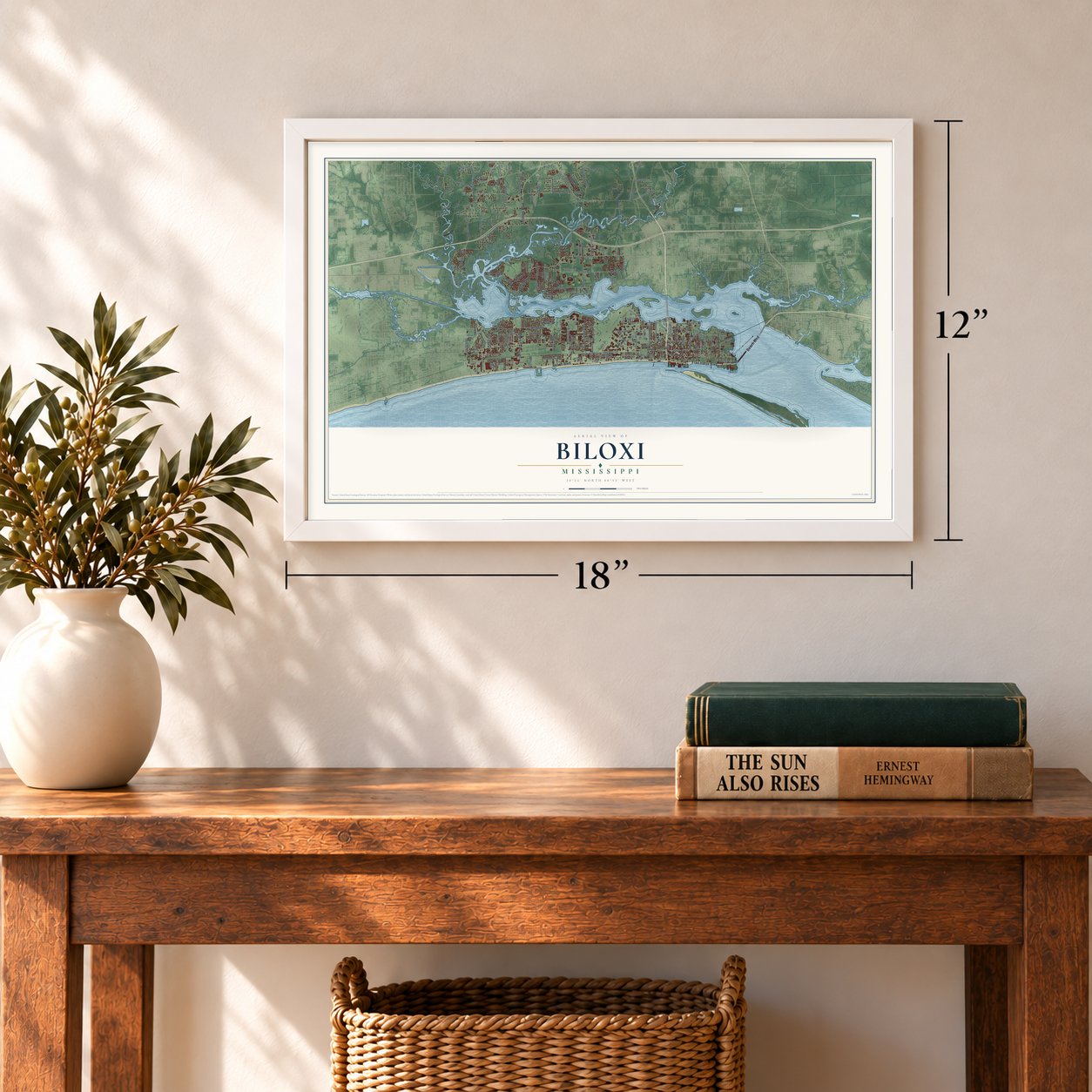
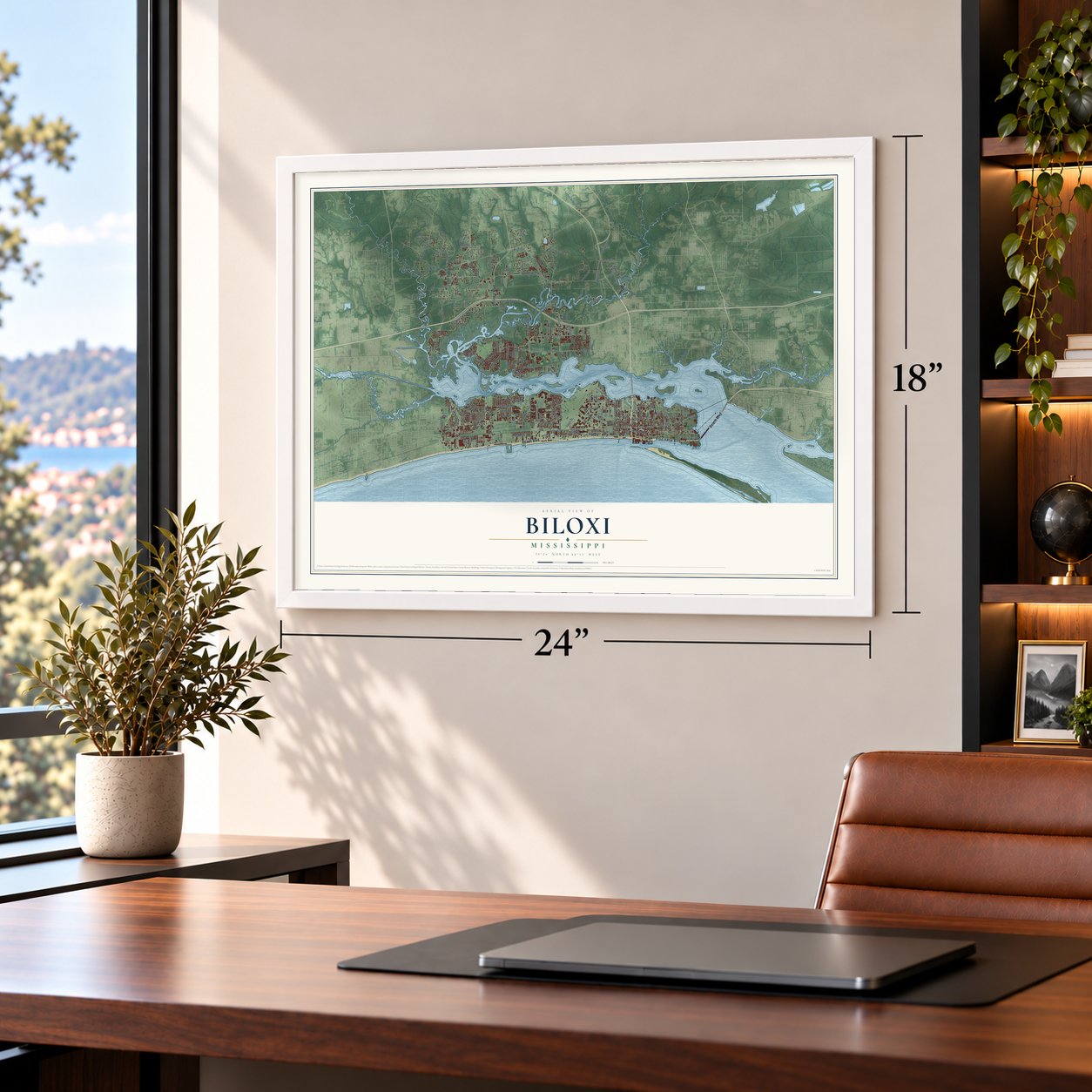
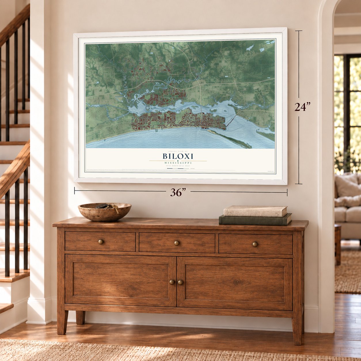
Biloxi, Mississippi Map Art
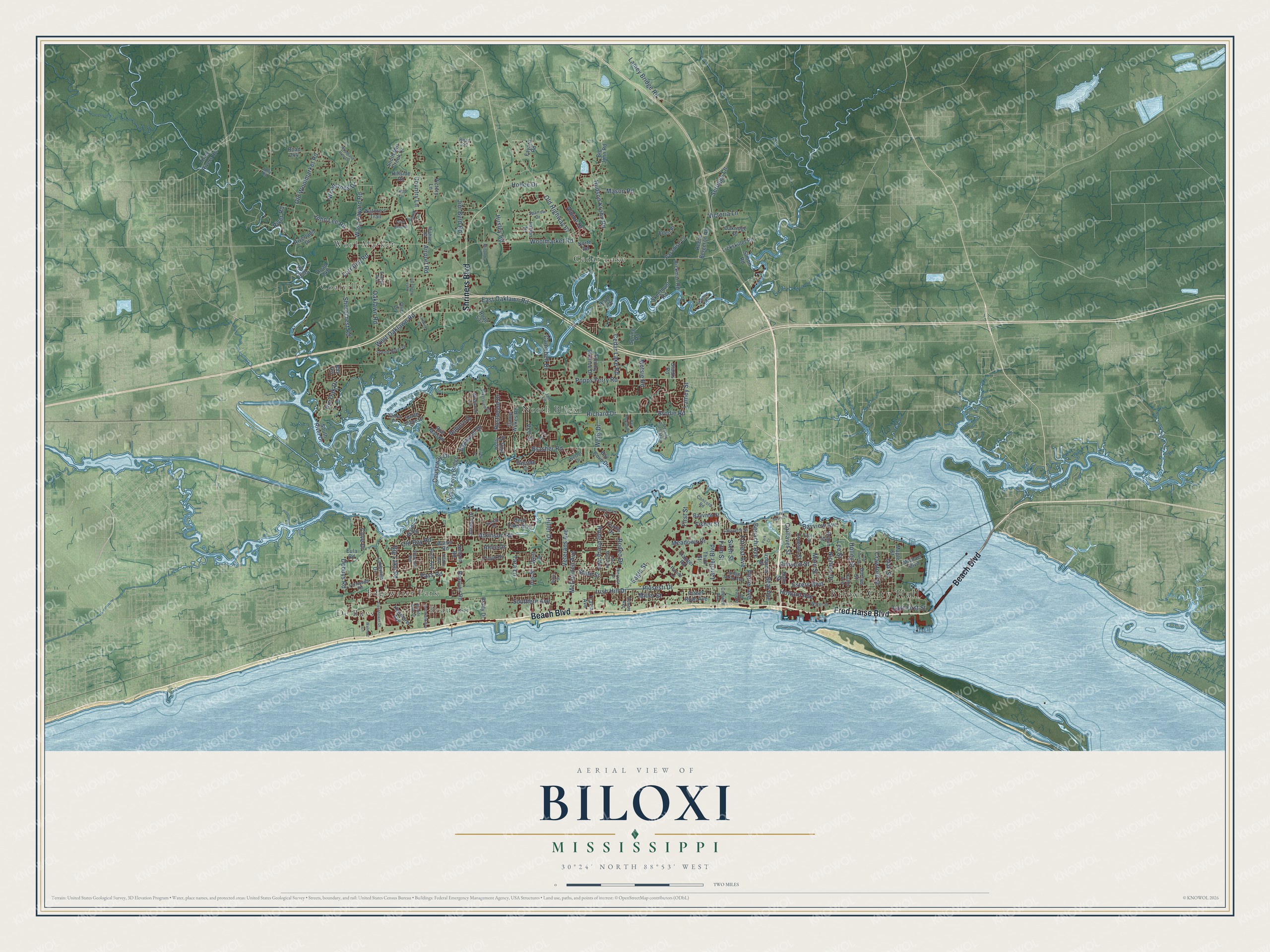
A new map of Biloxi, Mississippi, made in 2026 and printed to order on thick archival matte paper.
12" x 18" Archival Matte Print
A Map of Home. A Work of Art.
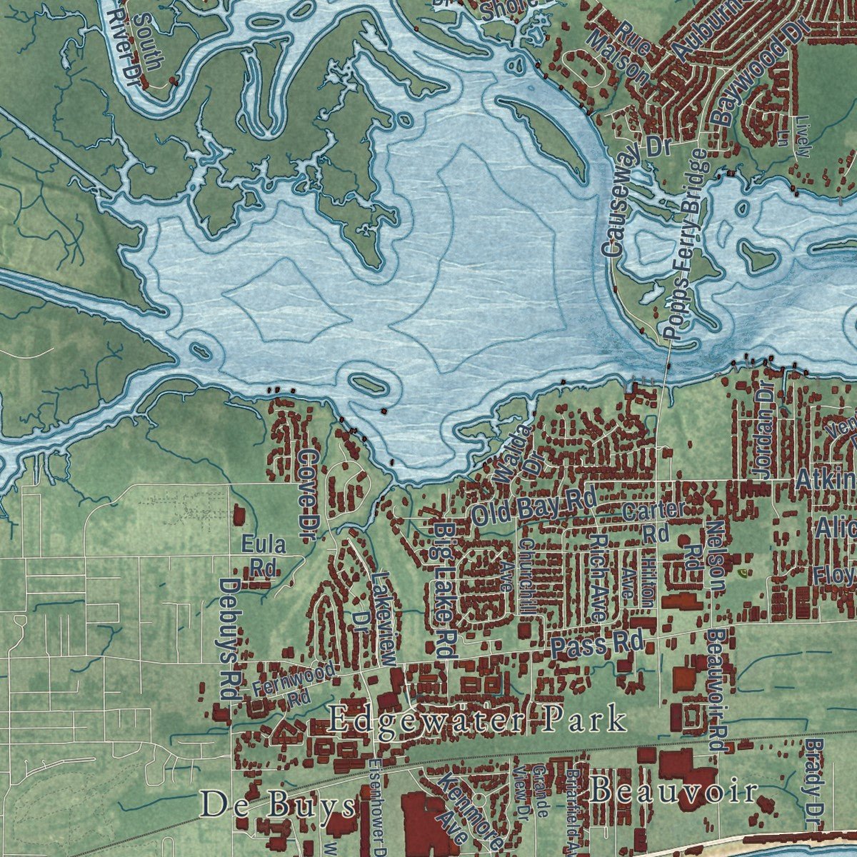
Explore Biloxi, Mississippi from a whole new perspective. Created using aerial imagery and detailed geographic data, this map captures Biloxi building by building, with labeled streets, familiar landmarks, and shaded topographical relief that highlights the natural contours of the landscape.
Combining modern data with the timeless character of a vintage atlas, this map is just as interesting up close as it is beautiful on the wall. Whether you grew up in Biloxi, spent memorable years there, or call it home today, this unique map is a great way to celebrate a place that means something to you. Zoom in on the preview to look for your street, and then order a print to put your memories on the wall.
Three ways to hang it
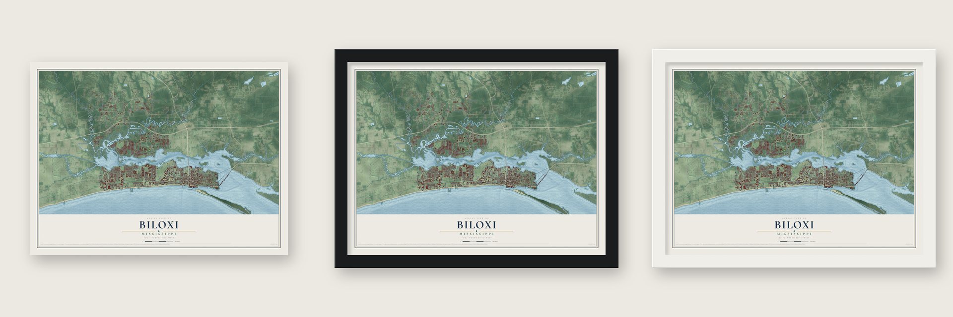
Unframed archival matte, a black wood frame or a white wood frame.
Up close
Geography Worth Displaying
This map was created using accurate cartographic data and authoritative geographic sources, including the U.S. Geological Survey and the Census Bureau. The map brings together terrain, waterways, roads, and building detail. The majority of the streets are labeled, houses are accurately depicted, and the topography is derived from government sources. Combining local data with carefully composed color and shading leads to this beautifully detailed Biloxi artwork for your wall.
Rather than simply showing street outlines, we’ve included as many of the street names as we could reasonably fit on the map while keeping their names legible. Zoom in on the high resolution preview to see exactly what’s on the map. We truly set out to create a statement piece for anyone who loves Biloxi. So whether it’s for you, or a gift for someone you love, we hope this map of Biloxi brings back fond memories.
Read the story behind this map of Biloxi, Mississippi from 2026.

About Biloxi, Mississippi
Biloxi is a city of 49,449 people in Harrison County, on the Mississippi Sound, and it shares the county seat with Gulfport. The city and its bay take their name from the Biloxi Indians, who lived along this coast. In April 1699, French colonists under Pierre Le Moyne d'Iberville built Fort Maurepas across the bay, near today's Ocean Springs, and that first settlement is remembered as Old Biloxi. The ground of the present city was first settled around Fort Louis in 1720, when the capital of French Louisiana moved here from Mobile. Fearing tides and hurricanes, Governor Bienville moved the capital again in 1722, to New Orleans.
Britain held the coast from 1763 to 1779 and Spain from 1779 to 1810, yet most families here kept their French roots. The United States took control in 1811, and Mississippi became a state in 1817. Sea breezes, beaches and an easy trip by water from New Orleans made Biloxi a summer resort before the Civil War, and the railroad later brought even more visitors. In 1881 the first seafood cannery opened, and immigrants from Europe came to work in the plants. New Orleans native Edward Barq invented Barq's Root Beer here in 1898, and by 1930 Biloxi was the state's third-largest city.
“We made choice of this place, merely on account of the road, where the small vessels can go and come at all times, and where we could assist, without fear, with a portion of the crew, in building the fort which I ordered to be constructed there”
- A lighthouse from BaltimoreThe Biloxi Lighthouse was made in Baltimore, Maryland, and shipped south, and it was finished at its site in May 1848. The Mississippi Gulf Coast once had twelve lighthouses, and this is one of the two that survive. Its storm surge marks record the worst hurricanes: 1855, 1906, 1909, 1947, Camille in 1969 and Katrina in 2005. It joined the National Register in 1973.
- Jefferson Davis at BeauvoirIn 1877 Jefferson Davis made the Beauvoir Plantation in Biloxi his home and spent much of his time there writing his memoirs. Davis died in 1889, and afterward the house served as a home for Confederate veterans. It opened as a museum honoring Davis in 1941, and veterans went on living there until the 1950s.
- The Mad Potter of BiloxiIn 1879 George Ohr started a shop in town called Biloxi Art and Novelty Pottery. Between about 1880 and 1910 he made some of the most inventive pottery of his day, which earned him the name the Mad Potter of Biloxi. In 2010 the city gained the Ohr-O'Keefe Museum of Art, a building by Frank Gehry.
- Blessing of the Fleet since 1929Shrimp boats and oyster luggers filled the harbor, and from the 1890s to the 1930s the Biloxi schooner grew into a fishing boat of its own type, built mostly for oystering. Beginning in 1887 the Knights of Labor organized unions in several of the canning factories. In 1929 Biloxi held what seems to be the nation's first blessing of fishing boats. Every year since, before shrimp season, priests bless the fleet and a wreath is dropped for fishermen who died.
- The Biloxi Wade-InsIn 1959 Dr. Gilbert R. Mason, a Black physician, went swimming at a Biloxi beach with seven Black friends, and a city policeman ordered them off the sand. Mason answered by leading protests that came to be called the Biloxi Wade-Ins. In 1960 they were followed by the worst racial riot in Mississippi history, in which ten people died, but the protests finally opened the city's beaches to everyone. Mason also helped found the county's NAACP chapter.
Find your street
Names on the Biloxi map
Every name below is printed on this map. Look for your street, your school, the park where you played, or the pond down the road.
Places and landmarks8
- Biloxi City Hall
- Beauvoir
- Cedar Lake
- Coalville
- De Buys
- Edgewater Park
- North Biloxi
- Wool Market
Streets and roads193
- Beach Boulevard
- Fred Haise Boulevard
- Shriners Boulevard
- Bayview Avenue
- Cedar Lake Road
- Caillavet Street
- Atkinson Road
- Brodie Road
- Richard Drive
- Plosesti Drive
- Old Bay Road
- Popps Ferry Road
- Old Highway 67
- Pass Road
- Lorraine Road
- Woolmarket Road
- John Lee Road
- Irish Hill Drive
- Shorecrest Road
- West Oaklawn Road
- Division Street
- Howard Avenue
- Old Woolmarket Road
- Esters Boulevard
- Hudson Krohn Road
- Jim Byrd Road
- Larcher Boulevard
- Main Street
- Debuys Road
- Brasher Road
Show all 193 streets
- Lamey Bridge Road
- Veterans Avenue
- Oaklawn Road
- Fifth Street
- Baywood Drive
- Rodenberg Avenue
- Benachi Avenue
- Oak Street
- Porter Avenue
- Lee Street
- East Oaklawn Road
- First Street
- Meadows Drive
- Holley Street
- Causeway Drive
- McDonnell Avenue
- Wash Fayard Road
- Rustwood Drive
- Hiller Drive
- Crawford Street
- Eagle Street
- Pin Oak Drive
- Campbell Drive
- Big Lake Road
- Southern Avenue
- Forrest Avenue
- Seruggs Lane
- Seal Avenue
- Fisher Street
- Woodlands Drive
- Vee Street
- Alpine Drive
- River Road
- Motsie Road
- Sixth Street
- East First Street
- Hollee Drive
- Nichols Drive
- Country Lane
- Mason Road
- Lamey Street
- Wells Drive
- Victoria Lane
- Husley Road
- Iris Street
- Airport Road
- Rodeo Drive
- Auburn Drive
- Miller Street
- Tara Lane
- Cove Drive
- Alice Drive
- State Street
- Eula Road
- Father Ryan Avenue
- Camp Wilkes Road
- Maple Street
- Larkin Drive
- Paradise Lane
- Croesus Street
- Carter Road
- Riverland Drive
- Beauvoir Road
- Hickman Road
- Reece Bergeron Road
- Skeethunt Road
- Popps Ferry Bridge
- Victory Lane
- Spring Road
- Holly Hills Drive
- Iroquois Street
- Third Street
- Rich Avenue
- Hanger Road
- Bohn Street
- Starks Road
- Tommy Monroe Drive
- Road 248
- Nature's Trail
- Big John Road
- Lickskillet Road
- Oakridge Place
- South River Drive
- Lakeview Drive
- Bayview Street
- Dorries Street
- Three Rivers Road
- Road 252
- South Shore Drive
- Kenmore Avenue
- Jordan Drive
- Bent Oaks Boulevard
- Bayside Drive
- Road 244
- Michael Boulevard
- South Mill Creek Drive
- Nelson Road
- Fayard Road
- Bay Cove Drive
- Braun Street
- West Drive
- Simon Road
- Rue Maison
- Brady Drive
- Eden Place
- Floyd Drive
- Walda Drive
- Hillside Road
- Travia Avenue
- Road 536
- Road 537
- North Road
- Orin Drive
- Curtis Drive
- Bay Vw
- Keller Avenue
- Destiny Plantation
- Riverview Drive
- Iberville Drive
- Jam Lane
- Water Street
- Lafayette Street
- Scenic River Drive
- Judge Sekul Avenue
- Fernwood Road
- Elder Street
- Sparrow Drive
- Wildwood Lane
- Jolly Road
- Churchill Avenue
- Concord Road
- Wetzel Drive
- Acacia Avenue
- Michael Street
- Venito Drive
- Caldwell Avenue
- Azalea Drive
- Parade Lane
- Evelyn Avenue
- Road 529
- Hilton Avenue
- Shore Drive
- Bay Shore Drive
- Eisenhower Drive
- Vandenberg Drive
- Boss Husley Road
- Woodland Hills Drive
- Audubon Trail
- River Birch Drive
- Baker Street
- Strangi Avenue
- Briarfield Avenue
- Walmart Lane
- Grande View Drive
- Emily Drive
- Poplar Trail
- Landing Court
- Krisandra Lane
- Saint Mary Boulevard
- Bay Breeze Drive
- Park Court
- Lively Lane
- Fern Court
Names are listed as they appear on the printed map. Zoom into the product photos to find them.
The art of mapping a place
How This Map Was Made
Real places. Remarkable detail. Discover the layers that turn geographic data into a map of home.

The view from above
Aerial imagery reveals the character of the land: woodland, open fields, and the patterns of a place.

The shape of the land
Elevation data brings hills, valleys, and subtle changes in the landscape into view.

The details of home
Roads, waterways, and building footprints come together to make the map feel unmistakably local.

Geography becomes art
Considered color, shading, and typography bring the layers together in a map made for your wall.


Process illustrated with Mendon, Massachusetts. Aerial imagery: USDA NAIP. Terrain: USGS 3D Elevation Program. Map details and finished artwork: KNOWOL.
The Details
About This Print
Choose an archival matte print, or a black or white Ayous wood frame. The archival matte print is unframed.
Select your size and finish above to see the matching product image and price.
Materials & Craftsmanship
A contemporary map with the character of a classic atlas, printed on archival matte paper. Optional frames are made from Ayous wood.
Your printed map does not include the watermark shown in the full-map preview.
Shipping & Delivery
Free shipping within the United States. Every print is made to order in the USA.
Buying a gift? Add a note in your cart and we'll include it. We never put prices in the package.
Prints ship within 2 to 3 business days. Allow 7 to 10 days total from ordering for delivery. Timing may vary during holidays or periods of high order volume.
Read our shipping policy.
Returns and damaged prints
Each print is made to order. Change-of-mind refunds are not available after production.
If your print arrives damaged, misprinted or incorrect, contact support@knowol.com within 30 days of receiving it. Include your order number, photos and a description of the issue.
Read our full refund and replacement policy. For questions about your order, email support@knowol.com.
Find your town
Looking for another city?
Find a map of home in our Mississippi collection, or any town in the country.
Nearby
Maps of towns near Biloxi
Know someone from one of these towns? Their map makes a great gift.
 D'Iberville
, Mississippi
From $39.99See the map
 St. Martin
, Mississippi
From $39.99See the map
 Latimer
, Mississippi
From $39.99See the map
More maps nearby: Gulf Hills, Gulfport, Ocean Springs, Gulf Park Estates and Lyman.