
Search for another town



Free U.S. delivery 7 to 10 days after you order
Blacksburg, Virginia Map Art
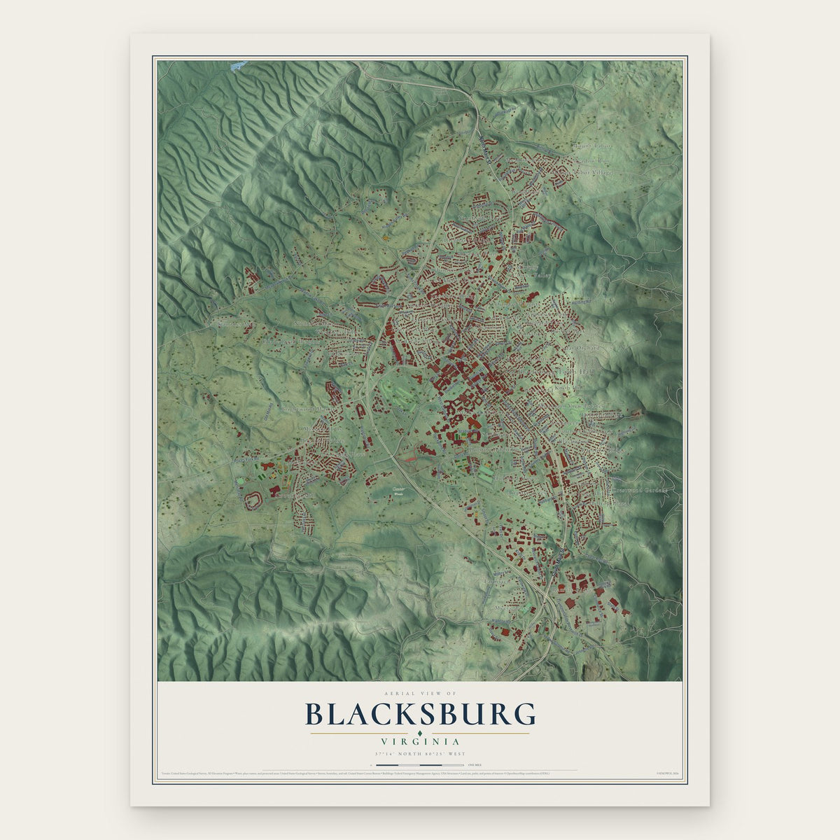
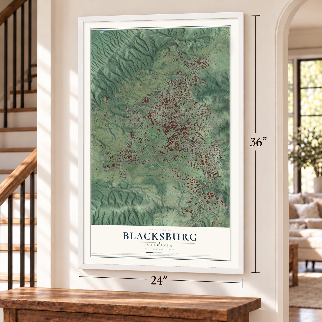
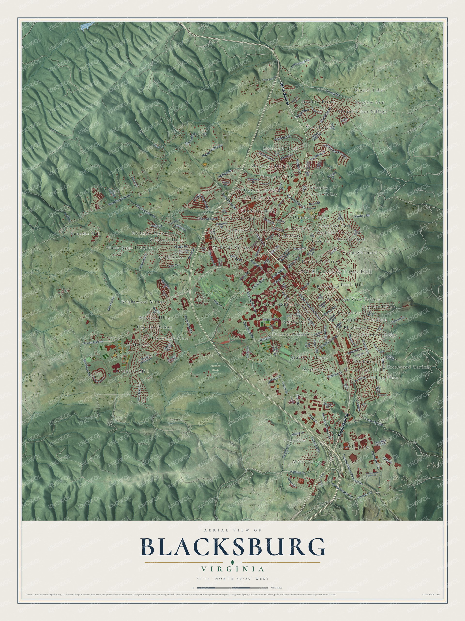
A new map of Blacksburg, Virginia, made in 2026 and printed to order on thick archival matte paper.
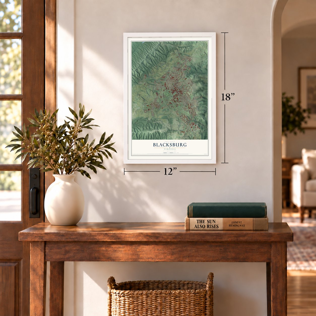
12" x 18" Archival Matte Print
A Map of Home. A Work of Art.
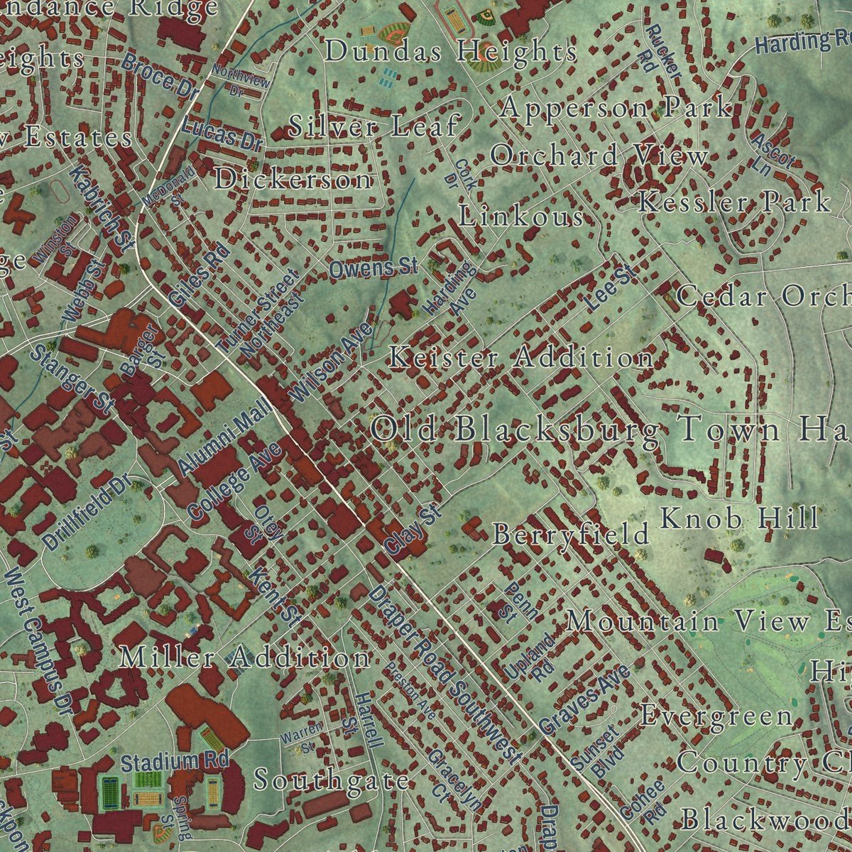
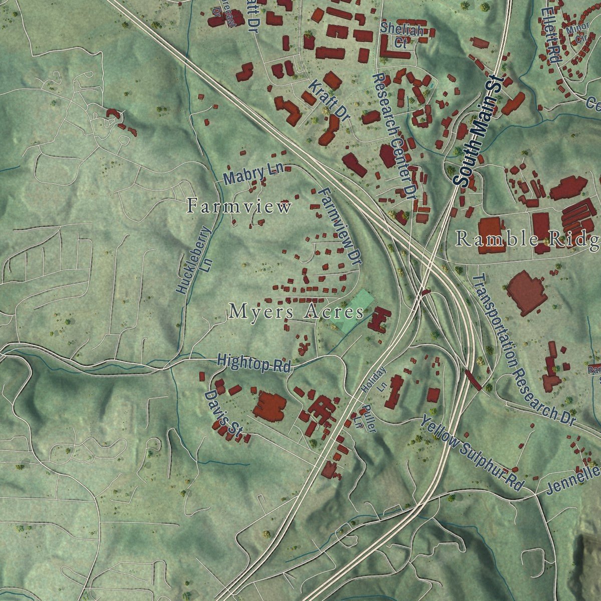
Explore Blacksburg, Virginia from a whole new perspective. Created using aerial imagery and detailed geographic data, this map captures Blacksburg building by building, with labeled streets, familiar landmarks, and shaded topographical relief that highlights the natural contours of the landscape.
Combining modern data with the timeless character of a vintage atlas, this map is just as interesting up close as it is beautiful on the wall. Whether you grew up in Blacksburg, spent memorable years there, or call it home today, this unique map is a great way to celebrate a place that means something to you. Zoom in on the preview to look for your street, and then order a print to put your memories on the wall.
Three ways to hang it
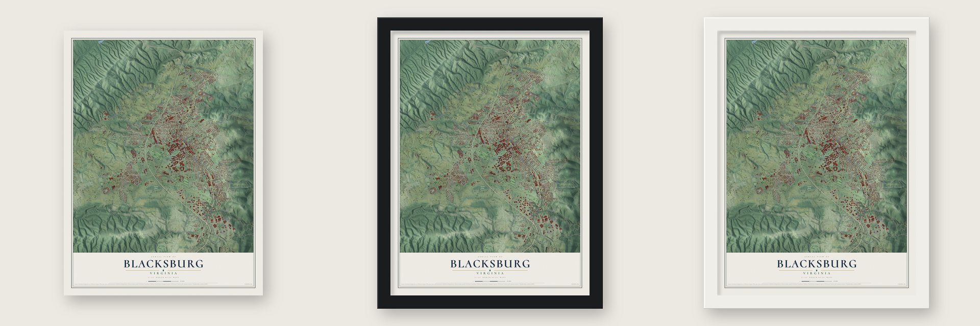
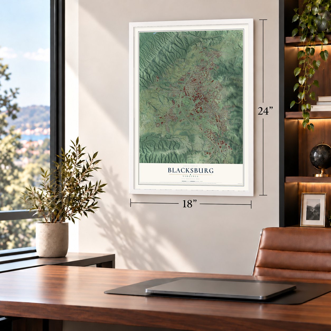
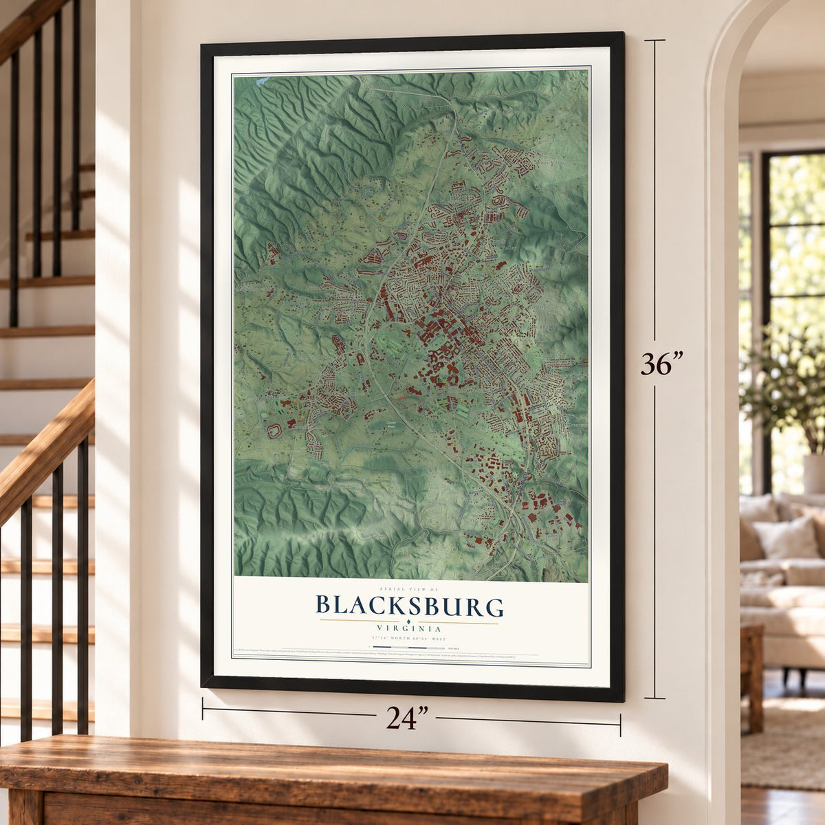
Unframed archival matte, a black wood frame or a white wood frame.
Up close
Geography Worth Displaying
This map was created using accurate cartographic data and authoritative geographic sources, including the U.S. Geological Survey and the Census Bureau. The map brings together terrain, waterways, roads, and building detail. The majority of the streets are labeled, houses are accurately depicted, and the topography is derived from government sources. Combining local data with carefully composed color and shading leads to this beautifully detailed Blacksburg artwork for your wall.
Rather than simply showing street outlines, we’ve included as many of the street names as we could reasonably fit on the map while keeping their names legible. Zoom in on the high resolution preview to see exactly what’s on the map. We truly set out to create a statement piece for anyone who loves Blacksburg. So whether it’s for you, or a gift for someone you love, we hope this map of Blacksburg brings back fond memories.
Read the story behind this map of Blacksburg, Virginia from 2026.

About Blacksburg, Virginia
Blacksburg is a town of 44,826 people in Montgomery County, and it is home to Virginia Tech. In 1772 Samuel Black, whose family had settled in Staunton, bought 600 acres around Draper's Meadow for his sons, John and William. After Samuel died in 1792, the brothers split the land into two halves along the line of today's Draper Road.
In 1797 William Black drew up 16 square blocks of streets and lots on his half, between what are now Clay, Wharton and Jackson streets and Draper Road. He asked the state legislature to make it a town, and Blacksburg was founded on January 13, 1798, on a tract of 38.75 acres. That August 4 he handed the deed to the town trustees, and the town took his name. Blacksburg was incorporated in 1871, with Thomas W. Jones as its first mayor.
- Draper's Meadow, 1755By 1748 the Draper and Ingles families had homes at Draper's Meadow, between today's campus and Hethwood. The French and Indian War reached the outpost in July 1755, when Shawnee warriors armed by France attacked its twenty or so settlers. About four died, and five were taken to Kentucky, Mary Draper Ingles among them; she later escaped. By the war's end nobody lived there. A memorial to the attack stands on a bridge near the Duck Pond.
- Smithfield, about 1774Colonel William Preston built Smithfield Plantation around 1774 on the original Draper's Meadow site, close to where the Duck Pond is now. After a renovation, the house reopened in 1964.
- A college on Solitude farmOn October 2, 1872, Virginia Agricultural and Mechanical College opened its doors with three teachers on the 250 acre Solitude farm. The farmhouse, Solitude, grew into a Greek Revival house. It served the college as an infirmary from 1882 to 1886 and is the oldest building on campus. The college later became Virginia Polytechnic Institute and is now Virginia Tech, the state's land-grant university.
- The HuckleberryThe first automobile passed through town in 1901. Three years later, trains began arriving from Christiansburg on the Virginia Anthracite & Coal Railroad, which people came to call the Huckleberry. The last freight train reached the Blacksburg depot on June 30, 1966, and within 24 hours the depot had closed and the tracks were pulled up. Residents spent years pushing for a trail on the old right-of-way, and the Huckleberry Trail opened on December 1, 1998.
- The county's first bankBlacksburg Savings Institution, founded in 1849, was the first bank in Montgomery County, and the town's first newspaper, the Montgomery Messenger, printed its first issue in 1869. As traffic grew, the town voted in January 1913 to stop letting cows roam its streets. In 1919 its first filling station opened, the only one between Roanoke and Bluefield, West Virginia.
Find your street
Names on the Blacksburg map
Every name below is printed on this map. Look for your street, your school, the park where you played, or the pond down the road.
Places and landmarks59
- Old Blacksburg Town Hall
- Mount Tabor
- Meadow Run
- Myers Acres
- Ramble Ridge
- Center Woods
- Airport Acres
- Alleghany Heights
- Apperson Park
- Berryfield
- Blackwood
- Brightwood Manor
Show all 59 places
- Carriage Hill
- Cedar Orchard
- Chowning Place
- Clover Valley
- Country Club Park
- Crestwood Gardens
- Dickerson
- Dundas Heights
- Dunton Addition
- Evergreen
- Farmview
- Glade Road Heights
- Gladewood
- Hethwood
- Highland Park
- Hilltop Plaza
- Hubbard Haven
- Hunters Ridge
- Kanodes Mill
- Keister Addition
- Kessler Park
- Knob Hill
- Linkous
- Longview Estates
- McBryde Village
- Meadow Brook
- Miller Addition
- Mission Hills
- Mount Tabor Village
- Mountain View Estates
- Murphy
- Nicholas Manor
- Northside Park
- Orchard View
- Patrick Henry Place
- Pheasant Run
- Piedmont
- Pilgrims Pointe
- Rainbow Ridge
- Silver Leaf
- Snidow Heights
- Southgate
- Stroubles Mill
- Sundance Ridge
- University Place
- Westover Hills
- Woodbine
Streets and roads162
- South Main Street
- North Main Street
- Research Center Drive
- Hightop Road
- Ellett Road
- Plantation Road
- Cedar Run Road
- Harding Road
- Yellow Sulphur Road
- Hubbard Street
- Shadow Lake Road
- Draper Road Southwest
- Duckpond Road
- Prices Fork Road
- Meadowbrook Drive
- Glade Road
- Toms Creek Road
- Patrick Henry Drive
- Tall Oaks Drive
- Bishop Road
- Giles Road
- Dairy Road
- Givens Lane
- Old Mill Road
- Broce Drive
- Clay Street
- Airport Road
- Lee Street
- Redbud Road
- Drillfield Drive
Show all 162 streets
- West Campus Drive
- Grissom Lane
- Transportation Research Drive
- Graves Avenue
- Lucas Drive
- Woodbine Drive
- Hidden Valley Road
- Farmview Drive
- Oak Lane
- Commerce Street
- Kraft Drive
- Alumni Mall
- Owens Street
- Jennelle Road
- Heartwood Crossing
- Boxwood Drive
- Primrose Drive
- Merrimac Road
- Stadium Road
- Vinyard Avenue
- Deerfield Drive
- Mateer Circle
- Village Way North
- Pratt Drive
- Country Club Drive
- Stanger Street
- Shelor Lane
- Perry Street
- Red Maple Drive
- Northside Drive
- Whipple Drive
- Oriole Drive
- Draper Road
- Kabrich Street
- Kent Street
- Davis Street
- Ardmore Street
- Smoot Drive
- College Avenue
- Wilson Avenue
- Sage Lane
- Mabry Lane
- Karr Lane
- North Drive
- Burruss Drive
- Alice Drive
- State Street
- Highland Circle
- Mount Tabor Road
- Harding Avenue
- Industrial Park Road
- Village Way South
- Turner Street Northeast
- Cedar Hill Drive
- Heather Drive
- Seminole Drive
- Southgate Drive
- Old Farm Road
- Park Drive
- Penn Street
- Huckleberry Lane
- Brook Circle
- Macarthur Street
- Ascot Lane
- Upland Road
- Barger Street
- Sunset Boulevard
- Harrell Street
- Cohee Road
- Lora Lane
- Fairfax Road
- Treetop Ridge Road
- Webb Street
- Tech Center Drive
- Gracelyn Court
- Sheliah Court
- Rucker Road
- Innovation Drive
- Old Glade Road
- Otey Street
- Lakewood Drive
- Elizabeth Drive
- Hunters Mill Road
- Mount Vernon Lane
- Dunton Drive
- Seneca Drive
- Georgia Street
- Tee Street
- Derbe Lane
- Lynn Drive
- Neil Street
- The Link
- Farmingdale Lane
- Scenic Ridge Circle
- Spring Street
- Sunrise Drive
- Nellies Cave Road
- Cork Drive
- Hardwick Street
- Lark Lane
- Stroubles Creek Road
- Winston Street
- Henry Lane
- Greenwood Drive
- Turning Leaf Lane
- Puller Lane
- Edison Lane
- Hidden Nest Drive
- McEver Road
- South Hill Street
- University City Boulevard
- Craig Drive
- Preston Avenue
- Landsdowne Street
- Cherokee Drive
- Jim Meadows Drive
- Northview Drive
- Partridge Drive Southeast
- Maywood Street
- Glen Cove Lane
- Gustafson Avenue
- Brighton Court
- Warren Street
- Robin Road
- Grove Avenue
- Minor Circle
- McDonald Street
- Holiday Lane
- Forecast Drive
- King Street
- Claytor Square
- Doe Run
Names are listed as they appear on the printed map. Zoom into the product photos to find them.
The art of mapping a place
How This Map Was Made
Real places. Remarkable detail. Discover the layers that turn geographic data into a map of home.

The view from above
Aerial imagery reveals the character of the land: woodland, open fields, and the patterns of a place.

The shape of the land
Elevation data brings hills, valleys, and subtle changes in the landscape into view.

The details of home
Roads, waterways, and building footprints come together to make the map feel unmistakably local.

Geography becomes art
Considered color, shading, and typography bring the layers together in a map made for your wall.


Process illustrated with Mendon, Massachusetts. Aerial imagery: USDA NAIP. Terrain: USGS 3D Elevation Program. Map details and finished artwork: KNOWOL.
The Details
About This Print
Choose an archival matte print, or a black or white Ayous wood frame. The archival matte print is unframed.
Select your size and finish above to see the matching product image and price.
Materials & Craftsmanship
A contemporary map with the character of a classic atlas, printed on archival matte paper. Optional frames are made from Ayous wood.
Your printed map does not include the watermark shown in the full-map preview.
Shipping & Delivery
Free shipping within the United States. Every print is made to order in the USA.
Buying a gift? Add a note in your cart and we'll include it. We never put prices in the package.
Prints ship within 2 to 3 business days. Allow 7 to 10 days total from ordering for delivery. Timing may vary during holidays or periods of high order volume.
Read our shipping policy.
Returns and damaged prints
Each print is made to order. Change-of-mind refunds are not available after production.
If your print arrives damaged, misprinted or incorrect, contact support@knowol.com within 30 days of receiving it. Include your order number, photos and a description of the issue.
Read our full refund and replacement policy. For questions about your order, email support@knowol.com.
Find your town
Looking for another city?
Find a map of home in our Virginia collection, or any town in the country.
Nearby
Maps of towns near Blacksburg
Know someone from one of these towns? Their map makes a great gift.
 Merrimac
, Virginia
From $39.99See the map
 Prices Fork
, Virginia
From $39.99See the map
 Christiansburg
, Virginia
From $39.99See the map
More maps nearby: Belview, Plum Creek, Fairlawn, Shawsville and Belspring.