
Search for another town





Free U.S. delivery 7 to 10 days after you order
Christiansburg, Virginia Map Art
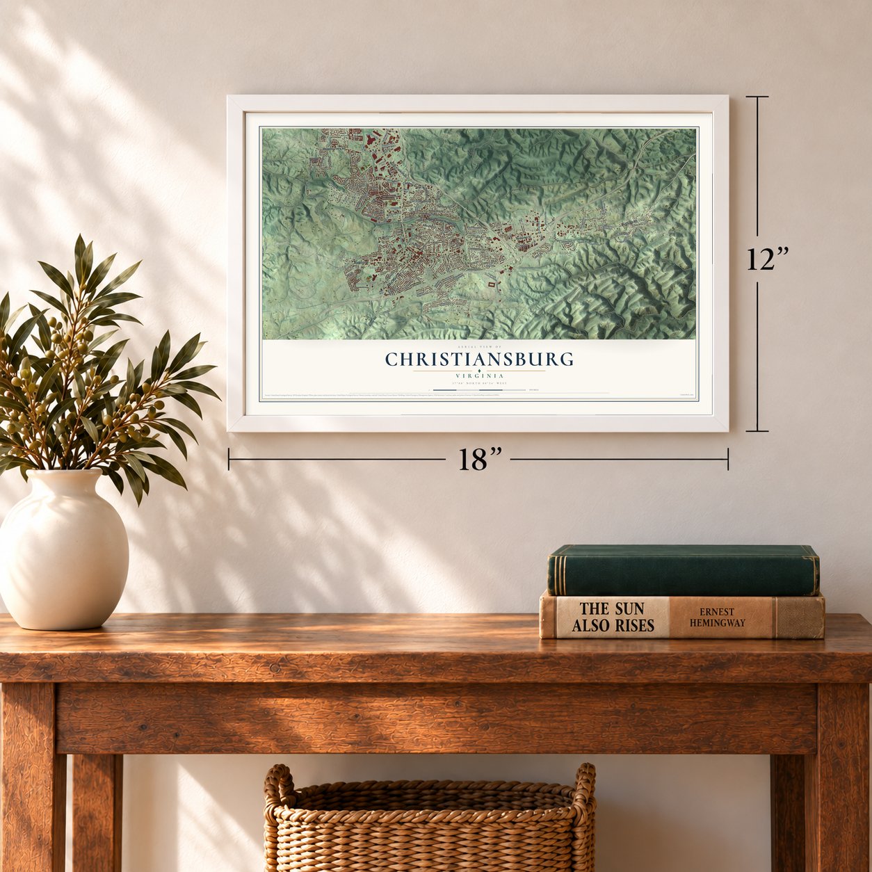
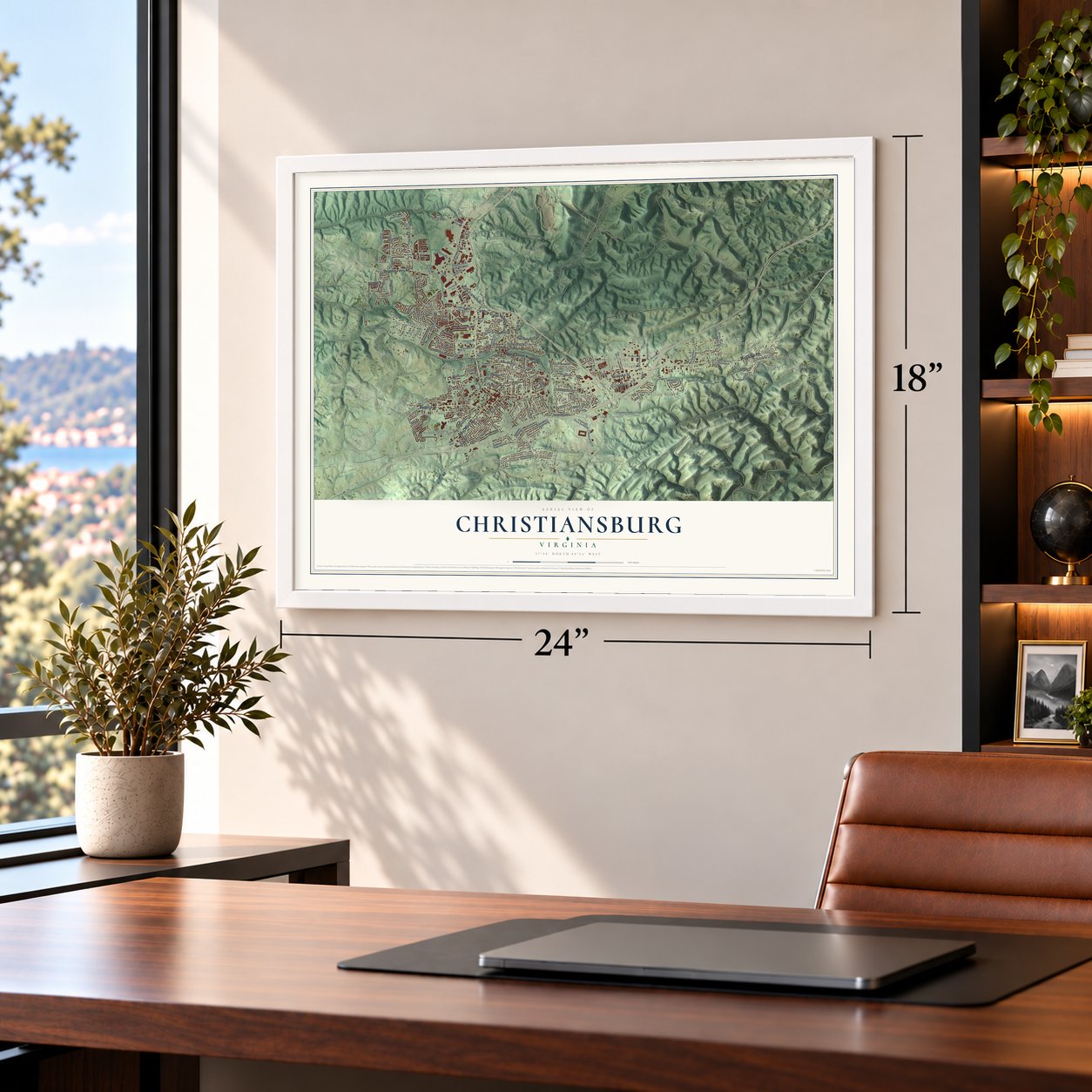
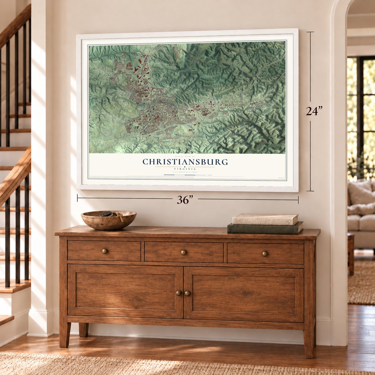
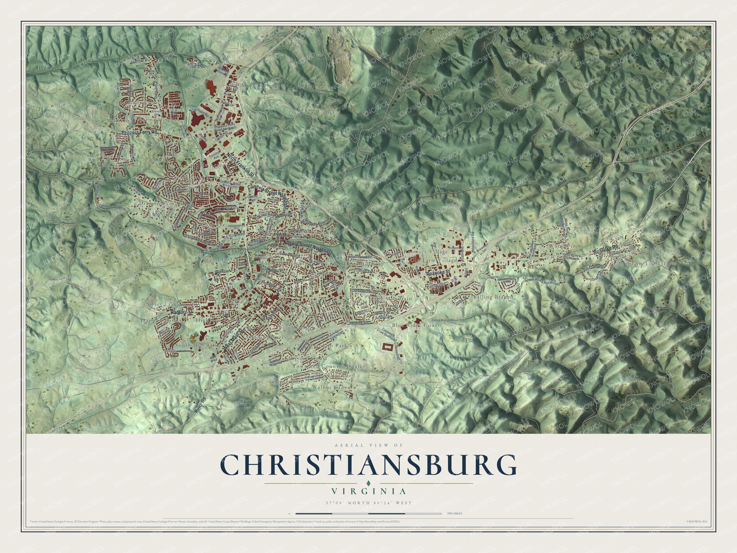
A new map of Christiansburg, Virginia, made in 2026 and printed to order on thick archival matte paper.
12" x 18" Archival Matte Print
A Map of Home. A Work of Art.
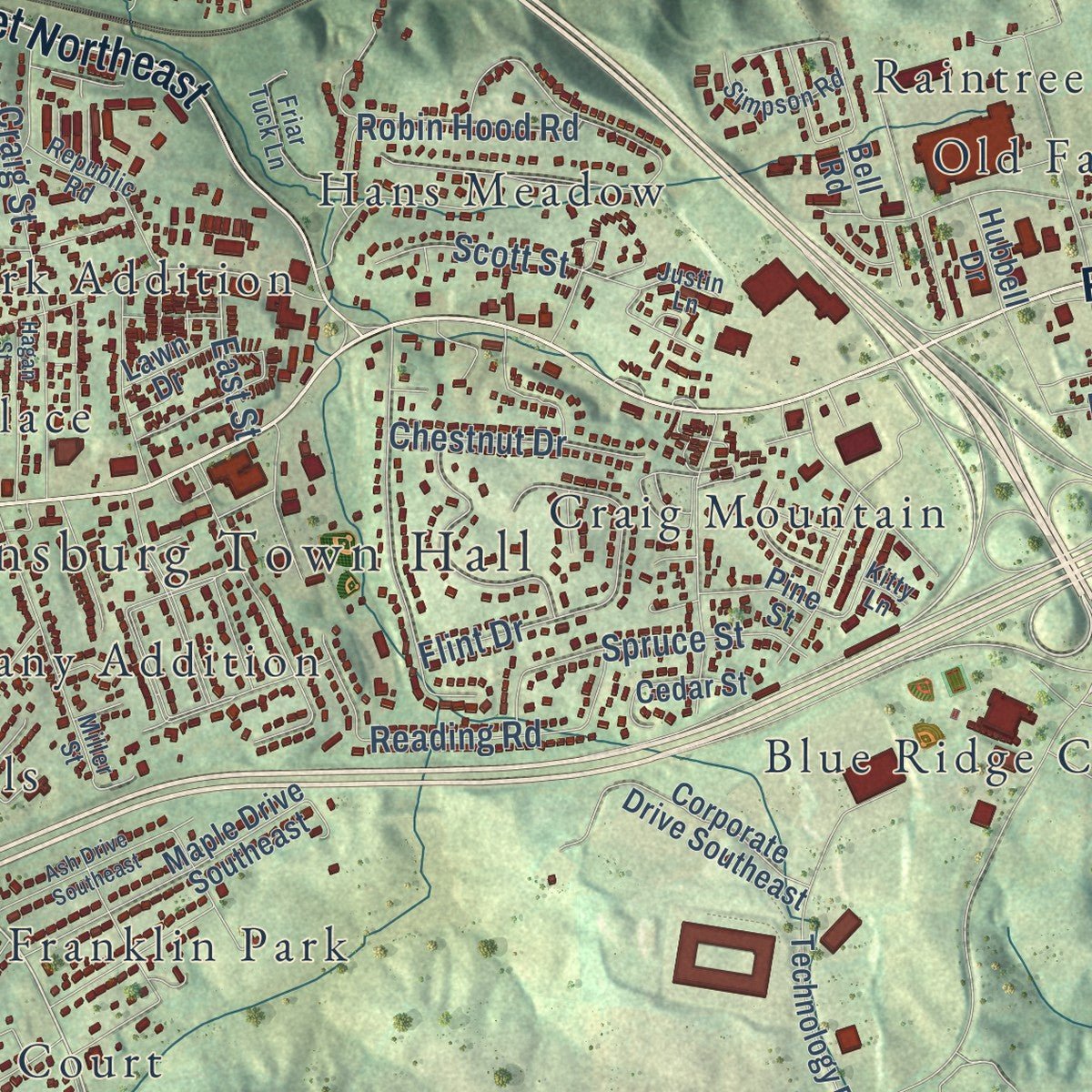
Explore Christiansburg, Virginia from a whole new perspective. Created using aerial imagery and detailed geographic data, this map captures Christiansburg building by building, with labeled streets, familiar landmarks, and shaded topographical relief that highlights the natural contours of the landscape.
Combining modern data with the timeless character of a vintage atlas, this map is just as interesting up close as it is beautiful on the wall. Whether you grew up in Christiansburg, spent memorable years there, or call it home today, this unique map is a great way to celebrate a place that means something to you. Zoom in on the preview to look for your street, and then order a print to put your memories on the wall.
Three ways to hang it
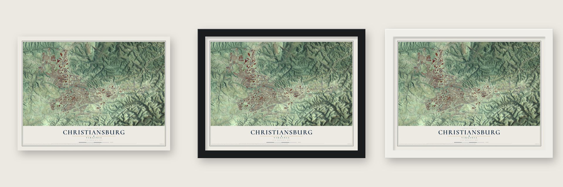
Unframed archival matte, a black wood frame or a white wood frame.
Up close
Geography Worth Displaying
This map was created using accurate cartographic data and authoritative geographic sources, including the U.S. Geological Survey and the Census Bureau. The map brings together terrain, waterways, roads, and building detail. The majority of the streets are labeled, houses are accurately depicted, and the topography is derived from government sources. Combining local data with carefully composed color and shading leads to this beautifully detailed Christiansburg artwork for your wall.
Rather than simply showing street outlines, we’ve included as many of the street names as we could reasonably fit on the map while keeping their names legible. Zoom in on the high resolution preview to see exactly what’s on the map. We truly set out to create a statement piece for anyone who loves Christiansburg. So whether it’s for you, or a gift for someone you love, we hope this map of Christiansburg brings back fond memories.
Read the story behind this map of Christiansburg, Virginia from 2026.

About Christiansburg, Virginia
Christiansburg is a town of 23,348 people and the seat of Montgomery County, high on the Eastern Continental Divide. The land was once called Hans Meadow, after a Dutch priest known as Friar Hans. Taverns and rest stops grew up here along the Great Wagon Road. On November 10, 1792, the Virginia General Assembly made it a town of 1.1 square miles and named it for Colonel William Christian, a pioneer, county justice and legislator whose wife's brother was Patrick Henry.
The town was incorporated on January 7, 1833, and by 1840 it had 400 people. In 1864 Union troops burned every building at the Christiansburg Depot but the passenger station, and after the war the town shrank from 864 people in 1870 to 659 in 1900. Then the Norfolk and Western depot became the county's main shipping point, and by 1910 Christiansburg had 1,568 people. The depot village became the town of Cambria in 1906 and later merged back into Christiansburg.
- The duel of 1808On May 9, 1808, Thomas Lewis and John McHenry faced each other with rifles in downtown Christiansburg, and both men died. The deaths led Virginia to pass the Barbour Bill in 1810, which banned dueling in the state. The surgeon at the scene, Dr. John Floyd, lived in town and later became governor of Virginia.
- Booker T. Washington's schoolCaptain Charles S. Schaeffer of the Freedmen's Bureau started a school for Black children on Zion Hill in 1866. Booker T. Washington led it from 1896 until he died in 1915, adding training in the trades. It moved to the Lattimer Plantation in 1898 and grew to 14 buildings on 185 acres. No Black high school in southwestern Virginia came before it, and it closed in 1966 with desegregation. The Old Christiansburg Industrial Institute is on the National Register.
- Boone, Crockett and ClarkA 1774 warrant in the courthouse ordered Daniel Boone's arrest for debt, but he had already left for Kentucky, and he paid it back later. Davy Crockett spent 18 months working at John Snider's hat shop on West Main Street. William Clark lived at 109 E. Main Street, the Montague home, where Union General George B. Stoneman's men were staying when word came of Lee's surrender.
- A mural and a drive-inDuring the Depression, the Christiansburg post office received a mural, Great Road, finished by John DeGroot in 1938. That post office is now on the National Register. The Starlite Drive-In opened in 1953 and still shows movies, one of the few drive-in theaters left in the country.
Find your street
Names on the Christiansburg map
Every name below is printed on this map. Look for your street, your school, the park where you played, or the pond down the road.
Places and landmarks42
- Christiansburg Town Hall
- Cumberland Forest
- Mountain Top Estates
- Blake Forest
- Alleghany Addition
- Apple Acres
- Atkinson Acres
- Belmont
- Belmont Estates
- Belmont Farms
- Beverly Hills
- Blue Ridge Court
Show all 42 places
- Cambria
- Canterbury
- Carma Heights
- Craig Mountain
- Diamond Pointe
- East Park Addition
- Echo Hills
- Edgewood
- Falling Branch
- Franklin Park
- Hans Meadow
- Harmon Forest
- Henley Place
- Highview Terrace
- Johnson Heights
- Kingston Court
- La Plateau
- Lee-Hi Court
- Lester Place
- Midway Heights
- Old Farm Village
- Raintree Village
- Silver Lake Heights
- Sleepy Hollow
- South Hill Park
- Town and Country Estates
- Victory Heights
- Vista Via
- Walnut Grove
- White Pine
Streets and roads141
- North Franklin Street
- West Main Street
- Cambria Street Northeast
- Roanoke Street
- Peppers Ferry Road
- Radford Street
- Depot Street Northeast
- Roanoke Road
- Riner Road
- Tower Road Southeast
- Stafford Drive
- State Route T-700
- College Street
- Montgomery Street
- New River Road
- Ellett Road Northeast
- Park Street
- Scattergood Drive Northwest
- George Edward Via
- Reading Road
- Church Street
- Virginian Drive
- Second Street
- Albert Lane
- Life Drive
- Flint Drive
- Wades Lane
- Craig Street
- Howery Street
- Scott Street
Show all 141 streets
- Oak Tree Boulevard
- John Lemley Lane
- North High Street
- Murray Street
- Houchins Road
- Arbor Drive
- Robin Hood Road
- Spruce Street
- Gold Leaf Drive
- Walnut Drive
- Carson Drive
- Industrial Drive
- School Lane
- Alder Lane
- Fairview Street
- Chestnut Drive
- Orchard Street
- Dow Street
- Lions Drive
- Sapphire Avenue
- Kays Drive
- Laurel Street
- Stuart Street
- Liberty Via
- East Street
- Giles Drive
- Cambria Street Northwest
- Chrisman Mill Road
- Walters Drive
- Lucas Street Northeast
- State Route T-661
- White Pine Drive Northeast
- New Village Drive
- Summit Ridge Road
- Peppers Ferry Road Northeast
- East Main Street
- Betty Drive
- Dunlap Drive Northeast
- Maple Drive Southeast
- Corporate Drive Southeast
- Cheverly Road
- Conston Avenue
- Technology Drive
- Kirby Drive Southeast
- Central Avenue
- Midway Plaza Drive
- Robin Road
- Burley Lane
- Brammer Lane
- Cedar Street
- Tarrytown Road
- Alexa Lane Northwest
- Bradley Drive
- Jarrett Drive
- South Hill Drive
- Ruby Court
- Pelham Lane
- Pine Street
- Mud Pike
- Hubbell Drive
- Juniper Drive
- Franklin Parke Court
- Bristol Drive
- Citrine Court
- Lawn Drive
- Lynn Drive
- Patriot Way
- Holmes Street
- Sara Street
- Pear Street
- Bell Road
- Diana Drive Northwest
- Independence Boulevard
- Sleepy Hollow Road
- Mill Lane Northeast
- Falling Branch Road
- Market Street Northeast
- Overland Drive Southwest
- Quin West Stuart Boulevard
- Miller Street
- Atkinson Road
- Brown Street Northeast
- Teel Street
- State Route T-651
- Prospect Drive
- Republic Road
- Talus Lane
- Friar Tuck Lane
- Highview Street
- Simpson Road
- Newcomb Street
- Merrimac Road
- Redwood Drive
- Water Street
- Light Street
- Dudley Drive
- Almetta Avenue
- Justin Lane
- Kitty Lane
- Peach Street
- Glade Drive Southeast
- Diamond Avenue
- State Route T-801
- Hillcrest Drive
- Ash Drive Southeast
- Hagan Street
- Ponderosa Drive
- Diamond Crest Court
- Madison Drive Southeast
- Tula Circle
- Perry Street
Names are listed as they appear on the printed map. Zoom into the product photos to find them.
The art of mapping a place
How This Map Was Made
Real places. Remarkable detail. Discover the layers that turn geographic data into a map of home.

The view from above
Aerial imagery reveals the character of the land: woodland, open fields, and the patterns of a place.

The shape of the land
Elevation data brings hills, valleys, and subtle changes in the landscape into view.

The details of home
Roads, waterways, and building footprints come together to make the map feel unmistakably local.

Geography becomes art
Considered color, shading, and typography bring the layers together in a map made for your wall.


Process illustrated with Mendon, Massachusetts. Aerial imagery: USDA NAIP. Terrain: USGS 3D Elevation Program. Map details and finished artwork: KNOWOL.
The Details
About This Print
Choose an archival matte print, or a black or white Ayous wood frame. The archival matte print is unframed.
Select your size and finish above to see the matching product image and price.
Materials & Craftsmanship
A contemporary map with the character of a classic atlas, printed on archival matte paper. Optional frames are made from Ayous wood.
Your printed map does not include the watermark shown in the full-map preview.
Shipping & Delivery
Free shipping within the United States. Every print is made to order in the USA.
Buying a gift? Add a note in your cart and we'll include it. We never put prices in the package.
Prints ship within 2 to 3 business days. Allow 7 to 10 days total from ordering for delivery. Timing may vary during holidays or periods of high order volume.
Read our shipping policy.
Returns and damaged prints
Each print is made to order. Change-of-mind refunds are not available after production.
If your print arrives damaged, misprinted or incorrect, contact support@knowol.com within 30 days of receiving it. Include your order number, photos and a description of the issue.
Read our full refund and replacement policy. For questions about your order, email support@knowol.com.
Find your town
Looking for another city?
Find a map of home in our Virginia collection, or any town in the country.
Nearby
Maps of towns near Christiansburg
Know someone from one of these towns? Their map makes a great gift.
 Merrimac
, Virginia
From $39.99See the map
 Riner
Riner, Virginia
From $39.99See the map
 Plum Creek
, Virginia
From $39.99See the map
More maps nearby: Belview, Blacksburg, Prices Fork, Fairlawn and Shawsville.