
Search for another town




Free U.S. delivery 7 to 10 days after you order
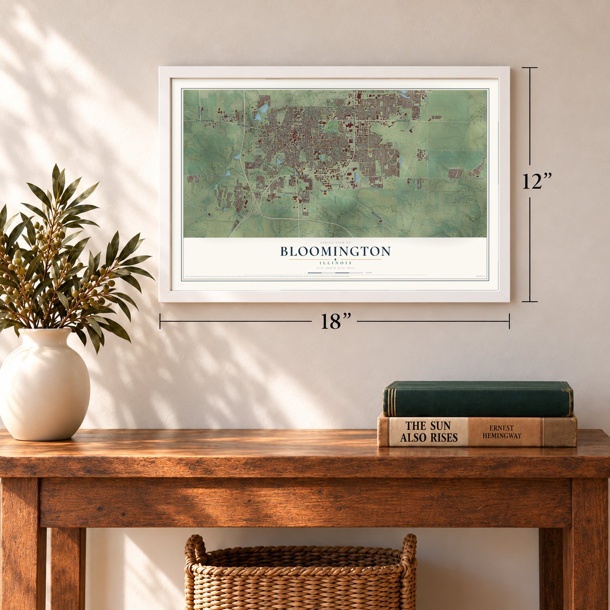
Bloomington, Illinois Map Art
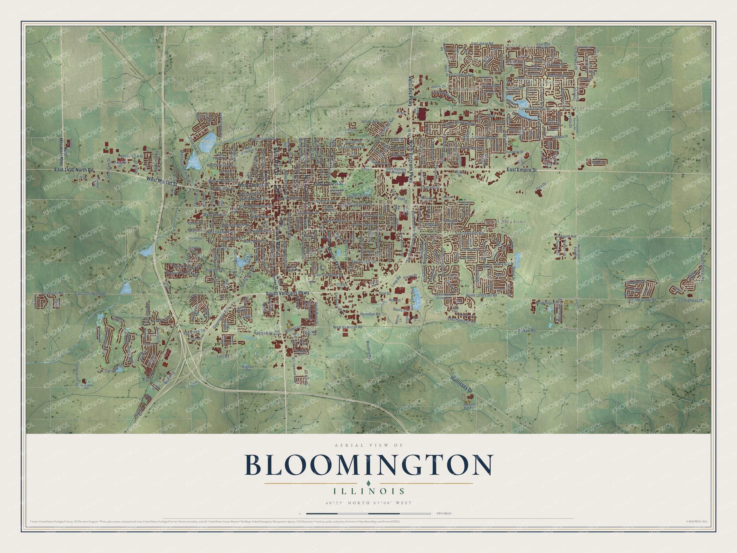
A new map of Bloomington, Illinois, made in 2026 and printed to order on thick archival matte paper.
12" x 18" Archival Matte Print
A Map of Home. A Work of Art.
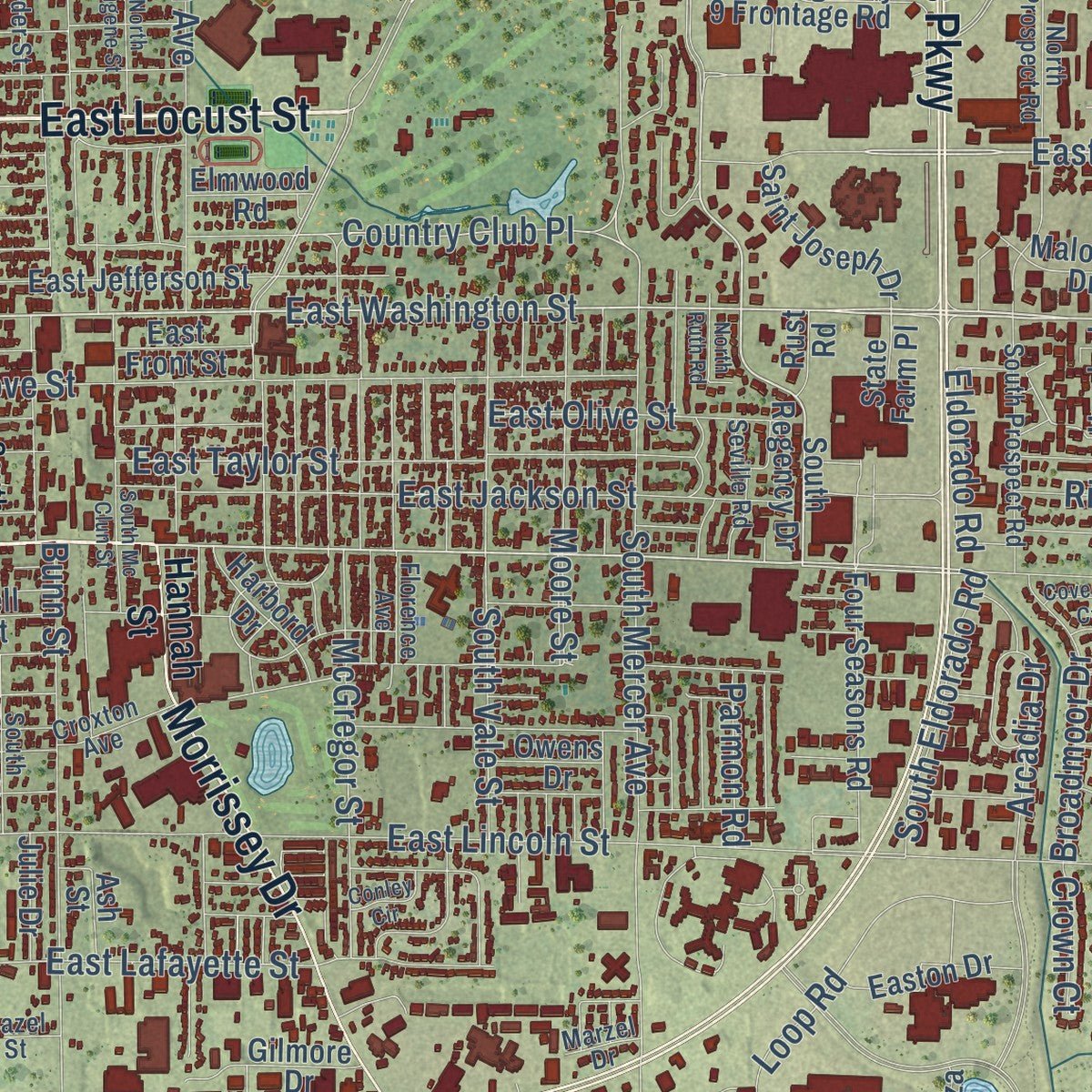
Explore Bloomington, Illinois from a whole new perspective. Created using aerial imagery and detailed geographic data, this map captures Bloomington building by building, with labeled streets, familiar landmarks, and shaded topographical relief that highlights the natural contours of the landscape.
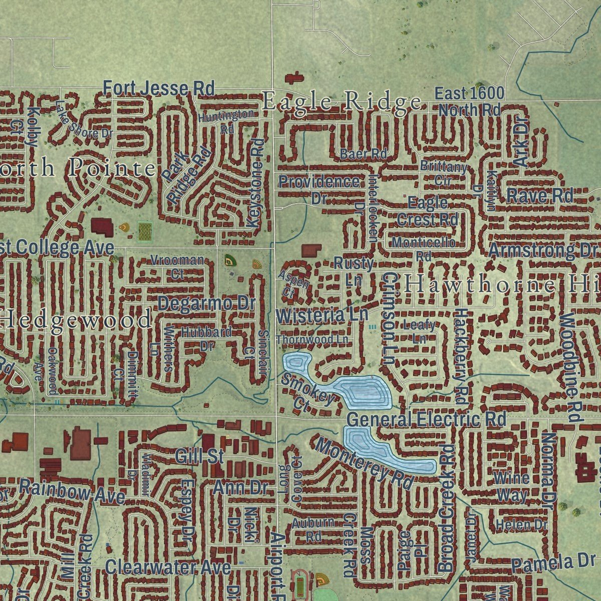
Combining modern data with the timeless character of a vintage atlas, this map is just as interesting up close as it is beautiful on the wall. Whether you grew up in Bloomington, spent memorable years there, or call it home today, this unique map is a great way to celebrate a place that means something to you. Zoom in on the preview to look for your street, and then order a print to put your memories on the wall.
Three ways to hang it
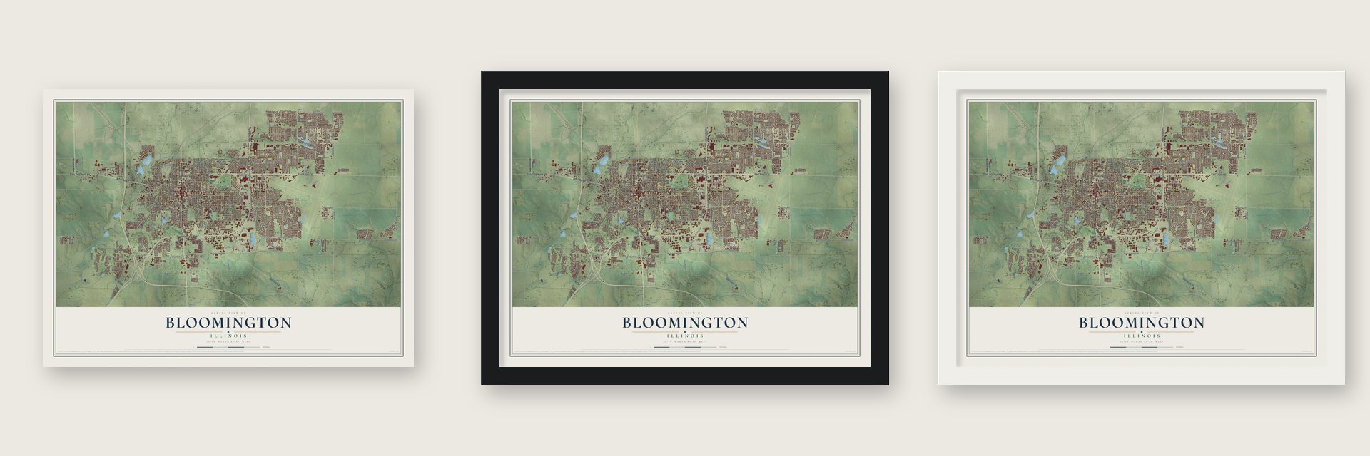
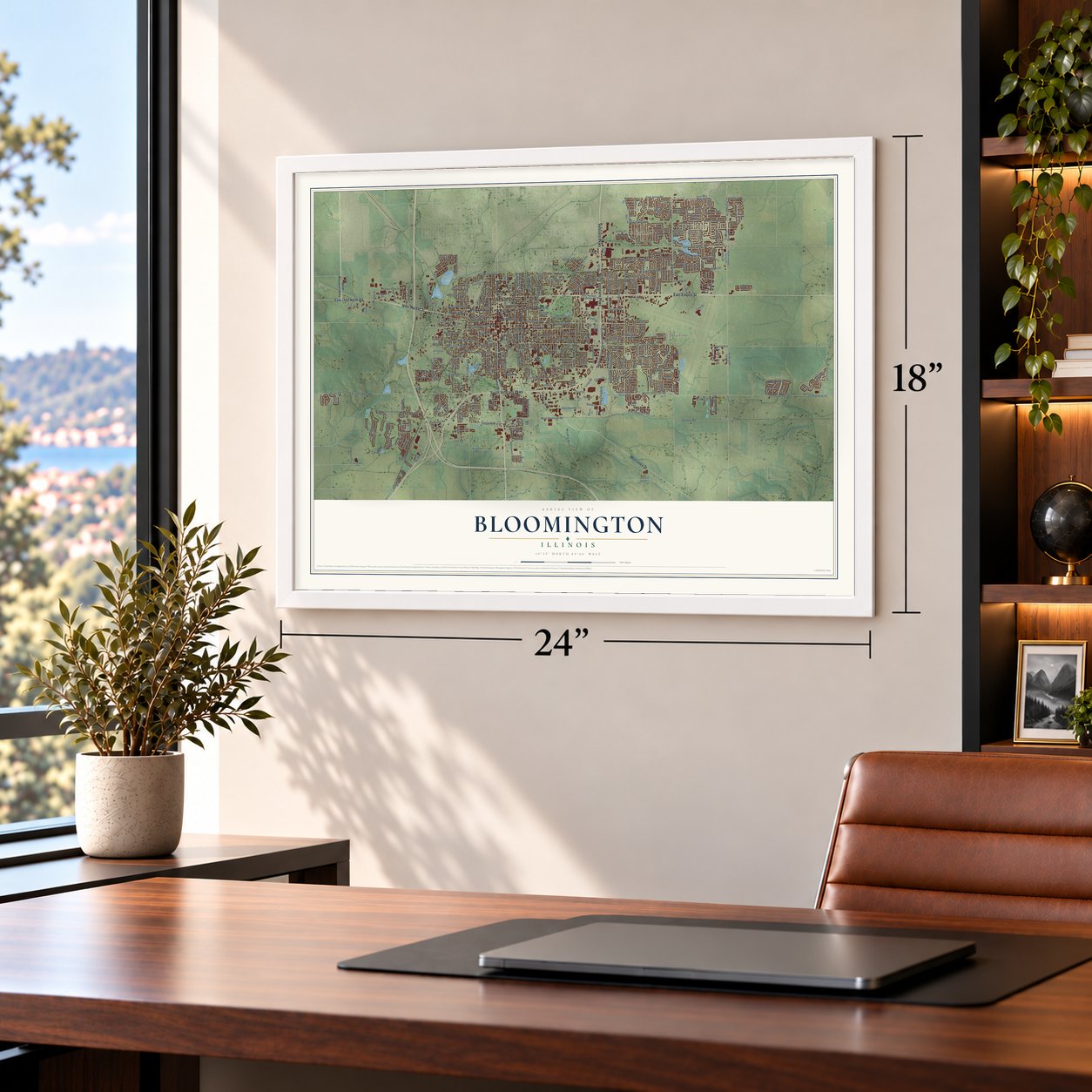
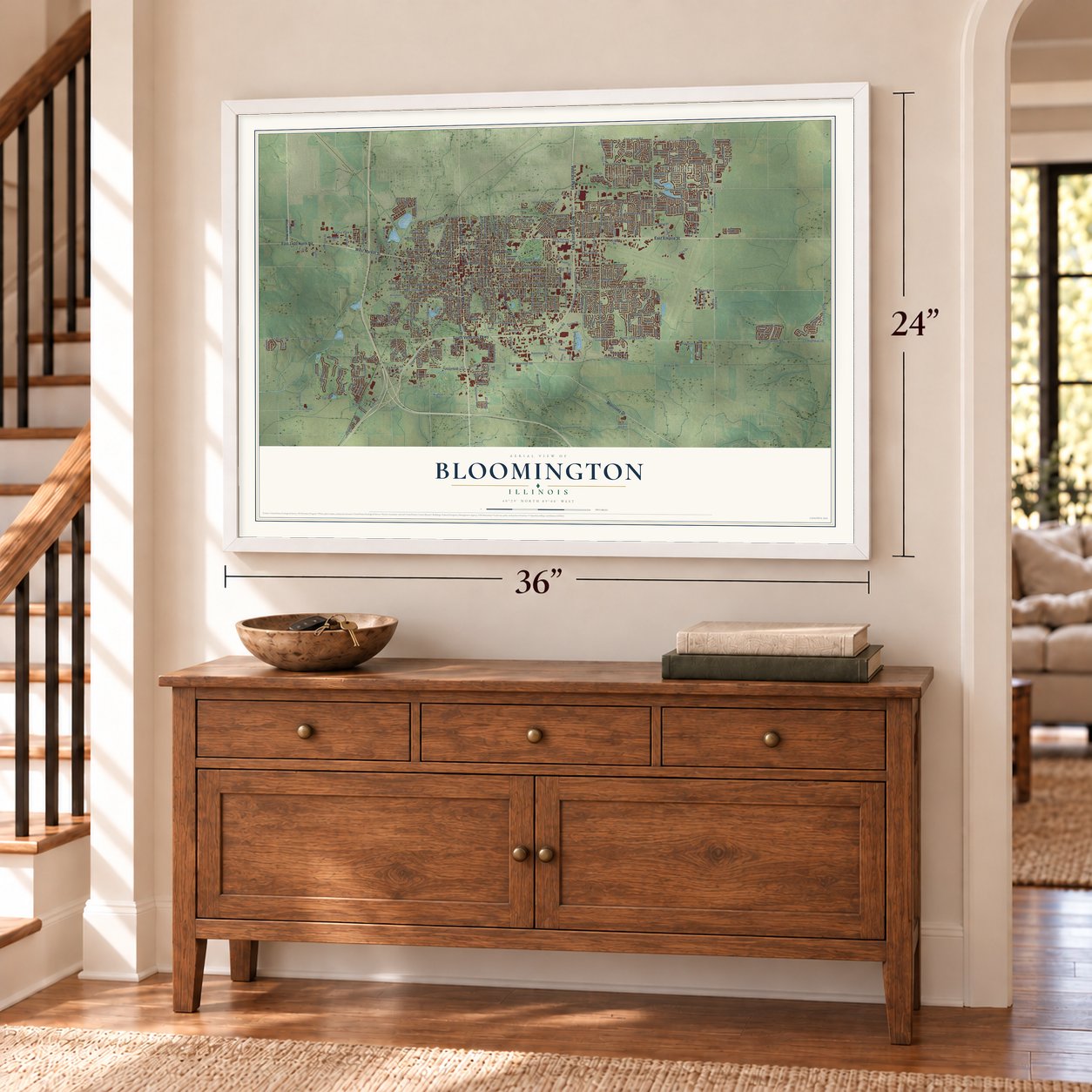
Unframed archival matte, a black wood frame or a white wood frame.
Up close
Geography Worth Displaying
This map was created using accurate cartographic data and authoritative geographic sources, including the U.S. Geological Survey and the Census Bureau. The map brings together terrain, waterways, roads, and building detail. The majority of the streets are labeled, houses are accurately depicted, and the topography is derived from government sources. Combining local data with carefully composed color and shading leads to this beautifully detailed Bloomington artwork for your wall.
Rather than simply showing street outlines, we’ve included as many of the street names as we could reasonably fit on the map while keeping their names legible. Zoom in on the high resolution preview to see exactly what’s on the map. We truly set out to create a statement piece for anyone who loves Bloomington. So whether it’s for you, or a gift for someone you love, we hope this map of Bloomington brings back fond memories.
Read the story behind this map of Bloomington, Illinois from 2026.

About Bloomington, Illinois
Bloomington is a city and the county seat of McLean County, where the 2020 census counted 78,680 residents. The community became the county seat when McLean County was created in 1830, and its first town lots were sold in 1831. Today, the city is home to Illinois Wesleyan University, State Farm, and the McLean County Museum of History.
- Public SchoolsThe Illinois legislature granted Bloomington a charter for a city public school system on February 22, 1857.
- Downtown RebuiltAfter a fire devastated much of downtown in 1900, the damaged area was reconstructed using designs by local architects George Miller and Paul O. Moratz.
- Insurance RootsRetired farmer George J. Mecherle founded State Farm in Bloomington in June 1922 as a mutual automobile insurer serving farmers.
- Historic CourthouseThe old McLean County Courthouse houses the McLean County Museum of History, whose origins reach back to a historical society founded in 1892.
- Performing ArtsThe Bloomington Center for the Performing Arts hosts more than 400 performances and community events each year.
Find your street
Names on the Bloomington map
Every name below is printed on this map. Look for your street, your school, the park where you played, or the pond down the road.
Places and landmarks9
- Eagle Ridge
- Hawthorne Hills
- White Oak Park
- Barnes
- Brokaw
- Colonial Meadows
- Hedgewood
- Normal
- North Pointe
Streets and roads389
- East Empire Street
- South Main Street
- West Market Street
- East Locust Street
- West Locust Street
- North Main Street
- South Veterans Parkway
- North Veterans Parkway
- Morrissey Drive
- East 1400 North Road
- North Clinton Street
- Veterans Parkway
- Ireland Grove Road
- East Oakland Avenue
- East Washington Street
- North 1200 East Road
- West Washington Street
- South Morris Avenue
- Eastland Drive
- Railroad 16
- County Highway 26
- West Oakland Avenue
- East Emerson Street
- Country Club Place
- Fairway Drive
- Airport Road
- North Lee Street
- East Hamilton Road
- East 1200 North Road
- Rhodes Lane
Show all 389 streets
- Dover Road
- West Division Street
- Ridge Creek Drive
- Vista Drive
- Martin Luther King Drive
- West Monroe Street
- Townley Drive
- Hamilton Road
- County Highway 28
- East Lincoln Street
- South Towanda Avenue
- General Electric Road
- Fox Creek Road
- Six Points Road
- County Highway 29
- North Hershey Road
- South Mercer Avenue
- East Jackson Street
- South Hershey Road
- Clearwater Avenue
- East College Avenue
- East Grove Street
- Greenwood Avenue
- West Olive Street
- East Taylor Street
- Springfield Road
- East Olive Street
- East Lafayette Street
- Arcadia Drive
- Arrowhead Drive
- Streid Drive
- West Chestnut Street
- Loop Road
- Brokaw Road
- Fort Jesse Road
- South Bunn Street
- South Madison Street
- West Grove Street
- Iaa Drive
- West Wood Street
- North Clinton Boulevard
- North Mason Street
- Cira Drive
- North Linden Street
- South Vale Street
- North Colton Avenue
- Beich Road
- West Graham Street
- South Clayton Street
- Carrington Lane
- Rainbow Avenue
- Moore Street
- East Monroe Street
- North Evans Street
- West Hamilton Road
- West Jackson Street
- South Oak Street
- Maple Hill Road
- McGregor Street
- Jumer Drive
- Jersey Avenue
- West Elm Street
- North Prairie Street
- Woodrig Road
- Woodbine Road
- Wisteria Lane
- Old Farm Road
- Louis Drive
- Eddy Road
- Pebblebrook Court
- Butchers Lane
- Rave Road
- Wylie Drive
- Rowe Drive
- Broad Creek Road
- Broadmoor Drive
- Sunset Road
- Mount Vernon Drive
- Pamela Drive
- Piney Run
- South Eldorado Road
- South Gridley Street
- North Fell Avenue
- Alexander Road
- Oakland Avenue
- Crimson Lane
- Gill Street
- Interstate Drive
- Eldorado Road
- Norma Drive
- South Wright Street
- Valley View Drive
- Monterey Road
- Ekstam Drive
- Leslie Drive
- Robinhood Lane
- Lutz Road
- Longfield Road
- Tracy Drive
- South Drive
- Armstrong Drive
- Degarmo Drive
- Eleanor Drive
- Bunn Street
- Capen Drive
- Ridge Road
- Glenbridge Road
- Cumbria Drive
- Graf Drive
- Park Street
- Caroline Street
- Challis Drive
- Longford Lane
- Bronco Drive
- Conlor Drive
- Parmon Road
- Eleventh Street
- Riley Drive
- Brown Street
- Crown Court
- Illinois Street
- Kris Drive
- Ann Drive
- Lay Lane
- Ark Drive
- Hannah Street
- South Center Street
- North Mitsubishi Mtwy
- East Ireland Grove Road
- South Regency Drive
- Eagle Crest Road
- Sixth Street
- North Morris Avenue
- Monica Lane
- 26th Street
- South East Street
- Hershey Road
- Towanda Barnes Road
- East Jefferson Street
- East 1600 North Road
- State Highway 9 Frontage Road
- North Cottage Avenue
- West Mulberry Street
- Four Seasons Road
- West Miller Street
- North 1900 East Road
- East Front Street
- State Farm Plaza
- Royal Pointe Drive
- North Mc Lean Street
- White Oak Road
- Crooked Creek Road
- Gettysburg Drive
- South Hinshaw Avenue
- West Emerson Street
- North 2100 East Road
- Fedor Circle
- Cornelius Drive
- South Evans Street
- Eastport Drive
- Woodhavens Drive
- 1700 East
- Spring Ridge Road
- Dry Sage Circle
- Timber View Drive
- Breezewood Boulevard
- Franklin Avenue
- Grey Fox Trail
- South Low Street
- North Drive
- Park Ridge Road
- Brigham Road
- Commerce Parkway
- Timberwolf Trail
- Gilmore Drive
- Hackberry Road
- Dianne Drive
- Keystone Road
- Paige Place
- Ballybunion Road
- Mill Creek Road
- Saint Joseph Drive
- Rocksbury Drive
- Easton Drive
- Riverwoods Lane
- Pendleton Way
- Moss Creek Road
- Nicki Drive
- State Farm Place
- White Eagle Drive
- Willow Creek Drive
- Country Lane
- East Stewart Street
- Kolby Court
- Rudder Lane
- Park Lake Drive
- Hillside Lane
- Wellington Way
- West Forrest Street
- Olympia Drive
- Danbury Drive
- Wine Way
- Beta Street
- Avalon Way
- Bell Street
- Harbord Drive
- Lone Oak Road
- Trinity Lane
- Providence Drive
- Westgate Drive
- Rusty Lane
- 24th Street
- Ethell Parkway
- Golden Rod
- Francesco Lane
- Anchor Drive
- Stillwell Street
- Indiana Street
- Bluebell Drive
- McKay Drive
- Dorset Court
- Harvest Hill Avenue
- Eide Road
- Park Place Drive
- Lake Fork Road
- Julie Drive
- Espey Drive
- Elmwood Road
- Gerig Drive
- Merna Lane
- Geneva Court
- Maloney Drive
- Fetzer Court
- Hemlock Drive
- Cashel Drive
- Duke Drive
- Smokey Court
- Brad Street
- Owens Drive
- Canada Lane
- Carri Drive
- Airline Drive
- Spahn Lane
- Case Drive
- Kurt Drive
- Zeta Street
- Ash Street
- Rust Road
- Fuller Court
- Andy Court
- 21st Street
- Cedar Court
- Jodi Lane
- Gas Avenue
- North East Street
- Monticello Road
- Twin Lake Road
- North Towanda Barnes Road
- North Allin Street
- Whites Place
- South Lee Street
- North Prospect Road
- Florence Avenue
- North State Street
- South Prospect Road
- South Clinton Street
- Koch Street
- Kenfield Circle
- Prenzler Drive
- Cabintown Road
- Revenue Drive
- Eastholme Avenue
- Brock Drive
- Cadwell Drive
- Dunraven Road
- Sinclair Court
- Crooked Creek Court
- Magoun Street
- Seville Road
- Auburn Road
- Chelsea Drive
- Winding Way
- Watford Drive
- Blackstone Street
- Sable Oaks Road
- Scottsdale Avenue
- Guiness Drive
- Interlocken Drive
- Winchester Drive
- Greenleaf Drive
- Stockholm Street
- Croxton Avenue
- Brookline Lane
- Sweeny Drive
- Auto Row Drive
- Brittany Circle
- Rena Drive
- Withers Lane
- Oakbrook Drive
- Vrooman Court
- Hubbard Drive
- Janet Drive
- Camelot Drive
- Helen Drive
- Elder Street
- Tyler Trail
- Kaitlyn Drive
- Lake Drive
- Wirsing Way
- Long Cove Court
- Baer Road
- 28th Street
- Dimmitt Court
- Kell Avenue
- Leafy Lane
- Zweng Avenue
- Wanda Way
- Marzel Drive
- Hazel Street
- West Drive
- Iris Way
- Sale Barn Road
- Crossgate Drive
- West Front Street
- South Mc Clun Street
- Oakwood Avenue
- Gloucester Circle
- Crista Ann Court
- Sate Highway 9
- Blue Heron Way
- Coventry Court
- Low Street
- Sweetbriar Drive
- Lake Shore Drive
- Binghamton Lane
- Bloomingdale Road
- Thornwood Lane
- Sugarberry Avenue
- North Eugene Street
- Huntington Road
- Golwitzer Road
- Stonehedges Court
- Szarek Drive
- Georgianna Lane
- Barnacle Lane
- Heartland Drive
- Reeveston Drive
- North Ruth Road
- Thor Drive
- Partner Place
- Conley Circle
- Addison Lane
- Vladimir Drive
- Treeline Drive
- Ninth Street
- Cashel Court
- Aspen Court
- Cutler Drive
- Ethel Parkway
Names are listed as they appear on the printed map. Zoom into the product photos to find them.
The art of mapping a place
How This Map Was Made
Real places. Remarkable detail. Discover the layers that turn geographic data into a map of home.

The view from above
Aerial imagery reveals the character of the land: woodland, open fields, and the patterns of a place.

The shape of the land
Elevation data brings hills, valleys, and subtle changes in the landscape into view.

The details of home
Roads, waterways, and building footprints come together to make the map feel unmistakably local.

Geography becomes art
Considered color, shading, and typography bring the layers together in a map made for your wall.


Process illustrated with Mendon, Massachusetts. Aerial imagery: USDA NAIP. Terrain: USGS 3D Elevation Program. Map details and finished artwork: KNOWOL.
The Details
About This Print
Choose an archival matte print, or a black or white Ayous wood frame. The archival matte print is unframed.
Select your size and finish above to see the matching product image and price.
Materials & Craftsmanship
A contemporary map with the character of a classic atlas, printed on archival matte paper. Optional frames are made from Ayous wood.
Your printed map does not include the watermark shown in the full-map preview.
Shipping & Delivery
Free shipping within the United States. Every print is made to order in the USA.
Buying a gift? Add a note in your cart and we'll include it. We never put prices in the package.
Prints ship within 2 to 3 business days. Allow 7 to 10 days total from ordering for delivery. Timing may vary during holidays or periods of high order volume.
Read our shipping policy.
Returns and damaged prints
Each print is made to order. Change-of-mind refunds are not available after production.
If your print arrives damaged, misprinted or incorrect, contact support@knowol.com within 30 days of receiving it. Include your order number, photos and a description of the issue.
Read our full refund and replacement policy. For questions about your order, email support@knowol.com.
Find your town
Looking for another city?
Find a map of home in our Illinois collection, or any town in the country.
Nearby
Maps of towns near Bloomington
Know someone from one of these towns? Their map makes a great gift.
 Normal
, Illinois
From $39.99See the map
 Downs
Downs, Illinois
From $39.99See the map
 Shirley
, Illinois
From $39.99See the map
More maps nearby: Twin Grove, Towanda, Hudson, Carlock and Heyworth.