
Search for another town





Free U.S. delivery 7 to 10 days after you order
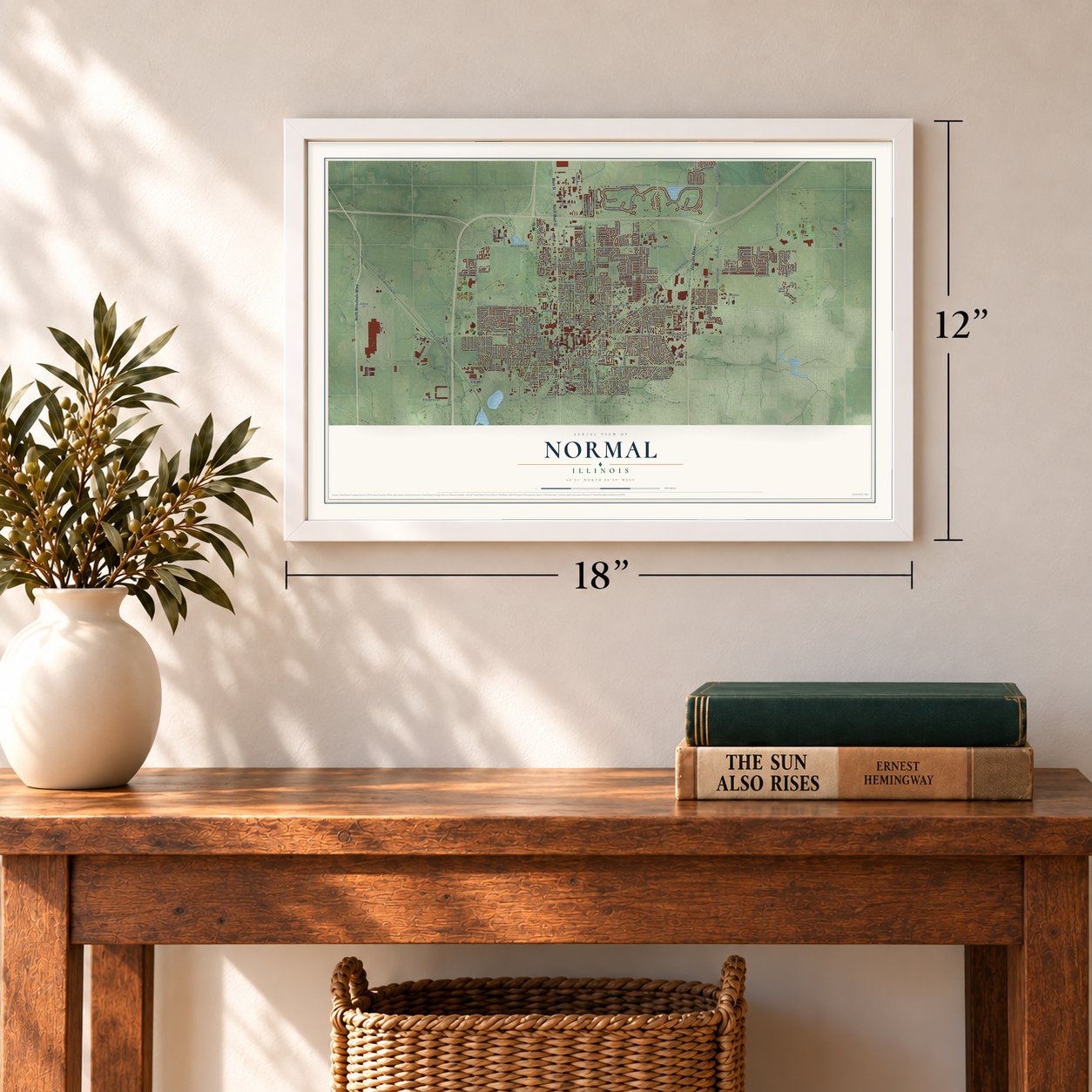
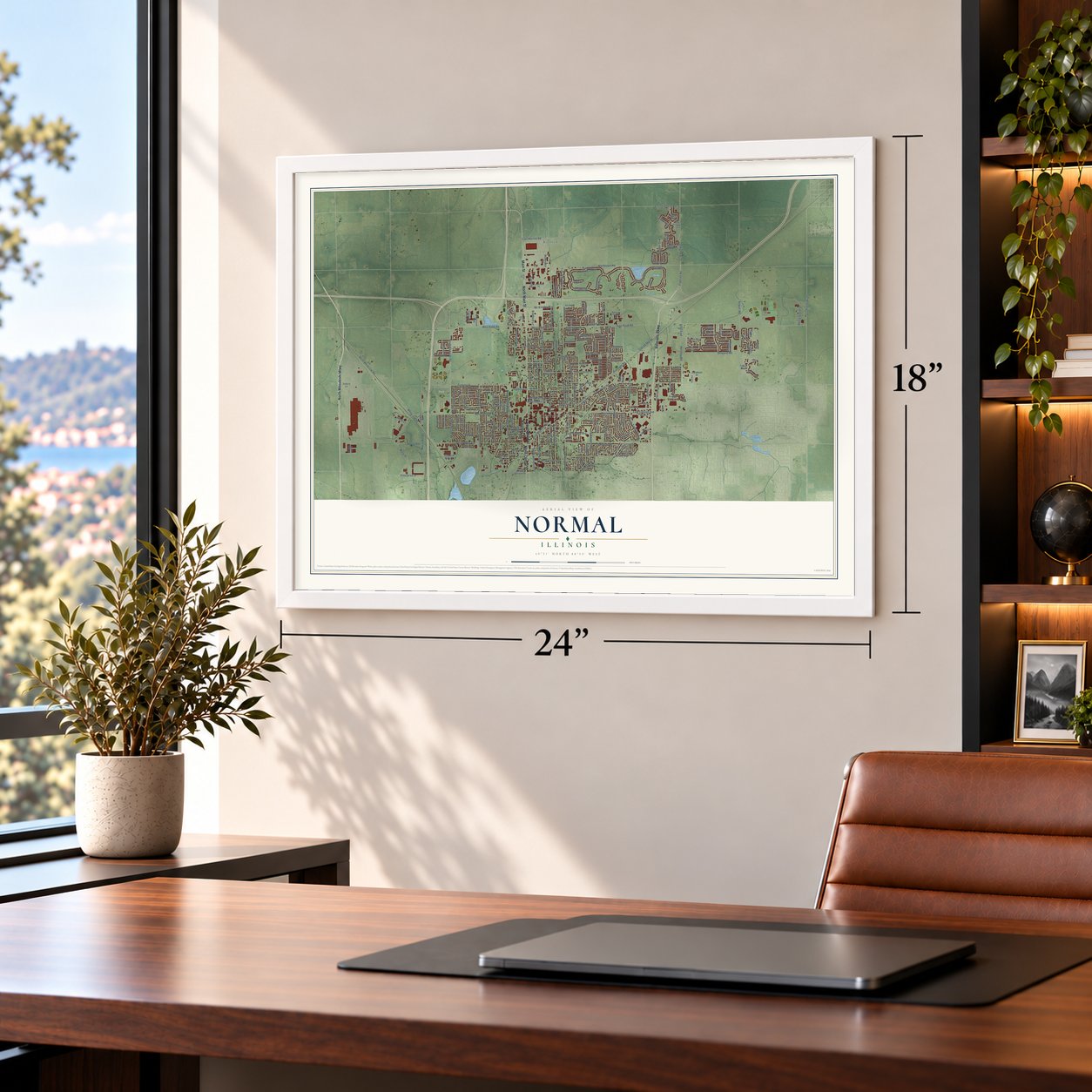
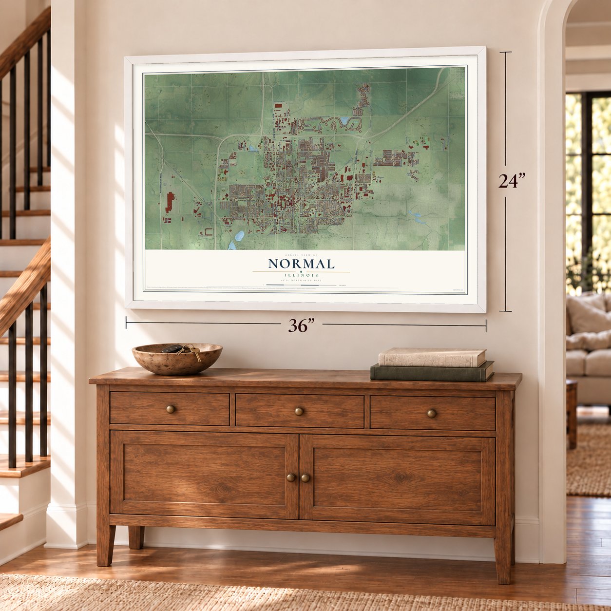
Normal, Illinois Map Art
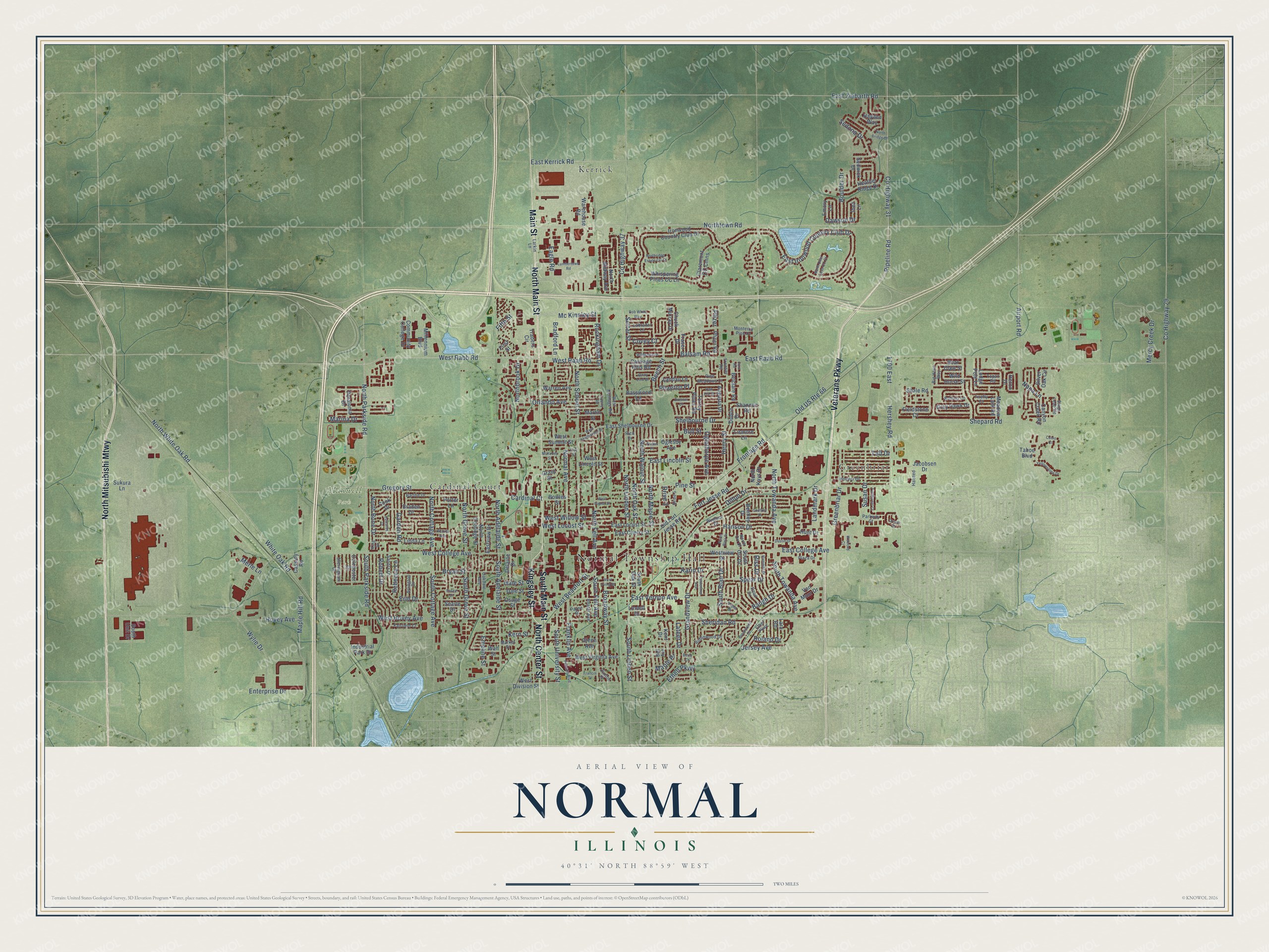
A new map of Normal, Illinois, made in 2026 and printed to order on thick archival matte paper.
12" x 18" Archival Matte Print
A Map of Home. A Work of Art.
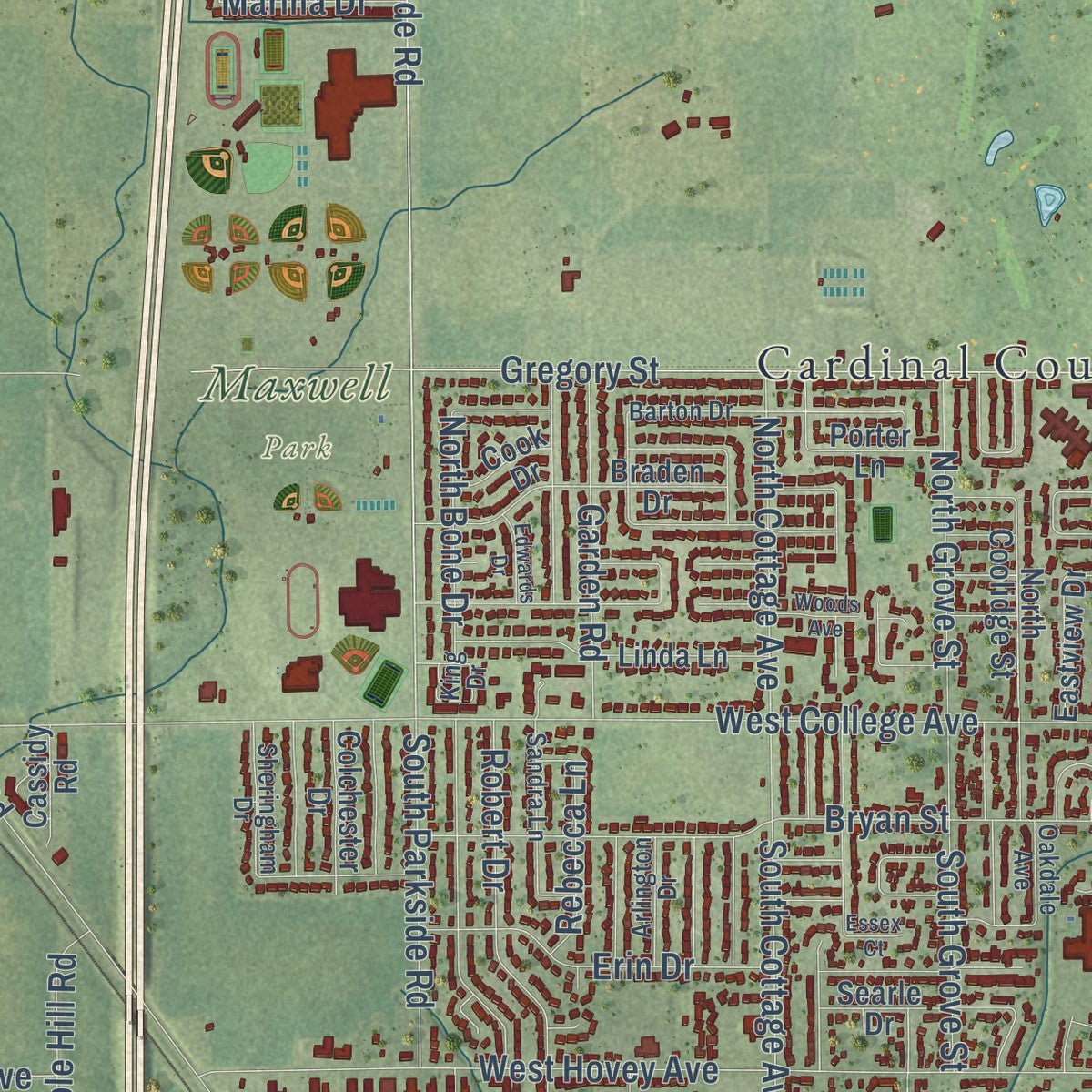
Explore Normal, Illinois from a whole new perspective. Created using aerial imagery and detailed geographic data, this map captures Normal building by building, with labeled streets, familiar landmarks, and shaded topographical relief that highlights the natural contours of the landscape.
Combining modern data with the timeless character of a vintage atlas, this map is just as interesting up close as it is beautiful on the wall. Whether you grew up in Normal, spent memorable years there, or call it home today, this unique map is a great way to celebrate a place that means something to you. Zoom in on the preview to look for your street, and then order a print to put your memories on the wall.
Three ways to hang it
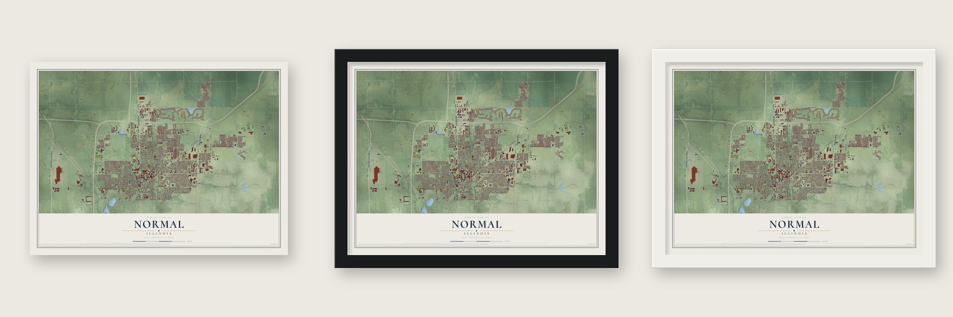
Unframed archival matte, a black wood frame or a white wood frame.
Up close
Geography Worth Displaying
This map was created using accurate cartographic data and authoritative geographic sources, including the U.S. Geological Survey and the Census Bureau. The map brings together terrain, waterways, roads, and building detail. The majority of the streets are labeled, houses are accurately depicted, and the topography is derived from government sources. Combining local data with carefully composed color and shading leads to this beautifully detailed Normal artwork for your wall.
Rather than simply showing street outlines, we’ve included as many of the street names as we could reasonably fit on the map while keeping their names legible. Zoom in on the high resolution preview to see exactly what’s on the map. We truly set out to create a statement piece for anyone who loves Normal. So whether it’s for you, or a gift for someone you love, we hope this map of Normal brings back fond memories.
Read the story behind this map of Normal, Illinois from 2026.

About Normal, Illinois
Normal is a town of 52,736 people in McLean County, just north of Bloomington. Joseph Parkinson laid out the town on June 7, 1854, under the name North Bloomington, but Jesse W. Fell was the man behind it. Fell had arranged for the new line that became the Chicago and Alton Railroad to run west of Bloomington and cross the Illinois Central, whose cars had come through in May 1853, on land he owned or controlled.
Illinois State Normal University, a school for training teachers, was founded in 1857. While its building went up, classes met in Major's Hall in Bloomington, starting in October 1857 and ending in June 1860. Trains had so little business at the crossing that, when building materials began arriving that fall, the State Board of Education asked the railroads for side-tracks, and the Chicago & Mississippi Railroad soon laid them. The village took the school's name in February 1865 and was incorporated on February 25, 1867. It counted 2,470 people in 1880 and 3,795 in 1900.
- Ball on the village greenIn June 1858 the Normal students made a trip to see the site of their future school, and on the way back the young men played ball on a smooth stretch of grass beside the tracks. The students called it the ball-ground, and for years it stayed open grass. The town did grow over it in the end: the spot became Normal's business district, lined with blocks of stores.
- A children's home until 1979The Soldiers' Orphans' Home, one of two state institutions in Normal, later became the Illinois Soldiers' and Sailors' Children's School. It closed in 1979 because care had grown costly, many campus buildings were wearing out and state agencies were sending fewer children. Some of its old buildings now house a seniors community, a swimming pool for lessons and a community football field.
- The first Steak 'n ShakeSteak 'n Shake got its start in Normal. The chain's very first restaurant served its customers here in 1934.
- Normal Theater, 1937The Normal Theater opened in 1937 as the first theater in Bloomington-Normal designed for sound films, and its bold Art Deco look was far ahead of most small Illinois towns at the time. It has been restored to its original condition, the Town of Normal owns it, and it still shows classic and independent movies. It joined the National Register in 1997.
- From Mitsubishi to RivianMitsubishi Motors and Chrysler opened a car plant here in 1986 as Diamond-Star Motors, and it became Mitsubishi's only car factory in North America. The plant closed on May 31, 2016. Rivian Automotive bought it in January 2017 and has built all-electric vehicles there since 2021, making it the company's largest U.S. plant.
Find your street
Names on the Normal map
Every name below is printed on this map. Look for your street, your school, the park where you played, or the pond down the road.
Places and landmarks5
- Normal Township Hall
- Maxwell Park
- Cardinal Court
- Greenbriar
- Kerrick
Streets and roads263
- Veterans Parkway
- North Mitsubishi Mtwy
- North Main Street
- South Main Street
- Kingsley Street
- Main Street
- North Center Street
- County Highway 31
- East Vernon Avenue
- West Beaufort Street
- Shelbourne Drive
- South Towanda Avenue
- West Raab Road
- Pipeline Road
- North Towanda Avenue
- Hershey Road
- 1700 East
- West Rabb Road
- South Fell Avenue
- North Maple Street
- Mc Kinnley Street
- North Parkside Road
- Old US Route 66
- North Fell Avenue
- Rockingham Drive
- West College Avenue
- East Raab Road
- East College Avenue
- White Oak Road
- North Linden Street
Show all 263 streets
- Northtown Road
- Beech Street
- Gregory Street
- West Hovey Avenue
- East Ironwood Country Club Drive
- Fort Jesse Road
- Shepard Road
- North School Street
- North White Oak Road
- Airport Road
- Jersey Avenue
- Franklin Avenue
- South University Street
- County Highway 37
- Bryan Street
- South Linden Street
- South Adelaide Street
- Greenbriar Drive
- Broadway Street
- North Walnut Street
- Henry Street
- North Cottage Avenue
- Dillon Drive
- North Oak Street
- Susan Drive
- Maple Hill Road
- Pine Street
- Orlando Avenue
- Grandview Drive
- North Adelaide Street
- Spear Drive
- Eagle Road
- Mercy Creek Drive
- Normal Avenue
- Wylie Drive
- East Lincoln Street
- Robert Drive
- Hovey Avenue
- South Cottage Avenue
- Sheridan Road
- Hanson Drive
- West Willow Street
- Ethell Parkway
- West Locust Street
- Erin Drive
- Landmark Drive
- South Grove Street
- Bradford Lane
- East Ziebarth Road
- North Grove Street
- South Parkside Road
- Garden Road
- County Highway 29
- East Kerrick Road
- South Blair Drive
- Enterprise Drive
- Kern Street
- Boulder Drive
- Frontage Road
- Taft Drive
- Riss Drive
- Sedona Drive
- Oglethorpe Avenue
- North Bone Drive
- Baugh Drive
- Bull Street
- Northbrook Drive
- Hale Street
- Napa Lane
- Maple Place
- Karin Drive
- Rebecca Lane
- Balsam Road
- Phaeton Place
- Marina Drive
- Roland Drive
- Emeline Street
- Setter Street
- Dawson Drive
- Merle Lane
- Covey Court
- Lateer Drive
- Fifth Street
- Drive 3
- Pfizer
- Hunt Drive
- East Shelbourne Drive
- West Summit Street
- West Division Street
- Jacobsen Drive
- Augusta Drive
- Wild Horse Street
- North Coolidge Street
- Heron Drive
- Ironwood Country Club Drive
- West Virginia Avenue
- South Orr Drive
- Braden Drive
- Heather Ridge Drive
- Claremont CC Cmns
- Linda Lane
- Canyon Creek Road
- Westview Drive
- Osage Street
- Dale Street
- Traders Circle
- Warehouse Road
- Searle Drive
- East Locust Street
- Oglesby Avenue
- Carriage Hills Road
- North Midway Avenue
- North Kays Drive
- Eastview Drive
- Von Maur Drive
- Grey Hawk Drive
- East Cherry Street
- Millennium Boulevard
- Community College Drive
- Warren Avenue
- South Oak Street
- Old Fort Jesse Road
- Martin Street
- Silver Oak Circle
- Torrey Pines Road
- Whispering Pines CC Lane
- Petaluma Drive
- Colchester Drive
- Lismore Lane
- Lodge Pole Lane
- West Lincoln Street
- Sedwick Drive
- Delaine Drive
- Landau Lane
- Basswood Lane
- Glenn Avenue
- Belclare Road
- Chuck Murray Drive
- Dublin Drive
- Meadow Lark Road
- Fieldstone Court
- South Unit Drive
- Sukura Lane
- Industrial Park Drive
- Grant Street
- Shannon Road
- Porter Lane
- Bear Claw Street
- Pfizer Road
- Bentley Drive
- Lindell Drive
- Bowles Street
- Cassidy Road
- Shale Road
- Hayden Way
- Lara Road
- Emory Lane
- Fraser Drive
- Cook Drive
- Kent Drive
- First Street
- Tahoe Boulevard
- Inez Lane
- Wall Street
- Clinton Place
- Barton Drive
- Hoover Drive
- Payne Place
- Ethel Parkway
- Doud Drive
- Hester Avenue
- Robinwood Drive
- Sandra Lane
- Market Street
- King Drive
- Pine Meadows Court
- Sheringham Drive
- West Heritage Road
- Larkin Lane
- Belt Avenue
- Fairfield Court
- Labrador Lane
- North Orr Drive
- Arlington Drive
- Monterey Pine Drive
- Topaz Road
- Windsor Drive
- Buffalo Lane
- Firefly Court
- Drive 5
- Big Horn Way
- Oakdale Avenue
- Parkway Court
- Frontier Road
- Halsted
- Viola Drive
- Stags Leap Road
- Plaza Drive
- Rich Drive
- West Shelbourne Drive
- North Blair Drive
- North Bridge Drive
- Hammitt Drive
- Centennial Avenue
- Wildberry Drive
- Brookwood Drive
- Como Court
- Yellowstone Drive
- Lumbertown Road
- West Irving Street
- Bob White Way
- Franklin Boulevard
- Fieldcrest Court
- McKinley Street
- Northridge Estate CC Court
- Cork Road
- North Deer Cove CC Court
- Godfrey Drive
- Jenny Lind Drive
- Dustin Drive
- Edwards Drive
- Dresser Drive
- West Poplar Street
- Oak Hill Street
- Woods Avenue
- Tilden Place
- Wexford Court
- Francis Street
- Dream Drive
- Liberty Road
- Birch Court
- Clay Street
- Essex Court
Names are listed as they appear on the printed map. Zoom into the product photos to find them.
The art of mapping a place
How This Map Was Made
Real places. Remarkable detail. Discover the layers that turn geographic data into a map of home.

The view from above
Aerial imagery reveals the character of the land: woodland, open fields, and the patterns of a place.

The shape of the land
Elevation data brings hills, valleys, and subtle changes in the landscape into view.

The details of home
Roads, waterways, and building footprints come together to make the map feel unmistakably local.

Geography becomes art
Considered color, shading, and typography bring the layers together in a map made for your wall.


Process illustrated with Mendon, Massachusetts. Aerial imagery: USDA NAIP. Terrain: USGS 3D Elevation Program. Map details and finished artwork: KNOWOL.
The Details
About This Print
Choose an archival matte print, or a black or white Ayous wood frame. The archival matte print is unframed.
Select your size and finish above to see the matching product image and price.
Materials & Craftsmanship
A contemporary map with the character of a classic atlas, printed on archival matte paper. Optional frames are made from Ayous wood.
Your printed map does not include the watermark shown in the full-map preview.
Shipping & Delivery
Free shipping within the United States. Every print is made to order in the USA.
Buying a gift? Add a note in your cart and we'll include it. We never put prices in the package.
Prints ship within 2 to 3 business days. Allow 7 to 10 days total from ordering for delivery. Timing may vary during holidays or periods of high order volume.
Read our shipping policy.
Returns and damaged prints
Each print is made to order. Change-of-mind refunds are not available after production.
If your print arrives damaged, misprinted or incorrect, contact support@knowol.com within 30 days of receiving it. Include your order number, photos and a description of the issue.
Read our full refund and replacement policy. For questions about your order, email support@knowol.com.
Find your town
Looking for another city?
Find a map of home in our Illinois collection, or any town in the country.
Nearby
Maps of towns near Normal
Know someone from one of these towns? Their map makes a great gift.
 Bloomington
, Illinois
From $39.99See the map
 Towanda
, Illinois
From $39.99See the map
 Hudson
, Illinois
From $39.99See the map
More maps nearby: Twin Grove, Carlock, Shirley, Danvers and Downs.