
Search for another town





Free U.S. delivery 7 to 10 days after you order
Bluffton, South Carolina Map Art
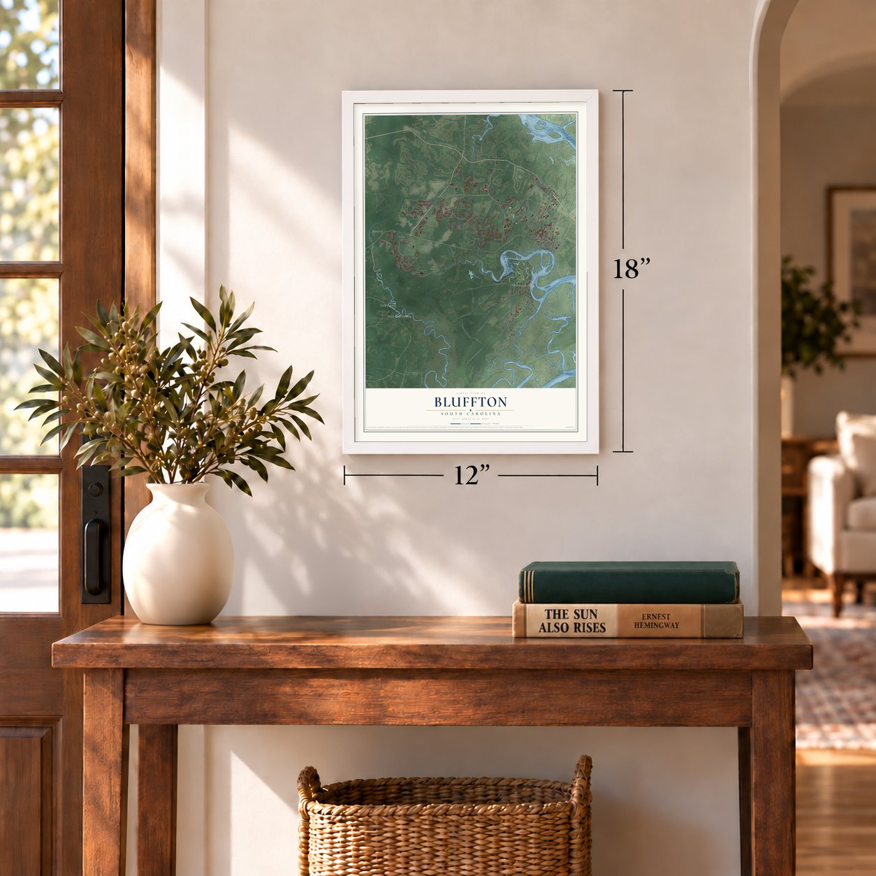
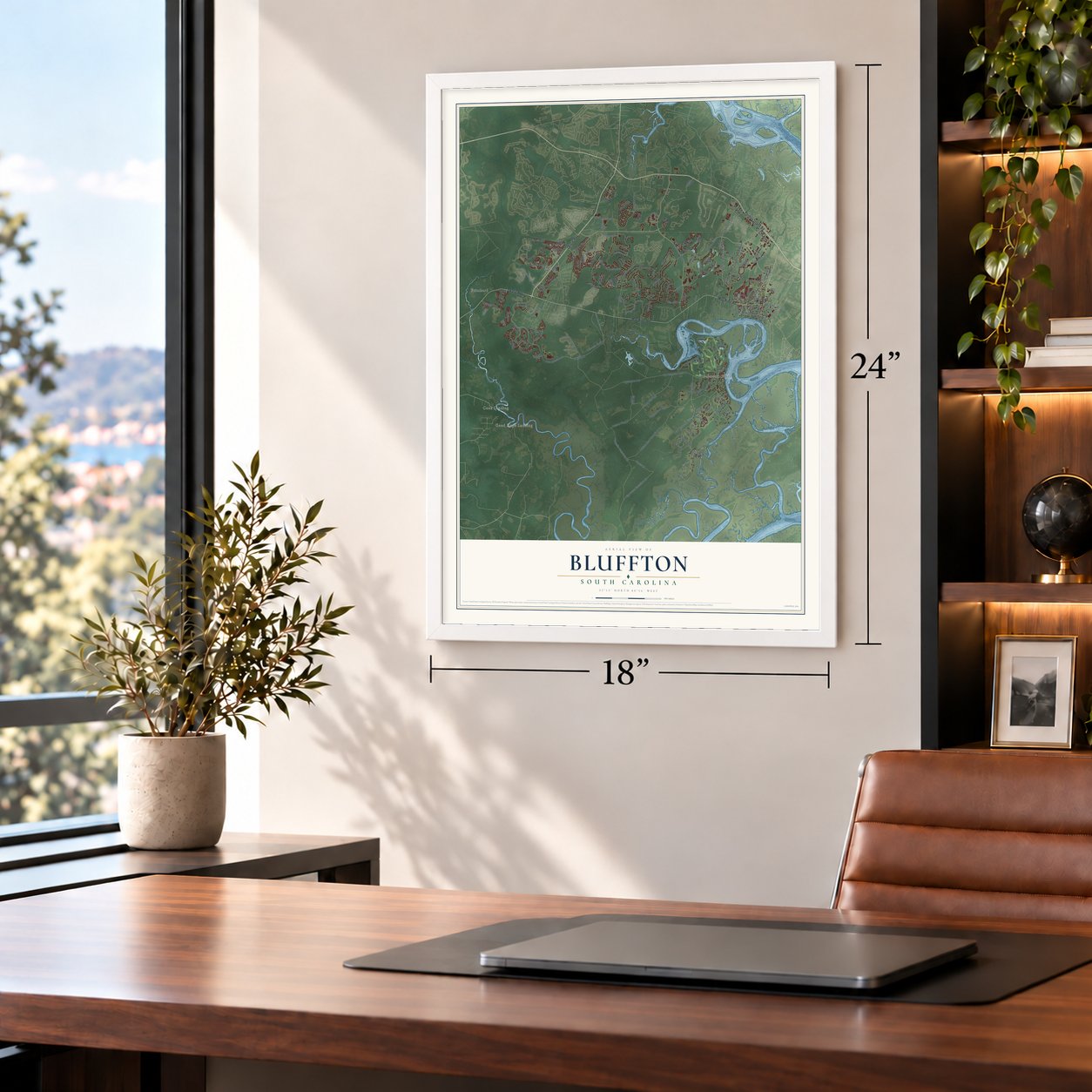
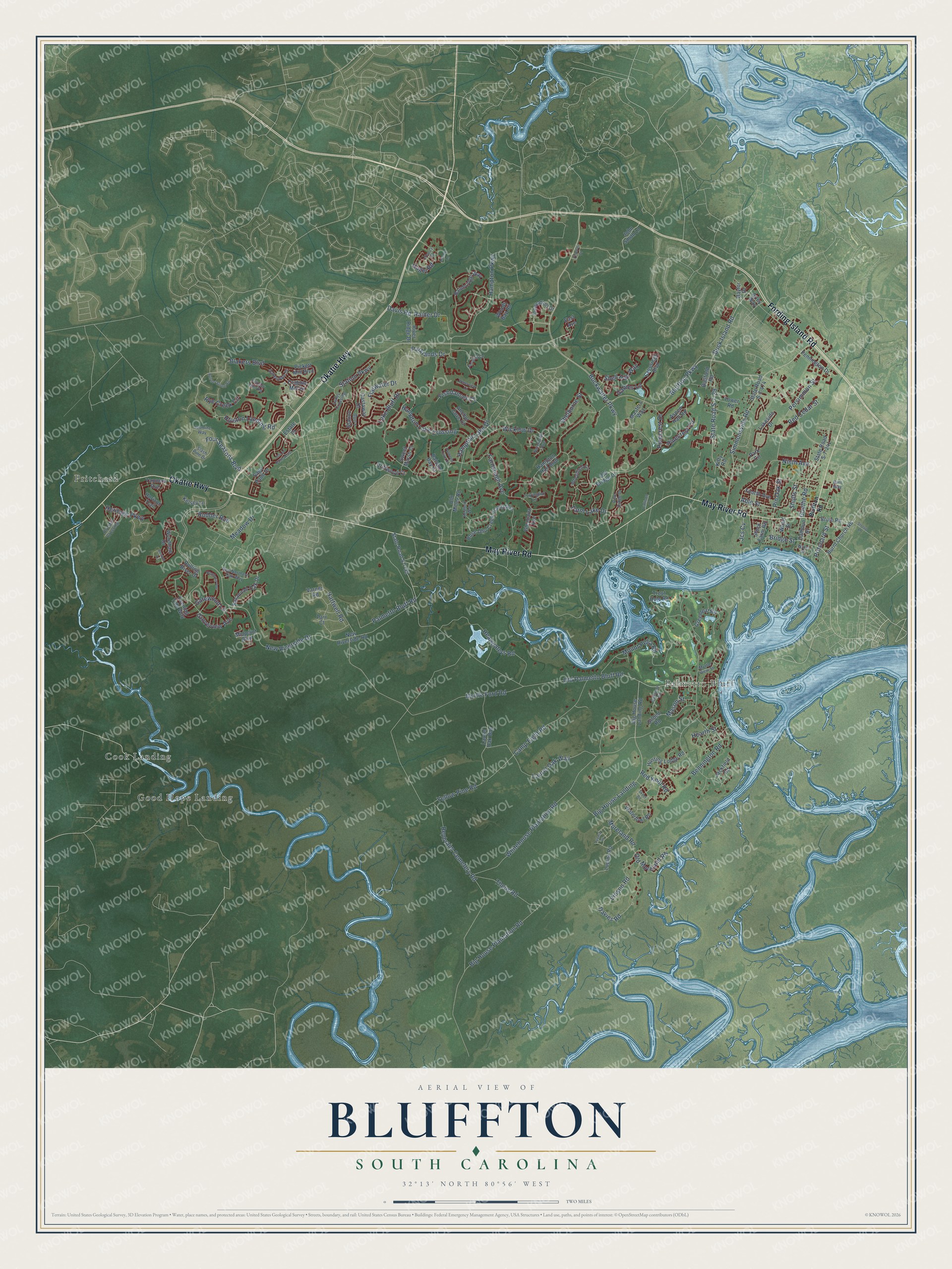
A new map of Bluffton, South Carolina, made in 2026 and printed to order on thick archival matte paper.
12" x 18" Archival Matte Print
A Map of Home. A Work of Art.
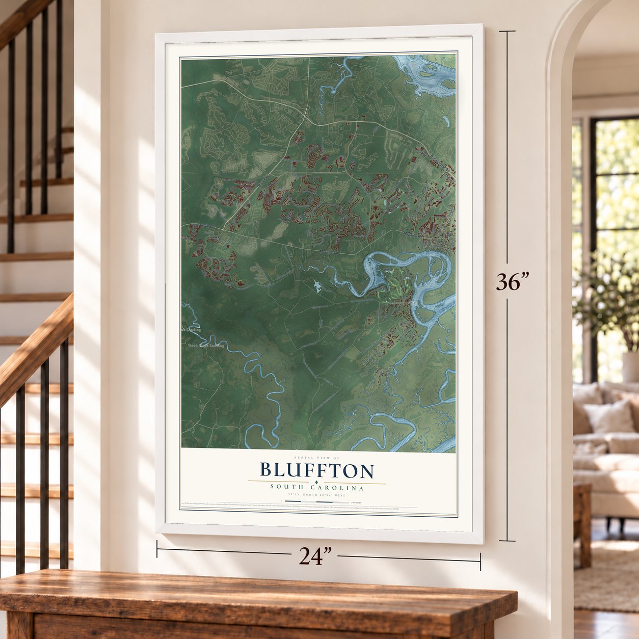
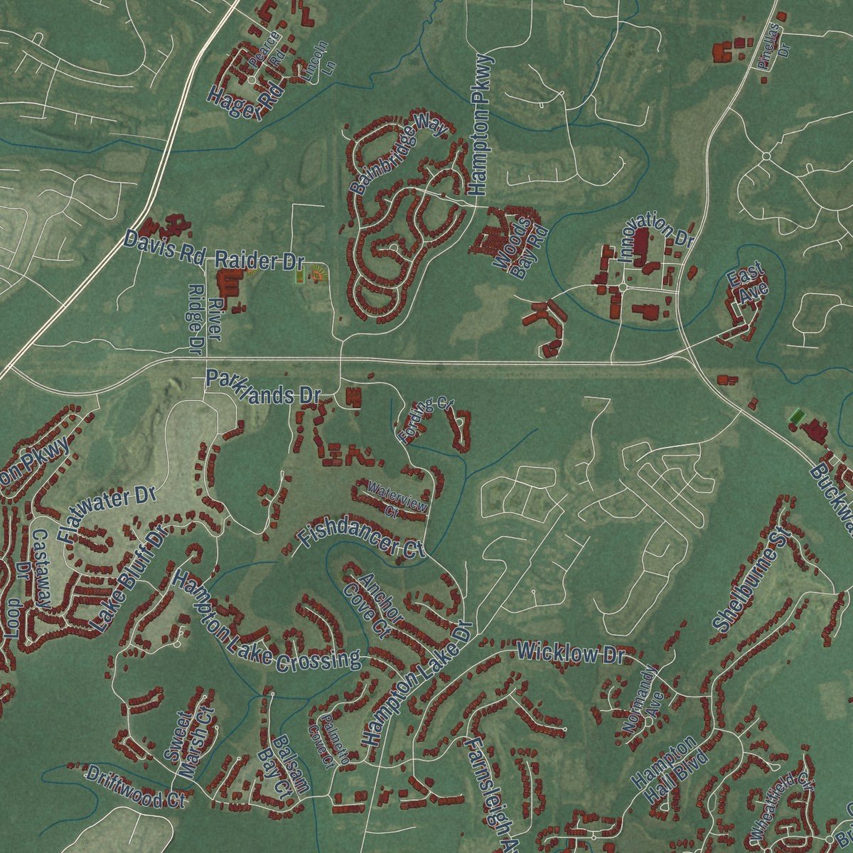
Explore Bluffton, South Carolina from a whole new perspective. Created using aerial imagery and detailed geographic data, this map captures Bluffton building by building, with labeled streets, familiar landmarks, and shaded topographical relief that highlights the natural contours of the landscape.
Combining modern data with the timeless character of a vintage atlas, this map is just as interesting up close as it is beautiful on the wall. Whether you grew up in Bluffton, spent memorable years there, or call it home today, this unique map is a great way to celebrate a place that means something to you. Zoom in on the preview to look for your street, and then order a print to put your memories on the wall.
Three ways to hang it
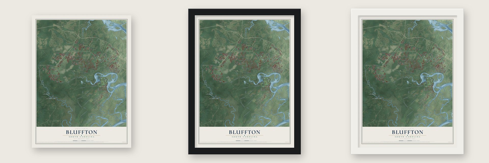
Unframed archival matte, a black wood frame or a white wood frame.
Up close
Geography Worth Displaying
This map was created using accurate cartographic data and authoritative geographic sources, including the U.S. Geological Survey and the Census Bureau. The map brings together terrain, waterways, roads, and building detail. The majority of the streets are labeled, houses are accurately depicted, and the topography is derived from government sources. Combining local data with carefully composed color and shading leads to this beautifully detailed Bluffton artwork for your wall.
Rather than simply showing street outlines, we’ve included as many of the street names as we could reasonably fit on the map while keeping their names legible. Zoom in on the high resolution preview to see exactly what’s on the map. We truly set out to create a statement piece for anyone who loves Bluffton. So whether it’s for you, or a gift for someone you love, we hope this map of Bluffton brings back fond memories.
Read the story behind this map of Bluffton, South Carolina from 2026.

About Bluffton, South Carolina
Bluffton is a town of 27,716 people in Beaufort County, on a bluff above the May River. Its first homes went up in the early 1800s, built by planters who wanted high ground and cool breezes away from their unhealthy rice and cotton plantations. Mill's Atlas of 1825 marks the spot as Kirk's Landing or Kirk's Bluff. Streets were laid out in the 1830s, and in the early 1840s the Kirk and Pope families settled on Bluffton as the name.
A steamboat landing opened at the foot of Calhoun Street in the 1850s, and travelers between Savannah and Beaufort made Bluffton the trading center of southern Beaufort County. The state incorporated it in 1852. After the Union won at Port Royal on November 7, 1861, Confederate lookouts in Bluffton watched the blockading fleet, so Union troops set the town on fire on June 4, 1863. About two thirds of its roughly 60 buildings burned, leaving two churches and fifteen homes, and the town did not truly rebuild until the 1880s.
- The Bluffton Movement of 1844Anger over the Tariff of 1842 ran high here. On July 31, 1844, Robert Barnwell Rhett led a protest against federal taxes under what is now called the Secession Oak. The Bluffton Movement soon faded, but it helped build the secession drive that made South Carolina the first state to leave the Union.
- Church of the Cross, 1857Architect Edward Brickell White designed the church to hold up to 600 people for $5,000. Work began in 1854, and the first services were held on July 17, 1857. It joined the National Register in 1975.
- Shucking oysters since 1899Since 1899, Bluffton Oyster Co. has worked from its spot where Wharf Street ends, beside the May River. No other business in South Carolina still shucks oysters full time.
- Mayfest since 1978The Bluffton Village Festival, known as Mayfest, began in the spring of 1978. Each year it brings local artisans and musicians together to celebrate life in Bluffton.
- The Heyward HouseThe Bluffton Historical Preservation Society opened the Heyward House to the public in 1998. In 2000 it became the town's welcome center, the same year zoning rules began protecting Old Town's historic buildings.
Find your street
Names on the Bluffton map
Every name below is printed on this map. Look for your street, your school, the park where you played, or the pond down the road.
Places and landmarks4
- Cook Landing
- Good Hope Landing
- Palmetto Bluff
- Pritchard
Streets and roads161
- Okatie Highway
- Fording Island Road
- May River Road
- Old Palmetto Bluff Road
- Whitehouse Plantation Road
- Blakers Boulevard
- Bridge Street
- Hulston Landing Road
- Big House Landing
- Hartwell Road
- Gatewood Lane
- Bluffton Parkway
- Buckwalter Parkway
- New Riverside Drive
- Rephraim Cemetery Road
- Mount Pelia Road
- Hampton Lake Drive
- Buck Island Road
- State Road S-7-29
- Myrtle Ford Road
- Farnsleigh Avenue
- Big House Plantation Road
- Laurel Oak Way
- Flatwater Drive
- Station Parkway
- Simmonsville Road
- Hampton Parkway
- Camp Eight Road
- Red Cedar Street
- Palmetto Bluff Road
Show all 161 streets
- Headwaters Road
- Wicklow Drive
- Davies Road
- Four Seasons Boulevard
- Moreland Road
- Heritage Parkway
- Pinecrest Circle
- Goethe Road
- Yellow Pine Road
- Hampton Lake Crossing
- Farm Lake Drive
- Meadow Drive
- Theus Road
- Lake Bluff Drive
- Persimmon Street
- Raider Drive
- Shelburne Street
- Pinecrest Drive
- Vinson Road
- Pin Oak Street
- Shell Hall Way
- Rye Creek Circle
- Bennington Road
- Groveview Avenue
- Old Moreland Road
- Hearth Street
- Parklands Drive
- Davis Road
- Shults Street
- Pritchard Street
- Fishdancer Court
- Rudder Run
- Mason Street
- Ninth Avenue
- Red Knot Road
- Able Street
- Gables Lane
- Jcs Cv
- Hager Road
- Big House Landing Road
- Savannah Oak Drive
- State Road S-7-35
- Old Bridge Drive
- Calhoun Street
- State Road S-7-474
- Hampton Hall Boulevard
- Rose Dhu Creek Plantation
- Bainbridge Way
- Hunting Lodge Road
- State Road S-7-241
- Old Miller Road
- Waterfowl Road
- New Riverside Road
- Pickett Mill Boulevard
- Innovation Drive
- Crossings Boulevard
- Greenleaf Road
- Sago Palm Drive
- Castaway Drive
- Burnt Church Road
- John Smith Lane
- Wyndham Drive
- Glencairn Avenue
- Station Loop
- Trout Hole Road
- Evening Tide Way
- Baylor Drive
- Lupine Road
- Bruin Road
- Pennington Drive
- Anchor Cove Court
- Woods Bay Road
- Balsam Bay Court
- Driftwood Court
- Fourth Avenue
- Masters Way
- Horizon Trail
- Stock Farm Road
- Wharf Street
- Jackfield Road
- River Ridge Drive
- Sweet Marsh Court
- Laurel Oak Bay
- Park Circle
- Tanners Run
- Gilded Road
- Lakeside Drive
- Tower Road
- Crabble Mill Drive
- Kelsey Lane
- Rolling River Drive
- Ballfield Road
- East Avenue
- Varner Road
- Midpoint Boulevard
- Aspen Hall Road
- Estate Drive
- Kitty Road
- Parr Court
- Arley Way
- Bluffton Road
- Pine Ridge Drive
- Lakes Crossing
- Myrtle View Street
- Wheatfield Circle
- Oakesdale Drive
- Fording Court
- Redbud Way
- Old Mill Crossing
- Jasmine Way
- Red Northern Oak Way
- Normandy Avenue
- Torrington Lane
- Cooper Run Road
- Slash Pine Drive
- Water Street
- Burr Way
- Heathrow Avenue
- Runner Stone Road
- Gallavant Road
- Isle of Palms East
- Palmetto Cove Court
- Pinellas Drive
- Benton Circle
- Lincoln Lane
- Waterview Court
- Stroup Lane
- Callison Lane
- Skeet Road
- Pearce Road
- Lyonia Street
Names are listed as they appear on the printed map. Zoom into the product photos to find them.
The art of mapping a place
How This Map Was Made
Real places. Remarkable detail. Discover the layers that turn geographic data into a map of home.

The view from above
Aerial imagery reveals the character of the land: woodland, open fields, and the patterns of a place.

The shape of the land
Elevation data brings hills, valleys, and subtle changes in the landscape into view.

The details of home
Roads, waterways, and building footprints come together to make the map feel unmistakably local.

Geography becomes art
Considered color, shading, and typography bring the layers together in a map made for your wall.


Process illustrated with Mendon, Massachusetts. Aerial imagery: USDA NAIP. Terrain: USGS 3D Elevation Program. Map details and finished artwork: KNOWOL.
The Details
About This Print
Choose an archival matte print, or a black or white Ayous wood frame. The archival matte print is unframed.
Select your size and finish above to see the matching product image and price.
Materials & Craftsmanship
A contemporary map with the character of a classic atlas, printed on archival matte paper. Optional frames are made from Ayous wood.
Your printed map does not include the watermark shown in the full-map preview.
Shipping & Delivery
Free shipping within the United States. Every print is made to order in the USA.
Buying a gift? Add a note in your cart and we'll include it. We never put prices in the package.
Prints ship within 2 to 3 business days. Allow 7 to 10 days total from ordering for delivery. Timing may vary during holidays or periods of high order volume.
Read our shipping policy.
Returns and damaged prints
Each print is made to order. Change-of-mind refunds are not available after production.
If your print arrives damaged, misprinted or incorrect, contact support@knowol.com within 30 days of receiving it. Include your order number, photos and a description of the issue.
Read our full refund and replacement policy. For questions about your order, email support@knowol.com.
Find your town
Looking for another city?
Find a map of home in our South Carolina collection, or any town in the country.
Nearby
Maps of towns near Bluffton
Know someone from one of these towns? Their map makes a great gift.
 Daufuskie Island
, South Carolina
From $39.99See the map
 Hardeeville
, South Carolina
From $39.99See the map
 Hilton Head Island
, South Carolina
From $39.99See the map
More maps nearby: Shell Point, Port Royal, Ridgeland, Burton and Laurel Bay.