
Search for another town





Free U.S. delivery 7 to 10 days after you order
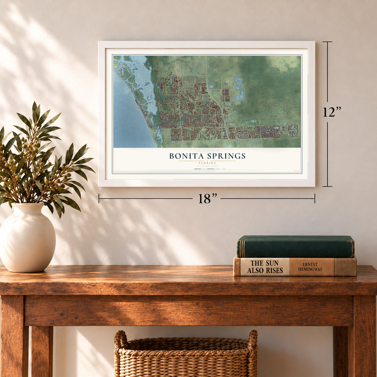
Bonita Springs, Florida Map Art
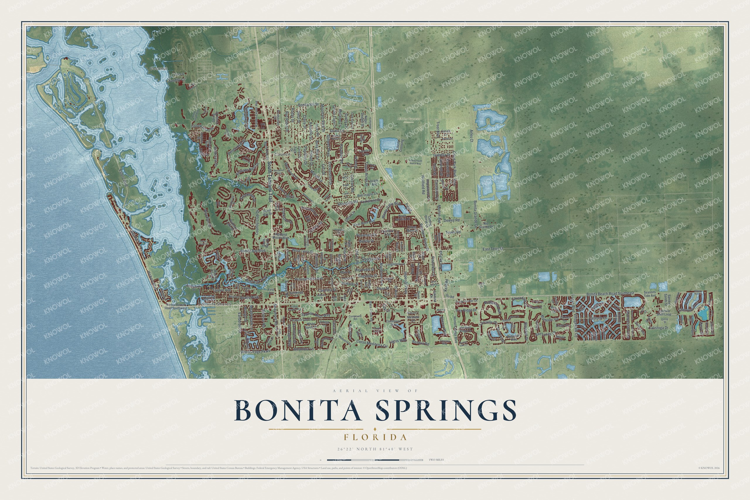
A new map of Bonita Springs, Florida, made in 2026 and printed to order on thick archival matte paper.
12" x 18" Archival Matte Print
A Map of Home. A Work of Art.
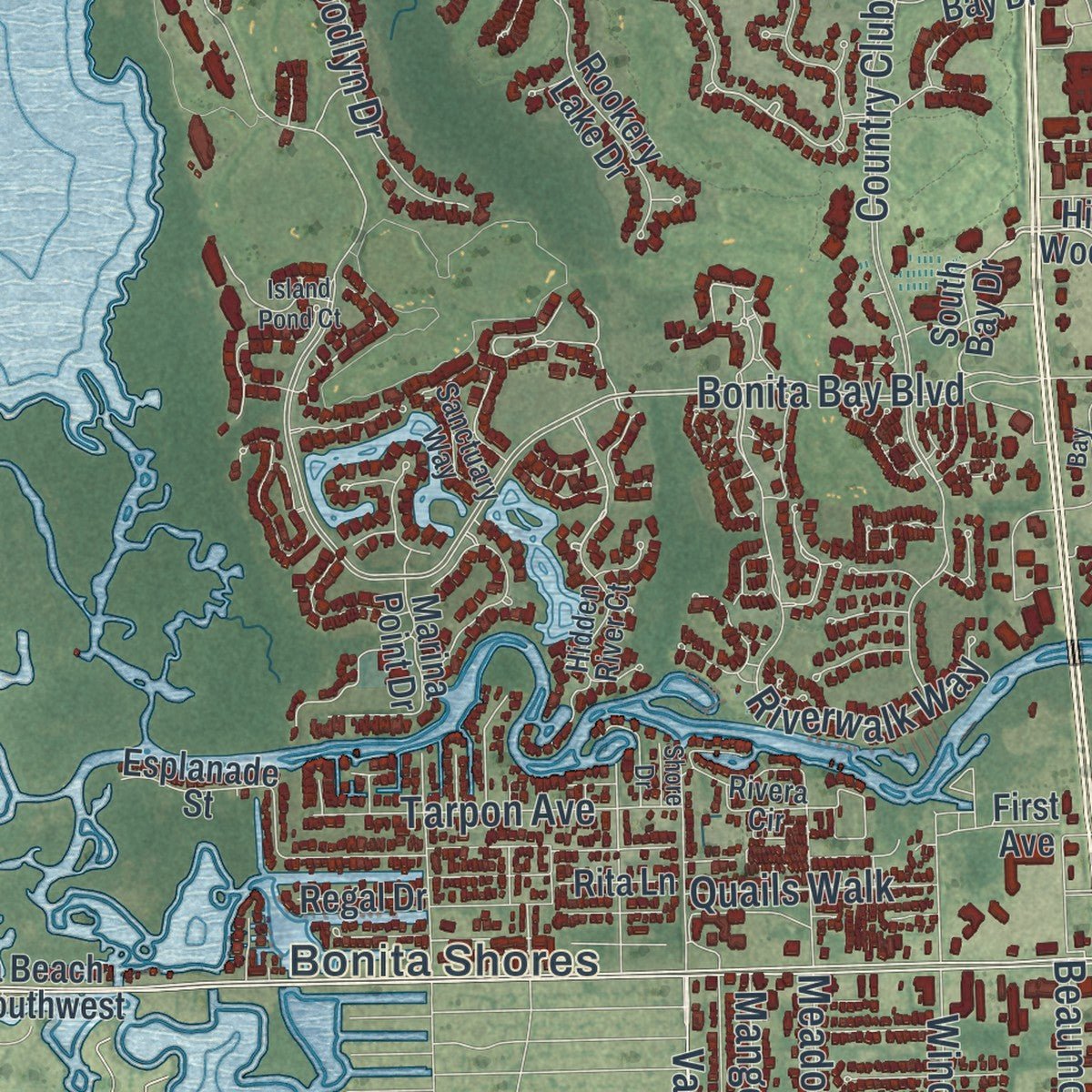
Explore Bonita Springs, Florida from a whole new perspective. Created using aerial imagery and detailed geographic data, this map captures Bonita Springs building by building, with labeled streets, familiar landmarks, and shaded topographical relief that highlights the natural contours of the landscape.
Combining modern data with the timeless character of a vintage atlas, this map is just as interesting up close as it is beautiful on the wall. Whether you grew up in Bonita Springs, spent memorable years there, or call it home today, this unique map is a great way to celebrate a place that means something to you. Zoom in on the preview to look for your street, and then order a print to put your memories on the wall.
Three ways to hang it
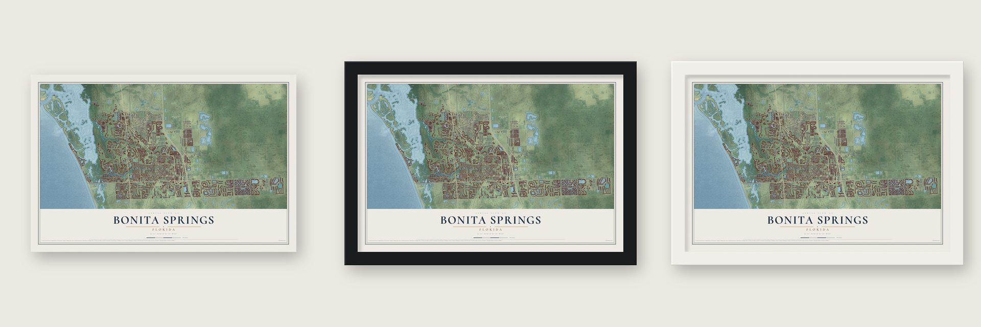
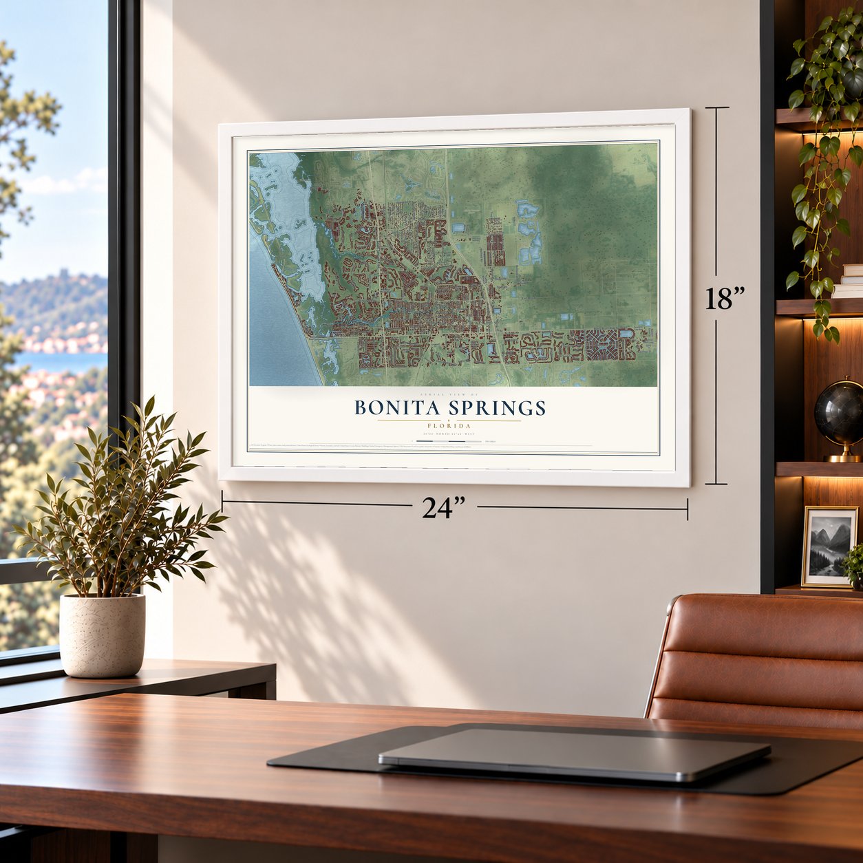
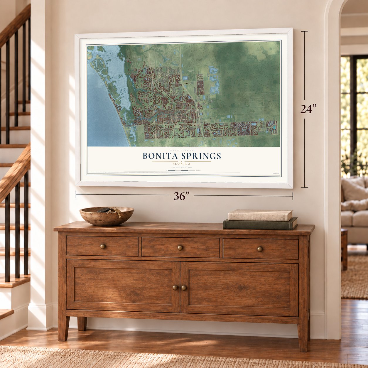
Unframed archival matte, a black wood frame or a white wood frame.
Up close
Geography Worth Displaying
This map was created using accurate cartographic data and authoritative geographic sources, including the U.S. Geological Survey (USGS) and FEMA. The map brings together terrain, waterways, roads, and building detail. The majority of the streets are labeled, houses are accurately depicted, and the topography is derived from government sources. Combining local data with carefully composed color and shading leads to this beautifully detailed Bonita Springs artwork for your wall.
Rather than simply showing street outlines, we’ve included as many of the street names as we could reasonably fit on the map while keeping their names legible. Zoom in on the high resolution preview to see exactly what’s on the map. We truly set out to create a statement piece for anyone who loves Bonita Springs. So whether it’s for you, or a gift for someone you love, we hope this map of Bonita Springs brings back fond memories.
Explore the full map of Bonita Springs, Florida and read about the local places it shows.
About Bonita Springs, Florida
Bonita Springs is a city of 53,644 people in Lee County, where the Imperial River flows into Estero Bay on Florida's Gulf coast. People lived here about 8,000 years ago, and they were building mounds by 4,000 years ago. The Calusa lived here in the thousands when Ponce de León came along these beaches in 1513.
In the 1870s a crew from the Army Corps of Engineers camped on the upper Imperial River while mapping the region. After the crew moved on, maps called the spot Survey and named the river Surveyor's Creek. Homesteaders turned the camp into a village, which got a post office in 1901. Developers later decided the old name wouldn't sell land, so by 1912 Survey had become Bonita Springs, with streets laid out and the creek renamed the Imperial River.
- Braxton Comer's 6,000 acresDuring the 1880s, Braxton Comer purchased 6,000 acres surrounding Survey for a plantation, and he brought indentured families to the area to work it. Visitors soon followed. By 1910 people were coming to hunt and fish, and the two-story Eagle Hotel gave them a place to stay.
- A city twiceA road to Fort Myers opened in 1917, Barron Collier's Fort Myers Southern Railroad reached town in the early 1920s, and the Tamiami Trail was finished in 1928. The land boom that followed made Bonita Springs a city for a short time. Much later, air conditioning, Interstate 75 and a big airport nearby drew new residents, and in 1999 voters made it a city again.
- Reptile Gardens of 1936The Everglades Reptile Gardens opened in 1936 as the town's first major roadside attraction, showing wildlife and caring for injured animals. Now called the Everglades Wonder Gardens, it still welcomes visitors with alligators, flamingos and exotic birds, along with its gardens of plants and a museum of natural history.
- Classrooms since 1921The town's school on Dean Street opened in a masonry building in 1921. As the town grew, a second building with Mediterranean Revival details went up beside it in 1927, and in the 1940s a short brick hallway joined the two. Children still attended it as Bonita Springs Elementary in 2025, and the Bonita Springs School joined the National Register in 1999.
- Irma's eye overhead in 2017On September 9 and 10, 2017, Hurricane Irma, a slow Category 3 storm, crossed Florida's southwest coast, and its eye passed right over Bonita Springs. The storm damaged or destroyed many buildings and left much of the city flooded.
Find your street
Names on the Bonita Springs map
Every name below is printed on this map. Look for your street, your school, the park where you played, or the pond down the road.
Places and landmarks5
- Coconut
- Bonita Shores
- Hidden Cypress Preserve
- Pine Lake Preserve
- Council
Streets and roads292
- South Tamiami Trail
- Pelicans Nest Drive
- Corso Mediterra Circle
- Vanderbilt Drive
- Goldcrest Drive
- Trost Boulevard
- Pennyroyal Drive
- Hickory Boulevard
- Del Lago Way
- Alhambra Lane
- Imperial Parkway
- Bonita Grande Drive
- Wellfield Road
- West Terry Street
- Pinecrest Lane
- Morton Avenue
- Bonita Beach Road Southeast
- Old 41 Road
- Bonita Bay Boulevard
- Strike Lane
- Villagewalk Circle
- Estero Boulevard
- Country Club Drive
- East Terry Street
- Citrus Park Boulevard
- Stillwell Parkway
- Clarkston Drive
- Altessa Way
- Pennsylvania Avenue
- Paradise Road
Show all 292 streets
- Riverwalk Way
- Matteotti Vw
- Shangrila Road
- Cockleshell Drive
- Fox Ridge Drive
- Woods Edge Parkway
- San Lucas Lane
- Dean Street
- Impatiens Court
- Isabella Drive
- Spanish Moss Way
- Arles Court
- Bonita Bill Street
- Carolina Street
- Blaisdell Drive
- Eleventh Street
- Yorkstone Drive
- Moriah Lane
- Luci Drive
- Kent Road
- Logan Boulevard
- Third Street
- Matheson Avenue
- Latitude Drive
- Bernwood Drive
- Montecristo Loop
- Tower Road
- Southern Pines Drive
- Meadowlark Lane
- Dietz Drive
- Rodas Drive
- Divot Drive
- Tropic Acres Drive
- Red Robin Drive
- Claire Street
- Busy Bee Drive
- Woodlyn Drive
- Seventh Street
- Beaumont Road
- Windsor Road
- Monte Carlo Boulevard
- Beneva Road
- Dewey Road
- Tarpon Avenue
- Cherrywood Court
- Bridgeford Avenue
- Pine Avenue
- Woodsage Drive
- Rosemary Drive
- Calistoga Drive
- Colony Road
- Lagos Way
- Princess Lane
- Flamingo Drive
- Sombrero Drive
- Arroyal Road
- Corzine Road
- Pinson Drive
- Mountain View Drive
- Colony Villas Drive
- Verde Lane
- Creekview Drive
- La Caille Drive
- Ragsdale Street
- Goodwin Street
- Cavendish Court
- Somers Drive
- Melaine Lane
- Bonita Drive
- Quails Walk
- Lime Street
- Mango Drive
- Rue de Paix
- Tahiti Drive
- Papillion Drive
- Reynolds Street
- Carnation Court
- Amarillo Street
- Kerry Court
- Sunny Lane
- Sandfly Court
- Tasca Drive
- Dee Drive
- Bay Road
- Derry Court
- Chisi Lane
- Lieto Lane
- Oak Lane
- Reef Lane
- Highland Woods Boulevard
- South Bay Drive
- Bonita Beach Road Southwest
- Cutting Horse Lane
- North Carolina Drive
- Palace Place
- Sanabria Loop
- Castellano Way
- Cedar Creek Drive
- Captivia Shell Loop
- Hunters Ridge Boulevard
- River Rock Boulevard
- Treasure Cay Lane
- Production Circle
- Kentucky Street
- Forest Mere Drive
- Rookery Lake Drive
- Hunters Ridge Drive
- Esplanade Street
- Seasons Tide Avenue
- Bourbonniere Drive
- Sicily Loop
- Williston Way
- Walden Center Avenue
- Liberty Crossing
- Tarocco Drive
- Race Track Road
- Spring Creek Road
- Bellino Terrace
- Golden Eagle Lane
- Trade Center Drive
- Pullen Avenue
- Longfellow Lane
- Ozark Avenue
- Wicklow Court
- Windward Boulevard
- Barefoot Lane
- Red Dragon Lane
- Casals Lane
- San Amaro Drive
- Marina Point Drive
- Marcello Lane
- Pixie Lane
- Lavante Court
- Rio Grande Drive
- Burnt Pine Drive
- White Sands Place
- Roger Dodger Street
- Chianti Terrace
- Somerset Lane
- Lisburn Court
- Sosta Lane
- Torchfire Trail
- North Bay Drive
- Jeneva Way
- Pienza Court
- Galleon Drive
- Palm Street
- Saville Avenue
- Carino Terrace
- Vermillion Lane
- Twain Drive
- Oakland Drive
- Forester Drive
- Cavan Court
- Sanibel Sands Street
- Ortega Lane
- Harbor Drive
- Morgan Road
- Rocky Road
- Essex Place
- Jarvis Road
- Regal Drive
- Dolphin Street
- Main Drive
- Pitt Road
- Xenon Way
- Meadow Lane
- Quinn Street
- Orr Road
- First Avenue
- Rita Lane
- Meravi Drive
- Elaine Drive
- Oliver Drive
- Piva Court
- Turin Court
- Lure Trail
- Iowa Street
- Ott Lane
- Tuck Drive
- Hidden River Court
- Draine Street
- Southampton Drive
- Winthrop Circle
- Lake Abby Lane
- Lake Shore Drive
- Mandevilla Drive
- Bay Creek Drive
- Sanctuary Way
- Tangelo Terrace
- Toscana Way
- Salinas Way
- Ascot Bend Court
- Cock Robin Lane
- Carl Circle
- Mediterra Drive
- Arvida Lane
- Tivoli Terrace
- Catskill Drive
- Compound Road
- Hidden Pines Lane
- Newton Court
- Teramo Way
- Del Lane
- Indiana Street
- Shanna Lane
- Tropical Drive
- Matera Lane
- Megan Drive
- Pepe Lane
- Carlow Court
- Rivera Circle
- Girard Terrace
- Gilroy Street
- Snell Lane
- Utah Street
- Bonita National Boulevard
- Imperial Harbor Boulevard
- Pelican Colony Boulevard
- Lakemont Drive
- Limetree Park Drive
- Pondview Circle
- Trails Edge Boulevard
- Pebblecreek Drive
- Felts Avenue
- Michigan Street
- Wood Ibis Avenue
- Lost Woods Circle
- Galway Run Court
- Wharton Drive
- Bonita Fairways Circle
- Palmas Grandes Boulevard
- Bernwood Parkway
- Bay Landing Drive
- New York Street
- Waterfall Drive
- Stardust Drive
- Alabama Street
- Liberty Youth Ranch Way
- Island Pond Court
- Edenbridge Court
- Via del Corso Lane
- Burano Drive
- Richview Court
- Bridgetown Court
- South View Drive
- Alvara Way
- Redbud Lane
- Glen Heron Drive
- Mira Way
- Tuscany Court
- Tarrah Lane
- Jef Nik Lane
- Danios Drive
- Riverside Drive
- Longford Court
- Harmony Park Drive
- Cavell Terrace
- River View Drive
- Herring Way
- Hunters Lake Court
- Shore Drive
Names are listed as they appear on the printed map. Zoom into the product photos to find them.
The art of mapping a place
How This Map Was Made
Real places. Remarkable detail. Discover the layers that turn geographic data into a map of home.

The view from above
Aerial imagery reveals the character of the land: woodland, open fields, and the patterns of a place.

The shape of the land
Elevation data brings hills, valleys, and subtle changes in the landscape into view.

The details of home
Roads, waterways, and building footprints come together to make the map feel unmistakably local.

Geography becomes art
Considered color, shading, and typography bring the layers together in a map made for your wall.


Process illustrated with Mendon, Massachusetts. Aerial imagery: USDA NAIP. Terrain: USGS 3D Elevation Program. Map details and finished artwork: KNOWOL.
The Details
About This Print
Choose an archival matte print, or a black or white Ayous wood frame. The archival matte print is unframed.
Select your size and finish above to see the matching product image and price.
Materials & Craftsmanship
A contemporary map with the character of a classic atlas, printed on archival matte paper. Optional frames are made from Ayous wood.
Your printed map does not include the watermark shown in the full-map preview.
Shipping & Delivery
Free shipping within the United States. Every print is made to order in the USA.
Buying a gift? Add a note in your cart and we'll include it. We never put prices in the package.
Prints ship within 2 to 3 business days. Allow 7 to 10 days total from ordering for delivery. Timing may vary during holidays or periods of high order volume.
Read our shipping policy.
Returns and damaged prints
Each print is made to order. Change-of-mind refunds are not available after production.
If your print arrives damaged, misprinted or incorrect, contact support@knowol.com within 30 days of receiving it. Include your order number, photos and a description of the issue.
Read our full refund and replacement policy. For questions about your order, email support@knowol.com.
Find your town
Looking for another city?
Find a map of home in our Florida collection, or any town in the country.
Nearby
Maps of towns near Bonita Springs
Know someone from one of these towns? Their map makes a great gift.
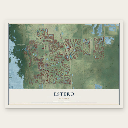 Estero
, Florida
From $39.99See the map
 Naples Park
, Florida
From $39.99See the map
 Pelican Marsh
, Florida
From $39.99See the map
More maps nearby: Florida Gulf Coast University, Three Oaks, Pelican Bay, Island Walk and Pine Ridge.