


Search for another town





Free U.S. delivery 7 to 10 days after you order
Boone, Tennessee Map Art
Building by building, with labeled streets and shaded relief.
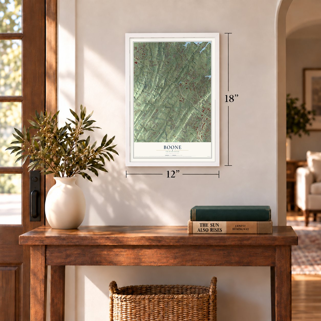
12" x 18" Archival Matte Print
A Map of Home. A Work of Art.
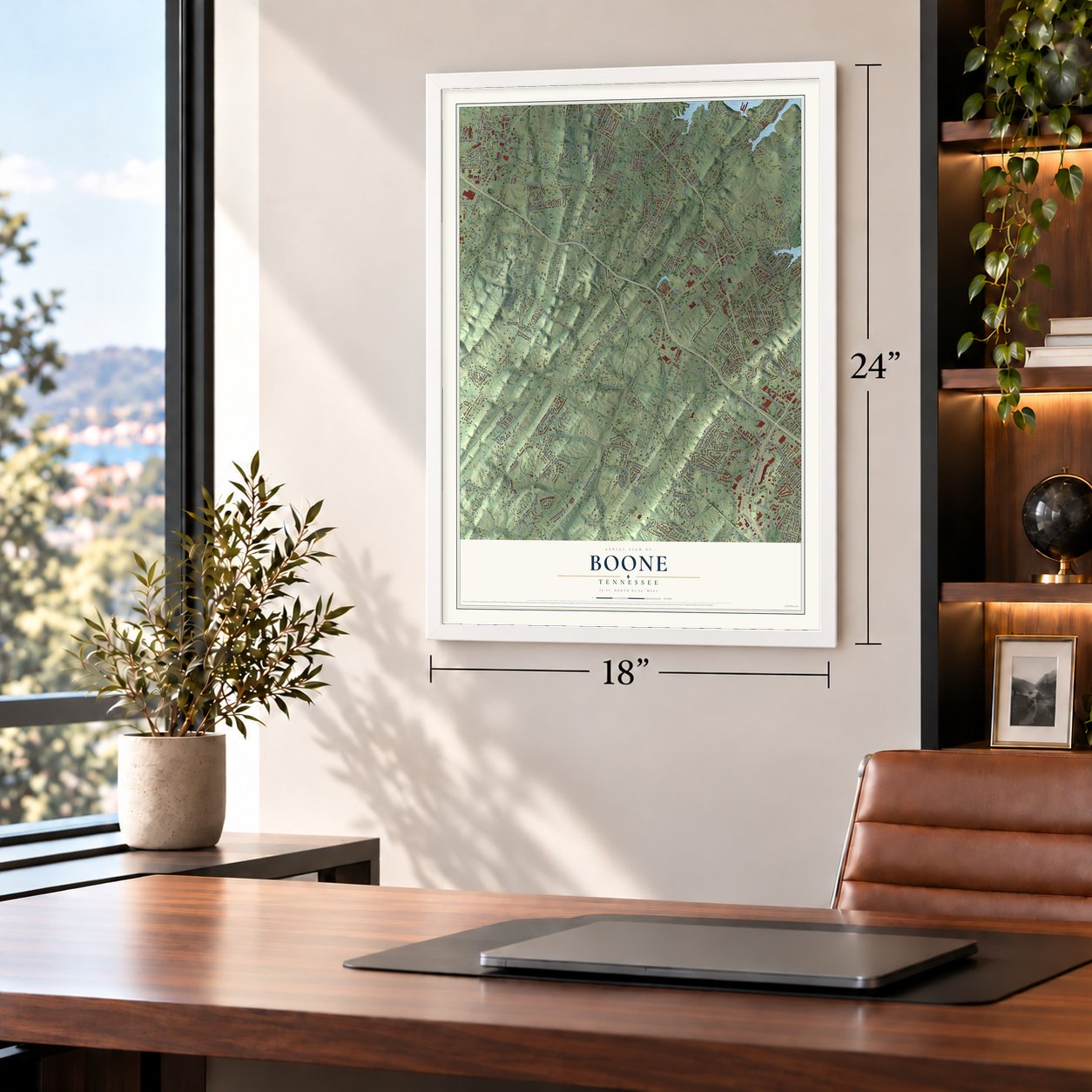
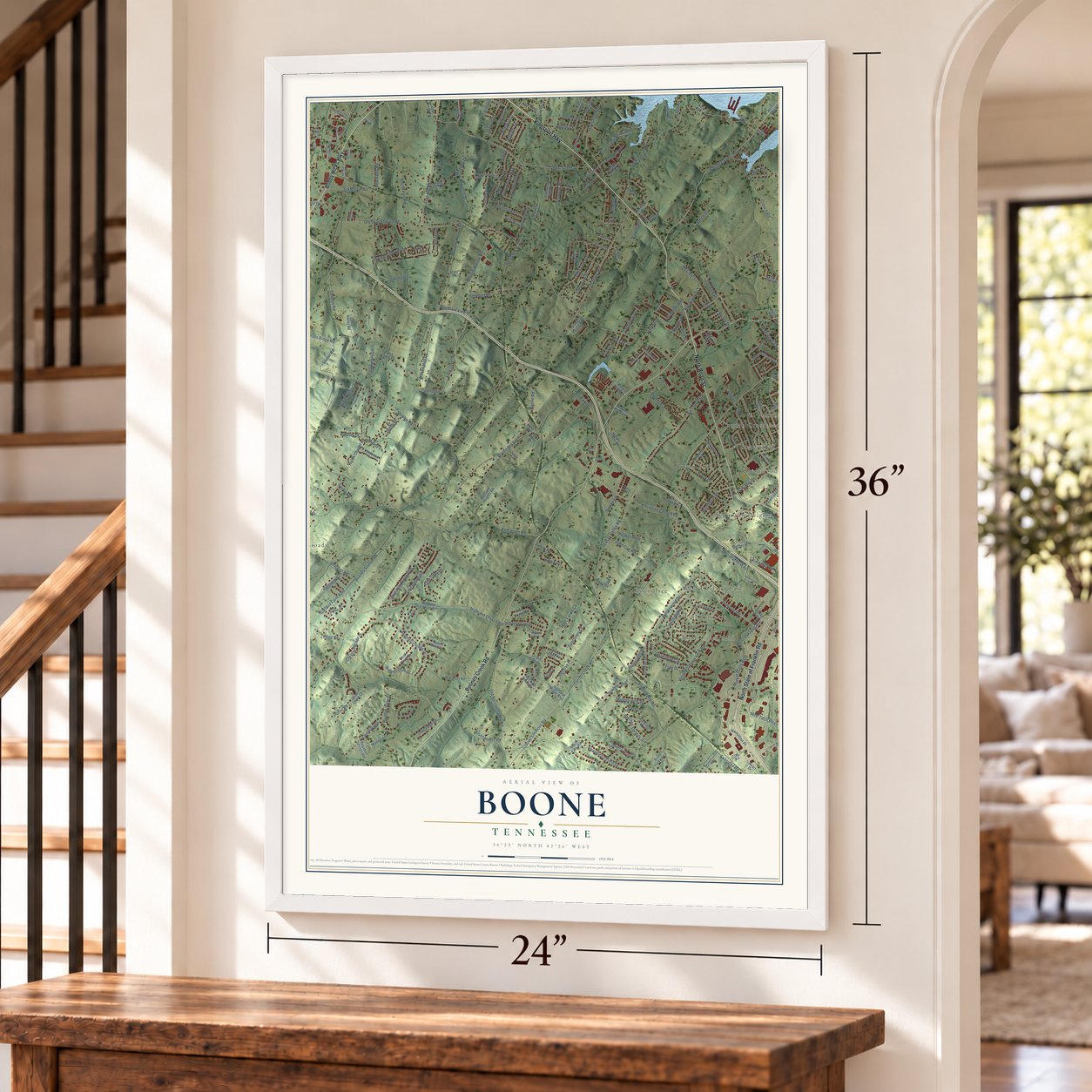
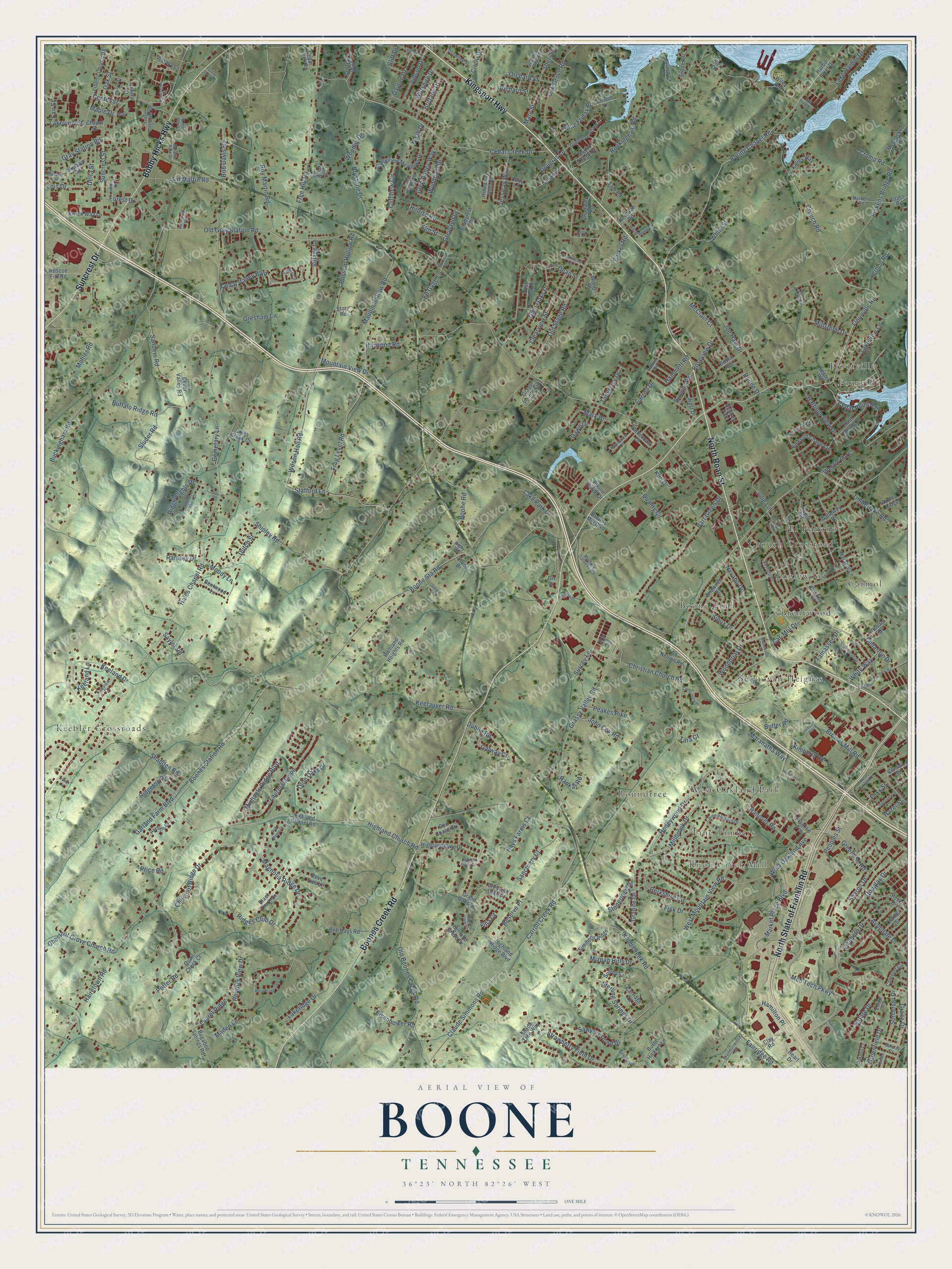
Explore Boone, Tennessee from a whole new perspective. Created using aerial imagery and detailed geographic data, this map captures Boone building by building, with labeled streets, familiar landmarks, and shaded topographical relief that highlights the natural contours of the landscape.
Combining modern data with the timeless character of a vintage atlas, this map is just as interesting up close as it is beautiful on the wall. Whether you grew up in Boone, spent memorable years there, or call it home today, this unique map is a great way to celebrate a place that means something to you. Zoom in on the preview to look for your street, and then order a print to put your memories on the wall.
Three ways to hang it
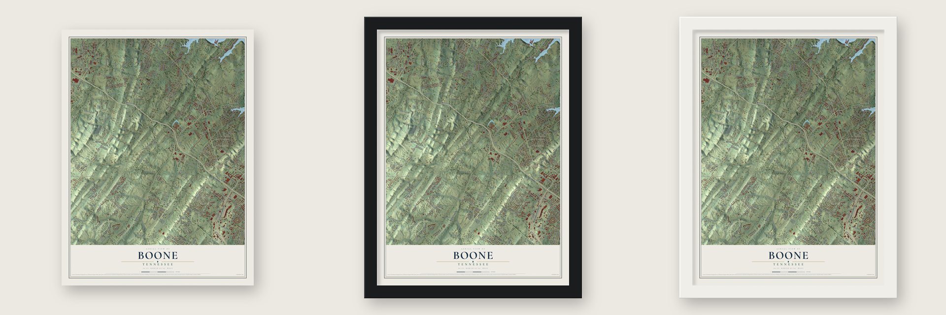
Unframed archival matte, a black wood frame or a white wood frame.
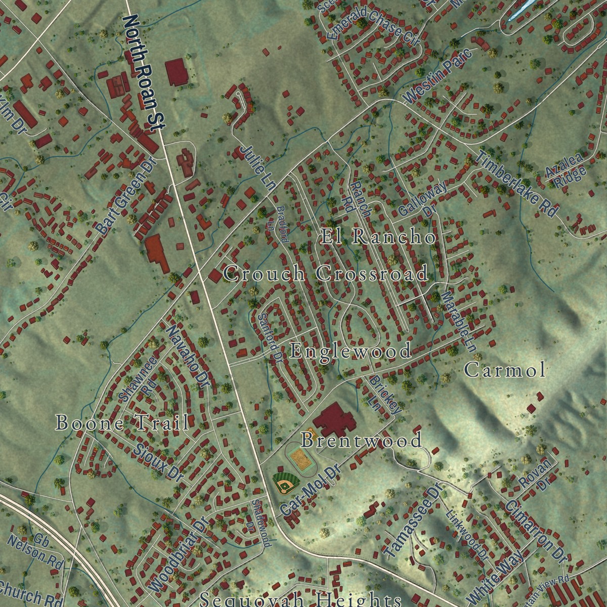
Up close
Geography Worth Displaying
This map was created using accurate cartographic data and authoritative geographic sources, including the U.S. Geological Survey and the Census Bureau. The map brings together terrain, waterways, roads, and building detail. The majority of the streets are labeled, houses are accurately depicted, and the topography is derived from government sources. Combining local data with carefully composed color and shading leads to this beautifully detailed Boone artwork for your wall.
Rather than simply showing street outlines, we’ve included as many of the street names as we could reasonably fit on the map while keeping their names legible. Zoom in on the high resolution preview to see exactly what’s on the map. We truly set out to create a statement piece for anyone who loves Boone. So whether it’s for you, or a gift for someone you love, we hope this map of Boone brings back fond memories.
Read the story behind this map: Detailed Map of Boone, Tennessee.

Find your street
Names on the Boone map
Every name below is printed on this map. Look for your street, your school, the park where you played, or the pond down the road.
Places and landmarks14
- Knob Creek Mill
- Keebler Crossroads
- Fourville
- Boone Trail
- El Rancho
- West Oakland Park
- Roundtree
- Sequoyah Heights
- Crouch Crossroad
- Carmol
- Brentwood
- Pine Timbers
Show all 14 places
- Englewood
- Flourville
Streets and roads322
- Kingsport Highway
- North State of Franklin Road
- Boones Creek Road
- North Roan Street
- Bobby Hicks Highway
- Suncrest Drive
- Pickens Bridge Road
- Med Tech Parkway
- Highland Church Road
- Boring Chapel Road
- Estate Drive
- Carroll Creek Road
- Flourville Road
- Boones Station Road
- Roseview Drive
- Old Gray Station Road
- Knob Creek Road
- Hales Chapel Road
- Old Stage Road
- Free Hill Road
- Claude Simmons Road
- Maupin Hollow Road
- West Mountain View Road
- Frog Level Road
- Rockingham Road
- Possum Hollow Road
- Browns Mill Road
- Buckingham Road
- Wilson Hall Road
- Hairetown Road
Show all 322 streets
- Boone Sta Road
- Keefauver Road
- Oak Grove Road
- Old Boones Creek Road
- Christian Church Road
- Grassy Valley Road
- Gray Station Road
- Roy Martin Road
- Peoples Street
- Bart Green Drive
- Cedar Creek Drive
- Shadden Road
- Glen Oaks Drive
- Mohler Road
- Honeywood Drive
- Cedar Point Road
- Laurel Canyon
- Boone Road
- Crouch Road
- Heather View Drive
- West Oakland Avenue
- Ridges Club Drive
- Shipley Road
- Sluder Road
- Saylor Road
- Fairridge Road
- Sid Martin Road
- Wiltshire Drive
- Magnolia Ridge Drive
- Berkshire Circle
- Harwood Road
- Chestnut Ridge Drive
- Buffalo Ridge Road
- Cedar Valley Boulevard
- Garland Farm Boulevard
- Joe Hale Drive
- Lake Park Drive
- Clearview Street
- Sterling Springs Drive
- Suncrest Street
- Strawberry Field Drive
- Mountain View Drive
- Sanders Road
- Market Place Boulevard
- Lakeview Lane
- Keeland Drive
- Center Street
- Orchard Street
- Millbrook Drive
- Oak Street
- Sharon Drive
- Hamilton Place
- Navaho Drive
- Potter Road
- Chestnut Grove Church Road
- Olde Oaks Drive
- Price Road
- Woodbriar Drive
- Woodby Drive
- Ridgeheights Drive
- Sanctuary Court
- Blue Friday Road
- Timberlake Road
- Circle Drive
- Glen Abbey Way
- Grace Drive
- Michaels Ridge Boulevard
- Brystone Drive
- Lake Harbor Drive
- Vernon Road
- Judson Drive
- White Street
- Hanover Road
- Car-Mol Drive
- Greenline Road
- Hays Farms Court
- Browns Road
- Avondale Drive
- Sawyers Pond Drive
- Douglas Drive
- Dutch Street
- Harbour View Drive
- Barker Road
- Dayton Drive
- Mary Street
- Cliffview Circle
- Lakeridge Drive
- Greyland Drive
- Moody Lane
- Hammett Road
- Jessicas Way
- Ridgetop Drive
- Cimarron Drive
- Mark Drive
- Somerset Drive
- Quality Circle
- Mizpah Hills Drive
- Gresham Lane
- John Cox Road
- Peakes Pike
- Laurel Ridge
- Noah Drive
- Sioux Drive
- Galway Court
- Reserve Place
- Wyndham Drive
- Maden Lane
- Eisenhower Road
- Dublin Road
- Lizabeth Drive
- Ed Gage Lane
- Bob Davis Road
- Kimberly Court
- Ramsey Drive
- Hillrise Road
- Cemetary Lane
- Maranatha Way
- Boone Drive
- Tangency Drive
- Millstone Drive
- Greenfield Drive
- White Way
- Carroll Drive
- Douglas Lane
- Stoneridge Drive
- McClain Court
- Stafford Lane
- Granite Drive
- Delta Street
- Lakeview Street
- Village Lane
- Richard Street
- Cliff Drive
- Fair Street
- Crump Road
- Forest Drive
- Brittany Drive
- Westin Parc
- Lois Drive
- Tamassee Drive
- Sheri Street
- Surcey Lane
- Keeland Lane
- Klm Drive
- Fink Drive
- Hankal Road
- Foxx Street
- Elm Street
- Julie Lane
- Butler Road
- Maple Drive
- Dawn Drive
- Hazel Street
- Dean Street
- Tara Court
- Villa Court
- Highland Ridge Boulevard
- Highland Chapel Road
- Franklin Terrace
- Bugaboo Springs Road
- Ranch Road
- Emerald Chase Circle
- Ridgeview Meadows Drive
- Marable Lane
- Liberty Church Road
- Grand Oaks Drive
- Bob Hays Road
- Grays Pointe Circle
- Boone Avenue
- Katies Way
- Highland Gate Drive
- Roscoe Fitz Road
- Hale Meade Drive
- Hideaway Hills Road
- Steven Drive
- Kwick Way Lane
- Simmons Ridge
- Cherry Street
- Rebeccas Lane
- Heritage Road
- Shawnee Road
- Sun Chase Court
- Galloway Drive
- Richland Heights Road
- Black Thorn Drive
- McCracken Drive
- Crescent Lake Place
- Shadyrest Drive
- Gb Nelson Road
- Harbor Point Drive
- Burnt Hickory Lane
- Dove Tree Lane
- Surrey Lane
- Central Street
- Bentwood Lane
- Skyland Circle
- Settlers Way
- Cross Creek Court
- Snyder Drive
- Cedar Creek Road
- West Drive
- Wiley Road
- Cedar Valley Road
- Camelot Circle
- Carriage Court
- Highland Grove Drive
- Azalea Ridge
- Quail Creek Court
- Gilliam Lane
- Browns Mill Boulevard
- Rovan Drive
- Chapel Street
- Post Oak Drive
- Clamar Street
- Widner Lane
- Bentley Parc
- North Creek Drive
- Arnold Lane
- Chadwick Road
- Coby Lane
- Boone Ridge Drive
- Stone Drive
- Shade Tree Way
- Clay Road
- Brickey Lane
- Heart Drive
- Story Road
- Tate Road
- Lester Road
- Glass Road
- Nick Drive
- Orr Court
- Memory Gardens Road
- Pine Timbers Drive
- Oak Grove Village
- Boonedock Lane
- Sanford Drive
- Keeview Drive
- Boone Hill Court
- Hayfield Drive
- Kennesaw Drive
- Scenic Oak Drive
- Spratlin Park Drive
- Linkwood Drive
- Oakdell Court
- Hazelwood Drive
- Brandonwood Drive
- Barclay Court
- Grove Street
- Shannon View Drive
- Dogwood Street
- Judge Gresham Road
- Lee Drive
- Valley Circle
- Matherly Road
- Briarwood Drive
- Julian Lane
- Industrial Road
- Estate Court
- Centre Park Drive
- Tall Tree Drive
- Candor Road
- Rigby Road
- Shadowood Drive
- Bradford Lane
- East Mountain View Road
- Lester Heights Road
- Whispering Lake Drive
- Morris Lane
- Isenberg Drive
- Kensington Place
- Hollow Timbers Drive
- Alexander Drive
- Grace Meadows Court
- Great Oak Way
- Cornerstone Drive
- Ridgeview Drive
- Austin Ridge Court
- Highland Ridge Terrace
- Elizabeth Avenue
- Maple Court
- Hopewell Drive
- Red Maple Court
- Highland Glen Court
- West Oakland Court
- Pinnacle Drive
- Homestead Lane
- Terrace Drive
- Internet Plaza
- Kram Court
- Trotter Lane
- Lizzy Drive
Names are listed as they appear on the printed map. Zoom into the product photos to find them.
About Boone, Tennessee
Boone is a small community in Washington County, Tennessee, with no town government of its own. The community took its name to honor the pioneer Daniel Boone.
Keep exploring Tennessee
Boone is one of 640 Tennessee towns we've mapped. Every dot on the map is a print of its own.
The search covers every state, Tennessee first.
Near Boone
Order 2 or more town maps and save 10%. Shown in the size and finish you picked above, so they hang as a set.
- Oak Grove 12" x 18" / Archival Matte Print $39.99
- Gray 12" x 18" / Archival Matte Print $39.99
- Johnson City 12" x 18" / Archival Matte Print $39.99


More maps nearby: Spurgeon, Jonesborough, Holston, Cherokee and Sulphur Springs.
The art of mapping a place
How This Map Was Made
Real places. Remarkable detail. Discover the layers that turn geographic data into a map of home.

The view from above
Aerial imagery reveals the character of the land: woodland, open fields, and the patterns of a place.

The shape of the land
Elevation data brings hills, valleys, and subtle changes in the landscape into view.

The details of home
Roads, waterways, and building footprints come together to make the map feel unmistakably local.

Geography becomes art
Considered color, shading, and typography bring the layers together in a map made for your wall.


Process illustrated with Mendon, Massachusetts. Aerial imagery: USDA NAIP. Terrain: USGS 3D Elevation Program. Map details and finished artwork: KNOWOL.
The Details
About This Print
Choose an archival matte print, or a black or white Ayous wood frame. The archival matte print is unframed.
Select your size and finish above to see the matching product image and price.
Materials & Craftsmanship
A contemporary map with the character of a classic atlas, printed on archival matte paper. Optional frames are made from Ayous wood.
Your printed map does not include the watermark shown in the full-map preview.
Shipping & Delivery
Free shipping within the United States. Every print is made to order in the USA.
Buying a gift? Add a note in your cart and we'll include it. We never put prices in the package.
Prints ship within 2 to 3 business days. Allow 7 to 10 days total from ordering for delivery. Timing may vary during holidays or periods of high order volume.
Read our shipping policy.
Returns and damaged prints
Each print is made to order. Change-of-mind refunds are not available after production.
If your print arrives damaged, misprinted or incorrect, contact support@knowol.com within 30 days of receiving it. Include your order number, photos and a description of the issue.
Read our full refund and replacement policy. For questions about your order, email support@knowol.com.