
Search for another town





Free U.S. delivery 7 to 10 days after you order
Bozrah, Connecticut Map Art
A new map of Bozrah, Connecticut, made in 2026 and printed to order on thick archival matte paper.
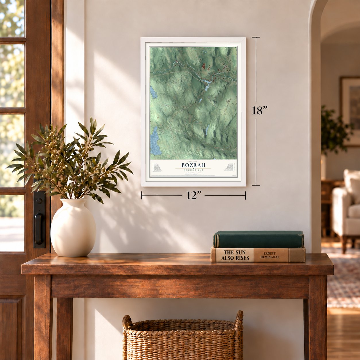
12" x 18" Archival Matte Print
A Map of Home. A Work of Art.
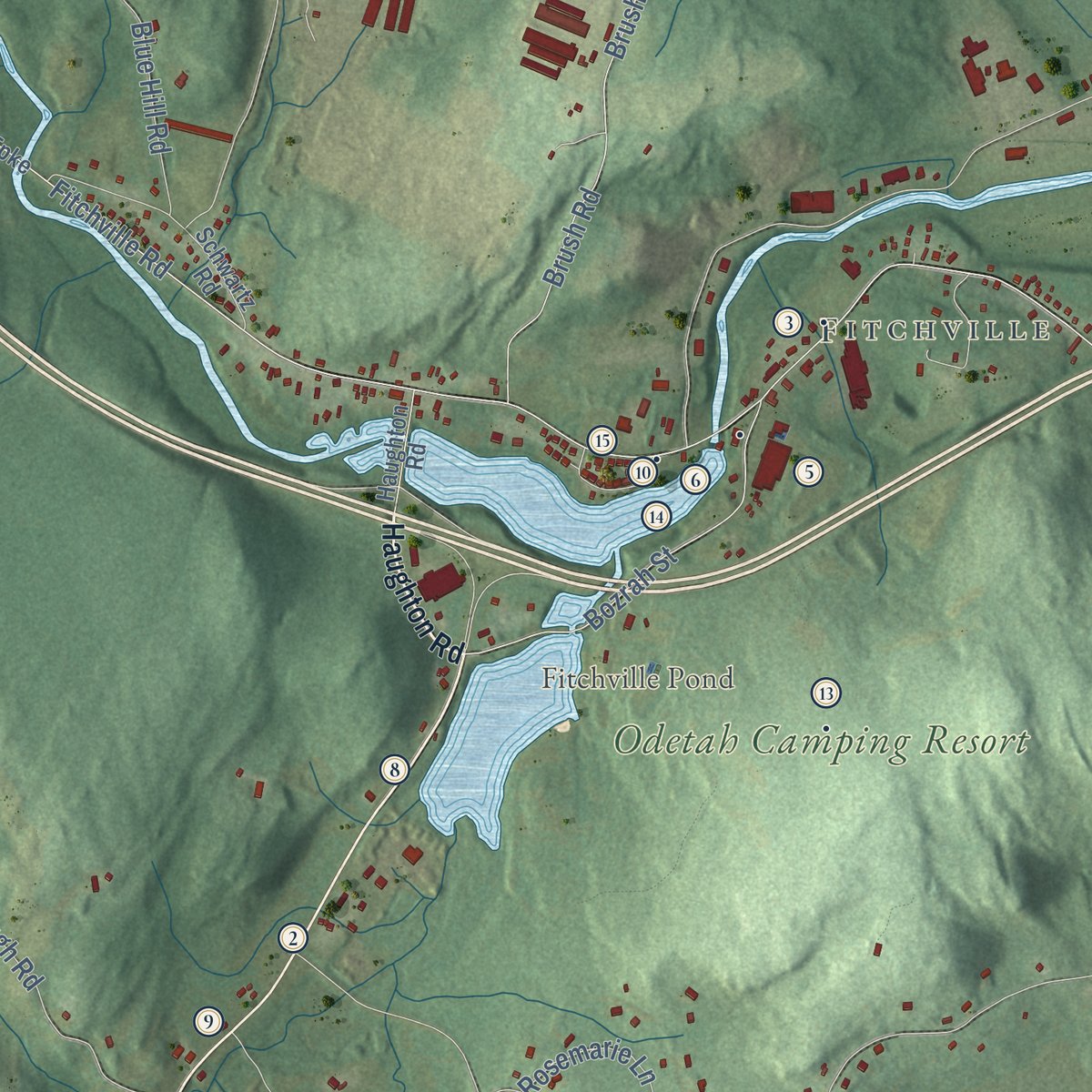
Explore Bozrah, Connecticut from a whole new perspective. Created using aerial imagery and detailed geographic data, this map captures Bozrah building by building, with labeled streets, familiar landmarks, and shaded topographical relief that highlights the natural contours of the landscape.
Combining modern data with the timeless character of a vintage atlas, this map is just as interesting up close as it is beautiful on the wall. Whether you grew up in Bozrah, spent memorable years there, or call it home today, this unique map is a great way to celebrate a place that means something to you. Zoom in on the preview to look for your street, and then order a print to put your memories on the wall.

Three ways to hang it
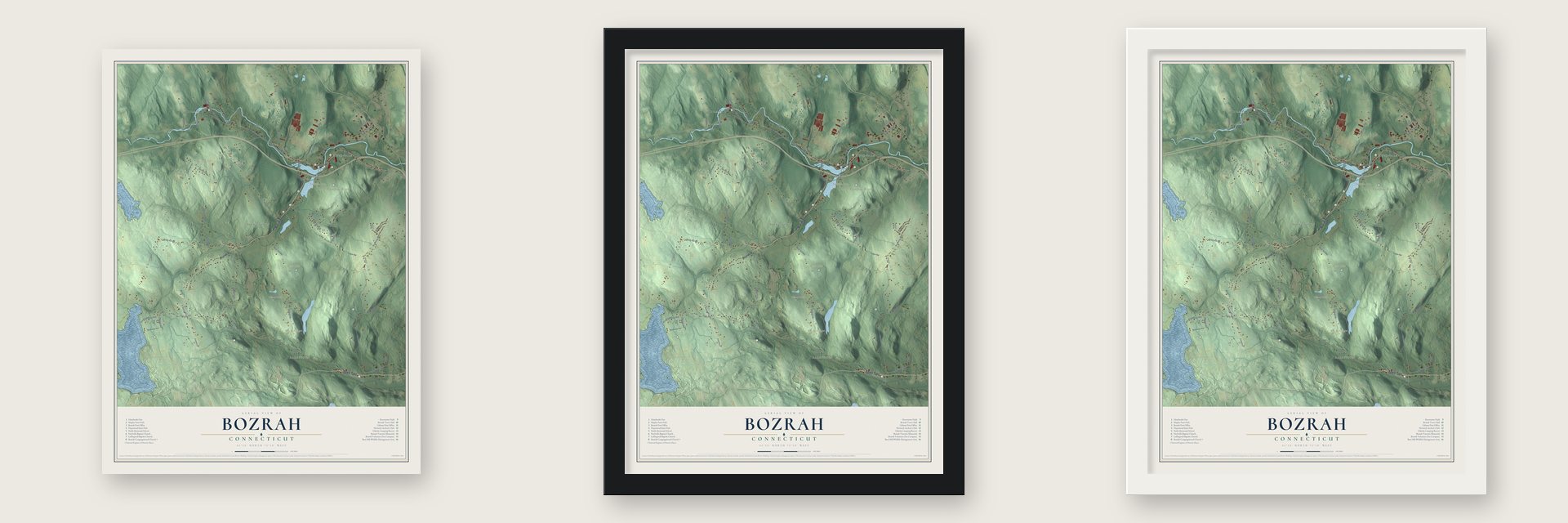
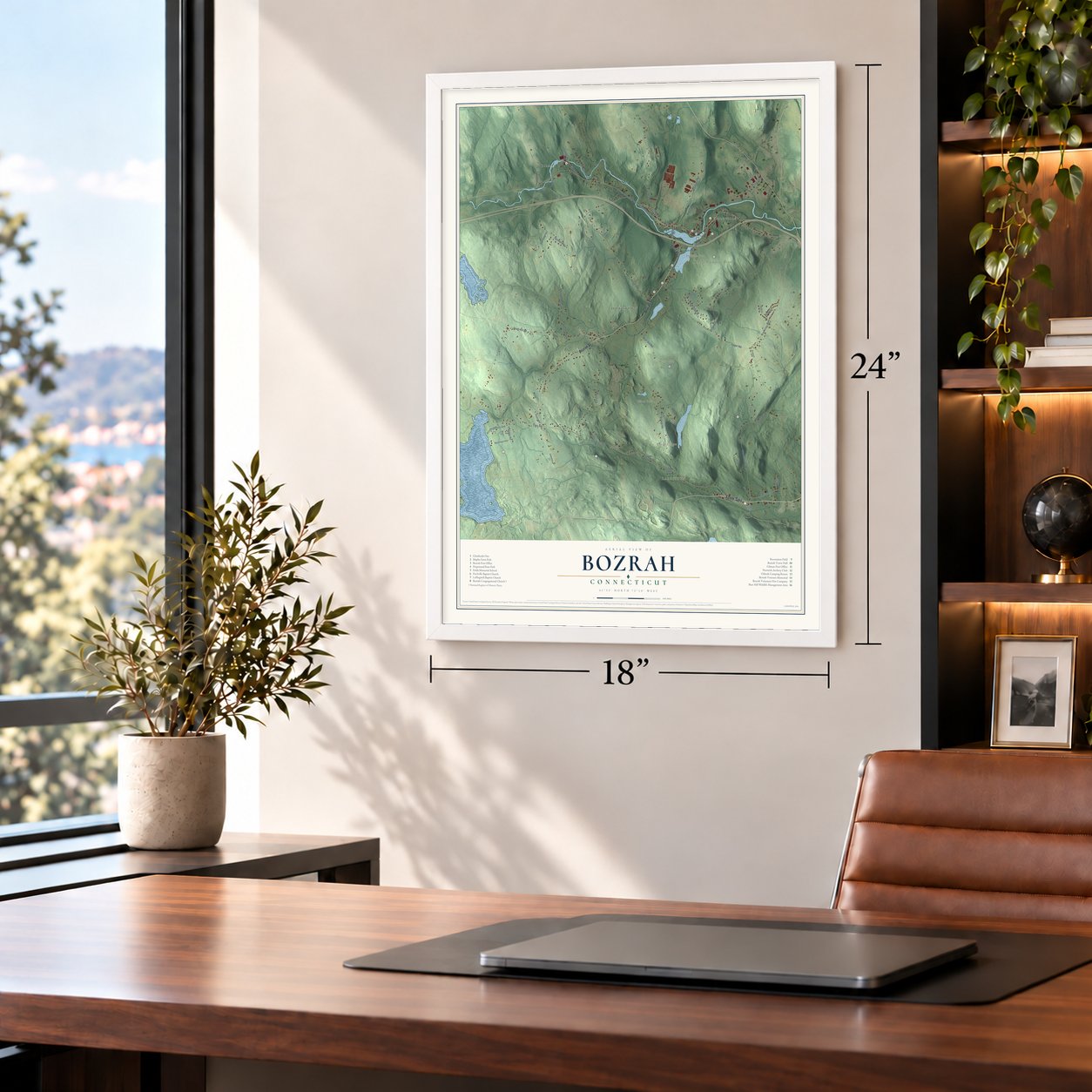
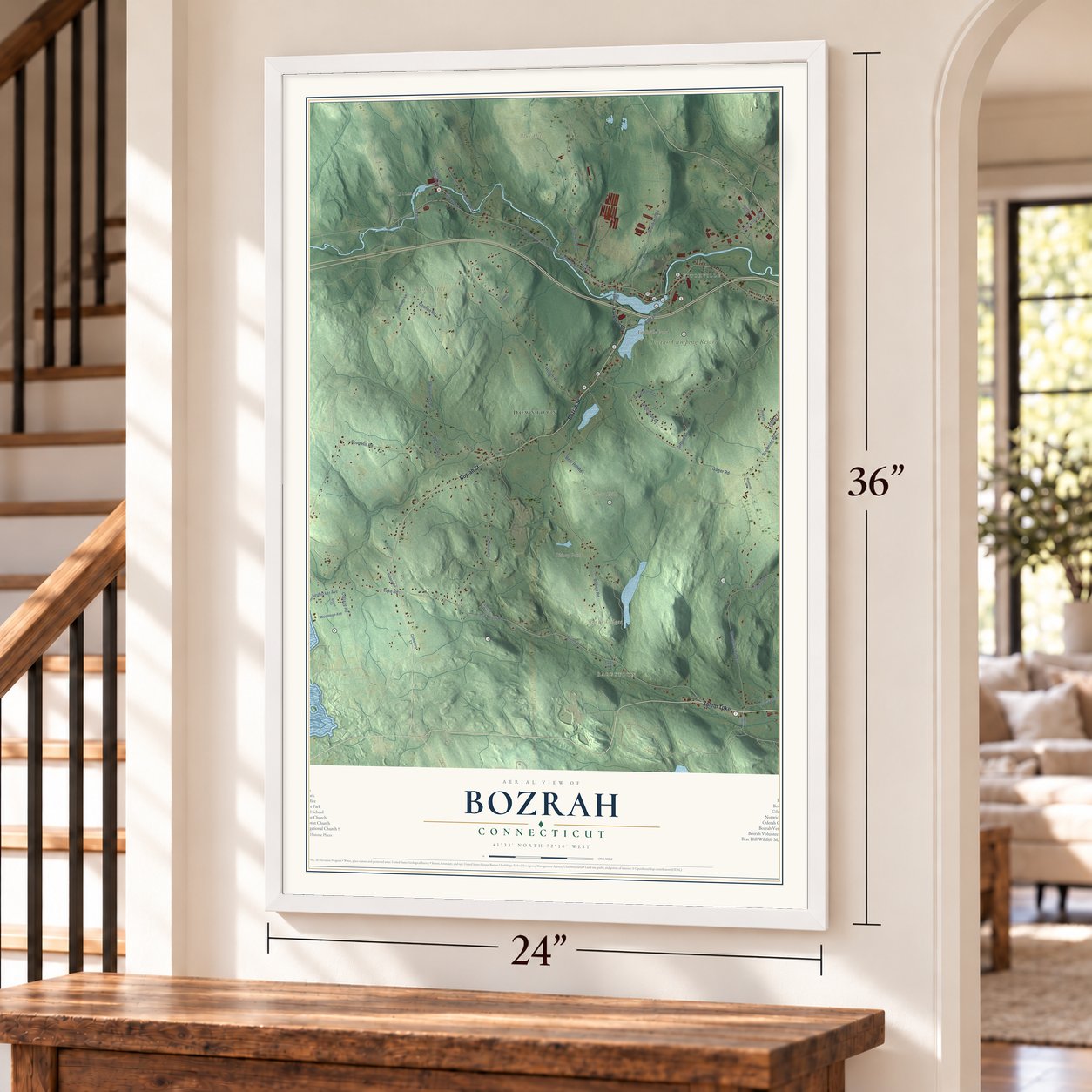
Unframed archival matte, a black wood frame or a white wood frame.
Up close
Geography Worth Displaying
This map was created using accurate cartographic data and authoritative geographic sources, including the U.S. Geological Survey (USGS) and FEMA. The map brings together terrain, waterways, roads, and building detail. The majority of the streets are labeled, houses are accurately depicted, and the topography is derived from government sources. Combining local data with carefully composed color and shading leads to this beautifully detailed Bozrah artwork for your wall.
Rather than simply showing street outlines, we’ve included as many of the street names as we could reasonably fit on the map while keeping their names legible. Zoom in on the high resolution preview to see exactly what’s on the map. We truly set out to create a statement piece for anyone who loves Bozrah. So whether it’s for you, or a gift for someone you love, we hope this map of Bozrah brings back fond memories.
Explore the full map of Bozrah, Connecticut and read about the local places it shows.

About Bozrah, Connecticut
Bozrah is a town of 2,429 people in New London County, on the Yantic River. Its land was first settled within the original nine-miles-square of Norwich. Residents won permission to form a parish in 1715 but couldn't yet pay a minister, so the parish wasn't organized until 1737, under the name New Concord, as Norwich's Fourth Society. Rev. Benjamin Throop was ordained its first pastor in 1739 and served 46 years, and in 1786 New Concord became the town of Bozrah.
The first town meeting gathered in the meetinghouse on June 20, 1786, and the new town sent one deputy to the General Assembly. A newer meetinghouse was finished in 1815, the year Rev. David Austin became minister. After two years of debate over repairing it or starting over, work on the present Bozrah Congregational Church began in January 1843. The town paid $400 to hold its own meetings in the basement, and it met there for more than 100 years. The parsonage went up beside the church in 1872 on land given by Clarissa Haughton, and the two joined the National Register together in 1991.
“The hail stones were so large as to be taken for the falling of bricks from the chimney upon the roofs of the houses.”
- The hailstorm of 1799Late on Monday, July 15, 1799, a dark cloud from the south collided with another out of the northwest, and by six o'clock Bozrah lay under a nearly black sky. Hailstones two and three inches across fell on winds close to hurricane force. Windows facing the storm broke, barns lost roofs, pigs, sheep and geese died, and hail drifts five or six inches deep lasted for days. Only two or three men and one or two children were knocked down.
- Mills on the YanticBozrah's industry began in 1750, when Nehemiah Huntington and Capt. Joshua Abel opened an iron works at today's Fitchville. In 1814 New Yorker David L. Dodge and partners built a stone cotton and wool factory upriver at Bozrahville. Norwich's Thames Company took it in 1824, and in 1837 James Boorman and other New Yorkers bought it as the Kent Manufacturing Company.
- Nathan Gilman's villageNathan Gilman came from Russia in 1897, and in 1905 he bought the Bozrahville mill along with nearly every house in the village. In March 1908 fire gutted the mill, a $75,000 loss with no insurance to cover it. Gilman still paid back every creditor within seven years, and the village carries his name today.
- How Bozrah got its nameA local legend says the parish wanted Bath, after the English spa, but its Hartford messenger wore homespun so loud that a legislator recalled Isaiah's dyed garments from Bozrah, and the Assembly took the joke. An 1836 history said an old man near today's Fitchville once quoted "the prophet Bozrah," and neighbors named his corner for it. Frances Caulkins guessed Throop picked it because it reportedly meant sheepfold, and in 1866 she noted no other American town shared it.
Find your street
Names on the Bozrah map
Every name below is printed on this map. Look for your street, your school, the park where you played, or the pond down the road.
Places and landmarks14
- Bargytown
- Gilman
- Fitchville
- Blue Hill
- Bear Hill Wildlife Management Area
- Bozrah Congregational Church
- Bozrah Town Hall
- Bozrah Veterans Memorial
- Brush Hill
- Fields Memorial School
- Hopemead State Park
- Norwich Archery Club
Show all 14 places
- Odetah Camping Resort
- Recreation Field
Streets and roads11
- Fitchville Rd
- Bozrah St
- Blue Hill Rd
- Brush Hill Rd
- Brush Rd
- Stockhouse Rd
- Hill Rd
- Caroline Rd
- Roy Rd
- Old South Rd
- Wawecus Hill Rd
Names are listed as they appear on the printed map. Zoom into the product photos to find them.
The art of mapping a place
How This Map Was Made
Real places. Remarkable detail. Discover the layers that turn geographic data into a map of home.

The view from above
Aerial imagery reveals the character of the land: woodland, open fields, and the patterns of a place.

The shape of the land
Elevation data brings hills, valleys, and subtle changes in the landscape into view.

The details of home
Roads, waterways, and building footprints come together to make the map feel unmistakably local.

Geography becomes art
Considered color, shading, and typography bring the layers together in a map made for your wall.


Process illustrated with Mendon, Massachusetts. Aerial imagery: USDA NAIP. Terrain: USGS 3D Elevation Program. Map details and finished artwork: KNOWOL.
The Details
About This Print
Choose an archival matte print, or a black or white Ayous wood frame. The archival matte print is unframed.
Select your size and finish above to see the matching product image and price.
Materials & Craftsmanship
A contemporary map with the character of a classic atlas, printed on archival matte paper. Optional frames are made from Ayous wood.
Your printed map does not include the watermark shown in the full-map preview.
Shipping & Delivery
Free shipping within the United States. Every print is made to order in the USA.
Buying a gift? Add a note in your cart and we'll include it. We never put prices in the package.
Prints ship within 2 to 3 business days. Allow 7 to 10 days total from ordering for delivery. Timing may vary during holidays or periods of high order volume.
Read our shipping policy.
Returns and damaged prints
Each print is made to order. Change-of-mind refunds are not available after production.
If your print arrives damaged, misprinted or incorrect, contact support@knowol.com within 30 days of receiving it. Include your order number, photos and a description of the issue.
Read our full refund and replacement policy. For questions about your order, email support@knowol.com.
Find your town
Looking for another city?
Find a map of home in our Connecticut collection, or any town in the country.
Nearby
Maps of towns near Bozrah
Know someone from one of these towns? Their map makes a great gift.
 Norwich
, Connecticut
From $39.99See the map
 Oakdale
, Connecticut
From $39.99See the map
 Franklin
, Connecticut
From $39.99See the map
More maps nearby: Montville, Salem, Mohegan, Baltic and Lebanon.