
Search for another town



Free U.S. delivery 7 to 10 days after you order
Montville, Connecticut Map Art
Building by building, with labeled streets and shaded relief.
12" x 18" Archival Matte Print
A Map of Home. A Work of Art.
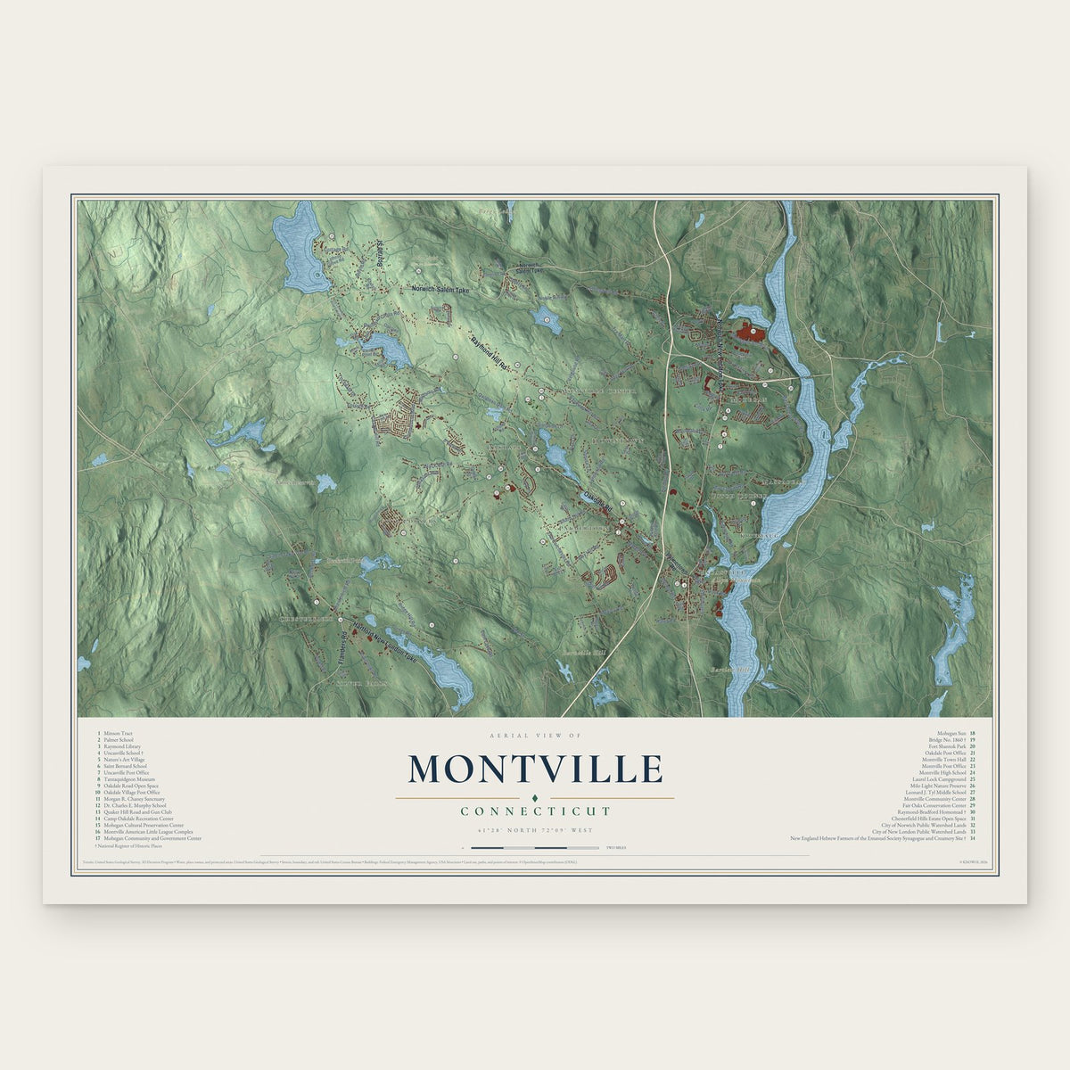
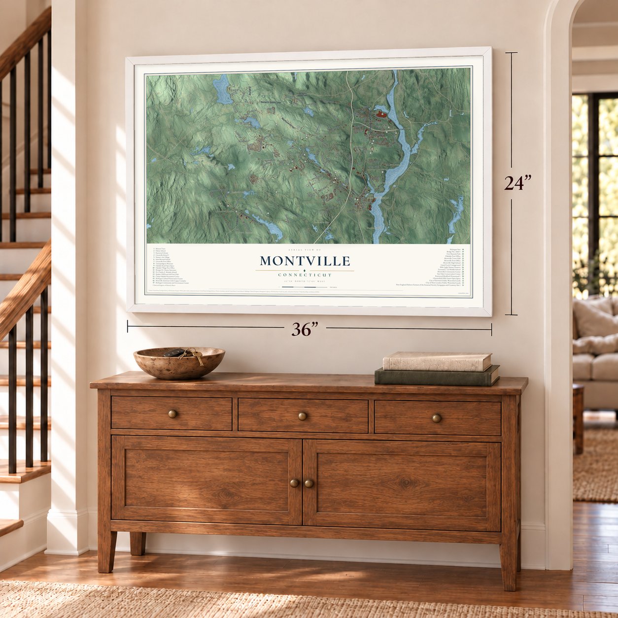
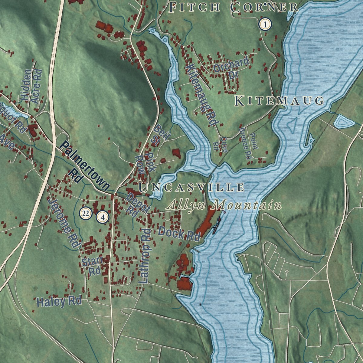
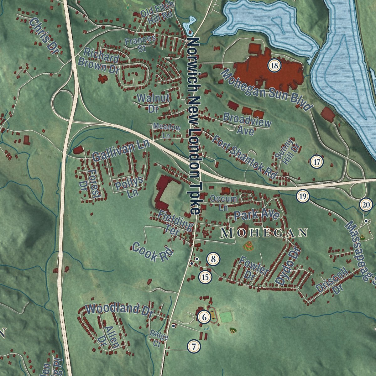
Explore Montville, Connecticut from a whole new perspective. Created using aerial imagery and detailed geographic data, this map captures Montville building by building, with labeled streets, familiar landmarks, and shaded topographical relief that highlights the natural contours of the landscape.
Combining modern data with the timeless character of a vintage atlas, this map is just as interesting up close as it is beautiful on the wall. Whether you grew up in Montville, spent memorable years there, or call it home today, this unique map is a great way to celebrate a place that means something to you. Zoom in on the preview to look for your street, and then order a print to put your memories on the wall.

Three ways to hang it
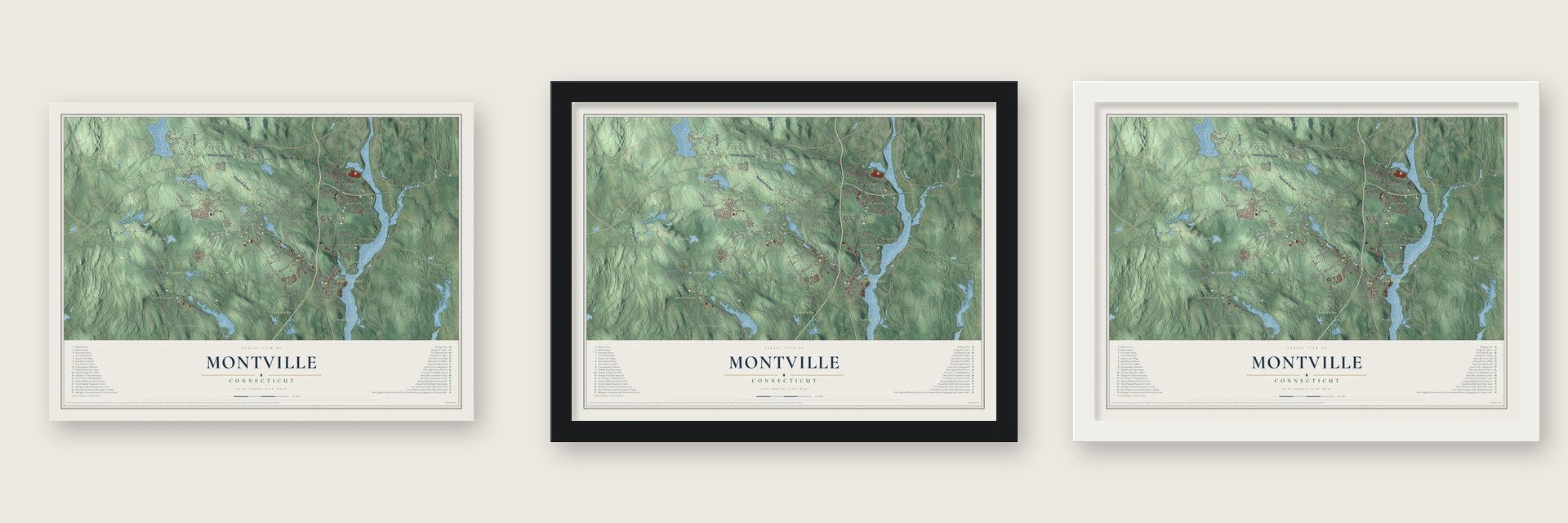
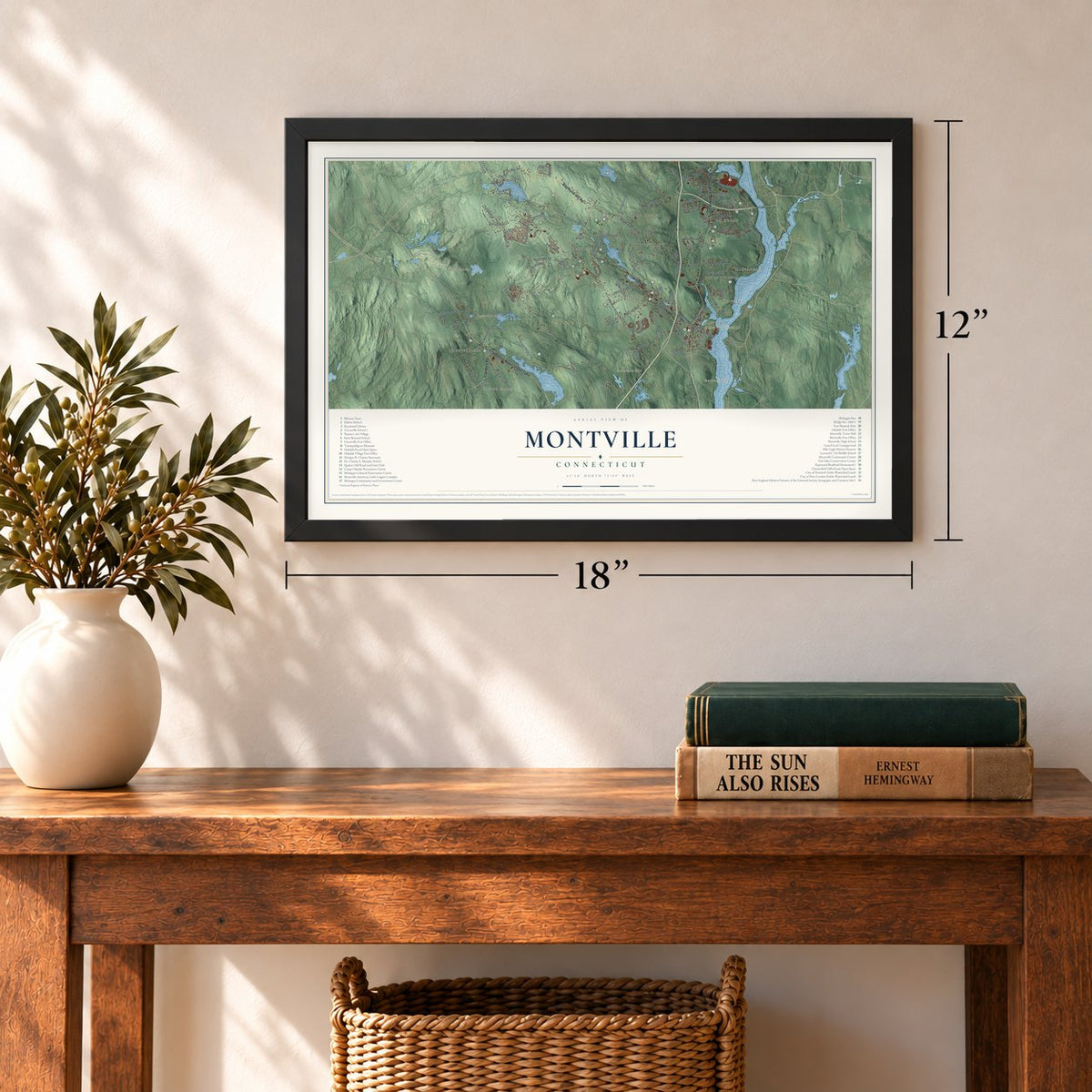
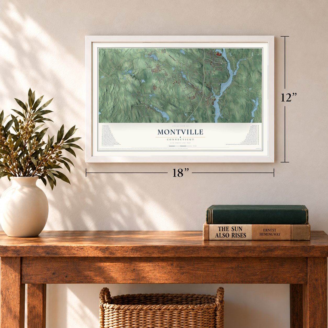
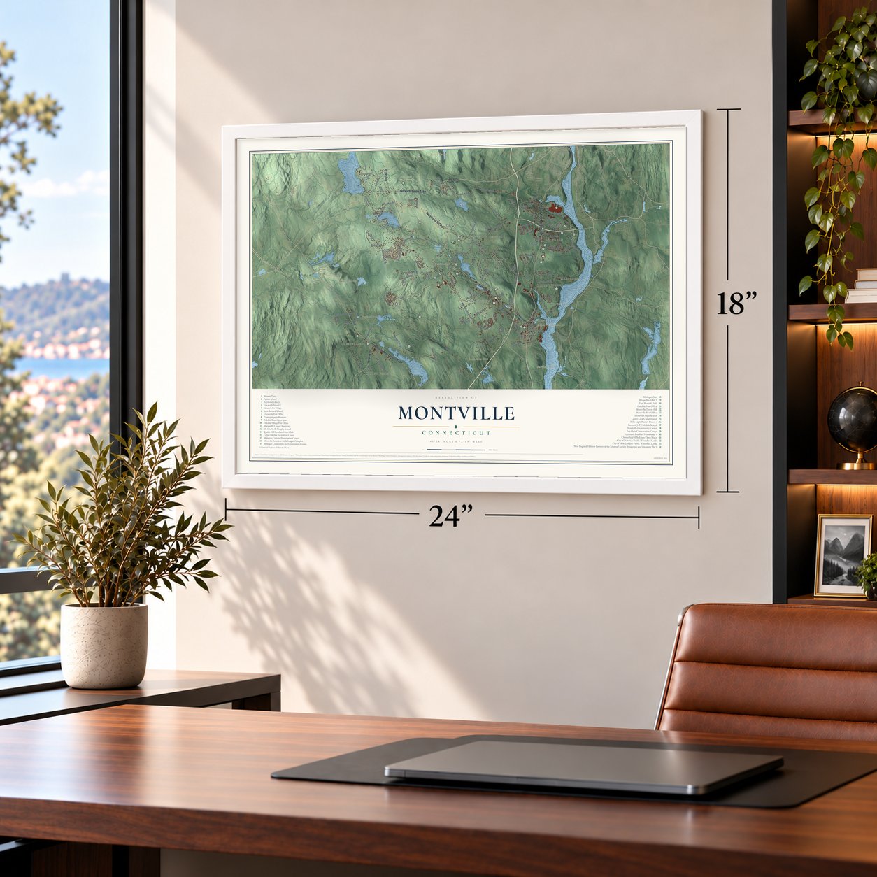
Unframed archival matte, a black wood frame or a white wood frame.
Up close
Geography Worth Displaying
This map was created using accurate cartographic data and authoritative geographic sources, including the U.S. Geological Survey (USGS) and FEMA. The map brings together terrain, waterways, roads, and building detail. The majority of the streets are labeled, houses are accurately depicted, and the topography is derived from government sources. Combining local data with carefully composed color and shading leads to this beautifully detailed Montville artwork for your wall.
Rather than simply showing street outlines, we’ve included as many of the street names as we could reasonably fit on the map while keeping their names legible. Zoom in on the high resolution preview to see exactly what’s on the map. We truly set out to create a statement piece for anyone who loves Montville. So whether it’s for you, or a gift for someone you love, we hope this map of Montville brings back fond memories.
Explore the full map of Montville, Connecticut and read about the local places it shows.

Find your street
Names on the Montville map
Every name below is printed on this map. Look for your street, your school, the park where you played, or the pond down the road.
Places and landmarks19
- Downtown
- Chesterfield
- Allyn Mountain
- Bargy Ledges
- Barnville Hill
- Bartlett Hill
- Barnes Reservoir
- Beckwith Pond
- Milo Light Nature Preserve
- Mohegan
- Silver Falls
- Fitch Corner
Show all 19 places
- Uncasville
- Massapeag
- Montville Center
- Four Corners
- Palmertown
- Kitemaug
- Oakdale
Streets and roads131
- Norwich-Salem Turnpike
- Hartford New London Turnpike
- Norwich New London Turnpike
- Oakdale Road
- Raymond Hill Road
- Flanders Road
- Bozrah Street
- Cherry Lane
- Old Colchester Road
- Chesterfield Road
- Fire Street
- Fitch Hill Road
- Kitemaug Road
- Maple Avenue
- Oxoboxo Dam Road
- Moxley Road
- Massapeag Side Road
- Ridge Hill Road
- Turner Road
- Chapel Hill Road
- Leffingwell Road
- Black Ash Road
- Connecticut Boulevard
- Lynch Hill Road
- Simpson Lane
- Cottage Road
- Gallivan Lane
- Derry Hill Road
- Massapeag Road
- Forsyth Road
Show all 131 streets
- Mohegan Sun Boulevard
- Doyle Road
- Woodland Drive
- Velgouse Road
- Gay Hill Road
- Noble Hill Road
- East Lake Road
- Jerome Road
- Butlertown Road
- Indian Hill Road
- Tra Mart Drive
- Pruett Place
- Oxoboxo Cross Road
- Sharp Hill Road
- Williams Road
- Salem Turnpike
- Lochdale Drive
- Pheasant Run
- Pires Drive
- Cook Road
- Lathrop Road
- Spruce Lane
- Beckwith Road
- Chris Drive
- Park Avenue
- Fielding Drive
- Dock Road
- Dydo Drive
- Haley Road
- Joy Lane
- Lisa Lane
- Norwich Salem Turnpike
- Palmertown Road
- Fort Shantok Road
- Depot Road
- Richard Brown Drive
- Fellows Road
- Pollys Lane
- Orchard Drive
- Pequot Road
- Daisy Hill Drive
- Lake Drive
- Salt Box Lane
- Broadview Avenue
- Pink Row
- Leitao Drive
- Lathrop Grove Road
- Oakland Drive
- Driscoll Drive
- D'Amato Drive
- Caroline Road
- Church Road
- Sarah Drive
- Hidden Acre Road
- Fowler Drive
- Carol Drive
- Fielding Terrace
- Laurel Point Drive
- Fox Road
- Day Road
- Allen Drive
- Forest Drive
- Glen Craig Place
- Marcia Drive
- Walnut Drive
- Birch Terrace
- Willow Drive
- Ortega Drive
- Lena Drive
- Lenas Road
- Starr Road
- Beit Street
- Oak Road
- Meeting House Lane
- Sunview Road
- Woodchuck Road
- Occum Lane
- Crandall Hill Road
- Old Fitch Hill Road
- Blais Road
- New York Road
- Frances Street
- Sunny Hill Drive
- Walker Road
- Green Valley Drive
- Platoz Drive
- Glendale Road
- Jennie Drive
- Saltbox Lane
- Looking Glass Circle
- Old Colchester Road Extended
- Hillcrest Drive
- Point Breeze Road
- Hunters Run
- Vermont Drive
- Gutterman Road
- Greystone Drive
- Meadow Lane
- Florida Drive
- Ridge Court
- Cove Road
Names are listed as they appear on the printed map. Zoom into the product photos to find them.
About Montville, Connecticut
Montville is a town of 18,387 people in New London County, on the west bank of the Thames River. The Mohegan sachem Uncas kept a fortified village at Shantok, high above the river, and it was the tribe's main village from 1636 to 1682. When New London's first bounds were drawn in 1646, they stopped at the Oxoboxo River, and the land to the north stayed Mohegan. Uncas made the first grants of it in 1658, to Richard Houghton and James Rogers, and by 1703 New London had annexed everything up to Norwich.
For generations this country was New London's North Parish, the halfway point on the river road to Norwich. The General Assembly turned the parish into a town on October 12, 1786, and on November 13 the first town meeting gathered in the parish meetinghouse, where voters gave the selectmen no pay for their time. The Mohegan Tribe was federally recognized in 1994, and its Mohegan Sun resort opened on October 12, 1996, exactly 210 years after the town's founding day.
“A name descriptive of its elevated and retired situation.”
- Woolen mills on the OxoboxoA saw-mill stood near the mouth of the Oxoboxo from about 1653, built by the direction of John Winthrop. John and Arthur Scholfield, who had first made woolens in Byfield, Massachusetts, leased the spot in 1798 and set up Connecticut's first water-powered woolen machinery. Montville had twelve small mills when it became a town in 1786 and twenty by 1882, when Palmer Brothers in Palmertown were making 2,500 bed quilts a day.
- Samson Occom's sermonsSamson Occom was born in Montville in 1723 and grew up as a Mohegan who became a minister. He sailed for Britain in 1766, and by July 1767 he had given close to four hundred sermons across England and Scotland to raise money for a school that later became Dartmouth College.
- A widow's farm from 1710The oldest part of the Raymond-Bradford Homestead on Raymond Hill Road went up about 1710. Mercy Sands Raymond, a Block Island widow, bought the land and farmed 1,500 acres there with her son Joshua and James Merritt until she died in 1741. The house got Federal-style changes about 1820 and more updates in the 1870s, and Raymond descendants still owned it when it joined the National Register in 1982.
- Jewish farmers in ChesterfieldIn the 1890s Jewish families from Eastern Europe moved from Brooklyn to Chesterfield, buying cheap farmland with help from the philanthropist Baron de Hirsch. Their congregation dates from 1890. Two years later, in 1892, they put up a small wooden synagogue and a cooperative creamery to handle their milk. A stone plaque marks the synagogue today, the creamery's foundations sit in the woods, and the synagogue and creamery site joined the National Register in 2012.
- A school that became Town HallGrace Palmer Melcer, whose family owned mills in town, paid for the Uncasville School, built in 1917 and 1918 to a Renaissance Revival design by Wilson Potter. It became a center of village life and held evening classes for immigrants. The building joined the National Register in 2001 and now houses Montville Town Hall.
Keep exploring Connecticut
Montville is one of 376 Connecticut towns we've mapped. Every dot on the map is a print of its own.
The search covers every state, Connecticut first.
Near Montville
Order 2 or more town maps and save 10%. Shown in the size and finish you picked above, so they hang as a set.
- Oakdale 12" x 18" / Archival Matte Print $39.99
- Oxoboxo River 12" x 18" / Archival Matte Print $39.99
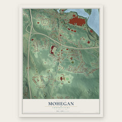
- Mohegan 12" x 18" / Archival Matte Print $39.99


More maps nearby: Quaker Hill, Gales Ferry, Salem, Bozrah and Oswegatchie.
The art of mapping a place
How This Map Was Made
Real places. Remarkable detail. Discover the layers that turn geographic data into a map of home.

The view from above
Aerial imagery reveals the character of the land: woodland, open fields, and the patterns of a place.

The shape of the land
Elevation data brings hills, valleys, and subtle changes in the landscape into view.

The details of home
Roads, waterways, and building footprints come together to make the map feel unmistakably local.

Geography becomes art
Considered color, shading, and typography bring the layers together in a map made for your wall.


Process illustrated with Mendon, Massachusetts. Aerial imagery: USDA NAIP. Terrain: USGS 3D Elevation Program. Map details and finished artwork: KNOWOL.
The Details
About This Print
Choose an archival matte print, or a black or white Ayous wood frame. The archival matte print is unframed.
Select your size and finish above to see the matching product image and price.
Materials & Craftsmanship
A contemporary map with the character of a classic atlas, printed on archival matte paper. Optional frames are made from Ayous wood.
Your printed map does not include the watermark shown in the full-map preview.
Shipping & Delivery
Free shipping within the United States. Every print is made to order in the USA.
Buying a gift? Add a note in your cart and we'll include it. We never put prices in the package.
Prints ship within 2 to 3 business days. Allow 7 to 10 days total from ordering for delivery. Timing may vary during holidays or periods of high order volume.
Read our shipping policy.
Returns and damaged prints
Each print is made to order. Change-of-mind refunds are not available after production.
If your print arrives damaged, misprinted or incorrect, contact support@knowol.com within 30 days of receiving it. Include your order number, photos and a description of the issue.
Read our full refund and replacement policy. For questions about your order, email support@knowol.com.