
Search for another town





Free U.S. delivery 7 to 10 days after you order
Brandon, Mississippi Map Art
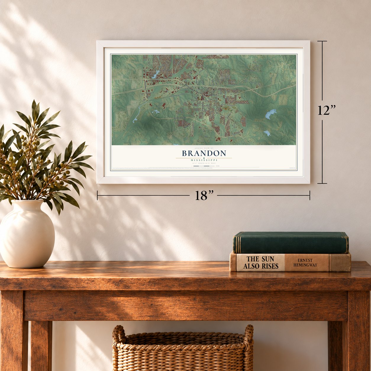
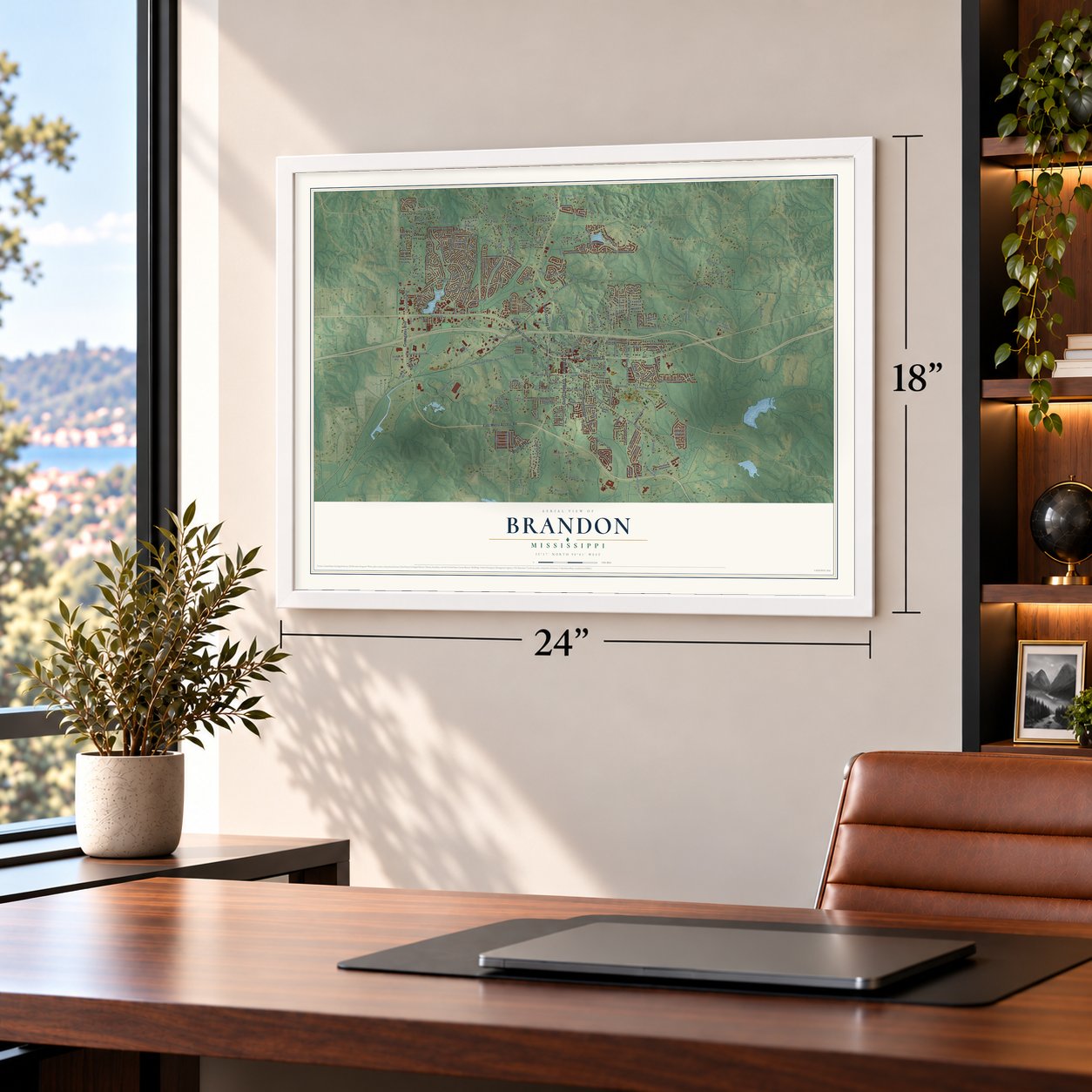
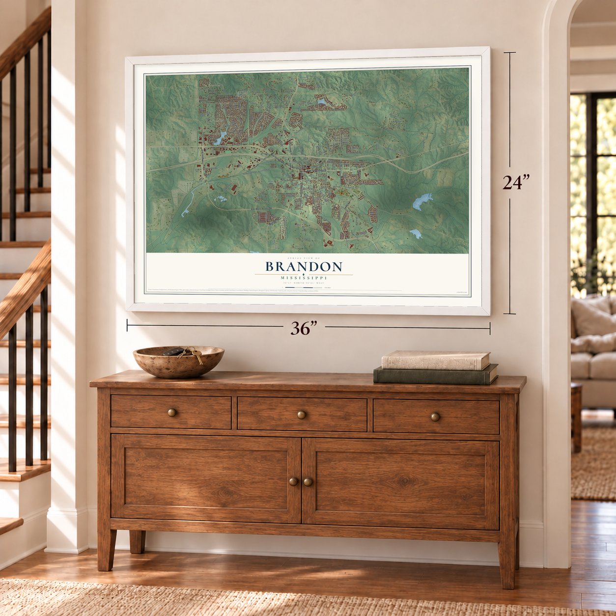
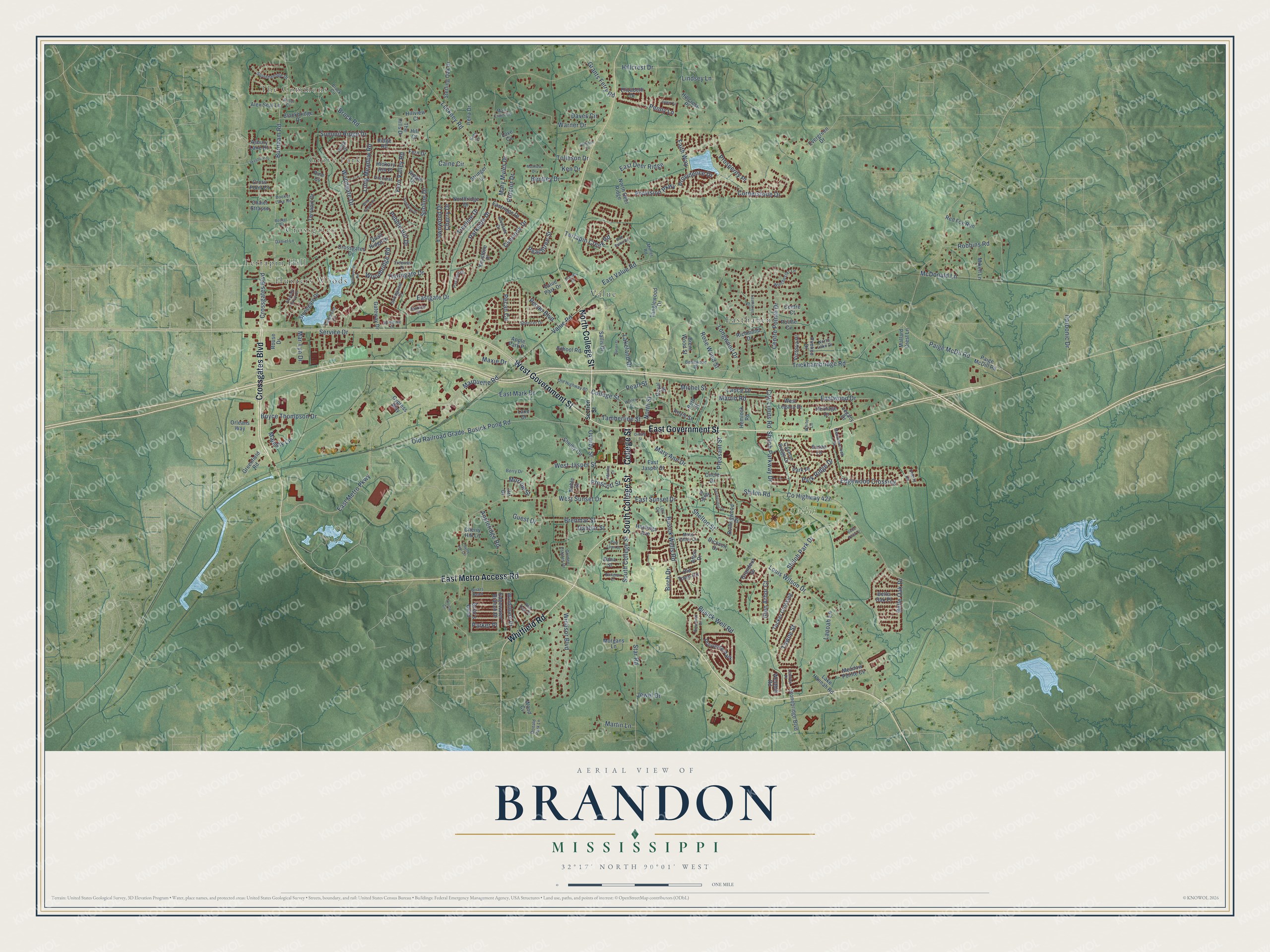
A new map of Brandon, Mississippi, made in 2026 and printed to order on thick archival matte paper.
12" x 18" Archival Matte Print
A Map of Home. A Work of Art.
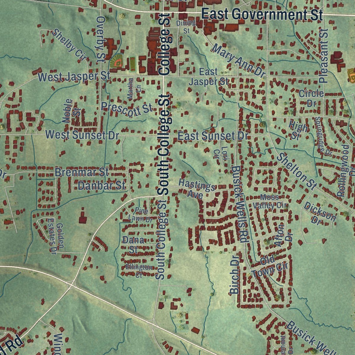
Explore Brandon, Mississippi from a whole new perspective. Created using aerial imagery and detailed geographic data, this map captures Brandon building by building, with labeled streets, familiar landmarks, and shaded topographical relief that highlights the natural contours of the landscape.
Combining modern data with the timeless character of a vintage atlas, this map is just as interesting up close as it is beautiful on the wall. Whether you grew up in Brandon, spent memorable years there, or call it home today, this unique map is a great way to celebrate a place that means something to you. Zoom in on the preview to look for your street, and then order a print to put your memories on the wall.
Three ways to hang it
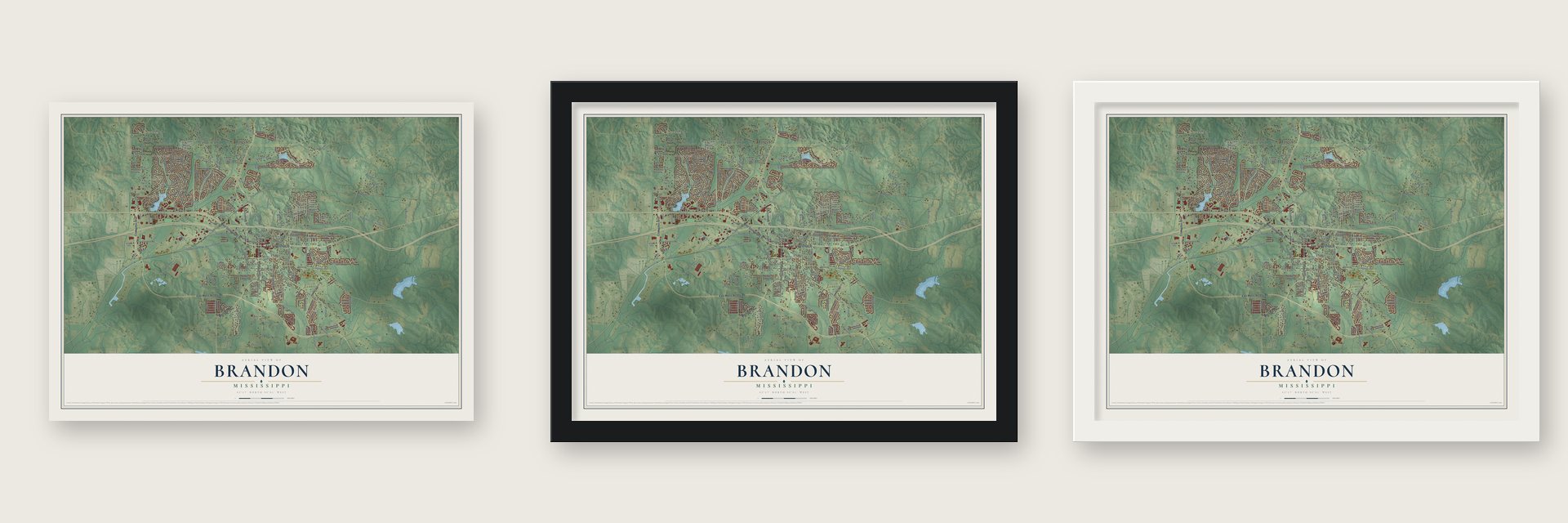
Unframed archival matte, a black wood frame or a white wood frame.
Up close
Geography Worth Displaying
This map was created using accurate cartographic data and authoritative geographic sources, including the U.S. Geological Survey and the Census Bureau. The map brings together terrain, waterways, roads, and building detail. The majority of the streets are labeled, houses are accurately depicted, and the topography is derived from government sources. Combining local data with carefully composed color and shading leads to this beautifully detailed Brandon artwork for your wall.
Rather than simply showing street outlines, we’ve included as many of the street names as we could reasonably fit on the map while keeping their names legible. Zoom in on the high resolution preview to see exactly what’s on the map. We truly set out to create a statement piece for anyone who loves Brandon. So whether it’s for you, or a gift for someone you love, we hope this map of Brandon brings back fond memories.
Read the story behind this map of Brandon, Mississippi from 2026.

About Brandon, Mississippi
Brandon is a city of 25,138 people and the county seat of Rankin County, about 12 miles east of Jackson. Rankin County was carved out of Hinds County in 1828, and its seat took the name of Gerard C. Brandon, who was Mississippi's governor in 1828-32. The town was incorporated on December 19, 1831.
Brandon grew as a market for the cotton farms around it, and the Alabama & Vicksburg railroad carried their crop away. An early county history counted between five and six thousand bales shipped from the town each year. In 1900 Brandon had 775 people and fifteen or twenty stores. The town also had a pair of hotels, a pair of livery stables, two cotton gins and a saw mill, along with an academy and telegraph and telephone offices.
- Methodists came firstThe Methodists put up Brandon's first church. The Presbyterians built next, then the Episcopalians, and the Baptists came last. By 1900 the small town supported six churches.
- A paper and two banksW. S. May founded The News, a Democratic weekly, in 1892 and served as its editor and publisher. The Brandon Bank opened in 1900 with $10,000 in capital, and by 1906 it held a surplus of $15,000 and deposits of about $135,000. That same year the Rankin County Bank opened with $20,000 in capital.
- From Brandon lawyer to governorRobert Lowry (1829-1910) practiced law in Brandon before rising to brigadier general in the Confederate army. He went on to serve in the state legislature and then as governor of Mississippi from 1882 to 1890.
- Miss America in 1959Mary Ann Mobley, born in Brandon, was crowned Miss America in 1959, the first winner from Mississippi. She went on to work as a singer, an actress and a television personality.
- Cookbooks since 1978In 1978 Barney McKee, who then led the University Press of Mississippi, started Quail Ridge Press in Brandon together with his wife, Gwen. The press began with Mississippi cookbooks and later grew beyond them.
Find your street
Names on the Brandon map
Every name below is printed on this map. Look for your street, your school, the park where you played, or the pond down the road.
Places and landmarks9
- The Commons
- Terrapin Hill
- Grove Park
- Crossgates
- Hunters Woods
- Shiloh Park
- Easthaven
- Value
- Provonce Park
Streets and roads249
- East Government Street
- Crossgates Boulevard
- South College Street
- North College Street
- College Street
- East Metro Access Road
- Whitfield Road
- West Government Street
- Burnham Road
- Busick Pond Road
- Mary Ann Drive
- East Metro Parkway
- Cornerstone Drive
- Trickhambridge Road
- Louis Wilson Drive
- Shiloh Road
- West Sunset Drive
- North Street
- Woodgate Drive
- Luckney Road
- Warner Drive
- Busick Wells Road
- Busick Well Road
- Summit Ridge Drive
- Fern Valley Road
- Lindsey Lane
- Eastgate Drive
- Shiloh Park Drive
- Thorngate Drive
- Star Road
Show all 249 streets
- Edgewood Crossing
- Paige McDil Road
- Boyce Thompson Drive
- McDonald Lane
- Brenmar Street
- Belle Oak Drive
- West Jasper Street
- Marquette Road
- Sunline Drive
- Mary Myles Drive
- Brock Road
- Pecan Circle
- East Deer Ridge
- Eastwood Drive
- Woodbridge Road
- Fawnwood Drive
- Value Road
- Centre Pointe Drive
- Lakeland Drive
- Towne Street
- East Value Road
- Carbonic Drive
- Windsor Boulevard
- Overby Street
- Long Meadow Road
- Old Railroad Grade
- Providence Drive
- Treeline Drive
- Martin Lane
- East Mark Drive
- Hillcrest Drive
- Michel Street
- Majesty Lane
- Parkside Drive
- Pebble Hill Drive
- County Highway 427
- Shiloh Parkway Drive
- City Limits Road
- Robbins Road
- Faith Way
- East Sunset Drive
- Tolleson Drive
- Lanoah Lane
- Overlook Drive
- Provision Parkway
- Prosperity Place
- Longwood Drive
- Pleasant Street
- Penny Lane
- Pearl Street
- Bentley Drive
- Terrapin Creek Road
- Rose Wood Street
- Glen Arbor Court
- Tamberline Street
- Martin Road
- Appleridge Road
- Lance Drive
- Park Ridge Drive
- Daves Circle
- Caine Circle
- Cherry Drive
- Grants Ferry Road
- Pecan Boulevard
- Proctor Drive
- Shelton Street
- Jewel Drive
- Peachtree Street
- Prescott Street
- Birch Drive
- Service Drive
- Danbar Street
- Morrow Street
- Mar-Lyn Drive
- Guest Drive
- Maxie Drive
- Parker Place
- Ken Drive
- Old Town Circle
- Susan Lane
- Crossgates Drive
- Paige McDill Road
- Tanglewood Drive
- Terrapin Drive
- East Jasper Street
- Afton Drive
- Richmond Drive
- Stonegate Drive
- Windchase Drive
- Grandeur Drive
- Cannon Ridge Drive
- Evergreen Drive
- West Legacy Drive
- Legacy Drive
- Rollingwood Drive
- Shelby Circle
- Tucker Crossing
- Chalet Strasse
- Hillcrest Place
- Apple Park Place
- Stonebridge Boulevard
- Northridge Drive
- Hastings Avenue
- Sterling Oak Drive
- The Hills Drive
- Eastridge Drive
- North Deer Ridge
- Edgewater Branch Drive
- Westhill Road
- School Road
- Elizabeth Drive
- Meadow Pointe Cv
- Value Park Drive
- Pimlico Drive
- Blackbridge Drive
- Victoria Place
- Hickory Hill Place
- Morgans Lane
- Red Fox Run
- Gateway Drive
- Briar's Bend
- Brent Wood Street
- Roxie Street
- Hemlock Road
- Alex Seal Lane
- Asbury Lane Drive
- Greenfield Road
- Irena Drive
- Orleans Way
- Mallard Crest Lane
- Lake Hannah Road
- Ridge Road
- High Street
- Heritage Drive
- Mikell Lane
- Circle Drive
- Belle Oak Place
- Dickson Drive
- Fern Drive
- Centre Court
- Keystone Place
- Pointe Cv
- Hillview Court
- Dana Street
- Cherry Hill Lane
- Park Place
- Rouse Drive
- Stringer Lane
- Quail Ridge Drive
- Cypress Way
- Sallis Drive
- Cross Point Cv
- Noble Street
- Ripple Drive
- Orr Drive
- Wood Cv
- Royal Street
- Love Cv
- Lake Drive
- Hill Court
- Beth Street
- Pine Cv
- Section Street
- Brock Circle
- Lakebend Circle
- Firecrest Drive
- Terrace Drive
- Briars Bend
- Old Highway 80
- Pavilion Drive
- Stonehendge Drive
- Daniel Lane
- Golden Estates Drive
- Springview Drive
- Red Oak Drive
- Bellewood Drive
- Spencer Drive
- Winchester Lane
- Glenside Drive
- Meadowcreek Drive
- Berry Drive
- Ridge Drive
- North Lake Drive
- Booker Lake Road
- Moss Valley Circle
- Cherry Lane
- Mary Crain Circle
- Treeway Drive
- Donald Park Lane
- Lori Circle
- Milner Road
- Lennox Place
- White Lane
- Arbor Court
- Kids Cv
- Springtree Drive
- Easthaven Drive
- Crosswoods Road
- Rosemont Drive
- Sandway Drive
- Springridge Drive
- Julee Circle
- Bella Vista Drive
- Lakeshore Drive
- Matthew Drive
- Cherry Hill Circle
- Pleasant Grove Drive
- Pine Lawn Drive
- Butler Street
- Ellington Court
- Booker Road
- Dining Street
- Wild Grove Place
- Tolleson Cv
- Martha Lane
- Rail Spike Road
- Brooks Drive
- Proctor Circle
- Worley Drive
Names are listed as they appear on the printed map. Zoom into the product photos to find them.
The art of mapping a place
How This Map Was Made
Real places. Remarkable detail. Discover the layers that turn geographic data into a map of home.

The view from above
Aerial imagery reveals the character of the land: woodland, open fields, and the patterns of a place.

The shape of the land
Elevation data brings hills, valleys, and subtle changes in the landscape into view.

The details of home
Roads, waterways, and building footprints come together to make the map feel unmistakably local.

Geography becomes art
Considered color, shading, and typography bring the layers together in a map made for your wall.


Process illustrated with Mendon, Massachusetts. Aerial imagery: USDA NAIP. Terrain: USGS 3D Elevation Program. Map details and finished artwork: KNOWOL.
The Details
About This Print
Choose an archival matte print, or a black or white Ayous wood frame. The archival matte print is unframed.
Select your size and finish above to see the matching product image and price.
Materials & Craftsmanship
A contemporary map with the character of a classic atlas, printed on archival matte paper. Optional frames are made from Ayous wood.
Your printed map does not include the watermark shown in the full-map preview.
Shipping & Delivery
Free shipping within the United States. Every print is made to order in the USA.
Buying a gift? Add a note in your cart and we'll include it. We never put prices in the package.
Prints ship within 2 to 3 business days. Allow 7 to 10 days total from ordering for delivery. Timing may vary during holidays or periods of high order volume.
Read our shipping policy.
Returns and damaged prints
Each print is made to order. Change-of-mind refunds are not available after production.
If your print arrives damaged, misprinted or incorrect, contact support@knowol.com within 30 days of receiving it. Include your order number, photos and a description of the issue.
Read our full refund and replacement policy. For questions about your order, email support@knowol.com.
Find your town
Looking for another city?
Find a map of home in our Mississippi collection, or any town in the country.
Nearby
Maps of towns near Brandon
Know someone from one of these towns? Their map makes a great gift.
 Robinhood
, Mississippi
From $39.99See the map
 Pearl
Pearl, Mississippi
From $39.99See the map
 Flowood
, Mississippi
From $39.99See the map
More maps nearby: Richland, Pelahatchie, Florence, Jackson and Ridgeland.