
Search for another town





Free U.S. delivery 7 to 10 days after you order
Bremerton, Washington Map Art
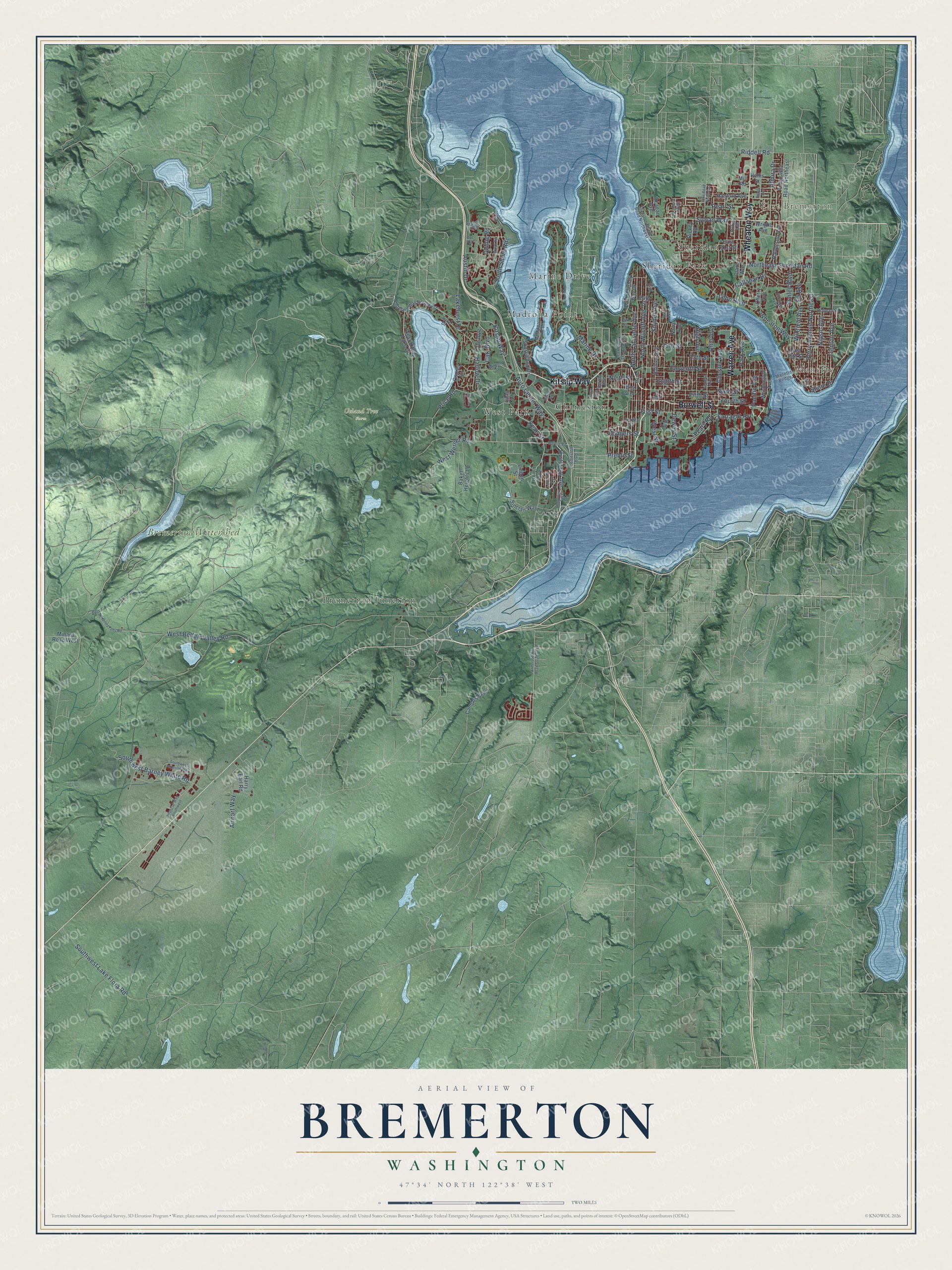
A new map of Bremerton, Washington, made in 2026 and printed to order on thick archival matte paper.
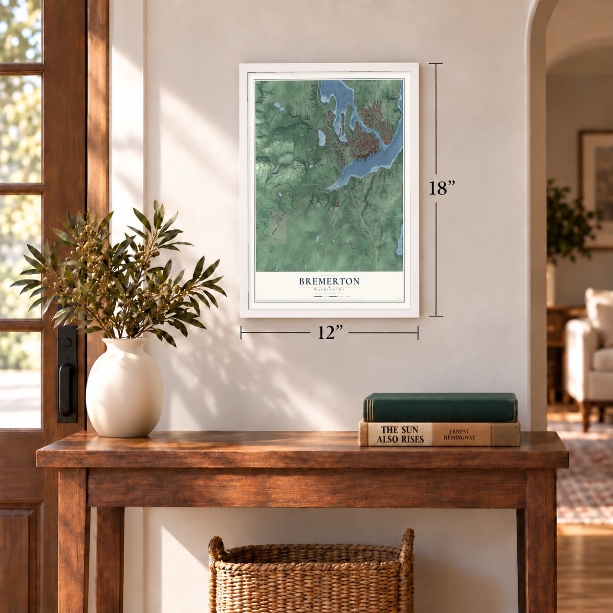
12" x 18" Archival Matte Print
A Map of Home. A Work of Art.
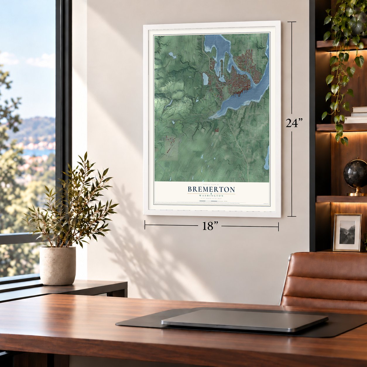
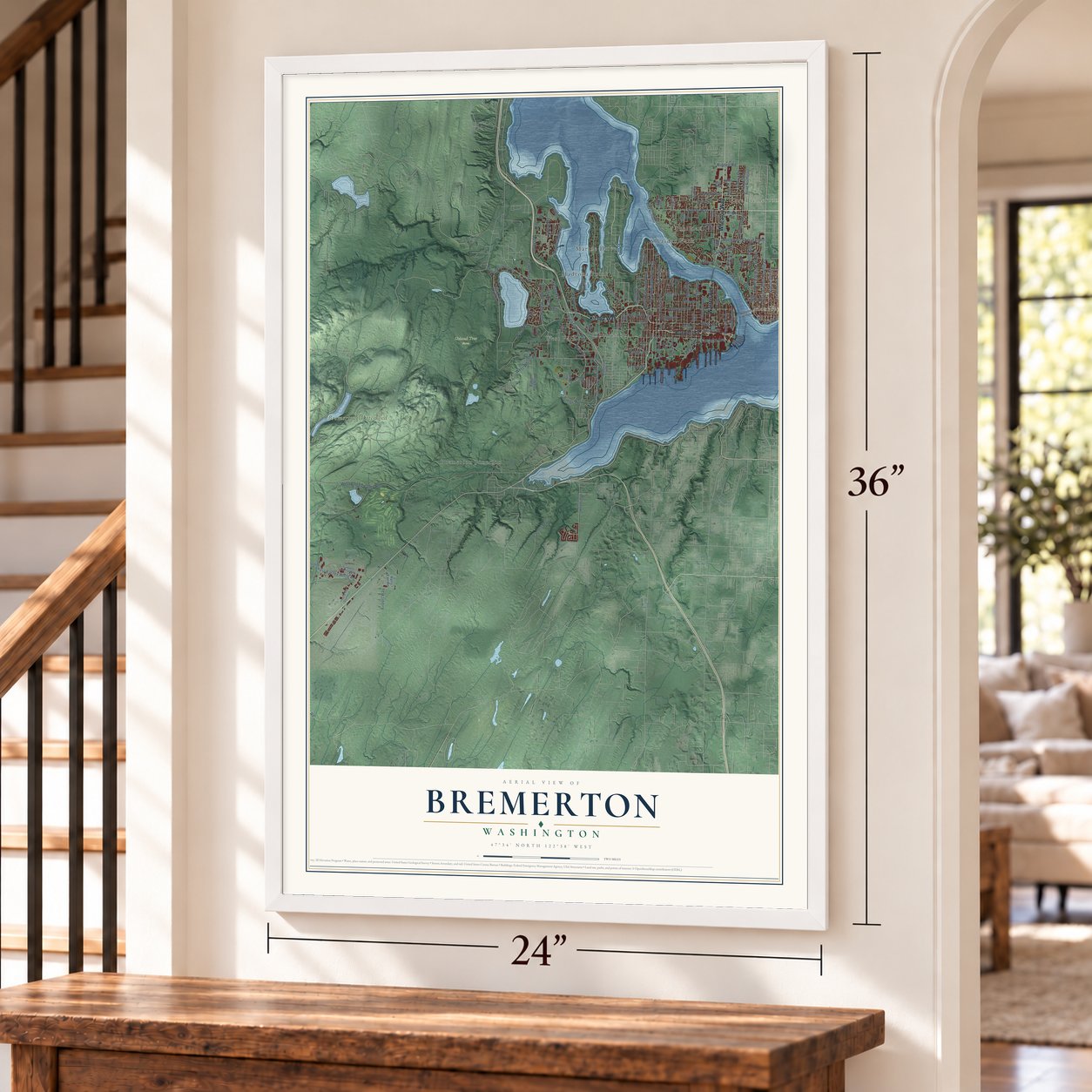
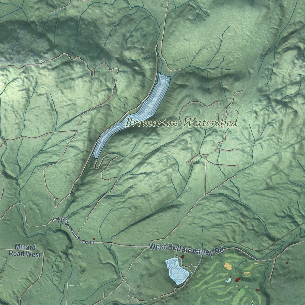
Explore Bremerton, Washington from a whole new perspective. Created using aerial imagery and detailed geographic data, this map captures Bremerton building by building, with labeled streets, familiar landmarks, and shaded topographical relief that highlights the natural contours of the landscape.
Combining modern data with the timeless character of a vintage atlas, this map is just as interesting up close as it is beautiful on the wall. Whether you grew up in Bremerton, spent memorable years there, or call it home today, this unique map is a great way to celebrate a place that means something to you. Zoom in on the preview to look for your street, and then order a print to put your memories on the wall.
Three ways to hang it
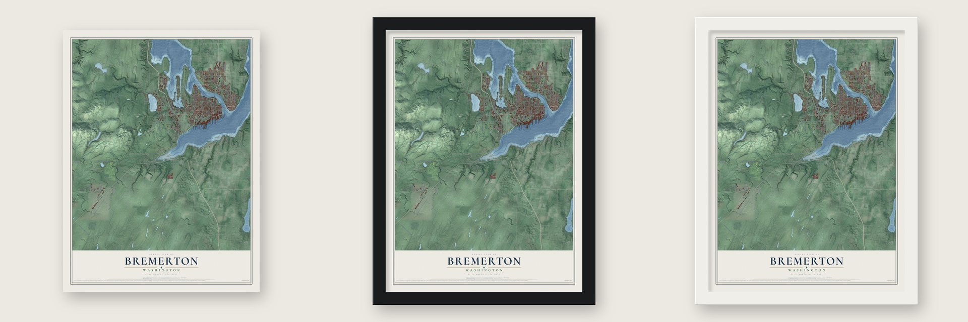
Unframed archival matte, a black wood frame or a white wood frame.
Up close
Geography Worth Displaying
This map was created using accurate cartographic data and authoritative geographic sources, including the U.S. Geological Survey and the Census Bureau. The map brings together terrain, waterways, roads, and building detail. The majority of the streets are labeled, houses are accurately depicted, and the topography is derived from government sources. Combining local data with carefully composed color and shading leads to this beautifully detailed Bremerton artwork for your wall.
Rather than simply showing street outlines, we’ve included as many of the street names as we could reasonably fit on the map while keeping their names legible. Zoom in on the high resolution preview to see exactly what’s on the map. We truly set out to create a statement piece for anyone who loves Bremerton. So whether it’s for you, or a gift for someone you love, we hope this map of Bremerton brings back fond memories.
Read the story behind this map of Bremerton, Washington from 2026.
About Bremerton, Washington
Bremerton is a city of 43,505 people in Kitsap County, on Point Turner about 15 miles west of Seattle. In 1877 Ambrose Barkley Wyckoff, a young lieutenant mapping upper Puget Sound, saw Sinclair Inlet as a home for the Navy and spent years pushing for a base there. Two Seattle men, William Bremer and Henry Hensel, guessed that a base would need a town beside it. In February 1891 they bought nearly 170 acres of waterfront, paying almost $200 for each acre, then sold 81 acres to Wyckoff at the Navy's limit of $50 an acre.
The partners lost over $12,000 on paper, but they kept the land inland and on the point. On December 10, 1891, Bremer filed a 25-acre plat for a town he named after himself. He gave or sold land cheaply for schools and churches and paid for the first wharf. The Panic of 1893 slowed the base and the town until Wyckoff, by then retired, rallied Seattle's Chamber of Commerce in 1899 and Congress raised funding. The yard's workforce grew from under 150 to over 600, and voters made Bremerton a city on October 2, 1901.
“There is not in the world nor could there be a harbour superior to Port Orchard”
- Give 'em hell, HarryOn the morning of June 10, 1948, President Harry S. Truman spoke to a large crowd on Pacific Avenue from the Elks Club balcony. Local legend says a man there was the first to shout "Give 'em hell, Harry!" Newspapers of the day reported the shout as "Lay it on, Harry!" instead, but a bronze plaque on the building's corner still claims the spot. That same day Truman attended Olympic Junior College's first commencement and received its first honorary degree.
- The saloon fight of 1904In November 1902 the Navy's Assistant Secretary, Charles Darling, sent all repair work to Mare Island in California, citing reports of prostitution, opium houses and robberies of sailors on the Bremerton waterfront. Mayor Alvyn Croxton wanted every saloon closed, and three council members fought him. Croxton won, and in June 1904 the council revoked all liquor licenses, so Darling made the yard a port of call again. Within two years the saloons were back.
- Hammerhead Crane No. 28Finished at the shipyard in April 1933, the crane stands 250 feet tall and can lift 250 tons. It was one of the largest in the nation, and it still rises over the Bremerton skyline.
- Home of the Mighty MoThe battleship USS Missouri, where Japan signed the surrender that ended World War II, joined the reserve fleet at the shipyard in 1955. For 30 years hundreds of thousands of visitors walked her surrender deck. She was recommissioned in 1985, and although local leaders fought through the mid-1990s to bring her home as a museum, the Navy gave her to Pearl Harbor in 1998.
Find your street
Names on the Bremerton map
Every name below is printed on this map. Look for your street, your school, the park where you played, or the pond down the road.
Places and landmarks11
- East Bremerton
- Manette
- Bremerton Watershed
- Ueland Tree Farm
- Bremerton Junction
- Charleston
- Madrona Point
- Marine Drive
- Sheridan
- Sheridan Park
- West Park
Streets and roads125
- Kitsap Way
- Burwell Street
- Wheaton Way
- Warren Avenue
- Farragut Avenue
- First Street
- Perry Avenue Northeast
- Kean Street
- Sylvan Way
- North Wycoff Avenue
- West Belfair Valley Road
- Sixth Street
- Eleventh Street
- Northeast Sheridan Road
- West Werner Road
- Southwest Lake Flora Road
- Ninth Street
- Fifth Street
- 13th Street
- Austin Drive
- 15th Street
- Harlow Drive
- Fourth Street
- Eighth Street
- North Lafayette Avenue
- Southwest Barney White Road
- Callahan Drive
- Auto Center Way
- Lebo Boulevard
- Chester Avenue
Show all 125 streets
- Almira Drive
- High Avenue
- Trenton Avenue
- Park Avenue
- Olding Road
- Price Road
- Nipsic Avenue
- Lakehurst Drive
- Schley Boulevard
- Shore Drive
- Rodgers Street
- Airport Way
- South Shore Road
- Snyder Avenue
- Winfield Avenue
- Pacific Avenue
- Carr Boulevard
- Riddell Road
- Pearl Street
- Ohio Avenue
- Fir Avenue
- Lyle Avenue
- Peary Road
- West Street
- Dewey Street
- Preble Street
- Oyster Bay Avenue
- Washington Avenue
- Union Avenue
- Baker Heights Lp
- Shorewood Drive
- Rainier Avenue
- Naval Avenue
- Campus Parkway
- Petersville Road Northeast
- Osprey Circle
- Cherry Avenue
- Ford Avenue
- Sinclair Way
- West Kitsap Lake Drive
- East Phinney Bay Drive
- Linden Street
- East 31st Street
- East 16th Street
- Halverson Avenue
- Rickey Road
- Wright Avenue
- Harry Earl Road
- Clare Avenue
- Minard Road West
- Hanford Avenue
- Hollis Street
- Reagan Avenue
- 24th Street
- Lilac Lane
- Mill Road
- Bayview Drive
- Boone Road
- Northlake Way Northwest
- Bertha Avenue
- Tracyton Beach Road Northwest
- Madrona Point Drive
- Corbet Drive Northwest
- Veneta Avenue
- Robin Avenue
- Bremerton Boulevard
- Seringa Avenue
- Manette Bridge
- Dora Avenue
- Holman Street
- Cole Avenue
- Lake Drive
- Taft Avenue
- Cedar Grove Street
- Lansing Avenue
- Coontz Street
- Pitt Avenue
- Werner Road
- Southwest Imperial Way
- Pine Road Northeast
- Anderson Hill Road Southwest
- Russell Road
- 19th Street
- West McKenna Falls Road
- Imperial Way Southwest
- Myers Road
- Higbee Road
- Wilmont Street
- Sereno Circle Drive
- Tik Place
- Maple Avenue
- Bye Road
- Meade Avenue
- Bryan Avenue
- 25th Street
Names are listed as they appear on the printed map. Zoom into the product photos to find them.
The art of mapping a place
How This Map Was Made
Real places. Remarkable detail. Discover the layers that turn geographic data into a map of home.

The view from above
Aerial imagery reveals the character of the land: woodland, open fields, and the patterns of a place.

The shape of the land
Elevation data brings hills, valleys, and subtle changes in the landscape into view.

The details of home
Roads, waterways, and building footprints come together to make the map feel unmistakably local.

Geography becomes art
Considered color, shading, and typography bring the layers together in a map made for your wall.


Process illustrated with Mendon, Massachusetts. Aerial imagery: USDA NAIP. Terrain: USGS 3D Elevation Program. Map details and finished artwork: KNOWOL.
The Details
About This Print
Choose an archival matte print, or a black or white Ayous wood frame. The archival matte print is unframed.
Select your size and finish above to see the matching product image and price.
Materials & Craftsmanship
A contemporary map with the character of a classic atlas, printed on archival matte paper. Optional frames are made from Ayous wood.
Your printed map does not include the watermark shown in the full-map preview.
Shipping & Delivery
Free shipping within the United States. Every print is made to order in the USA.
Buying a gift? Add a note in your cart and we'll include it. We never put prices in the package.
Prints ship within 2 to 3 business days. Allow 7 to 10 days total from ordering for delivery. Timing may vary during holidays or periods of high order volume.
Read our shipping policy.
Returns and damaged prints
Each print is made to order. Change-of-mind refunds are not available after production.
If your print arrives damaged, misprinted or incorrect, contact support@knowol.com within 30 days of receiving it. Include your order number, photos and a description of the issue.
Read our full refund and replacement policy. For questions about your order, email support@knowol.com.
Find your town
Looking for another city?
Find a map of home in our Washington collection, or any town in the country.
Nearby
Maps of towns near Bremerton
Know someone from one of these towns? Their map makes a great gift.
 Gorst
Gorst, Washington
From $39.99See the map
 Navy Yard City
, Washington
From $39.99See the map
 Kitsap Lake
, Washington
From $39.99See the map
More maps nearby: Port Orchard, Rocky Point, Erlands Point, East Port Orchard and Parkwood.