
Search for another town



Free U.S. delivery 7 to 10 days after you order
Brewton, Alabama Map Art
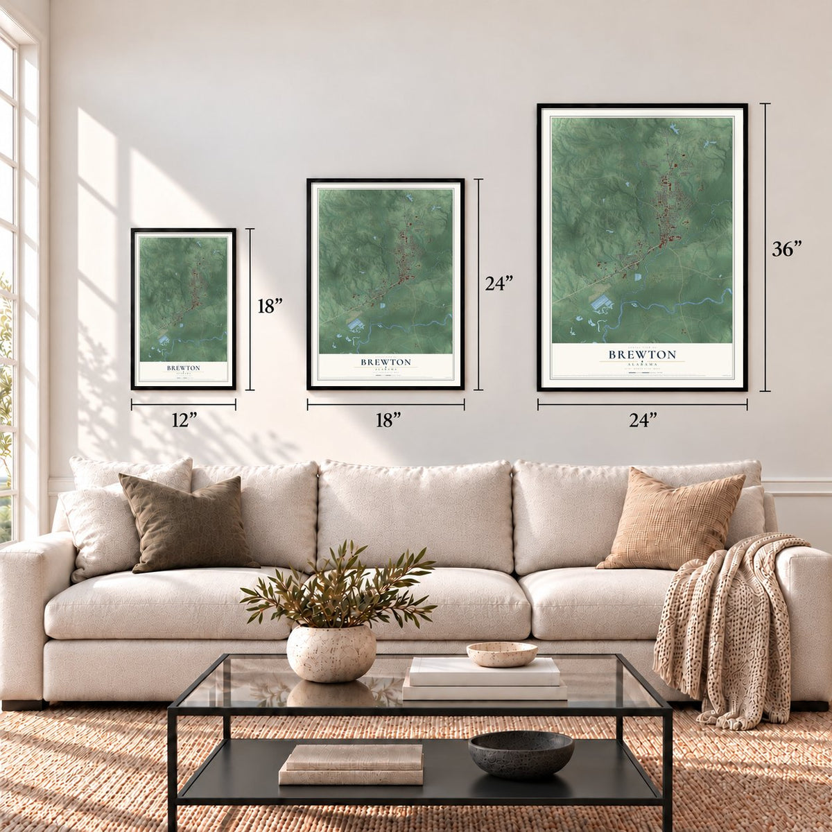
A new map of Brewton, Alabama, made in 2026 and printed to order on thick archival matte paper.
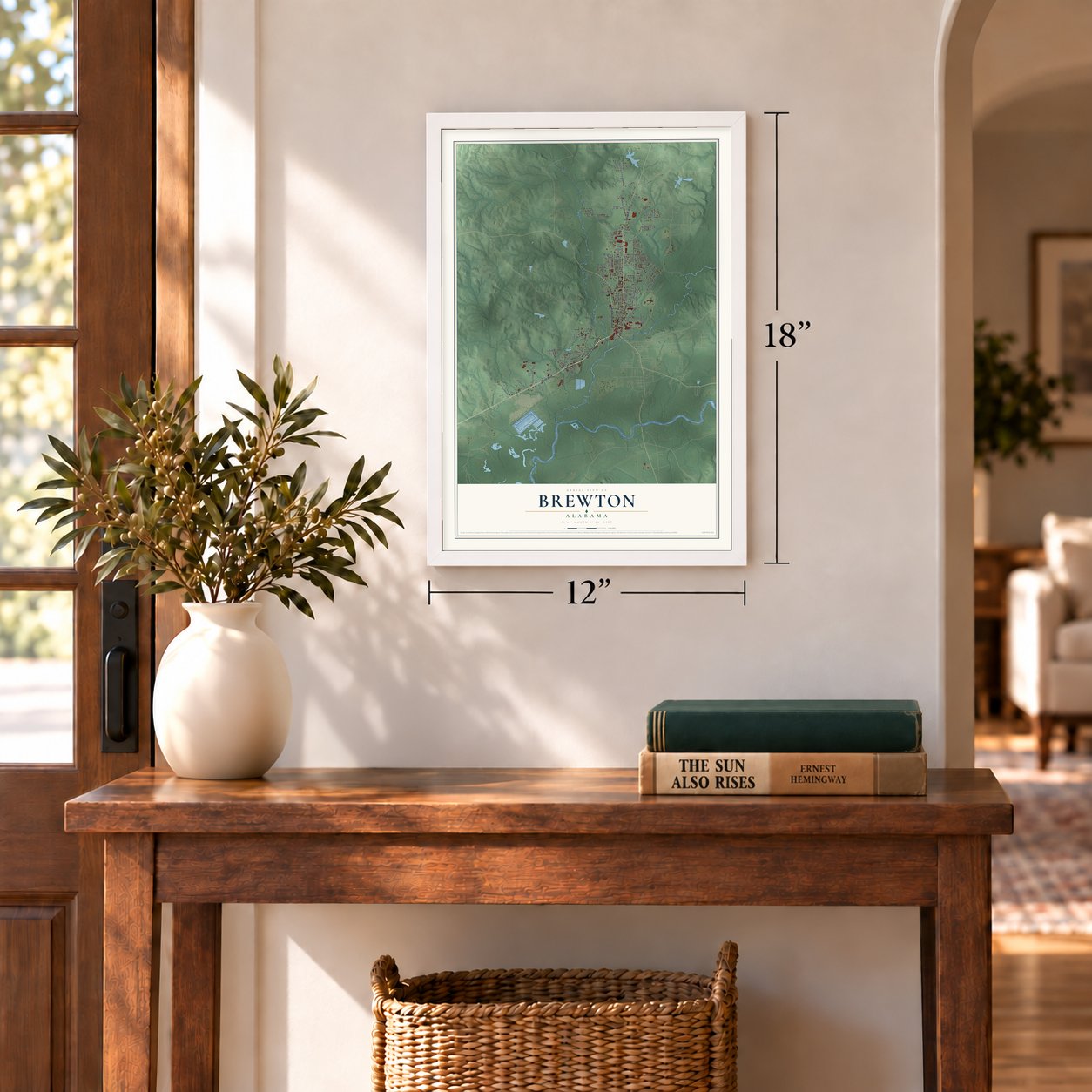
12" x 18" Archival Matte Print
A Map of Home. A Work of Art.
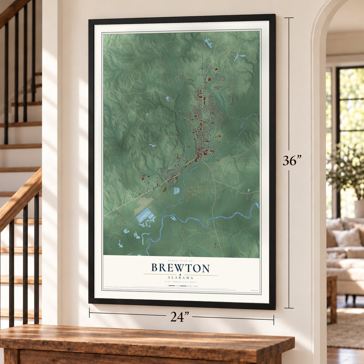
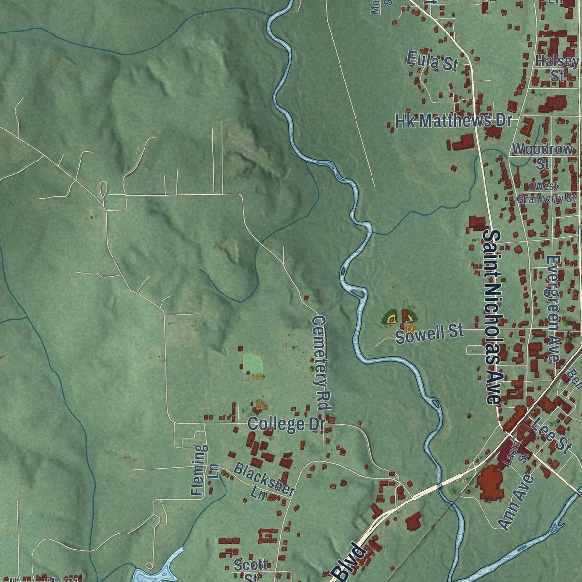
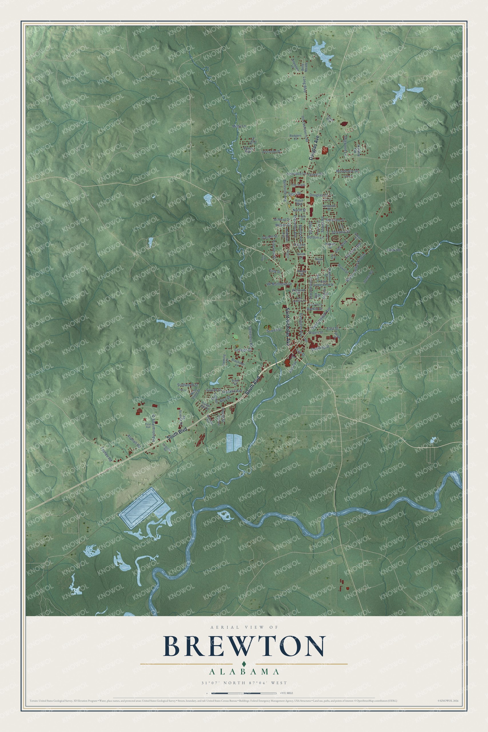
Explore Brewton, Alabama from a whole new perspective. Created using aerial imagery and detailed geographic data, this map captures Brewton building by building, with labeled streets, familiar landmarks, and shaded topographical relief that highlights the natural contours of the landscape.
Combining modern data with the timeless character of a vintage atlas, this map is just as interesting up close as it is beautiful on the wall. Whether you grew up in Brewton, spent memorable years there, or call it home today, this unique map is a great way to celebrate a place that means something to you. Zoom in on the preview to look for your street, and then order a print to put your memories on the wall.
Three ways to hang it
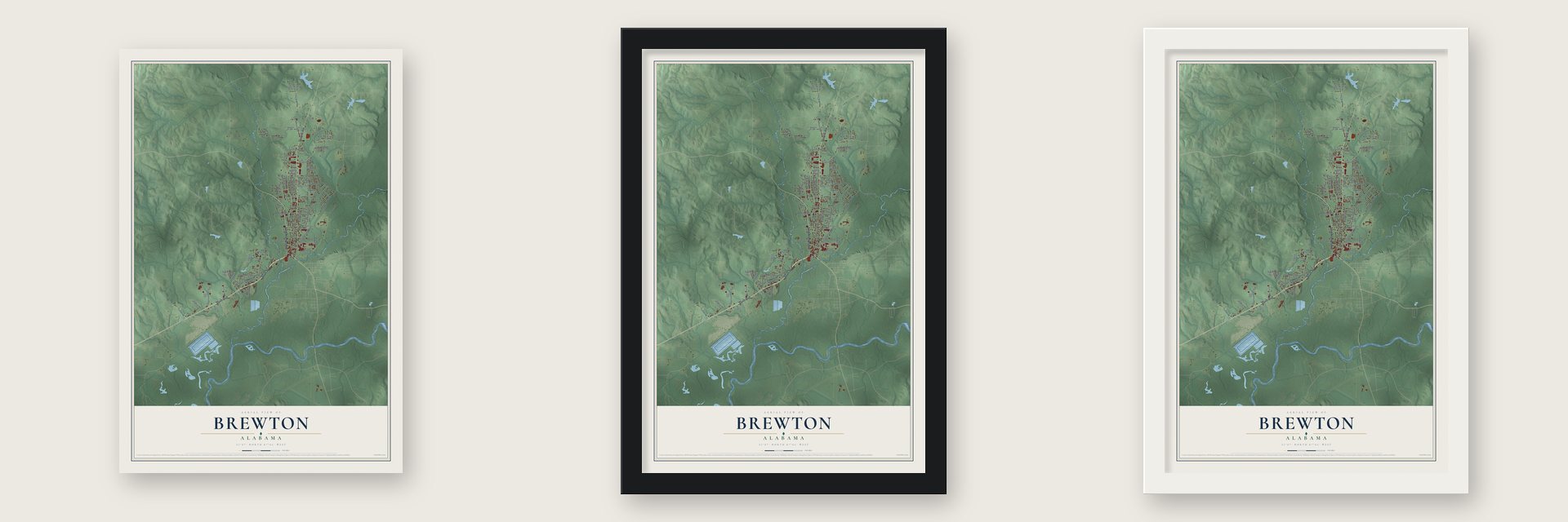
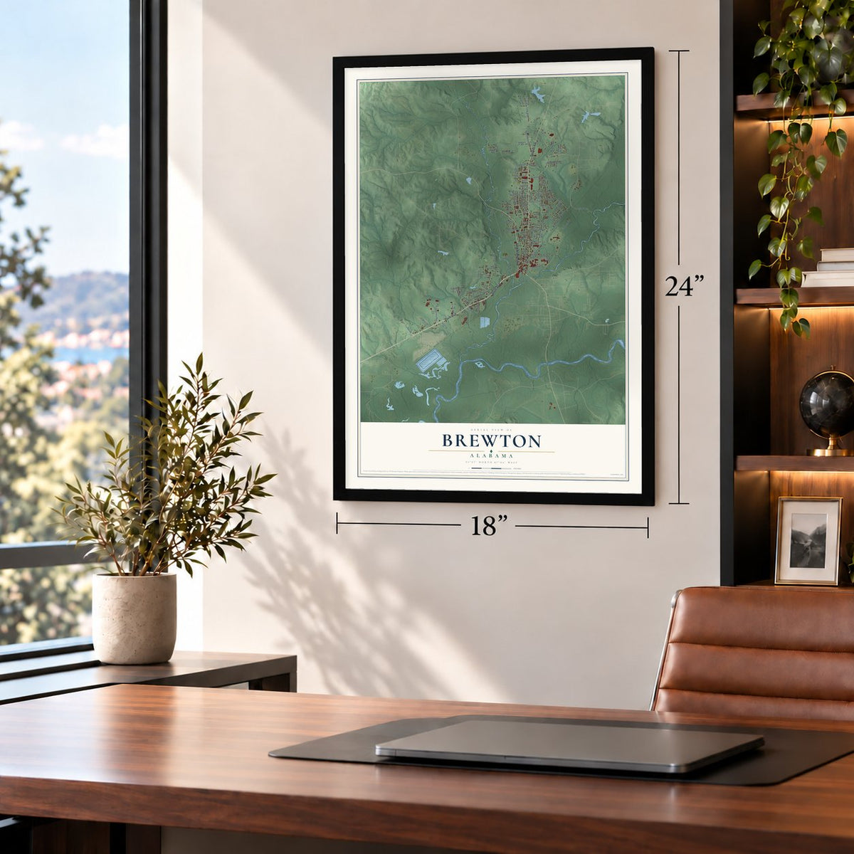
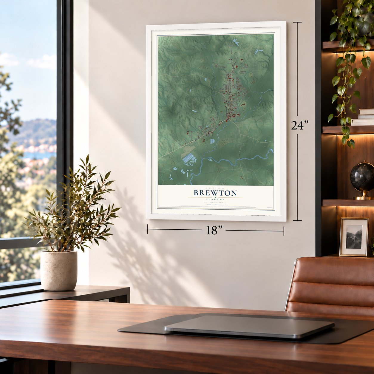
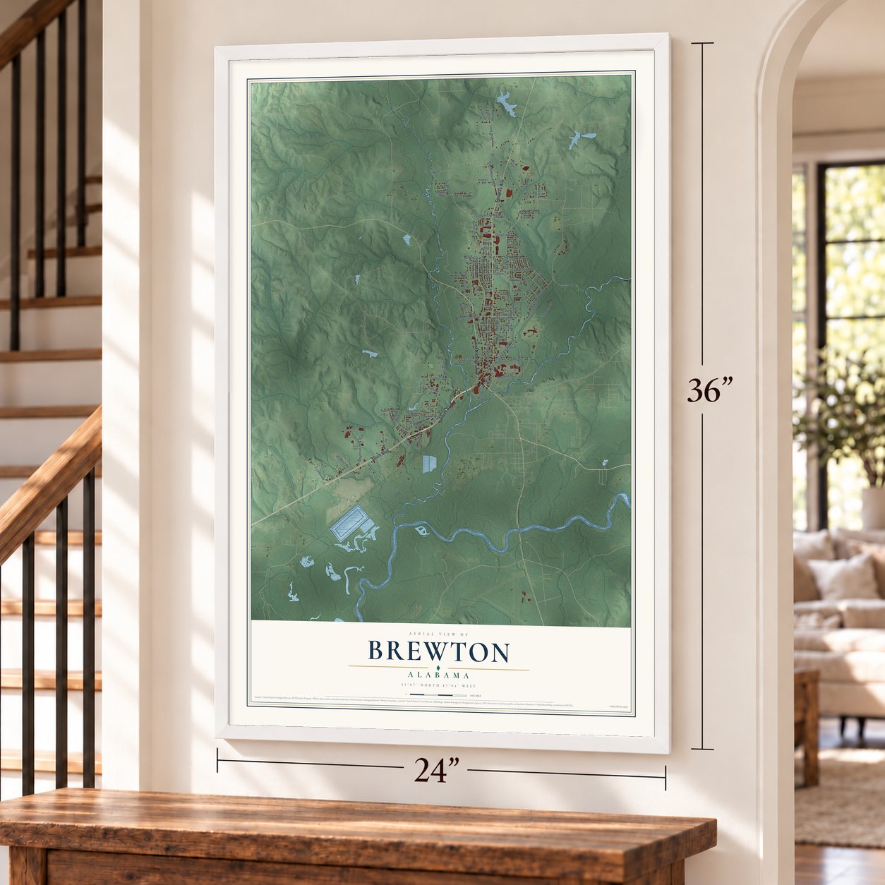
Unframed archival matte, a black wood frame or a white wood frame.
Up close
Geography Worth Displaying
This map was created using accurate cartographic data and authoritative geographic sources, including the U.S. Geological Survey and the Census Bureau. The map brings together terrain, waterways, roads, and building detail. The majority of the streets are labeled, houses are accurately depicted, and the topography is derived from government sources. Combining local data with carefully composed color and shading leads to this beautifully detailed Brewton artwork for your wall.
Rather than simply showing street outlines, we’ve included as many of the street names as we could reasonably fit on the map while keeping their names legible. Zoom in on the high resolution preview to see exactly what’s on the map. We truly set out to create a statement piece for anyone who loves Brewton. So whether it’s for you, or a gift for someone you love, we hope this map of Brewton brings back fond memories.
Read the story behind this map of Brewton, Alabama from 2026.
About Brewton, Alabama
Brewton is a city of 5,276 people and the seat of Escambia County, set between Burnt Corn Creek and Murder Creek near the Florida line. The land once belonged to the Creek Nation, and after the Creek War of 1813-14 Gen. Andrew Jackson ordered Fort Crawford built nearby. Settler Thomas Mendenhall soon put up a sawmill close to the Conecuh and Escambia rivers, and the community that formed around it was called Newport. Before the railroad came, barges carried goods between here and Pensacola on the two creeks.
By the Civil War the town had a railroad depot, several stores and close to 500 residents. Escambia County was formed in 1868 with Pollard as its seat, but Brewton grew faster, and county government moved here in 1883. The state incorporated the town on February 13, 1885, under the name Brewton, chosen to honor a prominent local family. A destructive fire swept through the next year, and residents rebuilt, as they would after later fires too. The population rose from 550 in 1880 to 2,185 in 1910.
“With a seating capacity for 761, the Ritz was the place to be on Saturday afternoon for generations of children.”
- The Ritz, 1936 to 1987The Ritz Theatre opened on September 14, 1936, with Yours for the Asking and closed after showing Crocodile Dundee on January 22, 1987. In between it hosted fashion shows, beauty pageants and dances, and stars from the Grand Ole Opry and Hollywood appeared on its stage. During World War II townspeople counted on it for trustworthy news from the front. A community message center built on the site in March 1996 keeps its memory.
- The richest little townLongleaf pine forests surrounded Brewton, and in the 1870s European demand for lumber set off a wave of timber operations, turning the Conecuh-Escambia river system into a timber route to Gulf ports. A handful of timber barons grew so wealthy that Brewton was once called the richest little town in the South, and they built grand homes along Belleville and Evergreen avenues. The T. R. Miller Mill, founded in 1848, still runs today.
- T. R. Miller footballThomas Richard Miller, a timber baron and town father, gave money to build and open the high school that carries his name. Every fall the town turns out to watch T. R. Miller football, which has won more games than any other program in the state.
- The lost town of AlcoJust southwest of Brewton, where Burnt Corn and Murder creeks meet, stood Alco, a town that took its name from the Alabama Lumber Company. It was incorporated in the 1880s and dissolved in 1897, and Brewton annexed it in 1945. The name lives on in Alco Road and in two churches, one Baptist and one United Methodist. Pilgrim's Rest Cemetery, among the oldest in Escambia County, sits across from the Methodist church.
- Blueberries in JuneEach June the Alabama Blueberry Festival fills Burnt Corn Creek Park to celebrate the local blueberry harvest, with arts and crafts, live music, a fun fair for children and an auto and motorcycle show. The town marks New Year's Eve with a Blueberry Drop.
Find your street
Names on the Brewton map
Every name below is printed on this map. Look for your street, your school, the park where you played, or the pond down the road.
Streets and roads103
- South Boulevard
- Saint Nicholas Avenue
- Douglas Avenue
- Saint Joseph Avenue
- Sowell Road
- Lee Street
- Belleville Avenue
- College Drive
- Alco Drive
- Cemetery Road
- Douglas Lane
- Tiger Drive
- Stallworth Street
- Martin Luther King Drive
- Downing Street
- Evergreen Avenue
- Liles Boulevard
- Industrial Park Drive
- Escambia Avenue
- Franklin Avenue
- Sowell Street
- Ann Avenue
- Gordon Lane
- Bonita Avenue
- Cook Road
- East Street
- Wilson Street
- Foshee Road
- Long Boulevard
- Jones Road
Show all 103 streets
- Hk Matthews Drive
- Fountain Avenue
- Lovelace Avenue
- Pineview Street
- Woodmere Drive
- Garrett Street
- Dogwood Lane
- Sylvania Street
- Lovelace Lane
- Young Street
- Asphalt Road
- North Street
- Misty Lane
- Glen Road
- Rankin Street
- Eula Street
- Fleming Lane
- West Shore Drive
- Old Castleberry Road
- Brooks Boulevard
- Nopajope Lane
- Rogers Street
- East Underwood Street
- McMillan Avenue
- Alexander Drive
- North Pine Street
- Dacus Street
- Ag Science Drive
- Blacksher Lane
- The Trails
- Robin Drive
- Bryant Street
- Rodgers Lane
- Fairway Drive
- McMead Drive
- Lynbrook Drive
- Jenkins Street
- Dawson Street
- Oak Ridge Place
- Woodrow Street
- Forest Hill Drive
- Belle Meade
- Luttrell Street
- Hamilton Street
- Davison Street
- Shaw Street
- Rotch Boulevard
- Auction Street
- Halsey Street
- Smith Lane
- Scott Street
- Oak Street
- Mason Street
- Peavy Street
- May Street
- Ferguson Road
- Robinson Avenue
- Tesone Boulevard
- High Avenue
- Azalea Place
- First Avenue
- Bell
- Rosemary Avenue
- Brookwood Drive
- East Brooks Street
- West Granberry Street
- Lane Avenue
- Cook Lane
- Laura Street
- James Street
- Terry Drive
- Moore Street
- Hurd Avenue
Names are listed as they appear on the printed map. Zoom into the product photos to find them.
The art of mapping a place
How This Map Was Made
Real places. Remarkable detail. Discover the layers that turn geographic data into a map of home.

The view from above
Aerial imagery reveals the character of the land: woodland, open fields, and the patterns of a place.

The shape of the land
Elevation data brings hills, valleys, and subtle changes in the landscape into view.

The details of home
Roads, waterways, and building footprints come together to make the map feel unmistakably local.

Geography becomes art
Considered color, shading, and typography bring the layers together in a map made for your wall.


Process illustrated with Mendon, Massachusetts. Aerial imagery: USDA NAIP. Terrain: USGS 3D Elevation Program. Map details and finished artwork: KNOWOL.
The Details
About This Print
Choose an archival matte print, or a black or white Ayous wood frame. The archival matte print is unframed.
Select your size and finish above to see the matching product image and price.
Materials & Craftsmanship
A contemporary map with the character of a classic atlas, printed on archival matte paper. Optional frames are made from Ayous wood.
Your printed map does not include the watermark shown in the full-map preview.
Shipping & Delivery
Free shipping within the United States. Every print is made to order in the USA.
Buying a gift? Add a note in your cart and we'll include it. We never put prices in the package.
Prints ship within 2 to 3 business days. Allow 7 to 10 days total from ordering for delivery. Timing may vary during holidays or periods of high order volume.
Read our shipping policy.
Returns and damaged prints
Each print is made to order. Change-of-mind refunds are not available after production.
If your print arrives damaged, misprinted or incorrect, contact support@knowol.com within 30 days of receiving it. Include your order number, photos and a description of the issue.
Read our full refund and replacement policy. For questions about your order, email support@knowol.com.
Find your town
Looking for another city?
Find a map of home in our Alabama collection, or any town in the country.
Nearby
Maps of towns near Brewton
Know someone from one of these towns? Their map makes a great gift.
 East Brewton
, Alabama
From $39.99See the map
 Riverview
, Alabama
From $39.99See the map
 Pollard
, Alabama
From $39.99See the map
More maps nearby: Flomaton, Castleberry, Atmore, Repton and Evergreen.