
Search for another town


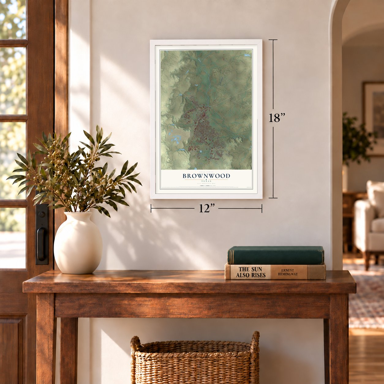
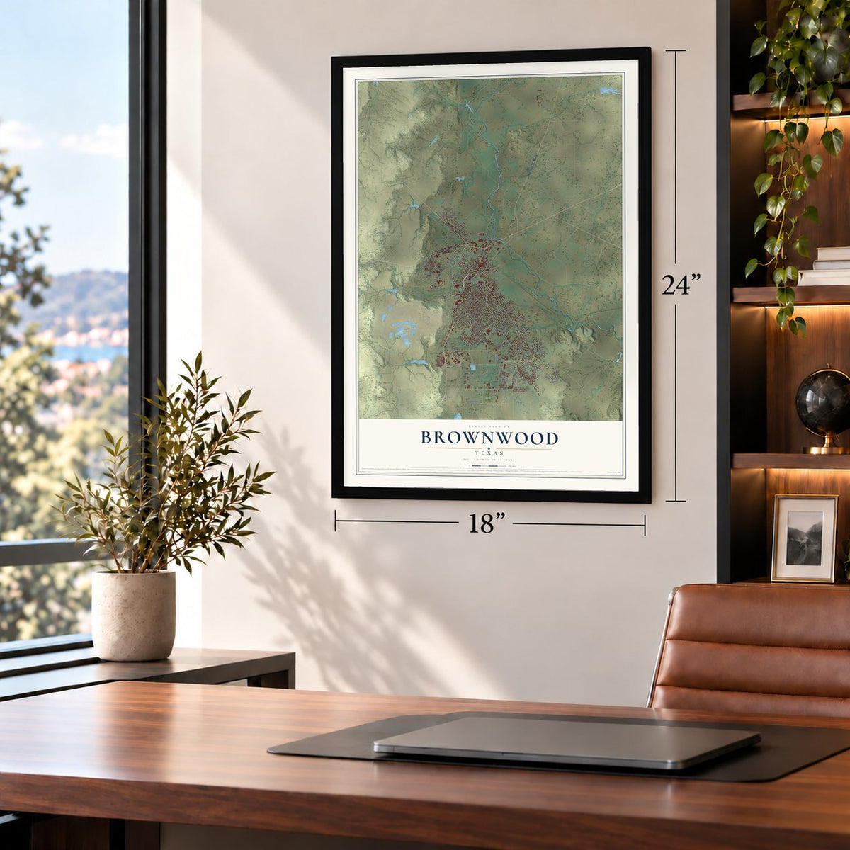
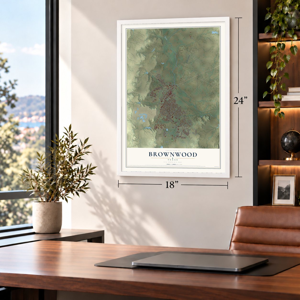

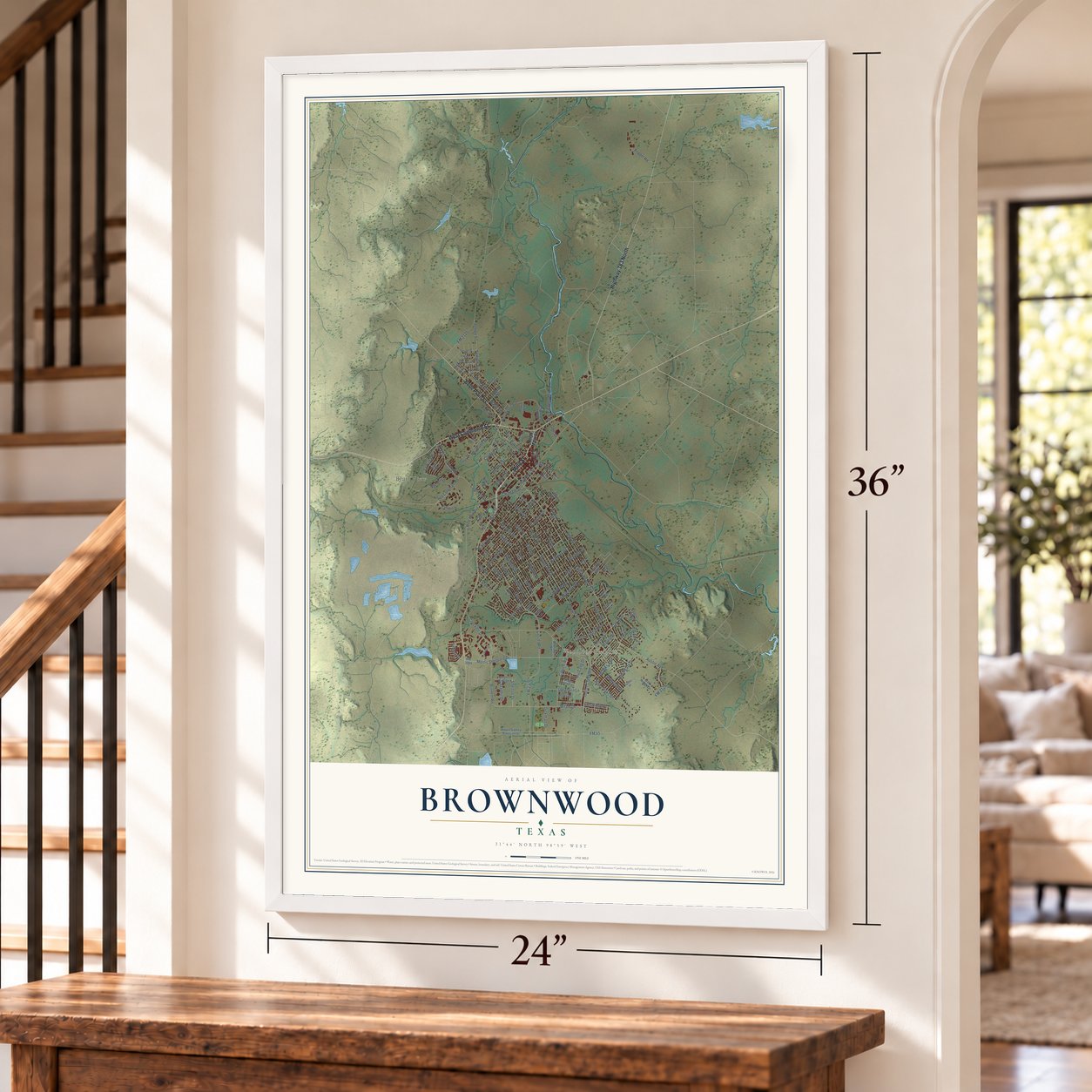

Free U.S. delivery 7 to 10 days after you order
Brownwood, Texas Map Art
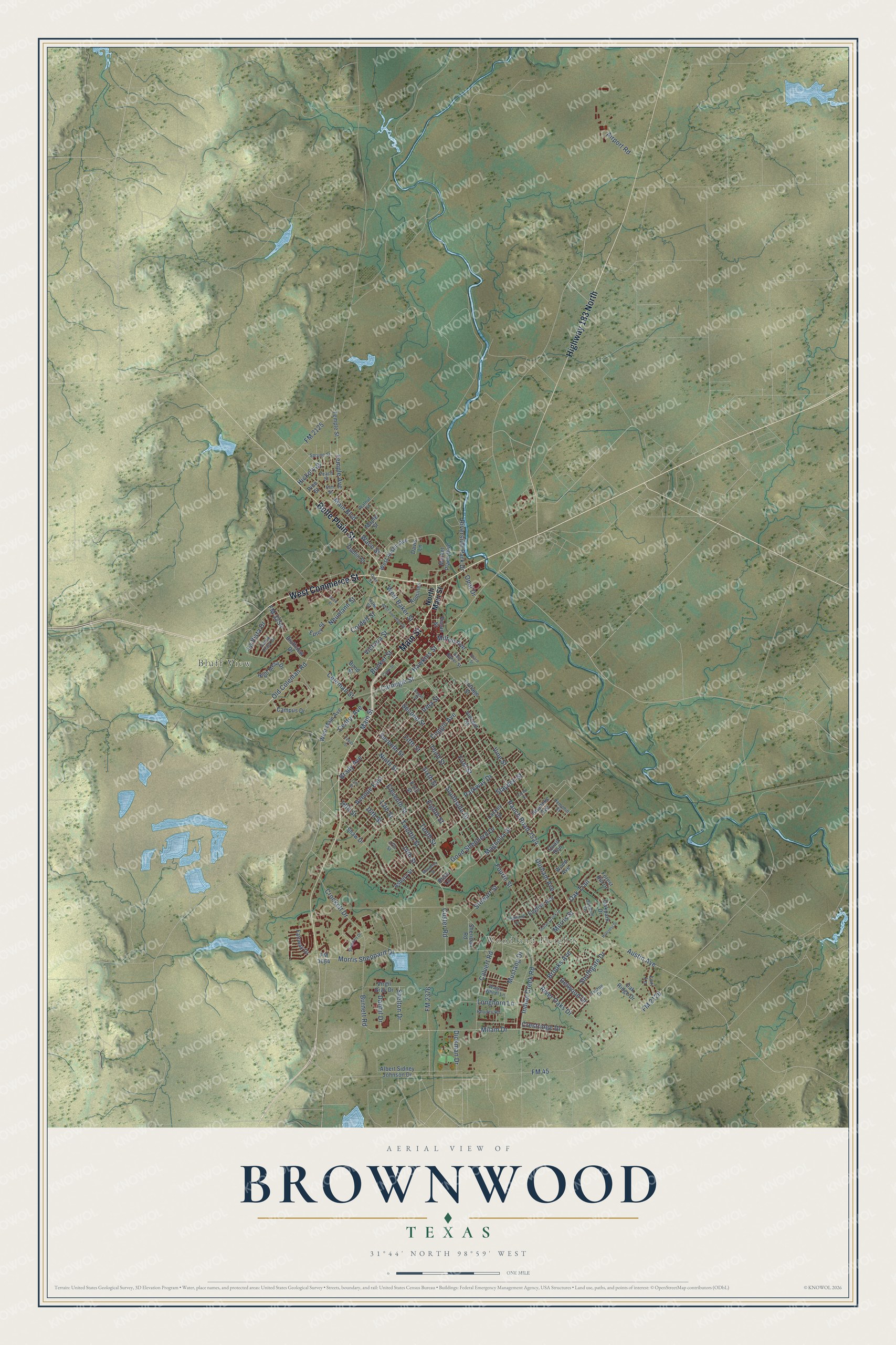
A new map of Brownwood, Texas, made in 2026 and printed to order on thick archival matte paper.
12" x 18" Archival Matte Print
A Map of Home. A Work of Art.
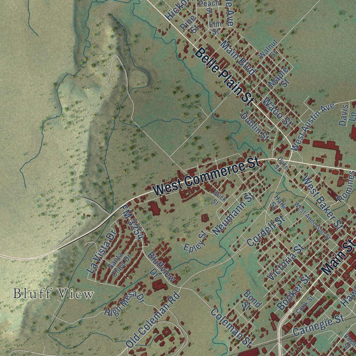
Explore Brownwood, Texas from a whole new perspective. Created using aerial imagery and detailed geographic data, this map captures Brownwood building by building, with labeled streets, familiar landmarks, and shaded topographical relief that highlights the natural contours of the landscape.
Combining modern data with the timeless character of a vintage atlas, this map is just as interesting up close as it is beautiful on the wall. Whether you grew up in Brownwood, spent memorable years there, or call it home today, this unique map is a great way to celebrate a place that means something to you. Zoom in on the preview to look for your street, and then order a print to put your memories on the wall.
Three ways to hang it
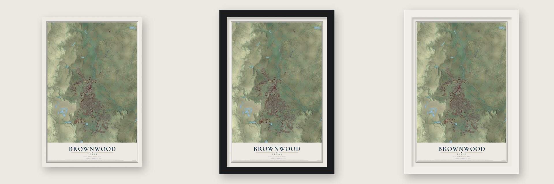
Unframed archival matte, a black wood frame or a white wood frame.
Up close
Geography Worth Displaying
This map was created using accurate cartographic data and authoritative geographic sources, including the U.S. Geological Survey and the Census Bureau. The map brings together terrain, waterways, roads, and building detail. The majority of the streets are labeled, houses are accurately depicted, and the topography is derived from government sources. Combining local data with carefully composed color and shading leads to this beautifully detailed Brownwood artwork for your wall.
Rather than simply showing street outlines, we’ve included as many of the street names as we could reasonably fit on the map while keeping their names legible. Zoom in on the high resolution preview to see exactly what’s on the map. We truly set out to create a statement piece for anyone who loves Brownwood. So whether it’s for you, or a gift for someone you love, we hope this map of Brownwood brings back fond memories.
Read the story behind this map of Brownwood, Texas from 2026.

About Brownwood, Texas
Brownwood is a city of 18,862 people and the seat of Brown County, on the west bank of Pecan Bayou. Both the city and the county carry the name of Henry Stevenson Brown. When the county was organized in 1857, its few residents picked the little settlement of Brownwood as county seat, and at first it stood east of the bayou. In the late 1860s a fight over land titles and a poor water supply pushed the townspeople across to the west side, onto sixty acres given by Greenleaf Fisk.
Growth came slowly at first, and in 1872 the town still had only two stores, a log courthouse and about five homes. Cowboys driving herds up a feeder of the Western Trail kept its stores and saloons busy, and a cotton gin opened in 1877 as farmers took up state land. Brownwood incorporated in 1884, the Gulf, Colorado and Santa Fe Railroad reached it a year later, and the population climbed from 725 in 1880 to 3,965 in 1900. By 1920 no town west of Fort Worth bought more cotton.
“City residents coped by turning a skating rink into a dormitory, by allowing patrons to bed down in a movie theater after the final show, by subdividing the existing housing stock, and by the building of additional housing units.”
- Greenleaf Fisk's giftGreenleaf Fisk gave sixty acres west of Pecan Bayou for the relocated county seat and another 100 acres for the county's use, and the town grew up on that ground. His house, the Greenleaf Fisk House, joined the National Register in 2004.
- Two colleges in 1889Two church colleges opened in Brownwood in 1889. The Presbyterians founded Daniel Baker College, and the Baptists founded Howard Payne College. Daniel Baker later closed, and in 1953 its campus became part of Howard Payne. Today Howard Payne University has won national cross country titles in 1957 and 1964 and a women's basketball title in 2008, and its campus holds the Douglas MacArthur Academy of Freedom museum.
- The saloons close, Battle Row opensProhibition gained support in town during the 1890s, and after a string of violent incidents Brownwood shut its saloons in 1903. Drinking clubs just as rowdy opened in their place, and one stretch of street earned the name Battle Row.
- Camp Bowie's wartime boomCamp Bowie went up south and southwest of town in the fall of 1940 and grew into the largest military training center in Texas. By December 1940 its 13,500 workers outnumbered the 13,398 people Brownwood had counted that year, and by March 1941 the city's population stood at 22,479. The camp closed in 1946, but it left the city better streets, improved sanitation and medical care, a municipal airport and new housing.
- Gordon Wood's LionsBrownwood High's Lions, in maroon and white, won seven state football championships, the last in 1981. Gordon Wood coached there for a quarter-century and retired in 1985 with 396 wins, one of the best records any Texas coach has posted.
Find your street
Names on the Brownwood map
Every name below is printed on this map. Look for your street, your school, the park where you played, or the pond down the road.
Places and landmarks2
- Woodland Heights
- Bluff View
Streets and roads139
- Main Street
- West Commerce Street
- Highway 183 North
- Belle Plain Street
- Brady Avenue
- Indian Creek Road
- Seventh Street
- Milam Drive
- Burnett Road
- Carnegie Street
- Center Avenue
- Parkway Drive
- Oak Trail
- 14th Street
- Morris Sheppard Drive
- Austin Avenue
- Ranch Road 2524
- Hawkins Street
- Coleman Street
- Magnolia Street
- Fourth Street
- First Street
- FM 2376
- Second Street
- Vine Street
- Coggin Avenue
- Ninth Street
- Third Street
- Durham Avenue
- FM 45
Show all 139 streets
- Good Shepherd Drive
- Eleventh Street
- Eighth Street
- Tenth Street
- Twelfth Street
- Avenue East
- Slayden Street
- Sixth Street
- FM 2126
- Cordell Street
- FM 3254
- 13th Street
- 16th Street
- River Oaks Drive
- Custer Road
- Southside Drive
- Waco Street
- Main Boulevard
- Riverside Park Drive
- Calvert Road
- Southgate Drive
- Booker Street
- Brooks Avenue
- Mustang Drive
- West Baker Street
- Temple Avenue
- Crockett Drive
- Fifth Street
- Victoria Street
- Delwood Drive
- Stewart Street
- La Vista Drive
- Old Coleman Road
- 18th Street
- Longhorn Lane
- Hickory Street
- Danhil Drive
- Shelton Drive
- Crestridge Drive
- Airport Road
- Neumann Street
- Dickman Drive
- FM 2125
- Milton Avenue
- Morris Street
- Opal Drive
- Irma Street
- North Main Street
- Market Place Boulevard
- West Austin Avenue
- West Main Avenue
- Vincent Street
- FM 3064
- Cottage Street
- Asbury Street
- Albert Sidney Johnson Drive
- Campus Drive
- Wood Avenue
- Bluffview Drive
- Oakpark Drive
- Quail Run
- Maple Street
- High Mesa Drive
- Virgil Gray Drive
- English Avenue
- Roanoke Avenue
- Fairway Drive
- Lori Lane
- Oak Ridge Drive
- Pecan Street
- Romines
- Dublin Street
- Sheridan Road
- Epley Street
- Lackey Street
- Temple Street
- Forest Hill Drive
- Shaw Drive
- Davis Lane
- Bond Street
- Rose Lane
- Pine Street
- 17th Street
- Walnut Street
- East Baker Street
- Tulane Drive
- Oakdale Drive
- Santa Clara Drive
- Hall Street
- Elm Street
- Spruce Street
- Rhodes Road
- Hemphill Street
- Wagon Wheel Lane
- Peach Street
- Indian Creek Drive
- Clark Street
- West Anderson Street
- 15th Street
- Brick Street
- Duke Street
- Sharp Street
- Streckert Drive
- Hillcrest Drive
- Highland Drive
- Rogan Street
- Carey Street
- Texas Street
- Monterey Street
Names are listed as they appear on the printed map. Zoom into the product photos to find them.
The art of mapping a place
How This Map Was Made
Real places. Remarkable detail. Discover the layers that turn geographic data into a map of home.

The view from above
Aerial imagery reveals the character of the land: woodland, open fields, and the patterns of a place.

The shape of the land
Elevation data brings hills, valleys, and subtle changes in the landscape into view.

The details of home
Roads, waterways, and building footprints come together to make the map feel unmistakably local.

Geography becomes art
Considered color, shading, and typography bring the layers together in a map made for your wall.


Process illustrated with Mendon, Massachusetts. Aerial imagery: USDA NAIP. Terrain: USGS 3D Elevation Program. Map details and finished artwork: KNOWOL.
The Details
About This Print
Choose an archival matte print, or a black or white Ayous wood frame. The archival matte print is unframed.
Select your size and finish above to see the matching product image and price.
Materials & Craftsmanship
A contemporary map with the character of a classic atlas, printed on archival matte paper. Optional frames are made from Ayous wood.
Your printed map does not include the watermark shown in the full-map preview.
Shipping & Delivery
Free shipping within the United States. Every print is made to order in the USA.
Buying a gift? Add a note in your cart and we'll include it. We never put prices in the package.
Prints ship within 2 to 3 business days. Allow 7 to 10 days total from ordering for delivery. Timing may vary during holidays or periods of high order volume.
Read our shipping policy.
Returns and damaged prints
Each print is made to order. Change-of-mind refunds are not available after production.
If your print arrives damaged, misprinted or incorrect, contact support@knowol.com within 30 days of receiving it. Include your order number, photos and a description of the issue.
Read our full refund and replacement policy. For questions about your order, email support@knowol.com.
Find your town
Looking for another city?
Find a map of home in our Texas collection, or any town in the country.
Nearby
Maps of towns near Brownwood
Know someone from one of these towns? Their map makes a great gift.
 Early
Early, Texas
From $39.99See the map
 Bangs
Bangs, Texas
From $39.99See the map
 Lake Brownwood
, Texas
From $39.99See the map
More maps nearby: Zephyr, Blanket, Thunderbird Bay, May and Santa Anna.