


Search for another town





Free U.S. delivery 7 to 10 days after you order
Burbank, California Map Art
Building by building, with labeled streets and shaded relief.
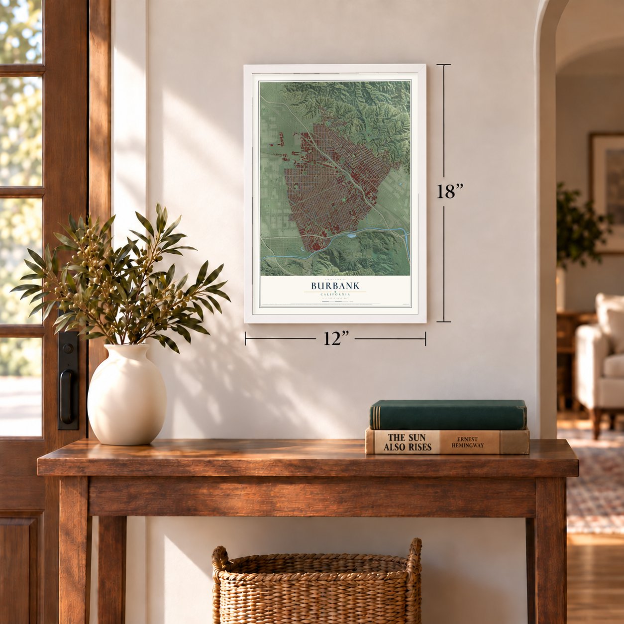
12" x 18" Archival Matte Print
A Map of Home. A Work of Art.
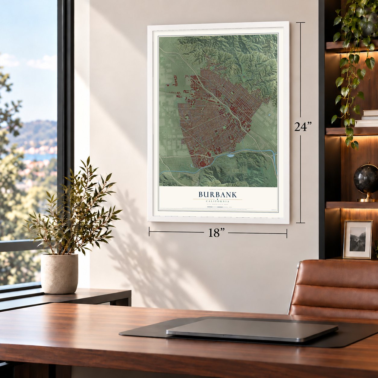
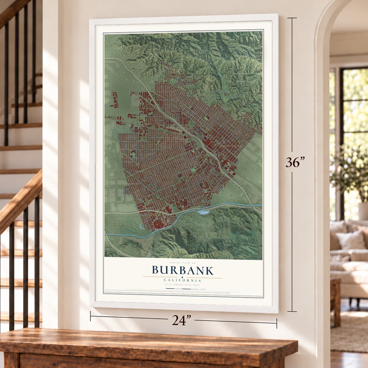
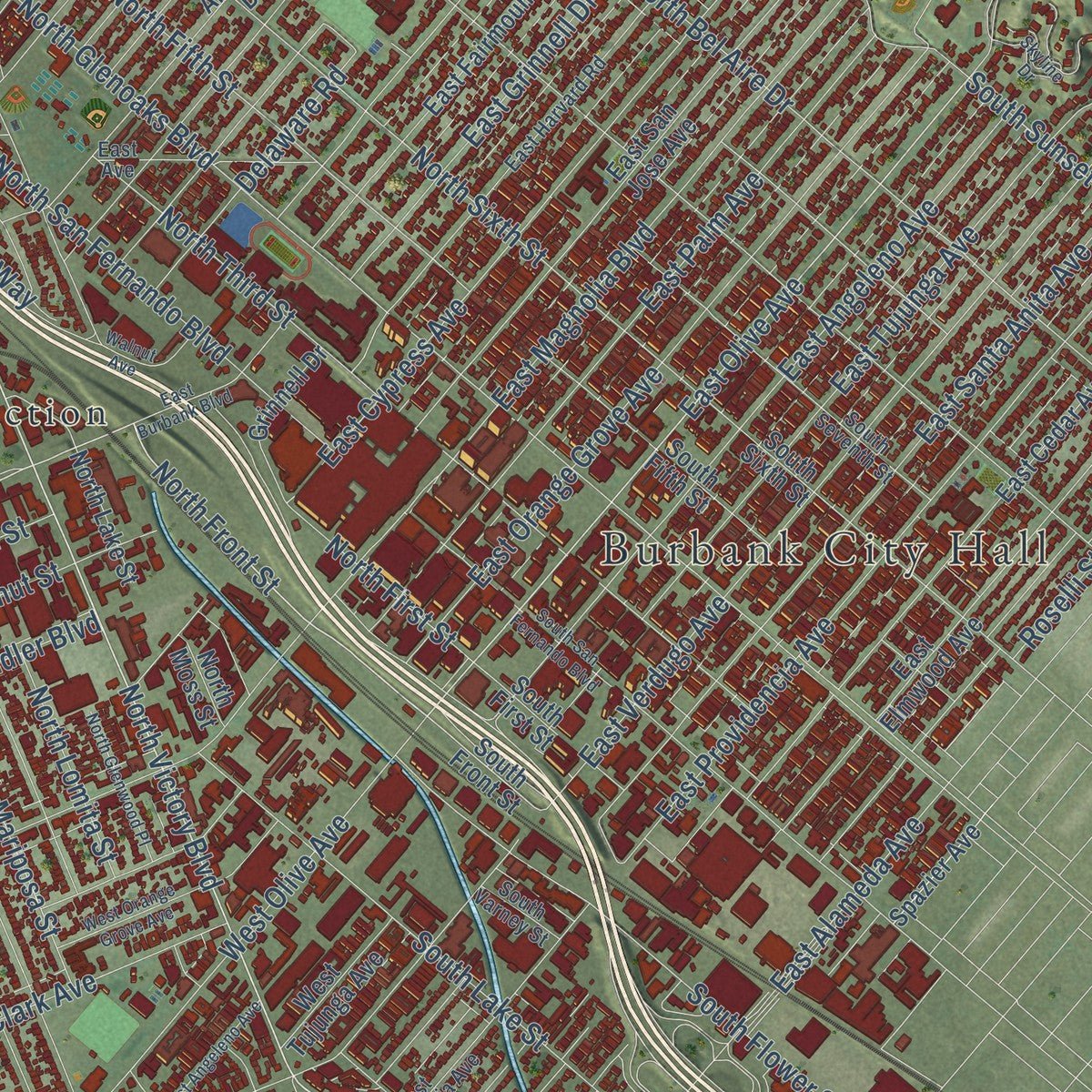
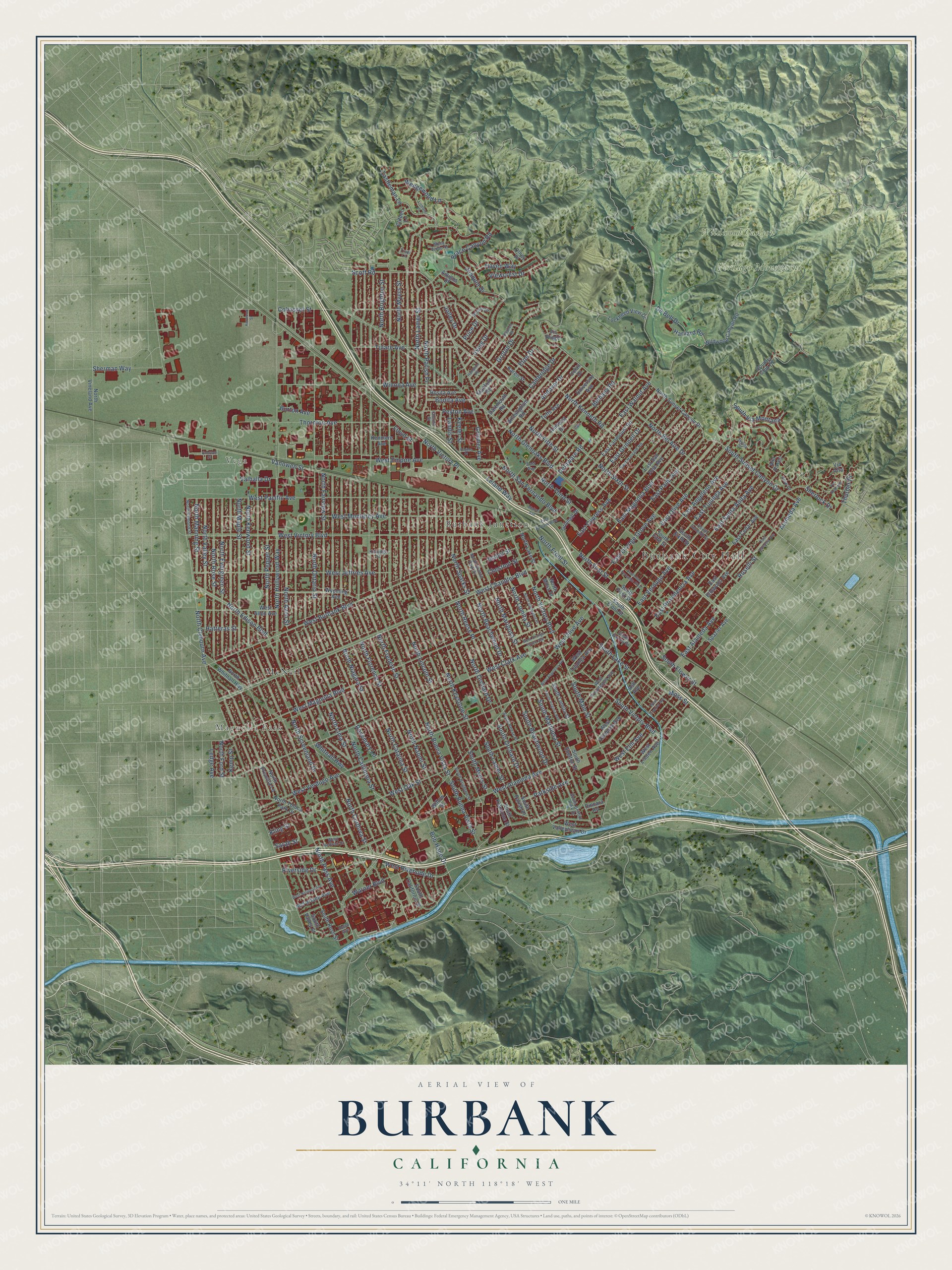
Explore Burbank, California from a whole new perspective. Created using aerial imagery and detailed geographic data, this map captures Burbank building by building, with labeled streets, familiar landmarks, and shaded topographical relief that highlights the natural contours of the landscape.
Combining modern data with the timeless character of a vintage atlas, this map is just as interesting up close as it is beautiful on the wall. Whether you grew up in Burbank, spent memorable years there, or call it home today, this unique map is a great way to celebrate a place that means something to you. Zoom in on the preview to look for your street, and then order a print to put your memories on the wall.
Three ways to hang it
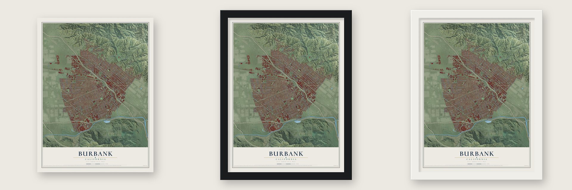
Unframed archival matte, a black wood frame or a white wood frame.
Up close
Geography Worth Displaying
This map was created using accurate cartographic data and authoritative geographic sources, including the U.S. Geological Survey and the Census Bureau. The map brings together terrain, waterways, roads, and building detail. The majority of the streets are labeled, houses are accurately depicted, and the topography is derived from government sources. Combining local data with carefully composed color and shading leads to this beautifully detailed Burbank artwork for your wall.
Rather than simply showing street outlines, we’ve included as many of the street names as we could reasonably fit on the map while keeping their names legible. Zoom in on the high resolution preview to see exactly what’s on the map. We truly set out to create a statement piece for anyone who loves Burbank. So whether it’s for you, or a gift for someone you love, we hope this map of Burbank brings back fond memories.
Read the story behind this map of Burbank, California from 2026.

Find your street
Names on the Burbank map
Every name below is printed on this map. Look for your street, your school, the park where you played, or the pond down the road.
Places and landmarks7
- Burbank City Hall
- Vega
- Magnolia Park
- Verdugo Mountains
- Wildwood Canyon Park
- Burbank Junction
- McNeil
Streets and roads228
- North Lincoln Street
- North Victory Place
- South Victory Boulevard
- North Victory Boulevard
- North Front Street
- North Clybourn Avenue
- East Olive Avenue
- West Burbank Boulevard
- West Olive Avenue
- West Pacific Avenue
- Parkside Avenue
- South Sunset Canyon Drive
- Rosemary Lane
- North San Fernando Boulevard
- West Chandler Boulevard
- North Hollywood Way
- North Buena Vista Street
- North Ontario Street
- North Lamer Street
- North Frederic Street
- North Naomi Street
- North Brighton Street
- North Keystone Street
- West Alameda Avenue
- North Fairview Street
- North Pass Avenue
- West Verdugo Avenue
- North Glenoaks Boulevard
- North Kenneth Road
- West Riverside Drive
Show all 228 streets
- West Magnolia Boulevard
- North Niagara Street
- North Catalina Street
- North Parish Place
- West Clark Avenue
- North Maple Street
- North Myers Street
- North Avon Street
- North California Street
- North Screenland Drive
- North Evergreen Street
- North Lima Street
- North Kenwood Street
- North Rose Street
- Scott Road
- West Victory Boulevard
- North Bel Aire Drive
- West Oak Street
- North Valley Street
- North Sixth Street
- North Orchard Drive
- North Reese Place
- West Empire Avenue
- East Tujunga Avenue
- East Walnut Avenue
- North Sparks Street
- Riverside Drive
- North Florence Street
- East Providencia Avenue
- East Verdugo Avenue
- Vanowen Street
- West Jeffries Avenue
- North Beachwood Drive
- North Fifth Street
- East Angeleno Avenue
- North Edison Boulevard
- East Magnolia Boulevard
- East Orange Grove Avenue
- North Cordova Street
- East Santa Anita Avenue
- East Palm Avenue
- East Cypress Avenue
- Winona Avenue
- South Beachwood Drive
- West Monterey Avenue
- Bethany Road
- South Mariposa Street
- North Mariposa Street
- North Third Street
- Haven Way
- South Flower Street
- South Lake Street
- North Pepper Street
- Delaware Road
- Tulare Avenue
- East Grinnell Drive
- Andover Drive
- Warner Boulevard
- Groton Drive
- Jolley Drive
- Thornton Avenue
- South Orchard Drive
- East Alameda Avenue
- South Main Street
- Cohasset Street
- Irving Drive
- Wedgewood Lane
- Cambridge Drive
- Castleman Lane
- Eton Drive
- West Elm Avenue
- Peyton Avenue
- South Lamer Street
- South Buena Vista Street
- Joaquin Drive
- North Manning Street
- Sherman Way
- North First Street
- North Lomita Street
- Bob Hope Drive
- South Via Montana
- Brace Canyon Road
- Viewcrest Drive
- Grismer Avenue
- Keeler Street
- Burton Avenue
- Thurber Place
- Valhalla Drive
- Leland Way
- South Myers Street
- De Bell Drive
- Floyd Street
- Harvard Road
- Bonita Avenue
- Alameda Avenue
- Whitnall Highway
- Hatteras Street
- Chestnut Street
- Isabel Street
- North Ford Street
- Kling Street
- Ledge Avenue
- Sherlock Drive
- Moss Street
- Kemp Street
- Sarah Street
- Landis Street
- Roselli Street
- Price Drive
- West Valleyheart Drive
- North Whitnall Highway
- South Front Street
- East Elmwood Avenue
- Country Club Drive
- Amherst Drive
- East Cedar Avenue
- East San Jose Avenue
- North Sunset Canyon Drive
- East Fairmount Road
- Birmingham Road
- South Parish Place
- University Avenue
- Wildwood Canyon Road
- Tufts Avenue
- South Sixth Street
- North Lake Street
- South Keystone Street
- West Linden Avenue
- Wyoming Avenue
- West Allen Avenue
- South California Street
- Uclan Drive
- West Valencia Avenue
- Stanford Road
- South Fifth Street
- South First Street
- North Vineland Avenue
- North Toluca Park Drive
- Lockheed View Drive
- McFarlane Avenue
- Kenmere Avenue
- West Tujunga Avenue
- North Priscilla Lane
- South Lomita Street
- Rosita Avenue
- Spazier Avenue
- South Rose Street
- Karen Street
- Via Alta
- Dartmouth Road
- Alta Paseo
- Grinnell Drive
- South Shelton Street
- Ash Avenue
- South Valley Street
- Dincara Road
- Clifden Lane
- North Moss Street
- Willow Street
- Amigos Drive
- Olney Place
- Vis Ridge
- East Harvard Road
- North Griffith Park Drive
- South Griffith Park Drive
- South Reese Place
- West Providencia Avenue
- East Avenue
- South Varney Street
- South Seventh Street
- Brown Drive
- West Heffron Drive
- South Brighton Street
- North Dymond Street
- Hood Avenue
- Kittridge Street
- Mesa Verde Drive
- Church Street
- Trudi Lane
- View Drive
- East Burbank Boulevard
- East Valencia Avenue
- South San Fernando Boulevard
- West Spazier Avenue
- West Orange Grove Avenue
- Pso Redondo
- South Virginia Avenue
- Stephen Road
- West National Avenue
- Hampton Road
- North Glenwood Place
- Skyline Drive
- West Angeleno Avenue
- Lismore Lane
- Walnut Avenue
- Vanowen Place
- Rogers Place
- Kenwood Street
Names are listed as they appear on the printed map. Zoom into the product photos to find them.
About Burbank, California
Burbank is a city of 107,337 people in Los Angeles County, at the southeastern end of the San Fernando Valley below the Verdugo Mountains. The Tongva people lived here for thousands of years. Later the land became part of two colonial grants, Rancho San Rafael in 1784 and Rancho Providencia in 1821. In 1867 David Burbank, a dentist who had started out in Waterville, Maine, bought parts of both ranchos, nearly 9,200 acres for $9,000, and raised sheep and wheat there.
Burbank sold the railroad a strip of land almost three miles long, and the first train came through on April 5, 1874. In 1886, a year when drought killed about 1,000 of his sheep, speculators bought much of his land for $250,000. They named the new town for him and began selling farm lots on May 1, 1887, the same year a water system and a Southern Pacific depot were finished. The land boom collapsed in 1889, and many lots were sold for taxes, but the region recovered in the years that followed.
“Burbank, the town, being built in the midst of the new farming community, has been laid out in such a manner as to make it by and by an unusually pretty town.”
- The Valley's first telephonesIn August 1900 Burbank opened the first telephone exchange in the San Fernando Valley. Other towns followed within five years. When Pacific Telephone took over the local companies in 1918, Burbank had an estimated 300 hand-cranked phones.
- A champion's ranch in 1904Heavyweight boxing champion James J. Jeffries bought 107 acres along Victory Boulevard in 1904. He raised cattle and shipped them to Mexico and South America. His barn stood near Victory Boulevard and Buena Vista Street until it was moved and rebuilt at Knott's Berry Farm in Buena Park.
- Fawkes' FollyApricot grower Joseph Fawkes and his wife Ellen held two patents for the nation's first monorail. His Aerial Swallow, driven by a propeller, was supposed to take about 20 riders into downtown Los Angeles from Burbank in just 10 minutes. On its only run, across his ranch in 1911, it moved about a foot and fell apart. No one was hurt, and city leaders turned to bringing in the streetcar instead.
- The Red Car arrivesResidents raised a $48,000 subsidy to get Pacific Electric to extend its line from Glendale. The first Red Car reached Burbank on September 6, 1911, to a huge celebration. Burbank had been incorporated as a city only about two months earlier.
Keep exploring California
Burbank is one of 1,990 California towns we've mapped. Every dot on the map is a print of its own.
The search covers every state, California first.
Near Burbank
Order 2 or more town maps and save 10%. Shown in the size and finish you picked above, so they hang as a set.
- Toluca Lake 12" x 18" / Archival Matte Print $39.99
- North Hollywood 12" x 18" / Archival Matte Print $39.99
- Valley Village 12" x 18" / Archival Matte Print $39.99


More maps nearby: Los Feliz, Hollywood Hills West, Glendale, Studio City and La Crescenta-Montrose.
The art of mapping a place
How This Map Was Made
Real places. Remarkable detail. Discover the layers that turn geographic data into a map of home.

The view from above
Aerial imagery reveals the character of the land: woodland, open fields, and the patterns of a place.

The shape of the land
Elevation data brings hills, valleys, and subtle changes in the landscape into view.

The details of home
Roads, waterways, and building footprints come together to make the map feel unmistakably local.

Geography becomes art
Considered color, shading, and typography bring the layers together in a map made for your wall.


Process illustrated with Mendon, Massachusetts. Aerial imagery: USDA NAIP. Terrain: USGS 3D Elevation Program. Map details and finished artwork: KNOWOL.
The Details
About This Print
Choose an archival matte print, or a black or white Ayous wood frame. The archival matte print is unframed.
Select your size and finish above to see the matching product image and price.
Materials & Craftsmanship
A contemporary map with the character of a classic atlas, printed on archival matte paper. Optional frames are made from Ayous wood.
Your printed map does not include the watermark shown in the full-map preview.
Shipping & Delivery
Free shipping within the United States. Every print is made to order in the USA.
Buying a gift? Add a note in your cart and we'll include it. We never put prices in the package.
Prints ship within 2 to 3 business days. Allow 7 to 10 days total from ordering for delivery. Timing may vary during holidays or periods of high order volume.
Read our shipping policy.
Returns and damaged prints
Each print is made to order. Change-of-mind refunds are not available after production.
If your print arrives damaged, misprinted or incorrect, contact support@knowol.com within 30 days of receiving it. Include your order number, photos and a description of the issue.
Read our full refund and replacement policy. For questions about your order, email support@knowol.com.