
Search for another town




Free U.S. delivery 7 to 10 days after you order
Burke, Virginia Map Art
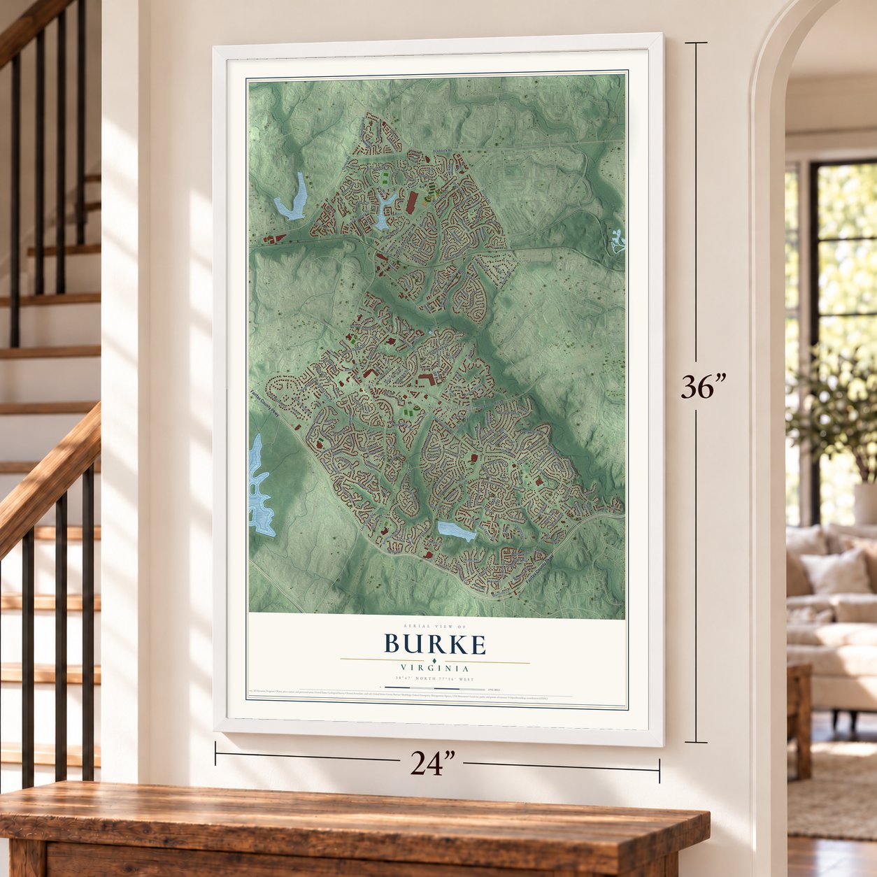
A new map of Burke, Virginia, made in 2026 and printed to order on thick archival matte paper.
12" x 18" Archival Matte Print
A Map of Home. A Work of Art.
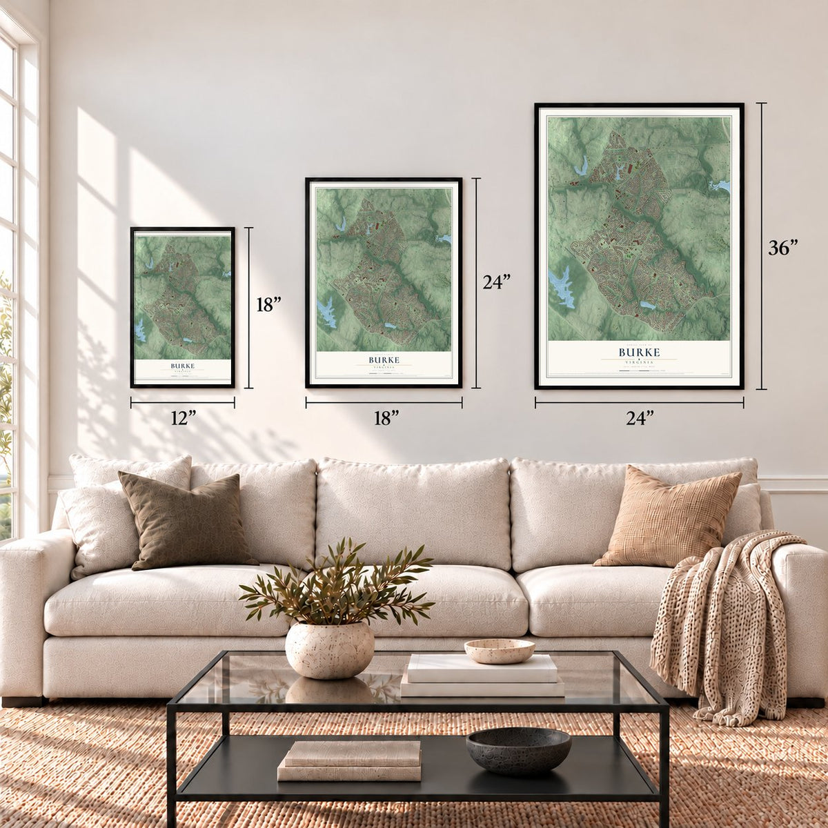
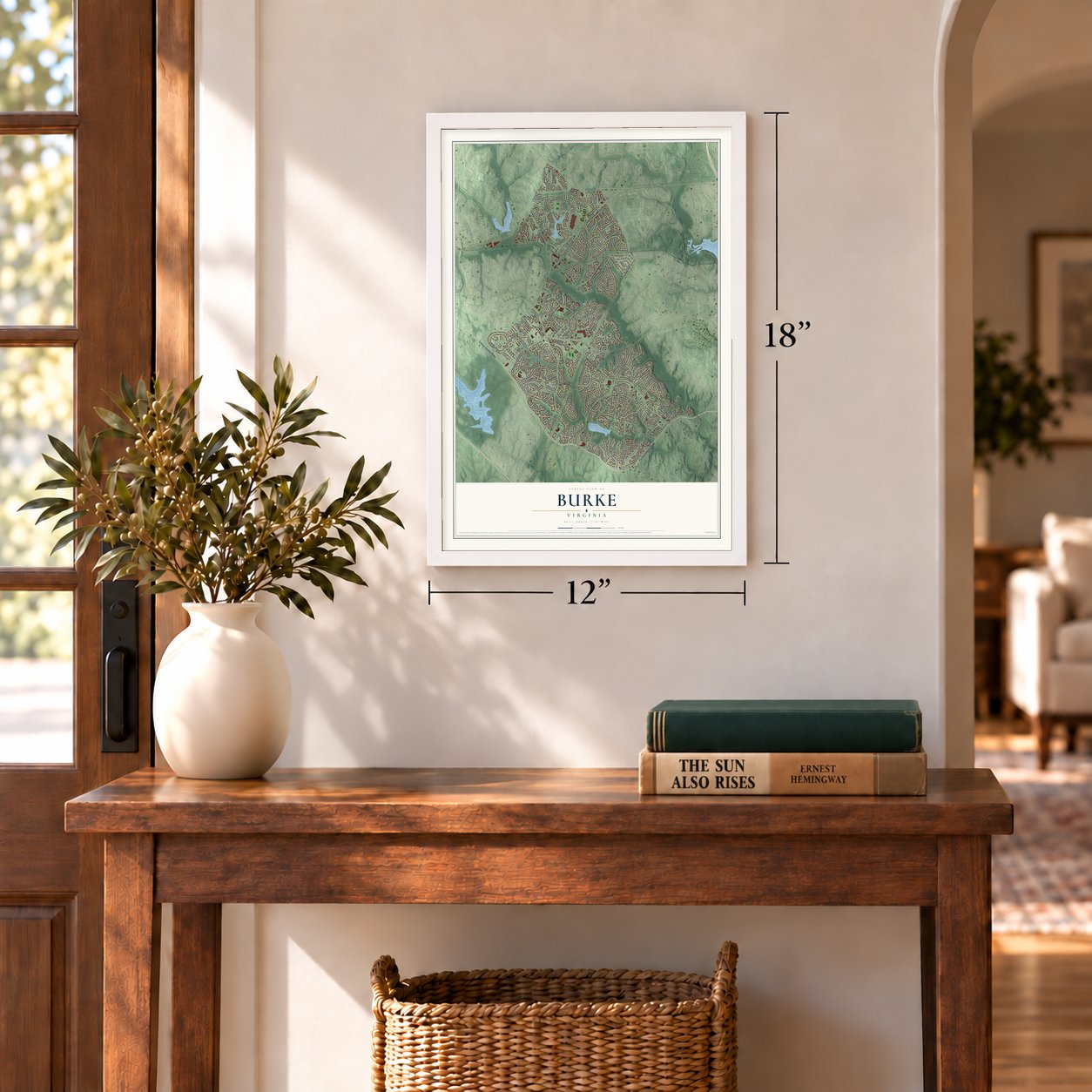
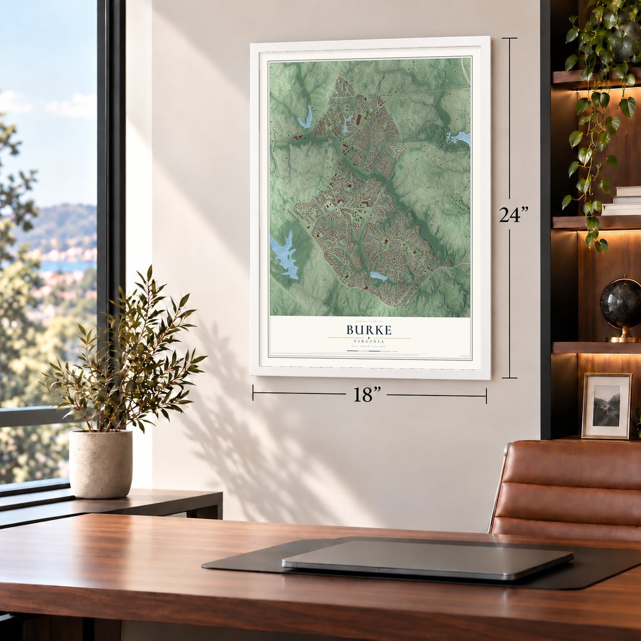
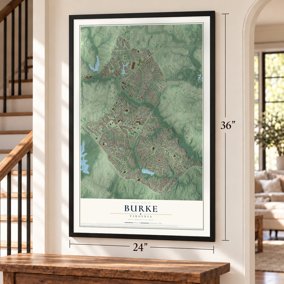
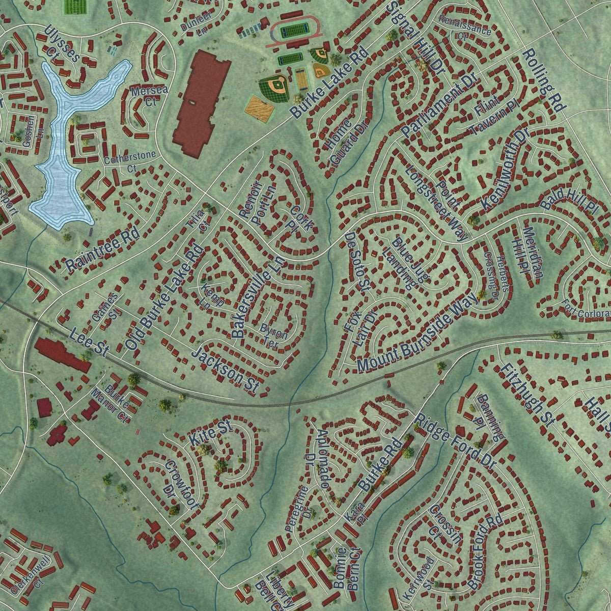
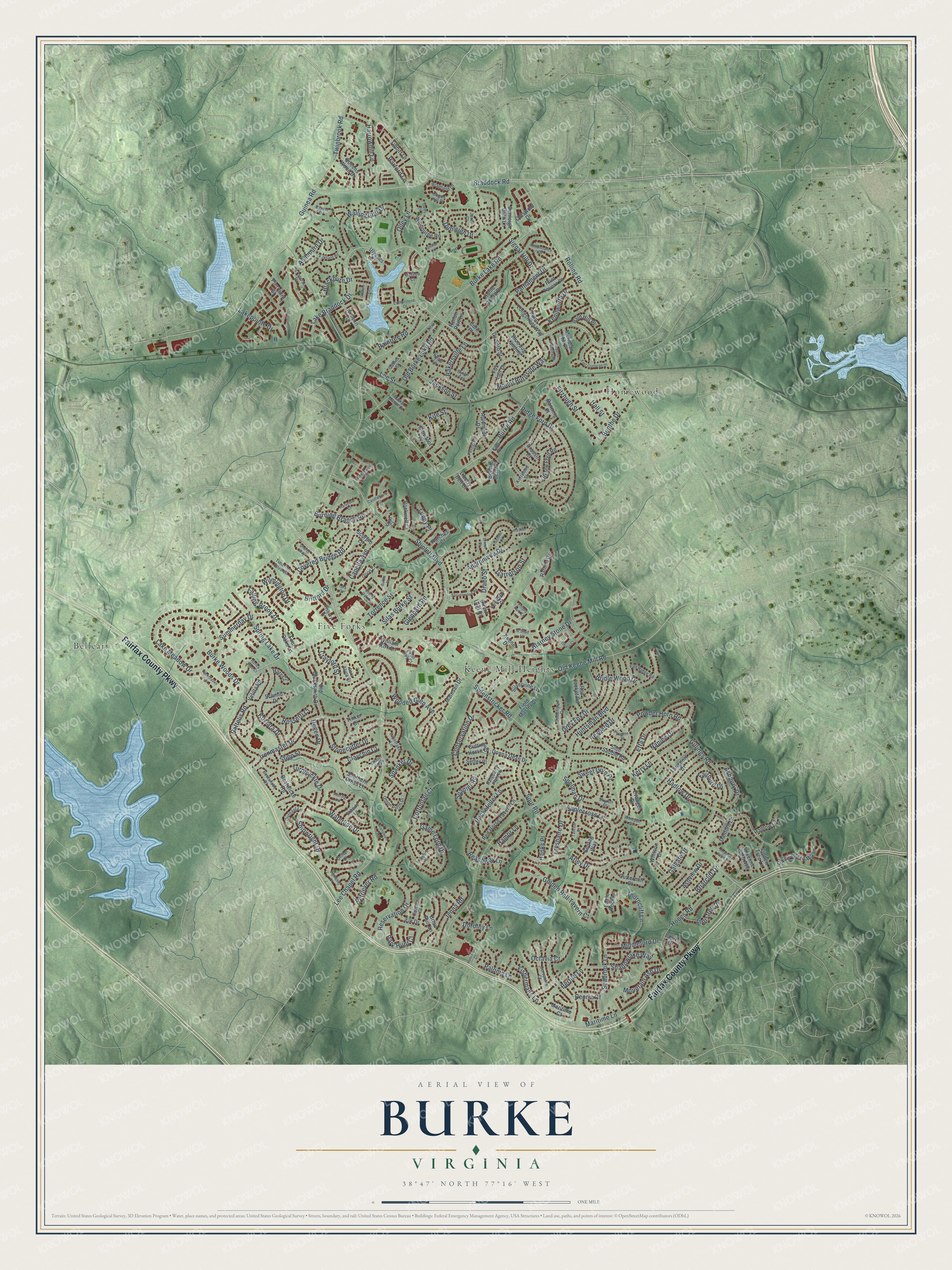
Explore Burke, Virginia from a whole new perspective. Created using aerial imagery and detailed geographic data, this map captures Burke building by building, with labeled streets, familiar landmarks, and shaded topographical relief that highlights the natural contours of the landscape.
Combining modern data with the timeless character of a vintage atlas, this map is just as interesting up close as it is beautiful on the wall. Whether you grew up in Burke, spent memorable years there, or call it home today, this unique map is a great way to celebrate a place that means something to you. Zoom in on the preview to look for your street, and then order a print to put your memories on the wall.
Three ways to hang it
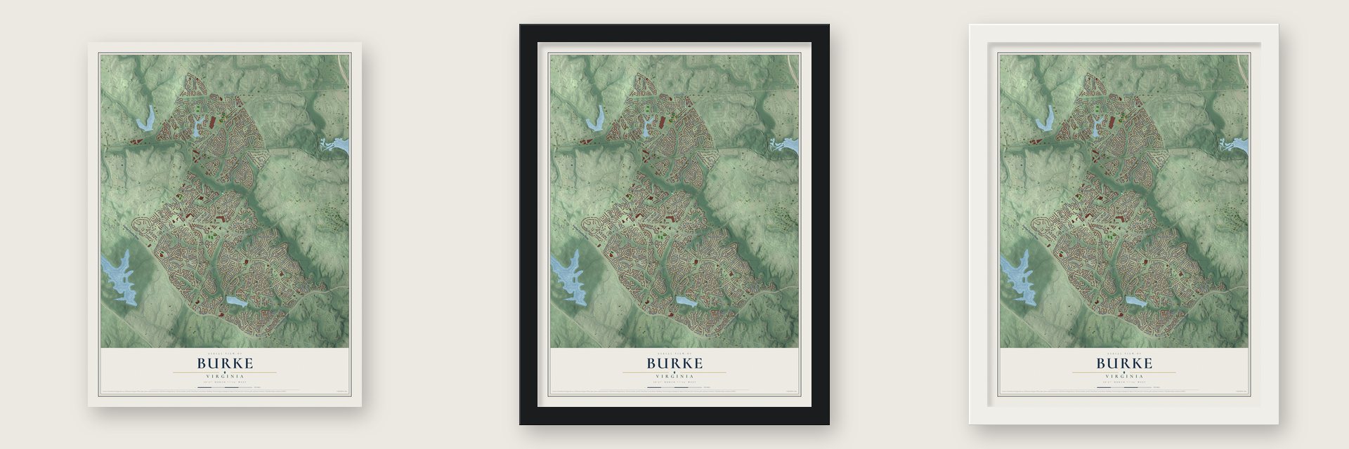
Unframed archival matte, a black wood frame or a white wood frame.
Up close
Geography Worth Displaying
This map was created using accurate cartographic data and authoritative geographic sources, including the U.S. Geological Survey and the Census Bureau. The map brings together terrain, waterways, roads, and building detail. The majority of the streets are labeled, houses are accurately depicted, and the topography is derived from government sources. Combining local data with carefully composed color and shading leads to this beautifully detailed Burke artwork for your wall.
Rather than simply showing street outlines, we’ve included as many of the street names as we could reasonably fit on the map while keeping their names legible. Zoom in on the high resolution preview to see exactly what’s on the map. We truly set out to create a statement piece for anyone who loves Burke. So whether it’s for you, or a gift for someone you love, we hope this map of Burke brings back fond memories.
Read the story behind this map of Burke, Virginia from 2026.

About Burke, Virginia
Burke is a community of 42,312 people in Fairfax County, and it takes its name from Silas Burke, who lived from 1796 to 1854. Around 1824 he built a house on a hill above the Pohick Creek valley. He became a judge, a sheriff and a director of the Orange and Alexandria Railroad, and he held slaves on his farm. When the railroad came through in the late 1840s, he gave it a right-of-way across his land, so the station at the foot of his hill was named Burke's Station.
A small village grew up around the station, and it got a post office in 1852. In 1903 Henry C. Copperthite bought the Burke House and 241 acres to build a track for harness racing, and he shortened the post office's name to Burke. The area stayed mostly farmland until the mid-20th century. Then Kings Park, the first large subdivision, went up starting in 1960, and many more followed over the next twenty years.
- Stuart's complaint about mulesUnion troops guarded the station during the Civil War. On December 28, 1862, Confederate cavalry led by General J.E.B. Stuart raided it, took supplies and destroyed a nearby bridge. His men listened in on Union messages over the telegraph line. Then Stuart wired Union Quartermaster General Montgomery C. Meigs to grumble that the mules he had captured were poor ones.
- The King of Pie's racetrackCopperthite was the largest employer in Washington outside the government, and in 1914 his Georgetown factory baked 50,000 pies a day. In Burke he built four hotels and stables, enlarged the general store and put in the first phones. Summer crowds rode trains from Washington and as far as Richmond for fairs, horse races, motorcycle races, boxing and baseball. Fairfax County marked the track's site in 2016.
- The airport that went to ChantillyIn 1951 the federal Civil Aeronautics Administration said it planned to condemn 4,520 acres in Burke for a second airport serving Washington. Residents fought the plan for years, and in 1958 the government chose a site near Chantilly instead, which became Washington Dulles International Airport. Land it had already bought here was later turned into Burke Lake Park and Burke Centre, a planned community.
- Two Olympic championsMia Hamm, the soccer player who won two Olympic gold medals and two Women's World Cups, went to Lake Braddock Secondary School in Burke. So did Allen Johnson, who won gold in the 110 metre hurdles at the 1996 Olympics in Atlanta and became a four-time world champion.
Find your street
Names on the Burke map
Every name below is printed on this map. Look for your street, your school, the park where you played, or the pond down the road.
Places and landmarks4
- Belleair
- Five Forks
- Homewood
- Keene Mill Heights
Streets and roads245
- Fairfax County Parkway
- Lake Braddock Drive
- Burke Lake Road
- Lee Chapel Road
- Burke Road
- Old Keene Mill Road
- Huntsman Boulevard
- Guinea Road
- Sydenstricker Road
- Rolling Road
- Arley Drive
- Shiplett Boulevard
- Braddock Road
- Lake Meadow Drive
- Andromeda Drive
- Ridge Ford Drive
- Dunleigh Drive
- Ironmaster Drive
- Rockefeller Lane
- Conservation Drive
- Galgate Drive
- Hooes Road
- Maritime Lane
- Old Burke Lake Road
- Spur Road
- Applecross Lane
- Golden Ball Tavern Court
- Game Lord Drive
- Reynard Drive
- Hadlow Drive
Show all 245 streets
- Etta Drive
- Reservation Drive
- Grey Fox Drive
- Wooded Glen Avenue
- Waterline Drive
- Wallingford Drive
- Torrence Street
- Shipwright Drive
- Ashbourn Drive
- Parliament Drive
- Twinbrook Road
- Koziara Drive
- Capella Avenue
- Seabrook Lane
- Thorncliff Lane
- Covered Bridge Road
- Mount Burnside Way
- Spring Lake Drive
- Glenbard Road
- Raftelis Road
- Kerry Lane
- Cottontail Court
- Harrowhill Lane
- Blarney Stone Drive
- Gillings Road
- Shadowlake Way
- Fitzhugh Street
- Jackson Street
- Draco Street
- Spelman Drive
- Crayford Street
- Lee Street
- Mountain Ash Drive
- Ashbury Drive
- Powder Horn Road
- Stonecutter Drive
- Lakepointe Drive
- Raintree Road
- Kenilworth Drive
- Jenna Road
- Olley Lane
- Boothe Drive
- Burning Branch Road
- Summerday Drive
- Turnbuckle Drive
- Falling Brook Drive
- Wilmington Drive
- Middleford Drive
- Sweet Gum Place
- Kite Street
- Garretson Street
- Nanlee Drive
- Bridle Wood Drive
- Octavia Court
- Silas Burke Street
- Retriever Road
- Freshaire Drive
- Briarcliff Drive
- Burke Woods Drive
- Innisfree Drive
- Stipp Street
- Harford Lane
- Dorothy Lane
- Fishermans Lane
- Beachway Lane
- Fairburn Drive
- Bertito Lane
- Park Hunt Court
- Spaniel Road
- Signal Hill Drive
- Bakersville Lane
- Ashview Drive
- Hall Street
- Claychin Court
- Degen Drive
- Blackburn Drive
- Hanks Place
- Britford Drive
- Paloma Lane
- Hamor Lane
- Spanker Drive
- Rossetti Court
- Peoria Court
- Lundy Place
- Field Master Drive
- Brook Ford Road
- Home Guard Drive
- Sontag Way
- Keene Drive
- Mainsail Drive
- Red Horse Tavern Lane
- Side Saddle Road
- Queens Wood Drive
- Tibbitt Lane
- Eagle Rock Lane
- William Kirk Lane
- Old Blacksmith Drive
- Langport Drive
- Fenestra Court
- Bestwicke Road
- Cuttermill Place
- Point Longstreet Way
- Fox Lair Drive
- Silvervine Lane
- Olde Lantern Way
- Red Jacket Road
- Flint Tavern Place
- Winbourne Road
- Aplomado Drive
- Whitson Drive
- Blue Jug Landing
- Cotswold Drive
- Donna Dean Drive
- Four Oaks Lane
- Hatches Court
- Rockwell Court
- Adrienne Glen Avenue
- Southern Cross Lane
- Linden Tree Lane
- Bonnie Bern Court
- Pierrpont Street
- De Soto Street
- Banning Place
- Danford Lane
- Bald Hill Place
- Hadlow Court
- Crowfoot Drive
- Dunleigh Glen Lane
- Meridian Hill Place
- Rathlin Drive
- Elk Drive
- Velilla Road
- Maritime Court
- Schmidt Drive
- Cutting Horse Court
- Scorpio Lane
- Brian Run Lane
- Setter Place
- Evangel Drive
- Birch Leaf Court
- Liberty Bell Court
- Lauren Drive
- Ulysses Court
- Crossin Court
- Harr Court
- Renoir Port Lane
- Tinker Court
- Cork Place
- Onion Patch Drive
- Timarron Cove Lane
- Kara Place
- Coachman Drive
- Kerrwood Street
- Cervantes Court
- Raspberry Plain Place
- Westport Lane
- Orion Court
- Mersea Court
- Tisbury Drive
- Lapstrake Lane
- Byron Terrace
- Kemp Lane
- Peregrine Drive
- Fox Ridge Road
- Tilia Court
- Bradfield Drive
- Outhaul Lane
- Capon Hill Place
- Bestwicke Court
- Ebbtide Lane
- Gaines Street
- Bronte Drive
- Crossrail Drive
- Peter Roy Court
- Burke Manor Court
- Calico Court
- Drifter Court
- Whitson Court
- Skyron Place
- Sara Alyce Court
- Jerell Court
- Virgo Court
- Ohara Court
- Sprucewood Road
- Fort Corloran Drive
- Clerkenwell Court
- Tiffany Park Court
- Herberts Crossing Drive
- Church Way
- Veering Lane
- Harvester Court
- Stanchion Lane
- Cotherstone Court
- Kirkfield Road
- Dunleer Lane
- Honey Tree Court
- Goshen Lane
- Renaissance Court
- Lightship Court
- Candleberry Court
- Yachthaven Drive
- Cherry Oak Court
- Chapel Hill Drive
- Huntsman Court
- Gemini Court
- Dalby Lane
- Erman Street
- Trappers Place
- Tailcoat Court
- Dianne Place
- O'Shad Lane
- Heather Point Drive
- Haskin Court
- Buffie Court
- Lyra Court
Names are listed as they appear on the printed map. Zoom into the product photos to find them.
The art of mapping a place
How This Map Was Made
Real places. Remarkable detail. Discover the layers that turn geographic data into a map of home.

The view from above
Aerial imagery reveals the character of the land: woodland, open fields, and the patterns of a place.

The shape of the land
Elevation data brings hills, valleys, and subtle changes in the landscape into view.

The details of home
Roads, waterways, and building footprints come together to make the map feel unmistakably local.

Geography becomes art
Considered color, shading, and typography bring the layers together in a map made for your wall.


Process illustrated with Mendon, Massachusetts. Aerial imagery: USDA NAIP. Terrain: USGS 3D Elevation Program. Map details and finished artwork: KNOWOL.
The Details
About This Print
Choose an archival matte print, or a black or white Ayous wood frame. The archival matte print is unframed.
Select your size and finish above to see the matching product image and price.
Materials & Craftsmanship
A contemporary map with the character of a classic atlas, printed on archival matte paper. Optional frames are made from Ayous wood.
Your printed map does not include the watermark shown in the full-map preview.
Shipping & Delivery
Free shipping within the United States. Every print is made to order in the USA.
Buying a gift? Add a note in your cart and we'll include it. We never put prices in the package.
Prints ship within 2 to 3 business days. Allow 7 to 10 days total from ordering for delivery. Timing may vary during holidays or periods of high order volume.
Read our shipping policy.
Returns and damaged prints
Each print is made to order. Change-of-mind refunds are not available after production.
If your print arrives damaged, misprinted or incorrect, contact support@knowol.com within 30 days of receiving it. Include your order number, photos and a description of the issue.
Read our full refund and replacement policy. For questions about your order, email support@knowol.com.
Find your town
Looking for another city?
Find a map of home in our Virginia collection, or any town in the country.
Nearby
Maps of towns near Burke
Know someone from one of these towns? Their map makes a great gift.
 West Springfield
, Virginia
From $39.99See the map
 Kings Park
, Virginia
From $39.99See the map
 Burke Centre
, Virginia
From $39.99See the map
More maps nearby: South Run, Ravensworth, Kings Park West, Long Branch and Newington Forest.